3 551 résultats
1895P83401Paris, L.Bataille et cie. 1895 808pp., illustré de 126 figures dans le texte, 25cm., reliure cart. (plats marbrés, qqs.petits manques de papier marbré, dos en cuir noir avec titre et fleurons dorés), feuilles de garde marbrées, peu de rousseurs, bon état, [Contenu: I.Hygiène militaire: Hygiène militaire en général, Recrutement, Habitation du soldat, Alimentation du soldat, Vêtement et équipement du soldat, Propreté du corps et du linge de corps, De l'éducation militaire, Prophylaxie hygiénique des principales maladies du soldat, Hygiène du champ de bataille, II.Hygiène navale: Le navire, L'équipage, La mer et l'atmosphère maritime], P83401
243377Londres, Hydrographic office, J. D. Potter [printed by William Clowes and sons], 1853 in-8, xii pp., [3] ff. n. ch., dont un d'addenda entre les pp. ii et iii, 552 pp., avec 9 planches hors texte, demi-basane aubergine à coins, dos à faux-nerfs orné de filets dorés, guirlande à froid sur les plats, tranches mouchetées de rouge (reliure de l'époque). Manque la pièce de titre, épidermures au dos, coins frottés.
211 pages plus two fold-out diagrams, two black and white plates and four pages of world maps indicating lines of equal vertial force, 1905. "The increased use of iron in the construction and armature of ships of war has led to a revision of the various instructions relating to the deviation of the compass heretofore published by order of the Lords Commissioners of the Admiralty." - from page iii. Prior owner's date and name stamps to front endpaper and title page. Some writing to front endpaper. Occasional pencil markings to contents. Above-average wear. Binding open in places. Backstrip open along back edge. A worthy reference copy of this fascinating treatise. Book
8" x 9" stiff beige card folded in half to form four-panel booklet. "Gives a close approximation of figures used in actual problems, sufficient for proof of correct application of formulas; and eliminates the necessity of remembering rules for obtaining the various quantities." - from second panel. Third panel contains rotating map and three independently rotating arrows representing the sun, vernal equinox, and stars, which may be positioned to make the appropriate calculation. Unmarked. Moderate wear and soiling. A sound example of this intriguing tool. Book
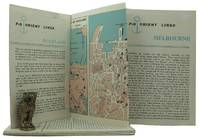
1962161834London: P&O Orient Lines 1962. Ten long single sheets folded into four five or six panels with text on one side and coloured maps on reverse the headings printed in blue & black; small cr. 8vo folded size; all numbered by hand near the top fore-corner of the upper panel with the number whited-out on number 2 Melbourne occasional slight soiling heavier on the Miami folder edges a trifle rubbed; P&O Orient Lines London 1962-1963. The folders were 'produced to assist passengers' and contain a brief history and description of each city including places of interest hotels shopping theatres currency information etc. P&O Orient Lines unknown
New English Original cloth bdg. In publisher's special slip-case. Oblong large 4to. (33 x 34 cm). Edition in Turkish. 264 p., ills. Islam uygarliginda astronomi, cografya ve denizcilik. Astronomy, geography and navigations in Islamic civilization. Hidden cultural treasures of Islamic civilization come to light. A book from a qualified name Prof. Fuat Sezgin. Islamic civilization is a journey full of hidden scientific history. Modern man knows the Arab-Islamic culture around the true meaning of universal history of science very little. Islamic civilization is a valuable work which has been collected from the German five-volume "Wissenchaft und Technik im Islam" s translation and describes astronomy, geography and maritime studies. Prof. Fuat Sezgin's a reflection of the long years of research and studies. This book is a real source of reference that will be to keep in the library's most special point.
101560aafin-8vo, 1. 96 p., bien illustré, 2. ca. 10 pages (pub) + 28 p. avec images et cartes de navigation + ca. 10 p. (pub), 3. 7 S. + 6 Karten, 4. 54 S., 5. Rapports présenté à la Commission technique de l’Association Suisse, 6. 278 S. + Tabellen + Tafelbeilagen, 7. 316 p. + images et graphiques, cartonnage original ill.
120563London, H. Hughes 1866, 220x145mm, III - 182pages, editor's binding. Excellent original publisher’s binding. Full green percaline with sharp cold-stamped decorations on both covers. The spine is blank as issued. The gilt work on the top cover - featuring the author, title, publisher, and a distinctive diagram of a spherical projection - remains bright and crisp. Very slight foxing, which is more pronounced on the endpapers only. The presence of only very slight foxing, which is more pronounced strictly on the endpapers, is exceptional for a technical manual intended for practical use at sea. A highly collectible, fine copy of a scarce Victorian maritime manual. This second edition is a comprehensive guide containing practical examples and formulae for all maritime problems. It features detailed astronomical definitions illustrated by spherical and plane diagrams. Designed specifically for young navigators, it was structured to enable students to master the science of navigation independently. Registered and entered at Stationer’s Hall.
8vo. original decorated cloth pp. 788 many illustrations and map ex library cover rubbed but ow excellent tight copy of a scarce and fascinating item.
BN168889Audio Navigation und Telematik für Kraftfahrzeuge <br/><br/>Audio Navigation und Telematik für Kraftfahrzeuge Audio Navigation und Telematik für Kraftfahrzeuge unknown
BN324090Segeln Schnelle Hilfe an Bord: Manöver · Navigation · Technik · Sicherheit Schwarzmeier Thomas <br/><br/>Segeln Schnelle Hilfe an Bord: Manöver · Navigation · Technik · Sicherheit Schwarzmeier Thomas Segeln Schnelle Hilfe an Bord: Manöver · Navigation · Technik · Sicherheit Schwarzmeier Thomas unknown
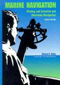
1990BN151395U S Naval Inst Pr 1990. 1990. Marine Navigation: Piloting and Celestial and Electronic Nagivation <br/><br/>Marine Navigation: Piloting and Celestial and Electronic Nagivation Marine Navigation - Hobbs Richard R. U S Naval Inst Pr unknown
Sm. folio, First Edition, with coloured frontispiece and very numerous monochrome photographs (a number full-page) in the text; black cloth, upper board blocked in blind, gilt back, green endpapers, a near fine copy in unclipped dustwrapper, the whole housed in publisher's board slip-case with twin thumb-holes. A sumptuous standard reference, and the third of the NMM catalogues of instruments (following globes and sundials).
367p. + Four folding drawings. Numerous text charts and graphs. Damp stained. Foxed. Paper very browned but not brittle. Contemporary book review pasted on front paste down. Small 4to. Original full leather binding, very worn. Spine taped. Hardbound. Scarce and important. **PRICE JUST REDUCED! NAVAL/1
Fine French Paperback. Roy. 8vo. (23 x 16 cm). In French. 41 p. Convention de commerce et de navigation entre la France et la Turquie. Signee a Ankara le 29 Août 1929. Trade and navigation agreement between France and Turkey signed on August 29, 1929. Only one institutional copy in Harvard University in OCLC: 24443185.
New English Original bdg. Dust wrapper. In special slip-case. 4to. (30 xx 22 cm). In English, with the Turkish transcription and the reprint of the original Ottoman text. 639 p., color ills. Book of navigation. [= Kitab-i bahriye]. Project coordinator: Nurettin Güz. Consultant: Halil Inalcik. Edited by Bülent Ari. Translation from Ottoman: Ahmet Demir. English translation by Ercüment Ozden, Fadime Özden, Akgun Ilhan. [English Edition]. "Kitab-i Bahriye of Piri Reis is authentic and important in that it shows the historical, geographical, ecological, social, cultural and natural characteristics of the lands it talks about in addition to the information he gives in the area of Turkish science and navigation in 16th century. We appreciate this work giving detailed information in many areas not only for our people but for universal culture also. The fact that the information in this book is not only for the interest of Turks but also for many other nations, and that it is not only about one part of the world but also about most of the known parts of the world including America shows us another characteristic of Kitab-i Bahriye. This work should be published again for the development of culture of tourism and for the purpose of directing young generations into the area of Turkish navigation".
Very Good Turkish Original albumen print mounted on cardboard. 21x48 cm. Handwritten Turkish note at the lower on empty section. Dated July 19, 1937. Slight fading on board. The photo is in very good condition. It was very significant both politically and militarily showing a Turkish war fleet visiting the British navy in Valletta, the capital of Malta, in 1937. The commander of the fleet was Admiral Sükrü Okan (1880-1957). The Turkish fleet consisted of the cruisers and destroyers named Yavuz Selim, Adatepe, Tinaztepe, Kocatepe, and Zafer, as well as four submarines and the submarine mothership Erkin. This very scarce photograph shows the Turkish fleet with the English fleet in the Valletta port on July 19, 1937.
ABE-1270472158DU 4 JANVIER AU 29 MARS 1890 (N°105 A 117)-RELIURE EDITEUR CUIR A COINS-5 NERFS-TITRE DORE SUR LE DOS ET LE PREMIER PLAT-LEGERES ROUSSEURS SUR CERTAINES PAGES-BEL ENSEMBLE (ETACA)
189810577Paris, Bardey, 1898 ; in-8, broché ; 183 pp., 12 très grandes planches dépliantes.
185317111853 Imp. Jean-Matthieu Douladoure, Toulouse, 1853. In-8 broché. (viii), 216 pages. Frontispice gravé(portrait de Riquet), planche du monument à Riquet, 2 cartes dépliantes
9480P., Imprimerie nationale, 1791. 60 pp.
214201Paris, Hachette, 1874 gr. in-8, IV-360 pp., illustrations in-t., une carte dépliante, demi-chagrin vert, dos à nerfs orné, tranches dorées (reliure de l'époque).
187110753Paris, Imprimerie Monrocq, mai 1871 ; 2 tomes in-folio, dos percaline et plats cartonnés gris ; 78 pp. ; 2 profils dépliants en couleurs : de Paris au kilomètre 147 et du kilomètre 147 à Rouen, ensemble lithographié, y compris le texte manuscrit.
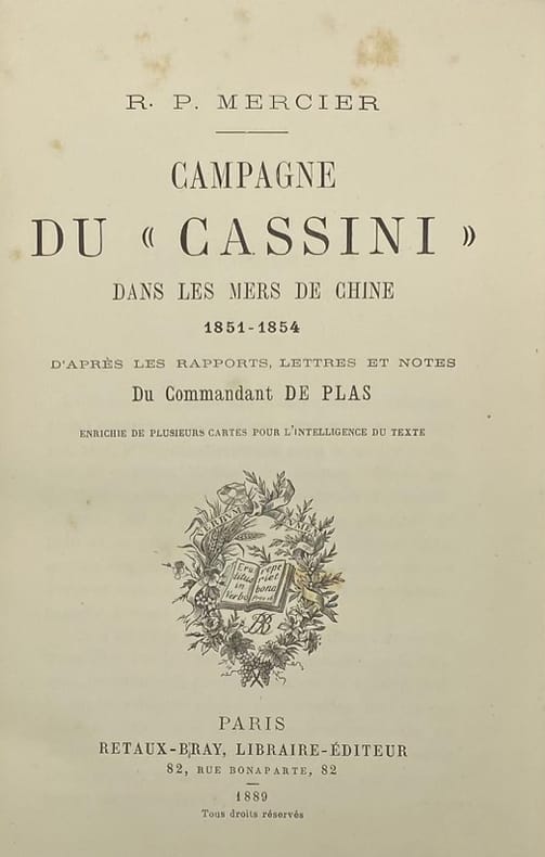
224802Paris, Retaux-Bray, 1889 in-8, XII-433 pp., carte sur double page, demi-chagrin rouge, dos à nerfs orné (rel. de l'époque).