1 884 résultats
1984nc984Société Géologique de France Broché 1984 In-4 (21,2 x 27 cm), broché, paginé de 325 à 568, illustrations en noir et blanc ; traces et marques d'usage sur les plats et le dos, par ailleurs intérieur frais, assez bon état général. Livraison a domicile (La Poste) ou en Mondial Relay sur simple demande.
1986nc986Société Géologique de France Broché 1986 In-4 (21,2 x 27 cm), broché, paginé de 355 à 526, illustrations en noir et blanc ; rousseurs sur la tranche de tête, ex-libris tamponné en première page, par ailleurs bel état. Livraison a domicile (La Poste) ou en Mondial Relay sur simple demande.
ORD-17233Tananarive. Pitot de la Beaujardière. 1950. In-4 (227 x 282mm) broché, couverture orange imprimée, et ornée d'un encadrement floral, XL, 159, (3) pages. Couverture un peu poussiéreuse, menus défauts mais bon exemplaire. On joint un article de journal sur le Cinquantenaire de l'Académie Malgache. Table des matières par courriel sur demande.
1954vh427Institut océanographique Brochure 1954 In-8 (16 x 25 cm), brochure, 20 pages, figures en noir ; dos fendu aux extrémités, petites déchirures en tête du premier plat, par ailleurs assez bon état. Livraison a domicile (La Poste) ou en Mondial Relay sur simple demande.
Limited Edition 2 Volume Set. xii, 496, iii, 657 pages. Index. Footnotes. Lists of Crews for Squadron 99, Squadron 355, and Squadron 356. "The histories of 'Liberator' Squadrons of the R.A.F. in Lord Mountbatten's South East Asia Command in the Second World War. These American aircraft came into service in 231 Group, the RAF Heavy Bomber component of Allied Strategic Air Force, and in 222 Group, Indian Ocean Air Force." - back cover of Vol I. Clean and unmarked with light wear. Bindings tight. A quality copy of this very informative set. Book
2000ESCLA7536131913Nantes, Les Anneaux de la Mémoire / UNESCO, 2000, 16 x 24, 316 pages sous couverture illustrée.
Preface 1 25x18,5 cm., legatura in piena tela bicolore, pagg. VI, 186 su carta forte, numerose illustrazioni in bianco e nero, carta del territorio in nero e rosso alle sguardie, prima edizione, in inglese, buone condizioni. Allegati: schede editoriale dell'opera e dell'A, e altre 4 illustrazioni.
2003LFA-126741634Un ouvrage de 179 pages, format 150 x 235 mm, illustré, broché, publié en 2003, Azur Editions, bon état (avec un envoi de Simone Moriot)
10563Paris, Flammarion, 1976 19 x 25, 96 pp., illustrations en couleurs, cartonnage éditeur + jaquette, bon état
160 pages. Preface by Yousuf Karsh. In this breathtaking photographic tribute to his adopted country, one of Canada's best-known and to-ranking photographers captures the many faces and moods of this vast land. From the Quaint fishing villages of Atlantic Canada to the quaint fishing villages of Atlantic Canada to the majesty of the Rocky Mountains, Malak offers a unique visual portrait of the people and places that make up this remarkable nation. Along with the glorious colour landscapes that span the geographic diversity of Canada from Ocean to Ocean, some of Malak's most memorable black-and-white portraits from the past focus in on the individuals who inhabit this country. And it is the interplay between people and their surroundings that forms the central theme of this volume. Book in fine unmarked condition but for water damage to lower portion of pages in last half of book. Remains a very handsome copy. Very light edgewear to attractive dust jacket. Book
Book is in excellent condition. Binding is solid and square, covers have sharp corners, exterior shows no blemishes, text/interior is clean and free of marking of any kind. 450 pages with a great many photos, mostly in b&w. Chapters, with a large number of sub-chapters, include Rail corridors through the Cordillera to Canada's two Pacific gatways; The first Pacific gateways to overseas treade; The gateways 1917 to 1929 -- Panama extends Vancouver's reach to atlantic markets; A visual record of the gateway ports and the men who moved to cagoes 1843 to 1918; The depression years 1930 to 1938; The war years 1939 to 1945; The gateways 1946 to 1970 -- new markets for bulk commodities -- etc. for a total of eleven chapters ending with The facilities needed to handle overseas treade to 2020.
"Contains information published for the first time, of navigable distances of lakes and rivers in north-western Ontario, Manitoba, Saskatchewan, Alberta and Mackenzie Territory; the draught and number of steamers plying on thoses waters. Similar information is given of the inland waters of British Columbia for the first time. In the description of the Transcontinental and Intercolonial railways much new information appears... Original photographs of various localities were procured from the headquarters of the railways and steamboat lines. The book is copiously illustrated." - A. Johnston, Deputy Minister of Marine and Fisheries. "Intended as a sketch of Canada, for the use of representatives, delegates and members of the XIIth Congress of the Permanent International Association of Navigation Congresses, to be held at Philadelphia. Contains information relating to Canada, important lines of communication on this continent, and ocean going steamers, that will be valuable to travellers engaged in business, tourists, sportsmen, yachtsmen, canoeists, surf bathers, and others who may find the means of satisfying any reasonable desire connected with travel, pastime or recreation." - from Introduction. Prior owner's name upon first blank leaf else unmarked. Average wear with the following exception: Affixed to the last leaf is a 35" x 21.5" fold-out map of the Dominion of Canada which shows national rail lines, resource locations, fog signals, lighthouses, wireless stations, and more. Through use, this leaf and the two which preceed it are loose but present. Two-inch opening at base of back cover and backstrip. Also included is a 21" x 17.5" fold-out map entitled "Chart of Radio-Telegraph Stations on the East Coast". Profusely illustrated with often enthralling black and white photography. Attractive gilt lettering upon embossed chocolate brown cover. A magnificent survey of Canada's natural resources and transportation infrastructure in the Pre- World War One era. Book
Features include: Spectacular Frobisher Bay; Orchids of the Gatineau Valley; Tidal Effects Upon the Ocean Floor; The Annual Eastern Arctic Patrol; Saving the World's Rarest Animals; Lake Shore Gold Mine. Abundant black and white photography. Musty. Average wear. Book
12 pages. Illustration of the "Empress of Scotland" on front cover. A very detailed fare guide which describes various classes of sailings from Montreal and Quebec to Southampton, Cherbourg, Hamburg, Liverpool, Belfast-Glasgow, and Antwerp. Average external wear and fading soiling. A quality copy of this wonderful vintage item. Book
1432595334.Gpaperback. Good. Access codes and supplements are not guaranteed with used items. May be an ex-library book. paperback
1527664317.Gpaperback. Good. Access codes and supplements are not guaranteed with used items. May be an ex-library book. paperback
0266711294.Ghardcover. Good. Access codes and supplements are not guaranteed with used items. May be an ex-library book. hardcover
10962Tableau géographique et statistique de l’Ile Bourbon. Baudoin frères éditeurs. Imprimerie de D’Urtubie et Worms, sans date (1831) 590x460mm avec le texte et la marge. 220 x240mm, carte en couleur seule. Très bon état
10963Tableau géographique et statistique de la Guyane. Baudoin frères éditeurs. Imprimerie Rignoux. Sans date. 492x395mm avec marges. 240x225mm carte seule. Rousseurs, visibles au verso avec de de petites déchirures en marges, éparées.
10964Tableau géographique et statistique de la Guadeloupe et de ses dépendances. . Baudoin frères éditeurs. Imprimerie Rignoux. Sans date. 515x396mm avec marges. 245x230mm carte seule. Une pliure, verso poussiéreux avec de petites déchirures en marge inférieure et en marge supérieure, réparées. Rousseurs, visibles au verso avec de petites déchirures en marges, éparées.
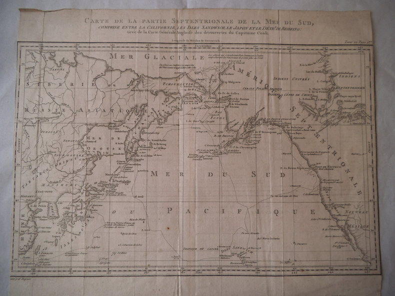
12570tirée de la carte générale angloise des découvertes du capitaine Cook gravée par DUPRE 360x295mm. Marge inexistante. Traces de pliures.
OCE193MHAZAN. 2000. In-8. Relié par l'éditeur, sous jaquette. Environ 80 pages- nombreuses illustrations couleurs et monochromes dans et hors texte
ORD-7489Tananarive. Imprimerie Off. 1937. In-8 br. 55pp. Tableaux.(n).
193663024New York: Cunard White Star Line October 1936. 4to. 8 x 9 in. which opens into 16 pp unpaginated. oblong folio 16 x 9 in. colour deck plans throughout photo illustrations of amenities centerfold photo of RMS Carinthia self-printed illustrated softcovers w/ Art Deco cover art by Frederick J. Hoertz 1889-1978 and fold creases as issued couple minor closed tears on first two leaves lower corner w/ original Cunard White Star Ltd. mailing envelope addressed to Mr. Harold Berson postmarked 1940 still G/VG copy from the library of Berson 1926-1986 avid world traveler and noted children’s book illustrator until his death. Revised edition of this rare original deck plans brochure for the RMS Carinthia II 1925. Launched in Feb. 1925. When built RMS Carinthia II was the largest of the mid-sized Cunard ocean liners and passenger capacity of 240 in First Class 460 in Second Class and 950 in Third Class with a crew of 450. She featured glamorous First Class public venues such as the 2-story El Greco Smoke Room on A Deck a First Class Lounge furnished to represent the period of King William of Orange and the restaurant was especially grandiose. The included a number of comfortable Third Class facilities including comfortable dining room and more. Converted in 1939 into an armed merchant cruiser the HMS Carinthia she was torpedoes by U-46 in 1940 and sunk June 7 1940. No copies located in Worldcat Wolfsonian contains a few clippings & program guide. Cunard White Star Line, paperback
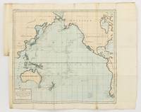
1790143934Paris: F. Dufart 1790. Very Good. Paris F. Dufart circa 1790. A hand-coloured engraved map printed surface 378× 415 mm sheet size approximately 420 × 540 mm. 'Gravée par Tardieu l'Ainé . Dessiné par Poirson . Ecrit par Beaublé'. Original folds as issued; some minor uneven tanning; in very good condition. An uncommon chart of the Pacific Ocean and Australia showing magnetic variation and dip drawing on observations made in the course of Pacific voyages after 1775 most notably Cook's third voyage. It is most likely from a duodecimo edition of Buffon's 'Histoire naturelle générale et particulière' around the end of the eighteenth century 'PL. III. Tome XVI' and 'Page 58' are printed in the top margin. It is based on a larger chart in four sheets attributed to Jean-Charles de Borda. The engraver Tardieu is one of half a dozen members of the family working as engravers at the period one of whom P.A.F. Tardieu would engrave the charts published in the official account of the Baudin voyage. F. Dufart unknown