Southern Pacific H&T SocietyBiblio.com
2 675 résultats
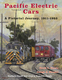
44567747133616New. Southern Pacific Historical and Technical Society hardcover with jacket 254 pages 9 x 11.5 x.75 in. B&W photographs roster index. Southern California's history and economic development were closely aligned with the Pacific Electric Railway organized 1901-1902 by Henry Huntington and carried on by a new corporation after 1911 of the same name owned by the Southern Pacific Railroad. This book addresses the period from 1911 to 1953 of the "new" Pacific Electric Railway that operated electric-powered passenger and freight trains in southern California. The co-authors had access to extensive photograph files illustrating Pacific Electric cars and their operating environment and selected the best for use in this book. Two major goals of this book is to illustrate all of the major classes of cars and locomotives operated by the Pacific Electric after 1911 and to provide detailed informative picture captions that can both stand on their own and also provide the seeds for future research. Contents:. Introduction pp. 1–23. Deluxe Cars and Wood City Cars pp. 24–41. Early Steel City Cars pp. 42–55. 500 Class Suburban Cars pp. 56–63. 600 Class Steel City Cars pp. 64–81. 800 Class Wood Interurban Cars pp. 82–89. 950 Class Wood Interurban Cars pp. 90–97. 1000 Class Wood Interurban Cars pp. 98–109. 1100 Class Steel Interurban Cars pp. 110–117. 1200 Class Steel Interurban Cars pp. 118–137. 1300 Class Combination Cars Wood and Steel pp. 138–147. 138-147. 1400 Class Box-Motor and RPO Cars Wood and Steel pp. 148–165. 1500-1600 Class Power Cars and Locomotives Wood and Steel pp. 166–189. 1700 Class Service Cars pp. 190–201. 300 Class "Blimp" Interurban Cars pp. 202–211. 400 Class "Blimp" Interurban Cars pp. 212–223. 450 Class "Blimp" Interuban Cars pp. 224–229. 496 Class "Blimp" Combination Cars pp. 230–235. 5000 Class PCC Suburban Cars pp. 236–244. Index pp. 245–254. Arts History hardcover
0243086024.Gpaperback. Good. Access codes and supplements are not guaranteed with used items. May be an ex-library book. paperback
0267966903.Ghardcover. Good. Access codes and supplements are not guaranteed with used items. May be an ex-library book. hardcover
56-0379San Francisco Calif.: Southern Pacific Company 1958 rev. 1961. Blueline print 24" x 62". Sheet three of three. From approx half a mile north of Pittsburg Des Moines Steel to Keifer Road. Includes Pittsburg Des Moines Steel Co railroad lines power lines. Scale 1" = 100'. San Francisco, Calif.: Southern Pacific Company, 1958, rev. 1961. unknown
56-0378San Francisco Calif.: Southern Pacific Company 1930 rev. 1959. Blueline print 24" x 56". Sheet two of three. From Bassett Street to Guadalupe Creek. Includes Commercial Solvents Corporation Magnesia Plant Western Carbonic Acid Gas Co Lick Mill road Agnew State Hospital with description of each building on grounds. Scale 1" = 100'. San Francisco, Calif.: Southern Pacific Company, 1930, rev. 1959. unknown
56-0383Oakland Calif.: Southern Pacific Company 1928 rev. 1961. Blueline print 24" x 56". From Webster Street to Alaska Packers Basin warehouses and Oakland Inner Harbor to Eagle Avenue. Includes University of California tract 32 John Huston plot JD Box Factory. Scale: 1" = 100'. Oakland, Calif.: Southern Pacific Company, 1928, rev. 1961. unknown
56-0384Oakland Calif.: Southern Pacific Company 1931 rev. 1962. Blueline print 24" x 56". From beyond Oak Street to High Street and border of Oakland Estuary to Lincoln Avenue. Includes downtown Alameda businesses Lincoln Junction station point Boyle Manufacturing Co Pacific Coast Engineering Co Signal Oil Co. Scale 1" = 100'. Oakland, Calif.: Southern Pacific Company, 1931, rev. 1962. unknown
56-0232San Francisco Calif.: Southern Pacific Company 1931 revised 1940. Map. Blueline print. 24 x 56 inches. Map of Alameda from west of Oak Street to High Street. Includes Boyle Manufacturing Co Pacific Coast Engineering Co all streets. Scale: 1 inch = 100 feet. San Francisco, Calif.: Southern Pacific Company, 1931, revised 1940. unknown
56-0397San Francisco Calif.: Southern Pacific Company 1927 rev. 1961. Blueline print 24" x 56". Sheet one of two. From Pacheco Slough and railroad tracks approx 1 mile north along County Highway. Includes detailed plan of Associated Oil Company site with Cooper Shop Can and Shook warehouse Research Lab Experimental Refinery. Scale 1" = 100'. San Francisco, Calif.: Southern Pacific Company, 1927, rev. 1961. unknown
56-0398San Francisco Calif.: Southern Pacific Company 1927 rev. 1956. Blueline print 24" x 56". Sheet two of two. From compressor building condensers to beyond AT&SF steel bridge over county road and railroad tracks. Includes very detailed plan of Associated Oil Company site with reservoir numerous tanks Edeleanu plant Residuum Coolers Salt Water pond and less detailed Standard Oil Company site. Scale 1" = 100'. San Francisco, Calif.: Southern Pacific Company, 1927, rev. 1956. unknown
56-0404Oakland Calif.: Southern Pacific Company 1927 rev. 1944. Blueline print 24" x 56". With pencil marks indicating switching limits. From Straights of Carquinez to East Sixth Street H Street to South Street. Includes Kullman Salz & Co G.W. Hume Co River Steamer Landing Martinez-Benicia Auto Ferry. Scale 1" = 100'. Oakland, Calif.: Southern Pacific Company, 1927, rev. 1944. unknown
56-0297San Francisco Calif.: Southern Pacific Company 1931. Map. Blueline print 8" x 39" with red pencilling. From west of Washington St crossing to approx. 1500 ft east of Halcyon Drive. Includes Levy and Zetner Packing telephone Western Pacific and Southern Pacific wire lines. Scale 1" = 100'. San Francisco, Calif.: Southern Pacific Company, 1931. unknown
56-0449Oakland Calif.: Southern Pacific Company 1929 rev. 1949. Blueline print. 8 x 52 inches. From Sevier Avenue to Del Norte Avenue along railroad tracks. Includes Newbridge Park Henderson. Scale 1 inch = 100 feet. Oakland, Calif.: Southern Pacific Company, 1929, rev. 1949. unknown
56-0228San Francisco Calif.: Southern Pacific Company 1926 revised illegible. Map. Blueline print. 24 x 56 inches. Map of San Leandro from Peralta Ave. to Castro St. Includes Caterpillar Tractor California Packing Corp San Leandro Creek. Scale: 1 inch = 100 feet. San Francisco, Calif.: Southern Pacific Company, 1926, revised? (illegible). unknown
56-0299Oakland Calif.: Southern Pacific Company 1960. Map. Blueline print 8" x 65" . Plan indicates railroad track communication wiring and two buildings. Includes Bishop Bros Warehouse Bishop Bros Wholesale. Scale 1" = 100'. Oakland, Calif.: Southern Pacific Company, 1960. unknown
56-0405Oakland Calif.: Southern Pacific Company. Blackline print 16" x 12.5". Right-hand portion of map of Berkeley railroad yard incomplete. Left strip of map yellowed by adhesive. Includes Tracks 1 and 2 Boxcar loading buildings Acid Hause Mack Shop Hard Butter Bldg Mill Building Margarine Bldg Boiler Room. Scale 1" = 25'. Oakland, Calif.: Southern Pacific Company. unknown
56-0251Southern Pacific Company 1951. Map. Blueline print 22" x 22" with red and green highlighting. From Riverside Dr to Vernon Ave and Hatch Rd to Briggsmore Ave. Includes U.S. highway 99 railroad lines Modesto Municipal Airport. Scale: 1 inch = 3/4 mile. Southern Pacific Company, 1951. unknown
58-0558San Francisco Calif.: Southern Pacific Company 1952. Blueline print 24 inches x 33 inches red and green ink indicate present and proposed pickup and delivery limits. From State Highway 117 and Salinas-Monterey Road to Sherwood Lane Salinas Municipal Airport. Includes City of Salinas. Not drawn to scale. San Francisco, Calif.: Southern Pacific Company, 1952. unknown
56-0291San Francisco Calif.: Southern Pacific Company 1955. Map. Blueline print 16" x 15" with red outline of proposed pickup and delivery limits and green lines indicating proposed extensions of present limits. From Los Gatos and Edenvale to Wayne and Kirk Ave. Not drawn to scale. San Francisco, Calif.: Southern Pacific Company, 1955. unknown
56-0439San Francisco Calif.: Southern Pacific Company 1953. Blueline print 18" x 15" with red and green highlighting indicating present and proposed limits. From Central Avenue to Teague Avenue and Cornelia Avenue to Hammer Field. Not drawn to scale. San Francisco, Calif.: Southern Pacific Company, 1953. unknown
56-0252Southern Pacific Company 1954. Map. Blueline print 16" x 21" with red and green highlighting. From Whitmore Rd to Staniford Ave and Dakota Ave to Claus Rd. Includes U.S. highway 99 railroad lines Modesto Municipal Airport irrigation district laterals. Not drawn to scale. Southern Pacific Company, 1954. unknown
56-0357San Francisco Calif.: Southern Pacific Company 1954. Map. Blueline print 24" x 34" with red and green highlighting. Small area in center of maps details all streets within city limits. Includes Yreka Hawkinsville all railroad lines with circle of two mile radius denoting proposed extension of present limits. Not drawn to scale. San Francisco, Calif.: Southern Pacific Company, 1954. unknown
56-0356San Francisco Calif.: Southern Pacific Company 1923 revised 1930. Map. Blueprint 12" x 56". From South Fork Mill Creek to beyond Tulare Avenue. Includes Shell Co of California General Petroleum Co Southern California Edison Co Mineral King Road. Scale 1" = 100'. San Francisco, Calif.: Southern Pacific Company, 1923, revised 1930. unknown
58-0507San Francisco Calif.: Southern Pacific Company 1964. Blackline print in reverse 16 inches x 21 inches. From Sacramento Yolo Port District and Alaska Packers Industrial Area to Sacramento River. Includes station points Washington and Mikon proposed station West Sacramento West Sacramento Freeway high school. Not drawn to scale. San Francisco, Calif.: Southern Pacific Company, 1964 unknown
56-0447Tucson Ariz.: Southern Pacific Company 1951 rev. 1959. Blueline print 24" x 56". Includes Hayden Junction employee' cottages complex with railroad track plans 1500' east and 3000' west of complex. With station points Hayden Junction Burns. Scale 1" = 100'. Tucson, Ariz.: Southern Pacific Company, 1951, rev. 1959. unknown