McMinn, Howard E.; Evelyn MainoMareMagnum

6 260 résultats
A clean, unmarked book with a tight binding. Previous owner's name on front endpaper. 414 pages. 5"w x 7 1/2"h. A guide to Pacific Coast trees with a key to genera, glossary of botancial terms, list of trees for various uses, index of species by common and scientific names. Many b&w illustrations.
310p. + Plus maps. Uncut and unopened. Title page ruled in red. Penciled ownership of John C. Schmidt (York, Pennsylvania). 8vo. Original full red cloth binding. First edition. Nice copy. Putnam Weale is the pen name of Bertram Lenox Simpson (1877-1930). This book is an "Insider's view of the growing turmoil in East Asia following the World War I, the Russian Revolution and the collapse of the Anglo-Japanese Alliance Treaty, imperialism in China, roles of Japan, Britain, United States and Canada, etc." **PRICE JUST REDUCED! WWI 5
196556840Los Angeles CA; Ketchum ID & Omaha NE: Schick; Gilbert Stanley Underwood & Micro-Tronics The Wurgler Co. 1965-1983. Collection including One original pencil drawing sized 6.5 x 23.5 in. framed & matted in black & glass frame sized 11 x 37.5 in. artist’s signature dated 12/83; Five blueprints reproduced on thick mylar stock sized 30 x 47.25 in.; 65 105 mm. blueprint negatives all carefully labeled in pencil on archival manila envelopes preserved in lidded black vinyl box gilt Sun Valley logo & lettering stamped on lid. This unusual collection containing a large panoramic elevation drawing of the historic Sun Valley Lodge five large blueprints reproduced from the originals as well as an invaluable grouping of 105 mm. blueprint negatives for all of the original drawings of the Sun Valley Lodge and sister lodge the Challenger Inn later Sun Valley Inn. Also present is a September 1932 blueprint negative for a proposed Union Pacific Cafeteria building in Ketchum ID. Harriman foresaw the tremendous potential in developing a skiing destination industry for the Union Pacific during the Great Depression and after hiring Count Felix Schaffgosch to scout locations determined in January 1936 that Ketchum ID would be the ideal spot. The Union Pacific contracted the famed Los Angeles CA architect Gilbert Underwood 1890-1960 who at the time was a key member in the Federal Architecture Project established by Roosevelt during the New Deal. Underwood was well known for designing Union Pacific lodges for the National Park Service including complexes at Cedar Breaks Zion Bryce Canyon North Rim of the Grand Canyon and the famed Ahwahnee Hotel at Yosemite. He would later produce the preliminary designs for the Timberline Lodge WPA project on Mount Hood OR. The large panoramic drawing depicts the historic South elevation of the Lodge as constructed in 1936 scale of 1 in. to 20 feet. The large reproduced plans include those for The First Floor Basement and Foundation Second Floor Third Floor and Fourth Floor and Roof Plan. The blueprint negatives include floor plans framing plans kitchen ceiling designs piping kitchen pantry details the range hoods bar plans dining table details & plans and even the bakers dough table. Bill Wurgler 1912-1996 founded the Wurgler Co. in downtown Omaha following World War II and maintained the largest and finest photographic and blueprint reproduction plant in the Midwest later selling to Standard Blue in 1969. We could find no similar collections in Worldcat; See: History of Sun Valley Visit Sun Valley Ketchum Idaho 2020; Laura Soulliere Harrison Architecture in the Parks: National Historic Landmark Theme Study 1986 pp. 245-249. Schick; Gilbert Stanley Underwood & Micro-Tronics, The Wurgler Co., unknown
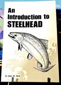
197510721Coburg Oregon: John W. Ball - Self Published 1975. First Edition. Original wraps. Fine. 8vo. pp. 66 decorated wraps illustrated. -- Condition. Contents: The Foolers of Depth Perception - The Hidden Bottom - The Hitch Effect - Jackrabbit Bait - Up and Down Sags - Pendulum Drift - Ideal Drift - Avoiding the Shake - Lures - Snags - Animated Lures - Animated Lure Criteria Ole - Tackle Foolers - Feeding Line to the Drifts Spinning Gear - Reel Lubrication - Back Lash - Paradox of Rod Position - Feeding line to the Drift Casting Gear - Steelhead Fly Fishing - Handling Hooked Fish - Handling the Landing Net - Artificial Weather - Three Kinds of Fish and Rivers - How to Hold a River Post Mortem - Killers to Watch For - Post Script. John W. Ball - Self Published unknown
1969736516PN. New. 1969. Soft Cover. Date is original print. This is a reprint edition. . PN paperback
1900IC147191900 12 p., 2 lithographed pls, roy. 4to, disbound (no covers).
19412111902154609658Seikatsu-sha 1941. Soft Cover. Fine. The book is in fine condition. Seikatsu-sha paperback
19842090502113715502Not Available 1984. Soft Cover. Fine. The book is in fine condition. Not Available paperback
Boards with light wear to extremities; In the immediate postwar era, Hawaii and the South Sea Islands were an uneasy combination of the traditional and the encroachment of the modern world, as author Furnas relates. ; B&W Photographs; 8vo; 542 pages
542p. + Photographs. 8vo. Original full cloth binding, worn. Hardbound. First printed in 1937, Furnas describes a true paradise. TRAVEL/3
8vo [21.5 x 14.5 cm]; [xii], 542 pp, numerous illus, map endpapers, bibliog, index. original two-part cloth with gilt spine title lettering, dj (not price clipped, bit rubbed at edges), small light stain on part of outer edge of text block, but clean very good or better copy. A picture of this book is available upon request by email. The author provides a fascinating work on the influence on the Pacific Islanders and their influence on us, based on his thousands of miles of travels in the area over the years and on the literature, legends and history.
4to., First Edition, with frontispiece and very numerous photographs and detailed drawings in the text; grey cloth, gilt back, a near fine copy in unclipped dustwrapper. One of the scarcest titles in Conway's splendid 'Anatomy of the Ship' series.
Oblong 4to., First Edition, with frontispiece and numerous photographs and detailed drawings in the text; grey cloth, gilt back, a near fine copy in unclipped dustwrapper. One of the scarcest titles in Conway's outstanding Anatomy of the Ship series.
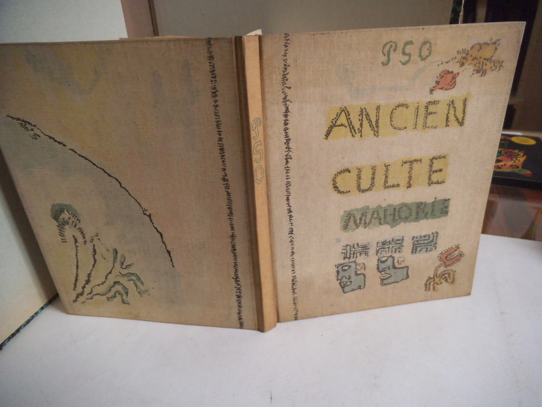
12959Manuscrit reproduit d’après l’original conservé au musée du Louvre (cabinet des dessins) photogravure offset en 6 couleurs et typographie en Bodoni corps 12 de l’imprimerie Georges LANG. Couverture par MOURLOT frères, cartonnage d’Engel. Edité par Pierre BERES LA PALME 5 juin1951. 37 reproductions d’aquarelles accompagnent le fac-similé du manuscrit autographe. 53 pages, présentation de l’ancien culte Mahorie par René HUYGUE 38 pages. Très bon état.
PG122721984 (3rd rev. ed.) x, 342 p., 22 pls, 27 maps, cloth (dust jacket). As new.
20070008765Anchorage AK: Yes Alaska Press 2007. First Limited edition. Hardcover. Fine/issued without. 4to 128 pages blue cloth in matching publisher's clamshell box with ribbon <br/><br/>Copy 294 of only 300 limited and signed copies each with a matching numbered giclee print of the city of Anchorage: signed by Mishler and Carey and Roderick. An evocative book of Mishler's love affair with Anchorage. " .its about the people who live here those crazy individuals who for what ever reason have decided to make Anchorage their home." With essays by Michael Carey and historian Jack Roderick. Note: these are photos of Anchorage at that period. Anchorage is subject to daily earthquakes: the bigger ones continually change the appearance of the city. Yes Alaska Press hardcover
Anchorages in the Galapagos Islands.In the left part of the chart insert of Wreck Bay and approaches From a British survey in 1849 with additions and corrections. In the middle of the chart insert of Iguana Cove From a British survey in 1836, Webb Cove From a British survey in 1886, James Bay From a British survey in 1836, Sulivan Bay From a British survey in 1836, Terrapin Road From a British survey in 1836, Freshwater Bay From a British survey in 1836, Conway Bay From a British survey in 1846, Wreck Bay to Stephens Bay From Italian surveys in 1882 and 1885. In the right part of the chart insert of Tagus Cove From a British survey in 1835, Gardner Bay From a British survey in 1835, Post Office Bay From British surveys in 1836 and 1846, Sappho Cove From a British survey in 1883, Black Beach Anchorage From a French survey in 1887. Washington D.C., published July, 1899, at the Hydrographic Office, under the authority of the Secretary of the Navy. Small corrections: Printed: Oct. 1926. Folded editorially. Autore: Admiralty Charts. Luogo: Galapagos Islands - Pacific Ocean. Anno: '900. Tecnica: incisione. Dimensioni: 639x1105 mm
Anchorages in the Solomon Islands. In the upper part of the chart insert of Hat horn Sound Sketch Survey to Lieut. Marx & Torlesse, H.M.S. "Swinger" and Lieut. Elton, H.M.S. "Diamond" 1884. North of Marx P.t by Lieut. Bower, H.M.S. "Danae", 1879. With additions from a Survey by Lieut. Comm. W.U Moore, H.M.S. "Dart" 1884, Hathorn Sound Sketch Survey by Lieut C. W. Beresford and S.V. Messum under the direction of Lieut. Comm. W.U. Moore, H.M.S. "Dart" 1884, Port Diamond or Sinarango Sketch survey by the Officers of H.M.S. "Diamond", 1886. under the direction of Captain F.S. Clayton, Choiseul Bay Surveyed By Lieut. C.F. Oldham and the Officers of H.M.S. Lark, 1883. In the lower part of the chart insert of Blanche Harbour Surveyed By Lieut. C.F. Oldham and the Officers of H.M.S. Lark, 188, Plan of the Anchorage, Bambatani From a rough Sketch by Lieut. G. Stapleton, H.M.S. "Torch"1900. London Published at the Admiralty, 30th Dec. 1884, under the Superintendence of Captain W.J.L. Wharton, Hydrographer. Small corrections: 1929. Autore: Admiralty Charts. Luogo: Salomon islands - Pacific Ocean. Anno: '900. Tecnica: incisione. Dimensioni: 450x623 mm
Anchorages in the Solomon Islands. In the upper part of the chart insert of Pavuvu Islands (Russell Islands) Sketch Survey by Lieut. G.E. Richards and the Officers of H.M.S. Renard 1880. Pepesala (Paddy) Bay from a sketch by M.r F.J. Bayldon, "Maresby" 1908. In the lower part of the chart insert of Viru Harbour Preliminary Survey By Commander A.F. Balfour, Assisted by the Officers of H.M. Surveying ship "Penguin" 1893, Rendova Harbour Preliminary Survey By Commander A.F. Balfour, Assisted by the Officers of H.M. Surveying ship "Penguin" 1893. London Published at the Admiralty, 28th Jan. 1895, under the Superintendence of Rear Admiral W.J.L. Wharton, Hydrographer. Small corrections: 1921. Autore: Admiralty Charts. Luogo: Salomon Islands - Pacific Ocean. Anno: '900. Tecnica: incisione. Dimensioni: 649x484 mm
Anchorages in the Solomon Islands. In the upper part of the chart insert of Sketch of the Islands in Manning Strait between Choiseul and Ysabel Islands By M.r W. Hamilton 1908. Ysabel I from a sketch survey by Lieutenant F.C.C. Pasco, H.M. Surveying Ship "Dart" 1902. Taura Bay from an Austrian Government Plan, 1897. In the lower part of the chart insert of Sketch of the Southern portion of Lord Howe Islands (Ongtong Java or Leueneuwa) By Lieutenant G. Stapleton H.M.S. "Torch", 1900. London Published at the Admiralty, 9th May 1901, under the Superintendence of Rear Admiral Sir W.J.L. Wharton, Hydrographer. Small corrections: 1921. Autore: Admiralty Charts. Luogo: Salomon Islands - Pacific Ocean. Anno: '900. Tecnica: incisione. Dimensioni: 457x659 mm
Anchorages in the Solomon Islands Surveyed by Commander A.F. Balfour, assisted by the Officers of H.M. Surveying ship "Penguin" 1894. In the upper part of the chart insert of Marovo Lagoon. In the lower part of the chart insert of Mongo Entrance, Charapoana Entrance, Tongoro Entrance. London Published at the Admiralty, 24th Feb. 1896, under the Superintendence of Rear Admiral W.J.L. Wharton, Hydrographer. Small corrections: 1919. Autore: Admiralty Charts. Luogo: Salomon Islands - Pacific Ocean. Anno: '900. Tecnica: incisione. Dimensioni: 626x481 mm
Anchorages in the Solomon Islands. In the upper left corner of the chart insert of Beaufort Bay From a Sketch by M.r T.H. Switzer Master Schooner Roderick Dhu, 1896, Sutulahia Anch.e Sketch Survey by Lieut. W.R. Willis H.M.S. "Ringdove" 1895. In the middle part of the chart insert of Vura Anchorage From a Sketch by M.r T.H. Switzer, Master, Schooner, "Roderick Dhu"1896, Narovo Island Surveyed by Lieut. C.F. Odham and the Officers of H.M. Surveying Ship "Lark" 1882. In the right part of the chart insert of Auki Harbour Surveyed by Lieut. Com. R.L. Hancock and the Officers of H.M. Surveying Vessel "Sealark" 1913, Albatros Bay From an Austrian Government Sketch Survey, 1897, Ngora Fu Harbour From a Sketch Survey by Lieut. G.P. Bigg-Wither and the Officers of H.M.S. "Pylades", 1905. London Published at the Admiralty 20th Feb. 1907, under the Superintendence of Rear Admiral A. Mostyn Field, Hydrographer.Small corrections: 1927. Autore: Admiralty Charts. Luogo: Salomon Islands - Pacific Ocean. Anno: '900. Tecnica: incisione. Dimensioni: 617x470 mm
Anchorages in the Solomon Islands. In the left part of the chart insert of Kunggava Bay From a sketch by Lieut. Com. R. Crookshank, 1928, Queen Carola Harbour From a German Government Survey, 1883, Wanderer Bay By Capt. H.M. Denham, 1855. In the middle part of the chart insert of Port Adam By W. Hilliard, Master H.M.S. Havannah 1850, Mallu Harbour By M.r Haddock, 1877, Astrolabe Harbour By Mons.r Marescot, Enseigne de Vaisseau Corvette Astrolabe French Royal Navy 1838, Cockatoo Anchorage By T.C. Tilly, Master, H.M.S. Cordelia, 1861, Aowawa Roadstead By Capt. H.M. Denham, 1854. In the right part of the chart insert of Hada or Recherche Bay By T.C. Tilly, Master, H.M.S. Cordelia, 1861, Kwakwaru and Kwi Harbours Sketch by M.r W.T. Wawn 1888, Port Mary By Lieut. C.F. Oldham, 1882, Makira Bay By Capt. H.M. Denham, 1855, Hunter Roadstead By Capt. H.M. Denham, 1854, Popau H.r Sketch by M.r R. Haddock, 1877. London Published at the Admiralty March 10th 1864, under the Superintendence of Capt. G.H. Richards, Hydrographer. Small corrections. Autore: Admiralty Charts. Luogo: Salomon Islands - Pacific Ocean. Anno: '900. Tecnica: incisione. Dimensioni: 643x495 mm
Anchorages in the Solomon Islands. In the left part of the chart insert of Utuha H.r or Port Purvis Enlarged from a Survey by Comm. R.W. Glennie, H.M. Surveying Ship "Sealark" 1911, With Additions from a sketch Survey by Lieut. J.P. Rolleston H.M.S "Royalist", 1889, Alite H.r Langa Langa H.r Sketch Survey by Lieut. C.G.S. Eeles, H.M.S. Curacoa, 1893, Anonyma Cove Sketch Survey by Lieut. C.G.S. Eeles, H.M.S. Curacoa, 1893. In the middle part of the chart insert of Sio Harbour Sketch Survey by Lieut. J.P. Rolleston H.M.S "Royalist", 1889, Uru I. Anchorage Sketch by T.H.Switzer, Mate S.S. Rhoderick Dhu, 1894, Korombusu P.t to Susu P.t Surveyed by Commander R.W. Glennie H.M. Surveying Ship "Sealark" 1912. In the right part of the chart insert of Waisissi or Royalist Harbour Sketch Survey by Lieut. J.P. Rolleston, H.M.S. Royalist, 1889, Palaina Anchorage Sketch Survey by Lieut C.G.S. Eeles, H.M.S. Curacoa, 1893, Coleridge Bay Sketch Survey by Lieut. E. Reeves, H.M.S Royalist, 1894, Sualaha Cove Sketch Survey by Lieut. C.G.S. Eeles, H.M.S Curacoa, 1893, Mappo Harbour Sketch by T.H. Switzer, Mate of S.S. Rhoderick Dhu, 1894, S.W. Coast of Malaita By W.T. Wawn, Master of the Brigantine "Borough Belle" 1891. London Published at the Admiralty 30th May 1890, under the Superintendence of Captain W.J.L. Wharton, Hydrographer. Small corrections. Folded editorially. Autore: Admiralty Charts. Luogo: Salomon Islands - Pacific Ocean. Anno: '900. Tecnica: incisione. Dimensioni: 649x998 mm
Anchorages in the Solomon Islands. In the upper part of the chart insert of Jack Harbour Surveyed by Commander A.F. Balfour & Lieut. G.W. Gubbins H.M. Surveying Ship "Penguin" 1894, Baranago Harbour Surveyed by Commander R.W. Glennie and the Officers of H.M. Surveying Ship "Sealark" 1911, Rice Anchorage Sketch Survey by Lieut. S.C. Weigall, H.M. Surveying Ship "Penguin", 1895. In the middle part of the chart insert of Mboli Harbour Sketch by J.E. Scudamore Master, H.M.S. "Curacoa" 1865 Additions from a sketch by Lieut. A.C. Scott H.M.S. "Mohawk" 1898, Kolieuro Inlet Surveyed by Lieuts. C.E. Monro & S.C. Weigall under the direction of Comm. A.F. Balfour H.M. Surveying Ship "Penguin", 1895. In the lower part of the chart insert of Rua Sura I.s Anchorage Surveyed by Comm. R.W. Glennie, and the Officers of H.M. Surveying Ship "Sealark" 1912, Mosquito Anchorage Surveyed by Lieut. T.H. Heming under the direction of Lieut. C.F. Oldham, H.M. Surveying Ship "Lark" 1882, Maoraha I. & Anchorage Surveyed by Lieut. T.H. Heming under the direction of Lieut. C.F. Oldham, , H.M. Surveying Ship "Lark" 1882. London Published at the Admiralty 28th Jan. 1896, under the Superintendence of Rear Admiral W.J.L. Wharton, Hydrographer. Small corrections: 1928. Autore: Admiralty Charts. Luogo: Salomon Islands - Pacific Ocean. Anno: '900. Tecnica: incisione. Dimensioni: 630x483 mm