2 675 résultats
20001323372PN. New. 2000. Soft Cover. Date is original print. This is a reprint edition . PN paperback
01-1144Pacific Silver Cloth ca. 1950s. Ten cloth bags some with zippers for silver. Pacific Silver Cloth, ca. 1950s. hardcover
01-1154Pacific Silver Cloth ca. 1950s. Four brown cloth bags some for silver. Pacific Silver Cloth, ca. 1950s. hardcover
1986776346PN. New. 1986. Soft Cover. Date is original print. This is a reprint edition. . PN paperback
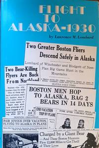
196660497<p>Private Printing. Very Good in Very Good dust jacket; Edges lightly foxed jacket rubbed and . edgeworn. 1966. First Printing. Hardcover. Red cloth binding xiii 139pp. Inscribed by the author on the front free endpaper. Photos. Lombard and his friend Pete Blodgett flew from Boston to Alaska and back again in an open cockpit biplane for a bear-hunting holiday in 1930. ; 8vo 8" - 9" tall .</p> Private Printing hardcover
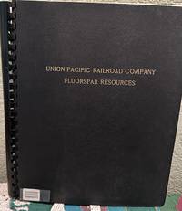
195229208Omaha Nebraska: Union Pacific Railroad Company 1952. First Edition. Plastic comb binding. Very Good-. Unmarked except for catalog and company stamp on inside cover page and catalog sticker on front cover. ; Book Description; Pages are clean and not marred by notes or folds. Covers are square with minor wear. Ships Safe and Fast. Fold-out maps in back of book. ; B&W Illustrations; 4to 11" - 13" tall; x pages DQ3. Union Pacific Railroad Company unknown
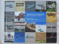
20192375North Pacific Media 2019. Hardcover. Very Good. Pictoral oblong quarto hardcover lacking jacket. A very good copy bright and attractive. Bumping to the corners and gutter visible at the very last page. 94 pp. full color photography throughout - a unique look at the signs and building names across Hawaii. <br/><br/> North Pacific Media hardcover
44818695-nnew. unknown
B9783036551609Hardback. New. hardcover
19422092902143400354Domei tsushin-sha 1942. Soft Cover. Fine. Size: A5 size Domei tsushin-sha paperback
19991313791PN. New. 1999. Soft Cover. Date is original print. This is a reprint edition . PN paperback
192061528Sydney Australia New York & San Francisco CA: Oceanic Publishing Co. A.M. Robertson 1920. Tall 8vo. xiii 1 375 1 pp. tipped-in blue errata slip on p. vii. Photo frontisp. photo plates illustrations maps. Blue publisher’s cloth white lettering & ruling front cover & spine w/ d.j. chipping & tears head & foot of spine minor loss to spine old tape repairs still NF/G- copy. First edition of the Polish-American/Australian author’s autobiographical memoir relating his travels over 40 years first as Journalist for the New York Herald and other papers and then subsequently as publisher and director for Oceanic Publishing. Coffee 1852-1929 details his travels through British Columbia the Pacific Northwest Hawaii including an automobile trip around the Island of Oahu trips to Easter Island New Caledonia Samoa Tonga Fiji New Guinea New Zealand Japan Alaska and more. Work was reprinted with corrections and additions in 1925. Very scarce in original dustjacket. See: Terry Fogarty & Joan Antarakis Frank Coffee Historical Willoughby 2024. Oceanic Publishing Co., A.M. Robertson, hardcover
1970TR-47Wheatland Wyoming: Triple R Press 1970. Fine text is an exact reproduction of the original publication by the Union Pacific Railroad Omaha Nebraska 1909- with three added supplements a table of the principle divisions of geologic time and a map showing the location of Como Bluff. Includes a description of the Grand Canyon of the North Platte River- one of the major scenic areas of Wyoming and directions for reaching it. 67 pgs. Illustrated. Reprint. Original Wraps. As New. 8vo - over 7¾" - 9¾" tall. Triple R Press Paperback
19779808Santa Cruz: Santa Cruz City Museum 1977. Original wraps. Good . Short square 8vo. 32pp. illustrated general and regional books on fossils and paleontology sources. -- Faint water stain to the top edges of the text causing light waviness throughout corners moderately bumped. Very light diagonal crease to the front cover. Santa Cruz City Museum unknown
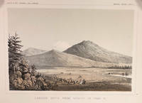
185714424Washington DC: A. O. P. Nicholson Printer 1857. First Edition. Very Good. 8.25x11in Four litho tinted illustrated plates I II VIII and XII; Some age-toning along edges one with large stain along right edge not affecting neatline of illustration. These plates are from from Volume VI of the quarto edition of twelve volumes were published from 1855 to 1861 as exploration and survey reports became available. These volumes contained not only the survey maps and elevations but a monumental collection of scientific reports on geography geology zoology botany and ethnology of the Native American tribes. The surveys also included 11 artists to record the landscape and indigenous peoples of the west. <br /> <br /> The plates were drawn in 1855 by John J. Young 1830-1879 a staff artist for the War Department. He was assigned in 1855 as a draftsman for the Lt. Williamson railway survey to connect California's Sacramento Valley with Oregon's Columbia River.Young's views of the Cascade Range included 14 landscape scenes one geologic scene and 10 drawings of trees in there habitat from Samuels p 545 <br /> <br /> The Illustrations are: Plate 1 - Lassens Butte From Vicinity of Camp 18 Plate II Mouth of Fall River near Camp 20 Plate VIII Canon of Psuc-See-Que Creek near Camp 41A Plate XII Shasta Butte and Shasta Valley from a point near Camp 70A.<br /> <br /> The twelve volumes were disorganized in publication with no overall all arrangement or indexing. Some of the plates and maps referred to in volumes were published in other volumes various reports were also published out of sequence relating to the four routes. Preliminary reports published were updated in latter volumes. From Wagner-Becker-Camp In 1853 Senator Gwin of California lead the inclusion of Congressional funding for 1853-54 of a series of surveys to determine the best and most economical railroad routes from the Mississippi River to the Pacific coast. The act directed the Secretary of War Jefferson Davis to plan and direct Army topographical engineers to conduct surveys of four routes. The first was between the 47th and 49th parallels generally along the Lewis and Clark route to the Pacific. The Second route between the 37th and 39th parallels was promoted by Senator Thomas Hart Benton of Missouri. The Third route was along the 35th parallel. The Fourth route was promoted by Secretary Davis along the 32nd parallel that followed Emory's 1846-47 reconnaissance. A. O. P. Nicholson, Printer unknown
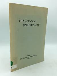
1950322024St. Louis/Chicago: Office of the Provincial / Franciscan Herald Press 1950. 1st Edition. Paperback. Fair. 55p. Ex-library paperback book in original binding. Spine and top edges toned; crease in front cover. Label on spine convent inscription on first blank page and card pocket in back. Otherwise a clean tight copy in good reading condition. Office of the Provincial / Franciscan Herald Press paperback
0282186573.Gpaperback. Good. Access codes and supplements are not guaranteed with used items. May be an ex-library book. paperback
0666829330.Ghardcover. Good. Access codes and supplements are not guaranteed with used items. May be an ex-library book. hardcover
1991Q-0813311012Westview Press 1991-02-13. Hardcover. New. New. In shrink wrap. Looks like an interesting title! Westview Press hardcover
58-0513San Francisco Calif.: Southern Pacific Company 1960 sketch approved 1961. Freight tariff 8.5 inches x 11 inches with 10 listings including Sacramento; sketch blue pen and red pencil with pencilled notes on paper 8 inches x 21 inches. Sketch features vicinity Mile Post 44.7 "500 feet east of the east line of Redding Avenue" west of county road beyond Redding Avenue east to track junction towards Tracy. Not drawn to scale. San Francisco, Calif.: Southern Pacific Company, 1960, sketch approved 1961. unknown
56-0435Fresno Calif.: Progressive Map Service n.d. Blueline print 38" x 26" with red and black pencilling indicating track lines switching limits. From Marks Avenue to Willow Avenue and Annadale Avenue to Barstow Avenue. Includes City Directory street index approx 400 listings. Scale approx 1" = 1700'. Fresno, Calif.: Progressive Map Service, [n.d.] unknown
56-0436Fresno Calif.: Progressive Map Service Southern Pacific notations approved 1942. Blueline print 38" x 26" with red and blue pencil on map attached typewritten and handwritten memorandum indicating proposed extension. Marks Avenue to Willow Avenue and Annadale Avenue to Barstow Avenue. Includes City Directory street index approx 400 listings. Scale approx 1" = 1700'. Fresno, Calif.: Progressive Map Service, Southern Pacific notations approved 1942. unknown
2090502113717271Not Available N.A. Soft Cover. Fine. The book is in fine condition. Not Available paperback
1948021604<p>Dallas Texas: Texas & Pacific Railway Company 1948. Book. Near Fine. Soft cover. 1st Edition. Original tan decorative wraps 50 pages illustrations. Includes a story of how discussions around the dinner table at Hashknife Ranch about where to locate a major cattle shipping center almost prevented the founding of Abilene Texas. Six-Guns 163 "A little book issued by the Texas and Pacific Railway now scarce. It contains some material on Sam Bass and his robberies of Texas and Pacific trains at Eagle Ford and Mesquite.".</p> Texas & Pacific Railway Company paperback
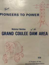
197612436Grand Coulee Dam Bicentennial Association 1976. 1st Edition . Soft cover. Poor. 4to - over 9¾ - 12" tall. Historical Sketches of the Grand Coulee Dam. 467 pages. White paperback. <br/> <br/> paperback