443 résultats
1887R150145543JOUVET. 1887. In-12. Broché. Bon état, Couv. légèrement passée, Dos satisfaisant, Mouillures. 228 pages. Ouvrage orné de 25 gravures et de deux cartes hors texte . Tampon sur la dernière page de texte, sur la page de garde. Petit manque sur la page de garde. Note au stylo sur le dos de l'ouvrage. Pièce de titre marron sur le dos de l'ouvrage.. . . . Classification Dewey : 996-Autres régions du pacifique
1886WRCAM8175Np 1886. 4pp. Dbd. Considerable chipping at blank margins old fold printed on brittle paper. Reports the case of the NPRR vs. Lilly in which the latter refused to allow the NPRR to cross a tract of land in accordance with the Congressional land grant of 1864. The court found in favor of the NPRR. unknown books
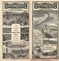
187544494Washington D.C.: From the Press of The Henry E. Wilkens Printing Co. n. d. ca 1875. 1875. First edition. 3 3/8" x 6" pictorial wrappers 50 pp. including covers illustrated from photographs map. A train trip on the Washington Line of the Southern Pacific Company is described from Washington D. C. to California. Beginning in Washington D.C through North Carolina Alabama Louisiana Texas Arizona New Mexico southern California northern California and ending in Portland Oregon. Many interesting photographic views are shown including the Congressional Library the White House a cotton market in Alabama the French Market in New Orleans the Alamo New Mexican Indians protesting against their picture being taken views of Riverside California Los Angeles and much more. The centerfold is an interior diagram and vignettes of a tourist bedroom and sleeping car. Stamp of Alex S. Thweatt Eastern Passenger Agent Southern Railway 1185 Broadway New York on the inside front cover light wear to the spine else a near fine bright copy of one of the nicest booklets we have handled. From the Press of The Henry E. Wilkens Printing Co., n. d. (ca 1875). unknown
1899WRCAM20177St. Louis 1899. 1102pp. plus folding map. Illus. Original printed wrappers. Some light soiling to wrappers. Else very good. Later edition. The wonders of Missouri farming especially with respect to fruit culture ".the value of the fruit crop of Missouri annually exceeds that of California" and stock raising. Illustrated halftones of farm scenes fine residences St. Louis and natural spendlors such as the Falls of Stout's Creek near Arcadia Missouri. Includes a folding map of the state. unknown books
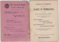
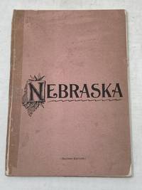
189246034St. Louis: Woodward & Tiernan Print. Co. 1892. Stapled paper wrappers. A good copy wrappers chipped soiled starting to detach seller stamp to front wrapper occasional soiling to contents. Lacking folding map. 64 pp. Illus. with b/w engravings. 12mo. Promotional booklet published by the Missouri Pacific Railway encouraging settlement in Nebraska. Lacks folding map. Woodward & Tiernan Print. Co. unknown
189287869St. Louis MO: Printed by Woodward and Tiernan Printing Co 1892. Second Edition. Staplebound Pamphlet. Good Plus. Stapled pamphlet. 7.5 in. x 5.25 in. pp. 64. Illustrated with in-text drawings and a fold-out map of Nebraska 21 in. x 26 in. Pink cardpaper wraps with black title to front. Light soiling to covers with chips to top/bottom of spine; older tape repairs to length of spine reattaching front cover and to left edge of rear cover. Fragile edges with chips to corners and several short closed tears to cover edges. Clean interior with very good plus map. This brochure was presented "With the Compliments of the General Passenger Department of the Missouri Pacific Railway." The text provides description and chart of information related to population geography geology weather land prices distances horticulture churches and more. Printed by Woodward and Tiernan Printing Co unknown
188933137St. Louis: Press of Woodward & Tiernan Printing Co. 1889. 1889. MISSOURI. First edition. 12mo. 7 1/2" x 5 1/4" printed wrappers 110 2 pp. engraved illustrations folding map advertisements. A detailed report of Missouri done county by county and discussing such subjects as location physical features and soil agriculture wheat corn grasses and pasturage stock raising and dairying wool growing mines and minerals coal iron lead zinc copper granite and other minerals fruit raising available lands for sale exemption and taxation laws timber lands manufacturing adaptability education and schools hunting and fishing labor wages and taxation etc. A discussion of each county is provided along with vital statistics pertaining to cattle hogs sheep et al county by county. The folding map of Missouri is in fine condition. Inked number "1889" on front cover else a very good clean tight copy. Press of Woodward & Tiernan Printing Co., 1889]. unknown
18342587Paris, Imp. de Cosson, 1834. In-8 de VIII-318 pp., demi-veau brun, dos orné à nerfs, pièce de titre en veau noir (reliure de l'époque).
1869WRCAM8181Philadelphia 1869. 51pp. Dbd. Marginal stain titlepage soiled and chipped else very good. Report of the expedition made by W. Milnor Roberts Civil Engineer under the direction of Messrs. Jay Cooke & Co. a Philadelphia banking firm. The narrative describes the route topography etc. unknown books
1890300405Pacific Electric Railway 1890. 1890. Photograph depicting 37 passengers at the Echo Mountain Terminal 3500 feet above sea level with printed descriptive information on the verso of mount with pictorial borders. 4 1/2" x 7 3/4" image on stiff 10" x 7" mount. No Binding. Very Good/No Jacket. Pacific Electric Railway [1890]. unknown books
1890300405Pacific Electric Railway 1890. 1890. Photograph depicting 37 passengers at the Echo Mountain Terminal 3500 feet above sea level with printed descriptive information on the verso of mount with pictorial borders. 4 1/2" x 7 3/4" image on stiff 10" x 7" mount. No Binding. Very Good/No Jacket. Pacific Electric Railway [1890]. unknown
187527665New York: Evening Post Steam Presses 1875. Original printed wrappers with wrapper title as issued. Stitched. iv 3-133 pp. Wrappers moderately worn else a clean text and Very Good.<br/><br/> A comprehensive compilation of the legal documents creating and authorizing the Railroad and its branches and affiliates. OCLC locates five copies under several accession numbers as of March 2018. A shorter version with this title appeared in 1873. Evening Post Steam Presses unknown books
189046165San Francisco: Crocker & Co. December 1890. 1890. 7" x 21" sheet on cream-colored stock folded to 12 panels each 7" x 3 1/2." 2 pictorial cover panels. Ticket rates from San Francisco to Monterey Pacific Grove or Santa Cruz along with excursion rates. 2 panels offering "Schedule of Stage Connections Showing Routes Distances Rates of Fare Etc." Black and white illustration showing bird's eye view of Hotel del Monte. Time schedules for the Monterey Line Pacific Grove Extension Santa Cruz Line Almaden Line Tres Pinos Line and Sta. Margarita Line. Light soiling to cover panels else near fine. Crocker & Co., December, 1890. unknown
187383541Evening Post Steam Presses 1873. Hardcover. Good/No jacket. A scarce title. Names vigorously erased on front endpaper so very noticeable removal. Covers worn. A few pages marked in pencil. Evening Post Steam Presses hardcover
187527665New York: Evening Post Steam Presses 1875. Original printed wrappers with wrapper title as issued. Stitched. iv 3-133 pp. Wrappers moderately worn else a clean text and Very Good.<br /> <br /> A comprehensive compilation of the legal documents creating and authorizing the Railroad and its branches and affiliates. OCLC locates five copies under several accession numbers as of March 2018. A shorter version with this title appeared in 1873. Evening Post Steam Presses unknown
18901397Paris, Calmann-Lévy, 1890. In-12 de XVI-308 pp., cartonnage éditeur.
1882A91353Bruxelles, Société royale belge de géographie 1882 132pp. & 36pp.de compte rendu des actes de la société, 23cm., br.orig. (petit manque au dos), non coupé, bon état, [contient principalement: BAMPS A.: Compte-rendu de la quatrième session du Congrès international des Américanistes (pp.5-37), VERSTRAETE: Géologie de la Nouvelle-Zélande (pp.38-68)], A91353
1897ZB338801Washington: GPO 1897. 15 pp issued as 54th Congress 2d Session SD 52; light extraction roughness at spine now disbound in self wrappers; “relative to the amount due the sinking fund . on account of subsidies paid by the Pacific Mail Steamship Company”. - If you are reading this this item is actually physically in our stock and ready for shipment once ordered. We are not bookjackers. Buyer is responsible for any additional duties taxes or fees required by recipient's country. Photos available upon request. Washington: GPO, unknown
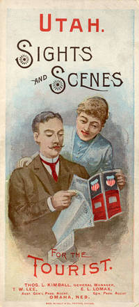
188852275Chicago: Rand McNally & Co. Printers 1888. 1888. UTAH RAILROAD. First Edition. 8vo. 21.5 x 10 cm. 8 1/2" x 4" color pictorial wrappers. 48 pp. illustrated from photographs fold-out map 'Tourist Map of Union Pacific and Connecting Lines' 20.5 x 59 cm. 8 1/4" x 23 1/2" present at the rear. The map is in nice condition and provides an excellent panorama of the Union Pacific Railway. Lines in red and run from Kansas City Atchison and Omaha to Denver and south to Gunnison or west through Cheyenne Granger and onto Portland with a spur up to Helena or west through Ogden and onto San Francisco with a spur down to Los Angeles. Blue shaded illustrations surround the lines which include a plowing scene Union Depot Salt Lake City Garfield Beach a mining scene Falls of the Yellowstone a ranching scene etc. Union Pacific produced guide for the would-be tourist of Salt Lake City including a description of the Mormons and their customs. Illustrated with nine full-page engravings from photographs by C.R. Savage. Also provided are List of Agents. Pullman Palace Car rates. Information on Salt Lake City tours Salt Lake City and the area surrounding "The Temple City" Beck's Hot Springs the Great Salt Lake Giant's Cave at Garfield Beach Echo Canon Weber Canon the Devil's Gate Ogden Ogden Canon etc. Detailed information on 9 different tours touting what the tourist might see and do. Covers lightly used light wear to fore-edges else a very good copy. Rand, McNally & Co., Printers, [1888]. unknown
189546744St. Paul MN: s.i. 1895. Very Good. St. Paul MN: s.i. 1895. Land map folded into a bi-fold informational pamphlet 90x95 cm; 23x11 cm; 9 unpaginated panels. All panels generally toned and creased as expected with minor rubbing to extremities and one closed tear to top edge of map along middle fold. Overall a Very Good or better example. <br /> <br /> An information-packed pamphlet for farming colonists looking for "healthful and pleasant living" in the Pacific Northwest; folds out to a map of the region and available land advertised at $3 to $10 an acre which could be bought from the Northern Pacific Railroad Company. Rail tickets could be purchased following the "Yellowstone Park and Dining Car Route" which also offered "Free Colonist Sleeping Cars" and 150 pounds of baggage carried for free on each full fare. s.i. unknown
1870WRCAM34144San Francisco: Thomas Houseworth & Co. 1870. Single stereocard 3 1/2 x 7 inches. Stereo image mounted onto printed orange cardstock. Slight wear at edges. Very good. A very attractive single stereocard image of the Central Pacific Railroad's "Long Ravine Trestle Bridge." The bridge is located in Nevada County California in the Sierra Nevada mountain range just west of the Nevada state line. The image comes from a set sixty-two stereocards created by Thomas Houseworth & Company for the railroad some time after the railroads completion in 1869. According to the website of the Central Pacific Railroad www.cprr.org the Houseworth company produced more than one hundred such stereocards for the railroad including more than a dozen views of the 878- foot long Trestle Bridge. A nice early stereoscopic image of an engineering wonder from an important American railroad. Thomas Houseworth & Co. unknown books
1870354322San Francisco: Thomas Houseworth & Co 1870. Single stereocard 3½ x 7 inches. Stereo image mounted onto printed orange cardstock. Slight wear at edges. Very good. Single stereocard 3½ x 7 inches. A very attractive single stereocard image of the Central Pacific Railroad's "Long Ravine Trestle Bridge." The bridge is located in Nevada County California in the Sierra Nevada mountain range just west of the Nevada state line. The image comes from a set sixty-two stereocards created by Thomas Houseworth & Company for the railroad some time after the railroads completion in 1869. According to the website of the Central Pacific Railroad www.cprr.org the Houseworth company produced more than one hundred such stereocards for the railroad including more than a dozen views of the 878-foot long Trestle Bridge. A nice early stereoscopic image of an engineering wonder from an important American railroad. Thomas Houseworth & Co unknown
1888WRCAM13837Philadelphia 1888. 38pp. Original printed wrappers. Wraps darkened and chipped top margin considerably chipped with no loss of text old fold. A decent copy printed on bad paper. In a folding cloth box leather label. The Mercantile Trust Company makes claims to security in property of the Railway including holdings in New Orleans. The property is described in detail. Also printed are the articles of the new mortgage and documents of certification of New York and Louisiana. hardcover books
1888VV237151888 20 p., 1 lithographed plate (by W. Hart), disbound (no covers). Published in: Proceedings of the Zoological Society of London.
1888VV249451888 20 p., 1 lithographed plate, disbound (the original front cover of the journal is added loose). Published in: Proceedings of the Zoological Society of London. Unopened. Depicting: Nasiterna aolae & Myzomela sharpei, drawn by W. Hart and lithographed by J. Smit.