50 748 résultats
Paperback Like New. Ships directly from publishers. Pls. allow a minimum of 25 business days delivery time being a new book from publisher.
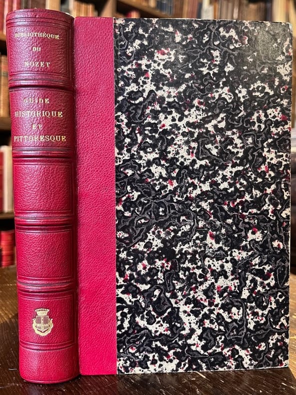
185820741Lyon, Imprimerie de Louis Perrin, 1858. In-8 de [4]-V-[3]-784-[2] pages, demi-maroquin rouge, dos à nerfs orné d'un supra-libros "Bibliothèque de Nozet" et des armes en queue (comte Lafond?).
1905qi1253Le Tour de France Le tour de France Relié 1905 Deux volumes in-4 (28x38.5 cm), reliés demi-chagrin marron, titre doré aux dos à nerfs, publication bi-mensuelle, volume 1 : première année, 1904, du n°1 (mai 1904) au n°7 -décembre-1er janvier), deuxième année du n°8 (15 janvier 1905) au n°18 (15 juin 1905) ; volume 2 : deuxième année du n°19 (1er juillet 1905) au n°29 (Noël 1905), puis du n°30 (janvier 1906) au n°34 (novembre 1906) ; nombreuses illustrations en noir et blanc dans le texte, en couleurs et en noir et blanc in et hors-texte (1450 photogravures et dessins inédits d'après nature), ouvrage collectif ; coiffes et nerfs un peu frottés, coins frottés, bon état général. Livraison a domicile (La Poste) ou en Mondial Relay sur simple demande.
19247536ALondon, Cook, 1924. 8°. 143 S. und ill. Werbeanhang. Mit zahlr. Abbildungen und 3 gefalt. Karten. OLn.bd. 5. Auflage.
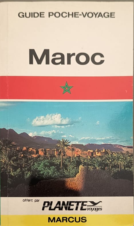
19739570Marcus 1973 64 pages 11 6x0 6x19cm. 1973. perfect. 64 pages. Le livre 'Maroc' de Lonely Planet est un guide de voyage complet et illustré conçu pour aider à planifier un itinéraire et découvrir la destination. Il met en avant les richesses culturelles du pays (épices palais souks désert) et propose des conseils pour des expériences de voyage authentiques
18277382Paris, Truchy, Ch. Simonneau, 1827. 136 x 86 mm, 759-(3) pp., 3 cartes dépliantes couleurs. Reliure demi-basane moderne à l'imitation, dos orné de filets dorés et fleurons à froid, rares rousseurs. Très bel exemplaire.
DISPONIBILITÀ GARANTITA AL 99%; SPEDIZIONE ENTRO 12 ORE DALL'ORDINE. OTTIME CONDIZIONI, LIEVISSIMI SEGNI DEL TEMPO ALLA COPERTINA; QUALCHE MACCHIETTA FIORITURA. Le Chemin de Fer de La Mure est maintenant plus connu pour la beauté de son parcours et la hardiesse de son tracé que pour son passé charbonnier. Prévu au départ pour relier Saint-Georges-de-Commiers à Gap, il n'a finalement jamais dépassé Corps avant de se replier aujourd'hui, sur la section la plus admirable. Ces trente et un kilomètres qui survivent, mais qui furent aussi les premiers construits, ont accumulé les performances: 142 ouvrages d'art, des millions de tonnes d'anthracite transportées, première mondiale de la traction électrique à courant continu haute tension. Après la description très documentée des trois tronçons successifs, mais si différents, de Saint-Georges-de-Commiers à La Mure, de La Mure à Corps et de Corps à Gap, une large place est donnée au pionnier de la traction électrique pour retracer l'évolution de ses installations fixes et de son parc moteur. Souvent original, le matériel roulant est décrit en totalité, avec des nombreux dessins : locomotives à vapeur et électriques, automotrices, voitures, wagons ou engins de service. Le trafic important du SG-LM-G lui a valu de connaître une exploitation proche de celle des grands réseaux. Elle est révélée au lecteur sous ses angles commerciaux et techniques : vitesses, horaires, règlements, signaux et bâton-pilote. Cet ouvrage de 512 pages, comprenant près de 1 000 photos bichromie et 200 plans, cartes et schémas, nous conte cent années de la carrière à la fois prestigieuse et discrète d'un passionnant chemin de fer, avec un clin d'œil sur ses vieux complices qu'ont été le Drac, grand pourvoyeur d'énergie, et les Houillères du Dauphiné, son meilleur client. Descrizione bibliografica Titolo: Le chemin de fer de La Mure: Saint-Georges-de-Commiers, La Mure, Corps, Gap Autore: Patrice Bouillin, Daniel Wurmser Avec la collaboration de: MM. Rémi Arsenne, Pascal Bejui, Joseph Emond Editore: Grenoble: Presses & Editions Ferroviaires, Patrice Boullin, 1995 Stampato in Italia (Imprimé en Italie): San Mauro (TO) Lunghezza: 511 pagine; 29 x 21 cm; illustrato (1000 photos noir et blanc, 200 plans, cartes et schémas) Peso: 3 Kg ISBN: 2905447117, 9782905447111 Langue: Français Lingua: Francese Language: French Soggetti: Libri rari, Vintage, Ferrovie, Storia ferroviaria francese, Francia, Treni, Collezionismo, Segnali meccanici, Signaux mécaniques, Tourisme et Voyages, Guides touristiques, France, Ottocento, Traction électrique, Linee ferroviarie elettriche, Grenoble, traction électrique, Sviluppo indutriale, Transports, Trasporti, Les tramways, Turismo, Tram, Rhone-Alpes, Turismo, Guide, Alpi, petit train de La Mure, Isère-Dauphiné, Tunnels, Locomotives électriques, Chamonix, Voitures à voyageurs, Vagons de marchandises, Viaducs, La gare, Stazioni, Ouvrages d'art, Corps et Valbonnais, Électrification, René Thury, Tracteur T7, viaduc haut de Loulla, Ligne à voie métrique en France, Train remarquable, Novecento, Lignes, Anthracite, Route Royal, Libri illustrati, Les Hommes, Edizioni a tiratura limitata, Presses & Editions Ferroviaires, Exploitation commerciale, Bibliografia, Etrangers en visite, Materiel remorqué, Signalisation, Reglementation, Secheron,Rare Books, Vintage, Railways, French Railway History, Trains, Collectibles, Mechanical Signals, 19th century, Electric railway lines, Development Industrial, Transports, Transportation, Guides, Alps, Illustrated books, Limited editions, Bibliography, Mechanical signals, Tourism and Travel, Tourist guides, Passenger cars, Viaducts, Structures, Electrification, High Viaduct, Metric Track Line in France, Remarkable Train, Men, Foreign visitors, Towed equipment, Signaling, Regulations, Antiquariat, collectibles, Collezionismo, livres de collection, Historie, Train Bleu, Railroad
198063728NY., James Wagenvoord, 1980. origi.Broschur, kl.4°, 191 Seiten.
Brandt Poulsen, Mogens. PNot in perfect condition. unknown
1901008935London: Macmillan and Co. 1901. First edition 1901. Scarce travel guide to the Western Mediterranean including both southewestern Europe and northwestern Africa. Includes maps and/or plans of: The Western Mediterranean; Lisbon; Andalucia; Seville; Cordoba; The Alhambra; Gibraltar; Morocco; Tangier; Algiers; Malta; Port of Valetta; Sicily; Palermo; Syracuse; Messina; Straits of Messina; Naples; Environs of Naples; Genoa; Marseilles. Includes yachting notes hotel recommendations historical notes and other usual travel information. Bright red cloth over flexible boards gilt lettering 238 pages plus 22 pages of advertising. Some light cover wear mainly rubbing to the corners and spine ends inner hinges lightly cracked cosmetic rather than structural pages clean and free from names or other markings. A well-kept copy. First Edition. Soft Cover. Very Good. 12mo - over 6¾" - 7¾" tall. Macmillan and Co. Paperback
1860045387London: Longman & Co. 1860. Undated ca 1860. Nicely bound book containing two chapters of the Alipine Guide undated but circa 1860 publisher name Longman & Co. and Edward Weller on the maps. Two chapters VII: Bernese Alps; VIII: Alps of North Switzerland with consecutive page numbering from 1 to 242 pages four folding maps including a linen-backed maps in pocket inside the rear cover the other maps accented with blue hand coloring. Full diced calf leather with gilt spine lettering speckled edges marbled endpapers no title page. Very good condition with only modest external wear sound text block with binding stitches visible between two pages at the front some edgewear to two leaves pages clean no names or other markings. All maps very good: Oberland District; The Alps of URI; Alps of Glarus; Map of the Central Alps Including Switzerland Lombardy and the Western Tyrol. Hard Cover. Very Good. 12mo - over 6¾" - 7¾" tall. Longman & Co. Hardcover
3 vols., 8vo., First Edition thus, with 3 frontispieces and 2 large folding maps; navy cloth, gilt backs, blue tops, a near fine set. The set comprises Vol. I: Preliminary Remarks and Andalucia; Vol. II: Ronda and Granada, Murcia, Valencia, Catalonia, Estremadura, Leon and Gallicia; Vol. III: The Asturias, The Castiles (Old and New), The Basque Provinces, Arragon and Navarre. COMPLETE SETS ARE VERY SCARCE IN THIS CONDITION.
8vo., First Edition, with illustrated title in red and black, over 800 photographs (many full-page) and a full-page map in the text, and pictorial endpapers; original pictorial tan cloth gilt, upper board board elaborately blocked and lettered in gilt and brown, gilt back, brown top, very neatly recased, a remarkably bright, clean copy. A remarkably well-preserved copy of the best nineteenth-century guide to the city, extensive in scope and comprehensive in detail. A second edition was issued in the following year; the original edition is very scarce, especially in this condition.
Very Good Turkish, Ottoman (1500-1928) Original color lithograph map. Folded. Oblong folio. (35 x 52 cm). In Ottoman script (Old Turkish with Arabic letters). It shows Sudan and West Africa, Atlas Ocean shores, Sahra Desert, and other parts of Africa. Scale: 1:15.000.000. A very detailed and attractive map. Slightly fading. Otherwise a very good copy. Dated Hegira: 1310 = [Gregorian 1894]. Taken from his attractive atlas titled "Yeni cografya atlasi. [i.e. New Geographical Atlas]". The cartographer, Ali Seref, or Hafiz Ali Seref (or Esref) Pasha (1840-1907) was an Ottoman soldier and mapmaker who was schooled in Paris as a cartographer around 1862. While in Paris he published his first atlas with 22 maps, called the Yeni atlas. Upon his return to Istanbul, he became the chief cartographer at the Matbaa-i Amire Printing Press in Beyazit. Chipping on extremities. Slight foxing. Overall a good copy. Not in OCLC.; Not in TBMM Map Collection.
Very Good Arabic Original hand-colored map on tissue paper. 23x19 cm. In Ottoman script and Arabic. No scale. Manuscript notes of toponyms. The manuscript shows Egypt, Ethiopia, Sudan, the Red Sea along the line of Red Sea shores. Manuscript notes show that the map was used for military purposes in the last Ottoman Imperial period. Habesh Eyalet, Ethiopia in northeast Africa was conquered by Özdemir Pasha in 1557. His son, Osman Pasha, transformed the region into an eyalet, which remained under Ottoman suzerainty until the early 19th century when Egypt assumed its administration. (Source: Pashas, Begs, Effendis: A historical dictionary of titles and terms in the Ottoman Empire, Bayerle, Gustav.).
Very Good German Original color map on cloth. A little foxing on cloth. Very good. Folded. Oblong folio. (45 x 51 cm). In German. Shows N. Enyed, Zalathna, Mediasch, Hermannstadt, Hatszeg, Petroseni, Ôzt River, etc. Scale: 1/300,000. Sibiu (Sibiiu - Hermannstadt - Nagyszeben) is a city in Romanian Transylvania. The city straddles the Cibin River, a tributary of the river Olt. The first official record referring to the Sibiu area comes from 1191 when Pope Celestine III confirmed the existence of the free prepositure of the German settlers in Transylvania, the prepositure having its headquarters in Sibiu, named Cibinium at that time. In the 14th century, it was already an important trade center. As of the year 1376, the craftsmen were divided into 19 guilds. Sibiu became the most important ethnic German city among the seven cities that gave Transylvania its German name Siebenbürgen (literally "Seven Citadels"). It was home to the Universitas Saxorum (Community of the Saxons), a network of pedagogues, ministers, intellectuals, city officials, and councilmen of the German community forging an ordered legal corpus and political system in Transylvania since the 1400s. During the 18th and 19th centuries, the city became the second -and then the first most important center of Transylvanian Romanian ethnics. The first Romanian-owned bank had its headquarters here (The Albina Bank), as did the ASTRA (Transylvanian Association for Romanian Literature and Romanian's People Culture). After the Romanian Orthodox Church was granted status in the Habsburg Empire from the 1860s onwards, Sibiu became the Metropolitan seat, and the city is still regarded as the third-most important center of the Romanian Orthodox Church. Between the Hungarian Revolution of 1848 and 1867 (the year of the Ausgleich), Sibiu was the meeting-place of the Transylvanian Diet, which had taken its most representative form after the Empire agreed to extend voting rights in the region (Source: Wikipedia). A sheet of the collection of 'The general map of Central Europe'. appeared in the years between 1873-1876 with the work of Joseph Ritter von Scheda, (1815-1888) who was a general, geographer, and cartographer.
Very Good Arabic Original hand-colored map on tissue paper. 23x19 cm. In Ottoman script and Arabic. No scale. Manuscript notes of toponyms. It shows Baghdad, Deir Al-Zor, Kirkuk, Mosul, Syria, borders of Ajamistan (Iran), etc. Manuscript notes show that the map was used in military purposes in the last Ottoman Imperial period.
Very Good Turkish, Ottoman (1500-1928) Original color map on cloth. Oblong atlas folio. (49 x 60 cm). Toponyms in Turkish with Arabic letters. In Ottoman script. Scale: 1/25.000. [MAP of ISTANBUL / CONSTANTINOPLE] Küçükköy, Petnahor, Makriköy, Kagidhane [Kagithane]. A rare Istanbul map including some old Byzantine toponyms.
Very Good Turkish Original huge color city plan of Ankara city. 83x67 cm. In Turkish. Scale: 1:8.000. Very detailed and huge city plan of Ankara prepared and printed at the early period of the Republican Turkey. There's one copy in the VEKAM collection of 'Ankara on the maps: Ankara maps and plans, a selection from collections' (p. 64).
Very Good Turkish, Ottoman (1500-1928) Original b/w city map of Byzantine Constantinople printed in ??? by Tüccarzâde Ibrahim Hilmi Çigiraçan, (1876-1963). Oblong: 37x50 cm. In Ottoman script. Folded. Scale is not described. Toponyms are Turkish besides some of old Byzantine. [OTTOMAN MAP of BYZANTINE CONSTANTINOPLE] Kurun-u vustâ inhâsinda Kostantiniyye. Doktor Moritma'nin tetkikâtina göre kable'l-feth-i sehrin plâni. Feth-i Kostantiniyye asârina aiddir. Published by Ibrahim Hilmi. Ibrahim Hilmi Çigiraçan was a Turkish publisher and author. He is one of the first Turkish publishers of the Ottoman Empire. He published more than 1000 books on history, literature, politics, religion and social issues and maps in the printing house he founded in 1896.
Very Good English Original color city map of Isfahan. 70x50 cm. In English. Folded. No scale. This detailed Isfahan city map includes a very detailed alphabetical index as well. There are some b/w photos indicated several important places and buildings on the map. Remarks says, "Please note that most Government Departments, Point 4, Fao, Banks etc. are situated around the Shah Sqaure. Ask for Ostandari i.e. the Governor's Office at F6 or find the Information Dept. at D6. All streets, avenues, kuchehs are listed under the name of khiaban eg. Khiaban Abbasssad is under K. not A. Historic places are listed both under their own names e.g. Ali-Qapu, Chehel-Sotoon etc.; and under Mosques, Minarets, etc.".
Very Good French Original copper engraving b/w map. 24,5 x 19,5 cm. In French. Shows Hormuz, on the left side a part of the Island of Kishim, the lower part of the Persian coast, the Island of Hormuz with its fortress, and the entrance of ships. Decorated with ships. "This map probably comes from Raynal's History of the East Indies, and it was earlier published in Prevot's collection of voyages.". Qasimi, p. 203. Jacob van der Schuere was a Dutch Golden Age writer. He was born in Menen but moved north to Haarlem where he became a schoolmaster and wrote educational books. In 1612 he published the work Nederduytsche spellinge, which was a proposal for a comprehensive spelling of the Dutch language and in 1643 he published the math book Arithmetica oft reken-konst. He probably died in Haarlem some time after the publication of his second book, though his death is not recorded.
Very Good Turkish, Ottoman (1500-1928) Original lithograph map partly colored in brown tones. 82x56 cm. (Map print size: 50x46 cm). This map including four different map blocks on the paper. Three small ones include completely Asia, Baycal Lake, and North Russia. The big one includes a very detailed view of Japan, the Sea of Japan, Korea Strait, Korean Peninsula, Korean Bay, Yellow Sea, Shangai, Mongolia, Manchuria, and East Russian lands. No info about the cartographer. "The Cartographer Plotting School was opened to train the cartographers, especially when they were needed on military issues in the Ottoman State. Since there are differences between land maps and sea maps (in terms of measurements), the institution of surveyors emerged. When surveyors were needed also in the Navy, students at the Naval School were trained on this issue, and the gap for surveyors was covered in this way." (SCHOOL OF MAP DRAWING IN THE OTTOMAN STATE, Derya Geçili). Minor splits on foldings. Map in good condition generally.
Very Good Turkish, Ottoman (1500-1928) Original color litographed plate. 18x41 cm. In Ottoman script (Turkish with Arabic letters). Two-paged plate. A rare color lithographed plate from Mehmed Esref's 'Muhtasar Umûmî Atlas'. A very detailed plate showing Europe's and the US' demographic structure in 1922 with very attractive detailed statistical schemes. Besides the usual demographic scheme, there are 28 European states on the plate: Germany, France, Spain, Russia (Soviets), England, Italy, Poland, Romania, Holland, Norway, Estonia, Czechoslovakia, Austria, Switzerland, Lithuania, Yugoslavia, Portugal, The United States of America, Hungary, Sweden, Denmark, Latvia, Belgium, Greece, Finland, Avrupa-yi Türkî [i.e. Turkey in Europe], Albania. Mehmed Esref (1846-1912) was a Turkish / Ottoman military cartographer and educator in the Ottoman military school [Mekteb-i Harbiye] active in the first part of the 20th century, and he prepared and published many separate maps and atlases more besides this one.
Very Good Arabic Original printed b/w map. Folded. 21,5 x 34,5 cm. In Arabic. Chipped on extremities. A good print. No scale. Shows Arabian Peninsula and Mecca, Bilad al-Sam.