11 983 résultats
La rarissima veduta aerea di Roma di Balthasar Jenichen, pubblicata a Norimberga. La veduta di Jenichen deriva a sua volta da una xilografia della Cosmographia di Sebastian Münster (Basilea, 1550), che raffigura Roma così com'era intorno al 1490 (Per la veduta di Münster si veda A. Frutaz, Le piante di Roma, XCVIII)."Orientata con nord in basso. A proiezione obliqua; veduta prospettica. È una ripetizione del panorama comparso la prima volta col Bergomensis (1490) e, con lievi modificazioni, ripetuto poi nello Schedel, nel Munster e in altre edizioni tutte inspirate al panorama, detto di Mantova, e che rappresenta Roma sotto il Pontificato di Alessandro VI. Forse lo Jenicken ricalca un vecchio rame senza mai aver visto Roma, sicché non riesce ad interpretare la linea della cupola del Pantheon, colloca l'Aventino presso la Porta del Popolo e qua e là dissemina altri errori topografici. L'assenza del Colosseo ricollega la presente pianta più direttamente al Munster" (cfr. Scaccia Scarafoni, p. 74)."In alto a sinistra legenda con lettere di rimando in veduta (A-Z). È noto un solo altro esemplare con iscrizioni in caratteri gotici conservato al Paul Getty Museum ed un altro con iscrizioni in caratteri romani conservato presso la BVE. Si tratta pertanto di una pianta di estrema rarità e peraltro graficamente assai raffinata" (cfr. Marigliani p. 121, che erroneamente raffigura e attribuisce la copia con caratteri gotici allo Jenichen).Il lettering del nostro esemplare è in latino, mentre esiste una copia con caratteri gotici, di dimensioni ridotte. Un esempio (ex collezione Pecci-Blunt) si trova al Getty Museum, un altro è pubblicato su Marigliani, altro ancora è descritto da Scaccia Scarafoni alla Biblioteca Nazionale di Roma.La veduta dello Jenichen è sconosciuta a Frutaz, mentre Hollstein ne descrive solo 2 esemplari nelle collezioni dei gabinetti delle stampe di Berlino e Monaco. Scaccia Scarafoni descrive l'esemplare presso la Biblioteca Nazionale di Roma; Jenichen è stato il principale editore tedesco di carte topografiche. Insieme al connazionale Matthias Zündt si interessarono particolarmente alle cosiddette carte d'occasione - nate per documentare avvenimenti - e ne produssero diverse sulla scia e nella tradizione di quelle dei loro omologhi editori italiani. Data la loro natura effimera, sono tutte rare o introvabili.La veduta di Roma, priva di data, può essere ricondotta la periodo 1562-1590 in base alle informazioni sul periodo di attività dell'artista. Una datazione intorno al 1570 ci sembra più compatibile con alcuni dei lavori topografici - datati - dell'artista.Acquaforte e bulino, impressa su carta vergata coeva priva di filigrana, con margini, in perfetto stato di conservazione. Rarissima.BibliografiaScaccia Scarafoni, Le Piante di Roma, pp. 74-75, n. 129; Marigliani, Le piante di Roma nelle collezioni private, p. 121, n. 17; Hollstein XL B, p. 54, n. 150; G.K. Nagler, Lexicon, VI, p. 439, n. 2; Andresen II, Nr. 279; Passavant IV, p. 429, n. 27; Le Blanc, II, p. 429, n. 27. The very rare Balthasar Jenichen's etched bird's-eye view of Rome, published in Nuremberg. Jenichen's view in turn derived from a woodcut in Sebastian Münster's Cosmographia (Basel, 1550), which depicts Rome as it was about 1490 (For Münster's view, see A. Frutaz, Le piante di Roma, XCVIII).Münster's table with lettered names keyed to buildings and monuments on the view has been shifted from the foot to the upper left-hand corner in Jenichen and the present view. In its place at foot are eight quatrains of German verse on the rulers of Rome, the last line of which reads: Das spricht Balthasar Jenichen. Lettering in the present view is Latin, while there is a copy with Gothic lettering, reduced in size. One example (ex Pecci-Blunt collection's) is at the Getty Museum, another one is published in Marigliani - who erroneously attributes the copy with Gothic characters to Jenichen. Unknown by Frutaz; Hollstein describes only 2 example of this very rare work. Scaccia Scarafoni listed the further example at the Biblioteca Nazionale di Roma (that own also the copy with Gothic text).Jenichen was the leading German publisher of news-sheet maps. Jenichen and compatriot Matthias Zündt took particular interest in the conflict and produced views and maps of it that equaled and surpassed those of their Italian counterparts. Given their ephemeral nature, all are rare and desirable.The view of Rome, undated, can be traced back to the period 1562-1590 according to the artist's period of activity. A dating around 1570 seems to us to be more compatible with some of the artist's topographical and dated works.Etching and engraving, printed on contemporary laid paper, with margins, perfect condition.LiteratureScaccia Scarafoni, Le Piante di Roma, pp. 74-75, n. 129; Marigliani, Le piante di Roma nelle collezioni private, p. 121, n. 17; Hollstein XL B, p. 54, n. 150; G.K. Nagler, Lexicon, VI, p. 439, n. 2; Andresen II, Nr. 279; Passavant IV, p. 429, n. 27; Le Blanc, II, p. 429, n. 27.
In 4° (234 x 163 mm), 3 parti in 1 volume.; [8], 358, [2] pagine; [28] carte; 47, [49] pagine, 64 carte geografiche a doppia pagina delle quali 27 raffiguranti il mondo antico e 37 raffiguranti il mondo moderno con la descrizione al retro, 12 xilografie e diagrammi nel testo, marche tipografiche (alcuni difetti.). Solida legatura coeva in pergamena con unghie (sguardie nuove).
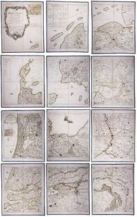
179023331Paris: Jean A. Dezauche successor of Delisle & Buache 1790. Each map in contemporary box with green morocco spines with titles 'Hollande' and 'Zelande' lettered in gold and green paper sides with ornamental gilt borders along the edges. Together ca. 230 x 155 cm. Engraved and etched map hand-coloured in outlines the cities coloured red. Printed on 12 sheets each divided into 4 segments numbered 1-48. The 48 segments are mounted on contemporary linen and folded the edges reinforced with blue ribbon. With: 2 LE ROUGE George Louis. Topographie de la Zelande en 9 feuilles traduitte de l'Hollandois. Second title: Partie orientale de la Flandre Hollandoise Paris Jean A. Dezauche 1790. Large engraved and etched wall map hand-coloured in outlines the cities coloured in red printed on 9 numbered sheets each divided in 4 segments numbered 1-36 size each sheet 48 x 56.5 cm; the 36 segments are mounted on contemporary linen the edges reinforced with blue ribbon. Two large complementary wall maps of the seven Dutch provinces covering 1 the provinces Holland Utrecht Friesland Groningen Overijssel and Gelderland and a part of Brabant bound to the line Steenbergen - Roermond and 2 Zeeland. Both are rare especially the map of Zeeland. They were the first maps of the Netherlands on such a large scale mostly about 1:105000 but with some eastern regions squeezed in at about 1:140000. Fully assembled the map of Hollande would measure about 230 x 155 cm and the map of Zeeland about 143 x 175 cm.Originally published in 1748 Le Rouge's 21 plates for the two maps were revised for publication in a second state by Jean Crepy ca. 1770. The map in its present third state was revised and published by Jean A. Dezauche in 1790. On the back of each sheet is an engraved label with the sheet number and the name of the region covered added in manuscript.From the library of Marco-Antonio III 1730-1800 Prince Borghese: on each box is the engraved armorial bookplate of the library of this Borghese Prince. Marc-Antonio's son Camillo Filippo Ludovico 1775-1832 married Napoleon's sister in 1803.Boxes are slightly scuffed. A remarkable copy with a princely provenance.l De Vries 'Een Franse wandkaart van Nederland uit 1748' in: Caert-Thresoor 1 1982 pp. 24-29; cf. BMC Printed maps VIII cols. 967 & 969 1748 edition; not in Donkersloot-de Vrij; Oehme A French world atlas in: Imago mundi 25 1971 pp. 55-64 on Le Rouge. Jean A. Dezauche, successor of Delisle & Buache, unknown
Engraved map. 282 x 440 mm (image). 311 x 465 mm (sheet). The famous nautical chart by the French geographer and cartographer d'Anville (1697-1782), encompassing the Arabian Gulf from Basra to the Straits of Hormuz. Although the southwestern part of the Gulf is poorly explored, various Gulf cities are identified, including "Julfar" (Ras al-Khaimah), "Mekehoan" (Umm Al Quwain), "Kalba", and "Ras-ol Lima". The city of "Al Katif" is clearly identified. The Qatar Peninsula is entirely absent, but the island of Bahrain is noted (though misaligned), and the coastline between Bahrain and Abu Dhabi is marked as an "entirely unknown coast". - With several contemporary manuscript additions in ink, including "Gatar" (south of Bahrain) and "Kouait" (Kuwait), as well as a few later notes in pencil in the Bahrain area. Old shelfmarks on the reverse. Slightly toned. David Rumsey Map Collection 2603.025. Al-Qasimi (2nd ed.), p. 236.
Folio (ca. 410 x 570 to 570 x 820 mm). 22 folded original military maps, 8 of which in colour (scales 1:20,000 - 1:420,000). - Includes 56 ff. of Ottoman Turkish manuscript notes on military history, loosely stored. A rare and substantial set of military maps of the Balkan Wars, issued as rear-pocket matter to accompany the three-volume work "1328-29 Balkan Harbi, Trakya Seferi" (1924-28) by the topographer and military historian Nihat Bey. Never seen at auction; merely three copies could be traced in libraries worldwide (Istanbul, Princeton, and Washington). The maps show the Ottoman military campaigns on the Balkan peninsula against Bulgaria, Serbia, Greece, and Montenegro in 1912 and 1913, wars which resulted in the Ottoman Empire losing the bulk of its European territory. - Nihad Bey (1886-1928) of Bursa held the rank of Lieutenant Colonel but is remembered as a scholar rather than a soldier. The first and foremost military historian of the Turkish Republic, he published no fewer than 39 books in which he meticulously evaluated operational mistakes and emphasized lessons to be learned from past wars. - Includes a set of manuscript notes in pencil, presumably taken by one of Nihat Bey's students at the military academy in the course of lectures on early 20th century Ottoman military history. Bey probably incorporated the maps in his lectures, as is suggested by marks and notes found on several map sheets, mostly in blue or red crayon, corresponding to the colours and patterns used in printing eight of the maps. - Small tears and holes to several maps, mostly along the folds. The manuscript notes show traces of stapling. An unusual and important specimen of Turkish military history.
Kupferstichkarte von 12 Platten mit Legende und sechs Kartuschen (darunter auch Veduten mit figürl. Staffage, u. a. eine Ansicht des Traunsees mit Gmunden u. Schloß Orth sowie Attersee mit Schloß Kammer), zus. auf Leinwand aufgezogen und auf zwei zeitgenössische Holzstäbe mit gedrechselten Knäufen montiert. 1280:1265 mm. Erste Ausgabe der großen Vischer-Karte von Oberösterreich, spätere Ausgaben sind 1762 und 1808 erschienen. “Die erste der großen Landkarten des Georg Matthäus Vischer ist die Karte von Oberösterreich. Ende des Jahres 1666 hat Vischer das Projekt den oberösterreichischen Ständen vorgeschlagen, im Mai 1667 erhielt er schon den Auftrag, Sommer 1667 ist er mit den Vermessungsarbeiten im Gelände beschäftigt, und im Winter desselben Jahres wird die Karte bereits gezeichnet. Am 21. Februar 1668 konnte Vischer die vollendete Karte den Ständen vorlegen” (Dörflinger/Wagner). Die vorliegende Karte gilt als die erste autoptisch aufgenommene, großformatige und detaillierte Karte von Oberösterreich und “diente einem der universalsten Barockkartographen, dem Venezianer Vincenzo Coronelli (1650-1718) als Vorbild” (Kat. Austria Picta, 56f.), der die vorliegende Karte 1692 für seinen ‘Corso Geografico universale’ in verkleinertem Format nachgestochen hat. - Durch die alte Montage und Aufhängung mit den üblichen Gebrauchspuren und an den Plattenkanten etwas rissig, das Leinen jedoch fachmännisch erneuert, einige kl. Fehlstellen retuschiert. Wie alle großformatigen Wandkarten des Barock selten, die vorliegende noch dazu in der originalen Fassung des 17. Jahrhunderts auf zwei hölzerne Rundstäbe montiert. Dörflinger/Wagner/Wawrik, Descriptio Austriae (1977), 126 u. Tafel 28.
8 charts. 560 x 735 mm, with key printed on the back. Scale 1:1,000,000. Substantial set of first edition U.S. pilot charts from the Second World War. Includes 2 maps of the Arabian Peninsula (668 and 669), depicting the border region of Saudi Arabia, Yemen and the Aden Protectorate and covering the area between the 42nd and 54th meridian east, and between the 16th and 20th parallel north. Also shows the Frasan Islands as well as large parts of the Rub' al Kahli desert with sections marked "unexplored", the city of Salala constituting the easternmost point. - Further, two maps of Iran (429 and 443) between the 53rd and 60th meridian east, and the 28th and 36th parallel north, identifying Kerman, Yazd and Birjand. - The remaining maps cover western Afghanistan (439), labelling Herat and Farah, central India (559), with cities such as Jabalpur, Bhopal and Achalpur, and the Indian Ocean showing the Chagos archipelago (1037) and Comoro Island (1052). - Chart no. 1037 dampstained with loss to the centre, chart no. 669 lacks approx. 5.5 cm, clipped away at upper margin. Remaining maps with occasional small tears, but overall in good condition.
Buon esemplare della carta del mondo di Henricus (Hendrick) Hondius. Prova del terzo stato di quattro, con la data 1663 che sostituisce l'originale 1630, che si trova nell'Atlas Contractus di Jan Jansson e negli atlanti marini di H. Van Loon.I cartigli abbelliti e le illustrazioni bizzarre fanno di questa mappa un eccellente esempio di cartografia olandese in stile barocco. Circondata da scene mitiche e bestie fantastiche, la carta del mondo stessa include affascinanti illustrazioni di velieri, mostri marini e pesci.Henricus Hondius era figlio del famoso cartografo Jodocus Hondius, il cui ritratto appare nella mappa in basso a sinistra. La carta include anche i ritratti di Gerard Mercator, Claudio Tolomeo e Giulio Cesare. Questi ritratti non sono solo accattivanti e storicamente rilevanti, ma probabilmente sono intesi a connettere la cartografia olandese (esemplificata da Hondius e Mercator) alla tradizione cartografica classica.L'atlante di Mercator-Hondius è stato pubblicato per la prima volta dal padre del cartografo, Joducus Hondius, che acquistò le lastre dell'opera di Mercator, ristampandole ed integrandole con un numero sempre crescente di sue mappe. Oltre alle numerose e bellissime illustrazioni sono notevoli nella carta diverse curiosità geografiche, tra cui la California come isola, le reti fluviali e i laghi del Nord America e le coste dell'Australia. In Sud America, lo Stretto di Le Maire appare ora ad est dello Stretto di Magellano. Lo Stretto di Le Maire era stato scoperto solo quindici anni prima della pubblicazione del primo stato di questa mappa, quando Jacob Le Maire e Willem Schouten condussero una circumnavigazione per minare il monopolio commerciale della Compagnia olandese delle Indie Orientali (VOC). L'inclusione della costa australiana in questa mappa traccia l'inizio della conoscenza olandese del continente australiano, quando la notizie di una "sconosciuta massa di terra ignota meridionale" si stava rapidamente diffondendo.Acquaforte, finemente colorata a mano, in ottime condizioni. A good example of the Henricus Hondius’ world map, a third state with the date 1663 that can be found in the Atlas Contractus of Jan Jansson and in sea atlases of Van Loon.The embellished cartouches and whimsical illustrations make this map an excellent example of baroque-style Dutch cartography. Bordered by mythical scenes and fantastic beasts, the world map itself includes charming illustrations of sailing vessels and fish, adding further visual interest to an already engaging tableau.The mapmaker Henricus Hondius was the son of famed cartographer Joducus Hondius, whose portrait appears at bottom left. The map also includes portraits of Gerardus Mercator, Claudius Ptolemy, and Julius Caesar. These portraits are not only eye-catching and historically relevant, but also serve to establish Dutch cartography (exemplified by Hondius and Mercator) alongside the Roman cartographic tradition.The Mercator-Hondius atlas was first published by the mapmaker’s father, Joducus Hondius. Joducus Hondius secured Mercator’s map engravings from Mercator’s relatives and republished them, along with his own work. The atlas was incredibly commercially successful, and its world map remained unchanged from Mercator’s depiction until the creation of this map by Henricus Hondius and partner Jan Jansson. This Hondius-Jansson version of the Mercator world map was included in all issues of the Mercator-Hondius atlases from 1633 until at least 1658.In addition to the numerous beautiful illustrations and map details, several geographic features included on this map are notable, including California as an island, the riverine networks and lakes of North America, and the coastline of Australia. California is shown here as an island, reflecting a widespread belief among Europeans from the sixteenth to eighteenth centuries. In South America, the Le Maire Strait now appears east of the Strait of Magellan. The Le Maire Strait had been discovered only fifteen years before the first state of this map was published, when Jacob Le Maire and Willem Schouten led a circumnavigation to undermine the trade monopoly of the Dutch East India Company (VOC). Setting this map apart from its contemporaries, it also includes an early appearance of Australia's northern coastline. The inclusion of the Australian coast on this map traces the beginning of Dutch knowledge of the Australian continent, preserving a moment in time when “The Unknown Southern Land” was quickly becoming known.Copperplate with fine hand colouring, in good condition. Shirley, The Mapping of the World: Early Printed World Maps, 1472-1700, map 336
In -folio, due voll. legati assieme; pp. (68), 504, (4); (40), 334, (2). Legatura in piena pelle alle armi di Felipe Ramirez Nuñez de Guzmán de Medina, nervi e titolo al dorso. Questa di Basilea del ’32 è considerata l’ultima e migliore edizione nel Cinquecento in latino delle Genealogie [...] che si deve all’umanista strasburghese Jakob Moltzer. Notevoli le illustrazioni genealogiche a piena pagina in quest’opera che, in vita, diede fama a Boccaccio, i cui lavori in volgare erano considerati una produzione minore. Rilegato con i Saturnalia e il commentario al Somnium Scipionis, le due maggiori opere di Macrobio nell’edizione di Camerario. Numerose illustrazioni nel testo fra cui l’incisione del planisfero macrobiano, diviso in zone climatiche, che costituì per circa un millennio il modello geografico terrestre: nella prima riproduzione a stampa di questa mappa, del 1483, le linee climatiche erano dritte, qui per la prima volta sono curve e rimandano a un modello di terra sferica e non piatta. This Basilea 1532’s edition is considered the last and the best latin edition in XVI century of “Genealogie”: it’s due to austrian scholar Jakob Moltzer. The full page genealogic illustrations are remarkable; this work gave a reputation to Boccaccio while he was still alive, and whose works in volgare were then considered a less important production. Bound with the “Saturnalia” and commentary to “Somnium Scipionis”, the most important Macrobio’s works in Camerario edition. Many illustrations in text: between them the macrobian world map, divided in climatical areas, that was for about 1000 years the geografic Earth pattern: in the first printed reproduction of this map, from 1483, the climatical lines were straight, while here they are bent and they suggest a spheric Earth model.
763 x 763 mm. Scale 1:1,000,000. Key in English. Printed on cloth. Blueprint map of the Gulf, showing Qatar, Bahrain, and Kuwait, as well as parts of Saudi Arabia, Iran and Iraq. It pays particular attention to oil fields, naming them individually and illustrating oil pipelines and facilities, including the 435 kilometre Qatif-Qaisumah pipeline which connects to the Trans-Arabian pipeline, as well as the offshore terminal and refinery at Ras Tanura. The map records some of the problematic borders within the region, showing the Iraq-Saudi Neutral Zone, the Kuwaiti-Saudi Neutral Zone and Buraimi Oasis. Among the more notable oil fields are Greater Burgan, the world's largest sandstone oil field, consisting of the Burgan field itself along with the much smaller Magwa and Ahmadi fields, as well as the Wafra field discovered in 1953 by the American Independent Oil Company and Pacific Western Oil Company. Wafra was unique in being operated jointly under separate concessions from two countries, Kuwait and Saudi Arabia, granted to American Independent Oil Company and Getty Oil Company (formerly Pacific Western Oil Company) respectively. - Slightly toned along folding lines and lower left margin.
Pen, black ink and watercolour on paper (590 x 440 mm), framed in a passe-partout (755 x 580 mm). Large, high quality watercolour of the Natural Bridge in Rockbridge County, Virginia. This natural arch spanning 27 meters was, along with Niagara Falls, one of the most popular tourist attractions in the United States in the late 18th and early 19th century. As an old natural wonder in a young country, it played an integral part in the formation of America's national identity and was "certainly a worthwhile side trip for travelers who hoped to experience the sublime quality of the American landscape" (Howat). The sublime aspect is often present when from the 1830s onward artists start depicting the Bridge: as in the present watercolour, where small figures are placed in the foreground to show the massiveness of the 88-meter geological formation. - The view shown in the present watercolour appeared as an engraving in John Howard Hinton's History and topography of the United States (1832) after a drawing made by the American landscape painter William Goodacre (1803-83). The image was widely pirated and imitated and appeared in numerous other publications, including Meyer's Universum in 1837, with a caption identical to the one on the present watercolour. The anonymous artist probably copied the image from the 1837 publication, but made several changes, simplifying most of the foliage but adding the large fern, duplicating the kneeling hunter and adding an extra deer. Interestingly, the engraving shows a tree peering out from behind the bridge, pencilled in outline, but never painted in. - From an Austrian private collection. In very good condition. Howat et al., American Paradise, pp. 272-274. Kastning, Natural Bridge, p. 20. Cf. Sears, Sacred places.
1942L7VCIV4N38L2UK Government: Survey Directorate HQ Tenth Army / Indian Field Survey Co. 1942. 42 chromolithographed topographic maps of parts of Iraq made from aerial photographs during World War II on a scale of 1:100000 and 1:253440 a quarter-inch to a mile. 68 x 50.5 cm & 60 x 47 cm. An impressive collection of Iraq maps compiled from the most current aerial photography and produced by the British Army for use in the Persian theatre of war during World War II. The cities and regions covered include Ain Sifni Aqra Tel Afar Salman Pak BaQuba Sumaika Penjwin Halabja Baghdad Kirkuk Dulaim Erbil and Mosul divisions.Previously folded. Generally well-preserved. Survey Directorate HQ Tenth Army / Indian Field Survey Co., unknown
Small oblong 8vo. Engr. t. p., 64 (instead of 100, 2 folding) plates in original watercolour. Contemp. half calf with giltstamped red label to gilt spine. Series of charming views of Vienna and its environs, including Baden, Klosterneuburg, and Bratislava, mostly engraved by Johann Jaresch. The famous streets, squares, buildings and interiors are bustling with visitors, strollers, and horse-drawn carriages. All plates are captioned in French and German, and numbered in the centre. The t. p. bears the rarely encountered publisher's address "Graben No. 1200"; individual plates are marked "Kohlmarkt No. 268". - Very attractive original colour. Wants 36 plates; 20 views are in their second state, two others in their third. The image of plate 51 has been pasted over with an alternate version. For nos. 21-24 (two doubles), Nebehay/W. also states a variant six leaves which apparently could be used to replace the panoramic views of Ebersdorf and Bratislava. - Binding slightly rubbed and bumped. Several plates trimmed closely; t. p. and a few plates show brownstaining. Contemp. ownership "L. Wagner" to pastedown. Detailed list of plates available upon request. Nebehay/Wagner 193.
Four-plate engraving by J. E. Mansfeld, mounted on cloth and framed under glass. 131 x 162 cm. Probably the most monumental layout plan of the Vienna inner city ever published, doubling the scale of Nagel's better-known (and more common) plan of Vienna and its suburbs (1781), and self-published as early as 1774. Nagel had begun his surveying task shortly after completion of the re-numbering of houses in 1770. "Probably completed in October 1774" (cf. Dörflinger). - Slight browning to margins, otherwise fine. Extremely rare. Dörflinger, Österreichische Karten des 18. Jhs. I, 71 and note 115. Not in Mayer or Eckl colls.
Paris, Chez l'Auteur - Saint-Petersburg, Issakoff, 1844-48. Small folio. (35 x 27 cm.). In a worn contemp. hcalf. Spine cracked and broken. Boards detached. All parts stitched, a few loose. All parts uncut and unopened. All parts clean and fine. Each part separately paginated and with own title-page. Text to each part (from 8-12 pp.). Each part having a large folded engraved general map and from 11 to 27 engraved folio-maps. In all 292 textpages and 441 engraved maps.
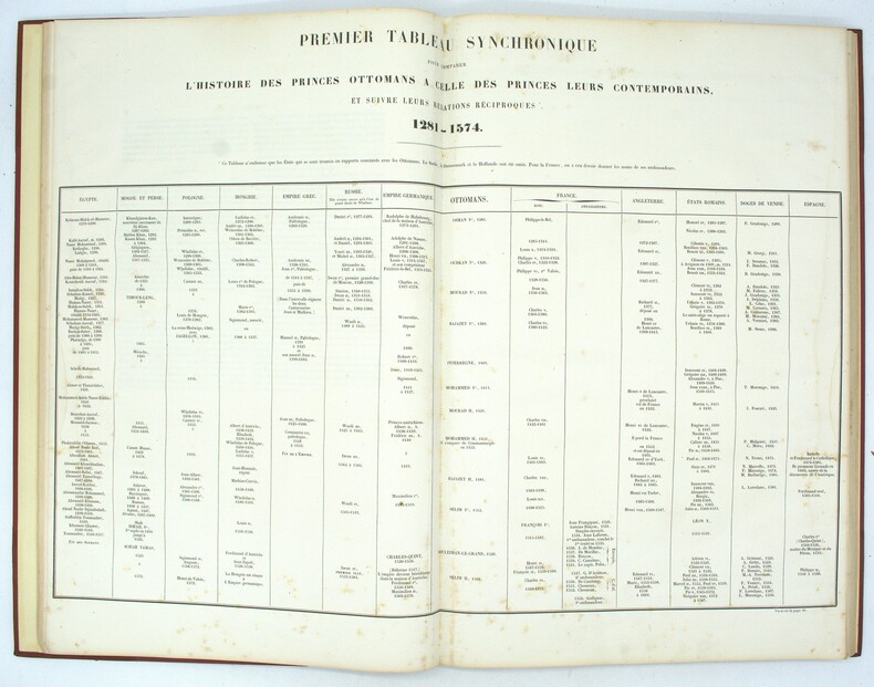
1835PHO-1982Paris, Bellizard, Barthes, Dufour et Lowell ; Londres, Bossange, Barthes et Lowell ; Saint-Petersbourg, Fd. Bellizard et Cie, 1835-1844. 18 volumes de texte in-8 et un atlas in-folio. TEXTE : 18 volumes in-8, relié demi basane et coins moderne, dos lisse orné avec pièces d’auteur, titre et tomaison noires, frottements et épidermures, défauts d’usage, rousseurs dans le texte, tampon et étiquette du relieur. ATLAS : Paris. Bellizard, Dufour etc. 1844. Imprimé chez Thierry Frères. Demi basane et coins à long grain grenat, dos à nerfs avec titre et auteur, In-folio (520x345mm), IV-82pp.-40 planches, il est composé du Commentaire sur l’Atlas de l’Empire Ottoman, d'une liste des cartes, d'une carte générale de l'Empire Ottoman (690x550mm), de 22 cartes particulières (dont une sur 2 feuilles) (815x850), de 13 plans de batailles ou de siège, et de 4 plans de villes dont un grand plan dépliant de Constantinople (690x670mm), le plan de Vienne est en 2 états, par G. Heck et Plée et gravé par U. Muschani, roussurs éparses, 2 cartes uniformément brunies avec réparations, mouillure claire en marge, tache sur les 16 premiers feuillets en tête et en fin d’ouvrage en pied. Provenance : collection de S.A.R. le Prince Osman Ibrahim d'Égypte (1951-2025), fils de S.A.R. le Prince Amr Ibrahim d'Égypte et de S.A.I. la Princesse Nejla Hibetullah Sultan (Necla Osmanoğlu) de Turquie, petite-fille du dernier calife Abdulmejid II et du sultan Mehmed VI, avec sa marque au tampon.
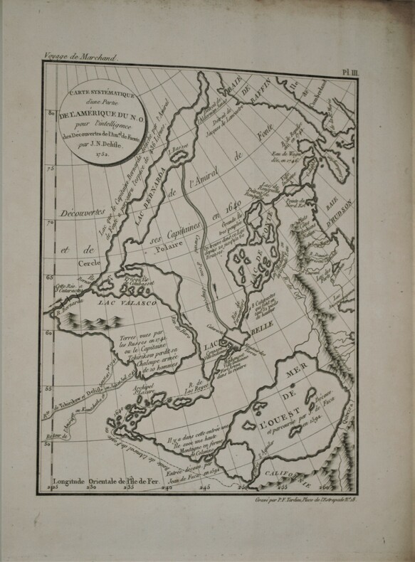
1798PHO-657Paris, De l’Imprimerie de la République, An VI-An VIII [1798-1800]. In-4 (28x22 pour les T.I et II,31,5x24 pour le T .IV) ,xii, cxliv, 628, [3] ; xvi, 676, [2] ;[xi], 431, [1];[2],viii, 158pp, relié couverture d’attente éditeur en cartonnage beige chiné , non rogné , le tome IV n’étant pas ouvert ,défauts d’usage , papier à grandes marges et bruni aux bords ,mouillures au tome III , quelques rousseurs ,tome II reliure demi cuir sous emboîtage à l’identique.Tome I,III et IV premier tirage , Tome II ,1841, ,édition originale remise en vente en 1841 avec un titre de relai portant la mention fictive , "nouvelle édition"(quelques exemplaire imprimés en 1798 n'avaient pas trouver preneur) .L’illustration comprend 16 planches dépliantes gravées sur cuivre, numérotées de I à XV, dont une planche notée VI bis, toutes réunies dans le 4éme tome . Les 15 cartes gravées par Bouclet, Collin, Tardieu, Fortier, etc., levées pour les côtes nord-ouest de l’Amérique du Nord, les îles des Marquesas de Mendoça (îles Marquises), les îles Tupaya (dans l’actuelle Polynésie française), la baie de Tchinkîtâné (actuelle Sitka Sound, près de la ville de Sitka en Alaska), les îles de la Reine-Charlotte (archipel canadien au large de la Colombie-Britannique), les îles Sandwich (Hawaï), le détroit de Magellan, le détroit entre les îles Banca et Billiton (actuelle Belitung) en Indonésie, etc., et une jolie planche à caractère ethnographique (n°V) représentant des échasses de Whûtahô, une des îles de l’archipel des Marquises. Le tome I renferme un tableau dépliant donnant les concordances de mots français avec la langue de Wahîtahô et le tome IV les Observations sur la division hydrographique du Globe .
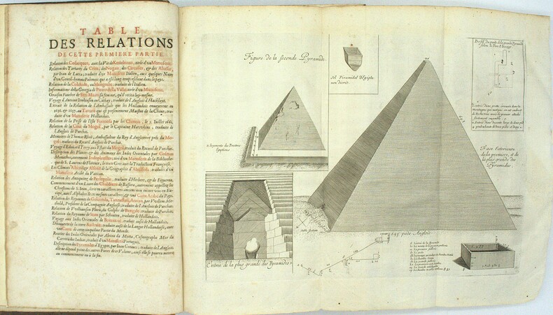
1696PHO-1981Paris, Thomas Moette, 1696 ; 5 parties en 2 vol. in-folio (37x23,5cm), veau marbré, dos à nerfs richement orné de motifs dorés avec tomaison et pièce de titre grenat, quelques frottements, charnières fendillées, manque au dos, coins usés, coiffes absentes, 8 feuillets détachés, rousseurs, qlqs feuillets brunis. L’illustration comporte de nombreuses gravures et illustrations dans et hors texte, 6 cartes dont la carte de l’Indostan, de la Colchide, du Japon (qui regarde l’Amérique), carte de la route du voyage de Canton à Péking, carte de l’Éthiopie, carte de l'Éthiopie ["Entrée de quelques ports…"]. Il manque la Carte de Bassorah, les 2 planches de caractères Chaldéens, la carte de l’Australie, la carte des côtes d’Arabie et d’Asie, la carte des Costes de Sierlionne, la carte des Philippines et Chine, la carte de Chine
1838021038London: T. McLean D.& P. Colnaghi and John F. Lewis 1838. 1838. Book. Illus. by John F. Lewis. Near Fine. Hardcover. First Edition. Folio approx. 55 x 36.5cm. Complete with all Lithographic plates as called for; tinted frontispiece tinted title-vignette further 27 tinted views on 25 leaves all by Lewis after Coke Smyth. A very clean bright copy. Finely bound in modern brown morocco to style with gilt lettering to the spine and gilt bands to the top and bottom of the spine. Contents clean and tight new light brown endpapers in keeping with the new binding two blank leaves to the front and rear all pages have been professionally cleaned and restored by a paper conservator minimal and unobtrusive water staining remains to some pages and plates mostly confined to the margins and blank areas most plates unaffected new archival paper guards to all plates no inscriptions. A fine complete copy beautifully rebound. References -. Abbey Travel II 394; Atabey 722; Blackmer 1015; Contominas 413; RIBA 1886. T. McLean, D.& P. Colnaghi and John F. Lewis [1838]. Hardcover
17804944[I. France, circa 1780]. II. Bruxelles, chez George Fricx, rue de la Madeleine, imprimeur. 1745. 1780 I: 1 feuille de 1 102 mm par 511 mm, tracée à l'encre et aquarellée ; II: 1 feuille de 420 mm par 456 mm, imprimée en noir. Les deux sont contrecollées sur toile. Cartonnage-étuis d'époque à rabats.
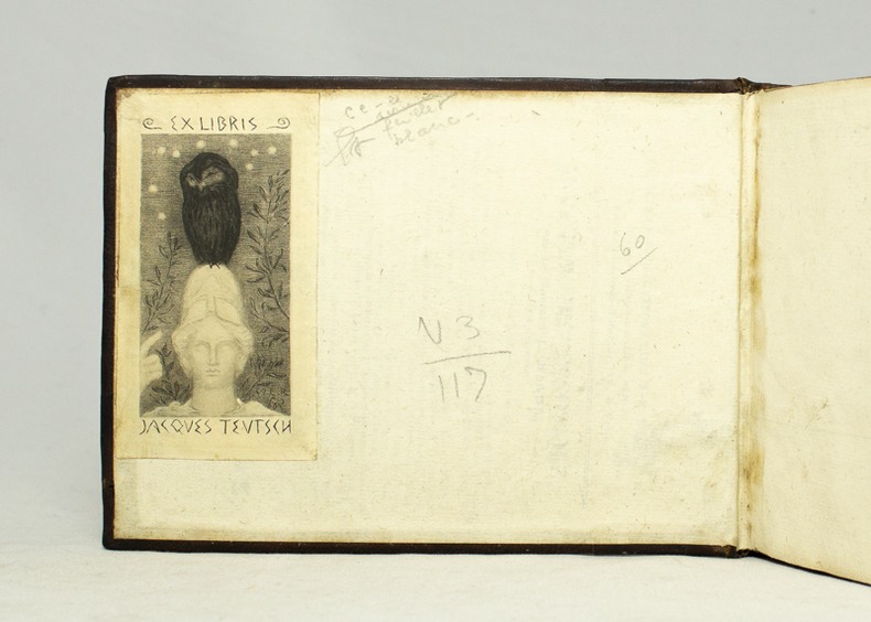
159516728Antverpiæ, Philippo Gallæo execudebat Arnoldus Coninx, 1595. In-8 oblong de [8]-109-[2] feuillets, plein maroquin brun, dos à nerfs orné de double D entrelacés, plats décorés d'un cartouche ovale doré, orné d'une composition allégorique, double filet doré encadrant les plats, tranches dorées. Reliure début XVIIème siècle. Ex-libris Jacques Teutsch.
1900169765Circa1900. Large illustrated map of Beijing showing the city in the period following the invasion of the military forces of the Eight National Alliance old folds scale not given. Some scattered light foxing particularly at edges short closed tear at fold lower edge neat non acidic tape repair short section upper edge wear along folds and a couple of small unobtrusive holes with minor image loss. Blocks of text in traditional Chinese right and left upper sections stating each nation's occupied zone Japanese text title accompanies the English title along the upper section of the map. 63.7 x 56.9cm. Very good overall. A rare and significant large Japanese woodblock map of Peking Beijing issued just after the suppression of the Boxer Rebellion. Centred on the Forbidden City the map depicts Peking following the multinational suppression of the Boxer Rebellion or Yihetuan Movement of 1900. The map was issued to illustrate the areas of occupation associated with each of the powers in the Eight Nation Alliance. <br> <br>The map gives measurements of the city walls detailed names of streets and buildings and the boundaries of the inner and outer city including the forbidden city are shown with demarcation lines in pink yellow and blue. The hand coloured eight national flags of the occupation powers are featured at the right and left. <br> <br>This map is essentially a later edition of 京城内外首善全圖 a map of Beijing issued by the Qing for administrative purposes in the mid-19th century. The Japanese seized the wood blocks during the suppression of the Rebellion and subsequently pulled new impressions overprinting them additional details including flags and demarcations of areas of the city held by members of the Alliance. Versions are known in French German Japanese and as with the present example English. An attractive map of great historical interest. . unknown
1804PHO-1187Paris, F. Buisson, 1804. 3 vol. in-8 de texte et 1 atlas de planches .Texte : I/ xv-[1]-408 pp. ; II/ [2] sq., 431 pp. ; III/ [2] sq., 473 pp. ; Atlas de 4 pp., 58 planches et cartes , relié demi basane époque (atlas reliure moderne) , coiffes usées, mouillure et quelques rousseurs dans l'atlas . Édition originale avec l'atlas complet des 58 cartes et planches dont 1 en couleur ,gravées en taille douce par Adam, Blondeau, Fortier, Dorgez, B. Tardieu d'après les dessins de l'auteur.
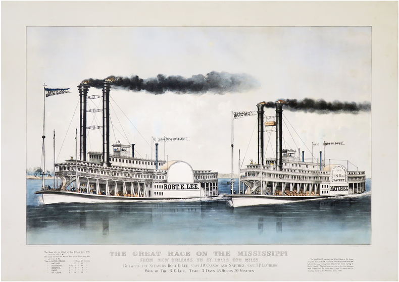
1870LBW-8700New York, Currier & Ives, [1870]. 543 x 740 mm ; sur papier fort.
Engraved map printed from 12 copper plates, with 2 supplements, dimensions 147,5 x 129 cm (including supplements 165 x 140 cm). Constant ratio linear horizontal scale ca. 1:2.1 million. Relief shown by hachures. Coordinates approximate and based on Greenwich meridian. Mounted on rough cloth; left and right edges protected by green strips of cloth. In French and German. Shows extensive detail of waterways, political divisions, various roads, post stations, variously sized settlements. Consisting of 12 main sheets and 2 supplements, the map "probably appeared just in time to be offered as a map of the theatre of Napoleon's invasion of Russia. Showing the area between Gdansk and Tobolsk, and between the Kara Strait and Armenia, the map displays (in the words of a contemporary review) 'most clearly, without being in any way cluttered, [...] all conceivably important settlements, mountains, rivers, lakes, etc. in the Russian Empire and its adjacent parts, and it is quite rightly to be preferred to all other renderings of the war theatre hitherto published, as it includes Astrakhan and Tobolsk, and is quite complete in every other respect, while other maps often include not even Moscow, for which reason this map is recommended as a very useful tool to anybody wishing to follow the history of the present war'" (cf. Dörflinger II, 463f.). The two supplements added at the middle of the lower and right edge concern the areas of Tobolsk and Tiflis. - Some occasional waterstaining; Tobolsk supplement fairly strongly wrinkled. The upper edge (beyond the plate) shows traces of former wall mounting. Dörflinger II, 463: Mol 39. Tooley I, 332 (without supplements). OCLC 964537090.