DENDIEVEL (Emile).Livre Rare Book
11 983 résultats
1875LBW-74651875. 87 x 60 cm, monté sur carton et entouré d'un passe-partout sur lequel sont remontés la date, le nom de l'auteur et le titre.
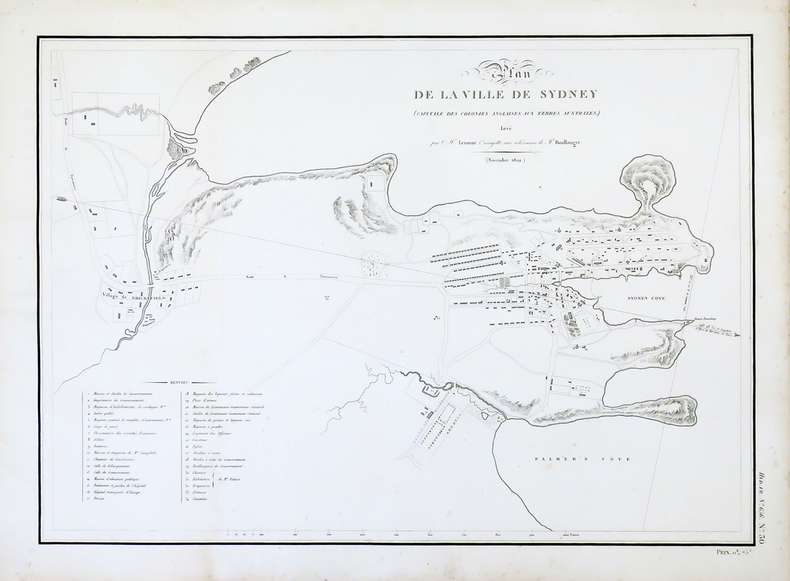
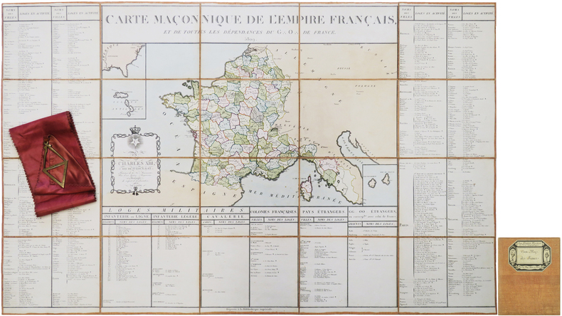
LBW-3943[1812]. 355 x 497 mm.
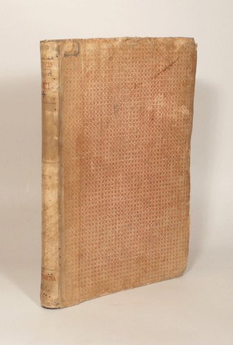
15500033071550 Venise, Francesco Marcolini, juillet 1550. Petit in-folio (225 X 322) demi-vélin ivoire, plats de papier dominoté, auteur, titre, lieu d'édition et date calligraphiés au dos en rouge et noir (reliure XVIIIe) ; A-Z4, Aa-Cc4 : 104 feuillets. A partir des figures des philosophes (page 64) il est donné un même numéro pour deux pages. Nombreuses restaurations aux premiers feuillets, l'encadrement architectural du portrait de l'auteur est masqué par un feuillet de doublure, marges du feuillet 43/44 rognées.
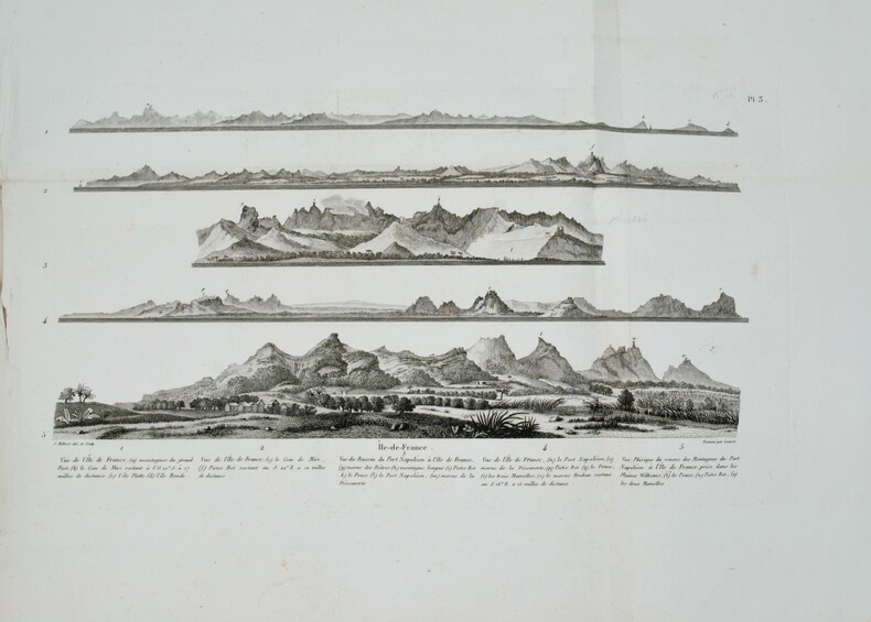
1812PHO-1228Paris, A. Nepveu, 1812. 2 volumes de texte in-8 (210x130), veau havane marbré, dos lisse orné, pièces de titre et de tomaison de maroquin rouge et tabac, roulette encadrant les plats, tranches mouchetées (reliure de l'époque) ,une coiffe usée, et un atlas in-folio oblong (420x280), demi-veau vert, dos lisse fileté or (reliure de l'époque) ,plats et dos frottés avec manques aux coins , début de fente . Première édition, illustrée de 3 tableaux dont 2 dépliants. L'atlas comprend 45 planches et cartes, dessinées et gravées la plupart par l'auteur ,certaines terminées par Coube, Hulk, Gossard ou Perdoux, (carte de l'île de France, vue de la ville du Port Napoléon, vue du Cap de Bonne-Espérance, etc.). L'ouvrage traite de l'histoire de l'île Maurice, de sa population et de son administration, de géologie et de sciences naturelles. Bon exemplaire. Mouillure très claire marginale à quelques planches, déchirure sans manque à la dernière avec réparation .
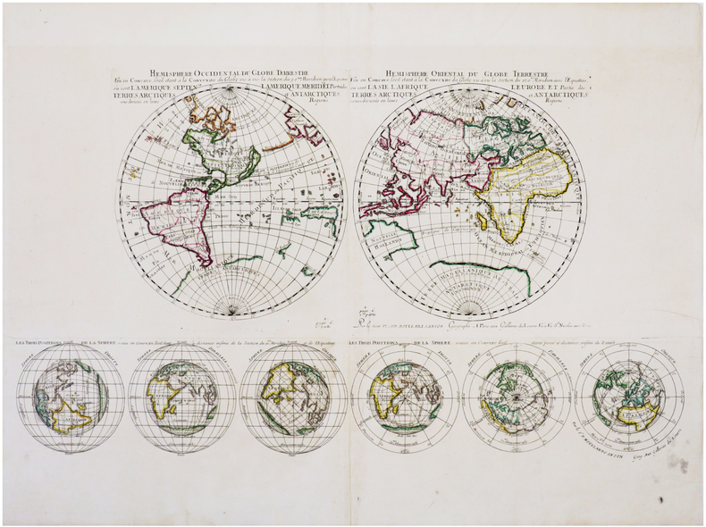
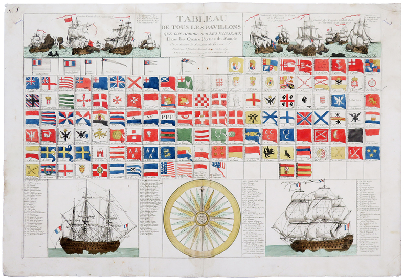
1710LBW-7241Paris, aux Galleries du Louvre vis à vis St. Nicolas avec priv., [1710]. 335 x 585 mm.
4 albumen prints, 190 x 725 mm and 205 x 270 mm, all mounted on contemporary paper (285 x 40 mm) with manuscript titles in French. "Hong-Kong / Panorama général": a fine, large-scale panorama embracing all of Victoria, the capital of Hong Kong, from the perspective of the harbour. The scene is centred upon the concentration of major buildings along the grand quayside of the Praya, including the City Hall, the Hongkong & Shanghai Bank Building and the Hong Kong Hotel, the six-story building featured in the centre-right of the panorama. Notably, the hotel seems to still be in a partially-completed state, as construction of the edifice was not completed until 1892, a detail which helps to date the photograph. Numerous boats can be seen plying the harbour in the foreground, evidence that Hong Kong was one of Asia's busiest ports. Victoria Peak rises above the city, and the thin white line shown ascending the mountain, above City Hall, is the famous Peak Tram. This funicular railway was completed in 1888. - "Hong-Kong / La Rade prise de Bowen Road": an engaging view looking down upon Hong Kong harbour from the perspective of Bowen Road. The line of the celebrated Peak Tram, completed in 1888, is shown running up the slope of Victoria Peak, while numerous ships ply the harbour in the background. Bowen Road was named after George Ferguson Bowen, who served as the 9th Governor of Hong Kong from 1883 to 1885. - "Hong - Kong / Anniversaire de la naissance de la Reine": this fascinating view captures the pageantry of the celebration of the birthday of Queen Victoria. Spectators are shown observing vast lines of troops as they fire an armed salute in honour of Her Majesty, while tall ships decorated with banners are moored in the harbor, in the foreground. Queen Victoria (reigned 1837-1901) personified the British Empire, and her birthday (May 24th) was celebrated annually throughout Britain's colonial possessions. Another example of the same photograph, entitled in manuscript, "Queen's Birthday Parade Hong Kong," can be found in the collections of the Herbert F. Johnson Museum of Art at Cornell University, Ithaca, NY (accession no. 86.140.310). - "Hong-Kong / Une Rue dans la ville Chinoise": this photograph captures an interesting street scene in Hong Kong's traditional "Chinatown", otherwise known as the Wan Chai District, located to the east of Victoria. While Victoria had a more "anglicized" appearance, befitting the centre of British colonial administration, Chinese modes of building construction, signage and ways of life prevailed in Wan Chai.
Foglio contenente sei fusi del Globo Terrestre, edito da Giuseppe de Rossi a Roma nel 1615.Il foglio costituisce la metà, raffigurante l'emisfero orientale, del celebre ed importante Globo Terrestre della tipografia De Rossi, replica italiana del più famoso globo di Jodocus Hondius, stampato ad Amsterdam nel 1601. La carta si estende dalle isole dell'Atlantico alle Indie Orientali, comprendendo le isole di Giappone (parzialmente tagliato) e Corea (qui appunto rappresentata come isola).Il solo set completo di gore di globo del de Rossi è oggi conservato alla Libray of Congress di Washington (https://www.loc.gov/item/2008627640/), mentre il solo foglio che contiene le gore qui mancanti, che coprono l'emisfero occidentale, è conservato al Marietim Museum di Rotterdam (WAE840).Sono invece noti alcuni esemplari del globo montati, tra cui quello della collezione Schmidt di Vienna, e quello del Maritime Museum di Greenwich.La peculiarità assoluta del nostro esemplare sta nel fatto che riporta in calce un imprint sconosciuto alla letteratura, Dominicus de Rubeis formis Romae ad Templum S. Marie de Pace. Domenico de Rossi, figlio o nipote di Giuseppe, è attivo a Roma nella seconda metà del XVII secolo. Fiorini (1899) descrive di Domenico de Rossi la sola ristampa del globo di Mattheus Greuter (1638) datata al 1695. Il globo terrestre di Giuseppe de Rossi – uno dei primi stampati in Italia – è una replica molto accurata dell’esemplare realizzato ad Amsterdam nel 1601 da Jodocus Hondius. Giuseppe de Rossi utilizzò le mappe di Hondius, apprezzate per la loro qualità, ma il globo è interamente realizzato in Italia e dedicato a un nobiluomo romano, come possiamo vedere dal cartiglio sul globo stesso: Ill.mo viro optimarumque artium amatori et Fautori D Paulo Mellino Romano Iosephus de Rubeis Mediolanensis devoti animi monumentum dat dicatque.Il cartiglio con dedica rivela anche la firma dell’artista e chiarifica le sue origini: Giuseppe infatti era conosciuto nella Roma dell’inizio del Seicento quale membro della nota famiglia de Rossi, già famosa a Milano per le sue stampe e mappe.Il globo presenta un secondo ampio cartiglio – nell’Oceano Pacifico – con le spiegazioni di Hondius e la data in cui è stato stampato in Italia: I[odocus] Hondius Lectori S[alutem]. In locorum longitudine hactenus mirifice peccatum esse omnibus hydrographiae peritis satis superque constat [...] Longitudinem incepimus non ab insulis fortunatis, ut Ptolemeus, sed ab ijs quae Açores vocantur, quod acus nautica ibi recte in Septentrionem vergat. Vale. Anno 1615.Un terzo cartiglio a sud dello Stretto di Magellano ci fa comprendere le conoscenze geografiche degli inizi del XVII secolo: TERRA AUSTRALIS NONDUM COGNITA (terra non ancora conosciuta).Foglio di estrema rarità.Bibliografia: Fiorini, Sfere Celesti e Terrestri di Autore Italiano, Roma 1899, pp. 271-272, 293, 369; E. L. Stevenson, Terrestrial and Celestial Globes, New Haven 1921, vol II, p. 13; P. van der Krogt, Globi Neerlandici, Utrecht 1993; The World In Your Hands. An Exhibition of Globes and Planetaria, exhibition’s catalogue of Christies Great Room in London and Museum Boerhaave in Leiden, 1995, p.42, n° 4.11; Sfere del cielo sfere della terra, exhibition’s catalogue edited by M. Milansei & R. Schmidt, Correr Museum, Venice 2007, pp. 50 and 59; Dekker, E. Globes at Greenwich (Oxford, 1999), pp. 357-9 & 482-4. Engraved plate showing 6 globe gores published by Giuseppe de Rossi in 1615, covering the Eastern Hemisphere, extended from Atlantic Ocena to the Far East. Including the Japan and Korea, here depicted as an insula (Corea ins.).This is the half set of the globe gores by Giuseppe de Rossi, known complete only for the example of the Library of Congress, while the sheet with the Western Hemisphere is preserved in the Maritiem Museum of Rotterdam. (WAE840).The peculiarity of our example is the imprint Dominicus de Rubeis formis Romae ad Templum S. Marie de Pace, not know in the literature. Domenico was the son or nephew of Giuseppe, active in Rome in the second half of 17th century.Fiorini (1899) listed by Domenico de Rossi only the late issue of the globe gores by Mattheus Greuter (1638).The terrestrial globe by Giuseppe de Rossi – one of the first printed in Italy – is a very accurate replica of the one made in Amsterdam in 1601 by Jodocus Hondius, who realized just few very detailed globes. Giuseppe de Rossi uses Hondius maps, appreciated for their quality, but the globe is entirely created in Italy and dedicated to a Roman nobleman, as we can see in the cartouche on the globe itself: Ill.mo viro optimarumque / artium amatori et Fau- / tori D Paulo Mellino Roma- / no Iosephus de Rubeis Mediolanensis devoti / animi monu- / mentum dat / dicatque. The cartouche with dedication includes also the artist’s signature and explains his origin: Giuseppe was renowned in Rome in early 17th century as a member of the well-known de Rossi family, already famous in Milan for its prints and maps.The globe bears a second large cartouche – in the Pacific Ocean – with the Hondius’ explanation and the date in which it has been printed in Italy: I[odocus] Hondius Lectori S[alutem]. / In locorum longitudine hactenus mirifice peccatum esse omnibus hydrographiae peritis satis / superque constat [...] Longitudinem / incepimus non ab insulis fortunatis, ut Ptolemeus, sed ab / ijs quae Açores vocantur, quod acus nautica ibi recte in Se- / ptentrionem vergat. Vale. / Anno 1615.A third cartouche under the Strait of Magellan let us understand the geographical knowledges of the early 17th century: TERRA AUSTRALIS NONDUM COGNITA.Very similar examples are housed at Correr Museum in Venice and in the Rudolf Schmidt’s Collection.Literature Fiorini, Sfere Celesti e Terrestri di Autore Italiano, Roma 1899, pp. 271-272, 293, 369; E. L. Stevenson, Terrestrial and Celestial Globes, New Haven 1921, vol II, p. 13; P. van der Krogt, Globi Neerlandici, Utrecht 1993; The World In Your Hands. An Exhibition of Globes and Planetaria, exhibition’s catalogue of Christies Great Room in London and Museum Boerhaave in Leiden, 1995, p.42, n° 4.11; Sfere del cielo sfere della terra, exhibition’s catalogue edited by M. Milansei & R. Schmidt, Correr Museum, Venice 2007, pp. 50 and 59; Dekker, E. Globes at Greenwich (Oxford, 1999), pp. 357-9 & 482-4.
Magnifica mappa del mondo a doppio emisfero finemente incisa, incisa da Jan Van Doetecum per Paulus Merula nel 1605. La raffinata incisione di Van Doetcum si basa su una mappa di suo padre Baptista van Doetecum per Petrus Plancius nel 1590, con diversi importanti aggiornamenti, tra cui l'aggiunta della recentemente esplorata Nova Zemlya (esplorata da Barentsz durante i suoi 3 viaggi nelle regioni artiche alla ricerca del “Passaggio a Nord-Est”) e l'aggiunta di due emisferi celesti, basati sulla mappa del mondo di Plancius del 1594. La mappa aggiunge, agli angoli, l’ingrandimento di 4 isole, Giappone, Isola, Ceylon e Sant'Elena. Include le quattro grandi isole dell'Artico, così come appaiono sullemappa di Mercatore del 1595. Il “Passaggio a Nord-Ovest” è aperto e chiaramente definito, permettendo un passaggio attraverso lo Stretto di Anian nel Pacifico verso l'Atlantico. California e Quivira sono nominati, insieme alle annotazioni sulla scoperta dell'America da parte di Colombo nel 1492 e alle note sulle regioni settentrionali conosciute e sconosciute dell'America. L'enorme continente meridionale è chiamato Magellanica, Terra Australis, e anche Terra del Fuoco, prima del viaggio di Le Maire e Schouten che avrebbe iniziato a riscrivere la credenza allora prevalente che lo stretto scoperto da Ferdinando Magellano fosse l'unico passaggio d'acqua tra l'Atlantico e l'Oceano Pacifico nell'emisfero meridionale. Viene mostrata una massiccia Guinea Nova, senza alcun segno delle moderne scoperte in Australia e Nuova Zelanda, con i resti delle informazioni di Marco Polo ancora presenti nella regione. C'è una prima apparizione delle Filippine (I. Filipinae). La costa cinese, pur essendo ricca di informazioni, precede la comparsa della Corea e fornisce una presentazione molto curiosa del Giappone. La mappa è riccamente impreziosita da decorazioni di velieri, che riflettono la mano del maestro incisore caratteristica della famiglia Van Doetcum, allora forse i migliori incisori impegnati attivamente nella realizzazione di mappe commerciali. Acquaforte e bulino, in ottimo stato di conservazione. Magnifico esemplare. Striking dark impression of this finely engraved double hemisphere map of the World, engraved by Jan Van Doetecum for Paulus Merula in 1605. Van Doetcum's fine engraving his based upon a map engraved by his father Baptista van Doetecum for Petrus Plancius in 1590, with several important updates, including the addition of the recently explored Nova Zemlya (explored by Barentsz during his 3 voyages to the arctic regions in search of the Northeast Passage) and the addition of two celestial hemispheres, based upon Plancius' world map of 1594. The map also adds fine large format images of 4 islands, Japan, Island, Ceylon and St. Helena, presenting fine enlargements of these islands as they appearon the map. The map includes the four large islands in the Arctic, as they appeared on Mercator's maps, including his very rare 1595 map of the Polar Regions. The Northwest Passage is open and clearly defined, allowing a passage via the Straits of Anian in the Pacific to the Atlantic. California and Quivira are named, along with annotations on the discovery of America by Columbus in 1492 and notes on the known and unknown northern regions of America. The massive southern continent is called Magellanica, Terra Australis, and also Terra del Fuego, pre-dating the voyage of Le Maire and Schouten which would begin to re-write the then prevailing belief that the strait discovered by Ferdinand Magellan was the only water passage from between the Atlantic and Pacific Ocean in the Southern Hemisphere. A massive Nova Guinea is shown, with no signs of the modern discoveries in Australia and New Zealand, with remnants of the information from Marco Polo still present in the region (Beach). There is an early appearance of the Philippines (I. Filipinae). The Chinese coastline, while filled with information, pre-dates the appearance of Korea and provides a very curious presentation of Japan. The map is richly embellished with strapwork decorations and sailing ships, reflecting the master-engraver's hand characteristic of the Van Doetcum family, which were then perhaps the finest engravers actively engaged in commercial map making. Etching with engraving, very good condition. R. W. Shirley, "The Mapping of the world", 254; New Hollstein, Doetecum IV, 995
Engraved map. 550 x 690 mm (image), 595 x 760 mm (sheet). Scale 1:519,210. 18 sections mounted on paper. Rare topographical map of Sicily, featuring two inset maps after Ptolemy and Al-Idrisi, allowing an immediate comparison of the depictions of the island in the 2nd, 12th, and 19th centuries. The main map identifies a remarkable number of towns and villages, including Palermo, Catania, Syracuse, Mazara, Caltanissetta, and Nicosia, as well as mountains, roads and paths. Two additional insets show Malta and the Aeolian Islands. Engraved by the German-French engraver and cartographer Erhard Schieble (1821-80). - Slightly foxed. Rarely seen at auction.
1809LBW-87605809 [1809]. En 20 sections montées sur toile et repliées, formant une carte de 541 x 854 mm ; étiquette au dos de l'éditeur et marchand de cartes parisien Jean Goujon.
Signed drawing, felt-tip pen on cardboard, c. 430 x 300 mm. Erotic sketch in red felt-tip pen on ochre cardboard, the result of Manzu's collaboration with his friend and colleague Edmund Georg Pielmann.
182342750London: T. Cadell and W. Davies 1823. First edition. Hardcover. g to vg. Large quarto 11 1/4 x 9". 2 xxviii xxiii 1 812pp; xix 13 715pp 1pp Errata 2pp Publisher's advertisement; 2 xv 12 20 822pp; 2 xx 14 735pp 1pp Errata; xii 14 763pp 1pp Errata; 2 iv 14 555 1pp. Modern half black morocco over dark grey cloth with gold lettering and ruling to spines. Raised bands. First volume with a striking tissue-guarded frontispiece portrait of the author engraved by Richard Golding after a painting by John Opie. Tissue-guarded engraved frontispiece in each volume.<br /> <br /> First edition of Edward Daniel Clarke's magnum opus "Travels in Various Countries of Europe Asia and Africa" the author's personal account of a fascinating journey throughout three continents. <br /> <br /> Following a tour of Scandinavia in 1799 Edward Daniel Clarke 1769-1822 travelled through Russia and the Crimea before proceeding to Constantinople Rhodes and afterwards Egypt and Palestine. Greece was the country next visited. While touring this country Clarke as a mineralogist and antiquary collected marbles coins and vases and purchased a large ancient statue at Eleusis. From Athens he proceeded by land to Constantinople and after a short stay in that city directed his course homewards through Rumelia Austria Germany and France.<br /> <br /> Each of the six volumes is lavishly illustrated throughout with numerous in-text vignettes and woodcuts as well as full-page copper plates many folded depicting views monuments natives in traditional costume ceremonies and processions antiquities etc. Includes several folded maps and charts. All the 185 copper plates and 157 vignettes and cuts are accounted for.<br /> <br /> Plates engraved by Joseph Skelton R. Pollard Laetitia and Elizabeth Byrne F. R. Hay J. Fittler and R. Cooper after illustrations by E. D. Clarke Angelica Clarke Guarenghi Martin Dreier W. Havell Camporesi J. B. Lusieri Morritt W. Harraden Grelot Fauvel G. Wilkins Henry Wrighte and Preaux. Most of the delightful vignettes were engraved by Elizabeth and Laetitia Byrne. The maps and plans were engraved by S. I. Neele and H. Mutlow.<br /> <br /> Some offsetting to text pages facing plates. Moderate to heavy foxing to plates throughout. Minor foxing to text pages. Sporadic clear water-staining along edges of plates in second volume Part 2 section 1. Ex-library copy with perforating library stamp to each title page and small reference stamp at inner gutter of the first text leaf of each volume not affecting lettering. Bindings in overall very good interior in good to very good condition. T. Cadell and W. Davies hardcover
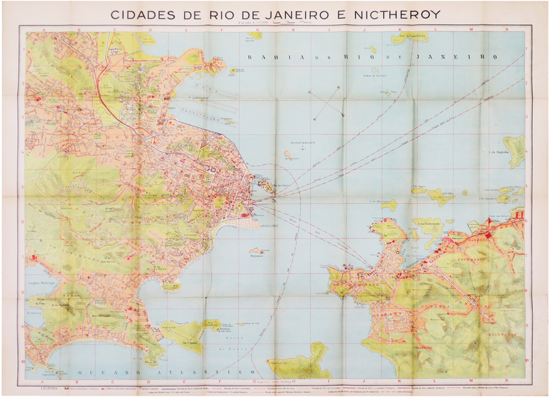
1922LBW-8149Rio de Janeiro, Grande Livraria editora Leite Ribeiro, 1922. Deux plans imprimés recto verso de 640 x 863 mm ; repliés dans une reliure éditeur contenant un guide de 72 pages."
1800LBW-8199Paris, Bance ainé, [circa 1800]. 465 x 601 mm.
RARISSIMO PRIMO STATO Primo stato, del celebre panorama dal Gianicolo che viene attribuito alla mano di Lugi Nisi-Cavalieri (Roma XIX sec.) e Augusto Marchetti (Forli 1813 – Roma 1871) per l'editore Tommaso Cuccioni.Prova avanti i ritocchi a bulino nel paesaggio e nel grande albero a sinistra; nel nostro esemplare l’uso del bulino si limita alla quinta arborea in primo piano, che inquadra la terrazza del Gianicolo, mentre la città ed il paesaggio è delineato a solo contorno.Scrive Barbara Jatta: "L'opera non è citata dai comuni repertori e la mancanza di iscrizioni ci induce a formulare solamente delle ipotesi attributive. È noto un esemplare della stampa (Roma, BASA) che indica come editore, e committente, Tommaso Cuccioni, attivo a via Condotti n. 18. Di lui si conosce anche un piccolo panorama della città che, perfettamente corrispondente a questo in esame, seppure di dimensioni molto ridotte, reca le indicazioni A. Marchetti inc il paesaggio L. Nisi-Cavalieri inc. il Panorama. Sembra dunque possibile, vista la corrispondenza tra i due incisori, che anche la presente sia da ricondurre ai medesimi autori. […] Il Cuccioni fu anche uno dei primi e più noti fotografi romani dell'Ottocento. […] Il panorama di Roma dal Gianicolo qui esposto ha senza dubbio una stretta relazione con gli esordi della tecnica fotografica. Eseguito ad acquaforte e bulino, esso deve la sua impostazione di base all'uso di strumenti meccanici". Inoltre: "Del panorama esiste anche un esemplare inciso al tratto acquafortistico, non terminato con il bulino, e avantilettera (Biblioteca Apostolica Vaticana, Stampe Ashby, Miscell. Panorami 24) che reca solamente un timbro a secco con le iniziali C. F. ad oggi non identificate" (cfr. Barbara Jatta in Roma Veduta, p. 230).Dunque, se l'attribuzione al Nisi-Cavalieri e al Marchetti è, sebbene plausibile, puramente congetturata, la commitenza di Tommaso Cuccioni e invece certa. Fatto che ci induce ad indicarlo, in qualità di editore, commitente e fotografo, come l'autore principale di questa veduta. Il timbro a secco che la Jatta identifica in "C. F." a noi appare chiaramente come un "C. T."; monogramma che identifica - fuori ogni dubbio - Tommaso Cuccioni.La stesura definitiva, con ritocco a bulino e completamento della lastra, reca l'imprint "Si trova vendibile presso l'Editore Tommaso Cuccioni, Negoziante di Stampe. Roma, Via della Croce n. 88". L'indirizzo di via della Croce 88 mette anche in dubbio la datazione assegnata da Barbara Jatta all'opera (1848 circa) che potrebbe essere quindi anche precedente. In accordo con le sue note biografiche infatti (cfr. Marina Miraglia - Dizionario Biografico degli Italiani - Volume 31, 1985) il Cuccioni viene descritto gia attivo all'indirizzo di Via Condotti 18 nel prima della morte di papa Gregorio XVI (1846). Una datazione intorno al 1840, ci sembra più compatibile con le note biografiche.Acquaforte e bulino, stampata su tre fogli di carta databile alla prima metà del'800, con margini, in eccellente stato di conservazione. Rarissimo. VERY RARE FIRST STATE First state, of the famous panorama from the Janiculum Hill that is attributed to the hand of Lugi Nisi-Cavalieri (Rome XIX sec.) and Augusto Marchetti (Forli 1813 - Rome 1871) for the publisher Tommaso Cuccioni.A proof state, before the burin retouches in the landscape and in the large tree on the left; in our exemplar the use of the burin is limited to the foreground, which frames the terrace of the Janiculum hill, while the city and the landscape is outlined with the etching only.Barbara Jatta writes: "The work is not mentioned by the common repertories and the lack of inscriptions leads us to formulate only attributive hypotheses. It is known a copy of the work (Rome, BASA) that indicates as publisher, and client, Tommaso Cuccioni, active in Rome, via Condotti n. 18. We also know of him a small panorama of the city that, perfectly corresponding to this one, even if of very small dimensions, bears the indications "A. Marchetti inc. il paesaggio L. Nisi-Cavalieri inc. il Panorama". It seems therefore possible, considering the correspondence between the two engravers, that also the present one is to be traced back to the same authors. [...] Cuccioni was also one of the first and most famous Roman photographers of the nineteenth century. [...] The panorama of Rome from the Janiculum Hill exhibited here has without doubt a close relationship with the beginnings of photographic technique. Carried out with etching and burin, it owes its basic approach to the use of mechanical instruments". In addition: "Of the panorama there is also an exemple engraved on the etching, not finished with the burin, and before the letter (Biblioteca Apostolica Vaticana, Stampe Ashby, Miscell. Panorami 24) that bears only a mark with the initials C. F. to date unidentified" (cf. Barbara Jatta in Roma Veduta, p. 230).Therefore, if the attribution to Nisi-Cavalieri and Marchetti is, although plausible, purely conjectured, the commission of Tommaso Cuccioni is certain. A fact that leads us to indicate him, as publisher, commissioner and photographer, as the main author of this view. The mark that Barbara Jatta identifies in "C. F." clearly appears to us as a "C. T."; monogram that identifies - beyond any doubt - Tommaso Cuccioni.The final issue, with burin retouching and completion of the plate, bears the imprint "Si trova vendibile presso l'Editore Tommaso Cuccioni, Negoziante di Stampe. Roma, Via della Croce n. 88". The address of via della Croce 88 also puts in doubt the dating assigned by Barbara Jatta to the work (about 1848) that could be therefore also previous. In accordance with her biographical notes in fact (see Marina Miraglia - Dizionario Biografico degli Italiani - Volume 31, 1985) Cuccioni is described already active at the address of Via Condotti 18 before the death of Pope Gregory XVI (1846). A dating around 1840, seems to us more compatible with the biographical notes.Etching and engraving, printed on three sheets of paper datable to the first half of the 19th century, with margins, in excellent condition. Very rare. Roma Veduta, p. 230, n. 72; Marigliani p. 364, n. 298.
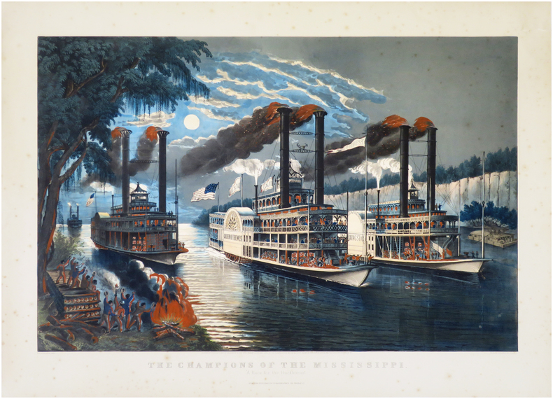
1866LBW-8672New York, Currier & Ives, [1866]. 515 x 715 mm ; sur papier fort.
1798PHO-1092Deuxième reliure de la première édition. Édition originale in-4 sur grand papier, remise en circulation en 1841 avec un nouveau titre avec la mention fictive "nouvelle édition" (quelques exemplaires imprimés en 1798 n'avaient toujours pas trouvé preneur). Une édition octavo en six volumes a également été publiée. in-4 ,y compris l'atlas. Avec 16 (10 dépliantes) dont 15 cartes gravées, 1 planche gravée et table dépliante. - Beau demi-cuir contemp , dos lisse avec titre et tomaison , petits manques au dos , quelques mouillures intermittentes et vieille trace d’humidité (T1), déchirure carte hydrographique sans manque. xii, cxliv, 628, [3] ; xvi, 676, [2] ;[xi], 431, [1];[2],viii, 158pp.
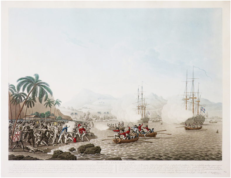
1791LBW-5966Paris, Mondhare et Jean, 1791. 592 x 866 mm.
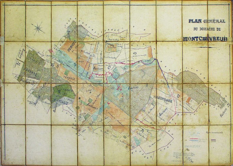
1904LBW-41331904. En 36 sections sur toile à calquer, montées sur toile et pliées formant une carte de 1,03 x 1,55 m.
La Pianta di Roma e del Campo Marzio appartiene al culmine della carriera del Piranesi.Nata dalla necessità di offrire una pianta di riferimento che accompagnasse le 135 tavole delle Vedute di Roma, l'opera fu intesa come tavola finale e indice dell'opera, con con cui veniva spesso venduta e rilegata. Attraverso le tre lastre che compongono questa grande piante, l'autore ha cercato di mettere in relazione le rovine superstiti di epoca antica con la contemporanea topografia di Roma, e di offrire dei riferimenti per i monumenti elencati ai due lati della mappa. Nella parte superiore ha realizzato una mappa della città contemporanea compresa entro le Mura Aureliane, estendendola a nord, a includere il territorio tra Porta del Popolo e Ponte Milvio, e inglobando anche l'area del Campo Marzio.Quest'area è mostrata nel dettaglio in una mappa isolata, in basso a destra, che mostra le antichità più importanti evidenziate da un numero che trova corrispondenza con quelli della mappa più grande. Ai lati, un indice dettagliato dei monumenti, con i numeri corrispondenti nella pianta grande, e con i rimandi ai passaggi più rilevanti delle sue opere maggiori: le Antichità Romane, Della Magnificenza ed Archittettura dei Romani e il Campo Marzio. L'opera è dedicata a papa Clemente XIV (1769-1774).La datazione dell'opera è complessa: - nel catalogo del 1792 di Francesco Piranesi, figlio dell'autore, l'opera è assegnata al 1778, data che, sebbene molto tarda - l'autore muore infatti il 9 novembre di quell'anno - viene accettata da Focillon e Hind. Questa datazione, tuttavia, è certamente basata su un errore, poiché nell'Avvertimento nella parte superiore della mappa, l'autore fa riferimento alla "approvazione che si è degnata mostrarne la Santità di N.ro Sig.re PAPA CLEMENTE XIV felicemente regnante", per cui l'opera non può essere successiva al 1774.A supporto di questa datazione, è un esemplare del Catalogo delle Opere, descritto da Scott, che contiene tre voci manoscritte per tre Vedute di Roma databili al 1774, e indica che la mappa era già disponibile.Esemplare dalla contemporanea edizione romana.Acquaforte e bulino, stampata da tre matrici su tre fogli carta vergata coeva uniti insieme, con filigrana "doppio cerchio e giglio", in ottimo stato di conservazione.Dimensione complessiva dei tre fogli: 132.1 x 82.1 cm Dimensioni complessive delle lastre: 121.2 x 71.1 cm Map of Rome and the Campus Martius, formed by three plates and usually found in association with the Vedute di Roma. He may have felt the need for a reference map to accompany collections of these plates and devised this work to fill this need. Exercising his skills in presenting formidable quantities of information coherently, he sought to relate the surviving remains of antiquity to the contemporary topography of Rome and to offer an easy reference to published information about them. He therefore produced a large map of the modern city within the Aurelian Walls, together with an extension showing the territory to the north, between Porta del Popolo and Ponte Milvio and including the Campus Martius area.This is augmented by a smaller map isolating the principal antiquities, which were marked with numbers correspondending to those in the larger map. Around these Piranesi arranged a detailed index listing the monuments according to their assigned numbers and referring to relevant passages in his major pubblications, including the Antichità Romane, Della Magnificenza ed Archittettura dei Romani and Campo Marzio.The dating of the map is problematic, since, although it is dedicated to Clemente XIV (1769-1774), Francesco Piranesi's 1792 cataloghe assigns is to 1778 and most authorities, including Giesecke, Focillon and Hind, have accepted a late, if not posthumous date; however this date is certainly based on error, since Giambattista, in his Avvertimento at the top of the main map, refers to "l'approvazione che si è degnata mostrarne la Santità di N.ro Sig.re PAPA CLEMENTE XIV felicemente regnante". Supporting evidence for an earlier date comes from an impression of the Catalogo delle Opere, referred to by Scott, which contains manuscript entries for the three Vedute di Roma datable to 1774 and indicates that the map was already available. Etching, printed from the plates on three sheets of contemporary laid paper with watermark, double circle with the fleurs-de-lys.A very good early impression for the contemporary roman edition. Hind, p. 87, [1778-9.]; Focillon 600; Ficacci 700; Wilton-Ely, II, 1008.
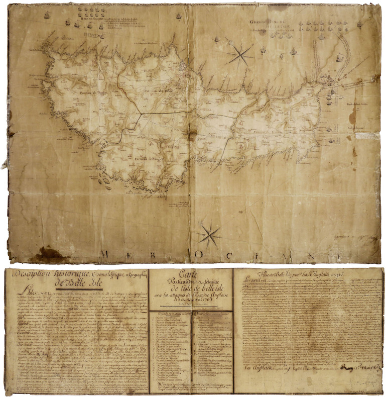
1765LBW-8783[circa 1765]. 610 x 870 mm, entoilée, accompagnée d’une légende manuscrite séparée, 290 x 875 mm, également entoilée.
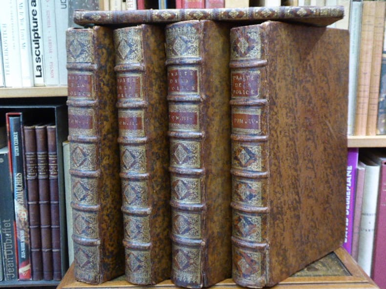
278472Cot - Brunet - Hérissant Paris 1735-1738 4 volumes + 1 volume de supplément in-folio. Reliures de l'époque pleine veau havane, dos à nerfs ornés de caissons de double filet doré richement et finement fleuronnés, pièces de titre et de tomaison en maroquin grenat, roulettes dorées sur coupes, toutes tranches rouges. Le supplément est en demi-reliure de l'époque. Orné de vignette sur titre répétée aux armes et chiffres royales, 10 en-têtes et lettrines historiées, et bien complet de ses 8 plans dépliants dont le plan des fontaines de la ville des faubourgs de Paris. Le supplément concerne les livres 1 et 2. Des cartes avec petites déchirures mais sans manque, divers défauts aux coiffes et mors mais l'ensemble reste solide et fort décoratif. BEL EXEMPLAIRE, peu commun
1373 x 1388 mm. Kolorierte Kupferstichkarte. 48 Segmente auf Leinen aufgezogen. Mit figürlicher Kartusche von Hieronymus Benedicti nach Grimm. In marmoriertem Schuber der Zeit mit blindgepr. Titelschild ("Plan de la Ville de Vienne et de ses Fauxbourgs") sowie einem handschriftlichen Rückenschildchen ("Plan de Vienne 1797"). Erste Auflage des sog. Grimm-Plans von Wien und Umgebung, mit den Hausnummern der 2. Häusernumerierung 1795, der den veralteten Nagel-Plan von 1780/81 ersetzte. "Ausgezeichnet ausgeführt" (Dörflinger). Grimm verkleinerte Nagels Plan um das anderthalbfache und brachte ihn auf den neuesten Stand; "das abgebildete Gebiet deckt sich fast zur Gänze mit dem der Vorlage, auch die Darstellungsweise ist nahezu identisch - lediglich die Orientierung wurde um 180° gedreht (nordost- statt südwestorientiert [...] Blatt VI enthält in tabellarischer Form ein alphabetisch geordnetes 'Verzeichniss der K. Kön. und Aerarial Gebäude', der fürstlichen, gräflichen und geistlichen Häuser, der 'Kirchen und Pfarren', der 'Academien, Schulen, Spitäler' und der 'Sehenswürdigkeiten für Fremde' sowie ein 'Register der Plätze, Straßen und Gassen'" (ebda.). - Der Schuber an den Ecken etwas berieben; die Karte wohlerhalten. Dörflinger S. 297, Art 24. Austria Picta 108.
Acquaforte, 1642, firmata in lastra in basso.Bellissima prova, impressa su carta vergata coeva, con ampi margini, in perfetto stato di conservazione.Inusuale veduta panoramica della città, presa dalle pendici di Monte Mario. La Basilica, in primo piano, è disegnata con grande dettaglio, come pure il panorama della città, dove sono riconoscibili numerose opere architettoniche. "L'incisione è la prima grande veduta di Roma realizzata da Israel Silvestre pochi anni dopo il suo arrivo in città. Questa è ripresa dalle pendici di Monte Mario e il panorama spazia dalla Porta del Popolo al complesso del Vaticano. Il formato oblungo e la scelta del punto di vista verrà largamente ripreso dagli artisti successivi. La veduta venne incisa da un disegno eseguito ad vivum da L. de Lincher, un disegnatore francese poco noto che fu attivo in quegli anni a Roma e fornì i sui disegni a diversi incisori fra i quali anche il conterraneo Francois Collignon" (cfr. Barbara Jatta in "Roma Veduta" p. 164),Il Silvestre, incisore e disegnatore, nasce a Nancy nel 1621. Tra il 1638 e il 1641 viaggiò in Italia; si hanno notizie della sua presenza nella Penisola ancora nel 1643 e nel 1653. Il suo stile fu, all’inizio, piuttosto sciolto, ma dal 1643 in poi divenne più raffinato e delicato, acquisendo accuratezza e precisione senza essere asciutto, risultando a volte simile a quello di Jacques Callot o di Stefano della Bella, con i quali ebbe rapporti di amicizia. Accanto alle testimonianze per la Roma antica mostrò ben presto un grandissimo interesse per la città "moderna", divenendo uno dei precursori del vedutismo - non solo nel campo incisorio - anticipando artisti come Lievin Cruyl e Gaspar van Wittel.Primo, in ordine cronologico, dei quattro panorami dedicati dall’artista francese alla città. Molto rara. Bibliografia Le Blanc III, p. 508, 224; Roma Veduta, pp. 164-165, n. 24; Faucheaux, Catalogue raisonné de l’oeuvre d’Israel Silvestre, 28 II/II. Etching, 1642, signed on lower plate.Beautiful work, printed on contemporary laid paper, wide margins, in very good condition. First, in chronological order, of the four panoramas dedicated by the French artist to the city. The engraving is the first large view of Rome made by Israel Silvestre a few years after his arrival in the city. This is taken from the slopes of Monte Mario and the panorama ranges from the Porta del Popolo to the Vatican complex. The oblong format and the choice of the viewpoint will be largely taken up by the artists who followed. The view was engraved from a drawing made ad vivum by L. de Lincher, a little-known French artist who was active in Rome in those years and supplied his drawings to various engravers, including his fellow countryman Francois Collignon (cf. Barbara Jatta in "Roma Veduta" p. 164) Silvestre, engraver and draftsman, was born in Nancy in 1621. Between 1638 and 1641 he travelled in Italy; we have news of his presence in the Peninsula still in 1643 and 1653. His style was, at the beginning, rather loose, but from 1643 onwards he became more refined and delicate, acquiring accuracy and precision without being dry, sometimes similar to that of Jacques Callot or Stefano della Bella, with whom he had friendly relations. Alongside the evidence for ancient Rome, he soon showed great interest in the 'modern' city, becoming one of the precursors of vedutism - not only in the field of engraving - anticipating artists such as Lievin Vruyl and Gaspar van Wittel. Literature Le Blanc III, p. 508, 224; Roma Veduta, pp. 164-165, n. 24; Faucheaux, Catalogue raisonné de l’oeuvre d’Israel Silvestre, 28 II/II.
Pianta archeologica a proiezione verticale, con rappresentazione in alzato degli edifici antichi. Disegnata ed ideata da Pirro Ligorio, viene incisa da Jacob Bos per l’editore Tramezzino. Si tratta della grande pianta archeologica del Ligorio, frutto della sua valente esperienza di archeologo, che ebbe una grande influenza sulla produzione topografica della città per oltre due secoli. Per elaborare questa pianta, si avvalse della sua profonda conoscenza archeologica delle rovine di Roma, delle fonti classiche e di una vasta documentazione costituita da iscrizioni, bassorilievi e monete antiche. Per la parte topografica il Ligorio si basa sulla pianta del Bufalini del 1551.Roma entro le mura appare come un fantasioso insieme di edifici, alcuni noti e ancora presenti e altri che, sebbene localizzati con una certa esattezza, indubbiamente sono frutto di ricostruzioni abbastanza fantasiose. Non mancano gli errori di localizzazione, come ad esempio il Foro Romano, erroneamente collocato tra il Campidoglio ed il Palatino. Il primo stato della carta è noto solo attraverso gli esemplari conservati al British Museum e alla Philadelphia Library Company. La carta ebbe una ristampa inalterata, circa un secolo dopo per mano di Gian Battista de Rossi. Dopo un altro secolo circa (1773) anche Carlo Losi ne realizza una ristampa dalle lastre originali, che poi furono acquisite da Giovanni Scudellari e ristampate verso il 1820/30.In alto, lungo il bordo superiore, è impresso il titolo: ANTEIQUAE URBIS IMAGO ACCURATISSIME EX VETUSTEIS MONUMENTEIS FORMATA. Nel cartiglio all’angolo superiore sinistro si legge: EFFIGIES ANTIQUAE ROMAE EXVESTIGIIS AEDIFICIORUM RUINIS TESTIMONIO VETERUM AUCTORUM FIDE NUMISMATUM MONUMENTIS AENEIS PLUMBAEIS SAXEIS TIGLINISQUE COLLECTA ATQUE IN HANC TABELLAM REDACTA ATQUE DESCRIPTA A PYRRHO LIGORIO ROMANO PER XIIII REGIONES IN QUAS URBEM DIVISIT IMP CAESAR. AUG. PIOQUE IIII PONT MAX DICATA EXCUDERUNT ROMAE MICHAEL ET FRANCISCUS TRAMEZZINI M.D.LXI. Seguono l’indicazione del privilegio e la firma dell’incisore: Cum privilegio Sum[m]i Pont[ificis] et Senat[us] Venet[iani]. Iacobus Bossius belga incidebat. Orientazione fornita dal punto cardinale SEPTENTRIONE, indicazione collocata nell’angolo in alto a sinistra; il nord-est è in alto. Nella tavola alcuni monumenti e luoghi sono evidenziati attraverso il toponimo.Bulino, stampato su dodici fogli, applicati su tela e più volte ripiegati. Esemplare nel quarto stato finale, della tiratura Scudellari, finemente colorato a mano.Bibliografia:Bifolco - Ronca, Cartografia e Topografia italiana del XVI secolo (2018), pp. 2341-2342, tav. 1207, IV/IV; Destombes (1970): n. 94; Bevilacqua-Fagiolo (2012): p. 25; Caldana (2013): p. 22 e n. I.7; Frutaz (1962): n. XVIIa-b e tavv. 671-684; Hülsen (1915): VIII, pp. 52-53, nn. 31-35; Hülsen (1933): pp. 105-106, VIII; Karrow (1993): n. 51/11 e 51/11.4-51/11.7; Mandowsky-Mitchell (1963): tavv. 75-76; Scaccia Scarafoni (1939: nn. 11-13. Archaeological map with vertical projection, with representation in elevation of ancient buildings. Designed and conceived by Pirro Ligorio, it is engraved by Jacob Bos for the publisher Tramezzino. It is the great archaeological plant of Ligorio, the result of his valuable experience as an archaeologist, which had a great influence on the topographic production of the city for over two centuries. In order to elaborate this plan, he used his deep archaeological knowledge of the ruins of Rome, classical sources and a vast documentation consisting of inscriptions, bas-reliefs and ancient coins. For the topographic part Ligorio is based on the map by Bufalini of 1551.Rome within the walls appears as a fanciful set of buildings, some of them known and still present and others that, although located with a certain accuracy, are undoubtedly the result of quite fanciful reconstructions. There is no lack of localization errors, such as the Roman Forum, erroneously located between the Capitol and the Palatine Hill. The first state of the map is known only through the examples preserved at the British Museum and the Philadelphia Library Company. The ma was reprinted unchanged, about a century later by Gian Battista de Rossi. After another century or so (1773) Carlo Losi also made a reprint from the original plates, which were then acquired by Giovanni Scudellari and reprinted around 1820/30.At the top, along the upper edge, is engraved the title: ANTEIQUAE URBIS IMAGO ACCURATISSIME EX VETUSTEIS MONUMENTEIS FORMATA. In the cartouche in the upper left: EFFIGIES ANTIQUAE ROMAE EXVESTIGIIS AEDIFICIORUM RUINIS TESTIMONIO VETERUM AUCTORUM FIDE NUMISMATUM MONUMENTS AENEIS PLUMBAEIS SAXEIS TIGLINISQUE COLLECTA ATQUE IN HANC TABELLAM REDACTA ATQUE DESCRIPTA A PYRRHO LIGORIO ROMANO PER XIIII REGIONES IN QUAS URBEM DIVISIT IMP CAESAR. AUG. PIOQUE IIII PONT MAX DICATA EXCUDERUNT ROMAE MICHAEL ET FRANCISCUS TRAMEZZINI M.D.LXI. Follow the indication of the privilege and the signature of the engraver: Cum privilegio Sum[m]i Pont[ificis] et Senat[us] Venet[iani]. Iacobus Bossius Belgian incidebat. Orientation provided by the cardinal point SEPTENTRION, indication located in the upper left corner; the northeast is at the top. Engraving, printed on twelve sheets, applied on canvas and folded several times. Exemple in the fourth final state, of the edition by Scudellari. Literature:Bifolco - Ronca, Cartografia e Topografia italiana del XVI secolo (2018), pp. 2341-2342, tav. 1207, IV/IV; Destombes (1970): n. 94; Bevilacqua-Fagiolo (2012): p. 25; Caldana (2013): p. 22 e n. I.7; Frutaz (1962): n. XVIIa-b e tavv. 671-684; Hülsen (1915): VIII, pp. 52-53, nn. 31-35; Hülsen (1933): pp. 105-106, VIII; Karrow (1993): n. 51/11 e 51/11.4-51/11.7; Mandowsky-Mitchell (1963): tavv. 75-76; Scaccia Scarafoni (1939: nn. 11-13. Bifolco - Ronca, Cartografia e Topografia italiana del XVI secolo (2018), pp. 2341-2342, tav. 1207, IV/IV.