1 660 résultats
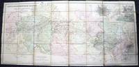
185732586Edward Stanford London unknown circa 1857 First Edition thus. Paperback. maps show slight toning a few stains & marks to back of linen otherwise in very good condition case bumped and rubbed with scuffed corners. approximately 54 x 54 inches. dissected linen backed colour map in two parts: North - from Konigr Ungar & Scharzes Meer to Serbia Bulgarien and Schwarzes Meer: South - Vusitrin & Griechenland to Scharzes Meer Meer von Marmara Kleinasien & Archiplagus Weiss. Both 71 X 137 cm legend in English on the North map boundaries carriage trails battlefields harbours in German scale of English miles 69 to one degree boxed set linen backed maps with marbled paper ends cloth covered slipcase Edward Stanford hardcover
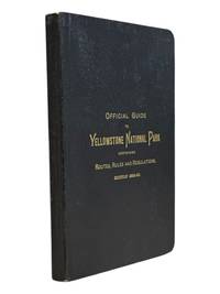
18899062St. Paul Minn: W.C. Riley 1889. 8vo 140 15pp ads and blank journal at rear. Illustrations maps large folding map in pocket at rear as issued. Original leather over card covers stamped in gilt on front with red page edges. Gift inscription on ffep in pencil dated 1907 else clean internally. A beautiful fine copy. <br /> <br /> Beautiful copy of this illustrated tourist's guide to Yellowstone giving descriptions of the attractions and features of the park with maps a brief history and rules and regulations. Riley issued a just few of these according to OCLC between 1886 and 1890. Scarce and more so in this condition - the nicest we've seen.<br /> <br /> <br /> . W.C. Riley unknown
1992047410Pachuca Mexico: Consejo de Recursos Minerales 1992 Book. As New. Hardcover. 1st US Ed. The state of Zacatecas is one of Mexico's most historically and economically significant mining regions often highlighted in specialized geological reports including this comprehensive Geological-Mining Monograph of the State of Zacatecas with its detailed text stratigraphic charts and geological maps often in 1:250000 scale that serve as a guide for exploration and academic study of this major mining region. Published by the Consejo de Recursos Minerales now part of the Mexican Geological Survey - SGM 155 p. illus charts col large format fold out maps in rear pockets. As new except for an ownerhip stamp NOTE : Very Heavy 1.5 kg/ large format volume. 35 x24 x24 cm. Consejo de Recursos Minerales hardcover
1835000014144London: Cha. F. Cheffins 1835. Map. Ex-Library. 29 3/8" x 61.5". Linen-backed map done on two sheets. Map printed in black pink yellow and green hand-colored. Housed in a 8" x 5.5" green case with gilt lettering and a gilt device on the front board the front of the case states "London & Birmingham Railway. Map of the Line. above the device Incorporated 6th May 1833". A portion of the map backed with green goat in order to have it enter and exit the case more smoothly. A large and beautiful representation of the London to Birmingham railway line with the stops outlined at the bottom edge of the map. With two engraved vignettes showing the depots in Birmingham and in London. An early example of this captivating map. A bookplate and one stamp on the verso of the map otherwise no markings. The bookplate states that the map was a gift donated by James J. Hill a wealthy bibliophile from St. Paul to the University of Wisconsin Library. The map has three small spots of loss to its folds. The case has wear and light discoloration. Cha. F. Cheffins unknown
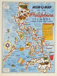
1945204557U.S.A.: Mem-O-Map Co. 1945. Colour pictographic / pictorial map 32.1 x 23.8 cms; 35.4 x 26.6 cms sheet very good condition. Rare pictorial map published in 1945 by John G. Drury aTechnical Officer who served with the 214th Ordnance Battalion to mark the end of World War II as souvenirs for the military. Military personnel could fill in banners "came in on good ship." and "departed on good ship." their name organisation and "Line of Advance or movement" blank in this example. Pictographs mark various memorable spots and wildlife including larger-than-life insects. A "Terrible Tillie Typhoon" looms over the coast at Luzon. <br>Drury published a series of five maps: Philippines and Okinawa in 1945; Japan and Korea Oahu and Europe in 1946. They are all scarce. “These almost whimsical maps are designed to support the creation of personalised geographies. At a time when digital mapping is beginning to experiment with the creation of personalised content that would render the same map in different ways for different users Mem-O-Maps demonstrate the principle in action." Kenneth Field ICA Commission on Map Design. . Mem-O-Map Co. unknown
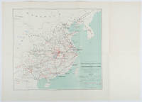
1898214719Paris.: Erhard Frères. 1898. Lithographed folding colour map 44.5 x 49.5 cms; 54.6 x 76.3 cms sheet towns and cities items of production and trade routes highlighted in red original folds in very good clean condition. Detailed map prepared for the Lyon Chamber of Commerce Mission to China under the direction of a young Henri Brenier 1867-1962 with the purpose of advancing French colonial expansion and shoring up the interests of the dominant Lyon silk trade. <br> <br>The map shows the principal centres of population production waterways roads telegraph lines and railroads togther with the centres of production and distribution for coal iron tin gold and silver opium tea rice sugar peanuts cinnamon wool medicinal plants and leather. The trade mission was organized following the Treaty of Shimonoseki and the end of the Sino-Japanese War: the Chamber of Commerce of Lyon understood that end of this war would signal a profound economic development and change. . Erhard Frères hardcover
194364219Washington D.C.: Prepared and distributed by Army Orientation Course Special Service Division 1943. One double-sided double-atlas folio colour map sized 35 x 47 in. 6.25 x 12 in. when folded as issued colour lithographic hemispherican map on recto 4 inset 2-colour maps on verso text in blue & black w/ photo illustrations as well original fold creases slight age toning very minor shelfwear folds w/ minor rubbing still a VG bright copy. First edition of this remarkable World War II propaganda pictorial map featuring Berlin Germany situated at the center of concentric bulls-eye circles and the artist has wonderfully detailed how they created this simulated 3-dimensional image as well as a detachable scale to be cut-off and used by the educational viewer. Within days of this map’s publications Allied bombers directed by British Air Marshall Arthur “bomber†Harris directed destructive air raids against the city lasting until March 1944 which also demonstrated the ineffectiveness of bombing population centers in order to alter the course of a War. The Newsmap portion detailing the course of the War in the 215th Week includes the inset maps of Bridgeheads across the Dnepr River as the Soviet forces began pushing German Army units back along the Eastern Front stretching from Leningrad to the Sea of Azov; the New Britain campaigns in the South Pacific; Operations in Burma including pushes over the Burma Road against the Japanese and bombing routes into Italy Germany and central Europe. Manning fl. 1940-1945 was a cartographer with the Chicago Sun and during World War II produced a number of propaganda maps for the Army Orientation Course of the Special Service Division Army Service Forces as part of the United States War Department. Prepared and distributed by Army Orientation Course, Special Service Division, unknown
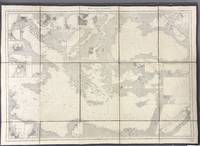
1914005933Paris: Dépôt des Cartes et Plans de la Marine 1914. Cloth Backed. Very good. This extensive uncolored sea chart provides comprehensive coverage of the entire Eastern Mediterranean Sea in multiple panels which have been assembled and backed with cloth to form a large composite map. Published by the official French hydrographic office in Paris the "Dépôt des Cartes et Plans de la Marine" which became the Service Hydrographique de la Marine around this time the chart is a practical navigational aid rather than a decorative one. It features a dense network of hydrographic data including numerous soundings indications of sea bed composition and detailed representations of coastlines and harbors. The chart's functional uncolored style is typical of official government maritime surveys designed for practical use by mariners with details corrected and augmented over time to reflect the most current surveys. Sheet dimensions: 76 cm x 107 cm approx. assembled from multiple sheets. Condition: Very Good. Sound paper uncolored as issued minimal signs of wear along seams where sheets are joined. Please see photos for full appraisal of condition. Dépôt des Cartes et Plans de la Marine unknown
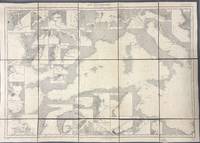
1914005930Paris: Dépôt des Cartes et Plans de la Marine 1914. Loose Sheet. Very good. This extensive uncolored sea chart provides comprehensive coverage of the entire Western Mediterranean Sea in multiple panels which have been assembled and backed with cloth to form a large composite map. Published by the official French hydrographic office in Paris the "Dépôt des Cartes et Plans de la Marine" which became the Service Hydrographique de la Marine around this time the chart is a practical navigational aid rather than a decorative one. It features a dense network of hydrographic data including numerous soundings indications of sea bed composition and detailed representations of coastlines and harbors. The chart's functional uncolored style is typical of official government maritime surveys designed for practical use by mariners with details corrected and augmented over time to reflect the most current surveys. Sheet dimensions: 76 cm x 107 cm approx. assembled from multiple sheets. Condition: Very Good. Sound paper uncolored as issued minimal signs of wear along seams where sheets are joined. Please see photos for full appraisal of condition. Dépôt des Cartes et Plans de la Marine unknown
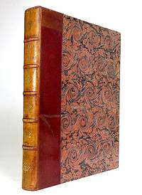
5178Paris Librairie Larousse 1915-19. 1st Edition . Hardcover. . ~ ~ NOTE: THE PRICE OF THIS BOOK IS CURRENTLY REDUCED! ~ ~ . 41 issues bound in one volume. Thick royal quarto. Unpaginated. With hundreds of letterpress maps many of which are in colour printed on recto only on 246 leaves of plates. Some photo-plates. Explanatory text to each map. Introductions. HARDCOVER bound in handsome brown quarter morocco bit rubbed and scuffed in places spine with raised bands gilt lettering to second compartment gilt fleuron to each of the others vellum French corners marbled endpapers with original yellow card wrapper of first issue bound-in. In about fine condition. Excellent copy. ~ FIRST EDITION. Very rare. G-3 <br/> <br/> Paris, Librairie Larousse, (1915-19). hardcover
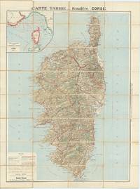
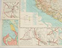
62609Paris: Cartes Tarides c.1922. Original separately issued colour-lithographed map of Corsica 105 x 81 cm dissected into 32 sections and backed onto linen with an inset map showing the navigation lines between Corsica France and Italy to upper left. Printed by Gaillae-Montrocq et Cie. Folding between drab paper covers. Some light spotting to verso most noticeable along folds some light marginal soiling generally a very good attractive example. The key to bottom left provides plenty of useful information to the motorist including the best roads those to avoid and the main summer seaside and thermal resorts which are highlighted in red. Paris: Cartes Tarides, [c.1922]. unknown
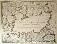
172354819Rainer Ottens. 1723. A most attractive map with early outline hand colour vertical fold barely visible diagonal crease upper half of map few very pale small brown spots otherwise a clean and bright image. Numbering in red pencil few annotations in pencil and light number stamp on reverse however not at all visible from front of map or affecting image. Sheet measures 46.6 x 60.2cm. . Rainer Ottens. unknown
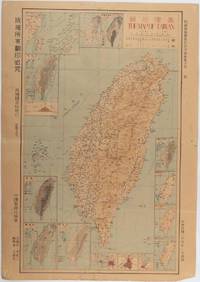
1945215871Taiwan.: 禹甸圖書局. Yudian tushuju. 1945. 1945 Ministry of Interior map of Taiwan published in the 34th year of the Republic of China with inset title and key top right. Romanised Japanese names for some areas and cities written in capital letters on main map which is surrounded by 15 small inset maps at edges each with its own scale. Paper browned wear at folds and edges repaired with archival washi on reverse some light stains and a few marks. 1 x 3cm chip bottom right corner. 77.4 x 54 cm. Text in traditional Chinese characters. Inset maps show clockwise from right edge; 1. Distribution of inhabitants according to ethnic background or minority group 2. Qing Dynasty prefectures and counties 3. Japanese administrative regions during the occupation 4. Strategic industrial and military places three city maps - 5.Chilung or Keelung port 6. Taipei city and 7. Tainan city 8. Geological formations 9. agricultural metallurgical and mineral products 10. Soil types 11. Topography of the island including sea currents and altitude diagram 12. Taiwan's position in relation to the mainland coast provinces of Fujian and Zhejiang as well as the Liuqiu Ryukyu Islands including Okinawa 13. Okinawa detail 14. Climate and rainfall in January 15. Climate and rainfall in July. . 禹甸圖書局. [Yudian tushuju]. unknown
1962174808Kuala Lumpur.: Survey Department Federation of Malaya. 1962. Very attractive large coloured folding map 108 x 83cm showing all the major hotels and rest houses throughout the country. Coloured references show rubber rice coconut and oil palm areas pineapple and miscellaneous cultivation areas mining land jungle built-up areas and shopping centres along with major features such as rivers principal roads minor roads and cart tracks railways lighthouses district state and international boundaries and triganometrical stations with heights. Scale 18 miles to an inch mile. Two inset maps of Northern Malaya and South Western Malaya are 9 miles to an inch. There are smaller inset maps of Ipoh; Malacca Singapore & Johor Bahru Penang Sungei Patani Kuala Lipis Kuantan Alor Star Kota Bharu Petaling Jaya Seremban Klang Batu Pahat Muar Segamat Johore Bahru and a small inset map of Malaya and adjacent territories. There is a large black & white table of approximate mileages. When folded the map is encased in the original printed manila covers measuring 21 x 14cm with a printed price of $2.50. A crisp bright map in very good condition. Survey Department Federation of Malaya No. 23. . Survey Department Federation of Malaya. unknown
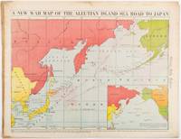
1942206849Chicago.: Chicago Daily Tribune. 28 January1942. Printed colour map 40.3 x 53.6 cm; 46.5 x 60 cm sheet inset map of the North Pacific back cover from a section of the Chicago Daily Tribune newspaper pages 21-34 January 28 1942; central fold edgewear and browning with a few minor tears not affecting the map in very good condition. Based on a Rand McNally map and issued less than two months after the bombing of Pearl Harbour by the Japanese. The Tribune briskly got to work issuing maps for readers showing the beginnings of the war with Japan. Later maps were also published for sale separately but remarkably few have survived. The map shows "the nearness of our Aleutian Island chain west of Alaska to the islands of Japan. At Dutch Harbor and other points in the Aleutians are actual and potential sea and air bases lying on the shortest route from northwestern United States to Japan." The inset map at lower right situates the areas in the larger map in respect to the countries bordering the North Pacific Ocean. <br> <br>Included with the map is the complete newspaper section from which it is the final full page. Covering sport and the market with half a dozen popular comic strips including "Dick Tracy" and "Little Orphan Annie" it shows a domestic United States a world away from what had been seen as a European War. <br> <br>". the historic Chicago Tribune was an innovator in color inks and printing but also a pioneer in bringing colorful art in the form of illustrations photographs cartoons and advertisements to the average person in an everyday medium." see The Janet A. Ginsburg Chicago Tribune Collection Michigan State University Libraries." . Chicago Daily Tribune. unknown
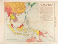
1619180757Chicago.: Chicago Daily Tribune. December 161942. Printed colour map on a single newspaper leaf 41.6 x 52.8 cm; 45 x 60 cm sheet inset legends marginal browning and at the folds but remarkably bright in very good condition. Map of Southeast Asia published in the Chicago Daily Tribune "The World's Greatest Newspaper" delineating the Pacific theatre of war with a detailed text legend. "This is a new war map of the far east showing an important part of southeastern Asia and Australasian waters from a station in which according to Prime Minister Curtin of Australia a United States fleet will operate." Interestingly New Guinea is marked as British rather than as an Australian administrative region which it became following the Treaty of Versailles. <br> <br>"… the historic Chicago Tribune was an innovator in color inks and printing but also a pioneer in bringing colorful art in the form of illustrations photographs cartoons and advertisements to the average person in an everyday medium." see The Janet A. Ginsburg Chicago Tribune Collection Michigan State University Libraries. . Chicago Daily Tribune. unknown
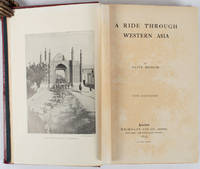
1897176109London.: Macmillan and Co. Limited. 1897. Photographic frontispiece of 'The Shah returning to Teheran' and numerous full page photographic illustrations four folding printed colour maps marginal spotting xii 275 pages 23 x 15 cm original red glazed red cloth boards occasional spotting the cloth a little marked and flecked the spine sunned but in very good condition.<P> An extensive and intrepid modern Grand Tour account through Constantinople and Turkey to Persia and Central Asia with 34 striking photographic plates. Clive Bigham was an Honorary Attaché to the British Embassy at St. Petersburg and war correspondent in the Near East travelled at the very height of the Armenian troubles when the strict orders had been issued by Turkey that Asia Minor was to be closed to Europeans. Burrell 94. <br> <br>This item is held off-site. Please note there may be a few days delay while it is brought into our shop for viewing or mailing to you. Thank you for your understanding.<P> <b>When referring to this item please quote stockid 176109</b> . Macmillan and Co. Limited. hardcover
1935036820Los Angeles California: Title Guarantee And Trust / Title Insurance And Trust 1935 1936 1937 1938 1942 1946 1949 1951 1956 1957 1959 1961 1935. First Edition 1st Printing. Soft cover. Very Good/No Dust Jacket. 9 1/4" High. A Group Of 30 Different Booklets Including 19 Different First Printings 1935-1961 One With Second Issue Tipped In Slip 8Th Printing Of Old Spanish And Mexican Ranchos Of Orange County Six Are First Printings Of Later Revisions There Were Many Minor Revisions Usually Each Time They Were Re-Issued. Several Have Notations On Covers That They Were Gifts To Dr. George Hill Hastings From Arthur Mordan President Of Title Guaranty Who Employed Robinson. The Beverly Hills Book Has A Presentation Inscription From Mordan To Hastings The Island Of Santa Catalina Has A Long Notation By Hastings That It Was A Gift From Robinson Upon The Death Of Mordan A Dear Friend; Signed H. H. All Very Good To Near Fine Except Culver City Which Has Wear And Some Damp Spotting Centered On Spine And Extending Inwards Up To 1/4"; And The Forest And The People Is Only Good Worn And Some Small Light Water Spots. <br/> <br/> Title Guarantee And Trust / Title Insurance And Trust 1935 1936 1937 1938 1942 1946 1949 1951 1956 1957 1959 1961 paperback
192862600Ottawa ONT: Natural Resources Intelligence Service 1928-1929. Four large folding colour maps. atlas folio w/ largest sized 45 x 35 in. w/ each sheet including an index map indicating there are 4 in total with outlines fold creases as issued minor age toning to fore-edges a few minor closed tears at fold creases still a VG set of maps. Early printing of this four sheet map depicting the automobile roads connecting Canada and the United States during the 1920’s as the Good Roads Movement rapidly expanded through the Northern Country following World War I. These maps depict the burgeoning highway and national road system which had been fostered by urban centers attempting to convince rural municipalities to replace their seasonal dirt roads with those of gravel or crushed stone and facilitate much greater movement of agricultural and manufacturing products across the continent and with the U.S. The Atlantic map stretches from the maritime provinces down to Washington D.C. and over to Niagara Falls and Buffalo NY; The Middle West map documents the main automobile roads and highways from Port Albert to Port Arthur and South from Denver to St. Louis indicating provincial federal and state roads and highways; The Great Lakes section tracks the extensive network of roads and highways surrounding the Great Lakes including those in Iowa Kentucky Wisconsin New York and the Canadian provinces of Quebec and Ontario; while the Pacific Map records the highways from San Francisco to Denver and up through Alberta and over to British Columbia. Uncommon with all four maps present. See: J.I. Little Confronting Rural Localism: The Good Roads Movement in Quebec’s Eastern Townships 1897-1920 Social History/Histoire sociale Vol. 57 No. 117 May 2024. Natural Resources Intelligence Service, unknown
LD7400c. early 19th century. Hardcover. Very Good. Half cloth and marbled paper over boards handwritten label on upper board; oblong folio 460 x 360 mm; entirely handwritten and drawn in black ink on the rectos only with "tableau des batiments militaires" and 7 maps. Boards heavily scuffed; binding shaken; some dusty finger-smudges here and there. Sold as is. <br/><br/> hardcover
1867s02256Washington D.C: Government Printing Office 1867. 1st Edition. Hardcover. Very Good. Brown pebbled cloth boards with blindstamped rules; 9" tall; 151 pp plus large folding map. Good condition with wear to spine ends of corners of boards; map itself in very good condition colors bright folded properly modern tape reinforcement at creases. -- The "Map of the United States and Territories" by Joseph S. Wilson was one of the largest and most accurate maps of the country published at the time. It clearly marks major Native American territories and the colored mineral deposits show a clear rationale for expansion to the West. Joseph Wilson was Commissioner of the General Land Office both before and after the Civil War and this map was produced during the first year of his second tenure. The accompanying report asserts the United States' right to possession of the Western territories and states encourages the population thereof and admits to continuing arbitration land claims especially in California. Government Printing Office hardcover
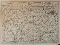
1891List3031Lynn Massachusetts: Arthur W. Robinson 1891. Nine of a ten-map series mostly measuring 14 ½ x 19 inches. Folded with slight marginal folding and wrinkling; Near Fine. Nine of a set of ten maps of the entire state of Massachusetts produced in 1891 for the League of American Wheelmen. The League was founded in Rhode Island in 1880 as a membership organization for cyclists. Besides presiding over racing and producing cycling guidebooks it advocated for increased government spending on road improvements especially for rural roads; these maps indicate roads of superior and inferior quality. In the 1890s there was a boom in cycling’s popularity mainly because of several inventions that allowed a safer and more pleasant ride compared to that of a penny-farthing.<br /> <br /> This group is near complete; we find two complete editions on OCLC. Arthur W. Robinson unknown
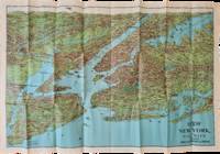
1928List2973George J. Nostrand; Winkoop Hallenbeck Crawford Co 1928. Map measuring 20 x 29 inches; trifold measuring 8 ½ x 12 inches. Map folded with some small tears at folds slightly wrinkled pencil markings verso; very attractive. Overall excellent. Offered here is a large attractive bird’s-eye view map of New York City and the surrounding areas by George J. Nostrand a New York City-based lithographer and cartographer; and a small pamphlet advertising sightseeing tours by car or yacht with “lecturers accompanying each trip explaining all points of interestâ€. The map highlights the most car-friendly routes around the city and New Jersey as far west as Mountain View and is beautifully illustrated with buildings landmarks and ships in the harbor. It was likely produced between 1927 and 1929 given certain details for instance the George Washington Bridge is labeled only as “proposedâ€; we find two copies of the 1928 printing and four of the 1929 printing on OCLC. George J. Nostrand; Winkoop Hallenbeck Crawford Co unknown
1881ABE-EBAY-197700219739London: Kegan Paul 1881. Hardcover. Good. A Polar Reconnaissance. Being the Voyage of the ""Isbjörn"" to Novaya Zemlya in 1879. By Albert H. Markham. With Maps and Illustrations. London: C. Kegan Paul 1881. 10 engravings 6 of them full-page plates 2 folding maps. Top and bottom of spine significantly chipped other extremities rubbed spine sun-faded a little scuffing and staining. Pages yellowed with an occasional bit of foxing smudge minor blemish; there are a couple of light pencil marks; a blank page at the end has a few pencil notes. Binding cracked and weak one signature is detached a couple of others are loosening. Owner bookplate James Richardson. Kegan Paul hardcover
1854182A61A.O.P. Nicholson Printer Washington D.C.: . 1854 2 pp. Title-page with list of contents on the verso 45 maps and plans of various sizes some quite large most folding. Some damp stain and foxing but nothing too substantial except to the endpapers. Original full black cloth binding stamped in blind and lettered in gold gilt. Lightly worn. 4to. 300mm. These maps and plans illustrate the Reports of: the Commissioner of the General Land Office 8: Commissioner of Public Buildings 1-4; National Hospital for the Insane 1; Colonel of Topographical Engineers 31; and the Report of the Chief of Ordnance and Hydrography 1 Officers Quarters at Annapolis. Significant regions covered include parts of: Kansas; Nebraska; Arkansas; Florida; Michigan; Iowa; California; Minnesota; Wisconsin; Ohio; District of Columbia; New York; as well as a Topographical Map of a portion of the Isthmus of Darien in site of proposed inter-oceanic navigation canal. These reports were apparently an adjunct to the MAPS AND CHARTS OF THE UNITED STATES COAST SURVEY. A wonderful addition to any collection of U.S. Maps. . PRICE JUST REDUCED! W155 CTR Language: eng. Full Cloth. Hardcover. Very Good. A.O.P. Nicholson, Printer, Washington [D.C.]: . hardcover