Maps - History - Strass, FriedrichBiblio.com
1 660 résultats
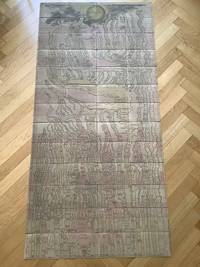
181711715AB1817. Vienna Geistinger 1817. 71 : 148 cm. Manyfolded contemporary coloured engraving. Contemporary mounted on linen. Interesting historical map giving an broad overview of the development of the history from ancient times until the 18th century. Friedrich Strass 1766-1846 was a teacher at the monastery of Berge near Magdeburg. His "Strom der Zeiten" got a great populariety and was admired also from the foreign countries. - As mostly browned. unknown
158464215Antwerp.: Abraham Ortelius. circa1584. Two engraved maps on laid paper each 30.3 x 19.5 cm printed on the one sheet 48 x 60 cm original fold attractive hand colour with related French text on verso slight toning and spotting to the margins but the maps in very good condition preserved in a modern window mount. Attractive maps of the German coast published in Ortelius' great atlas "Theatrum Orbis.". The left-hand map showing the mouths of the Elbe complete with sea monster and Eider Rivers and the coast of Schleswig-Holstein; the right-hand map of the Baltic coast with the Pomeranian islands of Rugen and Usedom. . (Abraham Ortelius). unknown
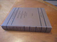
1948055564Division Of Mines Department Of Natural Resources State Of California 1948. 1st Edition 2nd Printing. Hardcover. Near Fine. Xvi 773 Pp; Errata On Last Page; Folding Map In Pocket At Rear. Brown Cloth. Stated Second Printing With Errata At Rear. Near Fine No Marks. With Folding Map In Pocket At Rear In Fine Condition. When They Pump The Oil And Gas Out The Land Sinks But The Producers Are Then Far Away. <br/> <br/> Division Of Mines, Department Of Natural Resources, State Of California hardcover
179832540-440Paris Edme Mentelle 1798. C. 330 x 430 mm. Framed 510 x 610 mm. Paris Edme Mentelle 1798. Fine map of the mouth of the Gironde river with Cognac and Angoulème in the centre. On upper corner right the map bears the no. 41. GEOGRAPHY: MAPS ; KARTEN KARTOGRAPHIE ; FRANCE ; Paris, Edme Mentelle unknown
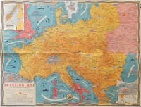
1944206781Toronto.: C.C. Petersen. 1944. Colour pictorial map 51 x 67 cms two small inset maps of Scandinavia and the Baltic and South Greece and the Dodecanese on the verso a black and white world map showing the Pacific Theatre marking keys events of the war and in European world history folding into the original pictorial pocket a little toned and marked 25.8 x 17.7 cms small fold split but in very good condition. A scarce map in the "Dated Events" series published by C.C. Petersen in Canada and distributed throughout North America commemorating D-Day. The colour map by Stanley Turner encompasses the area from England as far south as the French border with Spain and as far east as the USSR and Turkey. "With this invasion map you will be able to follow the progress of the Allied troops on their way to smash Germany.". The text at lower left goes on to elaborate on the features shown on the map from elevation "major battles are seldom fought on the tops of mountains" to pictographs of bombs falling. <br> <br>The black and white map on the verso shows the Far Eastern theatre of war centring on the Pacific Ocean with the Asian landmass including India and the USSR at upper left Australia at lower left and North America and the coast of South America at right of the map. Naval bases are shown and significant events in the war are noted in text boxes. <br> <br>A handsome production of a scarce map rarely seen with the original pictorial pocket. . C.C. Petersen. unknown
mon0003321896Edward Stanford. Good. . This is a large folding coloured linen backed map. Map is clean with minimal wear. No copyright date is given. Edward Stanford unknown
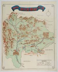
1930206841Kofu.: Onkodo Printing Co. circa1930s. Colour pictorial map 70.2 x 56 cms; 75.5 x 59.5 cms sheet light wear along the inner margin some soft creases from folding short split at center fold; in very good clean condition. An appealing and decorative map of Yamanashi Prefecture which while a process print has the attractive soft look of a lithograph adorned with vignettes of key attractions landmarks such as Mt. Fuji and industry such as silk and wine. The legend lists Railways 'Footing' Roads Hot Springs Hotels and National Parks. A scarce and attractive English language map for the tourist market. . Onkodo Printing Co., unknown
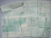
1967203843Washington D.C.: Army Map Service. 1967-1968. Five printed colour adjoining topographic maps folded legends to physical features including roads some including footpaths or trails railroads rivers streams lakes mountains boundaries and place names Route Markers Railroads airfields bridges and detailed terrain a few including tea plantations rice fields coffee and rubber plantations. glossary of Vietnamese terms in very good unused condition: <br> <br>1. Special Use S.E. Asia. Xuat-Banlan Thu. Sheet 6026. Series L607. <br>Map 57.3 x 73 cms sheet inset map of Hon Khoai Island; <br> <br>2. Special Use S.E. Asia. Sheet 5927. Series L607. Khoang Cach Deu Vong Cao-DQ. <br>Map 72.3 x 57.3 cms sheet. he Viet Cong stronghold of Quan Long Cà Mau is shown; <br> <br>3. Special Use S.E. Asia. Sheet 6027. Series L607. Vietnam. <br>Map 72.3 x 57.3 cms sheet legend showing boundaries villages elevation and hydrographic data glossary of Vietnamese terms in very good unused condition. Southeast Vietnam and the Mekong delta. The town of Vĩnh Lợi Bạc Liêu is at the mid right edge of map.; <br> <br>4. Special Use S.E. Asia. Sheet 6028. Series L607. Vietnam. Do Cao Toi-da Duoi 5 met. <br>Map 54.5 x 54.5 cms 73.3 x 56.6 cms sheet; <br> <br>5. Special Use S.E. Asia. Sheet 5928. Series L607. Vietnam. Hon Rai. <br>Map 55 x 55 cms 74.3 x 56.7 cms sheet inset map of Hon Rai. <br>The caption has the note: "Dense forest or jungle indicates more than 25% of ground is concealed by canopy with undergrowth generally impassable on foot". Detailed topographic maps in unusually fine condition of Central and Southern Vietnam issued during the Vietnam War by the United States Corps of Engineers. . Army Map Service. unknown
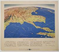
1944200808Remington Rand. 1944. Five printed colour maps each: 31.4 x 47 cms; 46.3 x 53.3 cms sheet central fold marginal edge wear chips and a few small edge tears tidemark affecting the ocean at the outer edge of Map VII but all the maps in very good condition. From a series of World War II battlefront maps "for the delight of arm-chair strategists" published by the Library Bureau of Remington Rand seven were published. Taken from a bird's eye view of the globe and with relief artistically rendered by artist Kenneth Thompson 1907-1996 and descriptive text by George Fielding Eliot 1894-1971. Eliot spent his youth in Australia attending Melbourne University serving with distinction in the Australian Infantry in WWI. Moving to the United States after a short stint in Canada serving with the RCMP her served as a reserve officer in the U.S. Army reserve in military intelligence from 1922 to 1933 and during WWII Eliot famously broadcast the first extended television coverage following the attack on Pearl Harbor. He continued to write books and articles about military strategy and world politics into the 1960s. <br> <br>In keeping with the "aviation-age" cartography of Richard Edes Harrison the unusual perspective of the maps--from above and often with a direction other than north at the top of the map--challenges the viewer to reconsider the geopolitical situation with the text of Eliot as a further prompt his captions below: <br> <br>Map III Italy & South France "Hannibal Caesar and Napoleon made their reputations here" <br>Map IV The Western Front "Will the cockpit of 1918 see the decisive battles of 1944" <br>Map V Southeastern Asia "The road to Mandalay -- and to China --along which bombs for Tokyo must travel" <br>Map VI The Southwest Pacific "Island-hopping toward Japan -- in short and long hops" <br>Map V11 The North Pacific "Here the enemy trusts in the protection of vast ocean distances" . Remington Rand. unknown
18739509Paris 1873. French naval chart sheet 3273 sheet size 105.5 x 72 cm engraved by Nyon black and white centrefold one or two marginal nicks and tears blank verso. This detailed chart of Grenada was derived from British Admiralty surveys. Map unknown
18739508Paris 1873. French naval chart sheet 3256 sheet size 72.5 x 105 cm engraved by Delamare black and white with coastal profiles in the lower part of the chart centrefold one or two marginal nicks and tears blank verso. This detailed chart of Isla Culebra now an island-municipality of Puerto Rico was derived from British Admiralty surveys. With no permmanent population for centuries the island was settled by the Spanish in the 1880s and ceded to the United States after the Spanish-American War. Map unknown
1030X61IJR6Hardcover. Very Good. SIGNED by the topographer Col. Graham and apparently amended by him or someone with same contemporary hand. Please see our pics. Senate Document 121; 1852; Hardcover; Very Good; Original brown cloth with title "Report of Col. Graham Mexican Boundary in gilt on front. " 250 pages plus the 2 maps and the barometric report. Text is lightly foxed throughout but completely readable fascinating content. Folding maps & report very good faintly foxed small closed tears as pictured. Well-bound and subtly ex-library. hardcover
1859H4454Dublin: Mark Allen 1859. Hardcover. Very Good. Published 1859 the map in 20 panels backed with linen measures 39.75 x 29.5 inches 100.5 x 75 cm hand colored in outline in very good condition small gray spot to blank area lower left in original cloth binding with printed label to front cover light wear and soil to binding. The accompanying pamphlet 31 pp. green wraps very good some of the stitching along spine coming loose. Both map and pamphlet signed Francis L. Casey RCV Cork. Uncommon. Mark Allen hardcover
19501749Vichy France: Société des Cartes Folkloriques de France 1950. Wraps. Near fine. R. MARGOTTON. FRENCH LANGUAGE POSTCARDS FASHION / TRADITIONAL DRESS. R. MARGOTTON illustrator. <br /> 6 1/8" x 4 1/8" ; 84 cards numbered; half-bound tweed cloth folder with ties marbled paper over board color paper label to front folder; 3 black cloth folder ties; hand-colored wood-engraved cards verso is a divided back postcard with labeling and numbering within the series and four printed lines on which to write an address; light age-toning of edges; near fine. OCLC locates 3 copies all in the U.S. The art on the post cards is signed R. Margotton and it is possible this was Rene Margotton 1915-2009 although by the early 1950s he was a major French painter and one of the cubists from the early part of the 20th century. The laid-in form in the rear pocket is a listing of the cards by area. Société des Cartes Folkloriques de France unknown
19942092902137201060Taipei Nantian Book Office 1994. Soft Cover. Fine. Number of books: 2 Taipei Nantian Book Office paperback
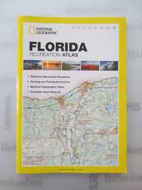
20122412P-48999A-1308CNational Geographic Maps 2012-10-01. paperback. Very Good. 9x0x15. This Book is in Very Good condition. See our picture for exact item you will receive. All items ship within 24 hours. Packaging is 100% Recyclable. Most items purchased from Charitable organizations. A portion of each sale is also donated to a monthly charity check your package for this month's charity. Reuse-Recycle-Rebook! National Geographic Maps paperback
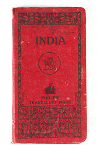
121332London Geoge Philip & Son Ltd. N.d. c. 1920 . Folding colour printed map laid on linen and housed within a red cloth case worn. Some small splits at the folds size when open: 67.5 cm x 54 cm.<br /> <br /> London, Geoge Philip & Son Ltd. N.d. c. 1920 hardcover
191363117New York: C.S. Hammond & Co. Schum Bros. Stationers and Printers 1913. 12mo. 3.5 x 7.5 double-sided colour lithograph map which folds out to 25.25 x 16.5 in. on 28 x 17.75 in. sheet very light dustsoiling slight shelfwear very slight age toning along the folds. Original printed gray-blue pocket portfolio folder blue lettering on recto & verso added affixed label of Schum Bros. over imprint minor age toning still a VG bright clean map. First edition thus of this very scarce Brass Era automobile travel map depicting Manhattan and portions of Long Island from Brooklyn across to Smithtown and Great River. Verso Map includes Long Island fro Great River up to Darlington across to Truman Beach and Bridgehampton with two inset maps: “Contination of North Shore†and “Continuation of South Shore†with “Good Roads†and “Fair Roads†differentiated as well as depiction of the Long Island Railway line and red dots tracing the electric interurban lines. As early as 1906 Hammond & Co. had produced a map for Good Roads enthusiasts and motorists but this updated issue documenting the improved roads was issued in 1913 and then regularly from 1914-1925. No copies in Worldcat. C.S. Hammond & Co., Schum Bros., Stationers and Printers, unknown
2012SONG1597755206National Geographic Maps 2012-05-31. 2012. paperback. Used: Good. 10.50x0.25x14.75. Buy with confidence. Excellent Customer Service & Return policy. National Geographic Maps paperback
1945194660New York.: Army Information Branch. Volume III No. 51F. 9 April1945. Folding colour map and six inset maps in a vertical panel 88 x 119 cms sheet and on the recto circular map of Europe smaller inset map of Asia and of the Ryukyu Islands descriptive text original folds in very good bright condition. Scarce Newsmap of "China Southeast Coast" from Shanghai to French Indochina with the islands of Formosa and Hainan. At the right edge are inset maps of the vicinities of Shanghai Wenchow Foochow Swatow Canton and Hong Kong. On the verso is a large map of the European theatre of operations centred on Berlin a map of the Pacific area noting the American occupation of Okinawa with a detailed map of this island. In unusually fine bright condition. . Army Information Branch. unknown
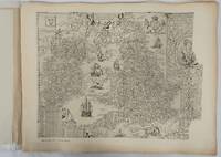
1932176499London.: Royal Geographical Society. 1932. Twenty one loose maps with tissue guards printed on sheets 49.5 x 63.5 cm in the original folio title-wrappers the maps with some edge wear and toning but on the whole in very good condition the wrappers browned and stained torn with minor loss at the foot of the title wrapper small closed edge tears now re-enforced with archival material and sound. Lacking the introductory notes by Edward Heawood. The complete suite of maps: an impressive production. The first map is a general map of England and Ireland by an unknown author 1594; nineteen county maps; and a final sheet of miniature county maps printed as a deck of playing-cards. The county maps proper vary in date from Saxton's “Southamtonia” of 1575 to John Speed's version of Norden's map of Sussex dated 1610. A contemporary reviewer dubbed it " a rich cartographical feast" allowing easy access to rare and valuable maps and comparison of maps by different cartographers for the same county. <br>The county maps reproduced include five by Christopher Saxton three by John Norden Philip Symonson's map of Eastern Kent published in 1596 a series of seven maps dating from the early years of the seventeenth century two maps prepared for Camden and two published by John Speed. . Royal Geographical Society unknown
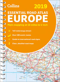
DADAX0008313482Collins 2019-03-01. spiral_bound. New. 0.30x8.20x11.60. Buy with confidence. Excellent Customer Service & Return policy. Collins unknown
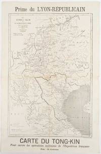
1883180621Lyon.: Lyon-Républicain. circa1883. Engraved map 40.5 x 27.5; 48.9 x 31.8 cm sheet original folds some browning to the fold and margins two small holes at the central fold without significant loss in good condition. Map issued as a supplement to "Le Lyon-Republicain" one of the great radical daily newspapers in Lyon. The map is after documents by French explorer and trader Jean Dupuis 1829-1912 who had explored regions along the Red River in the hopes of establishing trade routes within Vietnam and China and variously published. This supplement was issued on the eve of the Tonkin War in 1883 so that readers could follow the military movements of the French Expeditionary Force. It shows northern Vietnam and into south-western China with provinces marked and river systems in detail. . Lyon-Républicain. unknown
200749413Washington D. C.: Dumbarton Oaks Research Library and Collection 2007. Good to near fine condition. Quarto. li 394 xv 290 plates 3 folding maps in envelope on inside back cover. Original textured blue cloth with gilt lettering on covers and spines in photo-illustrated dustjackets brown lettering on spine. Frontispiece maps.<br /> <br /> The Pontos and its Empire of Trebizond 1204-1461 embraced the distinctive Black Sea coastlands mountains and pastures of northeastern Anatolia. "The purpose of this Study is twofold. First it is an essay in placing the material remains of the medieval peoples of a distinct region of Anatolia the Pontos in their historical and geographical setting. Second it is a record – all too often of what can no longer be recorded. In the two decades since Anthony Bryer A.A.M.B. and David Winfield D.C.W. first met in the east porch of the Hagia Sophia Trebizond on 19 August 1959 the Pontos has suffered a greater physical transformation than in its entire previous history." Preface. <br /> <br /> Illustrated with some five hundred b/w photographs on 290 plates three folding maps two in two colors and in-text drawings maps plans and tables. Contains list of figures abbreviations and an extensive bibliography at front appendix with measurements and indices at rear. Dustjackets with light creasing at top and bottom edges light creasing hear and small closed tear at top left of volume two. Interiors in near fine condition. Dumbarton Oaks Research Library and Collection unknown
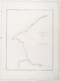
1796209283London.: George Nicol. 1796. Engraved copperplate map on Whatman paper 43.8 x 33.6 cm; 57 x 42 cm sheet including plate markscale in nautical and English miles; light undulation to sheet marginal toning and edgewear but in very good condition. Finely engraved and detailed map of two routes to Pekin Beijing along the White River Baihe from the Gulf of Petcheli and along the Imperial Highway from Jehol and includes commentary locating palaces and gardens type of cultivation "many barges" and "the road shaded by willow trees". The map elegantly drawn by Henry William Parish was published in George Staunton's account of Earl Macartney's embassy to China 1792-1794. . George Nicol. unknown