No AuthorBiblio.com

1 660 résultats
18705388<p>Gall & Inglis' 1870's-1880's. Paperback. Very good. VGC.Gall & Inglis'.No date given but probably 1870's to 1880's prior to London Tower Bridge build which is not included on the map.Green hardbacksmall dentsnicks and light shelf wear on the cover with folded map in VGC.The map is in VGC but with small stain marks and foxing marks on the edgessmall tear on the edge of the map.The map is hand coloured and includes:RailwaysRailway StationsSteamer RoutesOmnibus and Tramway RoutesParks.The size of the map is: 30x20 inch.The scale of the map is: 3 3/4 to 1 mile.The map covers: From Hyde Parkincluding parts of Kensington Palace to Blackwall and from Mildmay Park to South Lambeth.The map is in VGC for its age. A collectable and scarce map.</p> Gall & Inglis' paperback
GOR006768433Paperback. Very Good. paperback
1862H4452Edinburgh and London: Gall & Inglis 1862. Hardcover. Very Good. Ca. 1862 folded backed in original linen housed in original cloth folder with green printed title label to cover the map measures 26.75 x 22 inches; 67.5 x 56 cm and is in excellent condition with vivid coloring. No date on map or binding but we found an advertisement for this map in another Cruchley production dated 1862 and it feels right. RARE with no copies in OCLC to our knowledge. Gall & Inglis hardcover
197941930Warszawa Warsaw: Pan´stw. Wydawn. Naukowe 1979. Pamphlet. 1st Edition. Original Cloth in dustjacket 8vo 678 2 pages 36 unnumbered leaves of plates with 164 illustrations. 25 cm. In Polish. Title translates to “Nazi camps in Poland 1939 - 1945. An Encyclopaedic Reference Book.†ISBN: 8301000651. <br> A massive encyclopedic record of Nazi camps prisons and ghettos in Poland based on extensive source material in Polish and foreign archives and research carried out by the General Commission for the Investigation of Nazi Crimes in Poland. The 5877 entries pages 87-601 are arranged in alphabetical order of location providing data on the period of existence character of and fundamental information about each site. Pages 11-86 comprise an introduction by Czeslaw Pilichowski "Hitlerowskie obozy i os´rodki przymusowego odosobnienia oraz ich rola w realizacji programu ludobo´jstwa i zaglady narodu polskiego" "Nazi Camps and Forced Detention Centers and Their Role in Implementing the Program of Genocide and Extermination of the Polish Nation". Includes a bibliography and indexes and summaries in Russian English French and German p. 657-676. The last 73 pages contain photographs. <br> SUBJECTS: World War 1939-1945 -- Prisoners and prisons German. -- Concentration camps -- Poland. Guerre mondiale 1939-1945 -- Prisonniers et prisons des Allemands. -- Camps d'internement -- Pologne. Obozy koncentracyjne -- Polska -- 1900-1945. OCLC: 5709074. <br> Top corners bumped some tears to dust jacket otherwise Very Good Condition in Very Good Dustjacket. Important Work. BK5 holo2-147-20. Warszawa (Warsaw): Pan´stw. Wydawn. Naukowe unknown
18819118Algiers: Adolphe Jourdan Libraire-Editeur 1881. First edition. 22x14cm vi 70 2. Large folding map "Carte du Sahara Central par M. Camille Sabatier" and table of contents at rear. Stitched in gray laid paper wraps. Single pencil annotation on pg. 47 else clean internally and nearly fine. <br /> <br /> Scarce French Algerian text by Camille Sabatier 1851-1919 lawyer and politician who wrote extensively on the geography and politics of the Sahara region. Sabatier was French deputy in Algeria from 1885-1889. He was a member of the geographical societies of Oran and Algiers and prepared the map in this text with the assistance of French cartographer Justin Pouyanne.<br /> <br /> The work focuses on the local tribes of the Sahara region including Hamyan Trafi Laghouati Chambaa Ait-Atta Arib and Doui-Menia their interactions religions etc. The text also details trade routes geography and climate of the region arguing the ignorance of seeing the Sahara as just "a sea of sands" leads to political surprise and disaster. <br /> <br /> OCLC cites 6 holdings 4 of them in France. <br /> <br /> <br /> . Adolphe Jourdan, Libraire-Editeur unknown
1957112925Thomas Nelson & Sons 1957. hardcover. Very Good. 0x0x0. Color Maps. Slender large format hardcover in lightly shelf worn jacket now under mylar. Tight and unmarked. Oversized and overweight Please email for photos. Thomas Nelson & Sons hardcover
197388204Austin: University of Texas Press 1973. First Edition. Two quarto volumes 29.5cm. Part I in green cloth-covered boards; dustjacket; xvi34-1542pp; black-and-white photographic halftone illustrations throughout. Part II spiral-bound in green cloth; 147 numbered illustrations with printed acetate overlays; rear cover has attached folder with three large folding maps the largest "Map 3" measuring 190cm x120cm. Modest shelf-wear with light rubbing to board edges; light wear to dustwrapper text and contents uniformly clean and unmarked; Very Good to Near Fine. From the library of poet-translator-anthropologist Nathaniel Tarn with his printed bookplates to both volumes. <br /> <br /> Volume I complete in itself presents the most detailed site map ever completed of the great Mexican city of Teotihuacán. Further volumes in the series on ceramics and mortuary practices were added later. <br /> 88204. University of Texas Press unknown
1597755206-7-1-13National Geographic Maps. 2012. Acceptable. The item might be beaten up but readable. May contain markings or highlighting as well as stains bent corners or any other major defect but the text is not obscured in any way. National Geographic Maps unknown
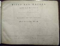
51860Leipzig Georg Joachim Göschen 1830. . Verlags-Bibliographie Göschen 1785-1838 Nr. 1027. Vgl. Studien zur Verlagsgeschichte u. zur Verlegertypologie der Goethezeit S. 190. - Einband stark beschabt Textteil gebräunt/stockfl.; erste Karte gebräunt sonst nur gelegentlich stockfleckig im weißen Kartenrand. - Allgemeine Übersicht. Topographie der vorzüglichsten Orte von A-Z. Grenzkolorierte Karten von Königreiche ENGLAND SCHOTTLAND u. IRLAND; Gibraltar Malta Helgoland Ionien; die Kolonien: Britisch-Ostindien Kap-Kolonie Westindien afrikanische Westküste Goldküste Guinea Mauritius St. Helena Nordamerika Hopparo Britisch-Guyana Australien. - Der königlich sächsische Kammerrat W. E. A. v. Schlieben 1781-1839 Statistiker u. Oberlandfeldmesser war Mitbegründer des Statischen Vereins in Sachsen 1831-1850 u. Leiter des Zentralkomitees des Vereins. Leipzig, Georg Joachim Göschen, 1830. unknown
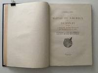
195920489AB1959. Madrid 1959 36 : 26 cm. 129 pages 1 leaf with facsimiles of maps some folded and titles. Original half calftwo back lables. One of 500 numbered copies on special paper. The illustrations are made in Photogravure a high-quality engraving technique that uses light to transfer a photographic image onto a plate traditionally copper but now often photopolymer to create deep reliefs that reproduce soft tones and fine details when printed on paper. It is ideal for artistic reproductions and precision applications on various materials combining craftsmanship with digital technology. unknown
1597755567-7-1National Geographic Maps. 2013. Acceptable. The item might be beaten up but readable. May contain markings or highlighting as well as stains bent corners or any other major defect but the text is not obscured in any way. National Geographic Maps unknown
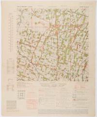
1945200411Washington D.C.: Army Map Service. First edition - revised AMS4. 1945. Army survey map printed in colour 36.7 x 36.7 cm; 58 x 48 cm sheet conversion graph glossary and administrative index to the inner margin; scale three column legend index to adjoining sheets and notes re grid references and mean declination to the foot; sheet toned a very few edge tears the map in very good condition. Wartime map produced by the US Army Map Service AMS who formed in 1942 and were at the forefront of military mapping campaigns during WWII and the post-war years. The very detailed map shows residency and administrative boundaries transportation ground and water features vegetation cultivation ruins religious sites "Graves; Chinese native" and "Cemetery; heathen Christian" walls hedges populated places built-up areas and buildings with those of iron stone wood and bamboo differentiated by colour; fishponds plantations and much more. . Army Map Service. unknown
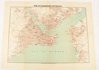
1925174961Constantinople.: The Anglo-American Book & Newsagency. 1925. Printed folding colour map 36 x 49.2 cm street grids for Stambul Pera Galata and Skutari railways and landing places marked small fold splits affecting the margins only now repaired with archival material two small holes at central folds pin-holes to the four corner some age-toning but in very good condition. A scarce map of the historic peninsula soon after the Republic of Turkey was founded and the capital moved to Ankara. Printed for the tourist market this map is a rare survival. . The Anglo-American Book & Newsagency. unknown
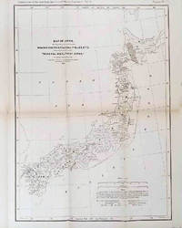
1878210211Philadelphia.: American Institute of Mining Engineers. Sherman & Co. printers. 1878. Large folding map of Japan showing "some of the more important Mining Districts Coal Fields etc." small fold split without loss tables 67pp. Covers a little scuffed and discoloured overall in very good condition. Scarce offprint separately paginated of a paper included in Volume V of the Transactions of the American Institute of Mining Engineers. The author Henry S. Munroe had been retained by the Japanese Government as Assistant Geologist and Mining Engineer with the Geological Survey of Yesso for the Hokkaidō Colonization Agency. His work laid the foundations for the future coal mining industry in Hokkaido. The report contains two lengthy tables relating to coal production and quality. . American Institute of Mining Engineers. Sherman & Co., printers. unknown
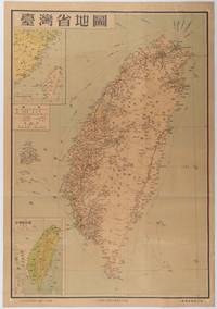
1954215869地圖出版社. Reprint. 1954. Colour folding map of Taiwan showing all major cities towns and villages railways highways roads rivers and sea routes. Topographical inset map at lower left Taiwan Straits with mainland coast inset map at top left. Each map has its own scale. Text in traditional Chinese characters. Washi repairs along some folds on reverse pin marks at corners evenly browned and a little faded. A nice map of Taiwan in fair condition. 77 x 53.8cm. . 地圖出版社. unknown
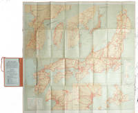
1927215711Tokyo.: Japanese Government Railways. Circa1927. Large folding colour map 78.5 x 80 cm of Japan and Korea 6 inset maps one of which shows Taiwan scale 1:1640000 for Hondo Shikoku and Kyushu 1:2340000 for Chosen; tipped into the original orange cloth covered case with orange ties text in 31 panels on the verso one a little age-toned a few very small fold splits without loss a very good copy. Attractive tourist map for the English-speaking traveller issued by the Japanese Government Railways with extensive notes for tours and points of interest on the verso short descriptions of cities and sites to visit principal theatres with suggestions for cafes restaurants and department stores. . Japanese Government Railways. hardcover
184463111London: J.&C. Walker 9 Castle Street Published by Longman & Co. ca. 1844. 16mo. 3.5 x 5 in. folding out to 13.25 x 16.5 in. dissected 15-panel hand-coloured steel-engraved map linen-backed w/ 3 leaf folding population and mileage distance chart from Dublin by County mounted on front pastedown. Dark gray-green publisher’s cloth portfolio pocket binding decorative borders in blind gilt lettering stamped on front cover a NF copy. First edition thus of this very scarce dissected pocket map of Ireland published against the backdrop of the full impact of the Great Potato Famine which from 1841-1851 resulted in the diaspora and death of nearly 30% of the Irish population and as reflected in the mileage table mounted with the map the population in 1845 had already dropped from 8.2 million in 1841 to 7.7 million by 1844 and it would plummet further to below 6.5 million by 1851. The bulk of these emigrated to the United States Canada and the United Kingdom resulting in the fact that Ireland’s current population still resides below the high of 1841 and nearly 38 million Irish-Americans claim descent from the successive waves of migration much of which channeled through New York’s Lower East Side and the Bowery in the 19th-Century. John Walker 1787-1873 was a British mapmaker engraver lithographer hydrographer draughtsman and publisher publishing nautical charts and geographical maps with his brothers Charles and Alexander in their firm J.&C. Walker located at 9 Castle Street Holborn from 1841-1847 and moving to 37 Castle St. in 1848 where they remained to 1875. Much of their work was published under the auspices of the Society for the Diffusion of Useful Knowledge or S.D.U.K. Worldcat locates 1 copy Yale. J.&C. Walker, 9 Castle Street, Published by Longman & Co., hardcover
S17M-01576Horton Family Maps. Used - Good. Good condition. A copy that has been read but remains intact. May contain markings such as bookplates stamps limited notes and highlighting or a few light stains. Horton Family Maps unknown
BN92838Veiatlas Norge: Veikart = road maps = Strassenkarten 1:300 000 : bykart = city maps = Stadtplane 1:20 000 Norwegian Edition Unknown Binding <br/><br/>Veiatlas Norge: Veikart = road maps = Strassenkarten 1:300 000 : bykart = city maps = Stadtplane 1:20 000 Norwegian Edition Unknown Binding Veiatlas Norge: Veikart = road maps = Strassenkarten 1:300 000 : bykart = city maps = Stadtplane 1:20 000 Norwegian Edition Unknown Binding unknown
1937049296New York: The Derrydale Press 1937. One of 950 copies of the regular edition 1937. Well illustrated throughout in both color and in black and white. Hefty volume in green cloth lettered and decorated in gilt top edge gilt illustrated endpapers 193 pages plus plates folding map book 12.5 inches tall. Very good with very modest edge rubbing a little more rubbing to the spine ends a slightly dulled but readily legible spine good hinges sound text block clean pages with some very light foxing to the upper margins of a few pages personal bookplate on preliminary blank no other names or markings. Map appears to have never been unfolded. . First Limited Edition. Hard Cover. Very Good. Folio - 12" - 15" Tall. The Derrydale Press Hardcover
191176478New York: Automobile Club of America 1911. First edition Tall octavo. 876 pp. plus 48 leaves of maps one folding. Original flexible calf with two-brad binding gilt cover lettering yellow endpapers. Leather with some professional restoration. Text complete and clean. OCLC only records 3 copies all east of the Mississippi.The very first coast-to-coast automobile guidebook was published in 1901 The Official Automobile Blue Book. One usually finds these early automobile road guides devoted to specific parts of the country New England West Coast etc. but this one covers the entire nation. In this guidebook the routes given for the West comprise the smallest section of the book. 1911 was before the official opening of all of the major early automobiles routes: The Lincoln Highway planned in 1912 officially opened in 1913; The National Old Trails Road 1912; The Yellowstone Trail 1912; Pacific Coast Highway began in 1913. Automobile Club of America hardcover
19392092902141000906Tokyo Mikuraku 1939. Soft Cover. Fine. The book is in fine condition. Tokyo Mikuraku paperback
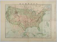
1911179415Tokyo.: 楠山正雄. Kusuyama Masao. Meiji 44 1911. Colour folding map 40 x 55cm inset maps showing the Philippines Alaska and Hawaii very good copy. This map was a supplement of October 1911 issue of a monthly magazine Shin Nippon 新日本 which was published between 1911 and 1918. The main map covers the contiguous United States with inset maps of the world showing the American territories of Alaska Hawaii and the Philippines. Curiously Cuba has been marked as an American territory having been directly occupied from 1906 to 1909 though at the time still beholden to the 1903 Cuban-American Treaty of Relations. . 楠山正雄. [Kusuyama Masao]. unknown
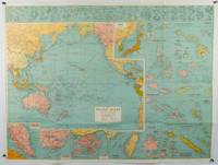
1945180206Sydney.: H.E.C. Robinson. Circa1945. Full colour inset maps principal cities and towns marked shipping routes international boundaries and railways. 99 x 73cm. Some small insect damage has been repaired on the verso visible on map as a few small lighter areas in the western Pacific. Pinpoint holes at folds paper repair along cover but a very good clean copy. From the Sydney publisher H.E.C. Robinson the firm founded in 1895 by Herbert Robinson 1857-1933 a founder of the Royal Geographical Society of Australasia. <br> <br>Although the map is undated North and South Korea are shown as divided which occurred in late 1945 and Manchuria is marked as still under Soviet occupation which only lasted until 1946 at which point it was handed over to Communist China. <br> <br>As well as what now would be considered Southeast Asia the main map shows the eastern half of India Tibet and parts of Mongolia the USSR and East Asia. Inset maps include: Caroline Islands Marshall Islands Federation of Malaya Singapore Hong Kong Taiwan Japan Hawaiian Islands Philippine Islands Midway Gaum and Wake Islands Fiji Islands Eastern & Western Samoa Santa Cruz and Solomon Islands New Caledonia Rabaul Tahiti Lord Howe etc. . H.E.C. Robinson. unknown
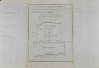
1749136794Paris. circa1749. Black and white engraved plan map of Peking on laid paper folded designed by the prominent French cartographer Jacques-Nicolas Bellin. This map is No. 18 Vol. 5 from the impressive 15-volume "Histoire Generale des Voyages" compiled by French novelist Antoine François Prévost. This city map shows two areas of walled cities: Ville Tartare Imperial city and the Forbidden City and Ville Chinoise ethnic Han residential area. <br> <br>Notes A and B represents buildings within the Forbidden City. A: Lieu de Plaisance ou l'on voit une Montagne faite a la main B: Grandes Cours du Palais de l'Empereur. Two missionary buildings French and Portuguese as well as the Tower of Mathematics illustrated within Ville Tartare. Two temples illustrated side by side near the south gate of the Ville Chinoise. <br> <br>Overall in good condition very light browning on edges and darker toning along the borders of the map. Text in French. Map measures 21 x 16.4cm. . unknown