1 660 résultats
19521204090009Government Printing Office 1952. Hardcover. Very Good. xiii 875 p.; 26 cm. Blue cloth. Good binding and cover. Shelf wear. Clean unmarked pages. Government Printing Office hardcover
20082401030033Philip's 2008-10-06. Hardcover. Very Good. 12x2x17. Bound in publisher's cloth. Hardcover. Lacking slip case. Good binding and cover. Shelf wear. Corner chipped. Clean unmarked pages. 584 pages : illustrations chiefly color chiefly color maps ; 39 cm. <br> Includes maps of each state in the USA and large-scale maps of Britain and Ireland; Canada; Mexico; Scandinavia; Israel Lebanon and Jordan; Central Asia; Korea; Taiwan; Australia; New Zealand; and the islands of the Caribbean Indian Ocean and Pacific. This title includes a set of five ocean floor maps and maps of Moon and the night sky. <br> This is an oversized or heavy book which requires additional postage for international delivery outside the US. Philip's hardcover
14486Without date or place. London Fire Force circa 1943. On one side of piece of 41 x 20.5 cm paper with lines and indications in light and dark blue red and green. In fair condition on aged paper with creasing and one closed tear towards the head. The map has Trafalgar Square at its head with the note that the two 'Basins' carry '40000 Galls. each' and Parliament Square at its foot. Whitehall and Parliament Street connect the two on the right of the map and to the left of the map is the lake in St James's Park: '200000 Galls Underground Tank Pumping Station 1400 Galls Pump 15 foot Gravity Main from Serpentine'. Also marked on the map are 'Inlet connections for L.F.F. Pumps and Pits' '6 Signle Outlet Suction Hydrants Round Thread' and 'Two 6 foot Steel Pipes in Subway Also under Embankment in Subway'. Down the centre of the map are the government buildings: the Admiralty Treasury Downing Street Foreign and Colonial Offices India Office and Home Office Office of Works Board of Education Board of Trade and Ministry of Health. No other copy found listed.Image on application. Without date or place. (London Fire Force, circa 1943.) unknown
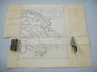
18738669Paris 1873. French naval chart sheet 3245 sheet size 51 x 36 cm engraved by Régnier after a British Admiralty chart of 1871 black and white blank verso. Akkeshi Bay located in Kushiro Subprefecture on the east coast of Hokkaido the most northerly of the main islands of Japan. Map unknown
1994Q-0719550173John Murray 1994-01-01. Hardcover. New. In shrink wrap. Looks like an interesting title! John Murray hardcover
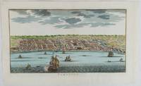
1750177186circa1750. Hand-coloured engraving 19.5 x 35.6 cm 25.5 x 41.6 cm sheet original folds two old paper repairs not affecting the image a trifle toned but in very good condition Attractive bird's-eye view town plan of Makassar in Sulawesi prepared for Abbé Prevost's monumental 'Histoire Générale des Voyages.' . unknown
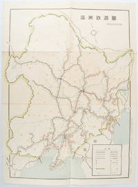
1519172590奉天. Mukuden.: 満鉄鉄道総局. Mantetsu Tetsudo Sokyoku. 昭和 15 1940. Colour folded map seven small very holes not affecting the printed image otherwise good. 53 x 38.5cm Map showing the comprehensive railway network in Manchuria with names of all the stations. It includes the lines run by the South Manchurian Railway Company their temporary industrial lines light rail as well as the lines run by other Russian and Chinese companies. By 1940 the network had expanded so much that it included almost the whole of Manchuria. . 満鉄鉄道総局. [Mantetsu Tetsudo Sokyoku]. unknown
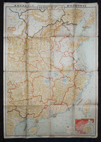
1938159295Tokyo: 大日本雄辯會講談社 Dainihon Yūbenkai Kōdansha. Shōwa 13. 1938. Two large detailed maps of China and on the reverse of the Soviet Union in Asia Manchuria and Mongolia printed double sided on a single large sheet. Issued as a supplement to Volume 14 Number 1 of the magazine Kingu on New Year's Day in 1938. <br> <br>Holes at a number of holes causing a small amount of loss some occasional browning some chipping on margins. The map has clearly been used but is still largely complete. The colourful map of China on a scale of 1:2600000 includes part of Manchukuo and Inner and Outer Mongolia on the north and part of French Indochina to the south-west. It shows East Hebei Autonomous Anti- Communist Council Jidong Fanggong Zizhi Zhengfu 冀東防共自治政府 south of Manchukuo which existed from late 1935 until February the 1st1938. The legend includes national and provincial borders cities roads railways sea and air routes and undersea cables. There is an inset map of East Asia titled "Present Situation of Far East" on the lower right corner which shows the areas under influence of Communism and those under influence of/controlled or colonised by the United Kingdom France Japan and China. <br> <br>The map on the reverse printed in blue and black shows the Asian section of the Soviet Union Manchuria and Mongolia on a scale of 1:3000000. There is an inset map of Asia titled "Asian Continent" at the upper left corner the area enclosed by a rectangle which indicates the area covered in this map. The legend includes cities railways roads national borders district borders province borders and air routes. . 大日本雄辯會講談社 [Dainihon Yūbenkai Kōdansha]. unknown
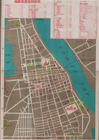
1960217495國家旅行社. National Travel Company. Circa1960s. Folding tourist brochure of Phnom Penh and environs in total 64.5 x 49.8cm 15 panels folded size 21.5 x 9.8cm. Two maps one of the city of Phnom Penh with street names in Khmer transliterated into Latin script 43 x 30cm. On reverse a coloured topographical map of southen Cambodia showing border with Vietnam 20 x 28.5cm. Numerous black and white photographic illustrations to accompany information on flights trains tourist entry requirements sights of interest to tourists. All information in traditional Chinese characters. Slight browning on one panel and two small holes mended with washi paper else in very good condition. Of particular interest in the visitor information is a description of an area about 150 km from the city of Phnom Penh which tourists can visit to take photographs of or hunt wild animals as long as they bring their own rifles. . 國家旅行社. National Travel Company. unknown
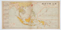
1572160545No place of publication.: 朝日新聞社. The Asahi Shimbun. 昭和十五1940. Published by 朝日新聞社 The Asahi Shimbun Japanese folding coloured WWII map with a calendar from January to June Shōwa 15 at the left scale 1:300000. Map includes French Indochina Dutch East Indies and parts of the territory of Papua China and British India. Some light browning and foxing otherwise very good. Text in Japanese. 25.3 x 51cm. Legend at lower left lists the boundaries between continents countries and provincials or regions railways airline routes capitals and Japanese embassies and consulates. <br> <br>The natural resources are indicated across the map. The map also shows parts of the territory of Papua under Australia's administration " 濠洲委任統治領 Gōshū inin tōchiryō". . 朝日新聞社. [The Asahi Shimbun]. unknown
19552083002117401981Giho-sha 1955. Soft Cover. Fine. Volume: 1 Giho-sha paperback
1749136781Paris. circa1749. Black and white engraved map on laid paper showing entrance to Pearl/Canton river Macao and the area which would become Hong Kong Sinn-gan-hien folded designed by the prominent French cartographer Jacques-Nicolas Bellin. This map is No. 16 Vol. 5 from the impressive 15-volume "Histoire Generale des Voyages" compiled by French novelist Antoine François Prévost. The walled city of Canton upper section is divided into areas of Tartar and Chinese. <br> <br>Some light even browning on paper added at margins good copy. Map measures 25.7 x 20.5. . unknown
19702080502106505576Fukui Agata History Reprint Publishing Society 1970. Soft Cover. Fine. Number of books: 4 Fukui Agata History Reprint Publishing Society paperback
V00A-12754Hamburg-Bergedorf: Verlag Otto Heinevetter. Collectible - Good. Hamburg-Bergedorf: Verlag Otto Heinevetter 1982. Folio. Brown hardcover with gilt lettering on the front cover gilt top-edge. Facsimile of the 1652 publication. 40 full page maps. German edition. Near Very Good condition. Cover lightly scratched and soiled. The front and rear free endpapers have a large fold the front also showing light foxing. There is a short gifter's inscription to the front pastedown. Otherwise Very Good with light curling to a few lower corners. The title in English is "Schleswig-Holstein 1652. The maps by Johannes Mejer Husum from the new description of the two duchies of Schleswig and Holstein by Caspar Danckwerth D. 1652." books in German maps cartography Inquire if you need further information. NOT AVAILABLE FOR SHIPMENT OUTSIDE OF THE UNITED STATES. Hamburg-Bergedorf: Verlag Otto Heinevetter hardcover
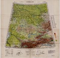
19425332Washington D.C.: Army Map Service U.S. Army 1942. Second Edition. Loose sheet. Very Good. Full color map measures 29 x 29 inches. With a list of authorities i.e. other maps consulted in the creation of this map. Glossary. Index to boundaries. Folds as issued and with light soiling. A bright copy. First published 1931 by the War Office this edition is labeled "For Use by War and Navy Department Agencies Only. Not for Sale or Distribution." A vital map published the year 1942 the Japanese invaded Burma and closed off the Allies main supply route the Burma Road. Having already controlled littoral China supplying inland Chinese forces and the Chinese population became increasingly fraught. The region covered extends westward to USSR southward to Northern India and eastward to Mongolia. From the collection of Asian books and maps formed by Albert Ravenholt. On verso Ravenholt has written "Central Asia as far as E. of Tihwa. Army Map Service U.S. Army unknown
1919061262New York: Frederick A. Stokes Co. 1919. Book. Near Fine. Hardcover. 1st Edition. 12mo - over 6¾" - 7¾" tall. Blue cloth spine panel lettered in orange color front and back cover pastedown illus. Text block edges typically somewhat tanned with minor loss along top edge/corner of cover pastedown otherwise only slight wear. Color illus. dust jacket shows area of loss along top front edge minor loss to corners several closed tears and rubbed joints/folds now in mylar. xii371 pp. illus. Frederick A. Stokes Co. Hardcover
BN330515Editions du BRGM. Carte géologique : Les côtes de France <br/><br/>Carte géologique : Les côtes de France Cartes BRGM Editions du BRGM unknown
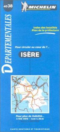
BN328198Michelin Editions des Voyages. Carte routière : Isère N°4038 <br/><br/>Carte routière : Isère N°4038 Cartes Michelin Michelin Editions des Voyages unknown
BN209964Good Vibrations- Verlag 2005. Motorrad Powerkarten - Nord- und Ostdeutschland - 8 Karten laminiert <br/><br/>Motorrad Powerkarten - Nord- und Ostdeutschland - 8 Karten laminiert Nabelt / maps and more Good Vibrations- Verlag, 2005 unknown
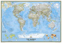
2012BN200358National Geographic Maps 2012. 2012. World Classic Enlarged & Tubed <br/><br/>World Classic Enlarged & Tubed National Geographic Maps National Geographic Maps unknown
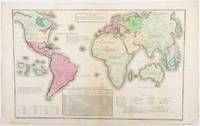
1835203763Philadelphia.: W. Marshall. Circa1835. Handcoloured engraved map 26.5 x 41.3 cms; 29.6 x 48.3 cms sheet central fold insets of "Oceanica" and "New Holland" central table some light staining in the image and margins in good condition. Eurocentrism laid bare. This 19th Century map includes a "State of Society" for each part of the world declared with a symbol to represent "Barbarous Half Civilized Civilized and Enlightened Societies" as well as noting religion and ethnicity. It includes a table of distances between chief towns or capitals and between these towns and Washington DC. Australia "New Holland" is styled principally as pagan barbarous unexplored and African a thin sliver of what is now New South Wales and Victoria is labelled civilized European and Protestant. Scarce. . (W. Marshall). unknown
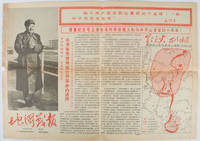
1967169746Beijing.: 地图戰報.Di tu zhan bao. September1967. Maps printed in red and black single sheet printed on both sides folded scale not given photographic image of Mao Zedong. Some light browning at edges with tears and losses on left edge still good. Text in Chinese. Sheet measures 26.5 x 38.4cm. Includes a map of Autumn Harvest Uprising and also shows the routes of the military advancing towards Jinggangshan between September and October 1927. On reverse left section a map shows the route along which Chairman Mao led the Fourth Army of the Chinese Red Army marching towards south of Anhui and Jiangxi Provinces in 1929. On reverse right section a map titled "The Long March of The Chinese Workers' and Peasants' Red Army October 1934-October 1935". Quotations of Chairman Mao about the Long March insert on corners of the map. <br> <br>Issue no. 6 of a series of maps with text issued by the Red Guards organisations in the form of Cultural Revolution tabloid-sized newspaper. This issue is designed to celebrate the 40th anniversary of the Autumn Harvest Uprising which was one of the earliest armed uprisings organised by the Chinese Communist Party. . 地图戰報.[Di tu zhan bao]. unknown
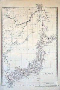
1852185246London.: Cassell Petter & Galpin. circa1852. Map with outline handcolour 42.5 x 30.1 cms; 49.2 x 34.3 cms sheet margins a little toned small corner crase but in very good condition. Very detailed map of the Japanese islands with Sakhalin above and the coast of Manchuria and Korea. . Cassell, Petter & Galpin. unknown
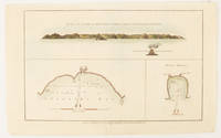
1784174896London.: Alexander Hogg at the King's Arms. circa1784. Engraved map in triptych on laid paper 20.1 x 32.7 cm three insets: cross section of the north side of Queen Charlotte's Islands Solomon Islands with detail of a volcano "6 leagues North"; Swallow's Bay Harbour; and Byron's Harbour early hand colour trimmed to the plate mark at the top edge neat sealed tear affecting the publisher's caption slight edge wear and paper toning but a most attractive map in very good condition. Attractive engraving of the Queen Charlotte's Islands Solomon Islands. The Islands were named for the consort of King George III by Philip Carteret the British naval officer and explorer who participated in two of the Royal Navy's circumnavigation expeditions in 1764–66 and 1766–69. His ship the Swallow gave her name to the Bay and Carteret's commanding officer on the first of his voyages John Byron to the Harbour depicted in this most attractive early chart. . Alexander Hogg at the King's Arms. unknown
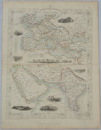
1850177525London.: The London Printing and Publishing Company. circa1850s. Lithographed map with original outline hand colour 33 x 24.5 cm including border and captions seven vignette illustrations two reference keys decorative border central fold light toning mainly at the central fold and to the verso of the sheet in very good condition preserved in a window mount. Attractive decorative map with fine vignettes of the London Post Office Suez Bombay Madras. Aden Malta Gibraltar and a wonderful camel train led by a carriage and horses crossing North Africa originally by the great mapmaker and publisher John Tallis. The two reference keys note steam packet routes railways electric telegraph and the Suez Canal. . The London Printing and Publishing Company. unknown