MENTELLE, E WITH CHANLAIRE, PG P GBiblio.com
1 660 résultats
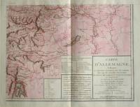
1805570721805. Copper engraving with handcolouring map shows the border of the Austrian Empire and Hungary Vienne sic and the Danube can be seen at the top of the map Two keys and scale inset. Few closed tears and some browning edges otherwise a clean and bright image. Map measures approximately 34 x 44cm. Map of Germany <br>indicating the present division of this empire as well as the new possessions of the princes who make up the Germanic body and including Batavia and Helvetia Switzerland with their divisions. by E. Mentelle a member of the institute and P. G. Chanlaire one of the authors of the National Atlas. An xiii 1805. Paris. There is a key to the explanation of the signs and an explanation of the colours used for the district of the various states contained in this map. . unknown
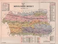
1935215892Lahore.: Government Printing. Revised Edition. 1935. Four folding colour maps xi 311 pages 26.5 x 18 cms; original papered boards spotted and a trifle scuffed linen backstrip with paper title label worn; foredges and endpapers spotted a few leaves toned but on the whole in very good condition the maps particularly bright and clean. A remarkable association copy: the author Frederick Blyth Wace's copy with his inked initials to the front free endpaper and his humorous unpublished foreword tipped in opposite the preface together with a dedication leaf both in Wace's hand and his business card loose within. As a further dedication makes clear this copy was given by Wace's son a couple of his loose notes on scrap paper are included the eminent botanist Nigel Morritt Wace 1929-2005 late head of the Australian National University's department of Biogeography and Geomorphology in 2003 to his fellow academic and marsupial biologist Dr. Hugh Tyndale-Biscoe. Both Wace and Biscoe were born in India and began their schooling in Kashmir at the school founded by Tyndale-Biscoe's father a Christian missionary and for whom the school is named. <br> <br>From the collection of Hugh Tyndale-Biscoe. . Government Printing. hardcover
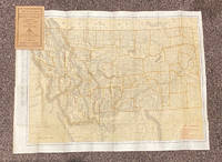
192020799Chicago & New York: Rand McNally & Co 1920. 12mo. 32 pp text; large color folding map 20 1/2" x 27 1/2"; printed on both sides. The front side shows railroads electric lines counties cities towns villages post offices lakes rivers etc. The verso shows the Montana automobile road map. Montana is home to two of the country's most beautiful and iconic National Parks - Yellowstone and Glacier. Printed stiff brown wrappers in fine condition; 3 short closed tears along lower edge of map. Rand McNally & Co unknown
GOR008024636Paperback. Good. paperback
2004mon0000832965Streetwise Maps 2004-03-01. Map. Good. 0.1300 in x 8.3000 in x 4.0400 in. Streetwise Maps unknown
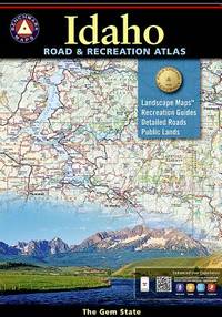
20159780929591063-2025National Geographic Maps 2015. Paperback. New. <p><strong>Author:</strong> National Geographic Maps</p><p><strong>Publisher:</strong> National Geographic Maps</p><p><strong>Binding:</strong> Paperback</p><p><strong>ISBN:</strong> 9780929591063</p><p><strong>Release Date:</strong> 2015</p><p><strong>Number Of Pages:</strong> 96</p><p><strong>Details:</strong> Idaho's boundless recreational opportunities and varied scenery is skillfully captured in Benchmark's Idaho Road and Recreation Atlas. Landscape Maps™ show the full range of topography: from the forest stands of the panhandle the mountainous backlands of central Idaho to the plains and prairies in the south. The Recreation Guide features complete fishing information hunting units and listings of campgrounds and RV parks.Map Scale = 1:250000</p> National Geographic Maps paperback
ANAIS-1597755222National Geographic Maps. paperback. Good. 9.5X6.5X1.5. Buy with confidence. Excellent Customer Service & Return policy. National Geographic Maps paperback
GOR015000109Paperback. Acceptable. paperback
GOR010781409Paperback. Very Good. paperback
183261842collection of 18 hand coloured folding maps including Derbyshire Devonshire Durham Essex Hampshire Kent Lancashire Leicestershire Norfolk Northamptonshire Northumberland Nottinghamshire Shropshire Somersetshire Staffordshire Suffolk Surrey & Sussex each are by Robert K. Dawson 1798‱861 - an English surveyor and cartographer. Plus reports from some of the counties reports signed L. B. Allen or J. G. S. Lefevre" hardcover
18738667Paris 1873. French naval chart sheet 3119 50 x33 cm black and white blank verso. Chart of the island of Montserrat in the British West Indies featuring coastal profiles dominated by the Soufrière Hills volcano and an inset of Plymouth the former capital of the island which was destroyed in the volcanic eruptions of the mid 1990s. Map unknown
18728668Paris 1872. French naval chart sheet 3068 sheet size 36 x 53 cm engraved by Régnier black and white blank verso. The anchorage at San Juan Bautista located on Cumberland Bay Robinson Crusoe Island; the main settlement in the Juan Fernández Islands off the coast of Chile. Map unknown
1840344261840. Lg. format. Green cloth. gilt. Bound maps numbered 1 - 110. Numbers not bound in: 92224314546606979109. 100 maps bound in. Plus 23 maps bound in rear from Lewis's Topographical Dictionary. 41 hand-coloured maps 59 plates hand-coloured Town Plans taken from the "View of the Representative History of England Samuel Lewis". A very nice copy. hardcover
1998109297Granta Books London. 1998. Granta Books London. 1998. Paperback. Illustrated. Covers slightly worn to extremities. Page edges foxed and pages browned o/w clean and sound. SCARCE. paperback
193856963Fresno CA: City Planning Commission 1938. Oblong folio. 13.5 x 9.25 in. 17 blueprint maps variously numbered. w/ first map as the Key Map for the remainders. Stapled at gutter margin w/ protective green-tinted back softcover folded to provide reinforcement at spine from the library of George Reed Volker 1925-2018 former World War II pilot and urban planner in California New York and Washington State. First editions of these exceedingly scarce land use district zoning maps drawn up in 1938 after the passage of the 1937 Housing Act which unfortunately upended much of the spending not only by the WPA but also required any federal money to spent in “blighted†areas. These detailed maps show major streets demarcate singe family housing multi-family housing manufacturing and commercial bases for the community. Eventually the Public Housing which was built in Fresno during World War II began in West Fresno or “Chinatown first with the Sequoia Courts and later the Sierra Plaza followed by others. No copies located in Worldcat; See: Bibliography of Research Projects Reports W.P.A. Technical Series Research and Records Projects Bibliography No. 1 Feb. 2 1940 p. 53 Zoning Ordinance. City Planning Commission, paperback
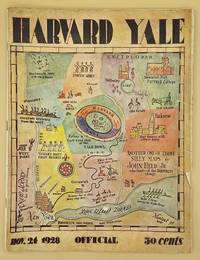
66643Yale University Athletic Association. Good. 160pp. Thin quarto 31 cm The front wrap is detached but present. The rear wrap is absent. Two small closed tears to the fore-edge of the front wrap. Scarce. Cover art by Utah artist John Held Jr.<br /> <br /> Utah Artist John Held Jr. 1889-1958 was a prominent illustrator of the 1920s and 1930s. He began by drawing sports and political drawings for The Salt Lake Tribune when he was just 16 years old. Held moved to New York City in 1910 where he went on to gain notoriety for his drawings in the popular magazines "Life" "The New Yorker" "Vanity Fair" "Judge" and "College Humor." His work epitomized the Jazz Age. He is most recognized for creating the short-haired "flapper."<br /> <br /> The cover of this publication features one of Held's maps. Held's maps illustrate the diversity of his art while at the same time serving to demonstrate Held's interpretation of various notable places and things. Kori Alexander writes in his article entitled Relevant Magic in the Art of John Held Jr. "While it was Held's caricatures of the young college chaps and flapper girls that earned him public notoriety it was his linoleum cuts and pen and ink maps that fortified his legitimacy as a social commentator." Virginia Commonwealth University website. Yale University Athletic Association unknown
194148041Minneapolis MN: Global Map Co. ca. 1941. Oblong folio 22.5 x 11.25 in. Two rotating wheels each showing hemisphere projection maps which are attached to a thick brown base w/ printed labels on front cover original rivets still present printed paper label and instructions on verso some rubbing & edgewear minor foxing & scuffing still a G exemplar. First edition of this fascinating and scarce global map which allows the user to view steamship or airline distance routes as well as the principal railroads. The global map was designed so that opposite halves of the earth’s surface could be rotated and synchronized enabling continuous and accurate spherical relationships across any point on the rotating maps. The label on the back lists the area in square miles and population totals of the world. The map is dated to around 1941 because of the inclusion of Vichy France the government allowed by the Nazi occupiers after the fall of France in 1940. Global Map Co., unknown
194164221Chicago IL: Greyhound Corp. 1941. Oblong atlas folio colour-illustrated pictorial map sized 30 x 20 in. fold creases as issued w/ site index specifically listed on the verso couple text illustrations of Greyhound bus minor age toning couple slight closed tears very minor shelfwear still VG copy. A charming pictorial map focused on natural and some manmade roadside attractions across the United States with Wagner’s pictorial caricatures ranging from the charming to politically incorrect especially for Native American depictions. Attractions range from Craters of the Moon in Idaho to Grasshopper Glacier near Cooke MT Old Faithful in Yellowstone National Park to the Great Salt Lake in Utah. Other depictions include the statue of Tom Sawyer and Huckleberry Finn in Hannibal MO Fort McHenry where Francis Scott Key penned the National Anthem and more. Greyhound Corp., unknown
194726905HUDDERSFIELD & District Woolen Export Group ENGLAND Printed at Curven Press. LONDON 1947 FRONT INNER BLANK DJ INNER FLAP HAS ORIGINAL PRICE OF 7S.6D.NET At Btm Corner. HBDJ Stated First Published 1947 on Copyright Page 1st Edition VG/GOOD- AS-IS SMALL Chip Front Btm Left of Dustjacket but Does not AFFECT TITLES Other Small Chips Tears Rub Wear Extremities DJ Interior Nice Tight Clean Light Wear Fox DJ Protected Clear Mylar 70 PGS Five maps by Macdonald Gill one folding and in colour. Original cloth woven in a colourful Freedman Salmon & Brown & White Decorated Endpapers Light Fox wear B/W Photographic Frontispiece at Night in Colne Valley of Lighted Factories & Tall Smokestacks with Illustrated B/W Drawings & Color foldout of a Map of Colne Valley Cloth District with 1946 in Corner ILLUSTRATIONS INCLUDE MARKETING CLOTH IN CHURCHYARD Huddersfield Parish Church 1671 Handthrown Shuttle of a 17th Century Loom Seen Thru Press by Sir Francis Meynell Devised & Supervised by William Haigh List of Illustrations in Color Dustjacket of Red & Green Tweeds CLOTH Woolen FABRICS with Typed Letter from Maurice Barber Chairman of Export Group Huddersfield & District Woolen Sub- Group Includes B/W Drawing of Advent of Tweeds Among the Sporting Fraternity Cog Hole Last of Water Driven Scribbling Mills Colour & DesignQuality Tells Wool & Water aps are By Macdonald Gill Covers & Endpapers by Barnett Freedman WEAVING In cludes Color Illustration Another Page from 18TH Century Clothiers Pattern Book. 1st Edition. Hardcover. Very Good/Good. HUDDERSFIELD & District, Woolen Export Group ENGLAND, Printed at Curven Press. LONDON hardcover
19631125558442Chicago: Denoyer-Geppert Social Science Maps 1963. Book. Very Good. No Binding. 1 map : color ; 69 x 105 cm folded to 42 x 28 cm. showing transport routes America wide.main lines and secondary routes divided in sections and laid on canvas eyelets for hanging very good conditionScale ca. 1:4500000 Denoyer-Geppert social science maps A19. Denoyer-Geppert Social Science Maps unknown
193828569New York: Thomas Y. Crowell. 1938. HBDJ 1938 1ST EDITION VG/GOOD 6 1/2 X 9 In. BEAUTIFUL RED CLOTH CVR With Printed Title & Illustration LABE on Front & Spine CvrL Hardcover. Book Condition: Very Good with Mild TONING PGS . Dust Jacket Condition: Good. First Edition; First Printing. DJ has some soiling EDGE chipping and wear with chips missing on DJ Spine Ends LIGHT Small CORNER FADE CVR 233 pgs INDEX Old Houses & Park Benches & Index NY IS A BIG EXCITING CITY. The Aquarium Statue of Liberty Empire State Building Syrian Candy Kitchen ETC Each chapter covers a Days Outing. . 1st Edition. Hardcover. Very Good/Good. Illus. by Syd Browne . New York: Thomas Y. Crowell. Hardcover
G088130591XI5N00Thomas Brothers Maps. Unbound. Acceptable. Readable copy. Pages may have considerable notes/highlighting. ~ ThriftBooks: Read More Spend Less.Dust jacket quality is not guaranteed. Thomas Brothers Maps unknown
2000G1581741294I5N00Thomas Brothers Maps 2000. Unknown. Acceptable. Readable copy. Pages may have considerable notes/highlighting. ~ ThriftBooks: Read More Spend Less.Dust jacket quality is not guaranteed. Thomas Brothers Maps unknown
GOR010798343Paperback. Very Good. paperback
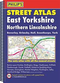
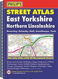
3163575Philips. Paperback. Used; Good. Simply Brit welcome to our online used book store where affordability meets great quality. Dive into a world of captivating reads without breaking the bank. We take pride in offering a wide selection of used books from classics to hidden gems ensuring theres something for every literary palate. All orders are shipped within 24 hours and our lightning fast-delivery within 48 hours coupled with our prompt customer service ensures a smooth journey from ordering to delivery. Discover the joy of reading with us your trusted source for affordable books that do not compromise on quality. 10/01/2015 Philips paperback