1 660 résultats
2005Q-159775000XNational Geographic Society Maps 2005-05-01. spiral_bound. New. In shrink wrap. Looks like an interesting title! National Geographic Society Maps unknown
20189780008285647-2025Collins 2018. Paperback. New. <p><strong>Author:</strong> Collins Maps</p><p><strong>Publisher:</strong> Collins</p><p><strong>Binding:</strong> Paperback</p><p><strong>ISBN:</strong> 9780008285647</p><p><strong>Release Date:</strong> 2018</p><p><strong>Number Of Pages:</strong> 1</p><p><strong>Details:</strong> Handy little full colour Collins map of Skye with a high level of detail. Clear mapping of the Isle of Skye showing the road network ferries and places of interest. Map at a scale of 1:175 000 3 miles to 1 inch.Clear detailed full colour Collins road mapping is presented in a handy format ideal for the pocket or handbag. It is excellent value and covers the whole of the Isle of Skye.INCLUDES• Scotland route map• Caravan and camping sites• Tourist locations• Ferry links• Listing of major places to visit with additional details for Dunvegan Castle Old Man of Storr and Loch Coruisk• Detailed place names index</p> Collins paperback
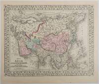
1879221209Pennsylvania. 1879. Lithographed maps on two sides of a single leaf with original hand-colouring 27 x 34 cms map size 31.1 x 37.1 cms sheet with a finely-engraved foliated border margins age-toned one margin tide-marked at the edge not affecting the maps a handsome pair of maps in very good condition. A most attractive pair of late 19th Century maps on two sides of a single leaf: Asia as a whole polar projection with Europe and parts of Africa and New Guinea. Scale 1:1000 miles. It includes steamship routes and mileages from London to destinations in Asia: Zhoushan Chusan Island Hong Kong Manilla Sarawak Bombay etc. along with political and geographical details; and on the verso the map covers the regions of Persia Iran Arabia including parts of the Arabian Peninsula Turkey in Asia Anatolia Afghanistan and Beloochistan parts of Iran Afghanistan and Pakistan and marks key settlements rivers and geographic features. . unknown
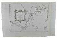
1749136827Paris. Circa1749. Engraved map on watermarked laid paper 20 x 27.3 cm of Fuzhou and coastline of Fujian Province original folds designed by the great French cartographer Jacques-Nicolas Bellin. This map is from the impressive 15-volume "Histoire Génèrale des Voyages" compiled by Antoine François Prévost map no. 2 Vol. 6. This map shows the estuary of Yangtze River Rivière de Chang. Very light browning on sheet edges but in very good condition. . unknown
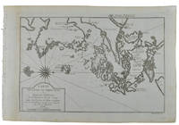
1749136826Paris. circa1749. Black and white engraved map on watermarked laid paper 20.9 x 32.7cm showing coastal area of Zhejiang Province Province de Che-kiang including Zhoushan Archipelago Isle de Chusan Zhoushan Bay Bay de Chusan and Xiangshan County Siang-chan-luen a walled city outside of upper border Ningbo Ning-po prefecture under Qing administration title cartouche lower left original folds. This map is No. 3 Vol. 6 from the impressive 15-volume "Histoire Generale des Voyages" compiled by Antoine François Prévost. Even browning mainly to the sheet edges in very good condition. . unknown
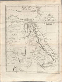
1803174955London. circa1803. Engraved map 23 x 18.5 cm original folds small split to one fold affecting the margin only paper age- toned lower corner darkened and on the verso inked circles to the lower half in an early hand but in good condition. Finely engraved early 19th Century map also showing to the north Syria Palestine and Cyprus and Darfur and Mountains of the Moon Sources of the Nile to the South. . unknown
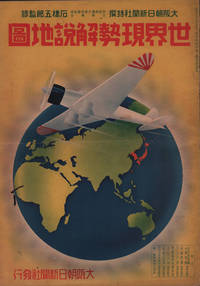
1937208633大阪朝日新聞社. Osaka Asahi Shinbunsha. Showa 12 1937. 10 colour maps not including insets or sketch maps in text on 12 pages. Handsome world map features as the centre fold colour pictorial paper wrappers. A little light soiling and horizontal crease wrappers. An attractive atlas. 38 x 26.7cm. A large format atlas with six pages of coloured maps showing the nations of the world and five pages of Japanese text. The publication seems to have been produced to celebrate the 1937 world record flight from Tokyo to London by Iinuma Masaaki and Tsugayoshi Kenji in their plane 'Kamikaze' which was sponsored by the Asahi Newspaper. The front cover depicts the plane soaring over a map of the world while the back cover also had a colour image of the 'Kamikaze' with an advertisement for the Oji Paper Company which we are told donated a hundred million yen to support the flight. The name 'Kamikaze" had at that stage not yet taken on the connotations which it acquired during the Pacific War. <br> <br>The maps inside the volume show political boundaries major cities and transport routes. The opening pages show the Japanese Empire including Japan proper Korea Karufuto and Manchukuo with small insets covering Taiwan the Chishima Archipelago and Japan's South Sea mandate. The accompanying text focuses on Japan's newly acquired client state of Manchukuo detailing its area population principle products etc while the map includes graphs illustrating Japan's trade with the world and with Manchukuo. China receives an entry of its own with a map of the Chinese Republic and information on the political situation population trade and infrastructure. The central pages of the volume are taken up with a double-spread map of the world including depictions of the flags of a selection of the world's nations. Other sections of the work cover Asia Europe America Africa and Oceania grouped together. The discussion of Oceania includes a section on Hawaii and some small and improbable depictions of Maori and Indigenous Australians. . 大阪朝日新聞社. [Osaka Asahi Shinbunsha]. unknown
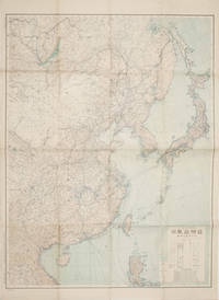
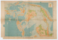
1419160524Tokyo.: 大日本帝國陸地測量部. 昭和14 1939. Large colour folding Japanese WWII map. Scale 1:5000000 featuring Japan Korea Taiwan Karafuto Eastern China parts of French Indochina and the Northern Philippines US colony in detail. Legend includes territorial boundaries national and regional and shows some borders as unclear i.e. Taiwan and bordering region along Northeast China the Soviet Union and Mongolia air routes submarine communication cables linking major costal cities i.e. Hong Kong Xiamen Shanghai Nagasaki etc. airports radio stations mining fields and more. A small chart shows the names of mountains rivers and lakes also included adjacent to legend. Some small holes at folds creases and some minor loss edges generally very good. Text in Japanese. 109 x 77.8cm. . 大日本帝國陸地測量部. unknown
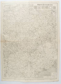
1572172829大阪. Osaka.: 大阪毎日新聞社. Osaka Mainichi Shinbunsha. 昭和 13 1938. Black and white map folded showing Hankow one of the three cities which merged to become Wuhan 54.5 x 49cm scale 1:2000000. Some light browning tiny closed tear upper margin neatly repaired with conservation standard tape. Good copy. This Hankow/Hankou War Situation Map is a supplement map of Osaka Mainichi Newspaper on 25 August 1938. The two inset maps show the region around Nanjing and Hong Kong. It gives detailed place names of Hankow area. . 大阪毎日新聞社. [Osaka Mainichi Shinbunsha]. unknown
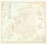
1572171093Qingdao: Taiheiyoko. 太平洋行. 昭和 13 1938. Coloured folding plan of Qingdao in 1938. some browning on reverse with a small lighter section on map Japanese place names no scale 36 x 39cm 3 inset maps. This 1938 Qingdao city map shows street names in Chinese characters and location of Chinese and Japanese public buildings such as the hospital shrines Japanese primary schools and high schools. The 3 inset maps show railway and transport routes as well as outskirts of the city. . [Taiheiyoko]. 太平洋行. unknown
1819162103Tokyo.: Tōseisha. Showa 18 1943. Folding colour map of Australia 54.2 x 76.4cm. Some foxing particularly along folds and upper right margins a few repaired tears and small holes at folds.With original sleeve. The 15th map in the Standard Maps of Greater East Asia series of 20 maps. Shows the natural resources such as sheep gold pearl diary regions opals etc. Tasmania appears as an inset in the bottom right corner. Text in Japanese. . Tōseisha. unknown
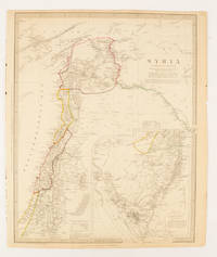
1843174934London.: Chapman & Hall. 1843. Engraved map with outline hand colour 39.4 x 31.4 cm inset map "Continuation from the Dead Sea to Mount Sinai" with finely engraved notes and a key to the Divisions under control of the Turkish Government manuscript pagination in an early hand to the top right edge tear nicks and browning but in very good condition. A most attractive map with detailed notes published when Syria was still under control of the Ottoman Empire. . Chapman & Hall. unknown
1572160533Tokyo.: 日本名所圖繪社.Nihon Meisho Zuesha. 昭和 17 1942. Folding Japanese coloured map of the Malay Archipelago and Thailand during World War II scale 1:8500000. Legend in lower corner indicates altitudes. Ink annotation in Japanese left edge. Pin holes at three corners upper right corner torn with loss evenly browned otherwise very good. Text in Japanese and English. 52.8 x 75.6cm. This map shows most of Thailand former Indochina Hainan Province and South China Sea Sumatra and Java Sea Borneo the Philippine Islands Celebes Timor New Guinea and parts of Micronesia. Natural resources such as tobacco spices wood sugar metal mines tin iron and etc. rice and other resources are indicated on the map. . 日本名所圖繪社.[Nihon Meisho Zuesha]. unknown
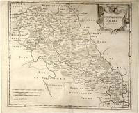
64216London.: Gibson. Early 18th Century. Black and white map from Camden's Britannia showing towns roads rivers and landforms 38 x 46.5 cm. . [Gibson.] unknown
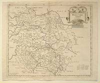
64139London.: Gibson. Early 18th Century. Engraved map on watermarked paper central fold 38 x 46.5 cm decorative title cartouche towns roads rivers and landforms shown; from Gibson's edition of Camden's Britannia upper edge trimmed by the original binder causing minor loss to the border at the inner edge but in very good condition. . [Gibson.] unknown
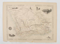
1851174666London.: Tallis John. 1851. Lithographed map 24.2 x 32 cm districts picked out in original hand colour inset vignette illustrations decorative border lower margin ragged but the attractive map in very good condition. Attractive decorative map from "Tallis's illustrated atlas and modern history of the world." one of the last great illustrated series of world maps. The fine vignettes are of Cape Town Graham Town and entrance to the Knysha Heads. . (Tallis, John). unknown
20191-1566958326Natl Geographic Society Maps 2019. Paperback. New. fol map edition. 568 pages. 9.50x4.75x1.00 inches. Natl Geographic Society Maps paperback
2012SONG1597755222Universal Map 2012-10-01. 2012. paperback. Used: Good. 9.88x0.39x15.20. Buy with confidence. Excellent Customer Service & Return policy. Universal Map paperback
2023SONG1566958164National Geographic 2023-01-01. 2023. map. Used: Good. 4.50x1.25x9.25. Buy with confidence. Excellent Customer Service & Return policy. National Geographic unknown
19567943Ottawa Ontario Canada: Pubished by the Authority of the Minister of National Defence Roger Duhamel Queen's Printer and Controller of Stationery 1956-1960. Hardcover. pp. xiii 629; xv 807; xiii 770. Thick Royal 8vo's. Uniformly bound in bright red cloth over boards gilt lettering to the spines and armorial device embossed to the centre of the front boards; map endpapers. Replete with many black-and-white and colour maps including many fold-out photographs illustrations portraits et al. Excepting some light bumping to the spine ends the extremities remain remarkably well-preserved with no additional detectable flaws contents remain equally and uniformly without blemish with bright clean and unmarked pages and tight sound bindings; about fine with each housed in light shelfworn dustjackets now in protective mylar covers. Overall very good to near fine. <br/><br/> Pubished by the Authority of the Minister of National Defence | Roger Duhamel, Queen's Printer and Controller of Stationery hardcover
1976Q-0878132252s.n. 1976-01-01. Hardcover. New. In shrink wrap. Looks like an interesting title! s.n.] hardcover
2003I-265-661IGN - Institut Géographique National 2003. Very Good. Former library book. Different cover. Edition 2003. Ammareal gives back up to 15% of this item's net price to charity organizations. IGN - Institut Géographique National unknown
19932082402113507248Mitsumura Maps Nire Publishing 1993. Soft Cover. Fine. Number of books: 30 Mitsumura Maps, Nire Publishing paperback
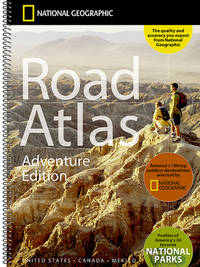
20049780792289890-2025National Geographic Maps 2004. Spiral-bound. New. <p><strong>Author:</strong> National Geographic Maps</p><p><strong>Publisher:</strong> National Geographic Maps</p><p><strong>Binding:</strong> Spiral-bound</p><p><strong>ISBN:</strong> 9780792289890</p><p><strong>Release Date:</strong> 2004</p><p><strong>Number Of Pages:</strong> 144</p><p><strong>Details:</strong> National Geographic's Road Atlas: Adventure Edition is the ideal companion for the next time you hit the road. Includes up-to-date road maps for all 50 U.S. States plus Canada Mexico and Puerto Rico. Major cities and metropolitan areas are shown in detail with inset maps that include popular attractions infrastructure and points-of-interest.Setting this atlas apart from all other road atlases are the inclusion of detailed maps and guidebook-like recommendations on the top 100 destinations for adventure plus the top 24 most visited National Parks. An additional resources section provides contact information for local tourism offices plus a place name index to help easily locate a specific city.The Road Atlas: Adventure Edition features a heavy duty spiral binding and Travel Tough a tear-resistant cover for durability and lay-flat reading.Folded Size = 11" x 15"</p> National Geographic Maps unknown
30286<p>HBDJ 1968 EARLY Edition VG/VG- AS-IS Original publisher's blue paper-covered boards pictorial dustjacket large 8vo: xij 108pp. fold-in map in Middle and in back footnotes bibliographical notes. Verynear fine copy.Octavo. 5.5 x 8.5 in. lived to be hundreds of years old and were capable of telepathy astral travel and teleportation.ATLANTIS they became greedy petty and "morally bankrupt" and the gods "became angry because the people had lost their way and turned to immoral pursuits" Orser says. As punishment he says the gods sent "one terrible night of fire and earthquakes" that caused Atlantis to sink into the sea.</p> LONDON, Illinois: Theosophical Publishing House, hardcover