Thomas Brothers MapsBiblio.com
1 660 résultats
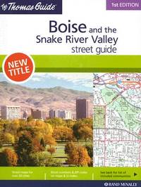
20061-0528859455Rand McNally 2006. Paperback. New. 1st spi edition. 182 pages. 10.50x8.75x0.50 inches. Rand McNally paperback
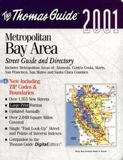
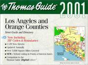
1999mon0004114102Thomas Brothers Maps 1999-09-01. Spiral-bound. Good. 1.1000 12.0000 8.3000. Thomas Brothers Maps unknown
2000G1581741294I5N00Thomas Brothers Maps 2000. Unknown. Acceptable. Readable copy. Pages may have considerable notes/highlighting. ~ ThriftBooks: Read More Spend Less.Dust jacket quality is not guaranteed. Thomas Brothers Maps unknown
1999Q-0881309826Thomas Brothers Maps 1999-03-01. Spiral-bound. New. In shrink wrap. Looks like an interesting title! Thomas Brothers Maps unknown
1581741103.Gpaperback. Good. Access codes and supplements are not guaranteed with used items. May be an ex-library book. paperback
0528995715.Gspiral_bound. Good. Access codes and supplements are not guaranteed with used items. May be an ex-library book. unknown
052899932X.Gpaperback. Good. Access codes and supplements are not guaranteed with used items. May be an ex-library book. paperback
1581741243.Gspiral_bound. Good. Access codes and supplements are not guaranteed with used items. May be an ex-library book. unknown
0528956817.Gspiral_bound. Good. Access codes and supplements are not guaranteed with used items. May be an ex-library book. unknown
0528998501.Gmap. Good. Access codes and supplements are not guaranteed with used items. May be an ex-library book. unknown
1581741545.Gspiral_bound. Good. Access codes and supplements are not guaranteed with used items. May be an ex-library book. unknown
1581742827.Gpaperback. Good. Access codes and supplements are not guaranteed with used items. May be an ex-library book. paperback
1581741928.Gmap. Good. Access codes and supplements are not guaranteed with used items. May be an ex-library book. unknown
1581742797.Gpaperback. Good. Access codes and supplements are not guaranteed with used items. May be an ex-library book. paperback
1581742509.Gspiral_bound. Good. Access codes and supplements are not guaranteed with used items. May be an ex-library book. unknown
2002Q-0528956485Thomas Brothers Maps 2002-01-01. Spiral-bound. New. In shrink wrap. Looks like an interesting title! Thomas Brothers Maps unknown
2000SKU1022344Thomas Brothers Maps 2000-09-01. Spiral-bound. New. New Inside and Outside. Clean and crisp pages w/no markings! You will be pleased. Excellent book! z1s163C Some very minor shelf wear on cover. Fast Shipping Thomas Brothers Maps unknown
SONG1581741243Brand: Thomas Brothers Maps 0000-00-00. spiral_bound. Used: Good. 11.75x1.25x8.75. Buy with confidence. Excellent Customer Service & Return policy. Brand: Thomas Brothers Maps unknown
SONG0528995715Rand McNally 0000-00-00. paperback. Used: Good. 8.75x0.75x10.75. Buy with confidence. Excellent Customer Service & Return policy. Rand McNally paperback
2000SONG15817424012000-08-01. paperback. Used: Good. 1.00x11.75x8.75. Buy with confidence. Excellent Customer Service & Return policy. paperback
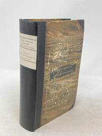
184987523Washington D.C.: Government Printing Office 1849. Hardcover. Very Good. Octavo 9.2 in. x 6 in. pp. 678 1 index. Personal copy with gilt ownership plate to front board of DeWitt C. Lawrence Chief Clerk of the Patent Office. Illustrated with sixteen folding maps. Black half calf with decorative gilt chain rule over marbled boards. Rebacked spine. Gilt name on black ownership panel to front board. Black title on paper panel to spine. Marbled endpapers. Front free endpaper detached but present. Detailed pencil notes presumably from DeWitt Lawrence to preliminary pages index and rear endpapers and to occasional penciled comments on margins of main text providing reference and guidance. Fremont Preuss's maps #II-VIII in VG condition. Other maps in G condition with additional creases a few short closed tears at seams and light browning to several edges. <br /> <br /> ALL16 maps detached as they were removed for preservation and study. Maps I IX-XVI folded in archival pocket. The PREUSS Maps II-VIII "The Rockwell Maps" are laying flat preserved in archival sheath and will be mailed separately under cover. Includes additional copy of Rockwell's map of "Section III". The 16 folded maps include: #I. Map of the Country Between the Atlantic and Pacific Oceans. 1848. Rob Mills. Pencil notes on map. #II-VIII. Road from Missouri to Oregon in 7 Sections 1848. Charles Preuss. Includes two identical copies of Section #III map. All eight Preuss maps in VG condition #IX. Republica Mexicana Plano del Curso del Rio Coatzacoalcos. 1843 #X. Profils en Long et en Traviors du Canal. L'Isthme de Panama1841. Garella. #XI. Profile of That Section of the Country between Nicaragua and the South Sea 1838. Based on Thompson's Guatamala. #XII. Nicaragua Realejo Harbour Edward Belcher Harbour of San Juan de Nicaragua George Peacock 1832 #XIII. Chart of the Bay of Limon or Navy Bay 1829. J.A. Lloyd. #XIV. Republica Mexicana Pano de la Parte Austral del Istmo de Tehuantepec 1843. Jose de Garay. #XV. Panama Canal Longitudinal Section. J.A. Lloyd. Four inch closed tear with 1/2 inch chip to seam. #XVI. Carte Topographique de la Partie De L'Isthme de Panama comprise entre Panama Chagres. 1845. Garella. Uniquely annotated copy. <br /> <br /> The "first major government report devoted to interoceanic communication.Rockwell in addition to his prime focus on Central American canals compiled memorable documents on the suddenly urgent need for more directly binding California to the Union.Foremost.was the matchless seven-section map of the Oregon Trail made by Charles Preuss Fremont's gifted cartographer. Lieut. G.K. Warren in his 1859 memoir wrote that Preuss's 'skill in sketching topography in the field and in representing it on the map has probably never been surpassed in this country.' <br /> <br /> ".The Senate had issued this map separately in 1846; now the House was trying to make available to the Forty-0niners what was by far the best trail map of them all.this treasure was so deeply buried in this report that but few gold seekers found it and it is still so rare in both editions that Wheat lamented that it ' has been insufficiently appreciated by students of Western history.' ." Plains & Rockies 1800-1865: Supplemental volume to the series News of the Plains and Rockies; 2001 Arthur H. Clark Spokane. [Government Printing Office] hardcover
158464215Antwerp.: Abraham Ortelius. circa1584. Two engraved maps on laid paper each 30.3 x 19.5 cm printed on the one sheet 48 x 60 cm original fold attractive hand colour with related French text on verso slight toning and spotting to the margins but the maps in very good condition preserved in a modern window mount. Attractive maps of the German coast published in Ortelius' great atlas "Theatrum Orbis.". The left-hand map showing the mouths of the Elbe complete with sea monster and Eider Rivers and the coast of Schleswig-Holstein; the right-hand map of the Baltic coast with the Pomeranian islands of Rugen and Usedom. . (Abraham Ortelius). unknown
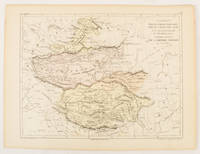
1856175109Paris.: Gustave Barba Editeur. 1856. Lithographed map with original hand colour central fold 24.2 x 31.5 cm marginal toning plate number in manuscript in very good condition. Finely engraved Dufour map of Central Asia prepared for his "Atlas Populaire" showing East Turkestan Petite Boukharie and Kalmykia Dzoungarie Mongolia and Tibet. . Gustave Barba Editeur. unknown
19302080502106910370Not Available 1930. Soft Cover. Fine. The book is in fine condition. Not Available paperback
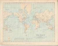
1874174897London.: Virtue & Co. circa1874. Printed colour map 18.4 x 24.1 cm edge wear marginal spotting and on the verso but the map in very good condition. Unusual map showing time differences east and west of Greenwich before the atomic clock and well before satellites! The explanatory text notes aso that: "The space comprehended between the meridiens of 120 & 160 E. is repeated in order to show the relative position of England to Australia both eastward and westward." . Virtue & Co. unknown