1 660 résultats
186161812New York: W. Schaus; printed by Sarony Major & Knapp 1861. Second Edition. 59 x 76cm open. 19.5x19cm closed. Tinted lithographic map backed in brown silk in black slipcase with printed paper label. Bookseller's ticket of Rev. A. O. Brickman Baltimore. Two ownership inscriptions of "J. M. Deems Maj. 1st MD Cav" and inscribed "Deems" on the slipcase. Trimmed; splits along half of one horizontal fold; minor stains and discoloration to verso not affecting image which is bright and generally Very Good. Hand-made slipcase worn with portion cut out but with manuscript ownership label intact. <br /> <br /> Uncommon Civil War map used by a distinguished Union Army officer. James Monroe Deems 1818-1901 was a composer and music educator from Baltimore who secured a commission as a major in 1861. He was promoted to Lieutenant Colonel in spring 1863; led the First Maryland Cavalry during the Battle of Gettysburg; retired due to rheumatism in November 1863; and was brevetted Brigadier General in 1867. He likely acquired this map in Baltimore near the beginning of his military career and certainly before his promotion in 1863 given the use of "Maj." in his ownership inscriptions. <br /> <br /> The map itself is the second edition of this design by J. Schedler despite the title it is not a bird's-eye view. The more common first edition has two insets showing the Lower Mississippi Valley and the city of Richmond see Stephenson 17.3. This version has only one inset showing the eastern United States. Stephenson describes this edition as having a Washington DC bookseller's ticket; the present copy has a Baltimore bookseller's ticket instead. <br /> <br /> This copy was mounted for use in the field: it was trimmed down to the neatline the captions removed the image cut up into segments and mounted on linen. The printed label on the slipcase appears to be a portion of the original title. This may have been done by the bookseller Brickman possibly at Deems' request. <br /> <br /> Uncommon. OCLC records about 10 similarly titled maps but few listings distinguish between the first and second editions. STEPHENSON LC Civil War Maps 2nd ed 17.35. 61812. [W. Schaus; printed by Sarony, Major & Knapp] unknown
1332193862.Gpaperback. Good. Access codes and supplements are not guaranteed with used items. May be an ex-library book. paperback

193929724HBDJ 1939 on title & Copyright Pg 1st edition VG/VG- PRICECLIPPED But $3 on back of DJ Contains two folding maps Clean lightly-worn copy in Green Cloth with Gold Illustration & Titles DJ has rub Wear Spine & Tiny TEARS & Extremities Chips Lightly worn hardcover in the original dust cover. Book shows very light wear Dust cover is price-clipped and shows wear/chipping to spine ends. A very clean copy that I will call Very Good. Measures 6 1/8 X 8 3/4 284 pages. Contains two folding maps.<br /> Dodd, Mead and Co. hardcover
Q-0207942242Simon & Schuster 1953-01-01. Hardcover. New. In shrink wrap. Looks like an interesting title! Simon & Schuster hardcover
1664215654.Ghardcover. Good. Access codes and supplements are not guaranteed with used items. May be an ex-library book. hardcover
42599476like new. unknown
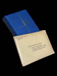
19394298Harrisburg PA: The Military Service Publishing Company 1939. Hardcover. Very Good. <br /> <br /> Twenty first edition April 1939. 4to 216 pp. Publisher's blue cloth with gilt lettering and design. Very good with some soiling to boards and edges of page block. Clean internally with a few annotations in pencil throughout. Included is the supplementary envelope with Special Map "A" and four protractors only 2 are listed on the envelope. A few contemporary papers and supplementary materials for a course taken at the University of Wyoming are laid in as well. The Military Service Publishing Company hardcover
ANAIS-0136950248Prentice-Hall Inc. hardcover. Good. 9.5X6.5X1.5. Buy with confidence. Excellent Customer Service & Return policy. Prentice-Hall, Inc hardcover
SONG01369502480000-00-00. hardcover. Used: Good. xx. Buy with confidence. Excellent Customer Service & Return policy. hardcover
201689152Oxford: Oxford University Press 2016. First Edition. First Impression. Oblong Octavo 25cm x 31cm; green cloth-covered boards with titling stamped in gilt on spine and front cover; pictorial endpapers; dustjacket; 281pp; colorful illustrations. From the library of noted poet translator and anthropologist Nathaniel Tarn 1928-2024 with his pictorial bookplate to verso of front endpaper. A Near Fine copy. Dustwrapper lightly spine-faded with trivial surface wear and price sticker to lower rear panel; Very Good. Biography of Wordsworth with marginal glosses notes chronology and bibliography. 89152. Oxford University Press unknown
2080202103703542Penguin Books N.A. Soft Cover. Fine. Page size: 2 v. Size: 18 cm New book size Penguin Books paperback
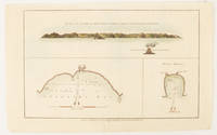
1784174896London.: Alexander Hogg at the King's Arms. circa1784. Engraved map in triptych on laid paper 20.1 x 32.7 cm three insets: cross section of the north side of Queen Charlotte's Islands Solomon Islands with detail of a volcano "6 leagues North"; Swallow's Bay Harbour; and Byron's Harbour early hand colour trimmed to the plate mark at the top edge neat sealed tear affecting the publisher's caption slight edge wear and paper toning but a most attractive map in very good condition. Attractive engraving of the Queen Charlotte's Islands Solomon Islands. The Islands were named for the consort of King George III by Philip Carteret the British naval officer and explorer who participated in two of the Royal Navy's circumnavigation expeditions in 1764–66 and 1766–69. His ship the Swallow gave her name to the Bay and Carteret's commanding officer on the first of his voyages John Byron to the Harbour depicted in this most attractive early chart. . Alexander Hogg at the King's Arms. unknown
192052936Syracuse NY: Empire New England Company Inc. ca. 1920. Double Elephant folio. 51 x 59 in. Large colour-printed map dissected and mounted on linen backing brass grommets at upper fore-edge for hanging title stamped on verso minor edgewear at creases very minor lifting at seams minor dustsoiling to outer linen when folded still a VG exemplar. First edition thus of this scarce education map of post-World War I South American geography. The map details the principal railways water routes major cities steamship routes and geographical and political details. The Empire New England Company was active in upstate New York from about 1915 until the end of the 1920s selling educational supplies maps textbooks and more. The New World School Maps could be purchased individually or in cases which held between 6-10 individual maps for school uses according to company literature of the period. Worldcat locates 1 copy Buffalo & Erie County Public Library smaller size - 1931 ed. Empire New England Company, Inc., unknown
38642741like new. unknown
38642741-nnew. unknown
SONG1851376283Hweryho 2019-10-18. 1st edition 2019. hardcover. Used: Good. 8.27x0.98x9.84. Buy with confidence. Excellent Customer Service & Return policy. Hweryho hardcover
DADAX1851376283Hweryho 2019-10-18. 1st edition 2019. hardcover. New. 8.27x0.98x9.84. Buy with confidence. Excellent Customer Service & Return policy. Hweryho hardcover
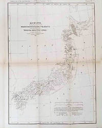
1878210211Philadelphia.: American Institute of Mining Engineers. Sherman & Co. printers. 1878. Large folding map of Japan showing "some of the more important Mining Districts Coal Fields etc." small fold split without loss tables 67pp. Covers a little scuffed and discoloured overall in very good condition. Scarce offprint separately paginated of a paper included in Volume V of the Transactions of the American Institute of Mining Engineers. The author Henry S. Munroe had been retained by the Japanese Government as Assistant Geologist and Mining Engineer with the Geological Survey of Yesso for the Hokkaidō Colonization Agency. His work laid the foundations for the future coal mining industry in Hokkaido. The report contains two lengthy tables relating to coal production and quality. . American Institute of Mining Engineers. Sherman & Co., printers. unknown
0332212777.Gpaperback. Good. Access codes and supplements are not guaranteed with used items. May be an ex-library book. paperback
2067184997.Ghardcover. Good. Access codes and supplements are not guaranteed with used items. May be an ex-library book. hardcover
2013DADAX2067184997MICHELIN 2013-01-01. MICHELIN. hardcover. New. 4.53x0.87x7.48. Buy with confidence. Excellent Customer Service & Return policy. MICHELIN hardcover
1948TOB217-32701-A-0.50Doubleday. Good with no dust jacket. 1948. Hardcover. 309 pages; Copyright page does not state edition or printing. Likely 1st edition judging from date. Foxing heavy to the exterior edge of pages only. Yellowing to pages. Otherwise in good condition. No writing or major blemishes. ; - We're committed to your satisfaction. We offer free returns and respond promptly to all inquiries. Your item will be carefully wrapped in bubble wrap and securely boxed. All orders ship on the same or next business day. Buy with confidence. . Doubleday hardcover
197256368Charles Scribners 1972-01-01. Hardcover. Like New. 7x5x1. Pristine Hardcover in Fine dust jacket. Clean tight and square. Appears to be unused. Prompt shipping from Colorado. Choose Expedited/Priority 2-6 days.~ "Buy with Confidence Satisfaction Guaranteed! Charles Scribners hardcover
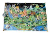
19589265Holland MI: Charles R. Sligh Co 1958. Third edition. Large color map 26x37" The image remains bright but there is moderate wrinkling throughout more severe at the edges. There are several tape repairs to the margins and corners and several other edge tears one extending about 2" into the image. A good copy that has seen much use. Will ship rolled as was found. <br /> <br /> This is an original 1958 printing of this iconic pictorial fantasy map from Czech-born Michigan landscape painter Jaro Hess 1889-1979. Hess painted and first published this in 1930 the map showing some 60 references to nursery rhymes fairy tales and children's stories and offering escapism during the Great Depression. The first edition of the map shows a figure "The Wandering Jew" which was later as here changed to "The Wanderer." This third edition was published by the furniture magnate Charles R. Sligh and printed by Dickinson Brothers a lithography firm in Grand Rapids Michigan. Hagstrom co. acquired the rights to the image about 1982 and issued reprints.<br /> <br /> A bright and as typical heavily worn example of this beautiful and whimsical map. Charles R. Sligh Co unknown
1979Q-0827601166Jewish Publication Society of America 1979-01-01. Hardcover. New. In shrink wrap. Looks like an interesting title! Jewish Publication Society of America hardcover