1 660 résultats
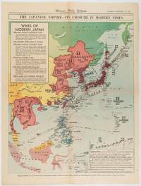
1619180755Chicago.: Chicago Daily Tribune. December 161941. Printed colour map on a single newspaper leaf 50 x 41.5 cm; 60 x 45 cm sheet two inset legends marginal browning and at the folds but remarkably bright in very good condition. Map of the Japanese Empire published in the Chicago Daily Tribune "The World's Greatest Newspaper" on December 16th 1941 9 days after the bombing of Pearl Harbour. The two legends list the "Wars of Modern Japan" from 1894 with territorial gains marked noting that "Each seizure of mainland areas has given Japan new field of raw materials." <br> <br>"… the historic Chicago Tribune was an innovator in color inks and printing but also a pioneer in bringing colorful art in the form of illustrations photographs cartoons and advertisements to the average person in an everyday medium." see The Janet A. Ginsburg Chicago Tribune Collection Michigan State University Libraries. . Chicago Daily Tribune. unknown
0282623124.Gpaperback. Good. Access codes and supplements are not guaranteed with used items. May be an ex-library book. paperback
185095311J & F. Tallis London Edinburg & Dublin 1850-01-01. Leather. Very Good. 1850 Tallis 6 volumes bound into 2 vols 3/4 leather over marbleized boards. 7 hand colored maps 56 plates ownership ink to flyleafs and book dealership pencil. Tight bindings text unmarked. oversized and overweight. Please email for photos. J & F. Tallis, London, Edinburg & Dublin hardcover
19892083002117402765new person oraisha 1989. Soft Cover. Fine. The book is in fine condition. new person oraisha paperback
0332247260.Gpaperback. Good. Access codes and supplements are not guaranteed with used items. May be an ex-library book. paperback
1997Q-0887402445Schiffer Publishing Ltd 1997-01-15. Hardcover. New. In shrink wrap. Looks like an interesting title! Schiffer Publishing, Ltd hardcover
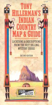
2002Q-1892040107Time Traveler Maps 2002-11-01. Map. New. In shrink wrap. Looks like an interesting title! Time Traveler Maps unknown
1976Q-0878132252s.n. 1976-01-01. Hardcover. New. In shrink wrap. Looks like an interesting title! s.n.] hardcover
194164221Chicago IL: Greyhound Corp. 1941. Oblong atlas folio colour-illustrated pictorial map sized 30 x 20 in. fold creases as issued w/ site index specifically listed on the verso couple text illustrations of Greyhound bus minor age toning couple slight closed tears very minor shelfwear still VG copy. A charming pictorial map focused on natural and some manmade roadside attractions across the United States with Wagner’s pictorial caricatures ranging from the charming to politically incorrect especially for Native American depictions. Attractions range from Craters of the Moon in Idaho to Grasshopper Glacier near Cooke MT Old Faithful in Yellowstone National Park to the Great Salt Lake in Utah. Other depictions include the statue of Tom Sawyer and Huckleberry Finn in Hannibal MO Fort McHenry where Francis Scott Key penned the National Anthem and more. Greyhound Corp., unknown
303089Eighth Battalion the Royal Australian Regiment N/D c.1970. Quarto grey textured buckram boards gilt lettering to spine & front board 160pp illus/photos VG light scuffing & bruising to spine & extrems sl discolouration to boards light tanning to page edges & eps Eighth Battalion the Royal Australian Regiment N/D (c.1970) hardcover
360075Macmillan and Co. 1920. 3 VOL SET. Super octavo grey card boards label to brown cl spine lettered in gilt; frontis. illus. plates maps; xviii 378 2 advts viii 383 x 352 pp.; VG- moderate to heavy soiling & scuffing to boards moderate to heavy bruising to edges & extrems w moderate chipping; light to moderate soiling tanning & foxing to pg edges; moderate tanning foxing & soiling to eps prelims & terminals; moderate cracking to front vols. 1 2 & 3 & central vol. 2 gutters; wormholes rear boards vols 1 & 2 & sl to spine vols 1 2 & 3; wormholes to rear hinges 1 2 & 3 ; ffep unopened vol. 3; tape to boards. Macmillan and Co. 1920 hardcover
1330383230.Gpaperback. Good. Access codes and supplements are not guaranteed with used items. May be an ex-library book. paperback
1759848041759. T. Kinnersley. London. 1759. In Two Volumes II and III and contains the whole set for the year 1759. Bound in 18th century quarter brown calf gilt very worn and rubbed and lacking portions of leather from heads and tails of spine. Joints tender but holding. Vol. II; ii 372 pages plus 4pages of index. Vignette to general title-page and engraved head-piece for each month. 6 engraved plates of unusual and more ordinary fauna including the dodo the rhinoceros sea hedge-hog the horned didapper flying fish and cassowary. 1 portrait plate of Magliabechi 14 full page engraved maps and plans. Vol. III; ii. 404 pages plus 4 page index. Engr. vignette to general title-page and engraved head-pieces or decorations to each month 4 engraved plates of fauna one portrait plate of Major General Wolfe 1 incredible engraved plate displaying the Torments Inflicted by the Dutch on the English in Amboyna plus the engraved frontis. to Pope's Essay on Man. Three engraved plates - 1 map and 2 plans. A wonderful insight into what interested people in the mid-18th century. Pages browned and occasionally foxed but otherwise a very useful set. hardcover
0243147651.Gpaperback. Good. Access codes and supplements are not guaranteed with used items. May be an ex-library book. paperback
0259994545.Gpaperback. Good. Access codes and supplements are not guaranteed with used items. May be an ex-library book. paperback
1334235430.Gpaperback. Good. Access codes and supplements are not guaranteed with used items. May be an ex-library book. paperback
1527709027.Gpaperback. Good. Access codes and supplements are not guaranteed with used items. May be an ex-library book. paperback
194148041Minneapolis MN: Global Map Co. ca. 1941. Oblong folio 22.5 x 11.25 in. Two rotating wheels each showing hemisphere projection maps which are attached to a thick brown base w/ printed labels on front cover original rivets still present printed paper label and instructions on verso some rubbing & edgewear minor foxing & scuffing still a G exemplar. First edition of this fascinating and scarce global map which allows the user to view steamship or airline distance routes as well as the principal railroads. The global map was designed so that opposite halves of the earth’s surface could be rotated and synchronized enabling continuous and accurate spherical relationships across any point on the rotating maps. The label on the back lists the area in square miles and population totals of the world. The map is dated to around 1941 because of the inclusion of Vichy France the government allowed by the Nazi occupiers after the fall of France in 1940. Global Map Co., unknown
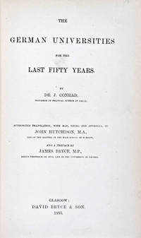
188530824Glasgow: David Bryce & Son 1885. First English language edition. Hardcover. g. Quarto. XXX 333 1 3pp. Original red cloth with gold lettering on spine. The present work is a captivating survey of the German Universities for the last 50 years between 1835 and 1885. It forms the second part of the third volume of a series of statistical inquiries in various departments of the national economy of Germany conducted by Dr. Conrad Professor of Political Science at Halle. Minor age wear on binding with spine slightly age toned. Previous owner's signature in ink on half-title page and dated 1885. Very minor age toning along paper margin. Binding and interior in overall good condition. David Bryce & Son hardcover
1774gnt774London: David Henry; Elizabeth Newbery. G: in good condition without dust jacket. 20th century binding with new eps. Inner hinge cracking. Sporadic foxing browning marking and off-setting from illustrations. Occasional pencil annotations. Loss to lower edge of prelims slightly impinging on content. 1774. First Edition. Buff hardback cloth cover. 220mm x 140mm 9" x 6". iv 628pp xvi plates. 20 b/w plates 3 fold-out plans 18 fold-out John Gibson and Thomas Bowen road maps. . David Henry; Elizabeth Newbery hardcover
351255Art & Educational Publishers 1946. Octavo black buckram boards gilt lettering to spine gilt military insignia to front board frontispiece xv 192pp illus/photos VG light bruising to extrems sl chafing to boards light tanning & foxing to page edges & eps occasional light soiling throughout Art & Educational Publishers 1946 hardcover
1334338108.Gpaperback. Good. Access codes and supplements are not guaranteed with used items. May be an ex-library book. paperback
1985Q-0671466755Simon & Schuster 1985-04-01. Hardcover. New. New. In shrink wrap. Looks like an interesting title! Simon & Schuster hardcover
19852090502113716172Not Available 1985. Soft Cover. Fine. The book is in fine condition. Not Available paperback
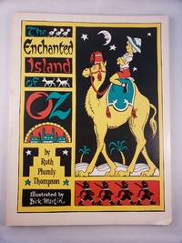
45456The International WIzard of Oz Club Inc. 1976. Small 4to.; illustrated stiff wraps softcover; 77 pages; black and white illustrations and maps; from the title page "founded on & continuing the famous OZ stories by L. Frank Baum"; a sunned errata slip laid in; bottom corner is bumped else very good. <br/><br/> The International WIzard of Oz Club, Inc., 1976 paperback