National Geographic MapsBiblio.com
1 660 résultats
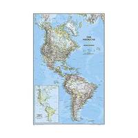
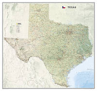
20111-1597754560National Geographic Maps 2011. Map. New. lam map edition. 1 pages. 24.90x1.90x1.90 inches. National Geographic Maps unknown
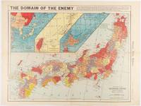
1941180789Chicago.: Chicago Daily Tribune. December 121941. Printed colour map on a single newspaper leaf 41.5 x 53 cm; 45.1 x 59.9 cm sheet three inset maps of the Japanese Empire; Taiwan and Ryukyu Islands; and Hokkaido and Chisima marginal browning and at the central fold but remarkably bright in very good condition. Map of the Japanese Empire ominously titled published in the Chicago Daily Tribune one week after the bombing of Pearl Harbour. Prefectures are attractively coloured. <br> <br>Based on a Rand McNally map the Tribune briskly got to work issuing maps for readers showing the beginnings of the war with Japan. Later maps were also published for sale separately but remarkably few have survived. <br>". the historic Chicago Tribune was an innovator in color inks and printing but also a pioneer in bringing colorful art in the form of illustrations photographs cartoons and advertisements to the average person in an everyday medium." see The Janet A. Ginsburg Chicago Tribune Collection Michigan State University Libraries. . Chicago Daily Tribune. unknown
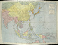
1940205763London.: Hutchinson & Co. Circa1940. Full colour folding map 70.7 x 93 cms; 76 x 101.2 cms sheet original folds short fold splits previous owner's neat title markings on the verso but the map in very good condition. A "Geographia" map of the war theatre in Asia and the Pacific including the northernmost coast of Australia. Showing railways and canals roads and steamer routes oilfields and pipe lines and a key to the unfederated states of Malaya. The Spratley Islands are marked as French and Thai territorial claims within French Indo China are marked. . Hutchinson & Co. unknown
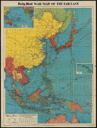
1944205765London.: George Philip & Son. 1944. Full colour folding map 101.5 x 76cm sheet inset maps legend folding into title wrapper 25.7 x 19.4 cms covers a little dusty and discoloured a few short fold splits without loss but the map in very good bright condition. Map of the Pacific Theatre of World War II with borders drawn as they stood in 1937 - complete with Chinese claims on Mongolia Tuva and Tibet. <br> <br>Shows transportation routes principal railways oil fields Allied naval bases territory occupied by the British Empire French Empire and the United States. This map shows only the northernmost section of Australia which allows for much better detail of the countries of East Asia. Small inset map of the Hawaiin Islands at mid right. Inset map of the Pacific Ocean at upper left. . George Philip & Son. unknown
0331318040.Gpaperback. Good. Access codes and supplements are not guaranteed with used items. May be an ex-library book. paperback
366634US: Houghton Mifflin 1952. Houghton Mifflin 1952 First Edition NAP Fine/Very Good DJ Author: De Voto Bernard; Raisz Erwin maps. Light blue cloth with grey text bloacks and brown lettering. USA map end papers. Pages lightly tanned with many smaller maps in text. xxii647 pages with index. Bright glossy clipped dust jacket with small mended tears protected in clear dust jacket cover. HEAVY ITEM 1.89 Pounds. Size: 8 5/8 x 6 x 1 1/2 inches. First Edition NAP. Hardcover. Fine/Very Good DJ. No Exp. Houghton Mifflin Hardcover
1946GK2103New York / Toronto: Rinehart & Company 1946. First Edition. Hardcover. Fine/Very Good. Part of "The Rivers of America" series edited by Hervey Allen and Carl Carmer. Cloth; illustrated dust jacket. With b/w and color illustrations and maps. Spine tips very lightly rubbed otherwise book is fine. Dust jacket very lightly rubbed a little scuffed along the edges; spine a bit sunned; VG not price-clipped presents nicely in mylar. <br/><br/> Rinehart & Company hardcover
1974Q-030729031xRandom House 1974-01-01. Hardcover. New. In shrink wrap. Looks like an interesting title! Random House hardcover
1527718301.Gpaperback. Good. Access codes and supplements are not guaranteed with used items. May be an ex-library book. paperback
0282155023.Gpaperback. Good. Access codes and supplements are not guaranteed with used items. May be an ex-library book. paperback
200749413Washington D. C.: Dumbarton Oaks Research Library and Collection 2007. Good to near fine condition. Quarto. li 394 xv 290 plates 3 folding maps in envelope on inside back cover. Original textured blue cloth with gilt lettering on covers and spines in photo-illustrated dustjackets brown lettering on spine. Frontispiece maps.<br /> <br /> The Pontos and its Empire of Trebizond 1204-1461 embraced the distinctive Black Sea coastlands mountains and pastures of northeastern Anatolia. "The purpose of this Study is twofold. First it is an essay in placing the material remains of the medieval peoples of a distinct region of Anatolia the Pontos in their historical and geographical setting. Second it is a record – all too often of what can no longer be recorded. In the two decades since Anthony Bryer A.A.M.B. and David Winfield D.C.W. first met in the east porch of the Hagia Sophia Trebizond on 19 August 1959 the Pontos has suffered a greater physical transformation than in its entire previous history." Preface. <br /> <br /> Illustrated with some five hundred b/w photographs on 290 plates three folding maps two in two colors and in-text drawings maps plans and tables. Contains list of figures abbreviations and an extensive bibliography at front appendix with measurements and indices at rear. Dustjackets with light creasing at top and bottom edges light creasing hear and small closed tear at top left of volume two. Interiors in near fine condition. Dumbarton Oaks Research Library and Collection unknown
1788024356London: Printed for J. Walker 1788. Book. Very Good. Hardcover. First Edition. 12mo. A very good four volume set in contemporary full tree calf binding with double lettering pieces in red and green. Complete pp. iii-vii 1 222; 2 206; 2 238 & 2 198. No half-titles which may or may not be wanting but the pagination for the prelims to vol. I might suggest that one is required Very good bindings with a little rubbing a couple of volumes slightly chipped to the head/tail of the spines corners lightly bruised. Contents clean and tight manuscript Greek initials to title pages dated 1788 otherwise unmarked no foxing paper crisp. A very good set. A Rare Eighteenth Century Novel. We have managed to located just one other copy at auction in the last thirty years and that at Sotheby's sale of July 21 1993 where it made £1000 on the hammer though seemingly not such a nice copy. Referenced by: ESTC T068744. Printed for J. Walker Hardcover
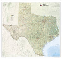
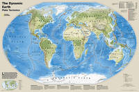
20131-0792250214Natl Geographic Society Maps 2013. Map. New. lam map edition. 1 pages. 24.50x2.00x2.00 inches. Natl Geographic Society Maps unknown
1933233821D. Van Nostrand Company Inc 1933. Book. Good. Hardcover. Dust jacket has fair amoutnt of edgewear. with small chips and tears and vertical crease to front and back. Boards have slightly darkened spiine with small white blotch there as well. Pages of text are clean lightly age toned and free of markings. Binding is tight and secure. Shipped within 24 hours from the beautiful Baltimore inner harbor area. First class service; accurate descriptions. Most items packed in boxes not envelopes. D. Van Nostrand Company, Inc Hardcover
1940128448Boston MA: Houghton Mifflin 1940. First Edition. 1st Printing. Hardcover. Very Good/Good-. 8.9 x 5.9 x 0.9. Hardcover. Book Condition: Very Good. Jacket Condition: Good-. Houghton Mifflin Boston MA 1940. First Edition. 1st Printing. 306 pages. Nice Firm Clean copy ! Light general wear. Dust jacket in tatters. Size: 8.9 x 5.9 x 0.9. Military History::WWI 6259 6259 Houghton Mifflin hardcover
A9781597752435Sheet map rolled. New. unknown
20121-1597752444Natl Geographic Society Maps 2012. Paperback. New. map edition. 1 pages. 38.20x2.00x2.00 inches. Natl Geographic Society Maps paperback
2022SONG1734315083Benchmark Maps 2022-04-01. 2nd Edition 2022. spiral_bound. Used: Good. 10.90x0.60x15.20. Buy with confidence. Excellent Customer Service & Return policy. Benchmark Maps unknown
20221-1734315083National Geographic Maps Division 2022. Spiral-bound. New. 2nd edition 2022 edition. 200 pages. 15.32x13.94x1.42 inches. National Geographic Maps Division unknown
19521204090009Government Printing Office 1952. Hardcover. Very Good. xiii 875 p.; 26 cm. Blue cloth. Good binding and cover. Shelf wear. Clean unmarked pages. Government Printing Office hardcover
19792090502113708698Not Available 1979. Soft Cover. Fine. The book is in fine condition. Not Available paperback
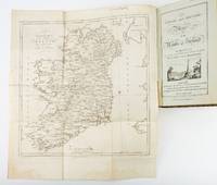
1783ST19355London: Engraved by G. Terry and Sold by T. Longman London and W. Wilson Dublin 1783. Second Corrected Edition. 260 x 155 mm. 10 1/4 x 6". XXVII 289 pp. 4 leaves index. <br/> Contemporary half calf over marbled boards flat spine divided into panels by gilt rules red morocco label very neat repair to head of front joint and top of spine. Engraved title page with vignette and dedication leaf large folding map of Ireland and 289 engraved maps. Title page with early ink signature of Jos. Sabine. Moreland & Bannister p. 190; Tooley "Maps and Mapmakers" p. 94. Small signs of age and wear to the binding including slight crackling and nicks to the spine folding map with faint dampstain to tail margin two negligible ink spots to blank area on the map of the Irish Sea but A VERY APPEALING COPY quite clean and remarkably fresh internally and in an entirely solid period binding.<br/> <br/> This is the second corrected edition of the first comprehensive road atlas of Ireland offered here in especially attractive condition. In response to increasing demand for accurate maps of the country's road system the Irish House of Commons commissioned George Taylor and Andrew Skinner who together had previously produced the first road atlas of Scotland among other works to undertake a survey of the land. Taylor and Skinner completed their work in 1777 and published the first edition of their findings in 1778. This second edition includes updates to the year 1783 as well as an additional map no. 289. Renowned for their precision and detail Taylor and Skinner's maps clearly show roads crossroads and bridges as well as topographical features such as hills lakes and rivers including the direction of the water flow; landmarks such as castles churches and ruins; and the names of local landlords and their homes. The maps appear either as half-page strips or in full-page and the distances are given in both Irish and English miles 11 Irish miles being equal to 14 British miles. The robust list of subscribers which includes a number of earls viscounts lords bishops and British and Irish army men demonstrates the great need for and widespread success of this important work. Our former owner may well be the famed and controversial naturalist Joseph Sabine 1770-1837 who often signed his name as "Jos. Sabine" as seen here. He certainly had good reason to own maps of Ireland. He was from an Anglo-Irish family himself and was Honorary Secretary of the Horticultural Society a position which at the time carried great clout in the botanical community and one that presupposed knowledge of geography across the realm. DNB tells us that "Sabine played a leading part in the establishment of the society's garden first at Hammersmith and afterwards at Chiswick; in sending out David Douglas and others as collectors; in starting local societies in connection with the Horticultural Society; and in growing and distributing new and improved varieties of flowers fruits and vegetables throughout the country." While not a rare book this is the kind of volume that would have normally encountered frequent and inevitably damaging use so to find a copy as well preserved as this one is a lucky occurrence. Engraved by G. Terry and Sold by T. Longman, London and W. Wilson, Dublin unknown
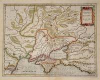
54794Amsterdam.: Jodocus Hondius. Circa Early 17th Century. Map depicting the southeastern part of present day Ukraine and the Crimean peninsula including the northern most part of the Black Sea and reaching north to Smolensk. Published by Hondius in the French edition of the Mercator-Hondius Atlas. Hand outline colour topographical detail shown pictorially some wear along centrefold occasional pale foxing mostly in margins decorative title cartouche upper right corner French text on verso showing through clear plate mark even age toning 48.5 x 58 cm. . [Jodocus Hondius]. unknown
194364219Washington D.C.: Prepared and distributed by Army Orientation Course Special Service Division 1943. One double-sided double-atlas folio colour map sized 35 x 47 in. 6.25 x 12 in. when folded as issued colour lithographic hemispherican map on recto 4 inset 2-colour maps on verso text in blue & black w/ photo illustrations as well original fold creases slight age toning very minor shelfwear folds w/ minor rubbing still a VG bright copy. First edition of this remarkable World War II propaganda pictorial map featuring Berlin Germany situated at the center of concentric bulls-eye circles and the artist has wonderfully detailed how they created this simulated 3-dimensional image as well as a detachable scale to be cut-off and used by the educational viewer. Within days of this map’s publications Allied bombers directed by British Air Marshall Arthur “bomber†Harris directed destructive air raids against the city lasting until March 1944 which also demonstrated the ineffectiveness of bombing population centers in order to alter the course of a War. The Newsmap portion detailing the course of the War in the 215th Week includes the inset maps of Bridgeheads across the Dnepr River as the Soviet forces began pushing German Army units back along the Eastern Front stretching from Leningrad to the Sea of Azov; the New Britain campaigns in the South Pacific; Operations in Burma including pushes over the Burma Road against the Japanese and bombing routes into Italy Germany and central Europe. Manning fl. 1940-1945 was a cartographer with the Chicago Sun and during World War II produced a number of propaganda maps for the Army Orientation Course of the Special Service Division Army Service Forces as part of the United States War Department. Prepared and distributed by Army Orientation Course, Special Service Division, unknown
1553414284.Gmap. Good. Access codes and supplements are not guaranteed with used items. May be an ex-library book. unknown