Eagleton, TerryMareMagnum

11 983 résultats
No marks or inscriptions. No creasing to covers or to spine. A very clean very tight copy with bright unmarked boards and no bumping to corners. 181pp. The book which 'separates the myths about the Irish from the reality with a blend of caustic commentary, jokes that will make you laugh out loud and answers to questions you were too polite to ask'.
62 x 43.5 cm one-sided colour pictorial map reduces to 22.5 x 10 cm when folded inside original blue card cover lettered in black. Illustrates the route of the CNR's Triangle Tour of British Columbia which included "Jasper National Park, Mount Robson Park, the Canadian Rockies, and the scenic seas of the North Pacific coast." Without saying so, the right side of the map switches scales so as not to display Lake Louise, a prime tourist attraction of rival railway Canadian Pacific. Includes eight sepia-tone photos of sights of interest along the way. Clean and unmarked with light wear. A well-preserved copy of this excellent piece of vintage Western Canadian tourist ephemera. Reference: Cornell University Library, Persuasive Maps: PJ Mode Collection 1219.01. Book
4to [27 x 21 cm]; 292 pp, hundreds of illustrations, almost all in color, including many full-page, index. original pictorial heavy paper wraps, title on spine and cover, light corner wear, else fine, clean and unmarked, includes the loose list of prices realized. A picture of this book is available upon request by email. One of Sotheby's better sales of book and paintings on the middle east, describing 762 lots in detail, very well-illustrated. Sale L03622.
This is a very good softcover copy with just light wear. Completely clean inside and out. Spine not creased, binding firm. There are some handling marks here and there and a scratch to the right page-edge, and spine. This is a sale catalog for an auction held at Sotheby's in London on October 14-15, 2003. Sale number: L03622. The sale consisted of paintings, watercolors, drawings, books, maps and photpgraphs of the Near and Middle East. 762 lots in the sale. Many illustrated in color. 11" high X 8" wide, 292 pages. Prices realized sheets included.
4to [27 x 21 cm]; 219, [iii] pp, hundreds of colored illustrations & maps, including many full-page, some black & white illustrations, bibliography, index. original pictorial heavy paper wraps, title on cover and spine, fine, clean, with the prices realized on loose sheets. A picture of this book is available upon request by email. A beautifully illustrated Sotheby's sale of books, maps and paintings on the middle east, describing 603 lots in detail, very well-illustrated, sale held in London 17 October 2001. A very useful reference. Includes large sections on Greece, Turkey, North Africa, etc. Sale L01956.
4to [27 x 21 cm]; 225, [i] pp, hundreds of colored & uncolored illustrations & maps, including many full-page, bibliography, index. original pictorial heavy paper wraps, title on cover and spine, few minor notes, near fine, clean. A picture of this book is available upon request by email. A beautifully illustrated Sotheby's sale of books, maps and paintings on Africa, Australasia, Near & Middle East, Americas, Asia, Europe, wall maps, atlases, etc describing 447 lots in detail, very well-illustrated, sale held in London 2 December 1999. A very useful reference. Sale L09215.
4to [27 x 21 cm]; 272 pp, hundreds of colored & uncolored illustrations & maps, including many full-page, bibliography, index. original pictorial heavy paper wraps, title on cover and spine, few minor notes, near fine, clean. A picture of this book is available upon request by email. A beautifully illustrated Sotheby's sale of books, maps and paintings on Africa, Australasia, Tahiti, South Seas, North & Central America, Caribbean, Europe, etc describing 454 lots in detail, very well-illustrated, sale held in London 14 December 2000. A very useful reference. Sale L00720.
Broch?. 64 pages. Couverture l?g?rement d?fra?chie.
Inscription on front end paper. No other marks or inscriptions. A very clean very tight copy with bright unmarked green cloth boards and a little bumping to upper edge and corners. Dust jacket not price clipped, front cover very slightly marked, rear cover soiled and with nicks and light creasing to edges. 296pp. Very detailed tourist guide to South Africa in 1969. Well illustrated, although strangely, there don't seem to be any black people living in the country !
20083278London 2008. Slipcased. as New. Bartholomew John G maps. Used - VG: in very good condition with slipcase Hardcover ISBN 13 9780007801503 ISBN 10 0007801505 <br /> The Times Book Group. Illustrated hardback laminated board cover. 460mm x 320mm 18" x 13". 67pp 224pp plates. Colour maps. Heavy item - shipping supplement will apply for overseas. . <br/><br/> unknown
1581741421.Gpaperback. Good. Access codes and supplements are not guaranteed with used items. May be an ex-library book. paperback
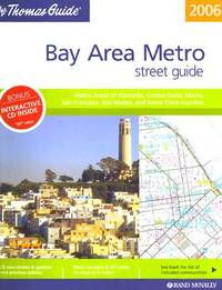
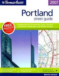
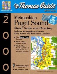
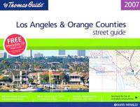
1999053262Thomas Brothers Maps 1999 Book. Good. Soft cover. 8vo - over 7¾ - 9¾" tall. Cover has some light rubbing and a few small creases name and date on inner front cover. Thomas Brothers Maps paperback
ANAIS-0528866915Thomas Brothers Maps. paperback. Good. 8.8x1x10.6. Buy with confidence. Excellent Customer Service & Return policy. Thomas Brothers Maps paperback
ANAIS-0528855360Thomas Brothers Maps. paperback. Good. 1x8.6x10.6. Buy with confidence. Excellent Customer Service & Return policy. Thomas Brothers Maps paperback
2005G0528855360I5N10Thomas Brothers Maps 2005. Paperback. Acceptable. Former library book; Readable copy. Pages may have considerable notes/highlighting. ~ ThriftBooks: Read More Spend Less.Dust jacket quality is not guaranteed. Thomas Brothers Maps paperback
0528855816.Gspiral_bound. Good. Access codes and supplements are not guaranteed with used items. May be an ex-library book. unknown
1998Q-1581740352Thomas Brothers Maps 1998-12-01. Spiral-bound. New. In shrink wrap. Looks like an interesting title! Thomas Brothers Maps unknown
0528873598.Gspiral_bound. Good. Access codes and supplements are not guaranteed with used items. May be an ex-library book. unknown
052885450X.Gpaperback. Good. Access codes and supplements are not guaranteed with used items. May be an ex-library book. paperback
0528866915.Gpaperback. Good. Access codes and supplements are not guaranteed with used items. May be an ex-library book. paperback
158174210X.Gspiral_bound. Good. Access codes and supplements are not guaranteed with used items. May be an ex-library book. unknown
DADAX0528859382Rand McNally 0000-00-00. spiral_bound. New. 11.50x0.75x8.50. Buy with confidence. Excellent Customer Service & Return policy. Rand McNally unknown
20192-1851376283Harvey Map Services Ltd 2019. Hardcover. New. 240 pages. 9.84x8.27x0.98 inches. Harvey Map Services Ltd hardcover
2019__1851376283Harvey Map Services Ltd 2019. Hardcover. New. 240 pages. 9.84x8.27x0.98 inches. Harvey Map Services Ltd hardcover
RARE illustrated account of a travel from Cairo to Damascus undertaken by a Scottish traveler and pastor Robert Walter Stewart (also called Roberto Gualtiero, 1812-1887), who was an important figure in Italian Protestantism and author of several books, among them "On the present condition and future prospects of the Waldensian Church, in Lectures on Foreing Churches delivered in Edinburgh and Glasgow" (Edinburgh, 1845), and "An Italian campaing, or Evangelical movement in Italy, 1845-1887" (London, 1890). The book features a frontispiece, additional 15 b&w illustrations and a large fold-out map of the Sinai peninsula. 220x150mm. XVI+528 pages (+ 8 advertisement pages). Quarter-cloth rebound Hardcover. Spine dirty. Spine edges slightly bumped. Ex libris sticker on front end-paper upper corner. Previous owner's name written in ink on title page upper corner/edge. Map inner edge bear binding slightly torn. Title page and page III/IV coming loose. Page XIII/XIV detached from binding (but present). Pages yellowing and slightly wavy. [SUMMARY]: Save for some light wear, this rare and beautifully illustrated travel account is in good condition.