333 résultats
1769MAP1013London: Russell and Price 1769. Original Map . No Binding. Fine. 4to. Single page map of the County of NORTHAMPTON SHIRE John Roque. Published in ENGLAND DISLAYED Being a New Complete and Accurate Survey and Description of the Kingdom of England and Principality of Wales. Plate 16 x20cm sheet 160 x 243mm. Fine original map printed on laid paper. Uncoloured. 2ND EDITION pub. 1769. OTHER COUNTIES ARE AVAILABLE FROM THIS ISSUE. <br/> <br/> Russell and Price unknown
1769MAP1015London: Russell and Price 1769. Original Map . No Binding. Fine. 4to. Single page map of the County of NOTTINGHAM SHIRE John Roque. Published in ENGLAND DISLAYED Being a New Complete and Accurate Survey and Description of the Kingdom of England and Principality of Wales. Plate 16 x20cm sheet 160 x 243mm. Fine original map printed on laid paper. Uncoloured. 2ND EDITION pub. 1769. OTHER COUNTIES ARE AVAILABLE FROM THIS ISSUE. <br/> <br/> Russell and Price unknown
1769MAP1017London: Russell and Price 1769. Original Map . No Binding. Fine. 4to. Single page map of the County of RUTLAND SHIRE John Roque. Published in ENGLAND DISLAYED Being a New Complete and Accurate Survey and Description of the Kingdom of England and Principality of Wales. Plate 16 x20cm sheet 160 x 243mm. Fine original map printed on laid paper. Uncoloured. 2ND EDITION pub. 1769. OTHER COUNTIES ARE AVAILABLE FROM THIS ISSUE. <br/> <br/> Russell and Price unknown
1769MAP1024London: Russell and Price 1769. Original Map . No Binding. Fine. 4to. Single page map of the County of STAFFORD SHIRE John Roque. Published in ENGLAND DISLAYED Being a New Complete and Accurate Survey and Description of the Kingdom of England and Principality of Wales. Plate 16 x20cm sheet 160 x 243mm. Fine original map printed on laid paper. Uncoloured. 2ND EDITION pub. 1769. OTHER COUNTIES ARE AVAILABLE FROM THIS ISSUE. <br/> <br/> Russell and Price unknown
1769Map1005London: Russell and Price 1769. Original Map . No Binding. Fine. 4to. Single page map of the County of ISLE OF WIGHT John Roque.Published in ENGLAND DISLAYED Being a New Complete and Accurate Survey and Description of the Kingdom of England and Principality of Wales. Plate 16 x20cm sheet 160 x 243mm. Fine original map printed on laid paper. Uncoloured. 2ND EDITION pub. 1769. OTHER COUNTIES ARE AVAILABLE FROM THIS ISSUE <br/> <br/> Russell and Price unknown
1769MAP1016London: Russell and Price 1769. Original Map . No Binding. Fine. 4to. Single page map of the County of NOTTINGHAM SHIRE John Roque. Published in ENGLAND DISLAYED Being a New Complete and Accurate Survey and Description of the Kingdom of England and Principality of Wales. Plate 16 x20cm sheet 160 x 243mm. Fine original map printed on laid paper. Uncoloured. 2ND EDITION pub. 1769. OTHER COUNTIES ARE AVAILABLE FROM THIS ISSUE. <br/> <br/> Russell and Price unknown
1769MAP1038London: Russell and Price 1769. Original Map . No Binding. Vg. 4to. Single page map of BUCKINGHAMSHIRE G. Rollos. Published in ENGLAND DISLAYED Being a New Complete and Accurate Survey and Description of the Kingdom of England and Principality of Wales. Plate 16x20 cm sheet 160 x 243mm. VG original map printed on laid paper. SOME MOTTLING. Uncoloured. 2ND EDITION pub. 1769. OTHER COUNTIES ARE AVAILABLE FROM THIS ISSUE. <br/> <br/> Russell and Price unknown
1769MAP1039London: Russell and Price 1769. Original Map . No Binding. Vg. 4to. Single page map of BERKSHIRE G. Rollos. Published in ENGLAND DISLAYED Being a New Complete and Accurate Survey and Description of the Kingdom of England and Principality of Wales. Plate 16x20 cm sheet 243 x 160mm. VG original map printed on laid paper. Uncoloured. 2ND EDITION pub. 1769. OTHER COUNTIES ARE AVAILABLE FROM THIS ISSUE. <br/> <br/> Russell and Price unknown
1769MAP1037London: Russell and Price 1769. Original Map . No Binding. Vg. 4to. Single page map of ANGELSEY G. Rollos. Published in ENGLAND DISLAYED Being a New Complete and Accurate Survey and Description of the Kingdom of England and Principality of Wales. Plate 16x20 cm sheet 160 x 243mm. VG original map printed on laid paper. SOME MOTTLING. Uncoloured. 2ND EDITION pub. 1769. OTHER COUNTIES ARE AVAILABLE FROM THIS ISSUE. <br/> <br/> Russell and Price unknown
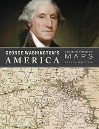
2010GT396New York: Walker Publishing Co. 2010. 1st edition 1st impression . Hardback. Fine/Fine. Folio. 303pp. Full colour d.j. No wear inscriptions fading or marks. A sumptuous production and very heavy. <br/> <br/> Walker Publishing Co., hardcover
1758W201Dublin: John Exshaw Dame Street 1758. 1st Edition . No Binding. Fine. 8vo. 259-312pp. A disbound copy of the Dublin version of the Gentleman's Magazine for the month of May 1758. Fine fresh paper with no foxing wear or marks. The title-page lists 22 articles on the title-page. Articles include The Effects of Camphire on a 'lunatic'.; York rioters ordered for execution; Shipping lists; The conduct of Admiral Knowles. Please email for photos. <br/> <br/> John Exshaw, Dame Street unknown
1843Map872London: Longman Hurst Row Orme & Co. 1843. 1st issue . Cloth. Vg. WALKERS COUNTY MAP SERIES. nd c1843. Folding map of KENTlaid on linen and dissected into 15 sections. Out-line hand-colour coloured woods and railway lines. Enclosed in a card case with a decorative paper label. Covers worn otherwise an attractive travellers map in a very clean condition. 34 x41 cms.13 x 16 inches <br/> <br/> Longman, Hurst, Row, Orme & Co. hardcover
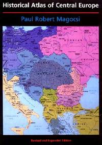
2002027737Seattle: University of Washington Press 2002. Flat uncreased spine. A solid reading / reference copy but rated only Good because something perhaps coffee was spilled leaving a light brown discoloration in part of the book's outer margin along the fore-edge. NO maps are affected. Almost no text is affected either except in the index where the discoloration reaches a few words on several pages and many words on the last page of the index. NOT as bad as it sounds -- PHOTOS UPON REQUEST. Oversize Softcover. 9" wide by 12" tall. This large heavy book may require extra postage for International shipments but only the standard charge for priority or media mail. Bound in the original black wraps lettered in white red and blue with a full color map on the front. Choice Outstanding Academic Title for 2003. From the rear cover: "THE HISTORICAL ATLAS OF CENTRAL EUROPE covers the area from Poland Lithuania and the eastern part of Germany to Greece and western Turkey and extends in time from the early fifth century to the present. This new edition of the HISTORICAL ATLAS OF EAST CENTRAL EUROPE first published in 1993 to great acclaim incorporates the enormous political changes that have taken place since 1989 taking into account comments from seventy-five reviewers from seventeen countries. The final third of the volume has been completely reconceptualized and reconfigured with new maps text and statistical tables. The bibliography has been updated and expanded. New Features: Twenty-one new maps; Forty-one revised maps; Eleven maps of newly independent countries; Eleven new chapters; Eight new thematic maps covering twentieth-century population changes distribution education and Catholic and Orthodox churches." Volume I in the series: A History of East Central Europe. Revised and Expanded Edition. Oversize Softcover. Good condition. Illus. by NOT a library discard. xiv 274pp. Great Packaging Fast Shipping. University of Washington Press Paperback
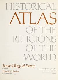
1974012035New York: Macmillan 1974. 8.75" wide by 11" tall. Previous owner's blindstamp. Otherwise a bright clean square tight unmarked copy. Not a book club edition. Not price clipped 15.00. No remainder mark. Illustrated with photos drawings and 65 maps. From the Dust Jacket: "Here is the most extensive historical atlas of religion ever published." Essays photos and maps illuminate the origins and distribution of religions; their movement; locations of sacred cities sites and temples; growth; the relation of one religion with another; places associated with leading rabbis theologians and writers; Jewish emigration; Muslim rule; religious use of narcotics; Chinese religions; 18th century Christianity; Islamic schools of law sects and reform movements; spread of Orthodox law schools; etc. Appendix 38 pages long gives detailed chronologies of the religions of the past. Subject Index. Name Index. First Printing of the First Edition. Oversize Hardcover. Near Fine condition/VG DJ tiny closed tears. xviii 346pp . Macmillan Hardcover
198713336Norman OK USA: University of Oklahoma Press 1987. First Edition Second Printing. Paperback. Very Good/No Dust Jacket. Large paperback no marks many maps and illustrations with 224 pages. <br/><br/> University of Oklahoma Press paperback
1997018405Mansfield Centre Connecticut: Martino Fine Books 1997. Brand New in perfect condition just removed from the publisher's shrinkwrap so we could write this description. NO rubbing. NO fading. Bright clean square and tight. Sharp corners. NO owner's name or bookplate. NO remainder mark. Fresh and crisp -- obviously never read. Limited to 100 copies. n. d. but 1997. Reprint of the expanded 1964 edition. The best edition of the best cartography of Texas maps. Describes and comments on some 1000 Texas maps from 1527 to 1900. Entries identify full title publisher map maker date content scale color dimensions etc. Illustrated. Bound in the original gilt-stamped bluish-green cloth. Moeb's U. S. REFERENCE-IANA 748: "A basic reference in the field. This 1964 issue contains 88 maps not in the prior printing." See Ristow 325. From the publisher: "This important work is the most extensive cartography devoted exclusively to Texas maps. It comprises the map collection of the Texas State Archives. In all approximately 1000 maps are meticulously described. There are excellent annotations describing coloring rivers mountains towns forts Indian tribes trails trading posts and a host of other subjects depicted in the maps. There is also interesting background information about the history of the territory or the map described. And of course dimensions and scales are given.". Reprint of the expanded 1964 edition. Hardcover. New/No jacket as issued. iv 178pp. Great Packaging Fast Shipping. Martino Fine Books Hardcover
1839W043Eton: E. Williams 1839. New and improved edition . Hardback. Fair. large 8vo. xviii 847 i adpp. Folding frontis. plate of the Solar system.; astronomical folding plate; folding plate of Athens. Lacks Rome and Syracuse plates. Title-page and frontis. loose and binding worn. READING/ REFERENCE COPY ONLY. <br/> <br/> E. Williams hardcover
1842Map 805Edinburgh: A&C Black 1842. No Binding. Fine/uncoloured. Folding plate of the two hemispheres. Beautiful steel engraving from Encyclopaedia Britanica Seventh edition dated 1842. Plate CCLXII. Fine example with no wear. Couple of small fox marks. Engraved by S. Hall Bury Str. Bloomsbury. Australia is named 'Australia and New Holland'. 400x280mm. <br/> <br/> A&C Black unknown
1890Map 728Scotland: Ordnance Survey Office 1890. 1st Edition . Hardback. Vg. Folding map. Folding map dissected in 18 sections the rare first series edition laid on linen and cased in the original green cloth boards 6.75 x 4.5 inches with a hand-written paper label. Surveyed 1859 -1863 and published in1890. Small grid of adjoining maps for the one inch and six inch series pasted to inside cover. 25x19 inches with hand-coloured roads. A nice copy with no wear or loss. There were 132 sheets for the complete Scottish ordnance maps and a second edition appeared in in 1898-1904 with coloured parishes. The one inch maps were based on larger scale surveys of 1843-1878 and published between 1856 and 1895. <br/> <br/> Ordnance Survey Office hardcover
1867Map 731Scotland: Ordnance Survey Office 1867. 1st Edition . Hardback. Vg. Folding map. Folding map dissected in 18 sections the rare first series edition laid on linen and cased in the original green cloth boards 6.75 x 4.5 inches with a hand-written paper label. Surveyed 1859-1864 and published in1867. Small grid of adjoining maps for the one inch and six inch series pasted to inside cover. 25x19 inches with hand-coloured roads. A nice copy with no wear or loss. There were 132 sheets for the complete Scottish ordnance maps and a second edition appeared in in 1898-1904 with coloured parishes. The one inch maps were based on larger scale surveys of 1843-1878 and published between 1856 and 1895. <br/> <br/> Ordnance Survey Office hardcover
1876Map 729Scotland: Ordnance Survey Office 1876. 1st Edition . Hardback. Vg. Folding map. Folding map dissected in 18 sections the rare first series edition laid on linen and cased in the original green cloth boards 6.75 x 4.5 inches with a hand-written paper label. Surveyed 1860-1871 and published in1876. Small grid of adjoining maps for the one inch and six inch series pasted to inside cover. 25x19 inches with hand-coloured roads. A nice copy with no wear or loss. There were 132 sheets for the complete Scottish ordnance maps and a second edition appeared in in 1898-1904 with coloured parishes. The one inch maps were based on larger scale surveys of 1843-1878 and published between 1856 and 1895. <br/> <br/> Ordnance Survey Office hardcover
1769MAP1018London: Russell and Price 1769. Original Map . No Binding. Fine. 4to. Single page map of the County of SHROP SHIRE John Roque. Published in ENGLAND DISLAYED Being a New Complete and Accurate Survey and Description of the Kingdom of England and Principality of Wales. Plate 16 x20cm sheet 160 x 243mm. Fine original map printed on laid paper. Uncoloured. 2ND EDITION pub. 1769. OTHER COUNTIES ARE AVAILABLE FROM THIS ISSUE. <br/> <br/> Russell and Price unknown
1769Map1007London: Russell and Price 1769. Original Map . No Binding. Fine. 4to. Single page map of the County of SUSSEX John Roque. Published in ENGLAND DISLAYED Being a New Complete and Accurate Survey and Description of the Kingdom of England and Principality of Wales. Plate 16 x20cm sheet 160 x 243mm. Fine original map printed on laid paper. Uncoloured. 2ND EDITION pub. 1769. OTHER COUNTIES ARE AVAILABLE FROM THIS ISSUE. <br/> <br/> Russell and Price unknown
1637Map2821637 1637. 2nd ediiton . No Binding. Fine. Hand-colour. 13x11 inches <br/> <br/> 1637 unknown
1952018855Madison: The University of Wisconsin Press 1952. SCARCE FIRST EDITION. Very Good condition in a Very Good dust jacket. SEE OUR PHOTOS. The jacket has small chips at the spine ends and corners. NOT price clipped $2.75. Protected by a removable Brodart clear-plastic sleeve. NOT a library discard. NO owner's name or bookplate. NO underlining. NO highlighting. NO margin notes. A few tiny brown speckles light foxing on the endpapers and one plate only. 1952. First Edition. A study of maps as art the importance of lettering calligraphy and type styles principles of design use of color hue intensity contrast projection etc. Figures. Tables. Bibliographical references. Bound in the original gilt-stamped green cloth. Complete with dust jacket. First Edition. Hardcover. Very Good condition/Very Good dust jacket. Illus. by NOT a library discard. 8vo. xi 105pp. Great Packaging Fast Shipping. The University of Wisconsin Press Hardcover