5 782 résultats
Historical overwiew Nikos Andriotis, Translation P.Kapsambelis. Text in english and greeke. Book in beautiful blue canvas with golden tits on the plate and back, with hundreds of color illustrations, pp 345. Very rare book - Cartography
1927217243Würzburg u. München, 1898-1927. M. Ktn. u. Abb. In 14 Hlwdbdn. Teilw. St. u. Sign. a. Tit. Bd. 18 Einbd. Wasserschaden. Fehlt: Bd. 22 TI.
63001BBo.J. (Frans Hogenberg, geboren 1535 in Mechelen, gestorben 1590 in Köln. Kupferstecher und Radierer. Georg Braun, geboren 1541 in Köln, gestorben 1622 ebenda. Theologe, Kanoniker. Braun und Hogenberg waren in den Jahren von 1572 bis 1618 Herausgeber des Städteansichtenbuches 'Civitates Orbis Terrarum').. [3 Warenabbildungen]
Incisione in rame, 1561 ca., b/n, cm 19,5 x 26,5 ca. (alla lastra). Ruscelli fu l’editore della versione riveduta e ampliata della “Geographia” di Claudio Tolomeo, stampata a Venezia svariate volte tra il 1561 e la fine del secolo, il 1598. Le carte di Ruscelli erano, a loro volta, in generale, basate su quelle catalogate da Giacomo Gastaldi per la sua edizione veneziana del 1548, lei stessa basata sulla “Geographia”. La presente carta geografica è quindi una variante di quella di Giacomo Gastaldi, che probabilmente è anche il disegnatore di questa lastra. Bella impressione, ampi margini, ottimo stato di conservazione..
Augusta, 1740 circa. Tratta dall “Atlas novus indicibus instructus”, incisione in rame, colore d’epoca, cm 50 x 58 (alla lastra). Carta raffigurante il territorio tirolese, l'impostazione è molto simile alla carta di J.B. Homann edita nel 1716. Anche le decorazioni che accompagnano il titolo ricordano quella dell' Homann, con la fortezza di Covelo sullo sfondo e diverse figure allegoriche nel primo piano. (Bibl. “Il territorio trentino - tirolese nell’antica cartografia” di Gino Tomasi, scheda n. 56). Ingiallimento della brachetta centrale, peraltro a pieni margini e in buono stato di conservazione.
1808Map930Paternoster Row London: Longman Hurst Rees & Orme 1808. 1st Edition 1st Printing. No Binding. Fine. Original early 19th century map CHART OF THE PACIFIC OCEAN BY AARON ARROWSMITH. A FINE CLEAN AND DARK IMPRESSION. Original folding plate including New Holland Australia with an incomplete southern coastline with a complete New Zealand. Watermarked paper 1811. A scarce example and in fine un-coloured original condition.41x27cms. Double-page. <br/> <br/> Longman, Hurst, Rees & Orme unknown
1807Map936Paternoster Row London: Longman Hurst Rees & Orme 1807. 1st Edition 1st Printing. No Binding. Fine. Original early 19th century map MAP OF THE EMPIRE OF JAPAN BY AARON ARROWSMITH. A FINE CLEAN AND DARK IMPRESSION. Original folding plate covering North Florida to Lower Canada. A scarce example and in fine un-coloured original condition.41x27cms. Double-page. <br/> <br/> Longman, Hurst, Rees & Orme, unknown
1805Map935Paternoster Row London: Longman Hurst Rees & Orme 1805. 1st Edition 1st Printing. No Binding. Fine. Original early 19th century map MAP OF THE EASTERN COAST AND LANDS OF THE UNITED STATES BY AARON ARROWSMITH. A FINE CLEAN AND DARK IMPRESSION. Original folding plate covering North Florida to Lower Canada Watermarked heavy paper 1804. A scarce example and in fine un-coloured original condition.41x27cms. Double-page. <br/> <br/> Longman, Hurst, Rees & Orme unknown
1804Map934Paternoster Row London: Longman Hurst Rees & Orme 1804. 1st Edition 1st Printing. No Binding. Fine. Original early 19th century map CHART OF THE PACIFIC WEST INDIES BY AARON ARROWSMITH. A FINE CLEAN AND DARK IMPRESSION. Original folding plate including Honduras Watermarked paper 1804. A scarce example and in fine un-coloured original condition.41x27cms. Double-page. <br/> <br/> Longman, Hurst, Rees & Orme unknown
1809Map939Paternoster Row London: Longman Hurst Rees & Orme 1809. 1st Edition 1st Printing. No Binding. Fine. Original early 19th century map MAP OF CHINA BY AARON ARROWSMITH. A FINE CLEAN AND DARK IMPRESSION. Original folding plate covering THE WHOLE OF CHINA AND THE EASTERN SEA Watermarked heavy paper dated 1808. A scarce example and in fine un-coloured original condition. An occasional light foxing mark. 41x27cms. Double-page folding map.Engraved by Russell. <br/> <br/> Longman, Hurst, Rees & Orme unknown
178185108Sans éditeur 1781 Les cartes sont dressées par M. Bonne, Ingénieur Hydrographe de la Marine. In-4, reliure, titre gravé en double page, 37 doubles cartes gravées montées sur onglets. et une planche 19e siècle contre collée. Reliure restaurée amateur, recouverte de papier kraft, gardes fragilisées annotations à l’encre d’époque et au crayon papier. Manque 7 cartes sur 44. Mouillures. Rousseurs.
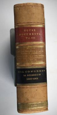
1901025183Washington: Government Printing Office 1901. SEE PHOTOS. A handsome example of the 1901 first edition in quite scarce original leather binding with 3 titles bound together as sometimes seen -- NOT print on demand edition or modern reprint. Very Good condition. NOT a library discard. NO owner's name or bookplate. Hinges are perfect. Minor offset as usual from the leather binding to edges of the endpapers. Front free endpaper has light soil and 4 small edge chips. Pages are otherwise clean and unmarked. NO foxing. 1901. First Edition. 1137pp. Bound in the original full leather calf binding we say "original" because we have seen other first editions in an identical leather binding including its 3 attractive leather spine labels -- in red black and brown -- although none of them were in condition as nice as this one. Leather is only moderately rubbed. SEE PHOTOS. All gilt stamping is still bright and shiny. This is House of Representatives Document No. 516 1901. Also bound in are: A LIST OF BOOKS WITH REFERENCES TO PERIODICALS ON PORTO RICO by A. P. C. Griffin. Senate Document No. 222. 55pp. 1901.; and A LIST OF BOOKS WITH REFERENCES TO PERIODICALS ON THE DANISH WEST INDIES by A. P. C. Griffin. Senate Document No. 223. 18 pp. 1901. Oversize Hardcover. 7.25" wide by 10.25" tall by 3" thick. This large heavy book will require extra postage for Priority and International shipments but only the standard charge for media mail. Sheehy 1986 CL287: "Lists maps to be found in books and atlases as well as those separately issued. Describes many old state and country maps and city plans.". First Edition. Oversize Hardcover. Very Good condition. Illus. by NOT a library discard. 1137pp. 55pp. 18pp. Great Packaging Fast Shipping. Government Printing Office Hardcover
1977101504Peregrine Smith, Inc., Santa Barbara, 1977. 50,5 x 42,5 cm ; Leinen
Very Good Turkish Original manuscript map of Alexandria Port and its immediate hinterland. Folio. (33 x 41 cm). In Turkish (Modern). Folded. No scale. The manuscript shows Alexandria Port and the Palace of the King Farouk of Egypt, customs shores, ports and harbors, locations of the British ships, radio station, location of SS Ramlah, strait, Great Pass (?), waterfront for the lumber ships, sea current zones and probably entrance and exit routes etc. A very detailed map, decorated with ships. Some repairs with tape, tears, foxing and stains. Overall a good copy.
Very Good French This attractive color lithographed map shows the Imperial Ottoman territories in the Balkan Peninsula, Anatolia, also North African shores and Maghreb countries, Egypt and Vilayet de Tripoli (Libya) and Liva de Benghasi. It has small views with a small scale of Tripoli, Europe, Egypt, and Nubia with the Arabian Peninsula. This map reflects the territories and situation of the last period of the Ottoman Empire soon after the Second Constitutional Era in 1908. Inside the red lines in this map shows the Ottoman territories in 1909 with its maximum extent, just before the Balkan Wars, (1912-1913). In Europe, Western Thrace territories up to Montenegro including Adrianople are within the borders of the Empire. E. Nardin was a French cartographer who prepared more than sixty maps in the early 19th century, especially mapping Middle Eastern, North African, Sub-Saharan African areas. Original color lithograph folded map in its original wrappers. Oblong double elephant folio. (77x95 cm). Wrappers dimensions: (21,5x14 cm). In French. Echelle 1/4.165.000 (Scale). Only two copies in OCLC. Extremely rare. No date.
Very Good Turkish, Ottoman (1500-1928) Original color map on cloth. Oblong atlas folio. (44 x 58 cm). Scale: 1/200.000. Toponyms in Ottoman script /Turkish with Arabic letters). Shows southwest of the Gallipoli Peninsula [and the Hellespont], Edremid Gulf, Tenedos, and North Aegean shores of Anatolia]. Folded. This is one of the series of the Bonn projection maps which are the first map series in modern techniques in Turkey and the Ottoman Empire. In order to produce these maps covering Turkish territory, Reconnaissance Branch was incorporated into The Mapping Commission. The maps were produced in the datum based on the latitude and longitude of the Ayasofya Mosque in equal area Bonn Projection. The field works for the 123 sheets covering the country were conducted by 76 staff. The production was completed in 18 years starting from east-west. Fieldworks continued without stopping except in the years 1914 and 1920. This map series called also reconnaissance maps contributed a lot to producing 1:25.000 scale maps. Hegira: 1336 = Gregorian: 1920. Not description on map-maker. Extremely rare.
Very Good Turkish, Ottoman (1500-1928) Original color map of Eastern Anatolia, Dogu Beyazit, Bayazid, Bargiri, Nakhchevan, Karakilise, Van, etc. 50x60 cm. In Ottoman script (Enverî). 1 p. Scale: 1:200.000. Slightly toned, several small holes on paper. Otherwise a very good copy. Enverî script is the war minister Enver Pasha's alphabet and writing amendment, which he tried to implement within the Ministry of War between 12 March 1914 and 10 August 1914. Starting from the Tanzimat (Westernization) period in the Ottoman Empire, the discussions on simplification in language, writing, alphabet and reading-writing had increased and at the end of the 19th century, military necessities also became one of the concerns. The problems such as the low rate of literacy among the recruited soldiers, the need to teach the soldiers how to read and write in a short time, and their misconceptions about the spelling of proper nouns led Enver Pasha to add the writing problem to his reform agenda, once he took office. Enver Pasha's reform is based on the principle of writing the Ottoman letters, which take different forms in the beginning, in the middle and at the end according to their unification with the other letters, separately in their original state without merging them. While this new alphabet was being created, the existing 32 letters in the Ottoman were preserved. The 8 vowels in the Turkish language, which could not be written with the old letters, was shown by placing small marks on the existing vowels and by doing so a new alphabet consisting of a total of 40 letters was created. With this alphabet, officially called 'Ordu Elifbasi', rules were adopted such as writing of the letters without merging them, writing the words as they are pronounced. At first glance, Enver Pasha's writing reform, which appeared as a definite solution to the theory of the solution of the ongoing debates on the alphabet and the spelling, formed a wide experiment field in the military. It was not possible to use Ordu Elifbasi, which essentially is a transliteration alphabet that allows transferring the sounds of these three different languages (Turkish, Arabic, Persian) to a single alphabet, in the daily life. Thanks to this new alphabet and spelling, learning to read and write were accelerated to some extent. However, it was seen that the literacy rate of the well-educated, literate people fell to the spelling and did not even progress. This alphabet and spelling reform, which Enver Pasha thought of spreading to the whole country, caused much more problems as it was experienced in the army. Although it was postponed until the end of the mobilization period following the declaration of the mobilization, Ordu Elifbasi, which remained in force for 152 days, eventually failed to be realized. (Source: Karakus: Enver Pasha's Alphabet And Spelling Attempt: Ordu Elifbasi (Army Alphabet)).In this extremely rare document, there are some articles and thoughts on a case. This is one the serie of the Bonn projection maps which are the first map series in modern techniques in Turkey and the Ottoman Empire. In order to produce these maps covering Turkish territory, Reconnaissance Branch was incorporated into The Mapping Commission. The maps were produced in the datum based on the latitude and longitude of Ayasofya Mosque in equal area Bonn Projection. The field works for the 123 sheets covering the country were conducted by 76 staff. The production was completed in 18 years starting from east west. Field works continued without stopping except in years 1914 and 1920. This map series called also reconnaissance maps contributed a lot to producing 1:25.000 scale maps. Extremely rare. KW: "Harfleri Islah Cemiyeti" Hurûf-i munfasila Reform Turkish Letter revolution First World War WW 1 Map Geography Military maps.
Very Good Turkish, Ottoman (1500-1928) Original chromolithograph folded map. Oblong atlas folio. (49 x 65 cm). In Ottoman script. Repaired with a band in the contemporary period from its backside. Set including 4 sheets. Other sheets are Basrah, Bagdad, and Qut al-Amare. This is the first sheet including 'Samawah'. Rare. Scale is 1/500.000. Samawah city was settled by the Arab tribe of Banu Quda'a around the 3rd century AD. It is built on both sides of the Euphrates river; there are four bridges in the center of town for crossing between the two sides. The west bank of the city contains the commercial heart of the city and includes the old town and the Jewish quarter, Agd al Yahood. The west bank is the site of the covered market Suq Al Masgoof, which dates to the Ottoman period. The area surrounding the market is the old city with its Byzantine maze of crowded markets and streets. The eastern side of the city including 'Qushla' has a more modern feel and contains a number of estates of apartment blocks built during the 1970s and 1980s, As Samawah Stadium, which is home to the local Muthanna football team Samawa FC, as well as technical colleges and the polytechnic. There too is Al Qushla, the historic "Ottoman Barracks". The most famous attraction of Samawah in the ruins of the ancient Sumerian city of Uruk which dates to 4000 BC. This was the largest city in Sumer, extending over 2 km2. Uruk was not only the largest conurbation of the first urban civilization on earth, but it is also the place where the first written script was discovered, the oldest dating back to 3300 BC. The palm groves of Samawah: Samawah is built on both sides of the Euphrates and is surrounded by hundreds of palm groves that give it a tropical feel, especially in the southern and northern suburbs. These groves provide cool respite from the scorching heat of Mesopotamia and were the inspiration for the famous Iraqi folk song "The Palm of Samawah".
Very Good French A rare color lithograph map of French Indochina, showing international and provincial boundaries, transportation, and water features. Relief is shown by shading, spot heights, and bathymetric contours, as well as Cambodge, Thailande, Hai-Nan Island, Golfe du Tonkin, Mer de Chine, Yunnan Kouang-si, Kouang-Toung, Laos, Annam, Tonkin, Golfe du Siam, Bangkok, etc. Depths shown by contours. Prime meridians: Greenwich and Paris. "Compliled and drafted by l'Institut ge?ographique national, 1938. Revised by the Service ge?ographique de l'Indochine, 1948. Copied by AMS, 1951.". Original color map. Good. Folded. Double elephant folio. (93 x 66 cm). In French. 2 copies in OCLC (1948 Edition).; LCCN map59000405. Scale: 1/2000000. Restored on folded trace on right corner. A good copy.
Very Good Turkish, Ottoman (1500-1928) Original map of Kars Fortress. Oblong: 45x57 cm. In Ottoman script. Scale: 1/21000. [PLAN OF KARS FORTRESS] Kars Kal'asi plâni (Based on 1898 discoveries and 1908 practice). A very detailed plan in Ottoman script of Kars Fortress and is environment. Some red markings. Extremely rare.
Very Good German Original b/w city plan. Atlas folio. (58x47 cm). In German. Folded. [CITY PLAN of BRAILA -IBRAIL-] Stadtplan von Braila. Scale (Masstab): 1/10.000. No cartographer. 33 descriptive articles on bottom-right corner of the plan. Slightly chipped at extremities of paper and soiling. It shows Braila and Donau. Braila (Turkish: Ibrail) is a city in Muntenia, eastern Romania, a port on the Danube and the capital of Braila County. There's some Ottoman manuscript including translations of the German descriptive text on the plan, and also "'Ibrail' sehir plâni" written on verso in Ottoman script. Extremely rare.
Carta di cm. 46 x 70, inc. in rame e montata su tela, suddivisa in 10 riquadri. Sono comprese le province di Milano, Lodi e Vigevano. Esemplare ben conservato.
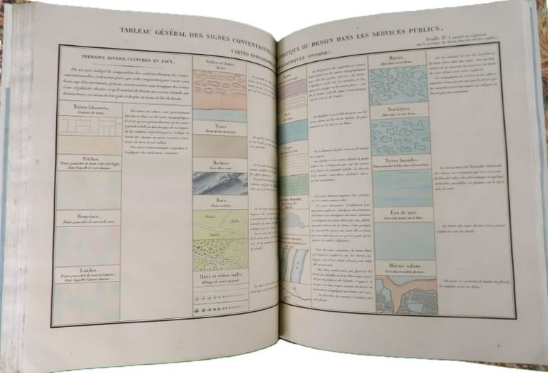
2752Paris, Typographie de Henri Plon, imprimeur de l'Empereur, 1855. In-4 - 28,5 x 22,5cm. Reliure moderne en demi-chagrin bleu nuit, dos lisse, pièce de titre en chagrin rouge orné de filets dorés, couvertures conservées. 115 pages paginées, 7 planches doubles. Ouvrage qui regroupe les règles pour l'établissement de cartes géographiques, topographiques et marines, de dessins divers, de plans, etc., afin d'uniformiser les conventions. Exemplaire bien complet de ses 7 planches doubles, reliées in fine et aquarellées à la main. Ouvrage de toute rareté, référencé dans seulement 2 collections publiques françaises : la BnF et le Conservatoire National des Arts et Métiers, à Paris.
Opera completa dei 110 fascicoli, brochure editoriale a stampa con numerose illustrazioni in nero. Ottimo stato. Contiene: Geographical Oddities, Dictionary of Mapmakers (Parts I-X), South East Asia, Small and Miniature Maps of Africa, Title Pages from 16th to 19th Century, Printed Maps of Central America, Some Portraits of Geographers and other Persons associated with Maps (complete), Printed Maps of Central America up to 1860, Catalogue of printed Maps of Greece and Greek Regions 1477-1800 (complete), Early Printed Maps of the British Isles 1477-1650 (complete), Printed Maps of America (Parts I-IV), Printed Maps of Australia (complete), Sequence of Maps of America, Maps in the Parliamentary Papers by the Arrowsmiths (Parts I-II), Playing Cards, Malinowski Collection of Maps of Poland (complete), Printed Maps of Hertfordshire (Parts I-V), Sequence of Maps of Africa, Printed Maps of St. Kitts and St. Lucia and St. Vincent, Early Maps of Colombia up to 1850, Maps of the Canary Islands published before 1850, Early Maps of Panama, Printed Charts of Scandinavia (Parts I-II).. .
Bella carta d’Italia incisa in rame (cm. 82,5 x 60,5), montata su tela e suddivisa in 20 riquadri. In alto a destra, cartiglio con la figura allegorica dell’Italia. I vari stati che la compongono (Regno Lombardo-Veneto, Sardo, Principato di Monaco, Ducati di Parma e di Modena, Granducato di Toscana e Lucca, Repubblica di San Marino, Stato della Chiesa, Regno di Napoli, stati limitrofi all’Italia) sono contraddistinti dai colori diversi dei confini. Ai lati sono riportate: “tavola di altezze in metri sul livello del mare di varie città d’Italia - spiegazione dei segni”. Picc. manc. al riquadro in alto a dx. e al margine inferiore, altrimenti ben conservata.