333 résultats
1880GT058Edinburgh: John Bartholomew & Co. 1880. 1st Edition . Hardback. Fine. Folio. ND 1880 The Royal Horticultural Society Gardens in Kensington are still mapped but closed in 1882 being the Royal Albert Hall and Royal College of Music so this scarce map is published prior to that date. 23.5 x 33 x 23.5 inches 80x60 cms Folded and enclosed with a green cloth booklet 31pp with index of the streets etc. A nice copy with a few pin-holes where the folds intersect. A single un-dissected sheet pasted on linen with 36 panels when folded. From Hampstead to south of Battersea and Shepherd's Bush to Greenwich with printed and hand-colouring. The map has grid-lines each covering half mile suares with grid letters and numbers in the margins. Tower Bridge is not present. <br/> <br/> John Bartholomew & Co. hardcover
1773Map922London: H. Turpin 1773. 3rd Edition . No Binding. Fine. Single map of Lincolnshire. A fine uncoloured copy of the last issue of Robert Moderns playing card maps. Approx 55x90mms. Title to the head wth Roman numeral VIII and the uncoloured map to the main section enclosed with double ruled lines above and below with county dimensions and distances at the foot. Harry Turpin published a 52 sheet set of these maps between 1764 and 1787 but no exact date is known for publication. RARE. Please email for photos. <br/> <br/> H. Turpin unknown
1808Map950Paternoster Row London: Longman Hurst Rees & Orme 1808. 1st Edition 1st Printing. No Binding. Fine. Folio - over 12 - 15" tall. Original early 19th century un-coloured MAP OF PORTUGAL BY AARON ARROWSMITH. A FINE CLEAN AND DARK IMPRESSION. Original folding plate covering HOLLAND printed on heavy paper dated 1806. A scarce example and in fine un-coloured original condition. An occasional light foxing mark. 41x27cms. Double-page folding map. engraved by LOWRY.A LOVELY COPY. paper watermark dated 1806 <br/> <br/> Longman, Hurst, Rees & Orme unknown
1760Map1001London: T. Bowen 1760. Original First Edition . No Binding. Fine. c1760 A fine example of Bowens map of Portugall. Title within an oval frame. An uncoloured example and printed of thick paper. 2 vertical folds to the page but nice clean margins and a dark impression. Some minor foxing reflecting its age but a nice example. 'Prepared for Barlow's General History of Europe'. Blank reverse. 33x34cms Barlows volume is often very damp stained and foxed. This map is however a fine example. Thomas Bowen 1714-1767 <br/> <br/> T. Bowen unknown
1912016735Borough of Hopatcong New Jersey 1912. Near Fine condition. SEE PHOTO. This is a beautiful and very scarce color map of Lake Hopatcong New Jersey. When unfolded it measures 18" tall by 38" wide. Some folds have been neatly reinforced on the blank side with archival-quality document repair tape. Buildings are represented by red squares water in green. Some of the properties and locations depicted are: Port Morris Landing Roxbury Township Borough of Mount Arlington Byram Township Nolans Point Atlas Powder Co. Brookland Borough of Hopatcong Byram Cove Henderson Bay Byram Bay Maxim Park Jefferson Township Woodport Hurdtown Hurd Mining Co. W. M. Force Estate John P. Lawless Mary Ingram estate Aaron Peck estate Raccoon Island Halsey Island Bertrand Island Theodore King Gertrude Otten Violet Littell Robert Dunlap estate etc. Full title: "Property Map of Lake Hopatcong New Jersey Prepared by Hudson Maxim for the Morris Canal Investigation Commission November 16 1912 Compiled from Various Maps and Actual Surveys by P. E. Boomer C. E.". First Edition. Folded map. Near Fine condition. 18" tall by 38" wide when unfolded. Borough of Hopatcong, New Jersey? Paperback
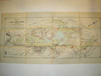
1808Map957Paternoster Row London: Longman Hurst Rees & Orme 1808. 1st Edition 1st Printing. No Binding. Fine. Original early 19th century MAP of PRUSSIA. On MERCATORS PROJECTION BY AARON ARROWSMITH. A FINE CLEAN AND DARK IMPRESSION. Original folding plate printed on heavy paper dated 1808. A scarce example and in fine un-coloured original condition. 41x27cms. Double-page folding map.A NICE COPY <br/> <br/> Longman, Hurst, Rees & Orme unknown
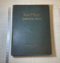
1929028276Chicago: Rand McNally & Company 1929. Good condition. Tears and creases to the title page. Vertical and corner creases up to page 6. SEE PHOTOS. Includes double page full color maps and other maps printed in yellow red and black. SEE PHOTOS. The double page maps open to an impressive 27.75" across. Contents: Part I: The World pp.4 - 23; Part II: The United States pp. 24 - 481; Part III: Foreign Countries pp. 482 - 537; Supplementary Maps: Canada Mexico China and Japan Polar Regions pp. 538 - 550. Bound in the original gilt-stamped green cloth. Oversize Hardcover. 15.50" wide by 20.75" tall by 2.25" thick at the spine. This massive extremely heavy book will require SUBSTANTIAL extra postage at our cost based on your locatuion. Sixtieth Edition 60th edition. Oversize Hardcover. Good condition. Illus. by NOT a library discard. 550 pages. Great Packaging Fast Shipping. Rand McNally & Company Hardcover
1892016610Chicago and New York: Rand McNally & Company 1892. Very Good condition but for short tears at 3 or 4 of the map folds which have been neatly reinforced with archival tape on the blank side. SEE PHOTOS. A very attractive well preserved copy. 60 pages of text including brief information on 78 railroads a detailed 39-page index and ads for Rand McNally publications. Attached at the rear is a full color map that unfolds to 13'' wide by 21" tall. Bound in the publisher's tan-color stiff printed wraps. Cover title: Rand McNally & Co's Indexed County and Township Pocket Map and Shippers' Guide of New Jersey Showing in Detail the Entire Railroad System The Express Company Doing Business over Each Road and Accurately Locating All Cities Towns Post Offices Railroad Stations Villages Counties Islands Lakes Rivers etc Locating the Nearest Mailing Point of All Local Places; Designating Telegraph Stations Population is Given According to the Latest Official Census" i.e. 1890. 1st ed No additional printings listed. Stiff card covers. Very Good condition. 60 pages a full color fold-out map. Rand McNally & Company Paperback
1929013898New York Chicago San Francisco: Rand McNally & Company 1929. 1929 edition No date on title page; 1929 on copyright page; no other printings listed. Very Good condition. 11.25" wide by 14.25" tall. Inner hinges are perfectly sound. Pages are clean and unmarked. Illustrated green endpapers feature scenes labeled Occident/Orient. First blank page has one vertical crease. Contains more than 125 pages of full-color maps. This 1929 edition is apparently quite scarce. Bound in the original dark green cloth lettered in gold on the front cover. Keywords: Atlases Map Reference Geography Maps. 1st ed No additional printings listed. Oversize Hardcover heavy. Very Good condition/No jacket probably as issued. 279pp. Rand McNally & Company Hardcover
1997Q-0679777121Random House Reference 1997-01-28. Hardcover. New. In shrink wrap. Looks like an interesting title! Random House Reference hardcover
1893013891Washington D. C.: Government Printing Office 1893. Very Fine condition. Beautiful full-color folding map of the United States that measures 30" wide by 19" tall when unfolded. Ideal for framing. This is the map only. It was removed from the rear pocket of FOURTEENTH ANNUAL REPORT OF THE U. S. GEOLOGICAL SURVEY 1892-1893 PART II by J. W. Powell. Note that the map shows the boundary lines in the United States as it was in the 1890s e.g. "Indian Territory" is shown where Oklahoma is today. First Edition. Softcover. Very Fine condition. 30" wide by 19" tall when unfolded. Government Printing Office Paperback
1769MAP1017London: Russell and Price 1769. Original Map . No Binding. Fine. 4to. Single page map of the County of RUTLAND SHIRE John Roque. Published in ENGLAND DISLAYED Being a New Complete and Accurate Survey and Description of the Kingdom of England and Principality of Wales. Plate 16 x20cm sheet 160 x 243mm. Fine original map printed on laid paper. Uncoloured. 2ND EDITION pub. 1769. OTHER COUNTIES ARE AVAILABLE FROM THIS ISSUE. <br/> <br/> Russell and Price unknown
1808Map933Paternoster Row London: Longman Hurst Rees & Orme 1808. 1st Edition 1st Printing. No Binding. Fine. Original uncoloured early 19th century map century MAP OF SCOTLAND BY AARON ARROWSMITH. A FINE CLEAN AND DARK IMPRESSION. Original folding map. A scarce example and in fine un-coloured original condition.41x27cms. Double-page. <br/> <br/> Longman, Hurst, Rees & Orme unknown
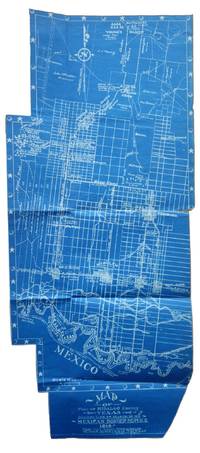
1917List2530VP 1917. Scrapbook measuring 15 ½ x 10 ½ inches. With forty leaves most with newspaper clippings and varied ephemera attached. Boards detached contents generally fine. Laid in is a blueprint map entitled Map of Part of Hidalgo County Texas Showing Line of March in my Mexican Border Service 1916. Made from Survey Notes taken on the march by Corp. C.A. Rice 74 Inf. N.G.U.S. Buffalo N.Y. Armory. Map measuring 33 ½ x 14 ¾ inches irregularly shaped and apparently complete. Very Good. A scrapbook documenting the military service of 1st Sergeant Samuel Gaffney of the 74th National Guard New York in the Mexican Border Service. Gaffney documents the campaign in great detail through printed matter - with each of the forty leaves containing material affixed including panoramic photographs advertisements from local businesses along the routes programs from entertainment offered to the troops military orders and official correspondence and many affixed newspaper articles and photographs. <br /> <br /> The scrapbook is most notable for the inclusion of an unrecorded map by Charles A. Rice the Buffalo native who would eventually map the campaign in larger fashion in a map entitled Map Showing Lines and March and Border Patrols in my Mexican Border Service 1916-1917. The map here just showing the route through Hidalgo County is unrecorded. The larger map - which was produced as souvenirs for the other members of the 74th - is quite scarce as well with five copies known to exist per OCLC with two different numbers. This blueprint map which appears to be complete cartographically and missing only the ornamental border on one portion shows the route taken early in the campaign in 1916. The Buffalo native Rice 1885-1931 who would eventually settle in Texas after the conflict also wrote a history of the 74th during the campaign. Rice published the maps and memoir himself. The map shows the route in great detail showing the location of wells farms roads and identifying landowners. Water quality and abundance is understandably a common theme in Rice’s notes. Some notes show the location of bandits smugglers and the like. We find no other examples of blueprint maps by Rice. <br /> <br /> Other highlights from the scrapbook include seven panoramic photographs of the 74th encamped at Pharr; a broadside advertisement for the shop of Agustin Acevedo in Pharr listing prices of goods; a handbill advertising the 74th’s Minstrels and Great Entertainment show on September 16 1916; an advertisement for a production entitled Glorious Liberty at the National Theatre in Pharr; two circulars instructing troop movement issued by Headquarters Brownsville District; several postcards with songs about the campaign; several snapshots; a mounted albumen photograph of troops at rest with the notation “Corp Frederick Paid†verso; a typed poem entitled “Home Again†and a notebook page describing his activities from January 1917 onward; and a thanksgiving menu for 1916 for the holiday spent at Pharr. The remainder of the scrapbook is composed of affixed newspaper clippings which provide extensive information on the 74th collected in a single volume. <br /> <br /> Overall a significant scrapbook with much information to glean for students of the 74th’s activities with the map providing a unique cartographic reference of the early days of the campaign. unknown
1769MAP1018London: Russell and Price 1769. Original Map . No Binding. Fine. 4to. Single page map of the County of SHROP SHIRE John Roque. Published in ENGLAND DISLAYED Being a New Complete and Accurate Survey and Description of the Kingdom of England and Principality of Wales. Plate 16 x20cm sheet 160 x 243mm. Fine original map printed on laid paper. Uncoloured. 2ND EDITION pub. 1769. OTHER COUNTIES ARE AVAILABLE FROM THIS ISSUE. <br/> <br/> Russell and Price unknown
1807Map951Paternoster Row London: Longman Hurst Rees & Orme 1807. 1st Edition 1st Printing. No Binding. Fine. Folio - over 12 - 15" tall. Original early 19th century uncoloured MAP OF THE SEVEN UNITED PROVINCES BY AARON ARROWSMITH. A DARK IMPRESSION. BUT DAMP EVIDENCE TO THE PAPER. Original folding plate covering SPAIN AND PORTUGAL printed on heavy paper dated 1807. A scarce example and in fine un-coloured original condition. An occasional light foxing mark. 41x27cms. Double-page folding map. engraved by COOPER.A LOVELY COPY. paper watermark dated 1808 <br/> <br/> Longman, Hurst, Rees & Orme unknown
1769MAP1024London: Russell and Price 1769. Original Map . No Binding. Fine. 4to. Single page map of the County of STAFFORD SHIRE John Roque. Published in ENGLAND DISLAYED Being a New Complete and Accurate Survey and Description of the Kingdom of England and Principality of Wales. Plate 16 x20cm sheet 160 x 243mm. Fine original map printed on laid paper. Uncoloured. 2ND EDITION pub. 1769. OTHER COUNTIES ARE AVAILABLE FROM THIS ISSUE. <br/> <br/> Russell and Price unknown
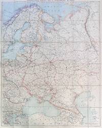
192284192London: Edward Stanford Ltd 1922. Large folding map. Lithograph in colors on uncoated paper dissected and laid down on linen as issued; overall dimensions 123cm x 97cm ca 48" x 38" folding to 20cm x 14cm 8" x 5-1/2"; card covers with publisher's slipcase of maroon cloth with printed paper title label. A bright clean well-preserved example Very Good to Near Fine. In the original slipcase cloth lightly rubbed at corners and a bit of soil to title label still easily Very Good.<br /> <br /> An impressive Revolutionary-era map of Russia in 42 sections scaled 1 inch to 50 miles. This revision dated March 1922 would appear to be the fourth and final edition of the map - it was preceded by editions in 1915 1917 and 1919. By December 1922 the Soviet Union would be formally established with Azerbaijan Georgia Belarus and Armenia which all appear here as independent states being absorbed into the Union of Soviet Socialist Republics. Edward Stanford, Ltd unknown
1875Map877London: Edward Stanford 55 Charing Cross 1875. 1st issue . paper wrappers. Fine. Folding map. 78.5 x 66.5 cms. The rare first issue of Stanford's April 19th 1875 map of the North Pole. Laid on cloth in 12 dissected sections. Coloured printing. Pasted to the lower left corner is a contemporary inset map of the Kennedy Channel entering ther 'frozen Polar Ocean' text to the reverse of the inset map.The voyages and journeys of the Artic explorers throughout the centeries are neatly printed in red throughout the map with dates including up to Austrian Exped. Payer 1874. Neatly enclosed in cloth covers when folded with a hand-written original label 'North Pole'. A lovely copy of a very scarce item. PLEASE EMAIL FOR PHOTOS. <br/> <br/> Edward Stanford, 55 Charing Cross unknown
1616Map 752London: Thomas Bassett and Richard Chiswell 1616. No Binding. Fine. Folio. 1611-1676 An original map of the county of Suffolk. Nice old hand-colouring a dark impression. 41.5 x 54cms. 16.25 x 21.5 inches. Wide margins outside the plate. ENGLISH TEXT to reverse. The imprint is by Thomas Bassett and Richard Chiswell in St Pauls Yard. London Floral initial letter to reverse in the style of Hall and Beale. PLEASE EMAIL FOR PHOTOS. Basset and Chiswell joined forces and purchase the original Speede plates and re-issued the maps in a fine edition in 1676. Only this issue was produced and is dated 1676 <br/> <br/> Thomas Bassett and Richard Chiswell unknown
1880NY068London: Mappin 1880. Original . No Binding. Fine. Metal dial and clasp with a small built in compass and a fine dial arm that is hinged to work out measurements. The compass dial pointer is loose but present within the bubble. A strong clasp ring 50mm surrounds the dial from the rear and the face is finely engraved with roman numerals of the hours of the day.The rear is finely stamped 1644 in minute type. The metal is not hall marked. A VERY ATTRACTIVE AND RARE ITEM c1880 <br/> <br/> Mappin unknown
1769MAP1010London: Russell and Price 1769. Original Map . No Binding. Fine. 4to. Single page map of the County of SURREY John Roque. Published in ENGLAND DISLAYED Being a New Complete and Accurate Survey and Description of the Kingdom of England and Principality of Wales. Plate 16 x20cm sheet 160 x 243mm. Fine original map printed on laid paper. Uncoloured. 2ND EDITION pub. 1769. OTHER COUNTIES ARE AVAILABLE FROM THIS ISSUE. <br/> <br/> Russell and Price unknown
1769Map1007London: Russell and Price 1769. Original Map . No Binding. Fine. 4to. Single page map of the County of SUSSEX John Roque. Published in ENGLAND DISLAYED Being a New Complete and Accurate Survey and Description of the Kingdom of England and Principality of Wales. Plate 16 x20cm sheet 160 x 243mm. Fine original map printed on laid paper. Uncoloured. 2ND EDITION pub. 1769. OTHER COUNTIES ARE AVAILABLE FROM THIS ISSUE. <br/> <br/> Russell and Price unknown
1810Map944Paternoster Row London: Longman Hurst Rees & Orme 1810. 1st Edition 1st Printing. No Binding. Fine. Original early 19th century MAP of SWEDEN DENMARK AND NORWAY On MERCATORS PROJECTION BY AARON ARROWSMITH. A FINE CLEAN AND DARK IMPRESSION. Original folding plate printed on heavy paper dated 1807. A scarce example and in fine un-coloured original condition. 41x27cms. Double-page folding map.A NICE COPY <br/> <br/> Longman, Hurst, Rees & Orme unknown
1806Map952Paternoster Row London: Longman Hurst Rees & Orme 1806. 1st Edition 1st Printing. No Binding. Fine. Folio - over 12 - 15" tall. Original early 19th century uncoloured MAP OF THE SWITZERLAND BY AARON ARROWSMITH. A FINE CLEAN AND DARK IMPRESSION. Original folding plate covering HOLLAND printed on heavy paper dated 1807. A scarce example and in fine un-coloured original condition. An occasional light foxing mark. 41x27cms. Double-page folding map. engraved by COOPER.A LOVELY COPY. paper watermark dated 1808 <br/> <br/> Longman, Hurst, Rees & Orme unknown