BLAEU, Joan - Intrduction et textes de Peter Van Der KrogtLivre Rare Book
5 783 résultats
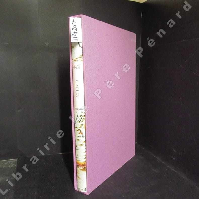
20061142072006 Editions Taschen - 2006 - In-folio, cartonnage blanc illustré en couleurs sous jaquette illustrée en couleurs, dans son emboîtage cartonné toilé rose de l'éditeur - 207 p. - Très riche iconographie in, hors texte et pleine page en couleurs - Ouvrage trilingue français / anglais / allemand
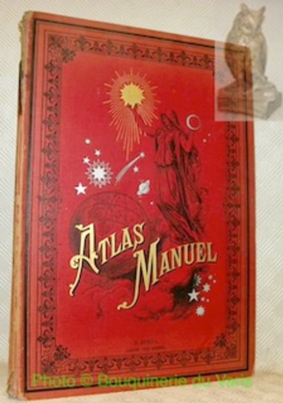
63928Paris, Librairie Hachette & Cie. sans date, vers 1880, 425x295mm, 72pages, reliure d'éditeur. Percaline ornée rouge, dos abimé, intérieur propre.
20071251782007 Editions Ulmer - 2007 - Fort in-4, cartonnage illustré - 728 pages - Avec 6000 photographies en couleurs, répertoriant 4200 espèces
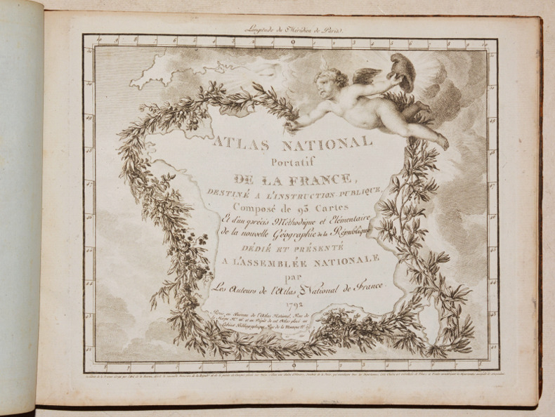
17920012621792 Paris, Dumez et Aubry, 1794 [et pour le second volume :] Paris, Bureau de l’Atlas National, 1792. Deux ouvrages reliés en un volume in-quarto (220 X 285 mm) à l’italienne basane fauve marbrée, dos lisse cloisonné et orné, pièce de titre maroquin grenat, tranches marbrées (reliure de l’époque) ; (2) ff. de titre, avertissement et table, XVI-190 pages (pagination double : deux numéros par page), un titre illustré gravé et 88 cartes numérotées. Coiffes refaites, épidermures restaurées sur les plats. Ex-libris tampon encré en marge du feuillet de titre du "Précis" : « Ch. Collemant à Grandvilliers (Oise) ».
160 pages. Illustrated in colour. Includes an historical section presenting maps of the province as it developed, details of 39 Alberta municipalities, and a section depicting the province's natural assets. Clean, bright and unmarked with very light wear. A lovely copy. Book
Hardcover, 139 pages, ENG, 315 x 235 mm, in New condition!, with illustrations in colour. ISBN 9789004144606. The Atlas presents European ideas and beliefs in the form graphs, charts and maps. Values such as democracy, freedom, equality, human dignity and solidarity are held by almost all Europeans, but the survey points to differing views about marriage, religion, work and such topics as euthanasia, happiness, sexuality and death. This unique Atlas covers all European nations from Iceland to Turkey, from Portugal to the Ukraine. It graphically illustrates the rich diversity that is Europe.
59584, Brill Academic Pub, 2005 Hardcover, 139 pages, ENG, 315 x 235 mm, in New condition!, with illustrations in colour. ISBN 9789004144606.
69800Otava,, Kustannusosakeyhtio; Geographical Society of Finland,, 1926 Original publisher's paper-covered boards, Elephant folio 46x35cm. 8 pages + 38 double-page color maps. Text in Finnish and English, In fine condition.
198713336Norman OK USA: University of Oklahoma Press 1987. First Edition Second Printing. Paperback. Very Good/No Dust Jacket. Large paperback no marks many maps and illustrations with 224 pages. <br/><br/> University of Oklahoma Press paperback
370x310 mm. 122 pages. Hardcover with dust-jacket. Jacket edges torn and worn. Spine edges slightly rubbed. Pages slightly yellowing. Else in good condition.
Very minor shelfwear and rubbing to boards. ; 60 pages
RARE comprehensive atlas of Israel covering all fields from physical, human and economic geography, to history, geology and geomorphology, botany and zoology, with numerous detailed large size maps. [SECTION EDITORS]: Cartography - Joseph Elster, Geomorphology - David H.K.Amiran, Geology - Leo Picard, Hydrology - Martin Julius Goldschmidt, Botany - Michael Zohary, Zoology - Jacob Wahrman, Land Utilization - Isaac Schattner, History - Michael Avi-Yonah, Population - Mordehai Gilead, Settlements - Joseph Elster, Agriculture - Emil Louis Levie & Samuel Pohoryles, Industry and Trade - Yitzhak Guelfat & Shaul Zarhi, Communications - Yehuda Karmon, Services - Helmut Muhsam & Amiram Gonen, Statistical Adviser - Roberto Bachi, Reproduction - Barukh Osri. The first edition in Hebrew was published in 1956-1964, this is the second English edition which was revised and published in 1970. 500x355mm. Unpaginated. Blue cloth Hardcover with plain dust-jacket laid cardboard slipcase. Gilt front cover and spine. Slipcase stained, worn and bumped (partly punctured). Jacket stained and slightly wrinkled. Jacket edges tattered. Jacket spine edges partly missing. Spine edges slightly bumped/wrinkled. Ex-libris sticker on front inner cover upper corner. Front whitepage and title page bottom corner creased. Title and first pages bottom corner slightly worn - NO damage to text. [SUMMARY]: This extremely rare, large and comprehensive atlas of Israel, especially revised and published in English as part of a collaborative project by the leading authorities in each field, is in good condition. PLEASE NOTE: This item is overweight. We may ask for extra shipping costs.
"The aim of this Atlas is to bring the reader's attention to essential geographical facts, visible on large-scale Canadian maps. The author has tried to give some explanations for the various forms of relief and patterns of human settlements, roads and boundaries. A selected bibliography, which includes research papers, has been placed at the end of each chapter. The atlas is intended as a tool in the teaching of Canadian geography in universities and colleges, and to some extent - general geography on examples, selected from the eastern part of Canada." - from page 128. Includes 610 cartographical illustrations. Bilingual English/French. Sir George Williams University, Department of Geography - Publication No. 1. Oblong 11" x 17". Signed and inscribed upon title page by author to a fellow-Professor in 1974. Average wear. Unmarked. A sound copy Book
1868016331New York: F. W. Beers; A.D. Ellis; G.G. Soule 1868. Near Fine condition. NO chips. NO tears. A bright clean tight copy. The spine is square and flat with NO creases. NO owner's name or bookplate. Pages are bright white clean and crisp. This is an undated modern facsimile of the 1868 original. Oversize Softcover with black cloth spine. 10.75" wide by 14" tall. This atlas consists of a printed title-page; an outline map of Morris County; 31 single and double-page maps; a Table of Distances for Morris County; and 2 pages of lithographic views of 6 buildings George Washington's Headquarters in 1779/80; Boonton Academy; Schooley's Mountain Seminary; etc. Included are maps of: Washington; Chester; Mendham; Brookside; Stephensburg; Whippany; Morris; Morristown; Passaic; Green Village; New Vernon; Chatham; Madison; Troy; Hanover; Chatham Long Hill; Parsippany; Roxbury; Drakesville; Randolph; Dover; Oram; Jefferson; Flanders; Milton; German Valley; Schooley's Mountain; Rockaway; McCainsville; Succasunny; Hanover; Boonton; Montville; Boonton Borough; and Pequannock. Laid in is a facsimile of an old map of Morristown scale: 20 rods to the inch that unfolds to 22" wide by 25" tall. The map is keyed to the locations of Morristown businesses such as livery stables markets boot and shoe sellers manufactures physicians hotels editors merchants etc. This large book will require extra postage for Priority and International shipments but only the standard charge for media mail. Facsimile Edition. Oversize Softcover. Near Fine condition. Unpaged but 64 pages. F. W. Beers; A.D. Ellis; G.G. Soule Paperback
30x23.5 cm. 159 pages. Gilt hardcover with dust jacket. Cover corners and spine edges slightly rubbed and bumped. Else in good condition. PLEASE NOTE: This item is overweight. We may ask for extra shipping costs.
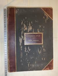
1889028277New York: Julius Bien & Co 1889. Condition of the binding is only Fair with pest damage. Leather over the spine has perished. Front and rear outer hinges cracks have been neatly reinforced with high quality clear flexible glue. Inner hinges are OK having been reinforced by the publisher/bookbinder with sturdy maroon cloth. SEE PHOTOS. Condition of all maps is NEAR FINE - FINE. NO foxing or toning. Pages are clean and unmarked. SEE PHOTOS. Includes a title page map of New Jersey Key to the System of Mapping and 19 linen-backed double page maps. Collated and complete per table of contents -- SEE PHOTOS. The maps are lithographically printed in blue red yellow and black. The double page maps open to an impressive 26.50" across by 36.50" tall. No year of publication is stated but Phillips 2149 in A LIST OF GEOGRAPHIC ATLASES Vol. 1 says 1889. The maps themselves are variously dated up to 1888. Titles of Sheets: No. 0. New Jersey State Map Geographic; No. 1. Kittatinny Valley and Mountain No. 2. Southwestern Highlands; No. 3. Central Highlands; No. 4. Northeastern Highlands; No. 5.Vicinity of Flemington; No. 6. Valley of the Passaic; No. 7. The Counties of Bergen Hudson Essex No. 8. Vicinity of Trenton; No. 9. Monmouth Shore; No. 10. Vicinity of Salem No. 11. Vicinity of Camden; No. 12. Vicinity of Mount Holly; No. 13. Vicinity of Barnegat Bay; No. 14. Vicinity of Bridgeton; No. 15. Southern Interior; No. 16. Egg Harbor and Vicinity; No. 17. Peninsula of Cape May; Unnumbered map. "New Jersey from Original Surveys based on the Triangulation of the U.S. Coast and Geodetic Survey Relief Map." Scale of first and last doublepage maps: 5 miles to an Inch. Scale of maps No. 1 to No. 17: 1 mile to an Inch. Bound in black pebble-grain cloth with gilt-stamped brown leather title label leather spine and corners leather backstrip has perished. SEE PHOTOS. The textblock could be easily rebacked or recased with no re-sewing required since all pages/maps are still securely bound together. Oversize Hardcover. 19.50" wide by 27" tall. This massive extremely heavy book will require SUBSTANTIAL extra postage at our cost based on your location. LeGear ATLASES OF THE UNITED STATES L5609. See also Schwartz and Ehrenerg's THE MAPPING OF AMERICA pp. 310-311. Phillips 2149. This massive extremely heavy book will require SUBSTANTIAL extra postage at our cost based on your location. Second Edition. Oversize Hardcover. Fair - FINE condition. Illus. by NOT a library discard. Atlas folio. Great Packaging Fast Shipping. Julius Bien & Co Hardcover
New Persian Original bdg. HC. Folio. (34 x 24 cm). In Persian with abstracts in English. 392 p., color and b/w ills. Tehran became a major city of Iran after 1554 A.D. during the Safavid period when Shah Tahmasb I, son of Shah Ismail, ordered the implementation of two large-scale public works. The first project was the construction of ramparts and moats surrounding the entire city, which defined the city's perimeters and increased its defense. The rampart consisted of 114 towers, representing the 114 chapters within the Holy Quran and enclosed an area of 4.35 km2. The second project was the establishment of the bazaar, the heart of the industrial and commercial activities of the city, surrounded by numerous holy shrines. However, it was 240 years later in the Spring of 1796 A.D. that Tehran became the national capital of Iran, during Agha Mohammad Khan Qajar's reign. 2016 A.D. actually marks the 220th year since Tehran became the political centre of Iran. The first known map of Tehran (page 18), a Russian spy map, dates back to 1826 A.D. The next Russian map of Tehran (page 24) from 1852 A.D. was translated into Persian and presented as a gift to Naser al-Din Shah Qajar (page 29). After the establishment of the military polytechnic school in 1851 A.D. and the arrival of Europe an military instructors, the importance of accurate topographical maps was recognized by the nation's leaders. The Austrian artillery trainer for cannons, August Karl Krziz, coordinated in 1858 A.D. the preparation of the maps of Tehran (page 39) and its surrounding area (page 35). This was the beginning of scientific cartography in Iran. By 1863 A.D., maps of Tehran Province for the purpose of tax collection (page 58) were being produced by engineer Abdul Rasool Khan. Tehran dramatically expanded after a huge flood in 1867 A.D. destroyed a large portion of the Safavid period ramparts and moats, after which Alexander Bohler, a French military instructor, designed a new and enlarged rampart and moat enclosure. Within four years between 1867 A.D. and 1871 A.D., Tehran grew from 4 .35 km2 to 19.75 km2 with these new constructions. By 1891 A.D., a highly detailed and technical map of Tehran (page 64) had been produced by Abdul Ghafar Najmolmoq. During the reigning years of Mozafar al-Din Shah, Mohammad Ali Shah, and Ahmad Shah, maps for Tehran postal services (page 126) and Tehran provincial delineation (page 127) were produced. During these years, the Russian, British and French prepared several geopolitical maps of the region including Tehran. For example, the map on page 323 reproduces a map prepared in 1892 A.D. by the British Survey of India at the scale of 1:506,880. In 1914 A.D., German publisher Wagner & Debes prepared a touristic map of Tehran (page 134). In 1922 A.D. the Ministry of Culture's Investigation Section prepared a map of schools in Tehran (page 138). During the Pahlavi I period (1925~1941 A.D.), modernization of Tehran became a national priority. By 1930 A.D. a map for street enlargement in Tehran (page 158) had been published. In 1932 A.D., the demolition of the Naser al-Din Shah Qajar period ramparts began simultaneous to further expansion of urbanized Tehran. The 1936 A.D. military map of Tehran (page 169) is testimony to the changes in the urban morphology of this period. The creation of a dedicated military cartographic service in 1935 A.D. marked an important milestone in the history of cartography in Iran. The 1937 A.D. urban development plan of Tehran (page 170) clearly shows the new streets, squares and urban development envisioned. The first known aerial photograph of Tehran dating from 1940 A.D. (page 177) displays the realization of this urban development plan. After the invasions by the Russians, British and Americans in 1941 A.D., cartographic activities in Iran suddenly increased. Sergeant Mohammad Reza Ghaffari privately published maps of Tehran [.] The above mentioned maps are a few representative samples of the over 270 maps
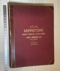
1910028278Philadelphia Pennsylvania: A. H. Muller Publisher 1910. Condition of the binding is Good but for rubbing at the corners and outer hinges cracked. SEE PHOTOS. Inner hinges are PERFECT having been reinforced by the publisher/bookbinder with sturdy maroon cloth. Housed in a Fine custom-made maroon cloth-covered clamshell case. SEE 2 PHOTOS its outside and both inner halves when opened. Condition of all maps is NEAR FINE - FINE. Pages are clean and unmarked. NO tears or foxing. SEE PHOTOS. This atlas consists of 25 i. e. 26 counting the Index map hand-colored lithographic linen-backed double page maps. The maps are color-keyed to the locations of each of the following: stone buildings brick buildings frame or half frame buildings stables or barns green houses steam railroads electric railroads water pipes sewers improved roads and fire hydrants. SEE PHOTOS. The double page maps open to an impressive 31.50" across by 22.25" tall. Each map did have a maroon leather numbered tab i. e. Index and 1-25 however the numbers for tabs 15-19 are broken/missing. SEE PHOTOS. Full title: "Atlas of Part of Morris Co. N. J. Embracing Town of Morristown The Boroughs of Madison Florham Park Chatham and Mendham: Morris Township and Parts of Chatham Hanover Mendham and Passaic Townships compiled from actual surveys official records and private plans by J. M. Lathrop and Thomas Flynn Civil engineers. Under the direct management and supervision of A. H. Muller Publisher 530 Locust Street Philadalphia PA. 1910." Collated and complete per table of contents. Includes a STREET INDEX. Bound in the original maroon cloth with maroon leather spine and corners. Gilt-stamping is still bright. SEE PHOTOS. The textblock could be easily rebacked with no re-sewing required since all pages/maps are still securely bound together. Oversize Hardcover. 17" wide by 22.50" tall. This massive extremely heavy book will require SUBSTANTIAL extra postage at our cost based on your location. LeGear ATLASES OF THE UNITED STATES L2343. Phillips A LIST OF GEOGRAPHIC ATLASES 3834. First Edition. Oversize Hardcover. Good - Fine condition/Fine clamshell case. Illus. by NOT a library discard. Atlas folio. Great Packaging Fast Shipping. A. H. Muller, Publisher Hardcover
2005b1150<p>University of California Press 2005. XIV150 pages. New Hardcover. NearFine DJ. Oblong. 12.0"x9.25"x1.0". be6</p> University of California Press hardcover
1834Map893London: Greenwood 13 Regent Street Pall Mall 1834. 1st Edition . Hardback. Fine. Elephant Folio - over 15" - 23" tall. A fine large ATLAS with 44 of 46 lacking Suffolk and lacking Norfolk double page maps bound with central hinges. Clean paper with little off-setting foxing tanning or marks. Decorative double page engraved maps of the counties with an uncoloured vignette views. Fine elegant engraved titles Original hand-colour block and outline. 65 x 80.5 cms 25 1/2 x 31 3/4 inches printed on thick paper with wide clean and fine margins. Printed July 4th 1829 and published in the C& J Greenwoods "Atlas of The Counties of England" dated 1834. SPINE LACKING AND THE BOARDS DETACHED. PLEASE EMAIL FOR PHOTOS. <br/> <br/> Greenwood, 13 Regent Street, Pall Mall hardcover
1989103698Foreign Languages Press, China Cartographic Publishing House, Beijing, 1989. 27 cm ; Pp.
Folio in blue pictorial DJ; approx 475 p. numerous full page color maps ; index. Maps, atlases. **Extra shiping charges at cost apply to international orders**
1972134413New York u.a. Wiley & Sons, (1972). 4°. M. zahlr. Ktn. 158 S. OLwd. Kleberest v. Rsign. St. a. Tit.
27x19. 15p. + XIX mapas. Mapas. Enc. cart. ed.
In-folio, mm 440x330, pp. (16), 32 carte geografiche, incise su doppio foglio, alcune ripiegate, legatura coeva in mezza pelle blu notte, firmata Hirou, fregi decorativi alle estremità del dorso titoli in oro, abrasioni alle estremità del dorso, piccole spellature agli angoli e una rottura al margine della cuffia inferiore ma nel complesso bell'esemplare, ex libris Biblioteca Sommi Picenardi al contro-piatto, occhietto e bel frontespizio calligrafico a pagina doppia, segue "Avertissement" a doppia pagina, segue sempre a doppia pagina "Liste des Cartes" e "Division du Nouveau Cours de Géographie Générale". Le 32 carte, in coloritura coeva, sono inquadrate da tabelle didascaliche ricche di dettagli, notizie, statistiche storiche, geografiche, naturali, minerali, militari etc., raffigurano i confini europei nei diversi periodi storici, dall'antichità agli inizi del XIX secolo. Le carte sono incise da Richard Wahl, datate tra il 1829 e il 1831. Edizione originale assai rara, un solo esemplare censitio in tutte le biblioteche italiane. Biblioteca Reale di Torino. ID 6488