5 783 résultats
Very Good Turkish, Ottoman (1500-1928) Original autograph letter signed 'Hâmid Sevket Ince'. 22x14 cm. In Ottoman script. 1 p. Full. Ince was a Turkish politician and a famous lawyer inAnkara city. He is a graduate of Istanbul University Faculty of Law. He served as the Deputy of Erzurum and Ankaraand he worked as a freelance lawyer. Dated 22/6/1936. Recipient was 'Mr. M. Sadik'. Punch holes on left side. A good paper with '...en Bank' watermarked.
PP.480, CM. 27X17, CART.
(Codice LO/4617) Scala 1:150.000, cm 86x70. Bella, particolareggiata carta stradale a colori. Al verso vari elenchi. Brossura originale con stemma, buono stato. ~~~ SPEDIZIONE IN ITALIA SEMPRE TRACCIATA
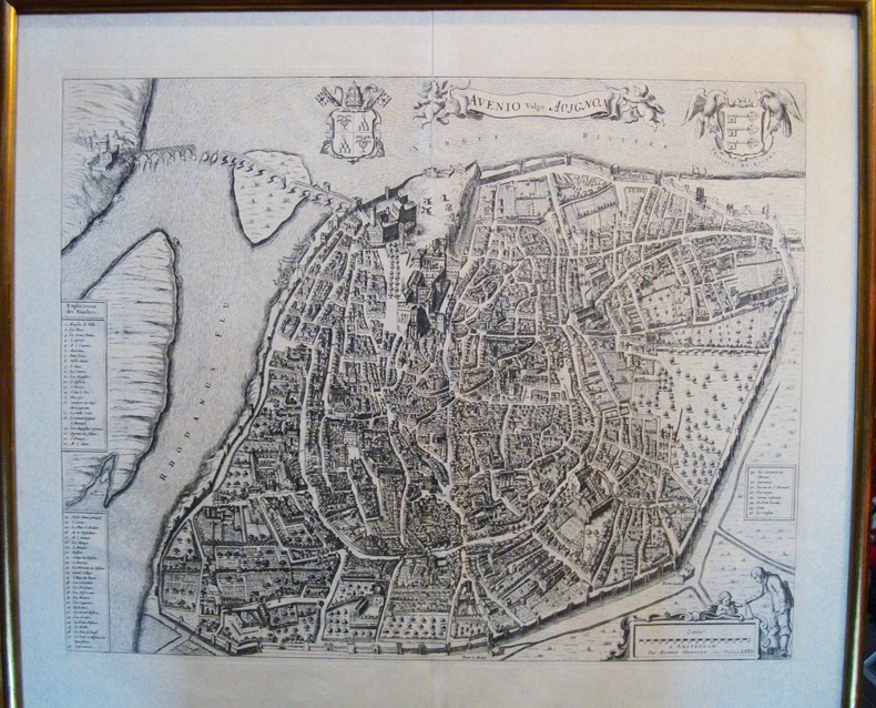
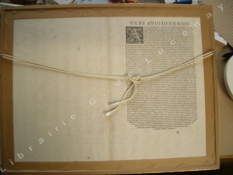
16715482Célèbre plan de la ville d’Avignon. De grandes dimensions, de nombreux détails apparaissent. Certainement un des plus beaux plans. Cadre doré. Petite fente dans le pli originel de la planche. Bon état Encadré très bon Avignon 1671 42,0 x 52,5 cm. 54 x 62 cm avec le cadre.
Foglio di cm. 67x52,3, impresso a colori solo recto, ripiegato. Nel pieno della campagna d'Etiopia (battaglia dell'Endertà: il 15 febbraio le truppe abissine si ritirarono sotto i bombardamenti dell'aviazione italiana) cfr. wiki.
158517559Cologne ca. 1585 in-folio Cuivre 310 x 475 mm. (avec marges 420 x 550 mm), coloris ancien un peu passé, texte latin au dos
22539Bartholomew (1903)
tavole a colori fuori testo
Incisione in rame di mm 170 x 120 alla battuta su carta spessa. Esemplare privo di difetti. L'immagine, in mancanza di informazioni più precise, doveva far parte dell'opera di Jean Baptiste Benoit "Viaggio pittoresco in Asia ed in Africa : riassunto generale dei viaggi antichi e moderni secondo Arman ... / di G.B. Eyries ; prima traduzione italiana di Silvestro Bandarini"
100108aafParis, Durand & Pissot, 1748, 17.5 x 20.5 cm (25 x 37 cm, la feuille), carte coloriée, papier légèrement bruni. 1 feuille.
1963153757London: Geographical Section General Staff 1963. Scarce charts of Bahrain and the Straits of Hormuz A rare and historically interesting pair of adjacent maps of the Arabian Gulf covering six degrees of longitude each the geographical area encompassing the whole of Qatar Bahrain and part of what was to become the United Arab Emirates Al-Hofuf being the major city in the Al-Ahsa Oasis Eastern Province Saudi Arabia; sixth and fifth editions respectively. Maps of the period issued by the GSGS Geographical Section General Staff use a 7-colour tint scale to distinguish altitude and a glossary that highlights towns of significance and other standout features which provided steady references for army personnel to aid navigation in the challenging conditions of the region. The Bander Abbas map was compiled by the US Army Map Service Corps of Engineers from a number of sources including USAF Aeronautical Approach Charts of 1951-55 and the US Geological Survey of the Arabian Peninsula 1958. The Hofuf chart is based inter alia on 512 Field Survey Royal Engineers charts 1942-4. WorldCat lists just three individual copies for Hofuf NG39 SUNY at Buffalo University of Notre Dame and Eastern Illinois University alongside four copies of Bandar Abbas NG40 University of Exeter University of Notre Dame Eastern Illinois University and University of South Florida. It should be noted that major national institutions - BL for example - will have holdings of these maps within the complete GSGS series. Most copies would be discarded on supersession making these an important record of cartographic progress in the region. Two two-colour printed maps 1:1000000 scale 690 x 610 & 750 x 610 mm respectively. Ex- libris stamp of Arizona State Library both stamped "superseded" in blank margin and "withdrawn" on verso some pencilled marginalia; both in excellent condition. unknown
42107, , 2012 Hardback,863 p., 40 b/w ill. 19 colour ill., 210 x 270 mm, Languages: French. ISBN 9782503544922.
45718, Brepols - Harvey Miller, 2012 Hardcover. 863 p., 40 b/w ill. 19 colour ill., 210 x 270 mm, Languages: French, Including an index. Fine copy. ISBN 9782503544922.
Hardback,863 p., 40 b/w ill. 19 colour ill., 210 x 270 mm, Languages: French. ISBN 9782503544922. Pour la premiere fois, une histoire comparee est appliquee a la cartographie urbaine. En collectant meticuleusement les vues et plans de Barcelone, Genes et Marseille conserves dans les principaux fonds cartographiques europeens, l'auteur analyse l?evolution des productions et des usages des images, depuis leur apparition dans la litterature humaniste jusqu?a l'emergence de la photographie. Qu?il s?agisse de plans ornant les galeries cartographiques, de representations editees dans des atlas ou diffusees sur le marche de l?estampe, de cartes militaires ou de plans d?amenagement urbain, les images traduisent les dynamiques de conception graphique et mentale des villes mediterraneennes. En eclairant les formes de pratiques cartographiques, ce livre propose d'aborder les representations urbaines par l?evolution des rapports a la ville, telle qu?elle peut etre percue, vecue et imaginee, dans les milieux intellectuels tres divers dont elles proviennent.Guenievre Fournier-Antonini est docteur en histoire moderne de l'Ecole des hautes etudes en sciences sociales, ancienne boursiere de l'Ecole francaise de Rome, recompensee par le John Brian Harley Fellowship Research. Commissaire de l?exposition La ville figuree organisee au musee d?histoire de la ville de Marseille en 2005, elle a publie l?ouvrage du meme nom aux editions Parentheses.
Very faint foxing to textblock else fine. ; 2 Volume Set; Vol. 1/2/2022; 13.1 X 10.1 X 4.5 inches; 1448 pages
60335BBo.J. Caspar Merian, geboren 1627 in Frankfurt am Main, gestorben 1686 Schloss Waltha/Westfriesland. Sohn und Schüler des Kupferstechers Matthäus Merian d. Ä. Führte nach dem Tod des Vaters den Frankfurter Verlag gemeinsam mit seinem Bruder Matthäus d. J. Herausgegebene Hauptwerke 'Topographia Germaniae' und 'Theatrum Europaeum'. [2 Warenabbildungen]
Mm 215x310 Nuova raccolta colombiana. Volume cartonato rigido di pagine 511, astuccio editoriale illustrato in cartone. Pari al nuovo. Spedizione in 24 ore dalla conferma dell'ordine.
c5978Paris, Imprimerie et Librairie Classiques de Jules Delalain et fils, sans date ( 1877); in-folio pleine percaline verte de l' éditeur , titre doré au 1er plat, marqe de l' imprimeur doré au 2ème plat ; ( 4)pp., et 10 cartes à double page en couleurs montées sur onglets.Rares piqûres. Bon exemplaire.
Mm 170x240 Volume nella sua brossura originale, 144 pagine con numerose illustrazioni in nero e a colori nel testo e fuori testo, Copia in ottime condizioni. Spedizione in 24 ore dalla conferma dell'ordine.
1975162373München, 1975. 4°. 43 S. OBr. St. a. Tit. (BAW. Veröff. d. Bayer. Komm. f. d. Internat. Erdmess.; Astron.-Geodät. Arbeiten 34).
50939BE - , Lannoo, 2017 cartonnage illustre de l'editeur / Gebonden ineen fraai linnen band, Onlongformaat, 442 pagina's: 400x340. fraai boek ! NIEUW!! . ISBN 9789401447348.
CARTA GEOGRAFICA di cm. 39x34,4 al filo della lastra, incisa in rame su forte carta pregiata di cm. 44x36,7 e COLORATA a mano all'epoca, proveniente da Atlante (probabilm. "Atlas Portatilis, Oder Compendieuse Vorstellung Der gantzen Welt: in einer kleinen Cosmographie, 1723) in cui era rilegata mediante brachetta alla piega. Uno dei primi atlanti scolastici, utile anche ai viaggiatori. WEIGEL, incisore su rame, mercante d'arte ed editore (cfr de.wikipedia). Salvo una fessura di 5 cm.al bordo inferiore della piega, è perfettamente conservata.
Levata nel 1883 e colle correzioni dell'Agosto 1903. Foglio 44/6 della Carta d'Italia. Carta telata, cm 48,5 x 49. Tracce di umido alla sola tela, leggermente rifilato il margine inferiore ma presenti tutte le indicazioni tipografiche, normale ingiallimento, discreto stato.
Ben conservata, con timbri del comando scuola di artigielria di fortezza.