333 résultats
1995018575Staten Island New York: Maurizio Martino Publisher 1995. Volumes 1-4. BRAND NEW HARDCOVERS. Three of the four volumes are STILL SEALED in the publisher's clear plastic SHRINKWRAP. Volume 1 has a small spot on its rear cover. Volume 2 has a mild bump at the head of its spine NO pages are affected. Bright clean square and tight. Sharp corners. NO owner's name or bookplate. NOT a remainder. Fresh and crisp -- obviously never read. The standard reference. No date but 1995 First Martino printing "strictly limited to 100". Reprint of the 1909-1920 Library of Congress originals. The four volumes are uniformly bound in the original gilt-stamped green cloth. Sheehy CL286: "An important catalog of an outstanding collection." Hodgkiss/Tatham KEYGUIDE 11: "The most comprehensive work on historical atlases." This heavy 4 volume set will require extra postage for Priority and International shipments. But for media mail you pay only our standard charge for 1 volume and we ship the other 3 volumes at no extra cost. First Martino printing. Hardcover. New/in publisher's shrinkwrap. Illus. by We ship all 4 volumes for cost of 1. 4 volumes. Great Packaging Fast Shipping. Maurizio Martino Publisher Hardcover
1995018565Staten Island New York: Maurizio Martino Publisher 1995. Volumes 1-4. BRAND NEW HARDCOVERS in perfect condition. STILL SEALED in the publisher's clear plastic SHRINKWRAP. NO rubbing. NO fading. Bright clean square and tight. Sharp corners. NO owner's name or bookplate. NOT a remainder. Fresh and crisp -- obviously never read. The standard reference. No date but 1995 First Martino printing "strictly limited to 100". Reprint of the 1909-1920 Library of Congress originals. The four volumes are uniformly bound in the original gilt-stamped green cloth. Sheehy CL286: "An important catalog of an outstanding collection." Hodgkiss/Tatham KEYGUIDE 11: "The most comprehensive work on historical atlases." This heavy 4 volume set will require extra postage for Priority and International shipments. But for media mail you pay only our standard charge for 1 volume and we ship the other 3 volumes at no extra cost. First Martino printing. Hardcover. New/in publisher's shrinkwrap. Illus. by We ship all 4 volumes for cost of 1. 4 volumes. Great Packaging Fast Shipping. Maurizio Martino Publisher Hardcover
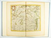
1985ST20505-12Fullerton California: Stone & Lorson 1985. ONE OF 89 COPIES in quarter vellum of a total edition of 115. 490 x 325 mm. 19 1/4 x 13". viii 23 1 pp. 1 leaf. <br/> Publisher's quarter vellum over gray paper boards covers with device in gilt smooth spine lettered in gilt. In just slightly chafed black buckram slipcase. WITH A MAP FROM THE ORIGINAL 1619 ATLAS bound in with period hand coloring. Map 293 "Tarvisina Marchia Et Tirolis Comitatus". De Hamel & Silver "Disbound and Dispersed" 186. One corner a bit bumped otherwise the main volume flawless; the map edges a bit browned and just slightly frayed a few light spots but still excellent with good color and strong general appeal.<br/> <br/> This attractive oversized production includes an original map of an important region of northeastern Italy taken from the 1619 edition of the Mercator-Hondius atlas. A pioneer in commercial cartography and a founder of the Netherlandish school of cartography and geography Mercator 1512-94 produced maps used around the world that were informed by his brilliant "Mercator Projection" which allowed the round Earth to be accurately depicted on a flat map. Near the end of his life he began work on an ambitious cosmography that would contain an account of the creation of the world a description of the universe descriptions of the countries and oceans of the world genealogies and political histories of the several countries and a chronology of the cosmos. Only the account of creation the chronology and maps of the known regions of the world came to fruition. Mercator having died before the work came to press it was completed by his heirs and published in 1595 with 107 maps. Leading Amsterdam map publisher Jodocus Hondius 1563-1612 acquired the plates in 1604 and issued the first Mercator-Hondius "Atlas" in 1606 with 37 maps he had engraved added to the original 107. Teacher and Hondius' brother-in-law Pieter van den Berg wrote the introduction and the descriptive text that appears on the versos of the maps. A 1611 edition increased the number of maps to 150 and another six were added in 1619. The hand-colored map included in our copy depicts the South Tyrol and Veneto regions including Lake Garda Verona Padua and Venice. It is accompanied with an essay by Norman J. W. Thrower 1919-2020 UCLA geography professor and cartographer describing the historical background of the atlas. Joel Silver in "Disbound and Dispersed" tells us that "the physical production of this leaf book is superb from the design by Vance Gerry to the presswork of Patrick Reagh.". Stone & Lorson unknown
1794025454Hartford Connecticut: Elisha Babcock 1794. Good - Very Good condition. SEE PHOTOS. Hinges are sound with only a single half inch hairline crack. NOT a library discard. NO owner's name or bookplate. Foxing mostly light to moderate to several pages. Slight age toning. Bound in full leather sprinkled calf with 5 raised spine bands. Brown leather spine label mostly chipped away. Gilt spine decorations and gilt double ruled borders on the front and rear covers. Handsome gilt inside dentelles i.e. borders decorated with gilt lacy pattern at inner edges. SEE PHOTOS. Frontispiece portrait of the author engraved by Amos Doolittle. This copy includes plates 1 2 4 5 6 8 also engraved Amos Doolittle. Of these 6 plates 5 are folding some copies have only 3 plates that are folding. Plate 1 is a map of New Haven and Its Environs Wheat 281. Plate 4 shows 3 maps one of which shows Hadley Mass Wheat 276 278 280. Plate 5 is a map of the City of New Haven Wheat 275. Plate 8 is another map of Hadley Massachusetts Wheat 279. Lacks pages 145-156 plates 3 and 9 which apparently were not bound in. Plate 7 does not exist in any copy per Howes and Sabin: "there is no plate 7 in any of the copies seen and it is probable none was made." This is a history of three members of the tribunal which had Charles I beheaded in 1649. The author Ezra Stiles was president of Yale College from 1778 until his death in 1795. No errata slip is present in this copy so presumably it is Howes' second issue. Includes the "Advertisement" at the end on an unnumbered page that offers subscribers the option to cancel if dissatisfied with the change in the dimensions of this book from what was described in the prospectus not present. Full title: "A history of three of the judges of King Charles I. Major-General Whalley Major-General Goffe and Colonel Dixwell: Who at the Restoration 1660 fled to America; and were secreted and concealed in Massachusetts and Connecticut for near thirty years. With an account of Mr. Theophilus Whale of Narragansett supposed to have been also one of the judges." Howes S-999. Evans 27743. Sabin 91742. Trumbull Connecticut 1425. ESTC W20469. Church 1264. Wheat and Brun 275-283. First Edition Second Issue. Hardcover. Good - Very Good condition. Illus. by NOT a library discard. 12mo. 358pp. "Advertisement". Great Packaging Fast Shipping. Elisha Babcock Hardcover
1978021557La Crosse Wisconsin: Sumac Press 1978. NEW in a NEW dust jacket. The jacket is protected by a removable Brodart clear-plastic sleeve. Sharp corners. First Edition Limited to 300 copies. Includes a hand-mounted genuine 13 cent Ben Franklin The Theatre of War USA bicenntenial stamp from 1976. Illustrated with numerous facsimiles of stamps showing maps. Tells their stories. Published by Emerson Wulling at the Sumac Press. Bound in the original red cloth stamped in bright gold. Complete with errata page and dust jacket. First Edition 1/300 copies. Hardcover. New/New. 8vo. 67pp. Great Packaging Fast Shipping. Sumac Press Hardcover
1839W043Eton: E. Williams 1839. New and improved edition . Hardback. Fair. large 8vo. xviii 847 i adpp. Folding frontis. plate of the Solar system.; astronomical folding plate; folding plate of Athens. Lacks Rome and Syracuse plates. Title-page and frontis. loose and binding worn. READING/ REFERENCE COPY ONLY. <br/> <br/> E. Williams hardcover
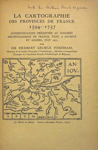
190827846Various places.: Various publishers 1908 to 1923. 10 volumes bound together in one volume. First Editions and all but one are inscribed by the author. Illustrated with cartographic cover art re-impressions of important works cartographic decorations and a number of maps including a number that are folding. 8vo the original printed wraps to each pamphlet are present and all are bound into the one cloth covered volume brown morocco label gilt. Each pamphlet can be considered fine and in exemplary condition some evidence of use and a bit of age to the cloth covers. A fine collection. A FINE COLLECTION OF INSCRIBED FIRST EDITIONS. Ranging from the cartography of the provinces of France 1594 to British and Irish Itineraries and Road-Books English Counties Welsh a pamphlet on the Evolution of the Maps of the Bristish Isles on the great engraver and mapmaker John Cary and two on France cartography and routes from the mid-1500's until the middle of the 19th century. ALL BOOKS ARE INSCRIBED BY THE AUTHOR. Various publishers paperback
19984973<p>The Nautical & Aviation Publishing Company of America 1998. 6110 pages. New Hardcover New DJ. 10.1"x7.0". be5</p> The Nautical & Aviation Publishing Company of America hardcover