(U S A). ATLAS OF THE UNITED STATESBiblio.com

990 résultats
188976491Uten sted. New York. Uten år. 1889. Oblong 8vo. Samtidig skinnryggbind med marmorerte dekler og tittelfelt i svart skinn på fordekkelen. Upaginert. 28 s. Med 50 kromolitograferte kart av U. S. A.’s stater. Med kartene er også andre motiver.8vo oblong. Contemporary half calf marbled boards title in blck on front cover. Not paginated. 28 pp. With 50 chromolithographed plates - maps and other motives . Engelsk. <br/><br/><em>Uvanlig i så god tilstand. A very good copy. </em> hardcover
SONG1469873206LWW 2016-09-28. Fifth. hardcover. Used: Good. 8.75x2.75x11.00. Buy with confidence. Excellent Customer Service & Return policy. LWW hardcover
2006x-0849335612CRC Pr I Llc 2006. Hardcover. New. 2nd edition. 446 pages. 10.25x7.50x1.25 inches. CRC Pr I Llc hardcover
1890867351890. ATLAS. ATLAS OF THE CITY OF BOSTON Vol. 7 BRIGHTON MASS. Philadelphia: G. W. Bromley & Co. 1890. Folio. 22" Contains 30 double page maps - outline and index map and 29 plates - measuring 32" x 22" with only slight marginal staining near spine at head. Maps are drawn at scale of either 600 100 or 150 ft/inch. Bound in 1/2 leather missing much of leather covering and has detached and chipped FFEP. Front hinge very weak. unknown
1906867321906. ATLAS. ATLAS OF THE TOWNS OF REVERE AND WINTHROP SUFFOLK COUNTY MASS. Boston: Whitman & Howard 1906. Folio. 22". Double page maps measure 32" by 22". All plans are drawn to a scale of 150 feet to one inch except index map. Includes street index outline and index map and 25 double-page maps. Interiors are in good condition with some light staining throughout at head and spine pencil or ink annotations to title page and plates 3 4 5 8. Exteriors are fair with heavily worn half-leather with black cloth boards and gilt-stamped edges. A good copy. unknown
1896867401896. ATLAS. ATLAS OF THE CITY OF CHELSEA AND THE TOWNS OF REVERE & WINTHROP MASS. Philadelphia: G. W. Bromley and Co. 1896. Folio 22.5". Contains street index outline and index map and 22 double-page maps measuring 22.5" by 32". Maps have only minor soiling to margins and occasional pencil annotations plates 12 17 18 21 and 22. Bound in half leather now mostly chipping or absent. In need of rebacking front board detached. As is. unknown
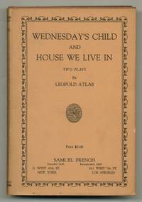
1934561982New York: Samuel French 1934. Hardcover. Fine/Near Fine. First edition. Fine in very slightly age-toned very near fine dust jacket. Inscribed by the playwright to Barrett H. Clark: "To Barrett with much thanks for past encouragement & hopes for the future. Lee Atlas." Clark was an exceptionally important figure in modern American drama aside from authoring many books he served as the longtime literary editor for the drama publisher Samuel French. Very scarce. Samuel French hardcover
1997DADAX0805306552Brand: Benjamin Cummings 1997-12-21. 4. hardcover. New. 7.66x1.24x9.28. Buy with confidence. Excellent Customer Service & Return policy. Brand: Benjamin Cummings hardcover
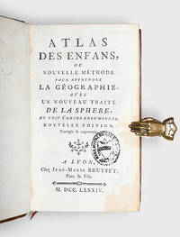
1784172751Lyons: Jean-Marie Bruyset 1784. A new and expanded edition of this popular teaching aid. Presented in a catechism-style question-and-answer format the text is accompanied by maps labelled with numbers and letters instead of place-names; the reader can test their ability to identify regions before checking their answers on the following page. It was published in Amsterdam in 1760. Duodecimo 156 x 93 mm pp. xi 1 331 1. Frontispiece of an infant figure of Atlas supporting the world 2 folding hand-coloured plates 22 similar maps all engraved after Guillaume Delisle head- and tailpieces. Contemporary mottled sheep spine with raised bands compartments decorated with elaborate floral design in gilt red morocco label floral patterned endpapers blue speckled edges red bookmarker. Later bookplate to front pastedown inscription noting purchase in 1793 to verso of first blank contemporary gift inscription to second blank later stamp to title page. Gilt a little rubbed rear board sprung corners bumped one worn small patches of stripping to front free endpaper from bookplate adhesive front hinge cracked but firm tidemark to fore edge margin occasional small ink marks. A very good copy. hardcover
186633700Gotha Justus Perthes 1866. Folio. 38x245 cm. Orig. full cloth blindstamped and with title on front board in gilt lettering. Spine ends worn and a tear to upper part of first hinge. The printed title pasted on inside of front cover from the publisher. 2 pp. and 31 steel-engraved double-page coloured maps. The first Planeten-System lightly brownspotted otherwise fine with a few marginal brownspots to margins. <br/><br/><em>With maps of all the Continents Europe The Hemispheres etc. </em> hardcover
195037963Toronto & Monteal: Underwriter's Survey Bureau Limited. 1950 1950. Hardcover. Very Good to Fine. Atlas Folio. 54.5 x 32cm with 17 double page scale maps in colour linen backed linen is a bit frayed doesn't effect maps black boards over green cloth spine Underwriter's Survey Bureau Limited. 1950 hardcover
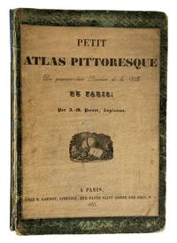
41356Paris. E. Garnot. 1834. 1835. 4to. 29x 20cm title-page vignette18p. preliminary place name index with 49 double-page colour maps preliminary lists prominent features in red each map with lithographic vignettes buildings parks boulevards etc. foliated paper is printed on one side only in the original paper over green boards with title with vignette reproduced on the upper cover with half title and publisher's vignette on the title page spine chipped at the top with 7cm piece missing covers worn hinges loose library plate removed removed on the front paste-down endpaper internally text and plates are fine. cgc. Note: the date on the title page is 1834 but 1835 on the cover title page. ~ A series of maps the first displaying the twelve arrondissements and the 42 districts of Paris as of 1834. The following maps are of the individual districts very detailed with prominent features in red and vignettes of important buildings parks and boulevards. The population of Paris was over 900000 at this time and was still a walled-city until 1860. The maps show the results of improvements made under Napoleon to be followed by changes made after the Restoration of 1815 and the reign of Louis XVIII. Paris. E. Garnot. 1834. (1835) unknown
BN106128Editions ATLAS. Softcover. Le crochet: 55 modèles à réaliser <br/><br/>Le crochet: 55 modèles à réaliser Editions ATLAS paperback
BN66317Atlas der Weichteiloperationen bei Hund und Katze Gourley Ira M; Gregory Clare R; Poulsen Nautrup Barabara and Rosenhagen Carsten <br/><br/> unknown
BN66313Atlas und Lehrbuch der Kleintierneurologie: Mit Filmsequenzen auf CD-ROM Jaggy André <br/><br/> unknown
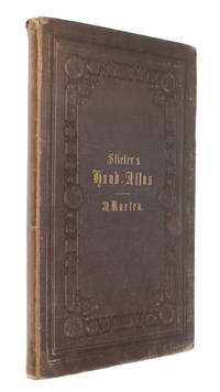
1850137729Leipzig and Glogau: C. Flemming 1850. The 1850 supplement to the Sohr-Berghaus Hand-Atlas comprising in total 40 maps including Texas and a world map. The atlas and its supplements were published in various editions from 1847 to 1906. Sohr is a pseudonym probably of Friedrich Handtke the editor and main cartopgrapher; from 1848 onwards the inclusion of three maps contributed by the geographer Heinrich Berghaus led to the atlas being published as the Sohr-Berghaus atlas. The atlas and supplement was issued in series and are often found with maps in variant orders; this volume does not include the map of Morocco. Folio 370 x 233 mm. 38 double-page lithographic maps with hand colouring 2 large folding maps bound at rear from different atlas series. Contemporary quarter sheep spine lettered in gilt brown cloth sides. Binding somewhat soiled and worn at extremities contents foxed the two folding maps substantially torn but others all intact contemporary manuscript title to most maps on recto. A good copy. hardcover
BN91194MVS Medizinverlage Stuttgart. Atlas der Gebärhaltungen <br/><br/>Atlas der Gebärhaltungen Atlas der Gebärhaltungen MVS Medizinverlage Stuttgart unknown
188162541Neillsville & Wasau WI: Bussell & Holway Civil Engineers 1881. 8vo. 180 pp unpaginated. with double-page engraved title plat maps throughout primarily on facing recto & verso of leaves while some are overlapping and on next blank continuing w/ laid-in Township Range Plat Map MS on form 4-590 demarcating Government Land and dated March 6 1895 inserted into rear pocket annotations demarcating plat changes red ink markings of “Government Land†w/ V’s and other annotations on several of the maps in Marathon County by former real estate land surveyor. Contemporary black calf rebacked hinges restored w/ thumbing some edgewear still a VG- copy. First edition of this detailed and compact pocket plat map atlas issued by Bussell b. 1854 was a surveyor/civil engineer based out of nearby Neillsville Clark WI and his partner Holway for lands platted through Marathon County Wisconsin in the 19th-Century as the centrally located County opened for logging and settlement on lands driven by the Wisconsin Central Railroad and the Wisconsin Valley Railroad later the Wisconsin Valley Land Company. This exceptional reference provides names of all the original homesteaders and plat-holders as of the time of publication as well as demarcating houses churches schools mills U.S. Government lands state lands as well as the lines for the Lake Shore Traffic Co. Dundee Land Co. and development lands of the C.P. Haseltine Co. Worldcat locates only 1 physical copy at Library of Congress Wisconsin Historical Society does have a scanned searchable copy available online; See: Louise Marchetti History of Marathon County Wisconsin and Representative Citizens 1913. Bussell & Holway, Civil Engineers, unknown
BN66307Atlas and Synopsis Der Klinischen Dermatologie : German Version of Colour Atlas and Synopsis of Clinical Dermatology: Pleas Fitzpatrick <br/><br/> unknown
BN66280Lehrbuch und Atlas der Bronchoskopie: Geschichte Techniken Krankheitsbilder Dobbertin Ingrid and Dierkesmann Rainer <br/><br/> unknown
183659541Darmstadt Litho. Anst. Fromann 1836-38 40. Folio-oblong. 395 x 51 cm. Contemp. hcalf. Spine worn. Corners weared down. With 37 outlinecoloured lithographed maps. Numbered II-XXXVI Titlepage numb. I lacks and 2 extra maps numbered XXVIII b and XXXI b present XXXI b dated 1840 most of the other maps dated 1836 1837 a. 1840. The maps having sometimes rather heavely dampstaining throughout. 2 maps with closed tears. A map added not belonging to the atlas "Charte und Meilenzeiger Daenemark mit Schleswig. Holstein. Lauenburg. Entworfen von Euard v. Grubl. Flensburg 1837". Some brownspots and a bit of lower right corner gone. <br/><br/><em>First edition of Glaser's world-atlas where the lacking title-page should be dated 1839. "The map sheets were to a large extent modeled on Stieler's handatlas. The maps were not simple copies however. They were newly drawn as can be seen for example in fact that some sheets were rotated 90 degrees. Glaser also chose to use a map sheet measuring 406 x 495 cm. a larger format than that of the Stieler whose sheets at that time were 363 x 442 cm. This enabled him to use a somewhat larger scale than that found in the STIELER."Jürgen Espenhorst Petermann's Planet p. 1013. </em> unknown
182525408Weimar in Verlage des Geographischen Instituts 1825-28. Folio. Each 49x60 cm. 5 steel-engraved maps depicting the 5 parts of Prussia. All Handcoloured in outline. Cont. blank wrappers wrappers partly lost. All maps with broad margins with use and tears one tear reaching engraved surface. Some soiling. The last 2 maps dampstained in right corners. <br/><br/><em>Contents. 1. Charte v. d. Königl. Preuss. Provinz Schlesien. - 2.Pommern. 3.Brandenburg. - 4.Sachsen. - 5. Westphalen und die Rhein-provinz. </em> unknown
187642075Gotha Justus Perthes Maps dated 1876. Folio. Orig. full cloth blindstamped and gilt frontboard. Corners bumped edges worn covers with scratches. 2 pp. and 31 steel-engraved double-page coloured maps. Light browning to lower margins of some maps otherwise clean. <br/><br/><em>With maps of all the Continents Europe The Hemispheres etc. </em> hardcover
187743308Gotha Justus Perthes n.d. 1877-78 Folio. Orig. full blindstamped cloth. Frontcover with gilt title. Lower part of spine ca. 8 cm. lacks and top of spine with some wear otherwise fine. With 31 double-page 37x435 steel-engraved maps with outline colouring. All maps clean and fine. Maps dated 1877 a. the last 1878. hardcover
1852feb1187581852. Used. For more details please contact me unknown