990 résultats
BN66254Punktionszytologie: Handbuch und Atlas Orell Svante R.; Sterrett Gregory F.; Walters Max N.-I. and Whitaker Darrel <br/><br/> unknown
BN90827Enke. Atlas der Sedimentgesteine in Dünnschliffen Perfect Paperback <br/><br/>Atlas der Sedimentgesteine in Dünnschliffen Perfect Paperback Atlas der Sedimentgesteine in Dünnschliffen Perfect Paperback Enke paperback
6302New York nd ca.1855: D. Appleton & Co. Hard Cover. Very Good. Folio. 228 text pages 56pp index with sixty-one elegantly engraved and colored maps with comparative scales. Maps are from the London sheets published by H.G. Collins. Internally clean and bright; bound in original cloth covered boards spine is 3/4 brown calf renewed to style; red leather lettering piece on spine gilt; new endpapers. A very good copy maps are fine. D. Appleton & Co unknown
192437960Toronto & Montreal: Underwriter's Survey Bureau Limited 1924. Hardcover. Very Good to Fine. Atlas Folio. 54.5 x 31.5cm 13 double page scale maps in colour linen backed green cloth covered boards pressed boards Underwriter's Survey Bureau Limited hardcover
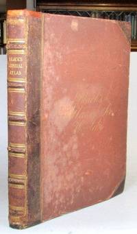
186552198Edinburgh: Adam and Charles Black 1865. Folio. 32 70 pp. Publisher's brown half morocco over cloth boards spine with raised bands gilt lettered direct to one panel cursive gilt lettering to the upper cover early owner's inscription to the front pastedown. Frontispiece of "The Flags of All Nations" plus 57 maps - 31 double page and 26 full page including a supplementary map of the borders of central Europe. Covers worn but sound some rudimentary repairs to the spine ends and the hinges similarly reinforced a number of maps with lightly pencilled 19th century annotations to the margins and/or their versos the contents mostly in decent shape. Edinburgh: Adam and Charles Black unknown
187357680Gotha Justus Perthes 1873-75. Folio-oblong. Contemp. hcalf. Titlelabel with gilt lettering. Spine somewhat worn and frontcover detached from spine. Stamp on title-page.Bound after title-page "Vorbericht zu Stieler's Hand-Atlas" 11 pp. Containing 89 engraved maps in outline colouring incl. title-page 1-24 26-90 A faint dampstain to some maps in upper right corners. Some underlining to German cities. Maps dated 1873 1874 a. 1875 mosly 1873. unknown
BN90759Hessen-Forst FENA. Atlas der Fische Hessens: Verbreitung der Rundmäuler Fische Krebse und Muscheln FENA Wissen Hessisches Ministerium für Umwelt Klimaschutz Landwirtschaft und Verbraucherschutz; Hessen-Forst; Dümpelmann C; Bobbe E; Schneider J; Hinz Priska and Gerst Michael <br/><br/>Atlas der Fische Hessens: Verbreitung der Rundmäuler Fische Krebse und Muscheln FENA Wissen Hessisches Ministerium für Umwelt Klimaschutz Landwirtschaft und Verbraucherschutz; Hessen-Forst; Dümpelmann C; Bobbe E; Schneider J; Hinz Priska and Gerst Michael Atlas der Fische Hessens: Verbreitung der Rundmäuler Fische Krebse und Muscheln FENA Wissen Hessisches Ministerium für Umwelt Klimaschutz Landwirtschaft und Verbraucherschutz; Hessen-Forst; Dümpelmann C; Bobbe E; Schneider J; Hinz Priska and Ger Hessen-Forst FENA unknown
187961342Chicago: J.H. Beers & Co. Publishers Lakeside Building Cr. of Clarks & Adams 1879. Atlas folio. 15 x 17.5 in. 82 pp fairly continuous pagination including maps & lithographs. With 39 hand-coloured lithographed maps several double-page Indiana United States World Columbus Township Columbus Plat Sand Creek & Wayne numerous lithographed plates some large double-page tables charts. Quarter-sheep over black embossed publisher’s cloth gilt lettering stamped on front cover borders embossed in blind wear & bumping to corners some chipping head & foot of spine some wear to fore-edges somewhat shaken still a G copy. First edition of this uncommon original 19th-Century plat map atlas for Bartholomew County Indiana during the Gilded Age. J.H. Beers specialized in County Plat Map atlases and histories from 1878-1900 and also focused on producing municipal history and biographical history titles primarily in and around the Midwest. Their well-executed lithograph birds-eye views of businesses towns family farms and more were quite popular were generally pre-sold through subscription and prosperous towns businesses and farms who paid extra were able to secure a biographical section or view within the volumes. Bartholomew County located about 40 miles south of Indianapolis was originally established in 1821 and named for Lt. Col. Joseph Bartholomew a militia officer wounded at the battle of Tippecanoe. The County featured such companies as the Reeves Pulley Co. Ceraline Manufacturing Orinoco Furniture and others in the 19th Century and as of this publication the population was about 30000 inhabitants and today the County features approximately 82000 inhabitants. The atlas was later reprinted in 1969 1979 and 1986 in very poor smaller reproductions. J.H. Beers & Co., Publishers, Lakeside Building Cr. of Clarks & Adams, hardcover
BN66120Atlas der Kleintierchirurgie Hardcover <br/><br/> hardcover
BN164047Thieme. Atlas der Hals- Nasen- Ohren- Krankheiten. Einschließlich Bronchien und Ösophagus Hardcover <br/><br/>Atlas der Hals- Nasen- Ohren- Krankheiten. Einschließlich Bronchien und Ösophagus Hardcover Atlas der Hals- Nasen- Ohren- Krankheiten. Einschließlich Bronchien und Ösophagus Hardcover Thieme hardcover
BN90734Atlas schädlicher Forstinsekten Hardcover <br/><br/>Atlas schädlicher Forstinsekten Hardcover Atlas schädlicher Forstinsekten Hardcover hardcover
BN66092Atlas metamorpher Gesteine und ihrer Gefüge in Dünnschliffen Hardcover <br/><br/> hardcover
D19537Philadelphia: Jacob Johnson. First American Edition. Hardcover. Very Good. Tree calf red leather spine label. 8 folded maps. Complete. Worn as almost always; front joint cracked spotting and toning creasing to maps. But a very respectable copy. <br/><br/> Jacob Johnson hardcover
178335996Paris J. Barbou 1783. Large 8vo. 185x135 cm. Contemp. blue boards. Covers with wear and some scratches. Backstrip gone. Old owners names on title.V49 pp. and 20 double-page engraved maps of which 19 are handcoloured in outline paper measuring 18x22 cm. Textlvs. with traces of use. 2 maps with some smaller inkspots. Maps fine apart from some browning to margins. Maps unsigned but after the listing of the maps verso of titlepage is printed "Ces Cartes ont été gravées par M. André sur les dessins de M. Brion." <br/><br/><em>This military school atlas contains Mappemonde L'Europe L'Asie L'Afrique L'Amerique Sepetentrionale L'Amerique Méridionale etc. etc. - Not in Phillips Geogr. Atlases in the Libr. of Congress - Not in Shirley Maps and Atlasses of the British Library. </em> hardcover
179027195A Lyon Jean-Marie Bruyset 1790. Small 8vo. Cont. full vellum. With some old inscriptions on covers. Engraved frontispiece. XII286 pp. and 24 folded handcoloured engraved maps. hardcover
182834844London Published by the Author 1828. Large 4to. 35x29 cm. Original worn hcalf part of back lacks. Orig. printed paperlabel with title on frontboard. Sewing loosening. Engraved title dedication-leaf a. Index-leaf. With 53 all engraved maps handcoloured in outline. Marginal tears to the 3 first leaves. 3 maps with marginal tears no loss. Some traces of use. Light scattered brownspotting. Maps loosening. Maps numb. 1-26 1-25 double-numb. unknown
1899867341899. ATLAS. ATLAS OF DORCHESTER WEST ROXBURY AND BRIGHTON CITY OF BOSTON in one volume. Boston: L. J. Richards 1899. Folio. 22" Street index plus 40 double page maps measuring 32" x 22". Bound in 1/2 leather which is largely absent. Front board is detached. Interiors are clean and free from staining with the exception of some light red or graphite pencil annotations on a few plates and soiled end-papers. Plates with pencil annotations: 28 29 30 37 39. Maps printed in as many as seven colors. A good copy. unknown
182957983Paris Leclerc Imprimé par Paul Renouard 1829. Folio. 53 x 375 c. Contemp. hcalf. Richly gilt spine. Original engraved titlelabel on upper board. Spine rubbed. Some wear to edges and corners. Title-page loose. Stamp on title-page. 6 pp. 35 doublefolio sheets partly with text and maps. Maps and some textsheets handcoloured. <br/><br/><em>Comprising maps from America Africa Asia Russia etc.etc. - See Phillips124-29 various editions. </em> unknown
187957673Gotha Justus Perthes 1879-80. Folio-oblong. Contemp. hcalf. Gilt spine. Gilt lettering. Spine somewhat worn. Corners bumped. Wear to edges.Bound in front is "Vorbemerkungen zu Stieler's Hand-Atlas" 8 pp. Inhalt 2 pp. and 95 incl. title-page engraved and coloured maps. Maps dated 1879/1880 some undated. Maps clean and fine only few minor marginal brownspots. unknown
183055689Hannover no printer 1830. Small folio-oblong. 24 x 375 cm. orig. marbled boards. Orig. printed titlelabel on upper cover. Lower part of spine with tape. 27 sheets: 1. printed title-page 2. engraved Massstab 3. engraved Tableau and 24 engraved maps coloured in outline. maps ca. 215 x 315 cm. Clean and fine. A paperlabel pasted on upper cover. hardcover
187551587Montreal Toronto & London: George N. Tackabury Printed by the Burland-Desbarats Lithographic Co. 1875. Folio. 14.25 x 17.75 in. 251 1 pp. Colour lithograph illustrated title page showing the Parliament Building in Ottawa Canada from photograph by W. Notman 53 colour lithograph maps many double-page many tables. Publisher’s plum-coloured embossed cloth gilt decorative lettering on front cover marbled endpapers nicely rebacked in simulated black calf corners renewed some wear & rubbing to corners 1 leaf w/ repairs to creases minor tidemark to upper right corner not affecting maps still G copy. First edition of this fine atlas of Victorian-era Canada including maps of climatology possessions provinces prior to Alberta Saskatchewan & Newfoundland becoming provinces plat maps of counties Railways as well as maps of the United States and Europe. Of particular interest are the city maps of Quebec Ottawa London Hamilton Kingston Toronto and Montreal. This excellent reference work also provides a comprehensive list of railways in Canada steamships in use lists post offices railway stations cities and populations as well as business cards located by city and town. George N. Tackabury, [Printed by the Burland-Desbarats Lithographic Co.], hardcover
1902mon0003335558J.H. Stuart & Co. South Paris M 1902T. hardcover. Acceptable. . 1890 edition. Ex-library copy with usual markings. Cover shows minor wear and soiling binder's tape around all the edges. Facsimile title page bound-in to replace missing original page. Pages tanned and clean. J.H. Stuart & Co. South Paris, M hardcover
184618561Folio. Bound in one cont. hcalf. gilt back. Back slightly rubbed. With 3266 fine steel-engraved maps made and drawn by Duvotenay and Defour. 2 maps handcoloured a few brownspots mostly marginal. unknown
1899867361899. ATLAS. ATLAS OF THE CITY OF BOSTON: SOUTH BOSTON. Philadelphia: G. W. Bromley Co. 1899. Folio 23". Street index and 33 double-page maps - outline and index map and 32 plates - measuring 32.5" x 22.5". Ffep missing. Outline and index map has tear near bottom where sheet folds. Plate 1 partly detached. Plates 29 30 31 are detached. Plates 2 and 32 have pencil annotations. Bound in 1/2 leather which is flaking. Interiors are bright some soil. Good. unknown
19835Paris: Dentu 1802. . 4to. pp.14 contemporary half green calf marbled paper-covered boards 37 copper-engraved plates and maps; upper margin of the first plate has been trimmed by the binder light wear to extremities of boards rubbing to spine a very good copy. Paris: Dentu, 1802. hardcover