4 995 résultats
5335Laval, 1837 in-8, 117 pp., broché.
186390S.l., s.d. (1844) in-8, 491 pp., couvertes d'une écriture fine et lisible (environ 20 lignes par page), feuillets réglés, demi-basane bouteille à coins, dos lisse cloisonné et orné en long, tranches mouchetées (reliure de l'époque). Coins et dos un peu frottés.
219961Laval, J. Feillé-Grandpré, 1843 in-8, 446 pp., 2 planches dont une repliée, cartonnage demi-percaline rouille (reliure de l'époque). Reliure modeste.
210477Collection Dossier d'histoire de la MayenneLaval, Archives départementales de la Mayenne, 1898 in-8, 99 pp., très nbses ill. in-t., broché.
184585130Paris Le Mans, Derache, Libraire, Gallienne, Imprimeur-Libraire, Le Mans 1845 Grand in-4. Reliure demi-basane vert moyen, dos lisse, filets à froid, 43-XCVI-735 pp., 1 carte repliée, IV planches contenant 91 figures de monnaies in fine. Reliure légèrement frottée, rousseurs éparses et marginales.
79668Angers, Imprimerie de l'Ecole de Génie, sans date, in 8° broché ; non paginé ; nombreuses illustrations et hors-texte, dont 8 en coulerus ; publicités.
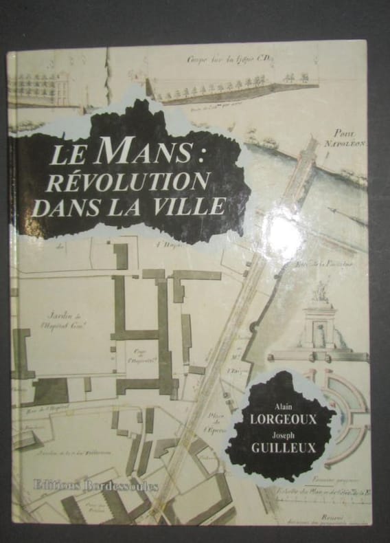
1991843241991 Saint-Jean-d'Angély, Editions Bordessoules, 1991, in 4°, cartonnage illustré en couleurs de l'éditeur, 173 pages ; très nombreuses illustrations en noir et en couleurs.
1973877591973 Le Mans, L'Auteur, 1973, fort volume grand in 8° relié pleine toile décorée de l'éditeur, 661 pages ; nombreuses illustrations hors-texte.
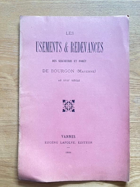
238482Vannes, Lafolye, 1888 in-8, 8 pp., cousu, sous couverture. Mouillures sur la couverture et en marge intérieure.
1995LFA-126741869Revue de 142 pages, format 230 x 300 mm, illustrée, brochée couverture couleurs, bon état
60907La Flèche, Jourdain, in 8° broché, IV-67 pages ; couverture un peu fanée.
193927234LES PONTS DE CÉ 1939 une photographie originale argentique en noir, format : 11,2 x 17 cm, découpée autour "à la ficelle", prise le 13 SEPTEMBRE 1939, LES PONTS DE CÉ (49) - LES PETITES PERRIÈRES, noté au dos à l'encre bleue : capitaine Hubert, lieutenant Anastase, Lieutenant Barbier, Lieutenant Rideau, Lieutenant Cyrolles
1825860481825 Fougères, Vannier, Paris, Tourneux, 1825, petit in 12 broché, 130 pages ; des rousseurs ; couverture fanée.
228910S.l., s.d. petit in-8, [30] ff. anopisthographes, couverts d'une écriture fine, régulière, moyennement lisible (environ 25 lignes par page), quelques biffures et ratures, 17 ff. vierges, broché sous couverture d'attente.
215393S.l.n.d. in-4, 7 pp., broché sous couverture factice du XIXe, avec manques de papier.
192041289Washington D.C.: Published by the United States Coast and Geodetic Survey 1920. Large folding nautical chart printed on heavy paper stock. Colored. A rare original coastal survey of Maine and New Hampshire including Portsmouth York Ogunquit Kennebunkport Biddeford and Cape Elizabeth.<br/> <br/> Established by President Thomas Jefferson in 1807 as the Survey of the Coast the U.S. Coast and Geodetic Survey was the United States' first civilian scientific agency. This agency has followed its mission to survey the U.S. coastline create nautical charts of the coast and help increase maritime safety since its founding and has often played fascinating roles in significant chapters of U.S. history. It served in all theaters of the Civil War in the service of the Union Army and Navy pioneered acoustic exploration in the wake of the sinking of the Titanic and during WWI it worked to detect enemy submarines. In addition this agency worked to survey and produce detailed maps and renderings of the U.S. coast. These nautical survey maps commonly referred to as "T-sheets" provide fascinating insights into the history of the United States coastline which has and will continue to shift. These maps are the most important data source for understanding the physical and ecological characteristics of the U.S. shoreline. The present map is a highly detailed and accurate sea chart of the coasts of Maine and New Hampshire and an important historical view of the developing states. Published by the United States Coast and Geodetic Survey unknown
192041283Washington D.C.: Published by the United States Coast and Geodetic Survey 1920. Large folding nautical chart printed on heavy paper stock. Uncolored. A rare original coastal survey of New Hampshire and Maine including Portsmouth Exeter Dover and the Piscataqua River.<br/> <br/> Established by President Thomas Jefferson in 1807 as the Survey of the Coast the U.S. Coast and Geodetic Survey was the United States' first civilian scientific agency. This agency has followed its mission to survey the U.S. coastline create nautical charts of the coast and help increase maritime safety since its founding and has often played fascinating roles in significant chapters of U.S. history. It served in all theaters of the Civil War in the service of the Union Army and Navy pioneered acoustic exploration in the wake of the sinking of the Titanic and during WWI it worked to detect enemy submarines. In addition this agency worked to survey and produce detailed maps and renderings of the U.S. coast. These nautical survey maps commonly referred to as "T-sheets" provide fascinating insights into the history of the United States coastline which has and will continue to shift. These maps are the most important data source for understanding the physical and ecological characteristics of the U.S. shoreline. The present map is a highly detailed and accurate sea chart of coastal New Hampshire and Maine and an important historical view of the developing states. Published by the United States Coast and Geodetic Survey unknown
192041288Washington D.C.: Published by the United States Coast and Geodetic Survey 1920. Large folding nautical chart printed on heavy paper stock. Colored. A rare original coastal survey of Portsmouth Harbor including Kittery Point New Castle Island and Portsmouth.<br/> <br/> Established by President Thomas Jefferson in 1807 as the Survey of the Coast the U.S. Coast and Geodetic Survey was the United States' first civilian scientific agency. This agency has followed its mission to survey the U.S. coastline create nautical charts of the coast and help increase maritime safety since its founding and has often played fascinating roles in significant chapters of U.S. history. It served in all theaters of the Civil War in the service of the Union Army and Navy pioneered acoustic exploration in the wake of the sinking of the Titanic and during WWI it worked to detect enemy submarines. In addition this agency worked to survey and produce detailed maps and renderings of the U.S. coast. These nautical survey maps commonly referred to as "T-sheets" provide fascinating insights into the history of the United States coastline which has and will continue to shift. These maps are the most important data source for understanding the physical and ecological characteristics of the U.S. shoreline. The present map is a highly detailed and accurate sea chart of Portsmouth Harbor and an important historical view of developing New Hampshire and Maine. Published by the United States Coast and Geodetic Survey unknown
1876S11176Paris:: Germer Bailliere 1876. 1876. Thick 8vo. 4 c 519 3 pp. Original printed wrappers; extremities chipped spine ends and cover corners missing small pieces. As is. SIGNED AND INSCRIBED from Gerard to M. H. Chotard verso title page. Maine de Biran 1766-1824 was a French philosopher who evolved from a sensualist to a mystical theosophist proposing that "human conscious experience might be exhibited as growing or developing from its essential basis in connection with external conditions" Wikip. Martin Henri Chotard 1821-1904 to whom the book is inscribed was a historian and lecturer first at Basencon and then at Claremont-Ferrand where he became dean. He was described by one inspector sitting in on his lectures as someone who "worked hard and did his utmost not to be common. . . 'Speaking easily clearly and soberly he does not hanker after rhetorical or declamatory effect. He has the tone and approach truly befitting a professor'" the inspector said den Boer 232. den Boer Pim. History as a Profession: The Study of History in France 1818-1914. Princeton NJ: Princeton University Press 1998. Germer Bailliere, 1876. unknown
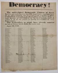
184037337South Berwick ME 1840. Broadside 11-3/4" x 14-1/2." Text as recited above in bold type of various sizes. Beneath are the printed signatures in smaller type of about 200 local citizens endorsing the call for assembly. Old folds as usual with several small pinholes along the folds which do not affect text. Ink signature on blank verso "Micajah Grant" preceded by "Mrs" "Hon.". Good plus.<br /> <br /> South Berwick Democrats seek support for the re-election of Maine Governor John Fairfield 1797-1847. Elected in 1838 he beat his Whig i.e. "Federalist" opponent in the 1840 campaign. <br /> Not located on OCLC as of May 2024 or online AAS Bowdoin Colby U ME U So. ME sites. unknown
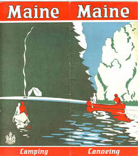
192941238N.P.: Maine Development Commission 1929. 1929. 18" x 16" sheet folded to 16 panels. 2 color cover panels showing a canoeing scene with a campsite in the background. 1-panel of information on camping and 1-panel of information on canoeing. 4 panels offering black and white photographs of scenery wildlife and individuals participating in various activities. Opposite panels offer 11 1/4" x 9" map of the state printed in black blue and red. Along the sides of the map is information on various cruises to include the Allagash trip; the St. John trip; the Fish River trip; the Rangeley Lakes trip; the Grand Lake - Machias trip; and the East and West Branch trips of the Penobscot River. 1/2" split to one fold and with light foxing and with light wear to the extremities. Very good. Maine Development Commission, 1929. unknown
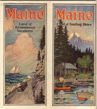
192841239Augusta: Kennebec Journal Co. 1928. 1928. First edition. 9" x 8" with vertical fold at center and with bright colorful cover showing a coastal scene on 1/2 and a cabin scene on the other. 72 pp. including wrappers. Illustrations. Foreword. Maps. Map Index. General Index. Information and black and white photographs of the Maine seacoast to include the Yorks the Scarboro Beaches Porland and Casco Bay Bowdoin College Boothbay Harbor Bar Harbor Bangor Camden and Prescott Bay Narraguagus Bay Passamaquoddy Bay Eastport etc.; Inland Maine to include Sebago country Bridgton Harrison the Saco Valley the Oxford County Hills the Poland County etc.; Northwestern Maine to include the Rangeley region the Kennebago country the Dead River region etc.; Central Maine to include Moosehead Lake and Mount Kineo Kennebec Belgrade Lake Parlin etc.; and Eastern and Northern Maine to include the Grand Lakes country in Washington County Northern Aroostook County Patten Norcross Mount Katahdin etc. Information on various camping opportunities winter sports Maine's industry and agriculture as well as a history of Maine and its colonization. At center is a two-page map of the state of Maine showing the location of all cities towns and seacoast and inland resorts. Much valuable information. Light soiling to wrappers and light wear to the extremities. Very good. Kennebec Journal Co., 1928. unknown
190433991Bethel Maine: Printed by E. C. Bowder 1904. First Edition. Hardcover. Good. Thick octavo. 3 169 pages 2. Ex-institutional copy from the Long Island Historical Society with blind stamp on he title page page 169 written numbers on the copyright page and rear paste down. Later blue cloth with title on the spine. Blue linen inner hinges. Contents are clean. Printed by E. C. Bowder hardcover
190833992Bethel Maine: Printed by E. C. Bowder 1908. First Edition. Hardcover. Good. Thick octavo. 3 148 pages 5. Ex-institutional copy from the Long Island Historical Society with blind stamps on he title page page 148 written numbers on the copyright page and rear paste down. Later blue cloth with title on the spine.Blue linen inner hinges. Contents are clean. Printed by E. C. Bowder hardcover
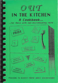
199510214Lenexa Kan.: Cookbook Publishers Inc. 1995. Comb-bound octavo 23 x 16 cm. viii 105 viii pages. Introduction; illustrated with a cover design by Cheryl Green. Title from Cover. FIRST EDITION. An important civil rights fundraising cookbook raising awareness and money to help defeat a state referendum question which would have overturned the Portland Human Rights Ordinance which extended protected classifications to "gays and lesbians" the nomenclature of the era. The cookbook itself was issued just as the referendum was defeated and the civil rights of gays and lesbians were upheld. In 2009 Maine was the first state to legalize same-sex marriage though the law was overturned in 2012. The text includes "A brief history of gay rights legislation in Maine". Lightest rubbing to black-printed green card stock covers otherwise fine with black comb-binding. Scarce. OCLC locates six copies. [Cookbook Publishers, Inc.] unknown