[Maine]Biblio.com

4 995 résultats
192041269Washington D.C.: Published by the United States Coast and Geodetic Survey 1920. Large folding nautical chart printed on heavy paper stock. Colored. A rare original coastal survey of Maine from Nash Island to Schoodic Island including Gouldsboro Prospect Harbor Steuben Milbridge Cherryfield Addison and Harrington.<br/> <br/> Established by President Thomas Jefferson in 1807 as the Survey of the Coast the U.S. Coast and Geodetic Survey was the United States' first civilian scientific agency. This agency has followed its mission to survey the U.S. coastline create nautical charts of the coast and help increase maritime safety since its founding and has often played fascinating roles in significant chapters of U.S. history. It served in all theaters of the Civil War in the service of the Union Army and Navy pioneered acoustic exploration in the wake of the sinking of the Titanic and during WWI it worked to detect enemy submarines. In addition this agency worked to survey and produce detailed maps and renderings of the U.S. coast. These nautical survey maps commonly referred to as "T-sheets" provide fascinating insights into the history of the United States coastline which has and will continue to shift. These maps are the most important data source for understanding the physical and ecological characteristics of the U.S. shoreline. The present map is a highly detailed and accurate sea chart of coastal Maine and an important historical view of the developing state. Published by the United States Coast and Geodetic Survey unknown
192041271Washington D.C.: Published by the United States Coast and Geodetic Survey 1920. Large folding nautical chart printed on heavy paper stock. Colored. A rare original coastal survey of Penobscot Bay including Belfast Isleboro Deer Isle Stonington North Haven Vinalhaven Rockland Camden and Rockport.<br/> <br/> Established by President Thomas Jefferson in 1807 as the Survey of the Coast the U.S. Coast and Geodetic Survey was the United States' first civilian scientific agency. This agency has followed its mission to survey the U.S. coastline create nautical charts of the coast and help increase maritime safety since its founding and has often played fascinating roles in significant chapters of U.S. history. It served in all theaters of the Civil War in the service of the Union Army and Navy pioneered acoustic exploration in the wake of the sinking of the Titanic and during WWI it worked to detect enemy submarines. In addition this agency worked to survey and produce detailed maps and renderings of the U.S. coast. These nautical survey maps commonly referred to as "T-sheets" provide fascinating insights into the history of the United States coastline which has and will continue to shift. These maps are the most important data source for understanding the physical and ecological characteristics of the U.S. shoreline. The present map is a highly detailed and accurate sea chart of Penobscot Bay and an important historical view of developing Maine. Published by the United States Coast and Geodetic Survey unknown
192041290Washington D.C.: Published by the United States Coast and Geodetic Survey 1920. Large folding nautical chart printed on heavy paper stock. Colored. A rare original coastal survey of Portland Harbor including Cape Elizabeth Westbrook and Portland.<br/> <br/> Established by President Thomas Jefferson in 1807 as the Survey of the Coast the U.S. Coast and Geodetic Survey was the United States' first civilian scientific agency. This agency has followed its mission to survey the U.S. coastline create nautical charts of the coast and help increase maritime safety since its founding and has often played fascinating roles in significant chapters of U.S. history. It served in all theaters of the Civil War in the service of the Union Army and Navy pioneered acoustic exploration in the wake of the sinking of the Titanic and during WWI it worked to detect enemy submarines. In addition this agency worked to survey and produce detailed maps and renderings of the U.S. coast. These nautical survey maps commonly referred to as "T-sheets" provide fascinating insights into the history of the United States coastline which has and will continue to shift. These maps are the most important data source for understanding the physical and ecological characteristics of the U.S. shoreline. The present map is a highly detailed and accurate sea chart of Portland Harbor and an important historical view of developing Maine. Published by the United States Coast and Geodetic Survey unknown
192141280Washington D.C.: Published by the United States Coast and Geodetic Survey 1921. Large folding nautical chart printed on heavy paper stock. Colored. A rare original coastal survey of Maine from Petit Manan to Quoddy Roads including Harrington Addison Jonesport and Machias.<br/> <br/> Established by President Thomas Jefferson in 1807 as the Survey of the Coast the U.S. Coast and Geodetic Survey was the United States' first civilian scientific agency. This agency has followed its mission to survey the U.S. coastline create nautical charts of the coast and help increase maritime safety since its founding and has often played fascinating roles in significant chapters of U.S. history. It served in all theaters of the Civil War in the service of the Union Army and Navy pioneered acoustic exploration in the wake of the sinking of the Titanic and during WWI it worked to detect enemy submarines. In addition this agency worked to survey and produce detailed maps and renderings of the U.S. coast. These nautical survey maps commonly referred to as "T-sheets" provide fascinating insights into the history of the United States coastline which has and will continue to shift. These maps are the most important data source for understanding the physical and ecological characteristics of the U.S. shoreline. The present map is a highly detailed and accurate sea chart of coastal Maine from Quoddy Roads to Petit Manan and an important historical view of the developing state. Published by the United States Coast and Geodetic Survey unknown
192041292Washington D.C.: Published by the United States Coast and Geodetic Survey 1920. Nautical chart printed on heavy paper stock. Uncolored. A rare original coastal survey of Richmond Island Harbor including Cape Elizabeth and Richmond Island.<br/> <br/> Established by President Thomas Jefferson in 1807 as the Survey of the Coast the U.S. Coast and Geodetic Survey was the United States' first civilian scientific agency. This agency has followed its mission to survey the U.S. coastline create nautical charts of the coast and help increase maritime safety since its founding and has often played fascinating roles in significant chapters of U.S. history. It served in all theaters of the Civil War in the service of the Union Army and Navy pioneered acoustic exploration in the wake of the sinking of the Titanic and during WWI it worked to detect enemy submarines. In addition this agency worked to survey and produce detailed maps and renderings of the U.S. coast. These nautical survey maps commonly referred to as "T-sheets" provide fascinating insights into the history of the United States coastline which has and will continue to shift. These maps are the most important data source for understanding the physical and ecological characteristics of the U.S. shoreline. The present map is a highly detailed and accurate sea chart of Richmond Island Harbor and an important historical view of developing Maine. Published by the United States Coast and Geodetic Survey unknown
192041285Washington D.C.: Published by the United States Coast and Geodetic Survey 1920. Nautical chart printed on heavy paper stock. Uncolored. A rare original coastal survey of Rockland Harbor Maine.<br/> <br/> Established by President Thomas Jefferson in 1807 as the Survey of the Coast the U.S. Coast and Geodetic Survey was the United States' first civilian scientific agency. This agency has followed its mission to survey the U.S. coastline create nautical charts of the coast and help increase maritime safety since its founding and has often played fascinating roles in significant chapters of U.S. history. It served in all theaters of the Civil War in the service of the Union Army and Navy pioneered acoustic exploration in the wake of the sinking of the Titanic and during WWI it worked to detect enemy submarines. In addition this agency worked to survey and produce detailed maps and renderings of the U.S. coast. These nautical survey maps commonly referred to as "T-sheets" provide fascinating insights into the history of the United States coastline which has and will continue to shift. These maps are the most important data source for understanding the physical and ecological characteristics of the U.S. shoreline. The present map is a highly detailed and accurate sea chart of Rockland Harbor and an important historical view of developing Maine. Published by the United States Coast and Geodetic Survey unknown
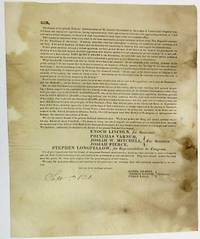
182634420Maine 1826. Folio sheet folded to 8" x 9-1/2". One printed page followed by three blanks. Addressed on final blank with folds for mailing and remnant of wax seal to William Thomas of Gorham Maine. Spotted Good or so.<br /> <br /> The document is signed in type at the end by Committee Members Daniel Gilbert Thomas Browne and Ethan Earle. It is dated in ink "Sept. 5th 1826." The Committee urges Maine "to send forth from our state an unequivocal voice in favor of the Head of the National Government" by voting for Adams supporters Enoch Lincoln Governor Stephen Longfellow Congress and other members of the State ticket.<br /> Allusions to the bitter 1824 presidential contest are numerous; the wounds inflicted by that campaign are obviously still open: "We have placed the man of our choice at the head of our government." If "we abandon him to the rude tempest of a bitter opposition how shall we answer it to our consciences and our country. What then has the President done that we should leave him to his enemies. We do not profess one thing and intend another-- we do not cry 'Adams' but mean 'Crawford'." <br /> Not located on OCLC as of November 2017. unknown
192041279Washington D.C.: Published by the United States Coast and Geodetic Survey 1920. Large folding nautical chart printed on heavy paper stock. Colored. A rare original coastal survey of St. George River and the Muscle Ridge Channel including Thomaston Cushing and St. George.<br/> <br/> Established by President Thomas Jefferson in 1807 as the Survey of the Coast the U.S. Coast and Geodetic Survey was the United States' first civilian scientific agency. This agency has followed its mission to survey the U.S. coastline create nautical charts of the coast and help increase maritime safety since its founding and has often played fascinating roles in significant chapters of U.S. history. It served in all theaters of the Civil War in the service of the Union Army and Navy pioneered acoustic exploration in the wake of the sinking of the Titanic and during WWI it worked to detect enemy submarines. In addition this agency worked to survey and produce detailed maps and renderings of the U.S. coast. These nautical survey maps commonly referred to as "T-sheets" provide fascinating insights into the history of the United States coastline which has and will continue to shift. These maps are the most important data source for understanding the physical and ecological characteristics of the U.S. shoreline. The present map is a highly detailed and accurate sea chart of Maine and an important historical view of the developing state. Published by the United States Coast and Geodetic Survey unknown
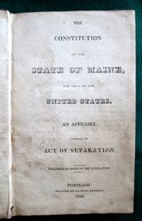
18203763<b>First Official Printing of Maine's Constitution</b><br /><br />A very scarce example of the first printing of the Maine Constitution. As noted on the verso of the title leaf 200 copies were ordered "printed for the use of the Legislature." In contrast the next printing ordered by the Legislature -- in 1825 -- was for 10000 copies. OCLC locates examples at six institutions. <br /><br /><br /><b>References:</b> Noyes <i>Maine Imprints to 1820</i>: 931. Skillin <i>A Bibliography of Maine Imprints 1785-1820</i>: 20-70. Not in Williamson A <i>Bibliography of the State of Maine</i>. Thompson:<i> Important Maine Maps Books Prints and Ephemera</i>: 28A. The Thompson copy sold for $1840 in 2003. Sprague <i>The Mirror of Maine</i>: see 11 for the 1825 edition. Shoemaker <i>A Checklist of American Imprints for 1820</i>: 2075.<br /><br /><b>Condition:</b> Contemporary calf. Boards well-scuffed and with small gouged area. Significant chipping of spine leather; hinges and joints cracked. Age-toned and areas of staining throughout. An unsophisticated but appealing example of a very scarce book. Published by Order of the Legislature. Printed by Francis Douglas. hardcover
171521151London 1715. Broadsheet. 1p. plus printed docket title on verso. Small folio. Bound to style in half calf over marbled paper-covered boards. Ornamental border. Minor foxing. Very good. A project for colonizing Maine in 1715. One of only two surviving copies.<br/> <br/> A rare early petition relating to British settlement in the eastern part of present-day Maine. The authors refer to petitioning "his Majesty in Council on the 6th Day of December last for having a Colony settled between New England and Nova Scotia" with "over one thousand disbanded men" and to be funded with the proceeds of a proposed coinage operation. The only copy of this document listed by OCLC and ESTC is at the New-York Historical Society which estimates merely that the document was printed during the 1700s. The historical context the text cited above and discovery of this broadsheet among similar petitions dating almost exclusively to 1714 and 1715 however make 1715 an extremely likely date of printing. In the Treaty of Utrecht 1713 the French ceded the land east of the Kennebec River presumably the area in question here to the British; this event and the reference to "disbanded soldiers" suggest that the War of the Spanish Succession had recently ended which it finally did in 1714. George I succeeded Queen Anne in late 1714 meaning that the petitioning of "December last" could not have been earlier than that year. With the new monarchy and a major upheaval in the House of Commons following the general election of 1715 petitionary literature distributed in the lobby of Parliament surged with this document almost certainly among the examples from that year. The petitioners evidently officers who had served in the recent war call attention to the fact that the lands they hope to settle "were formally survey'd and given by King Charles the Second to the Duke of York" and that the area has been confirmed as rich for farming. They ask that Parliament allow them to present their formal proposals for the settlement or "if not thought proper to have a Colony settled in that part of North-America" at least still to grant them a contract to coin 1000 tons' worth of half-pence and farthings. A very important Maine document one of only two surviving copies. unknown
192041277Washington D.C.: Published by the United States Coast and Geodetic Survey 1920. Large folding nautical chart printed on heavy paper stock. Colored. A rare original coastal survey of West Penobscot Bay including Camden Rockport Rockland the Fox Islands and Islesboro.<br/> <br/> Established by President Thomas Jefferson in 1807 as the Survey of the Coast the U.S. Coast and Geodetic Survey was the United States' first civilian scientific agency. This agency has followed its mission to survey the U.S. coastline create nautical charts of the coast and help increase maritime safety since its founding and has often played fascinating roles in significant chapters of U.S. history. It served in all theaters of the Civil War in the service of the Union Army and Navy pioneered acoustic exploration in the wake of the sinking of the Titanic and during WWI it worked to detect enemy submarines. In addition this agency worked to survey and produce detailed maps and renderings of the U.S. coast. These nautical survey maps commonly referred to as "T-sheets" provide fascinating insights into the history of the United States coastline which has and will continue to shift. These maps are the most important data source for understanding the physical and ecological characteristics of the U.S. shoreline. The present map is a highly detailed and accurate sea chart of Penobscot Bay and an important historical view of developing Maine. Published by the United States Coast and Geodetic Survey unknown
41295Washington D.C.: Published by the United States Coast and Geodetic Survey. Nautical chart printed on heavy paper stock. Uncolored. A rare original coastal survey of Winter Harbor Maine.<br/> <br/> Established by President Thomas Jefferson in 1807 as the Survey of the Coast the U.S. Coast and Geodetic Survey was the United States' first civilian scientific agency. This agency has followed its mission to survey the U.S. coastline create nautical charts of the coast and help increase maritime safety since its founding and has often played fascinating roles in significant chapters of U.S. history. It served in all theaters of the Civil War in the service of the Union Army and Navy pioneered acoustic exploration in the wake of the sinking of the Titanic and during WWI it worked to detect enemy submarines. In addition this agency worked to survey and produce detailed maps and renderings of the U.S. coast. These nautical survey maps commonly referred to as "T-sheets" provide fascinating insights into the history of the United States coastline which has and will continue to shift. These maps are the most important data source for understanding the physical and ecological characteristics of the U.S. shoreline. The present map is a highly detailed and accurate sea chart of Winter Harbor and an important historical view of developing Maine. Published by the United States Coast and Geodetic Survey unknown
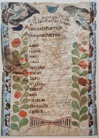
18003722<b><i>Family Register of Seward Porter circa 1800</i></b><br /><br /><br />A nicely accomplished though primitive family register of the Seward and Eleanor Porter family. Two colorful plants with birds in their top branches fill the sides of the register. At the top hover two angel-like figures one bearing an hour glass the other blowing a horn. <p>Seward and Eleanor Porter were from Weymouth Massachusetts but relocated to Falmouth in the District of Maine in about 1777 and then to Freeport in about 1782. This family register lists the names birth places and birth dates of the Porter's 13 children from 1778 to 1797. </p>Their fourth son on the list -- also named Seward Porter -- would become a prominent Maine mariner and entrepreneur. He brought the first steamboat to Maine in 1823. In 1837 he published a now-highly-prized set of charts of the Maine coast. For Seward Porter the son see:<i>Tooley's Dictionary of Mapmakers</i>: Vol 3 p. 453 and Guthorn <i>United States Coastal Charts 1783-1861</i>: p. 29. <br /><br /><b>Condition:</b> Approximately 14 x 10." Iron gall ink on wove sheet with colored decorations. The sheet is mounted on a ca. 1815 newspaper and strips of wallpaper about 1" wide have been applied along the left and right sides. The piece is in fair condition with overall cockling and some water damage. There is a small puncture on the left edge. The ink notations of the birth dates and locations are faded but legible.<br /><br />ICN 3198.
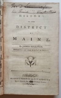
17953732This is the first general history of Maine written in the post-Revolutionary War time period that saw several state histories published including those by Belknap Jefferson and Ramsay. Despite its distinctly chilly initial reception and the less than impressive editorial standards Sullivan's <i>History</i>is a cornerstone work in any collection of Maine material. <p>The <i>History</i>includes as the frontispiece Osgood Carleton's <i>A Map of the District of Maine Drawn from the latest Surveys and other best Authorities by Osgood Carleton</i>. The map measuring 20 5/16 x 16 3/8" includes an inset titled <i>A Map of those parts of the Country most famous for being harassed sic by the Indians</i>. Carleton's map was the most detailed done of Maine to that time. </p><p>At the head of the title page is an inscription which has been lined out: "For D. Laincourt from his Friend the Author."</p><p><b>References:</b> Evans: 29589. Howes <i>USiana:</i> S-1122. Sabin: 93499. Williamson <i>A Bibliography of the State of Maine</i>: 9608. Thompson: <i>Important Maine Maps Books Prints and Ephemera</i>: 18A. For the map: Wheat & Brun <i>Maps and Charts Published in America before 1800</i>: 171. McCorkle <i>New England in Early Printed Maps 1513-1800</i>: Me795.1. </p><p><b>Condition: </b>vii iv 421 pp. With folding map frontispiece.Original full calf with worn red title label. Boards scuffed and bumped with areas of abrasion; joints cracked. Text block is very tight. Occasional light foxing and staining throughout. The map is in remarkably good condition especially in comparison to the usual state in which it is found. Trimmed close as usual along the binding edge. A sharp dark impression with minimal foxing or offsetting. <br /></p><p>ICN 7660.3.</p> Printed by I. Thomas and E.T. Andrews hardcover
186635589Augusta: Stevens & Sayward 1866. First Edition. Hardcover. Fair. Thick octavo. 1 1378 pages 1. Blueish marbled paper covered boards with leather corners and spine. Front board mostly detached and hanging by a thread. Rear cover glued back to the spine. Edge and shelf wear to the boards. Leather rubbed on the spine. Light to moderate toning and damp staining to the contents. Previous owner inscription of W.E. Towne Newport Maine written on the right front flyleaf and page iii. Fair condition only. Stevens & Sayward hardcover
184434352Kennebunkport Maine 1844. Folio broadsheet 11" x 16" printed in four columns recto and verso. Light scattered foxing old folds else Very Good.<br /> <br /> On July 4 1844 Maine's Democratic Party Convention was held in Alfred. Joshua Herrick a farmer was Maine's Democratic Congressman for its First Congressional District during the 1843-1845 Session. He sought renomination. But he was challenged by Judge William Alen Hayes. Hayes's campaign manager was future Supreme Court Justice Nathan Clifford whose manipulations aroused deep resentment over lawyers' control of the democratic process. This broadside reflects those class divisions emerging within the Democratic Party.<br /> Hayes who "is without doubt the richest man in the District-- has all the monied institutions at his control or in his interest-- all the aristocracy a queer idea in a dem. party but nevertheless true all or nearly all the Lawyers. Now what has Col. Herrick to go against this tremendous influence He is what we call self-made. has comparatively but little property but he has the confidence of the yeomanry of the District." Despite this appeal Herrick abandoned his effort to secure the Party's renomination and withdrew his name from consideration. He ran without the nomination and lost. <br /> Not located on OCLC or the online site of AAS. Not in Williamson American Imprints or Sabin. unknown
188641360Portland ME: B. Thurston & Co. 1886. First edition. Self wrappers. A very good- copy partially unopened uncut soiled and edgeworn wrappers small dampstain on lower edge rubbed upper portion of front wrapper. 8 pp with illustrated and oversized wrappers. Illus. with 3 b/w drawings. 4to. A scarce Maine item. Centennial celebration for its 150th anniversary; numerous ads including full page advertisement for B.A. Atkinson & Co. with three images. OCLC locates only three hard copies: Newberry Western Reseve Hist. Soc. and Univ. Of Maine at Orono OCLC: 47002014. B. Thurston & Co. unknown
190234346Bangor Maine: Perkins & Danforh Spoolwood Co 1902. Ledger. Good. Folio ledger. Approx. 14" x 9". A-Z thumb index 561 pages. 325 pages used for record keeping pages 328-561 are blank. Contents include some loose misc. paper records laid in between pages relating to specific accounts. Ledger has black cloth covered boards with leather corners and spine. The outer joints are cracked and split. The leather on the corners and spine is cracked and rubbed. Cloth is lightly shelf worn and chipped on the back cover. Inner hinges are sturdy. <br /> <br /> Accounts are neatly organized with printed page numbers located in the upper corners. Paper is lined with red vertical columns. The hand writing and contents are neat and clean. Dates for the ledger start in 1894 and the latest entries are dated December 1902. Accounts cover manufacturing railroads paper and beef companies individual businesses and partnerships etc. Most of the accounts record payments and dates. The Katahdin account and a few others record agricultural commodities perishable foods labor costs etc. A sample of company names include the Katahdin Iron Works which has 59 account pages Arnold J M Shoe Co. Bangor Pulp and Paper Co. Belknap Motor Co. Brownville Main Slate Co. Bangor Beef Co. Coats J & P Ltd. Doble Brothers Eastern Manufacturing Co. Great Northern Paper Co. Hincks Coal Co. Jordan Lumber Co. Northern Telegraph Co. National Pipe Bending Co. Perkins & Danforth Spoolwood Co. Public Works Co. Old Town Woolen Co. Overseers of the Poor Sweet Caldwell Whittier Beef and dozens more. Perkins & Danforh Spoolwood Co unknown
185034787Portland: Various 1850. Wraps. Good. Stitched wraps with titles on the front cover. 19 pamphlets dating from 1822 to 1850 non continuos. Condition range from fair to good. Original outer covers missing except one issue which are now laid inside the contents. Most minutes are untrimmed with several unopened or uncut pages. Stitching loose for a few issues resulting in detached title page and loose parts. Edges of the paper are brittle chipped and flaking. Light toning to the paper. Three minutes have old rubber institutional stamps from the Boston Athenaeum. <br /> <br /> Minutes of the General Conference include:<br /> <br /> 1828 Annual Meeting in Gorham. 24 pages. Last leave detached and chipped. Fair;<br /> 1829 Annual Meeting in Waldoborough. 19 pages 1 page blank. Title page detached. Stitching coming loose and contents are in parts. Fair;<br /> 1830 Annual Meeting in Winthrop. 24 pages. Paper lightly foxed. Period inscription written top of the title page. Good condition;<br /> 1831 Annual Meeting in Fryeburg. 27 pages 1 page blank. Previous owner name top of the title page. Good condition;<br /> 1832 Annual Meeting in Wiscasset. 32 pages. Stitching loose and contents are in parts. Previous owner name top of the title page. Fair;<br /> 1833 Annual Meeting in Portland. 24 pages. Good condition;<br /> 1834 Annual Meeting in Bath. 32 pages. Light scattered foxing. Period inscription written top of the title page. Good condition;<br /> 1837 Annual Meeting in North Falmouth. 23 pages 1 page blank. Red rubber stamp from Boston Athenaeum. Rubbed out pencil inscription front cover. Fair;<br /> 1838 Annual Meeting in Saco. 28 pages. Covers rubbed spotted. Fair;<br /> 1840 Annual Meeting in Hallowell. 24 pages. Good condition;<br /> 1841 Annual Meeting in Machias. 22 pages 1. Previous owner name top of the title page. Dup written in pencil top corner title page. Good condition;<br /> 1842 Annual Meeting in Portland. 24 pages. Pencil date and Dup written top of the title page. Good condition;<br /> 1843 Annual Meeting in Bangor. Disbound. 24 pages. Text trimmed. Title page foxed. Fair condition;<br /> 1844 Annual Meeting in Bath. 32 pages. Trimmed. Original brown outer wraps are detached flaking etc. The covers are laid inside. Fair condition;<br /> 1846 Annual Meeting in Augusta. 24 pages. Good condition;<br /> 1847 Annual Meeting in Portland. 27 pages 1 page blank. Rubbed out inscription title page. Red rubber institutional stamp from Boston Athenaeum. Fair condition;<br /> 1848 Annual Meeting in Bangor. 32 pages. Rubbed out inscription title page. Red rubber institutional stamp on the title page. Fair condition;<br /> 1849 Annual Meeting in Bath. 32 pages. Good condition;<br /> 1850 Annual Meeting in South Berwick. 24 pages. title page torn chipped toned. Fair condition. Various unknown
184444264Washington; Gardiner ME 1844. Very good pair marginal finger soiling only closed tear at one centerfold not obscuring text. 2 pp. 8 x 10 inches. Two letters from George Evans 1797-1867 who was U.S. Senator from Maine during the time of these letters.<br /> <br /> 1: Dated and signed Washington Dec. 20 1842. Bifolium 3 pp. To Rufus Daniel regarding the claims on the estate of Col. Thomas and his son John. Evans tells Daniel that "No examination of any extent has yet been made into the state of his affairs. I hoped it would appear that he had some money on hand or at command but not traces of any a clue to it has been discovered.I had some previous knowledge of them & shall render all the aid in my power to his son in advising the estate. The land here is subject to mortgages to its full value." Evans himself is owed money from the estate.<br /> <br /> 2: Dated and signed Gardiner Maine Aug. 17 1844. 1 pp. Evans declines Daniel C. Baker's invitation to a mass meeting in Lynn Essex County scheduled for September 4th because he was engrossed in work involving the Massachusetts election of September 9th. "We are holding a succession of mass meetings in every county of the state & have made great efforts to obtain distinguished gentlemen from Massachusetts to address our citizens; but not one has yet honored us with his presence. Thus compelled to rely upon our own resources I feel the greater necessity of remaining at my post until we have achieved our victory. I pray you accept this acknowledgment for the flattering terms in which your invitation is conveyed." Daniel Collins Baker 1816-1863 was a Massachusetts politician who served as the third Mayor of Lynn Massachusetts. unknown
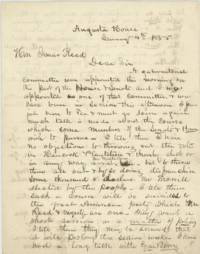
185545251Augusta House Augusta ME 1855. Very good folded small tear to one edge minor soiling and ink bleed through. 3 pp. Bifolium. 8 x 10 inches. Letter dated January 4th 1855 one day after the Maine elections from Maubec Mitchell Rawson newly elected Whig member of the Maine House of Representatives to fellow Whig party member and candidate for Governor Isaac Reed reporting on the efforts to fix the vote in favor of Reed's opponent Anson Morrill. Rawson had been appointed as a member of a gubernatorial committee that morning so was privy to the shenanigans: "Much talk is made about the course which some members of the Senate & House wish to pursue. I tell them I have no objections to throwing out the votes in the Hancock Plantation & thereby elect or in any way assist Mr. Milliken but to throw them all out & by so doing disfranchise some thousand & declare Mr. Morrill elected by the people. I tell them such a course will be suicidal to the great American party which Mr. Reed & myself are one."<br /> <br /> He goes on to report who is opposed to these moves and who might be witnesses: "When I see you I will inform you who are the men who are so conscientious about this matter. I am perfectly quiet & cool but I have been at work. most of the time for the last 24 hours. They the Committee propose to spend the night in the committee room so as to have it said that we are doing up business in shape but they are more anxious to declare Mr. Morill Gov by the dear people. I have heard nothing from you but I think my course is patriotic or an honest one & I shall pursue it unless you suggest otherwise. Don't show my letters to anyone. I shall be glad when this session shall close."<br /> <br /> Anson Morrill 1803-1887 was elected Maine's Governor in 1855 and served until 1856. He had been a candidate under the Know Nothing and then Republican parties.<br /> <br /> John F. Milliken however was not among the list of Representatives in 1855 but seems to have gotten himself appointed Postmaster in his hometown.<br /> <br /> Isaac Reed 1809-1887 was a merchant and shipbuilder. He served in the Maine Senate 1839-1840; 1850 1863; the Maine House of Representatives 1842-1843; 1846; 1870-1871; as State Treasurer 1856; and in the U.S. House of Representatives 1852-1853.<br /> <br /> Maubec Mitchell Rawson b. 1825 was from Waldoboro Maine. unknown
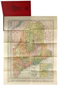
190447779New York: C.S. Hammond & Co 1904. Very Good . New York: C.S. Hammond & Co. 1904. Fold-out map of Maine in red pictorial wrappers 33x26 cm. Wrappers gently creased and dust soiled with mild water damage and previous paperclip ghosting. Interior has calendars for 1905 and 1906 and another ad for R. M. Lewsen & Co which matches the exterior proclaiming they are the largest cloak store and leading millinery store in Maine. Map folded with only light toning. A Very Good or better example. C.S. Hammond & Co unknown
2000LFA-126744039N° 19 (Novembre-décembre 2000) de la revue "Moyen Age" : 68 pages, format 230 x 295 mm, illustrée, brochée, bon état
190130294Maine: n/a 1901. Journal. Good. 12mo. Blue cloth hardcover titled "U.S. Navy Regulations 1870" repurposed and used for 11 signed dated tipped in correspondence between Ms. Lila P. Harden and "My Dear Friend" My Dear Mr. Hersey" and "My Dear Will." <br /> <br /> On the front paste down is an ex-library label from Freeport High School library Maine. Locations signed at the end of the letters include So. Paris Maine; 49 Waverly Street and "Smuggery." Letters were written on blue-green paper and are not stamped or come with envelopes possibly these were copy letters or from a diary. <br /> <br /> The first letter consists of 6 pages and dated March 30th 1901 and signed "Lila P. Harden So. Paris Maine";<br /> Second letter is dated April 12 1901 and has 8 pages of content; <br /> April 27 third letter has 10 pages; <br /> May 3 fourth letter has 8 pages; <br /> May 10 fifth letter has 8 pages <br /> May 18th sixth letter 8 pages; <br /> May 25th letter has 12 pages; <br /> June 8th has 15 pages;<br /> June 15 letter has 15 pages;<br /> June 22 letter has 10 pages; <br /> and 4 pages of correspondence dated June 27. <br /> <br /> Contents of the letters are personal and infer a close relationship between the couple. Ms Harden in the last correspondence discusses plans to meet Mr. Hersey. Letters also include observations of daily life activities heath weather Church going New England travels etc. There is one letter discussing watching a 'football' game. The blue-green paper is faded a bit but the writing is clean and neat. <br /> <br /> Following the letters are pages 205 to 379 of Navy Regulations. Some faded and worn spots to blue cloth binding. n/a unknown
181326297Angers 1813 1 document ORIGINAL, de 2 pages manuscrites à l'encre brune, format : 17 x 25,2 cm, sur papier velin crème, ligné et filigrané "à l'aigle couronné", timbre fiscal noir imprimé : "empire français 5c", AVERTISSEMENT DE CONGÉ (DE BAIL) PAR MR ANTOINE CRUCY, NÉGOCIANT A NANTES CONTRE LE SIEUR FOUQUET MARCHAND DE BOIS A ANGERS POUR LA SAINT JEAN BAPTISTE PROCHAINE, FAIT A ANGERS PAR MOREAU HUISSIER, LE 20 MARS 1813,