4 995 résultats
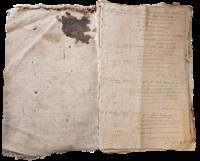
1898List2965United States and Caribbean 1898. Approximately twenty-nine pieces: logbook of eighty-four double-sided pages measuring 13 x 20 inches; eight letters seventeen documents and forms and three pieces of miscellany. Much wear and significant damage to logbook including water damage mildew and tearing; log book overall fair to good minus. Other materials good to very good. Overall good. William Higgins 1791–1872 was a farmer sea captain and owner of and investor in ships from Bowdoinham Maine. According to the Maine Maritime Museum which holds his family papers Higgins’ ships traded mainly in lumber which they took from Wilmington North Carolina to the Caribbean.<br /> <br /> Offered here is a logbook recording the travels of several of Higgins’ ships particularly the brigs Mary Jane and Llewellyn alongside related documents and personal letters. The logbook dating between 1832 and 1836 extensively documents the course wind data and weather remarks for travels of the ships between east coast US port cities and various locations in the Caribbean including Barbados St. Thomas and Martinique. The logbook also contains a copy of astronomer and mathematician Elijah Burritt’s illustration “A Plan of the Solar System Exhibiting its Relative Magnitudes and Distances†engraved by W. G Evans and printed in 1835 by F.J. Huntington.<br /> <br /> The letters and documents date from 1830 to 1867 and are also mostly business-related including an insurance document for the brig William Parrington a roll of sailors enlisted to work on a six-month journey between the Caribbean and the US in 1845 a bill of sale for ¼ stake in the brig Mary Jane and receipts and logs for items including various liquors sugar molasses casks and so on. One letter from a young man in Wilmington requests advice on how to start his own business in the style of Higgins’; other letters concern family matters. One interesting undated document is a writ addressed to the Marshal of the District of Maine concerning a lawsuit filed against Higgins and Rufus Carr master of the William Parrington by Zachrisson Nelson Co. The suit alleged that Carr acting as an agent for the ship’s owners that is Higgins had agreed to an affreightment involving shipping from Jamaica to Spain to New York but had then “wholly neglected and refused to do soâ€.<br /> <br /> Of interest to scholars of maritime history and trade in the mid-19th century. unknown
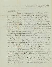
1845List2966Kennebunk Maine 1845. Two 7 ½ x 9 ¾ inch pages. Near fine. A letter from Barnabas Palmer in Kennebunk to Charles G. Bellamy Esquire in Kittery. Bellamy 1811–1892/1899 was a captain in the Maine militia a member of the Maine House of Representatives 1842–3 and State Senate 1846–7 York County Sheriff and then Inspector of Timber at the Navy Yard in Portsmouth.1 Palmer 1791–1867 may have been military; he appears in Maine state records as an agent for the Kennebunk Gun House which is listed in other records as under the purview of the Quartermaster General.<br /> <br /> Palmer gives Bellamy his opinion on the political prospects of “Pierce†versus “Hammond†commenting:<br /> <br /> “I did not hear of any legislative recommendation of Hammond while I was at Augusta and if there was and their late abolition speeches & Texan resolutions is a specimen of the support they intend to give Mr Polk it should not have much effect.â€<br /> <br /> The US under President Polk had not yet annexed Texas and Palmer is apparently underwhelmed by Maine’s support for the cause. He also remarks on Joshua Herrick’s 1793–1874 bid for re-nomination to Congress; though he feels that he had “been badly treated†by Herrick’s competition “Judge Hayes†Palmer nonetheless feels compelled to vote for Hayes over Herrick. Of interests to historians of Maine state politics.<br /> <br /> 1 John E. Frost Colonial Village Gundalow Club: 1948 28. unknown
1922IAIe[MAI58Edinburgh & London: T.N.Foulis Ltd. 1922. 1922. 4to. ff. 24. printed in red & black. 10 full-page illus. decorative headpieces initials & title vignette. unopened in original cloth-backed gilt bds. First Edition. F. Hardcover. Edinburgh & London: T.N.Foulis, Ltd., [1922]. Hardcover
185025184Rockville CT: Press of the Tolland County Republican 1850. 8pp untrimmed. Folded fold splitting pinned. Tanned with some spotting. Good. <br /> <br /> The author writes humorous poetry to express his distress at new and excessive tax laws. A complete list of taxable property would take "Methuselah's hours.Although I have little that now commands cash; I've plenty in 'ruins' all broken to smash; A fine dish of 'all-sorts' to publish in form; Would make out a list thrice as long as my arm. So I must abbreviate and name them in groups; then let our great ASSES-ors examine to boot."<br /> OCLC 15328280 9. Press of the Tolland County Republican unknown
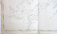
17763748<b>Striking Casco Bay Chart from the Atlantic Neptune 1776</b><br /><br />This is an exceptional chart of the coast of Maine between Cape Elizabeth and Popham from the early Revolutionary War period. It is from Des Barres' monumental <i>Atlantic Neptune</i> a sea atlas published by the British Admiralty during the last quarter of the 18th century. The <i>Atlantic Neptune</i> has been called "the most splendid collection of charts plans and views ever published." <br /><br />The present chart includes all of Casco Bay naming the larger islands and extends east to include Seguin "Segevin Island" and Georgetown Islands. Among the numerous geographic features named are Great Jebieg Chebeague Merrymeeting Bay Segadahock River Arrowsick Island and Halfway Road i.e. Rock. Roads are shown on the chart as are individual buildings. <br /><br />The chart is dated July___ 1776 i.e. with a prominent space after the month as if a date were going to be inserted. There is no type-stamped "15" at the upper right as called for in some copies of state "b" of the Stevens Catalogue. <br /><br />The chart was folded into four vertical panels about 30 1/4 x 12" to accommodate being "bound up in tall narrow form" Stevens' Catalogue p. vii. The chart paper has the LVG watermark consistent with the earlier issues of the chart. <br />A scarce early state of a desirable chart. <br /><br /><b>References:</b> Stevens <i>Catalogue of the Atlantic Neptune</i>: 105 State: b. Sellers & Van Ee <i>Maps and Charts of North America and the West Indies</i> 1750-1789: 855. <br /><br /><b>Condition: </b>A wonderfully clean example of a striking chart of Casco Bay.<br /><br />ICN 3763. From The Atlantic Neptune.
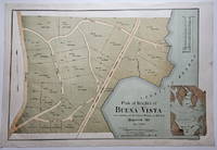
18883832<p>This attractively executed map/plan is for a proposed development by the Maine Central Railroad conveniently located "near terminus of the Mt. Desert Branch" of the railroad. The plan was "laid out by Joseph H. Curtis landscape engineer from surveys by J.G. Kelley." The completion of the Mt. Desert Branch in 1884 made possible an all-rail journey from Portland and points south to the Mt. Desert area. The proposed development apparently did not occur since a note on OCLC states: "Later maps show no evidence of the planned roads or lots."</p><p>Scarce with OCLC locating examples at the University of Maine at Orono Yale and Columbia. The Osher Map Library also has an example.</p><p><strong>Condition:</strong> Litho in green blue and brown. Very good with a small smudge at the middle of the right blank margin and remnants of mounting tape on the reverse.</p><p>ICN 7807.2</p> Heliotype Printing Co.
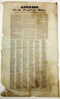
183234328Portland 1832. Broadside 11-3/4" x 19". Lightly foxed generously margined and untrimmed with lower blank margins chipped some old folds. Else Very Good. Matted. Dated in type at the end: Portland Oct. 25th 1832."<br /> <br /> The text of this rare broadside urging the defeat of President Jackson in the upcoming presidential election is printed in three columns. It is followed by six columns consisting of hundreds of printed names of Portland citizens endorsing its sentiments. <br /> Despite his promises to the contrary Jackson has expanded the power of the presidency reneged on his promise to serve only one term and enthusiastically practiced the Spoils System. "The expenses of his administration have largely exceeded those of any of his six predecessors." He has claimed the power of "interpreting for himself" the Constitution although contradicted by "the Supreme Judiciary." <br /> AI 10824 1- Harvard. OCLC 58786948 3- AAS NYHS Harvard as of November 2023. unknown
192041293Washington D.C.: Published by the United States Coast and Geodetic Survey 1920. Large folding nautical chart printed on heavy paper stock. Colored. A rare original coastal survey of the approach to Penobscot Bay including Matinicus Island and an inset map of Matinicus Harbor in the bottom right corner.<br/> <br/> Established by President Thomas Jefferson in 1807 as the Survey of the Coast the U.S. Coast and Geodetic Survey was the United States' first civilian scientific agency. This agency has followed its mission to survey the U.S. coastline create nautical charts of the coast and help increase maritime safety since its founding and has often played fascinating roles in significant chapters of U.S. history. It served in all theaters of the Civil War in the service of the Union Army and Navy pioneered acoustic exploration in the wake of the sinking of the Titanic and during WWI it worked to detect enemy submarines. In addition this agency worked to survey and produce detailed maps and renderings of the U.S. coast. These nautical survey maps commonly referred to as "T-sheets" provide fascinating insights into the history of the United States coastline which has and will continue to shift. These maps are the most important data source for understanding the physical and ecological characteristics of the U.S. shoreline. The present map is a highly detailed and accurate sea chart of Penobscot Bay and an important historical view of developing Maine. Published by the United States Coast and Geodetic Survey unknown
192041278Washington D.C.: Published by the United States Coast and Geodetic Survey 1920. Large folding nautical chart printed on heavy paper stock. Colored. A rare original coastal survey of Blue Hill Bay including Swans Island Deer Isle Mt Desert and Tremont.<br/> <br/> Established by President Thomas Jefferson in 1807 as the Survey of the Coast the U.S. Coast and Geodetic Survey was the United States' first civilian scientific agency. This agency has followed its mission to survey the U.S. coastline create nautical charts of the coast and help increase maritime safety since its founding and has often played fascinating roles in significant chapters of U.S. history. It served in all theaters of the Civil War in the service of the Union Army and Navy pioneered acoustic exploration in the wake of the sinking of the Titanic and during WWI it worked to detect enemy submarines. In addition this agency worked to survey and produce detailed maps and renderings of the U.S. coast. These nautical survey maps commonly referred to as "T-sheets" provide fascinating insights into the history of the United States coastline which has and will continue to shift. These maps are the most important data source for understanding the physical and ecological characteristics of the U.S. shoreline. The present map is a highly detailed and accurate sea chart of Blue Hill Bay and an important historical view of developing Maine. Published by the United States Coast and Geodetic Survey unknown
191941297Washington D.C.: Published by the United States Coast and Geodetic Survey 1919. Large folding nautical chart printed on heavy paper stock. Uncolored. A rare original coastal survey of Bath and Boothbay Harbor including Bath Georgetown Boothbay and Westport and Southport Islands.<br/> <br/> Established by President Thomas Jefferson in 1807 as the Survey of the Coast the U.S. Coast and Geodetic Survey was the United States' first civilian scientific agency. This agency has followed its mission to survey the U.S. coastline create nautical charts of the coast and help increase maritime safety since its founding and has often played fascinating roles in significant chapters of U.S. history. It served in all theaters of the Civil War in the service of the Union Army and Navy pioneered acoustic exploration in the wake of the sinking of the Titanic and during WWI it worked to detect enemy submarines. In addition this agency worked to survey and produce detailed maps and renderings of the U.S. coast. These nautical survey maps commonly referred to as "T-sheets" provide fascinating insights into the history of the United States coastline which has and will continue to shift. These maps are the most important data source for understanding the physical and ecological characteristics of the U.S. shoreline. The present map is a highly detailed and accurate sea chart of Bath and Boothbay Harbor and an important historical view of developing Maine. Published by the United States Coast and Geodetic Survey unknown
192041267Washington D.C.: Published by the United States Coast and Geodetic Survey 1920. Large folding nautical chart printed on heavy paper stock. Uncolored. A rare original coastal survey of Blue Hills Bay in Maine including Ellsworth Surry Tremont Southwest Harbor Swans Island Blue Hill and Acadia National Park.<br/> <br/> Established by President Thomas Jefferson in 1807 as the Survey of the Coast the U.S. Coast and Geodetic Survey was the United States' first civilian scientific agency. This agency has followed its mission to survey the U.S. coastline create nautical charts of the coast and help increase maritime safety since its founding and has often played fascinating roles in significant chapters of U.S. history. It served in all theaters of the Civil War in the service of the Union Army and Navy pioneered acoustic exploration in the wake of the sinking of the Titanic and during WWI it worked to detect enemy submarines. In addition this agency worked to survey and produce detailed maps and renderings of the U.S. coast. These nautical survey maps commonly referred to as "T-sheets" provide fascinating insights into the history of the United States coastline which has and will continue to shift. These maps are the most important data source for understanding the physical and ecological characteristics of the U.S. shoreline. The present map is a highly detailed and accurate sea chart of Blue Hills Bay and an important historical view of developing Maine. Published by the United States Coast and Geodetic Survey unknown
192241276Washington D.C.: Published by the United States Coast and Geodetic Survey 1922. Large folding nautical chart printed on heavy paper stock. Colored. Bisected into two maps. A rare original coastal survey of Maine including Boothbay Harbor Bath and Georgetown.<br/> <br/> Established by President Thomas Jefferson in 1807 as the Survey of the Coast the U.S. Coast and Geodetic Survey was the United States' first civilian scientific agency. This agency has followed its mission to survey the U.S. coastline create nautical charts of the coast and help increase maritime safety since its founding and has often played fascinating roles in significant chapters of U.S. history. It served in all theaters of the Civil War in the service of the Union Army and Navy pioneered acoustic exploration in the wake of the sinking of the Titanic and during WWI it worked to detect enemy submarines. In addition this agency worked to survey and produce detailed maps and renderings of the U.S. coast. These nautical survey maps commonly referred to as "T-sheets" provide fascinating insights into the history of the United States coastline which has and will continue to shift. These maps are the most important data source for understanding the physical and ecological characteristics of the U.S. shoreline. The present map is a highly detailed and accurate sea chart of coastal Maine from Boothbay Harbor to Bath and an important historical view of the developing state. Published by the United States Coast and Geodetic Survey unknown
192141274Washington D.C.: Published by the United States Coast and Geodetic Survey 1921. Large folding nautical chart printed on heavy paper stock. Colored. A rare original coastal survey of Maine around Casco Bay including Cape Elizabeth Portland Yarmouth Freeport and Harpswell.<br/> <br/> Established by President Thomas Jefferson in 1807 as the Survey of the Coast the U.S. Coast and Geodetic Survey was the United States' first civilian scientific agency. This agency has followed its mission to survey the U.S. coastline create nautical charts of the coast and help increase maritime safety since its founding and has often played fascinating roles in significant chapters of U.S. history. It served in all theaters of the Civil War in the service of the Union Army and Navy pioneered acoustic exploration in the wake of the sinking of the Titanic and during WWI it worked to detect enemy submarines. In addition this agency worked to survey and produce detailed maps and renderings of the U.S. coast. These nautical survey maps commonly referred to as "T-sheets" provide fascinating insights into the history of the United States coastline which has and will continue to shift. These maps are the most important data source for understanding the physical and ecological characteristics of the U.S. shoreline. The present map is a highly detailed and accurate sea chart of Casco Bay and an important historical view of developing Maine. Published by the United States Coast and Geodetic Survey unknown
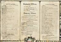
186338843Cincinnati: Ehrgott Forbriger & Co. Lithographers 1863. Folio lithograph broadside 18" x 22." Matted in a wood frame. Some soil and closed tears. The lists of Regimental Officers Company Officers Musicians Wagoneer and Privates are surrounded by lithograph vignettes of battle flags and rural household and battle scenes. Good.<br /> <br /> The Company was mustered into service on December 4 1861 at Augusta by Lieut. Col. S. Eastman. Ehrgott, Forbriger & Co., Lithographers unknown
192041281Washington D.C.: Published by the United States Coast and Geodetic Survey 1920. Large folding nautical chart printed on heavy paper stock. Uncolored. A rare original coastal survey of Maine from Nash Island to Cross Island including Jonesport Jonesboro Great Wass Island Preserve and Bucks Harbor.<br/> <br/> Established by President Thomas Jefferson in 1807 as the Survey of the Coast the U.S. Coast and Geodetic Survey was the United States' first civilian scientific agency. This agency has followed its mission to survey the U.S. coastline create nautical charts of the coast and help increase maritime safety since its founding and has often played fascinating roles in significant chapters of U.S. history. It served in all theaters of the Civil War in the service of the Union Army and Navy pioneered acoustic exploration in the wake of the sinking of the Titanic and during WWI it worked to detect enemy submarines. In addition this agency worked to survey and produce detailed maps and renderings of the U.S. coast. These nautical survey maps commonly referred to as "T-sheets" provide fascinating insights into the history of the United States coastline which has and will continue to shift. These maps are the most important data source for understanding the physical and ecological characteristics of the U.S. shoreline. The present map is a highly detailed and accurate sea chart of coastal Maine from Cross Island to Nash Island and an important historical view of the developing state. Published by the United States Coast and Geodetic Survey unknown
192041286Washington D.C.: Published by the United States Coast and Geodetic Survey 1920. Large folding nautical chart printed on heavy paper stock. Colored. A rare original coastal survey of the Damariscotta and Medomak rivers including Bristol Waldoboro and Damariscotta.<br/> <br/> Established by President Thomas Jefferson in 1807 as the Survey of the Coast the U.S. Coast and Geodetic Survey was the United States' first civilian scientific agency. This agency has followed its mission to survey the U.S. coastline create nautical charts of the coast and help increase maritime safety since its founding and has often played fascinating roles in significant chapters of U.S. history. It served in all theaters of the Civil War in the service of the Union Army and Navy pioneered acoustic exploration in the wake of the sinking of the Titanic and during WWI it worked to detect enemy submarines. In addition this agency worked to survey and produce detailed maps and renderings of the U.S. coast. These nautical survey maps commonly referred to as "T-sheets" provide fascinating insights into the history of the United States coastline which has and will continue to shift. These maps are the most important data source for understanding the physical and ecological characteristics of the U.S. shoreline. The present map is a highly detailed and accurate sea chart of the Damariscotta and Medomak rivers and an important historical view of developing Maine. Published by the United States Coast and Geodetic Survey unknown
192041287Washington D.C.: Published by the United States Coast and Geodetic Survey 1920. Large folding nautical chart printed on heavy paper stock. Colored. A rare original coastal survey of Maine at East Penobscot Bay including the Fox Islands Deer Isle Stonington and Isle Au Hunt.<br/> <br/> Established by President Thomas Jefferson in 1807 as the Survey of the Coast the U.S. Coast and Geodetic Survey was the United States' first civilian scientific agency. This agency has followed its mission to survey the U.S. coastline create nautical charts of the coast and help increase maritime safety since its founding and has often played fascinating roles in significant chapters of U.S. history. It served in all theaters of the Civil War in the service of the Union Army and Navy pioneered acoustic exploration in the wake of the sinking of the Titanic and during WWI it worked to detect enemy submarines. In addition this agency worked to survey and produce detailed maps and renderings of the U.S. coast. These nautical survey maps commonly referred to as "T-sheets" provide fascinating insights into the history of the United States coastline which has and will continue to shift. These maps are the most important data source for understanding the physical and ecological characteristics of the U.S. shoreline. The present map is a highly detailed and accurate sea chart of East Penobscot Bay and an important historical view of developing Maine. Published by the United States Coast and Geodetic Survey unknown
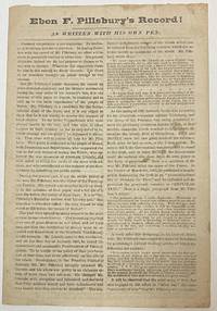
186634393Augusta 1866. 4 pp. Folded. Caption title as issued. Printed in two columns per page. Lightly foxed and worn Good.<br /> <br /> Pillsbury the Democrats' candidate for Governor of Maine had been editor of the Farmington Patriot during the Civil War. His editorial comments-- expressing "disloyal sentiments during the very crisis of his country's fate"-- disqualify him from public office. Pillsbury "charged Mr. Lincoln with deception and falsehood" called the draft unconstitutional and otherwise "encouraged the hosts of Rebeldom."<br /> Pillsbury's opponent Joshua Lawrence Chamberlain was meanwhile in the thick of the most crucial battles of the War. His record is "WRITTEN WITH HIS OWN SWORD." "Voters of Maine!! Read them both and choose between them on the 14th of September.!" <br /> Not located on OCLC as of August 2021 or the online sites of Harvard or Bowdoin. unknown
192041275Washington D.C.: Published by the United States Coast and Geodetic Survey 1920. Large folding nautical chart printed on heavy paper stock. Uncolored. A rare original coastal survey of the Fox Islands including Vinalhaven and North Haven.<br/> <br/> Established by President Thomas Jefferson in 1807 as the Survey of the Coast the U.S. Coast and Geodetic Survey was the United States' first civilian scientific agency. This agency has followed its mission to survey the U.S. coastline create nautical charts of the coast and help increase maritime safety since its founding and has often played fascinating roles in significant chapters of U.S. history. It served in all theaters of the Civil War in the service of the Union Army and Navy pioneered acoustic exploration in the wake of the sinking of the Titanic and during WWI it worked to detect enemy submarines. In addition this agency worked to survey and produce detailed maps and renderings of the U.S. coast. These nautical survey maps commonly referred to as "T-sheets" provide fascinating insights into the history of the United States coastline which has and will continue to shift. These maps are the most important data source for understanding the physical and ecological characteristics of the U.S. shoreline. The present map is a highly detailed and accurate sea chart of the Fox Islands and an important historical view of developing Maine. Published by the United States Coast and Geodetic Survey unknown
192041268Washington D.C.: Published by the United States Coast and Geodetic Survey 1920. Large folding nautical chart printed on heavy paper stock. Colored. A rare original coastal survey of Frenchman Bay including Acadia National Park Bar Harbor Lamoine Hancock Sullivan.<br/> <br/> Established by President Thomas Jefferson in 1807 as the Survey of the Coast the U.S. Coast and Geodetic Survey was the United States' first civilian scientific agency. This agency has followed its mission to survey the U.S. coastline create nautical charts of the coast and help increase maritime safety since its founding and has often played fascinating roles in significant chapters of U.S. history. It served in all theaters of the Civil War in the service of the Union Army and Navy pioneered acoustic exploration in the wake of the sinking of the Titanic and during WWI it worked to detect enemy submarines. In addition this agency worked to survey and produce detailed maps and renderings of the U.S. coast. These nautical survey maps commonly referred to as "T-sheets" provide fascinating insights into the history of the United States coastline which has and will continue to shift. These maps are the most important data source for understanding the physical and ecological characteristics of the U.S. shoreline. The present map is a highly detailed and accurate sea chart of Frenchman Bay and an important historical view of developing Maine. Published by the United States Coast and Geodetic Survey unknown
192041296Washington D.C.: Published by the United States Coast and Geodetic Survey 1920. Nautical chart printed on heavy paper stock. Uncolored. A rare original coastal survey of Maine including Camden and Rockport.<br/> <br/> Established by President Thomas Jefferson in 1807 as the Survey of the Coast the U.S. Coast and Geodetic Survey was the United States' first civilian scientific agency. This agency has followed its mission to survey the U.S. coastline create nautical charts of the coast and help increase maritime safety since its founding and has often played fascinating roles in significant chapters of U.S. history. It served in all theaters of the Civil War in the service of the Union Army and Navy pioneered acoustic exploration in the wake of the sinking of the Titanic and during WWI it worked to detect enemy submarines. In addition this agency worked to survey and produce detailed maps and renderings of the U.S. coast. These nautical survey maps commonly referred to as "T-sheets" provide fascinating insights into the history of the United States coastline which has and will continue to shift. These maps are the most important data source for understanding the physical and ecological characteristics of the U.S. shoreline. The present map is a highly detailed and accurate sea chart of the harbors of Camden and Rockport and an important historical view of developing Maine. Published by the United States Coast and Geodetic Survey unknown
192041284Washington D.C.: Published by the United States Coast and Geodetic Survey 1920. Large folding nautical chart printed on heavy paper stock. Colored. A rare original coastal survey of the Kennebec and Sheepscot Rivers including Bath Georgetown Boothbay and Wiscasset.<br/> <br/> Established by President Thomas Jefferson in 1807 as the Survey of the Coast the U.S. Coast and Geodetic Survey was the United States' first civilian scientific agency. This agency has followed its mission to survey the U.S. coastline create nautical charts of the coast and help increase maritime safety since its founding and has often played fascinating roles in significant chapters of U.S. history. It served in all theaters of the Civil War in the service of the Union Army and Navy pioneered acoustic exploration in the wake of the sinking of the Titanic and during WWI it worked to detect enemy submarines. In addition this agency worked to survey and produce detailed maps and renderings of the U.S. coast. These nautical survey maps commonly referred to as "T-sheets" provide fascinating insights into the history of the United States coastline which has and will continue to shift. These maps are the most important data source for understanding the physical and ecological characteristics of the U.S. shoreline. The present map is a highly detailed and accurate sea chart of the Kennebec and Sheepscot Rivers and an important historical view of developing Maine. Published by the United States Coast and Geodetic Survey unknown
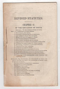
184238794Augusta: William R. Smith & Co. printers 1842. First edition. Stitched paper wrappers. Lacking the wrappers and title page else very good scattered foxing. 27 1 pp. 8vo. Attested to by Philip C. Johnson Secretary of State on May 3 1842. Includes Article I: Of the General Duties of the Towns; Article II: Of the Powers and Obligations of School Districts and the Assessments and Collection of Moneys Raised by such Districts; Article III: Of the Duties and Powers of the Superintending School Committees and School Agents and the Qualifications and Duties of Instructors; Article IV: Special Provisions Relating to the Regulations and Endowment of Schools and Affecting the Government and Discipline of Literary Institutions.<br /> <br /> Very rare. OCLC locates one copy: Trinity College. Sabin and American Imprints report a copy at the Boston Public Library but not found on their online catalogue. The printed version of Sabin lists this item as 43959 but the online version compiled by Gale assigns this number incorrectly to an 1826 version of 11 pages. American Imprints 423157. Sabin 43959. [William R. Smith & Co., printers] unknown
192041272Washington D.C.: Published by the United States Coast and Geodetic Survey 1920. Large folding nautical chart printed on heavy paper stock. Uncolored. A rare original coastal survey of Maine from Little River to Petit Manan including Milbridge Addison Great Wass Island Preserve Jonesport Machias and an inset map of Moose-a-Bec Bar and Pig Island in top left corner.<br/> <br/> Established by President Thomas Jefferson in 1807 as the Survey of the Coast the U.S. Coast and Geodetic Survey was the United States' first civilian scientific agency. This agency has followed its mission to survey the U.S. coastline create nautical charts of the coast and help increase maritime safety since its founding and has often played fascinating roles in significant chapters of U.S. history. It served in all theaters of the Civil War in the service of the Union Army and Navy pioneered acoustic exploration in the wake of the sinking of the Titanic and during WWI it worked to detect enemy submarines. In addition this agency worked to survey and produce detailed maps and renderings of the U.S. coast. These nautical survey maps commonly referred to as "T-sheets" provide fascinating insights into the history of the United States coastline which has and will continue to shift. These maps are the most important data source for understanding the physical and ecological characteristics of the U.S. shoreline. The present map is a highly detailed and accurate sea chart of coastal Maine and an important historical view of the developing state. Published by the United States Coast and Geodetic Survey unknown
192941282Washington D.C.: Published by the United States Coast and Geodetic Survey 1929. Large folding nautical chart printed on heavy paper stock. Colored. A rare original coastal survey of Maine from Monhegan Island to Cape Elizabeth including Bristol Damariscotta Wiscasset Boothbay Georgetown Harpswell Bath Brunswick Freeport Yarmouth and Portland.<br/> <br/> Established by President Thomas Jefferson in 1807 as the Survey of the Coast the U.S. Coast and Geodetic Survey was the United States' first civilian scientific agency. This agency has followed its mission to survey the U.S. coastline create nautical charts of the coast and help increase maritime safety since its founding and has often played fascinating roles in significant chapters of U.S. history. It served in all theaters of the Civil War in the service of the Union Army and Navy pioneered acoustic exploration in the wake of the sinking of the Titanic and during WWI it worked to detect enemy submarines. In addition this agency worked to survey and produce detailed maps and renderings of the U.S. coast. These nautical survey maps commonly referred to as "T-sheets" provide fascinating insights into the history of the United States coastline which has and will continue to shift. These maps are the most important data source for understanding the physical and ecological characteristics of the U.S. shoreline. The present map is a highly detailed and accurate sea chart of coastal Maine around Portland and an important historical view of the developing state. Published by the United States Coast and Geodetic Survey unknown