BARROW (John)Livre Rare Book
190 résultats
1819PHO-1356Paris, Gide fils, 1819. 2 volumes in-8,[iv], 357; [iv], 336 pp. , illustré d’une carte ,demi-veau havane, dos lisse orné, tranches marbrées, frottements , coiffes et coupes usées , mouillures en début du tome 1 et sur la carte.
183510721Paris, Carilian-Goeury (Corbeil, Bary éditeur et Crété imprimeur), 1835 ; in-8, broché ; (4), 200 pp., couverture bleue imprimée.
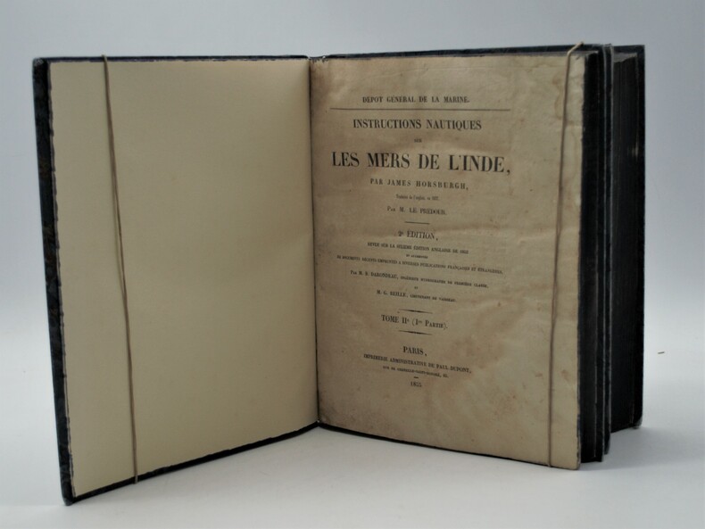
1853PHO-1002Paris, Imprimerie Administrative de Paul Dupont, 1853/55, 2 Volumes In-4 (270x225), premier tome et première partie du second tome. XXIII, 598pp, 1ff, Ap.-211,XXXIX; IV, 328 pp, Ap.-36 .Reliure en demi-percaline noire, dos lisse avec titre et tomaison, tranches bleues , accroc à la coiffe ,déchirure au dos, petite mouillure claire en début du tome 2 .
186985507h<p>London: Illustrated London News 1869. Book. Near Fine. Hardcover. Folio - over 12 - 15" tall. Half-year run bound in early half-leather over pebbled cloth boards. Some edge-wear and bumping to covers; small paper label painted over to upper spine. Edges toned and old library bookplate and marks to front and rear endpapers. Front hinge nearly exposed internally at endpaper but still firm. Otherwise clean tight and unmarked. Very neat -- a sound and handsome volume and internally unusually bright and clean. Superb illustrations.</p> Illustrated London News hardcover
1859189711Calcutta.: Surveyor Generals Office. 1870. Reissue of 1859 edition. Lithographed map 57.2 x 93 cms; 61.1 x 96 cms sheet original folds old paper repairs to the verso and a sealed marginal tear central folds archivally strengthened some toning to the folds and creasing but the map in remarkably good clean condition. Impressive large Calcutta printing from the Survey of India showing Rajasthan Uttar Pradesh and surrounding states with extremely detailed delineation of settlements roads railways rivers and major points of interest the Taj Mahal is highlighted. . Surveyor Generals Office. unknown
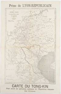
1883180621Lyon.: Lyon-Républicain. circa1883. Engraved map 40.5 x 27.5; 48.9 x 31.8 cm sheet original folds some browning to the fold and margins two small holes at the central fold without significant loss in good condition. Map issued as a supplement to "Le Lyon-Republicain" one of the great radical daily newspapers in Lyon. The map is after documents by French explorer and trader Jean Dupuis 1829-1912 who had explored regions along the Red River in the hopes of establishing trade routes within Vietnam and China and variously published. This supplement was issued on the eve of the Tonkin War in 1883 so that readers could follow the military movements of the French Expeditionary Force. It shows northern Vietnam and into south-western China with provinces marked and river systems in detail. . Lyon-Républicain. unknown
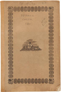
1840WRCAM29920Mexico: Impresso Por Igancio Cumplido 1840. 964pp. plus one plate. Contemporary pictorial wrappers. Spine reinforced with archival tape minor dust soiling. Very good. Variant issue without priority also printed in New Orleans in the same year. The text of a letter sent to Mexican president Anastasio Bustamente calling for a convention to address various ills affecting the newly independent state of Mexico. Estrada is heavy on political theory and with good reason. At the time of publication Mexican democracy was in a crisis. In July Gen. Urrea acting on behalf of Valentine Farias actually stormed the National Palace and took Bustamente prisoner. Bustamente soon escaped but the ensuing conflict between Farias and Bustamente for legitimacy had a devastating effect on hopes for a true democracy of the kind Estrada extols here. An excellent sample of Mexican political history and thought. SUTRO COLLECTION p.739 OCLC 7320339. Impresso Por Igancio Cumplido unknown books
1840354279Mexico: Impresso Por Igancio Cumplido 1840. 964pp. plus one plate. Contemporary pictorial wrappers. Spine reinforced with archival tape minor dust soiling. Very good. 964pp. plus one plate. Variant issue without priority also printed in New Orleans in the same year. The text of a letter sent to Mexican president Anastasio Bustamente calling for a convention to address various ills affecting the newly independent state of Mexico. Estrada is heavy on political theory and with good reason. At the time of publication Mexican democracy was in a crisis. In July Gen. Urrea acting on behalf of Valentine Farias actually stormed the National Palace and took Bustamente prisoner. Bustamente soon escaped but the ensuing conflict between Farias and Bustamente for legitimacy had a devastating effect on hopes for a true democracy of the kind Estrada extols here. An excellent sample of Mexican political history and thought. SUTRO COLLECTION p.739 OCLC 7320339 Impresso Por Igancio Cumplido unknown
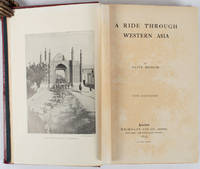
1897176109London.: Macmillan and Co. Limited. 1897. Photographic frontispiece of 'The Shah returning to Teheran' and numerous full page photographic illustrations four folding printed colour maps marginal spotting xii 275 pages 23 x 15 cm original red glazed red cloth boards occasional spotting the cloth a little marked and flecked the spine sunned but in very good condition.<P> An extensive and intrepid modern Grand Tour account through Constantinople and Turkey to Persia and Central Asia with 34 striking photographic plates. Clive Bigham was an Honorary Attaché to the British Embassy at St. Petersburg and war correspondent in the Near East travelled at the very height of the Armenian troubles when the strict orders had been issued by Turkey that Asia Minor was to be closed to Europeans. Burrell 94. <br> <br>This item is held off-site. Please note there may be a few days delay while it is brought into our shop for viewing or mailing to you. Thank you for your understanding.<P> <b>When referring to this item please quote stockid 176109</b> . Macmillan and Co. Limited. hardcover
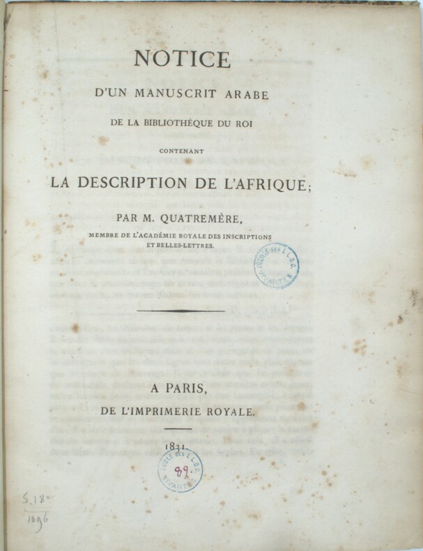
1831PHO-1372Paris , Imprimerie Royale , 1831 , in-4 , 230pp. , relié demi veau époque , tranches cailloutées ,ex-libris T.E. Mionnet (numismate ) , cachet ,dos manquant , frottements aux plats , rousseurs éparses.
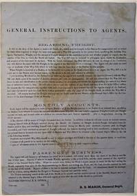
1855466Chicago: ICRR 1855. Broadside sheet. 280 x 195 mm. 11 x 8 /12 inches. Printed on blue paper folded brown stain in center portion of the sheet otherwise quite a good sound copy. Rare ICRR broadside containing instructions to their agents regarding freight accounts and passenger business with emphasis on recording and submitting Monthly Reports on all activities at their stations. It is signed by R. B. Mason General Sup't and though undated is from the early 1850's. Col. Roswell B. Mason was associated with the Illinois Central Rail Road from its inception overseeing construction of the line from 1852 to 1856 until he resigned in 1869 to become Mayor of Chicago. He was mayor during the fire of 1871 and used his power to declare martial law in its immediate aftermath. It is known that Abraham Lincoln served as counsel for Illinois Central in the early 1850s earning a fee of $5000 that occasion a law suit for nonpayment. Rare: this broadside in not among the Illinois Central Rail Road publications of the 1850s listed in OCLC. Not in Checklist of Ante-Fire Imprints 1851-1871. Not in Byrd Cecil B. Bibliography of Illinois Imprints 1814-1858 although three similar broadsides issued by Roswell Mason as General Superintendent are cited published in 1852 2 and 1855 1 all of which are in single copies at the Chicago Historical Society. (ICRR unknown
1855466Chicago: ICRR 1855. Broadside sheet. 280 x 195 mm. 11 x 8 /12 inches. Printed on blue paper folded brown stain in center portion of the sheet otherwise quite a good sound copy. Rare ICRR broadside containing instructions to their agents regarding freight accounts and passenger business with emphasis on recording and submitting Monthly Reports on all activities at their stations. It is signed by R. B. Mason General Sup't and though undated is from the early 1850's. Col. Roswell B. Mason was associated with the Illinois Central Rail Road from its inception overseeing construction of the line from 1852 to 1856 until he resigned in 1869 to become Mayor of Chicago.  He was mayor during the fire of 1871 and used his power to declare martial law in its immediate aftermath. It is known that Abraham Lincoln served as counsel for Illinois Central in the early 1850s earning a fee of $5000 that occasion a law suit for nonpayment. Rare: this broadside in not among the Illinois Central Rail Road publications of the 1850s listed in OCLC. Not in Checklist of Ante-Fire Imprints 1851-1871. Not in Byrd Cecil B. Bibliography of Illinois Imprints 1814-1858 although three similar broadsides issued by Roswell Mason as General Superintendent are cited published in 1852 2 and 1855 1 all of which are in single copies at the Chicago Historical Society. (ICRR unknown books
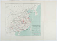
1898214719Paris.: Erhard Frères. 1898. Lithographed folding colour map 44.5 x 49.5 cms; 54.6 x 76.3 cms sheet towns and cities items of production and trade routes highlighted in red original folds in very good clean condition. Detailed map prepared for the Lyon Chamber of Commerce Mission to China under the direction of a young Henri Brenier 1867-1962 with the purpose of advancing French colonial expansion and shoring up the interests of the dominant Lyon silk trade. <br> <br>The map shows the principal centres of population production waterways roads telegraph lines and railroads togther with the centres of production and distribution for coal iron tin gold and silver opium tea rice sugar peanuts cinnamon wool medicinal plants and leather. The trade mission was organized following the Treaty of Shimonoseki and the end of the Sino-Japanese War: the Chamber of Commerce of Lyon understood that end of this war would signal a profound economic development and change. . Erhard Frères hardcover
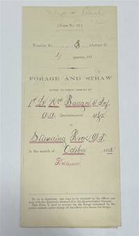
1875320963Standing Rock 1875. unbound. Partly printed military document signed 6th Infantry seven months before Little Big Horn 16.75 x 10.75 inches Standing Rock Nov. 1 1875 "A Statement Of Forage and Straw Issued to and Consumed by the Public Animals under my direction at Standing Rock Dakota Territory during the month of October 1875" for transient animals from Fort Rice signed by Captain and Commander of Post James S. Poland an officer who served under Major Reno at the Little Big Horn and was erroneously reported as "Killed In Action" when severely wounded in the back. At the time this document was signed Poland was ordered to cease his sale of rifles and ammunition to Indians at the Standing Rock Reservation as the recipients were closely connected with Sitting Bull's band. One month later the Commissioner of Indian Affairs called for the use of troops against those Indians. Also signed by Lieutenant William Badger a close friend of Custer who survived the Black Hills Campaign. His son Tom who filled out the body of this document became General Custer's personal secretary in 1876 and was killed at Little Big Horn. Also included: a Xerox of a rare photograph of the 7th cavalry 6th infantry in uniform with accoutrements all identified including Custer Badger and Poland. Partial tearing along one of the folds; otherwise near fine condition.<br/> <br/> unknown
1875243423Standing Rock 1875. unbound. Partly printed military document signed 6th Infantry seven months before Little Big Horn 16.75 x 10.75 inches Standing Rock Nov. 1 1875 "A Statement Of Forage and Straw Issued to and Consumed by the Public Animals under my direction at Standing Rock Dakota Territory during the month of October 1875" for transient animals from Fort Rice signed by Captain and Commander of Post James S. Poland an officer who served under Major Reno at the Little Big Horn and was erroneously reported as "Killed In Action" when severely wounded in the back. At the time this document was signed Poland was ordered to cease his sale of rifles and ammunition to Indians at the Standing Rock Reservation as the recipients were closely connected with Sitting Bull's band. One month later the Commissioner of Indian Affairs called for the use of troops against those Indians. Also signed by Lieutenant William Badger a close friend of Custer who survived the Black Hills Campaign. His son Tom who filled out the body of this document became General Custer's personal secretary in 1876 and was killed at Little Big Horn. Also included: a Xerox of a rare photograph of the 7th cavalry 6th infantry in uniform with accoutrements all identified including Custer Badger and Poland. Partial tearing along one of the folds; otherwise near fine condition.<br/><br/> unknown books
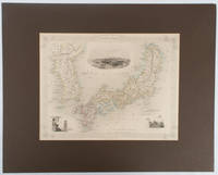
1850177528London.: The London Printing and Publishing Company. circa1850s. Lithographed map with original outline hand colour 25.8 x 33.5 cm three vignette illustrations decorative border central fold in very good condition presented in a window mount. Attractive decorative map with three vignettes by Rapkin: Yedo; a State barge in sail with penants flying--the paired oarsmen depicted through 10 small windows below deck; and Koreans in traditional costume; the map after the great mapmaker and publisher John Tallis. <br> <br>From the estate of the late collector and scholar Arthur Hacker with his pencilled catalogue mark on the verso. . The London Printing and Publishing Company. unknown
18282111902160201307Itamoto's seal is also unknown 1828. Soft Cover. Fine. Volume: 1 Itamoto's seal is also unknown paperback
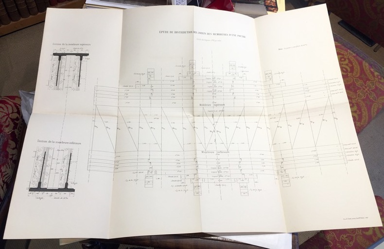
1891108701891 ; dossier petit in-folio (22 x 32 cm) ; composé d’une chemise cartonnée bleu-clair imprimée, dos toile et rubans de fermeture ; 8 grandes planches dépliantes lithographiées.I- Epure et distribution des joints des membrures d’une poutre ; II- Ensemble du tablier. Elvation et plan ; III- Demi-élévation extérieure d’une poutre au 1/10e et détails ; IV- Coupe transversale et assemblages ; V- Garde-grèves ; VI- Platelage ; VII- Détails des appuis des poutres ; VIII- Détails des garde-corps.
186510891Paris, Dunod, 1865 ; 2 tomes : texte in-4 et atlas in-folio ; demi-chagrin rouge à coins, dos à nerfs très décoré à froid et doré, titre doré, roulette décorative dorée sur les plats (reliure de l'époque) ; XV, (1 bl.), 496 pp. ; atlas de 47 planches doubles représentant plusieurs centaines de figures.
1836016450Boston: Dutton & Wentworth Printers 1836. Book. Very good condition. Hardcover. First Edition. Octavo 8vo. A bound volume containing a collection of ten publications relating to the Western Rail-Road Corporation from the incorporation in 1836 to 1840. The First Annual Report from 1836 is included twice. Bound in contemporary original three quarter leather which is moderately to heavily worn with the front board nearly detached. There is minor to moderate foxing and the final half of the text is lightly stained at the top corner. The 1836-37 Reports of the Engineers is complete with two fold-out maps which were printed on very thin onion-skin paper. These two maps have been detached and are misfolded with minor tearing as well as some foxing. A ready-made collection of the founding documents of this railroad company which starts in Boston winding its way across the state where it enters New York State at West Stockbridge. Dutton & Wentworth, Printers Hardcover books
180819195Bern, Stämpfli et J. J. Burgdorfer, 1808. In-8 de 48 pages, cartonnage de papier marbré.
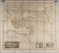
1853176118Paris.: Ministère d'Etampes et de Géographies. 1853. Engraved map with outline hand colour 67.2 x 75.1 cm sectioned and linen-backed two large vignettes: a view of Constantinople; and costumed Turks and European soldiers facing off across a stream the linen browned with some loss but not affecting the map with the fine nineteenth century label of Charles Delarue & Hivert on the verso. Fine map with beautiful vignettes by Adrien Toussaint Lallemand 1793 - c.1856 geographer and engraver at the Depôt de la Guerre. Lallemand was appointed at a precociously young age and later set up in business on his own the quality of his work assuring him of the continued business of the Depôt. <br> <br>Highly attractive map of the Ottoman Empire published at the outset time of the Crimean War 1853-1856. <br> <br>This item is held off-site. Please note there may be a few days delay while it is brought into our shop for viewing or mailing to you. Thank you for your understanding. . Ministère d'Etampes et de Géographies unknown
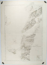
1883178272Paris.: Service hydrographique et océanographique de la marine. 1883 but1894. Engraved hydrographical chart on watermarked double sheet 99 x 63 cm soundings in metres lighthouses picked out in yellow and red inset map of the port and town of Tenedos central fold a few very slight edge tears to the generous margins light spotting and surface soiling but in very good condition. Fine and impressive large naval chart of this strategically important strait then still under the control of the Ottoman Empire. <br> <br>From a private collection; "Lord John Fitzroy Royal Yacht Squadron" in manuscript on the verso. . Service hydrographique et océanographique de la marine unknown
189840873N.P.: Sentinel and Gazette Steam Press 1851. 1898. 8 1/2" x 5 1/2" in light peach wrappers though missing the front wrapper. 15 pp. Illustrations. Map. Although it eventually became a transcontinental railroad the railroad that became the Milwaukee Road began as the Milwaukee and Waukesha Railroad whose goal was to link the developing Lake Michigan port city of Milwaukee Wisconsin with the Mississippi River. The company incorporated in 1847 but changed its name to the Milwaukee and Mississippi Railroad in 1850 before construction began. A report to the Board of Directors explaining that the railroad is not completed to Waukesha as was expected and offering reasons for the delay in its completion. "Considering our small beginning only a little over one year ago - that we have relied solely on the resources of the people of Wisconsin for the means of prosecuting this enterprise - without seeking foreign aid - with only the small contributions of each of our thousand Stockholders and the credits based on the securities of our city and citizens we have in that time completed the grade of our Road for twenty and a half miles laid the Track and brought into actual use the half of that distance - and will have the whole completed and in successful operation by the middle of February next." Information on estimated and actual costs of the First Division extending the road from Milwaukee to Waukesha. It appears that actual costs far exceeded estimates "but that has been the result of peculiar circumstances under which the work has been performed and by the adoption of a rail of greater weight than that estimated." It was determined that the contractors to whom jobs had been given at lower costs were inexperienced and inefficient resulting in their work having to be re-done. Furthermore the delay was caused by some stockholders not promptly paying the small installment of only 5% every three months thus leaving a deficit. Also a bank in a marsh sunk and had to be built back up. Th cost of constructing the first twenty and 1/2 miles is only $9495 per mile. Report ends with the reassurance that the Road will be complete by February and if weather permits perhaps even earlier. 8 1/4" x 21 1/2" map of the Milwaukee and Mississippi Rail-Road. Map is neatly torn in half at one fold and has 1 1/2 - 2" closed tears to tops of a couple folds. Front wrapper missing along with 3" split to toe of spine and with light wear to the extremities. Sentinel and Gazette Steam Press, 1851]. unknown
1806009589London: Printed for Richard Phillips Sold By Souter No. 1 Pater-noster-row. 1806. Book. Very Good. Hardcover. First Edition. Large 4to. A very good "large paper" copy with uncut edges leaf size approximately 285mm x 225mm with a few additional items bound in. Pp. xiv 2 530 ii ii. 16 hand-tinted aquatints of which several folding map plus an additional contemporary hand-coloured map of Ireland as frontispiece. Contents: frontispiece quarto format map - engraved for the Poem of Erin. The folding plate of Dublin shown as the frontispiece in the "Directions for Placing the Plates" has been bound in opposite the first page of text title page dedication prefacecontents errata directions for placing the engravings main body of the text additional page on St. Patrick from "Guide to Knowledge" bound in at rear before the Publisher's adverts cutting from the Times 1842 entitled "Robert Emmet and the Gaoler of Kilmainham" pasted to rear paste-down. Original paper-covered boards with recent pebbled cloth spine to match original with the original paper title-label applied to the spine binding in very good condition. Contents very good the uncut edges are a little worn in places and a couple of a small near-contemporary oval stamps of the "Baptist College Bristol" to the front end paper no other marks. Paper in very good condition without any obvious staining minimal foxing almost completly confined to the tissue guards maps and plates all very good clean and crisp short repaired tear to the edge of page 318 not nearly affecting the text. A very good to fine copy. Printed for Richard Phillips, Sold By Souter, No. 1, Pater-noster-row. Hardcover