[MANCHURIA & KOREA - MAP].Biblio.com
190 résultats
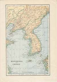
1900174813London. Circa1900. Map printed in colour showing submarine and overland telegraphs Manchuria Chosen Liao-Ting Kirin and Chili 21.5 x 13.3 cm 25.7 x 17.1 cm sheet size margins a little scuffed in very good condition. . unknown
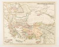
1877174915Gotha: Justus Perthes. 1877. Map with original colour and outline hand-colour 32.2 x 40 cm two inset maps text in German central fold in very good condition. A most handsome map detailing countries on the Aegean and Black Seas 1311 to 1390. The inset maps depict the kingdom of Stephan Duschan Serbia and the land of the Crimean Goths issued for the "Hand-Atlas für die Geschichte des Mittelatters und die Neueren Zeit". . Justus Perthes unknown
1838021038London: T. McLean D.& P. Colnaghi and John F. Lewis 1838. 1838. Book. Illus. by John F. Lewis. Near Fine. Hardcover. First Edition. Folio approx. 55 x 36.5cm. Complete with all Lithographic plates as called for; tinted frontispiece tinted title-vignette further 27 tinted views on 25 leaves all by Lewis after Coke Smyth. A very clean bright copy. Finely bound in modern brown morocco to style with gilt lettering to the spine and gilt bands to the top and bottom of the spine. Contents clean and tight new light brown endpapers in keeping with the new binding two blank leaves to the front and rear all pages have been professionally cleaned and restored by a paper conservator minimal and unobtrusive water staining remains to some pages and plates mostly confined to the margins and blank areas most plates unaffected new archival paper guards to all plates no inscriptions. A fine complete copy beautifully rebound. References -. Abbey Travel II 394; Atabey 722; Blackmer 1015; Contominas 413; RIBA 1886. T. McLean, D.& P. Colnaghi and John F. Lewis [1838]. Hardcover
1818ZB353063Washington: Printed by E. de Krafft 1818. 6 pp. 2 folding tables; issued as 15th Congress 1st Session H 201; extraction roughness at spine general age toning lower outside corner crumpled disbound in self wrappers; things are progressing well with average cost per mile $9744.21. - If you are reading this this item is actually physically in our stock and ready for shipment once ordered. We are not bookjackers. Buyer is responsible for any additional duties taxes or fees required by recipient's country. Photos available upon request. Washington: Printed by E. de Krafft, unknown
1832ZB348420Washington: 1832. 5 pp issued as 22d Congress 1st Session HD 52; untrimmed in self wrappers but tattered at margins and with an overall wrinkle no text lost but good only; repairs will cost a little over $230000 shortly thereafter the decision was made that the individual states should be responsible for maintenance in their own sections. - If you are reading this this item is actually physically in our stock and ready for shipment once ordered. We are not bookjackers. Buyer is responsible for any additional duties taxes or fees required by recipient's country. Washington: unknown
1885064721Madrid: Sucesores de Rivadeneyra 1885. No consta edición. Tapa dura. Good. XXXI 767 227 Láminas plegadas. 20 x 26 cm. LECCIONES DE NAVEGACIÓN - Precedidas de unas ligeras nociones de astronomía y seguidas de unas tablas para facilitar los cálculos náuticos. Buen estado. Sucesores de Rivadeneyra hardcover
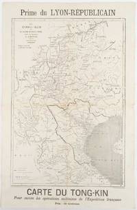
1883180621Lyon.: Lyon-Républicain. circa1883. Engraved map 40.5 x 27.5; 48.9 x 31.8 cm sheet original folds some browning to the fold and margins two small holes at the central fold without significant loss in good condition. Map issued as a supplement to "Le Lyon-Republicain" one of the great radical daily newspapers in Lyon. The map is after documents by French explorer and trader Jean Dupuis 1829-1912 who had explored regions along the Red River in the hopes of establishing trade routes within Vietnam and China and variously published. This supplement was issued on the eve of the Tonkin War in 1883 so that readers could follow the military movements of the French Expeditionary Force. It shows northern Vietnam and into south-western China with provinces marked and river systems in detail. . Lyon-Républicain. unknown
1840018232London: Printed and Published By J. Barfield 1840. Book. Very Good. Hardcover. Fourth Edition. Folio 30 x 46cm. "Revised Collated and Considerably Enlarged by John Satchell Esq." Seventy-four double-page engraved genealogical tables and geographical maps all with original hand colouring contemporary . half black morocco gilt with green cloth boards. Binding good with some general wear and rubbing leather chipped with loss to the base of the spine joints rubbed but still strong corners worn. All edges gilt./ Contents clean and tight contemporary ink stain effecting the fore-edges of the first few pages but not affecting text or maps most noticeable to the front end papers with also have a pencil inscription dated 30 November 1935. All maps and charts in very good condition. Notwitstanding wear to the binding a very good copy. Printed and Published By J. Barfield Hardcover
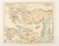
1876174910Gotha: Justus Perthes. 1876. Map with original colour and outline hand-colour 32.2 x 40 cm seven inset maps text in German central fold slight marginal toning in very good condition. A most handsome and highly detailed map detailing provinces of the Latin Empire in the wake of the Crusades. The inset maps depict Achaia in Greece Divisions of the Empire and a city plan of Constantinople issued for the "Hand-Atlas für die Geschichte des Mittelatters und die Neueren Zeit" . Justus Perthes unknown
189635319New York: America. Poor with no dust jacket. 1896. paperback. A reading copy only. pp brittle; a number loose. Spanish text. ; 46 pages . America paperback
18282111902160201307Itamoto's seal is also unknown 1828. Soft Cover. Fine. Volume: 1 Itamoto's seal is also unknown paperback
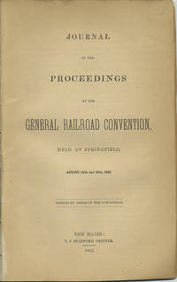
185240966New Haven: T.J. Stafford Printer 1852. First edition. Disbound. Removed from a larger volume else a very good copy chips to last three leaves of which two are blanks without loss of text. 24 pp. Sm. 8vo. To avoid ruinous rate wars railroads began to collude in earnest in the 1850s the first recorded meeting being that of the New England railroad companies in the winter of 1850-1851 followed then by this general railroad convention at Springfield Mass. called for by the principals of the New York and New Haven railroad to consider uniform train rules exchange of reports timetables and abuses in the issuance of free passes. The Ohio Railroad Convention thereafter met annually in the fifties. OCLC shows only eight locations: Lib. of Congress Amer. Antiquarian Soc. Harvard 2 Univ. Missouri Linda Hall Lib. Dartmouth and Univ. Denver. T.J. Stafford, Printer unknown books
185240966New Haven: T.J. Stafford Printer 1852. First edition. Disbound. Removed from a larger volume else a very good copy chips to last three leaves of which two are blanks without loss of text. 24 pp. Sm. 8vo. To avoid ruinous rate wars railroads began to collude in earnest in the 1850s the first recorded meeting being that of the New England railroad companies in the winter of 1850-1851 followed then by this general railroad convention at Springfield Mass. called for by the principals of the New York and New Haven railroad to consider uniform train rules exchange of reports timetables and abuses in the issuance of free passes. The Ohio Railroad Convention thereafter met annually in the fifties. OCLC shows only eight locations: Lib. of Congress Amer. Antiquarian Soc. Harvard 2 Univ. Missouri Linda Hall Lib. Dartmouth and Univ. Denver. T.J. Stafford, Printer unknown
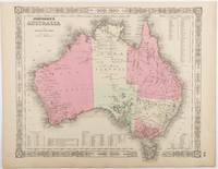
1865214355Johnson and Ward. Circa1865. Hand coloured map 32.3 x 39.7 x cms including the decorative border; 35.6 x 45.8 cms sheet key to major centres unrelated text on verso sheet age toned in very good condition. Detailed map from the leading mid 19th Century American firm of Johnson and Ward. Although Tasmania was known as such from 1856 the map refers to "Van Diemen Land". . Johnson and Ward. unknown
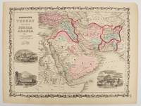
1860177019New York.: Johnson & Browning. circa1860. Engraved map 30.2 x 40.5 cm 34.5 x 45.5 cm sheet original hand-colour elaborate strapwork border three fine vignettes of Muscat Trebisond small marginal edge tears top corner chipped the map in very good condition. Most attractive decorative map of Arabia the Ottoman Empire Persia Afghanistan Beloochistan and surrounds by one of the most popular and successful 19th Century American atlas publishers. . Johnson & Browning. unknown
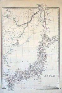
1852185246London.: Cassell Petter & Galpin. circa1852. Map with outline handcolour 42.5 x 30.1 cms; 49.2 x 34.3 cms sheet margins a little toned small corner crase but in very good condition. Very detailed map of the Japanese islands with Sakhalin above and the coast of Manchuria and Korea. . Cassell, Petter & Galpin. unknown
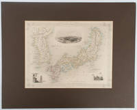
1850177528London.: The London Printing and Publishing Company. circa1850s. Lithographed map with original outline hand colour 25.8 x 33.5 cm three vignette illustrations decorative border central fold in very good condition presented in a window mount. Attractive decorative map with three vignettes by Rapkin: Yedo; a State barge in sail with penants flying--the paired oarsmen depicted through 10 small windows below deck; and Koreans in traditional costume; the map after the great mapmaker and publisher John Tallis. <br> <br>From the estate of the late collector and scholar Arthur Hacker with his pencilled catalogue mark on the verso. . The London Printing and Publishing Company. unknown
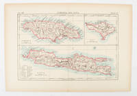
1900174875London and New York.: Encyclopedia Britannica. circa1900. Map in three insets after W & AK Johnston engravers with printed outline colour 18.9 x 28.9 cm central fold paper age-toned but in very good condition. Interesting map which first appeared in the ninth edition of Encyclopedia Britannica. . [Encyclopedia Britannica] unknown
188830736Chicago: The J. M. W. Jones Stationery and Printing Co 1888. 1st edition. Original pictorial wrappers. Some chipping to paper at spine ends with front wrapper starting to detach. Nevertheless a VG copy. 98 pp. Illustrated. 7-3/4" x 5-1/4" <br/><br/> The J. M. W. Jones Stationery and Printing Co unknown books
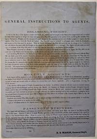
1855466Chicago: ICRR 1855. Broadside sheet. 280 x 195 mm. 11 x 8 /12 inches. Printed on blue paper folded brown stain in center portion of the sheet otherwise quite a good sound copy. Rare ICRR broadside containing instructions to their agents regarding freight accounts and passenger business with emphasis on recording and submitting Monthly Reports on all activities at their stations. It is signed by R. B. Mason General Sup't and though undated is from the early 1850's. Col. Roswell B. Mason was associated with the Illinois Central Rail Road from its inception overseeing construction of the line from 1852 to 1856 until he resigned in 1869 to become Mayor of Chicago.  He was mayor during the fire of 1871 and used his power to declare martial law in its immediate aftermath. It is known that Abraham Lincoln served as counsel for Illinois Central in the early 1850s earning a fee of $5000 that occasion a law suit for nonpayment. Rare: this broadside in not among the Illinois Central Rail Road publications of the 1850s listed in OCLC. Not in Checklist of Ante-Fire Imprints 1851-1871. Not in Byrd Cecil B. Bibliography of Illinois Imprints 1814-1858 although three similar broadsides issued by Roswell Mason as General Superintendent are cited published in 1852 2 and 1855 1 all of which are in single copies at the Chicago Historical Society. (ICRR unknown books
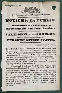
1850List2416Great Britain 1850. Broadside measuring 9 ⅞ x 15 ⅜ inches. Some chipping and wear to edge ink number written in corner two small section of loss due to improper mounting very good overall. Coat of arms of the United Kingdom above printed text. Very Good. A scarce broadside relating to British postal rates across the Panama Route through the Chagres River which supplied mail to California and Oregon beginning in 1848 before eventually being replaced by the Overland route in 1860. The service was characterized by long delay times as steamships on either side of the isthmus were often not coordinated causing major delays in the delivery. Several different steamship companies operated privately some carrying express mail. The letters were transported by canoe or pack animal across the isthmus. Postmaster General Cave Johnson began establishing post offices in California in 1848. Johnson also oversaw the transition to the prepaid delivery system. The broadside here of which we find no other records does state that postage must be prepaid and that the route can be accessed by writing “via New York†on the letters. A scarce postal history item relating to the expansion of mail services to California. We find no other records of this institutionally or in the trade. unknown
1855466Chicago: ICRR 1855. Broadside sheet. 280 x 195 mm. 11 x 8 /12 inches. Printed on blue paper folded brown stain in center portion of the sheet otherwise quite a good sound copy. Rare ICRR broadside containing instructions to their agents regarding freight accounts and passenger business with emphasis on recording and submitting Monthly Reports on all activities at their stations. It is signed by R. B. Mason General Sup't and though undated is from the early 1850's. Col. Roswell B. Mason was associated with the Illinois Central Rail Road from its inception overseeing construction of the line from 1852 to 1856 until he resigned in 1869 to become Mayor of Chicago. He was mayor during the fire of 1871 and used his power to declare martial law in its immediate aftermath. It is known that Abraham Lincoln served as counsel for Illinois Central in the early 1850s earning a fee of $5000 that occasion a law suit for nonpayment. Rare: this broadside in not among the Illinois Central Rail Road publications of the 1850s listed in OCLC. Not in Checklist of Ante-Fire Imprints 1851-1871. Not in Byrd Cecil B. Bibliography of Illinois Imprints 1814-1858 although three similar broadsides issued by Roswell Mason as General Superintendent are cited published in 1852 2 and 1855 1 all of which are in single copies at the Chicago Historical Society. (ICRR unknown
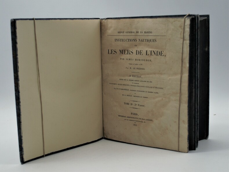
1853PHO-1002Paris, Imprimerie Administrative de Paul Dupont, 1853/55, 2 Volumes In-4 (270x225), premier tome et première partie du second tome. XXIII, 598pp, 1ff, Ap.-211,XXXIX; IV, 328 pp, Ap.-36 .Reliure en demi-percaline noire, dos lisse avec titre et tomaison, tranches bleues , accroc à la coiffe ,déchirure au dos, petite mouillure claire en début du tome 2 .
19005708Chicago: Rand Mcnally & Co 1900. Two color map 28x21" folding to 6x3.5." Few small marginal tears at folds some toning else very good. Attached to original Burlington Route folder lacking front cover. <br /> <br /> Uncommon Indiana pocket map from the Burlington Route showing roads counties cities etc. with an emphasis on railways which are listed in red at the bottom right corner. List of chief cities with populations along left margin. <br /> <br /> <br /> . Rand, Mcnally & Co unknown
1862111032294Printed by R. & R. CLARK Edinburgh: PRINTED FOR PRIVATE CIRCULATION 1862. Book. Fair. Hardcover. First Edition. 12mo - over 6¾ - 7¾" tall. Age-toned cover with black border and chocolate endpapers gilt spine title and gilt - In Memoriam. 1862 at front cover center. Fair condition with partially re-glued inner spine to text block and old tape at the inside front. Some page sections have been moved slightly forward from the binding and there is a separation at the contents gutter. The cover is spotted and sunned with frays at the corners and the pages are lightly foxed. Whole page 1863 associated related inscription at the half-title page with a 1971 inscription below from another relative. Pasted picture of his wife opposite the title page. Civil War era book. 7 x 4 1/2 with 133 pages. Rare. PRINTED FOR PRIVATE CIRCULATION Hardcover