Sampson, Emma SpeedBiblio.com
1 204 résultats
1436958903.Ghardcover. Good. Access codes and supplements are not guaranteed with used items. May be an ex-library book. hardcover
1918400527Chicago: The Reilly & Lee Co 1918. Hardcover. Very Good/Good. Twentieth edition. Pictorial red cloth stamped in black. Illustrated by William Donahey. Owner's Pinocchio bookplate on front pastedown pages lightly age-toned near fine in a good edgeworn dustwrapper spine faded with one inch chip on head. A sequel to Miss Minerva and William Green Hill. The Reilly & Lee Co hardcover books
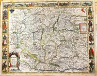
1676M11228London: Are to be sold in popshead Alley by G. Humble. 1676. Very Good . Notes: Highly decorative and detailed map of Bohemia the present-day Czech Republic.<br><br>English text on verso.<br><br>John Speed 1552 –1629 was an English cartographer and historian. He is known as England's most famous Stuart period mapmaker. His maps of English counties are often found framed in homes throughout the United Kingdom. For a series of maps Speed partnered with Dutch engraver Jodocus Hondius. <br><br> Size : 415x519 mm 16.34x20.43 Inches Coloring: Original Hand Coloring Category: Maps Europe Czech Republic Slovakia; Are to be sold in popshead Alley by G. Humble. unknown
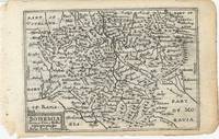
62157London: William Humble 1646. Original copper-engraved miniature map of Bohemia 8.6 x 12.4 cm. Uncoloured. English text on verso. Some very light show through text. Lower left margin slightly frayed but otherwise in good condition. [London: William Humble, 1646]. unknown
1975RO20000214DESSAIN ET TOLRA. 1975. In-8. Cartonnage d'éditeurs. Etat d'usage, Couv. défraîchie, Dos satisfaisant, Intérieur frais. 117 pp., nombreuses figures dans le texte. Couverture de bibliothèque.. . . . Classification Dewey : 694-Menuiserie
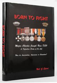
2002148707Melbourne: The Caps & Flints Press 2002. Pp. xxiv200 illustrated in colour and black & white some full page text maps erratum slip loosely inserted at p. 130 appendices glossary bibliography index; narrow cr. 4to; dust wrapper slightly scuffed; The Caps & Flints Press Melbourne 2002. First edition. Signed by the author on the title page. Charles Joseph Ross distinguished himself during the Boer War winning a DSO whilst riding with Roberts' Horse. In the First World War he fought in German East Africa. The Caps & Flints Press unknown
2002056142Melbourne: The Caps and Flints Press 2002. xxiv 200pp index bibliography glossary appendices bw ills maps. Dark brown leather titled in gilt. As new. SIGNED by author on title page with further personalised inscription signed Neil to the original subscriber expressing thanks for assistance. Collectors' edition limited to 100 copies of which this #85. Biography of Major Ross including his childhood/youth; time in the Yukon goldrush 1897; First and Second Boer Wars; British and German East Africa both before and during WWI; and his experiences as a game warden in Kenya after the war. Appendices cover his medal entitlements Nominal Roll for Canadian Scouts; Australians in the Canadian Scouts. Signed by the Author. Collectors Issue of First Edition. Hard Cover. Fine/None as Issued. Small 4to. The Caps and Flints Press Hardcover
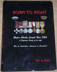
c2126Caps & Flints Press Melbourne 2002. #53 of 100 copies. Black leather photographs maps appendices glossary bibliography 200pp. Fine in like jacket. Australian Tax on Low Value Imported Goods LVIG exempt. hardcover
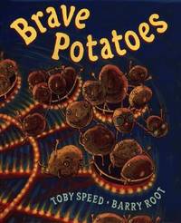
2000Q-0399231587Putnam Juvenile 2000-05-22. Hardcover. New. New. In shrink wrap. Looks like an interesting title! Putnam Juvenile hardcover
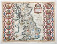
1676141841London: Basset and Chiswell 1676. Highly decorative map of the Saxon Heptarchy is from the 1676 edition of John Speed's famous atlas of 1610-12 "The Theatre of the Empire of Great Britain" published in London by Bassett and Chiswell. The most striking features of the map are the borders that flank the main body of the map. On one side they graphically portray and illustrate the seven ancient Saxon kingdoms together with their kings at the time of their own respective conversions to Christianity. The opposite side depicts the seven Saxon kingdoms with their respective kings when first established. Shields of the kingdoms a compass rose and a delightful title cartouche further enhance and embellish this most wonderful and interesting map. Copperplate engraving with hand colour. Plate mark size: 38.5 x 51. cm. Very good condition. Nicolson; The Counties of Great Britain A Tudor Atlas by John Speed p29. unknown
2017lib9019282726BC19Batsford 2017. Hardcover. Like New. large colorful oblong book in Fine shape Batsford hardcover
201687869London: Batsford 2016. Pages clean and bright. Biniding firm. Previous owner inscription to fly title page. Light shelf wear. Hard. Very Good. Elephant Folio Landscape. Batsford Hardcover
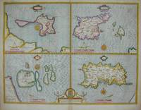
16765122London: Basset & Chiswell 1676. Copper engraving 38.5 x 51 cms modern hand-colour four maps on one sheet English text to verso. Islands around the British coast were often grouped in various cominations by early mapmakers. John Speed 1552-1629 is unquestionably the most significant English map-maker of the seventeenth-century. A brief note from Grangers Bibliographical History of England 1779 contains most of the information we have about Speeds life: John Speed who was bred a Tailor was by the generosity of Sir Fulk Grevil his patron set free from a manual employment and enabled to pursue his studies to which he was strongly inclined by the bent of his genius. The fruits of them were his Theatre of Great Britain containing an entire set of maps of the counties drawn by himself his History of Great Britain richly adorned with seals coins & medals from the Cotton collection; and his Genealogies of Scripture first bound up with the Bible in 1611 which was the first edition of the present English translation. His maps were very justly esteemed & his History of Great Britain was in its kind incomparably more complete than all the histories of his predecessors put together The first edition of Speeds Theatre was published in 1612. It was the first atlas of the British Isles and the first attempt made by an Englishman to match the achievements of the great continental publishing houses although much of the engraving of the copper plates was performed in Amsterdam by Jodocus Hondius. Speed was an antiquary and intended that his atlas should be read in conjunction with his history of Britain. He managed to include a great deal of historical detail on his modern county maps and the inset town plans some surveyed by himself together comprise the first collection of town plans of the British Isles all in all making the Theatre a highly decorative as well as a useful volume. It was a great success and there were editions printed throughout the seventeenth-century. Map Basset & Chiswell unknown
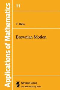
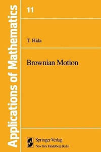
697545710Springer pp. 344 . Papeback. New. Springer unknown
B9781461260325Paperback / softback. New. Following the publication of the Japanese edition of this book several inter esting developments took place in the area. Speed v Preface The physical phenomenon described by Robert Brown was the complex and erratic motion of grains of pollen suspended in a liquid. paperback
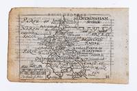
35357London: George Humble. 1627. 8.2 x 11.7 cm. Uncoloured. Miniature county map of Buckinghamshire. Text on verso. Some light show through text. Some light soiling but generally in good condition. [London: George Humble. 1627] unknown
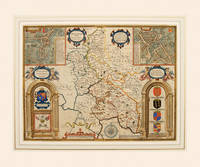
166254995Theatre of the Empire of Great Britain. Roger Rea. 1662-65. A beautiful map of Buckinghamshire from Speed's Theatre. Inset plans of the market towns of Buckingham and Redding the latter being a strange choice given that it lies in the county of Berkshire - an indication that the other market towns in Buckinghamshire were not large or prosperous. Embellished with cartouches cherubs and coats of arms belonging to the titled families of the county. Decorated scale at bottom with dividers above and compass rose to the right. Copper engraving. Good condition. Cut close at left and right hand sides but enough added margin for mounting and framing. Top margin strengthened. A closed tear 3 inches runs from the bottom up to the shield of Thomas of Wodstoke on the right. This has an old repair and is scarcely noticeable. Later colour. Size: 50 x 38 cm. 19½ x 15 inches unknown
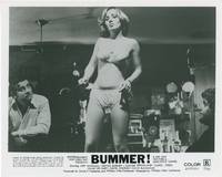
1973161563N.p.: Entertainment Ventures 1973. Vintage studio still photograph from the 1973 film. <br /> <br /> The bass player for an amateur rock band The Group goes on a killing spree while travelling with his band on the road.<br /> <br /> Set in and shot on location in Los Angeles. <br /> <br /> 8 x 10 inches. Near Fine.<br /> <br /> Thrower Nightmare USA. Entertainment Ventures unknown
A9780727766373Hardback. New. The main construction of HS2 Britain’s high-speed rail network began in September 2020. Phase One will see London to Birmingham linked by trains that can reach 225mph and Phase Two joins Birmingham with Manchester and Leeds. hardcover
1996Q-1887159045Preston-Speed Pubns 1996-07-01. Hardcover. New. In shrink wrap. Looks like an interesting title! Preston-Speed Pubns hardcover
Q-1887159118Preston-Speed Pubns. Hardcover. New. In shrink wrap. Looks like an interesting title! Preston-Speed Pubns hardcover
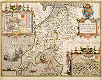
1610022406London: John Spede Speed John Sudbury Georg George Humble 1610. First Edition . Single Folded Sheet. Near Fine/No Jacket. Image 20 1/2' x 15". 1610 date in both the title block and the printing information block. Original two page map from Speed's atlas in a very strong impression. Very attractive later color coastal water outlines blue with brown along land coastlines inset maps of Bangor and Caernarvon in light blue and orange borders in red shields in red all details nicely colored. Near fine print and coloring strong no tears or repairs very slight dust/soiling in small area in margins adjacent to center fold. Nicely framed with double glaze displaying the atlas pages 123 and 124 on the reverse. <br/> <br/> John Spede (Speed), John Sudbury, Georg (George) Humble unknown
162764225London. c.1627. John Speed 1552-1629 is arguably the most famous name in early English cartography. In 1610 he published his wonderful and historic atlas 'The Theatre of Great Britain'. In 1627 he published another edition entitled 'A Prospect of The Most Famous Parts of The World' published in London by John Sudbury and George Humble. Speed based his maps on the earlier works done by Christopher Saxton and John Norden. His maps have always been keenly sought after as include many decorative features. Examples include: compass roses cherubs coats of arms mannerist style decoration prominent town plans stylish calligraphy and well defined regional physical features. John Speed's maps proved so popular that they were issued for many years after his death. This decorative and attractive example is of the Welsh county of Caernarvonshire. Size: 420 x 525 mm. Copperplate engraving with later hand colour. Fair to good condition. Repair to lower centrefold. Margins slim and 'chipped'. unknown
35391London: George Humble. 1627. 8.1 x 12.2 cm. Uncoloured. Miniature county map of Cambridgeshire. Text on verso. Some show through text otherwise in good condition. [London: George Humble. 1627] unknown
2023__0008546088Harpercollins Publishers 2023. Paperback / Softback. New. 2nd revised edition edition. 312 pages. 11.69x8.27x0.59 inches. Harpercollins Publishers paperback