Nicolas De Fer (1646-1720)Biblio.com
2 067 résultats
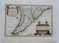
1704M5174Paris 1704. Excellent. Notes: French Map of Chile by renowned French cartographer. Size : 235x340 mm 9.25x13.375 Inches Coloring: Original Outline Coloring Category: Maps South America Countries; unknown
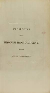
183753481N.p. n.d. 1837. 8vo pp. 36; large folding lithograph frontispiece of the Iron Mountains of Missouri one other full-page map; removed from binding; very good. American Imprints notes 3 editions in 1837: Hartford Philadelphia and Boston. The present edition is not located in American Imprints. Missouri Imprints 197. unknown
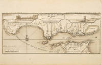
171053828Atlas Curieux ou le Monde. c.1710. The lower half of this attractive engraving shows the mouth of the Tagus from the sea to Lisbon showing the coastline settlement and fortification in detail. Title at top centre flanked by two views- To the left the 'Palais Royal de Lisbonne' and to the right 'Le Chateau de Belem'. Copper engraving. Fine condition. Uncoloured. Size: 405 x 175 mm. 16 x 7 inches. unknown
2017x-113882058XTaylor & Francis 2017. Hardcover. New. 272 pages. 9.25x6.25x0.75 inches. Taylor & Francis hardcover
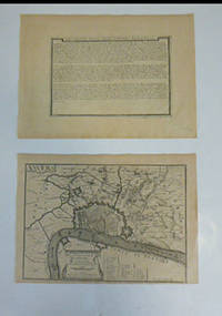
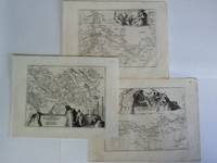
51-6462Paris: chez l'auteur dans l'Isle du Palais sur le quay de l'orloge a la Sphére Royale avec privilége du Roy 1705-1717. Engraved broadside and engraved map. Each 27.3 x 38cm. Contemporary laid paper uniformly time aged.OCLC Number / Unique Identifier:159878703.Published in "L'atlas curieux ou le monde reÌpreseÌnteÌ dans des cartes geÌneÌrales et particulieres du ciel et de la terre : diviseÌ tant en ses quatre principales parties que par eÌtats et provinces et orneÌ par des plans et descriptions des villes capitales et principales et des plus superbes edifices qui les embelissent comme sont les eglises les palais les maisons de plaisance les iardins les fontaines &c. ". OCLC Number / Unique Identifier:79022119.LThe Atlas Curieux is geographic encyclopedia of images and maps of France with detailed views of the grand waterworks at Marly views of the great palaces and chateaux views and plans of the Paris Observatory and samples of military architecture. Issued in six annual parts from 1700-1705 the maps are based on the new observations of the Académie des Sciences and drawn up with the assistance of Philipe de La Hire.ibrary of Congress:The French cartographer and engraver Nicolas de Fer was a master at creating maps that were works of art. The maps that he published were printed during the Baroque period when the decorative arts were characterized by ornate detail. De Fer’s detailed maps and atlases were valued more for their decorative content than their geographical accuracy.Nicolas de Fer was born in 1646. His father Antoine de Fer owned a mapmaking firm. At the age of twelve Nicolas was apprenticed to a Parisian engraver named Louis Spirinx. The family business was starting to decline when his father died in 1673. Nicolas de Fer’s mother Genevieve took over the business after the death of her husband. In 1687 the business was passed on to Nicolas and the profits increased after he took over the firm. Nicolas de Fer was a prolific cartographer who produced atlases and hundreds of single maps. He eventually became the official geographer to King Louis XIV of France and King Philip V of Spain.One of de Fer’s major works is an atlas titled L’atlas curieux The curious atlas. Paris: chez l'auteur dans l'Isle du Palais sur le quay de l'orloge a la Sphére Royale avec privilége du Roy, 1705-1717 unknown
2002__0471486698John Wiley & Sons Inc 2002. Hardcover. New. 1st edition. 272 pages. 10.25x7.00x0.75 inches. John Wiley & Sons Inc hardcover
2012x-1409437353Ashgate Pub Co 2012. Hardcover. New. new edition edition. 404 pages. 9.84x6.85x1.22 inches. Ashgate Pub Co hardcover
19929788476800966-2025Ir Indo Edicións 1992. Hardcover. New/New. <p><strong>Author:</strong> dirixido por XesuÌs Ferro Ruibal autores Ana Isabel BoulloÌn Agrelo . et al.</p><p><strong>Publisher:</strong> Ir Indo Edicións</p><p><strong>Binding:</strong> Hardcover</p><p><strong>ISBN:</strong> 9788476800966</p><p><strong>Release Date:</strong> 1992</p><p><strong>Number Of Pages:</strong> 668</p> Ir Indo Edicións hardcover
20152-0080974937Pergamon 2015. Paperback. New. 820 pages. 9.60x6.30x1.85 inches. Pergamon paperback
4B12251Imprimerie Alsabatt Beyrouth 1911. 263 S. mit 10 Tabellen uns 1 Korrektur-Blatt im Anhang betitelter originaler Leineneinband Name auf Vorsatz / Kanten etwas berieben. - seltene original Ausgabe in erster Auflage / gutes Exemplar / Text französisch - unknown
2n1617ca. 1694. Blattgröße: 365 cm x 275 cm. kräftige Abdrucke / saubere Blätter - unknown
1401JC071<p>Nuova Raccolta Colombiana. XI. Con la colaborazzione. di Pietro Barozzi Daniella Galassi Stefanella Guardo Maria Pia Rota. Ministero per i Beni Culturali e Ambientali. Comitato Nazionale per le Celebrazioni del V Centenario della Scoperta dellAmerica. Istituto Poligrafico e Zecca dello Stato. Roma. 1988.</p>_x000d_<p>Obra em 2 volumes. De 30x21 cm. Com 282 pags volume de ilustrações.</p>_x000d_<p>O 1º volume com encadernação do editor em pergaminho rígido com ferros a ouro na lombada e nas pastas e o segundo volume brochado acondicionados em caixa. </p>_x000d_<p>Obra impressa em papel de linho filigranado produzido especialmente para esta edição e apresentando marca-de-água com a efigie de Colombo em todos os fólios. Inclui bibliografia e índice.</p>_x000d_<p>Exemplar nº 47 de uma tiragem de 100 exemplares.</p>_x000d_<p>Ilustrado no segundo volume de Illustrazioni com mapas desdobráveis com a reconstituição estatística e gráfica de Ligúria e de Génova no tempo do navegador. Obra completa pertencente à colecção editada pelo Estado Italiano com o título de <em>Nuova Racolta Colombiana</em>.</p> I-28-D-3 unknown
153335Editora Nacional Taller de Artes gráficas de los Hermanos Bedia 1952 Santander. 1ª edición. . 23x16. Encuadernación nueva en 1/2 piel con hierros. 166 pgs. Dedicatoria de anterior poseedor. T5625 Editora Nacional, Taller de Artes gráficas de los Hermanos Bedia, 1952, Santander. 1ª edición. unknown
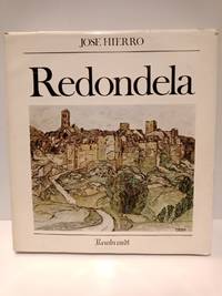
197947728Alicante: Ediciones Rembrandt 1979.- 190 p.: Profusión de láms. en negro y color además de cuatro litografías numeradas y firmadas por el artista realizadas especialmente para esta monografía; Folio mayor cuadrado 325 x 30 cm; Enc. en Tela Ed. con camisa ilustrada.- Edición limitada de 3500 ejemplares numerados siendo éste el número 1121. Canto inferior manchado de blanco seguramente porque el libro se apoyaría sobre una superficie pintada. Camisa restaurada de algunos desgarros y falta de un trocito en la zona de la tapa posterior. PINTURA DIBUJO Y GRABADO ESPAÑOLES Libro en español Ediciones Rembrandt hardcover
Asingh, Pauline & LynneruIn Pristine Condition. unknown
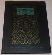
192896752Cincinnati Ohio: Cincinnati Iron Fence Co. Inc. 1928. 1928. Very good. - Quarto 11-1/4 inches high by 8-3/4 inches wide. Softcover bound in yapp-edged black wraps titled in black and light green with gilt and green art deco decorations on the front cover and a gilt vignette of an iron fence on the rear cover. The edges of the covers are slightly creased and the top edge is faded. There is a short tear along the bottom edge of the rear joint extending into the spine. 96 pages with a title leaf and foreword with profuse full-page black & white illustrations of various styles of architectural iron fences & gates and installations making use of them. The last 2 pages includes a partial list of owners of Cincinnati Iron Fences. Very good. <p>The text also includes instructions for taking measurements as well as some information on dimensions and prices.<p>The illustrations include many photographs of homes and property enclosed by ironwork fences as well as commercial properties which sometimes make use of attractive fencing and at other times simple chain link fencing. One example depicts simple but attractive iron fencing used as bridge railing for Cincinnati's Mt. Auburn's Walker and Ringold Street Bridge.<p>RARE. WorldCat locates only 2 copies those at the Columbia University Avery Classics library and The Henry Ford Benson Ford Research Center. Cincinnati, Ohio: Cincinnati Iron Fence Co., Inc., (1928). paperback
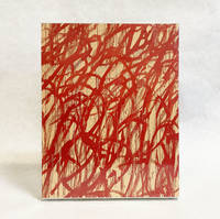
2016025911Gagosian Gallery New York 2016. Book. Near Fine. Hardcover Set with Slipcase. Box set of two hardcover books and one softcover book. Still in shrink-wrap but with a minor bump to the head of the spine of the slipcase with a slight pull of paper to the same area. Cy Twombly New York: 72 pages fully illustrated; Cy Twombly London: 92 pages fully illustrated; and Twombly's Time by Briony Fer: 14 pages fully illustrated Published in 2016 on the occasion of the exhibitions Cy Twombly at Gagosian 980 Madison Avenue New York and Cy Twombly at Gagosian Grosvenor Hill London. Gagosian Gallery, New York Hardcover
51-6451Paris: chez l'auteur dans l'Isle du Palais sur le quay de l'orloge a la Sphére Royale avec privilége du Roy 1705-1717. 2 Engraved maps and coats of arms on two leaves.Each 27.3 x 38cm. Contemporary laid paper uniformly time aged.Published in "L'atlas curieux ou Le monde reÌpreseÌnteÌ dans des cartes geÌneÌrales et particulieres du ciel et de la terre : diviseÌ tant en ses quatre principales parties que par eÌtats et provinces et orneÌ par des plans et descriptions des villes capitales et principales et des plus superbes edifices qui les embelissent comme sont les eglises les palais les maisons de plaisance les iardins les fontaines &c. ". OCLC Number / Unique Identifier:79022119.LThe Atlas Curieux is geographic encyclopedia of images and maps of France with detailed views of the grand waterworks at Marly views of the great palaces and chateaux views and plans of the Paris Observatory and samples of military architecture. Issued in six annual parts from 1700-1705 the maps are based on the new observations of the Académie des Sciences and drawn up with the assistance of Philipe de La Hire.ibrary of Congress:The French cartographer and engraver Nicolas de Fer was a master at creating maps that were works of art. The maps that he published were printed during the Baroque period when the decorative arts were characterized by ornate detail. De Fer’s detailed maps and atlases were valued more for their decorative content than their geographical accuracy.Nicolas de Fer was born in 1646. His father Antoine de Fer owned a mapmaking firm. At the age of twelve Nicolas was apprenticed to a Parisian engraver named Louis Spirinx. The family business was starting to decline when his father died in 1673. Nicolas de Fer’s mother Genevieve took over the business after the death of her husband. In 1687 the business was passed on to Nicolas and the profits increased after he took over the firm. Nicolas de Fer was a prolific cartographer who produced atlases and hundreds of single maps. He eventually became the official geographer to King Louis XIV of France and King Philip V of Spain.One of de Fer’s major works is an atlas titled L’atlas curieux The curious atlas. Paris: chez l'auteur dans l'Isle du Palais sur le quay de l'orloge a la Sphére Royale avec privilége du Roy, 1705-1717 unknown
19055882Cleveland Ohio: Van Dorn Iron Works Co 1905. First Edition thus. Staplebound. Good . Quarto 16pp. A good or better copy in the publisher's stapled wraps. The wraps appear to have at one point been detached and subsequently re-attached and the rear wrap was re-applied backwards. Still apart from this and some gentle edgewear a clean and visually striking catalogue from this maker of prison cells and other cerceral tools. Replete with illustrations of different cell types and with a long list of well-known jails and prisons for which the company was contracted to build cells including the Tombs in New York City. Each prison listed at rear includes the number of cells built by Van Dorn for that institution. An important document of turn-of-the-century prison architecture. We locate a single holding of this catalogue at Harvard and two copies of a similar one #58A at Missouri History Museum and John Jay College in New York. Rare. Van Dorn Iron Works Co unknown
51790097like new. unknown
51790097-nnew. unknown
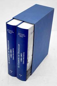
20043686678Madrid.: Ministerio de Defensa SecretarÃa General Técnica. 2004. Hardcover. Good. 30 cm. 2 v. 1814 p. il. col. y n. Encuadernación en tapa dura de editorial. Ãndice. En la port. : Armada Española. Guardados en estuche. Batalla de Trafalgar 1805. Fuentes . ISBN: 8497811364 Arte militar en general 355.494"1805"093 Historia de Europa 944"1805"093 Ministerio de Defensa, Secretaría General Técnica. hardcover
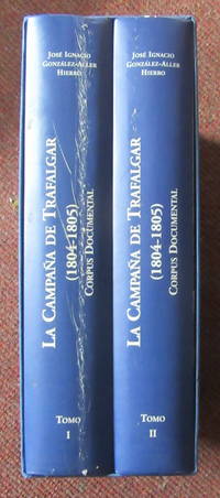
2004093324United Kingdom: Ministerio de Defensa Armada Espa~nola. 2 Volumes. Spanish text. 1814 pages Large size 30 cm x 22 cm. The spine of volume one has a superficial but noticeable scratch rubbing type mark from base to head see image from Winghale Books. Apart from this defect the books are very clean and sound. 2 Volume hardback set in a slip case. La campana de Trafalgar 1804-1805: corpus documental: 1 and 2. THIS SET WEIGHS OVER 7 KGS PLEASE ASK ABOUT INTERNATIONAL POSTAGE outside the UK . read description. Hardcover. 2004. Ministerio de Defensa Armada Espa~nola hardcover
16036Embossed heading Endcliffe Hall Sheffield 20 Dec. 1866. One page 12mo edges sunned and stained text slightly obscured but readable. "I regret I was confined to the House yesterday in fact since Saturday so could not attend the meeting at the Hall in the sad Oaks Colliery affair worst ever English mining disaster . My two partners were also from Home. Will you add the name of my Company 'John Brown & Co." without LImited for £100. If our Directors will not pay the same I will." [Embossed heading] Endcliffe Hall, Sheffield, 20 Dec. 1866. unknown
1990Q-0915795019Iron Crown Enterprises ICE 1990-09-01. Paperback. New. In shrink wrap. Looks like an interesting title! Iron Crown Enterprises (ICE) paperback