2 067 résultats
mon0003240680Iron and Steel Institute 1961T. hardcover. Good. . Iron and Steel Institute hardcover
18992111902160200289Genpon 1899. Soft Cover. Fine. Number of pages: 130 pages Size: 24cmx16.2cm 130p Number of books: 1 Genpon paperback
2026x-1041154658Taylor & Francis Ltd 2026. Hardcover. New. 882 pages. 9.68x6.87x9.61 inches. Taylor & Francis Ltd hardcover

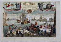
1725M4694Paris 1725. Excellent. Notes: A decorative and beautifully hand coloured title page of the important atlas L'Atlas Curieux ou Le Monde" by Nicholas de Fer. Size : 220x335 mm 8.625x13.125 Inches Coloring: Hand Colored Category: Maps Misc Curiosities Title Pages Games etc. unknown
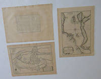
51-6467Paris: chez l'auteur dans l'Isle du Palais sur le quay de l'orloge a la Sphére Royale avec privilége du Roy 1705-1717. Engraved text broadside and 2 engraved maps.Each 27.3 x 38cm. Contemporary laid paper uniformly time aged.Published in "L'atlas curieux ou le monde reÌpreseÌnteÌ dans des cartes geÌneÌrales et particulieres du ciel et de la terre : diviseÌ tant en ses quatre principales parties que par eÌtats et provinces et orneÌ par des plans et descriptions des villes capitales et principales et des plus superbes edifices qui les embelissent comme sont les eglises les palais les maisons de plaisance les iardins les fontaines &c. ". OCLC Number / Unique Identifier:79022119.LThe Atlas Curieux is geographic encyclopedia of images and maps of France with detailed views of the grand waterworks at Marly views of the great palaces and chateaux views and plans of the Paris Observatory and samples of military architecture. Issued in six annual parts from 1700-1705 the maps are based on the new observations of the Académie des Sciences and drawn up with the assistance of Philipe de La Hire.Library of Congress:The French cartographer and engraver Nicolas de Fer was a master at creating maps that were works of art. The maps that he published were printed during the Baroque period when the decorative arts were characterized by ornate detail. De Fer’s detailed maps and atlases were valued more for their decorative content than their geographical accuracy.Nicolas de Fer was born in 1646. His father Antoine de Fer owned a mapmaking firm. At the age of twelve Nicolas was apprenticed to a Parisian engraver named Louis Spirinx. The family business was starting to decline when his father died in 1673. Nicolas de Fer’s mother Genevieve took over the business after the death of her husband. In 1687 the business was passed on to Nicolas and the profits increased after he took over the firm. Nicolas de Fer was a prolific cartographer who produced atlases and hundreds of single maps. He eventually became the official geographer to King Louis XIV of France and King Philip V of Spain.One of de Fer’s major works is an atlas titled L’atlas curieux The curious atlas. Paris: chez l'auteur dans l'Isle du Palais sur le quay de l'orloge a la Sphére Royale avec privilége du Roy, 1705-1717 unknown
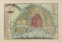
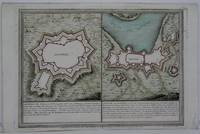
1705M4585Paris 1705. Very Good. Size : 230x340 mm 9x13.375 Inches Coloring: Hand Colored Category: Maps City Maps; Maps Europe Benelux unknown
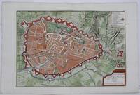
1705M5243Paris 1705. Excellent. Size : 225x320 mm 8.875x12.625 Inches Coloring: Hand Colored Category: Maps City Maps; Maps Europe Benelux unknown
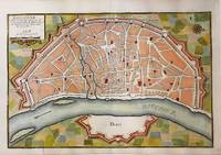
1705M5135Paris 1705. Very Good. Notes: Copper engraved plan of Cologne Köln in Germany. It is beautifully hand coloured. Size : 235x350 mm 9.25x13.75 Inches Coloring: Hand Colored Category: Maps City Maps; Maps Europe Germany unknown
1703M5179Paris 1703. Excellent. Size : 230x310 mm 9x12.25 Inches Coloring: Original Outline Coloring Category: ; Maps Asia Middle East Holy Land & Palestine unknown
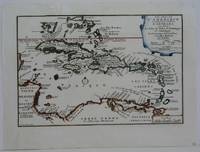
1702M5228Paris 1702. Very Good small tear in the upper left margin professionally repaired not affecting the image. Size : 225x335 mm 8.875x13.125 Inches Coloring: Hand Colored in Outline Category: ; Maps West Indies Whole unknown
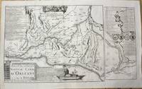
1705M10253Paris 1705. Very Good. Notes: Map showing the Canal de Briare and the Canal D'Orleans with indexes and descriptive notes on both canals. Size : 385x651 mm 15.16x25.63 Inches Coloring: Black & White Category: Maps Europe France; unknown
1705M5137Paris 1705. Excellent. Size : 235x350 mm 9.25x13.75 Inches Coloring: Black & White Category: Maps City Maps; Maps Europe Germany unknown
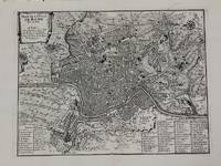
1700M5227Paris c.1700. Very Good. Size : 240x310 mm 9.5x12.20 Inches Coloring: Black & White Category: Maps City Maps; Maps Europe Italy Rome unknown
171458931714. : 7 In four places along the edges of the map some discoloration from tape is visible. This does not affect the map itself. Dimensions of the map excluding the white borders: Height: 22 cm Width: 325 cm Height cm: 25 CM Width cm: 375 CM unknown
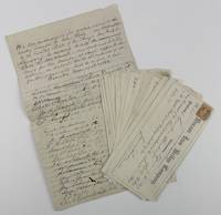
18693723Galveston Tx 1869. Very good. 2pp. on a single folded folio sheet of lined paper with integral blank plus fourteen partially-printed receipts completed in manuscript. Minor dust-soiling creasing and edge wear. A post-Civil War manuscript agreement from Texas with the signatures of twenty-six investors transferring their stock in the Brazos Iron Bridge Company to John Sealy of the Galveston Harrisburg and San Antonio Railway Company. Additionally the document is noted and signed on the verso by Sealy transferring those same shares to Thomas W. Peirce. The document is accompanied by fourteen receipts for installment payments on capital stock purchased in the Brazos Iron Bridge Company some of which relates directly to the larger transfer agreement. The Brazos Iron Bridge Company was organized in 1867. Its mission was to construct a railway bridge across the Brazos River. The bridge completed in July 1869 was purchased by the Buffalo Bayou Brazos and Colorado Railway later known as the Galveston Harrisburg and San Antonio Railway Company. When the dust settled on the various transactions among the shareholders John Sealy owned a one-eighth interest in the railway company. Sealy moved from Pennsylvania to Galveston in 1846 and became an important early Galveston merchant real estate investor and railroad magnate. unknown
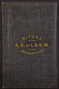
1877h42288NP: Publisher not identified 1877. Very good. 12mo 7.5 x 4.75 inches limp black cloth stamped in gilt on front cover very good light wear faint crease to rear cover contents very good. 36 pp. Very rare OCLC locating a single holding in Wisconsin unaccountably described as having only 24 pp. The Amalgamated was an American labor union formed in 1876 to represent iron and steel workers. It partnered with the Steel Workers Organizing Committee of the CIO in November 1935. Both organizations disbanded May 22 1942 to form a new organization the United Steelworkers. They suffered significant setbacks from the results of the Homestead Strike and their other labor organizing efforts and strikes in early 20th century Pittsburgh and became linked with the AFL which gave them greater traction that increased with the merger of the AFL and CIO. A foundational document in American labor history: one can see the direct influence of fraternal organizations and masonic societies on the rituals of membership in the earliest days of this labor union. Publisher not identified unknown
192388H. Antunes 1923. Brochure in good condition. Rare. Full title: The art of dying well: art conference held in Rio de Janeiro at Trianon on June 21 1922 and repeated in other parts of Brazil. Introduction by Paulo Menotti del Picchia. H. Antunes unknown
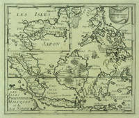
151658422copper engraving. RARE map from 'El atlas abbreviado.' Spanish edition French text on map then part of the Spanish Netherlands by the author a Belgian Cartographer whose attractive pocket-atlas went through several editions with Jan Duren. Reference: Quirino p. 87 Peeters; Koeman: Pee 1 vol.III Peeters; Bonacker 27; Bgrow/Skelton 466. Condition: blank on verso paper toning cleaned. published in Antwerp.
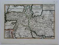
1703M5176Paris 1703. Excellent. Size : 230x335 mm 9x13.125 Inches Coloring: Original Outline Coloring Category: Maps Asia Near East Turkey; Maps Asia Middle East Iran Iraq; Maps Asia Middle East Caucasus.; unknown
20192-1096982846Independently published 2019. Paperback. New. 140 pages. 9.00x6.00x0.36 inches. Independently published paperback
2019x-1108417884Cambridge Univ Pr 2019. Hardcover. New. 1000 pages. 10.00x7.50x1.25 inches. Cambridge Univ Pr hardcover
1705M5239Paris 1705. excellent. Notes: With a decorative water mark Size : 255x355 mm 10x14 Inches Coloring: Hand Colored Category: Maps City Maps; Maps Europe Portugal unknown
1715M5226Paris 1715. Excellent. Size : 255x365 mm 10x14.375 Inches Coloring: Hand Colored Category: Maps City Maps; Maps Europe Portugal unknown
19322111902158501154Kensetsu-sha 1932. Soft Cover. Fine. Number of pages: 332p. Size: 23cm Kensetsu-sha paperback
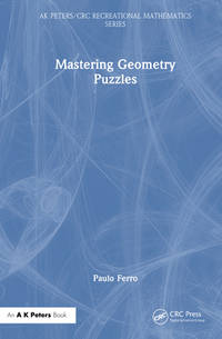
2026x-1041245890A K Peters Ltd 2026. Hardcover. New. 295 pages. 9.18x6.12x9.21 inches. A K Peters Ltd hardcover