2 067 résultats
Magnus, Bente. PhotographIn near perfect condition. unknown
2016x-1472522508Bloomsbury USA Academic 2016. Hardcover. New. 224 pages. 9.50x6.25x0.75 inches. Bloomsbury USA Academic hardcover

2019__1096982846Independently published 2019. Paperback. New. 140 pages. 9.00x6.00x0.36 inches. Independently published paperback
2037Americas: Paris de Fer Nicolas 1704. Copper engraved map of Martinique from Nicolas de Fer's "Alas Curieux" Original colour; verso blank. Detailed map engraved by P Starckman with long key identifying 63 places of interest Dark impression; upper margin trimmed to plate mark; crease to lower right corner;ink number to upper right corner. Nicolas de Fer 1646-1720 was the son of Antoine de Fer also a map engraver and colourist in his own right who had worked with Nicolas Berey and acted as an editor for Pierre Duval's "Cartes De Geographie ." of 1657. Nicolas began his career with an apprenticeship to the engraver Louis Spirinx in Paris. It soon became clear that his interest lay in the production of current maps recent discoveries and he was particularly interested in the topical production of military maps with town plans and their fortifications an especial interest. De Fer's first map was published in 1669 and was a rather unusual map of the Languedoc Canal with a phonetic title. Antoine died in 1673However it wasn't until 1687 that Nicolas took over the running of the family business. Over the next few years De Fer was able to make the publishing business flourish and in 1690 he was nominated as geographer to the Dauphin – their relationship had reciprocal benefits with De Fer producing in effect royal propaganda concerning the Dauphin's lands with each publication enhancing his own name and reputation as well as that of the Dauphin. When the Duke of Anjou ascended the throne in 1702 De Fer had the dual title of "geographe du roi d'Espagne et du Dauphin". De Fer published a number of atlases including the "Cotes de France" of 1690 containing Tassin's maps and the "Forces de l'Europe ou Introduction a la fortification" also of 1690 that reinforced his abilities and success with the buying public. Subsequent publications included the "Petit et Nouveau Atlas" which appeared in 1697 followed by the "Atlas Curieux". The "Atlas Curieux" was well-known and popular being expanded in successive editions between 1700 and 1705 and was re-edited in 1714 and 1716 under the title "Suite de l'Atlas Curieux". De Fer also produced a number of folio maps that appeared in the "Atlas ou Recueil de cartes" which was published in 1709. Americas Caribbean Martinique Paris de Fer, Nicolas 1704 unknown
KART0070Paris 1705. Wien - Plangröße: 50 x 165 cm rechter weißer Rand schmal beschnitten ob. Rand etwas ausgefranst mittl. Bugfalte schwach gebr. Ansicht des Donaulaufs von Krems bis Pressburg Wien und Pressburg ringbefestigt. Paris 1705. unknown
62374556Taylor & Francis Group pp. 232 . Hardback. New. Taylor & Francis Group hardcover
1997x-0415140072Routledge 1997. Hardcover. New. 1st edition. 416 pages. 9.53x6.26x1.02 inches. Routledge hardcover
19262110502150306340Treasure Museum 1926. Soft Cover. Fine. Volume: 1 Treasure Museum paperback
2010BN99364Xunta de Galicia Santiago de Compostela E 2010. 2010. O Libro da Vaca. Monografia etnolinguistica do gando vacun. <br/><br/>O Libro da Vaca. Monografia etnolinguistica do gando vacun. Xunta de Galicia, Santiago de Compostela (E) unknown
2026x-9048567815Routledge 2026. Hardcover. New. 136 pages. 9.18x6.12x9.45 inches. Routledge hardcover
2n1002Imprimerie Impériale Paris 1862. IX 185 S. mit eingen Tabellen Halbleder-Einband mit goldgeprägtem Rückentitel und 4 Schmuckbünde quart Kanten etwas berieben und bestoßen/Titelseite randfleckig. unknown
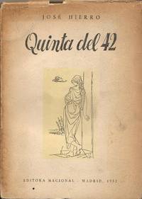
126760Editora Nacional Taller de Artes gráficas de los Hermanos Bedia 1952 Santander. 1ª edición. . 23x16. 166 pgs. Manchas de agua. Q8384 Editora Nacional, Taller de Artes gráficas de los Hermanos Bedia, 1952, Santander. 1ª edición. unknown
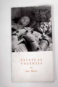
19552309292Santander. 1955. Paperback. Cubierta deslucida. Good. 20 cm. 22 p. Encuadernación en tapa blanda de editorial ilustrada. Hierro José 1922-2002 . Cubierta deslucida. Literatura española. Poesía lírica. Siglo XX. 821.134.2-14"19" 821.134.2-1 paperback
2022x-1032245042Routledge 2022. Hardcover. New. 192 pages. 9.18x6.12x0.80 inches. Routledge hardcover
2019x-0367150190Routledge 2019. Hardcover. New. 144 pages. 9.50x6.25x0.75 inches. Routledge hardcover
218412Paris: Librairie Générale de L'Architecxture et des Travaux Publics Ducher et Cie nd. Missing 6 20 26 30 32 50 83 of 84 plates 2 of plate 22. 2 page of text. 1 vols. Folio. In portfolio. Some foxing to plates else near fine. Missing 6 20 26 30 32 50 83 of 84 plates 2 of plate 22. 2 page of text. 1 vols. Folio. Librairie Générale de L'Architecxture et des Travaux Publics Ducher et Cie unknown
19000086438Wisconsin: np 1900. Wraps. Very Good. A large unique book ca. 1900 14 x 8.5 inches vertically oriented; softcover about 100 pages of typescript in purple carbon very seldom with ink corrections culled from “The Republic†— probably the Baraboo Republic a newspaper of the period published in Baraboo the county seat of Sauk County Wisconsin this book with material relating to the Iron Brigade the 6th Wisconsin Regiment of volunteers who fought for the Union in the Civil War and also concerning the Sauk County Riflemen. It apparently was compiled by a veteran-turned-historian who concludes this compilation writing “Returned to private life -- became the 'man behind the hoe' instead of 'behind the gun.’†Very rare and a great resource for anyone interested in this period of Wisconsin history. np unknown
980372London: E. F. Beadle and Co. Very Good-. N.D. Three-Quarter Leather. Six novellas of about 100 pages each bound into a single volume -- no over-all title page indicating that this was likely done by the owner rather than the publisher. The spine label carries the title "American Stories. No dates but the various titles date from the mid-1800's. Red leather with black title band. Nice condition with some rubbing to boards. Owner name. Good quality paper - bright and clean. ; 16mo 6" - 7" tall . E. F. Beadle and Co. hardcover
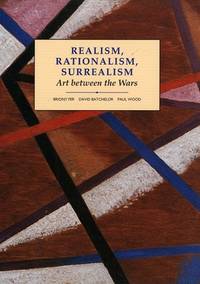
1993055303New Haven and London: Yale Univiersity Press in Association with the Open Univeirsity 1993. 2d Printing. 342p. colored and b/w illus. original stiff printed wrappers Modern art practices and debates. Yale Univiersity Press in Association with the Open Univeirsity unknown
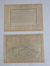
51-6464Paris: chez l'auteur dans l'Isle du Palais sur le quay de l'orloge a la Sphére Royale avec privilége du Roy 1705-1717. Engraved text broadside and engraved map.Each 27.3 x 38cm. Contemporary laid paper uniformly time aged.Published in "L'atlas curieux ou le monde reÌpreseÌnteÌ dans des cartes geÌneÌrales et particulieres du ciel et de la terre : diviseÌ tant en ses quatre principales parties que par eÌtats et provinces et orneÌ par des plans et descriptions des villes capitales et principales et des plus superbes edifices qui les embelissent comme sont les eglises les palais les maisons de plaisance les iardins les fontaines &c. ". OCLC Number / Unique Identifier:79022119.LThe Atlas Curieux is geographic encyclopedia of images and maps of France with detailed views of the grand waterworks at Marly views of the great palaces and chateaux views and plans of the Paris Observatory and samples of military architecture. Issued in six annual parts from 1700-1705 the maps are based on the new observations of the Académie des Sciences and drawn up with the assistance of Philipe de La Hire.ibrary of Congress:The French cartographer and engraver Nicolas de Fer was a master at creating maps that were works of art. The maps that he published were printed during the Baroque period when the decorative arts were characterized by ornate detail. De Fer’s detailed maps and atlases were valued more for their decorative content than their geographical accuracy.Nicolas de Fer was born in 1646. His father Antoine de Fer owned a mapmaking firm. At the age of twelve Nicolas was apprenticed to a Parisian engraver named Louis Spirinx. The family business was starting to decline when his father died in 1673. Nicolas de Fer’s mother Genevieve took over the business after the death of her husband. In 1687 the business was passed on to Nicolas and the profits increased after he took over the firm. Nicolas de Fer was a prolific cartographer who produced atlases and hundreds of single maps. He eventually became the official geographer to King Louis XIV of France and King Philip V of Spain.One of de Fer’s major works is an atlas titled L’atlas curieux The curious atlas. Paris: chez l'auteur dans l'Isle du Palais sur le quay de l'orloge a la Sphére Royale avec privilége du Roy, 1705-1717 unknown
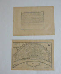
51-6460Paris: chez l'auteur dans l'Isle du Palais sur le quay de l'orloge a la Sphére Royale avec privilége du Roy 1705-1717. Engraved text broadside and engraved map.Each 27.3 x 38cm. Contemporary laid paper uniformly time aged.Published in "L'atlas curieux ou le monde reÌpreseÌnteÌ dans des cartes geÌneÌrales et particulieres du ciel et de la terre : diviseÌ tant en ses quatre principales parties que par eÌtats et provinces et orneÌ par des plans et descriptions des villes capitales et principales et des plus superbes edifices qui les embelissent comme sont les eglises les palais les maisons de plaisance les iardins les fontaines &c. ". OCLC Number / Unique Identifier:79022119.LThe Atlas Curieux is geographic encyclopedia of images and maps of France with detailed views of the grand waterworks at Marly views of the great palaces and chateaux views and plans of the Paris Observatory and samples of military architecture. Issued in six annual parts from 1700-1705 the maps are based on the new observations of the Académie des Sciences and drawn up with the assistance of Philipe de La Hire.ibrary of Congress:The French cartographer and engraver Nicolas de Fer was a master at creating maps that were works of art. The maps that he published were printed during the Baroque period when the decorative arts were characterized by ornate detail. De Fer’s detailed maps and atlases were valued more for their decorative content than their geographical accuracy.Nicolas de Fer was born in 1646. His father Antoine de Fer owned a mapmaking firm. At the age of twelve Nicolas was apprenticed to a Parisian engraver named Louis Spirinx. The family business was starting to decline when his father died in 1673. Nicolas de Fer’s mother Genevieve took over the business after the death of her husband. In 1687 the business was passed on to Nicolas and the profits increased after he took over the firm. Nicolas de Fer was a prolific cartographer who produced atlases and hundreds of single maps. He eventually became the official geographer to King Louis XIV of France and King Philip V of Spain.One of de Fer’s major works is an atlas titled L’atlas curieux The curious atlas. Paris: chez l'auteur dans l'Isle du Palais sur le quay de l'orloge a la Sphére Royale avec privilége du Roy, 1705-1717 unknown
2019x-0198812760Oxford Univ Pr 2019. Hardcover. New. 506 pages. 9.25x6.25x1.50 inches. Oxford Univ Pr hardcover
011099Brüssel. 1904. Hardcover. Gut. --- 2 Bde. mit zahlr. Abb. In-4 410 pp. u. 269 pp. Hln.-Bde. der Zeit mit Rückentitelvergoldung Einb. wenig fleckig Titel mit Bibliotheksstempel schöne Exemplare selten! <br/> <br/> Brüssel. 1904 hardcover
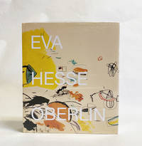
2019024607Hauser & Wirth New York 2019. Book. New. Cloth. 428 pages with 391 illustrations in color. Still in shrink-wrap. Edited by Barry Rosen. Foreword by Helen Hesse Charash and Andria Derstine. Hauser & Wirth, New York Hardcover