948 résultats
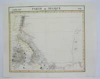
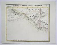
1825M4515Brussels 1825. Very Good minor worming on upper and lower portion of the map along the central fold proficiently repaired. Notes: The first atlas of the world on a uniform scale. If assembled as a globe gores forms a very large globe. Size : 460x536 mm 18.125x21.125 Inches Coloring: Original Outline Coloring Category: Maps Central America Mexico unknown
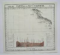
1825M4512Brussels 1825. Very Good minor worming on upper and lower portion of the map along the central fold proficiently repaired. Notes: The first atlas of the world on a uniform scale. If assembled as a globe gores forms a very large globe. Size : 460x500 mm 18.125x19.625 Inches Coloring: Original Outline Coloring Category: ; Maps United States West California unknown
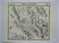
1825M4514Brussels 1825. Very Good minor worming on upper and lower portion of the map along the central fold proficiently repaired. Notes: The first atlas of the world on a uniform scale. If assembled as a globe gores forms a very large globe. Size : 465x540 mm 18.25x21.25 Inches Coloring: Original Outline Coloring Category: Maps Central America Mexico unknown
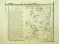
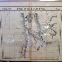
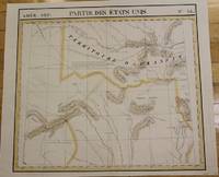
182740379Bruxelles: Ph. Vandermaelen 1827. First edition. A very good sharp copy. 1 sheet. Hand-colored lithographic map. 47 x 57 cm. Shows the ranges of eight Indian tribes. Covers parts of Utah Colorado and northern Arizona and New Mexico. Includes text: Note sur le Mexique. At a time when American map publishers were virtually ignoring the western United States Vandermaelen's large scale work -which includes sections of Utah Wyoming Arizona and Nevada then still considered part of Mexico along with the location of Indian tribes and shows Lake Timpanagos- was a landmark in the history the cartography of the Transmississippi West. Large text box on the left entitled: Note sur le Mexique by A. Delavault. From Phillipe Vandermaelen Atlas universel de geographie physique politique statistique et mineralogique. a magnificent and ground breaking six volume atlas of the entire world which was the first atlas to use lithography to show the entire world using such a large uniform scale approximately 26 miles to the inch and which was designed to be joined together into a three-dimensional globe with a diameter of approximately 25 feet. Wheat Transmississippi 378. Sabin 43762. Phillips 749. [Ph. Vandermaelen] unknown books
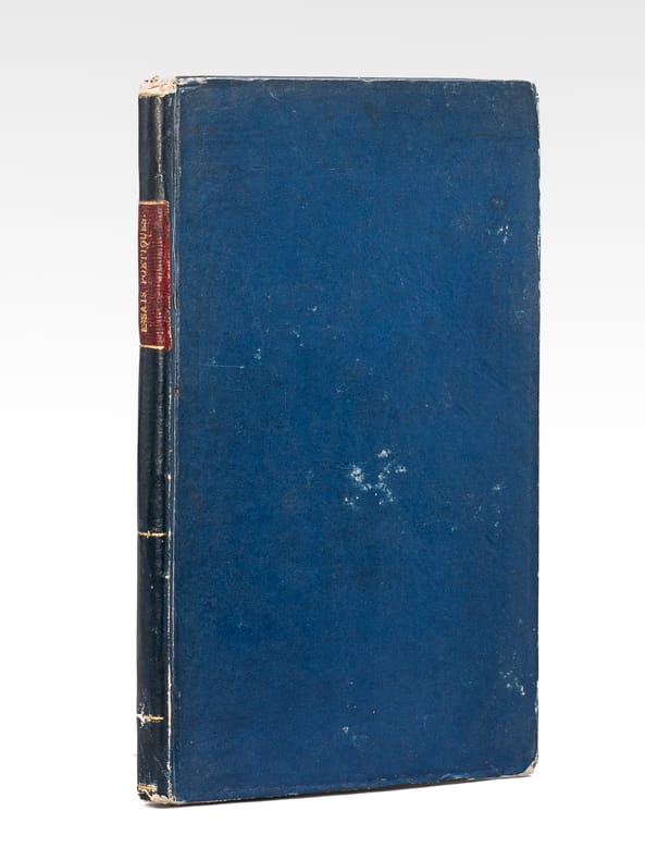
1822699491 vol. in-8 cartonnage bradel bleu de l'époque, s.n., Paris, février 1822, 104 pp.
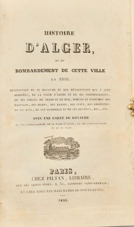
183040626Paris, Piltan, 1830. In-8 de 366 pp. demi-basane havane à petits coins de vélin ivoire, dos lisse orné, pièce de titre en veau rouge, tranches marbrées (reliure de l'époque).
183626273LA LIMOUZINIERE 1836/37 1- Plan Général sur lequel est indiqué l'écurie et l'étable à construire + le Presbytère à reconstruire, plan à l'encre sur papier calque contrecollé aquarellé en couleurs, format : 36 x 37,8 cm (cachet postal rons au dos daté du 1er Juin 1839), 2- Plan à l'encre de l'écurie et de l'étable du Presbytère daté de 1836 en couleur, format : 43,5 x 30,02 cm), 3- Plan de la Reconstruction du Presbytère de la Limouzinière : 3ème projet , signature à l'encre brune : Architecte Henri-Théodore Driollet, Nantes 11 mars 1837, plan en couleurs dessin à l'encre, format : 43,5 x 32 cm, 4- Plan Général du Projet de Reconstruction du Presbytère, signature manuscrite à l'encre brune : Driolet Architecte, Nantes, 1er Novembre 1836, plan à l'encre aquarellé en couleurs avec par dessus une variante du projet, format : 33,3 x 47 cm), 5- Projet de Reconstruction du Presbytère : Plan à l'encre du Rez-de-Chaussée + Plan à l'encre du 1er Etage (aquarellé en couleurs), Signature manuscrite à l'encre brune : Driollet Architecte, Nantes, 1 er Novembre 1836, format : 47 x 33,3 cm, 6- Plan de Coupe sur l'Epaisseur du Batiment et Coupe sur la Largeur, dessin à l'encre, lavis de couleur rose en bas, Signature manuscrite à l'encre brune : Driollet Architecte, Nantes, 1er Novembre 1836, format : 47 x 33,3 cm, 7- Plan à l'encre : Elévation Principale + Elévation dans le Jardin, lavis de couleur rose en bas, Signature manuscrite à l'encre brune : Driollet Architecte, Nantes, 1er Novembre 1836, format : 46,8 x 32,3 cm, 8 - Une enveloppe cachetée (cachet de cire rouge au dos) avec imprimé en bleu en haut à gauche : Service du Roi Cabinet de la reine , cachet rond bleu à droite : 24 Avril 1837 + en dessous, à droite et en bleu : un cachet de "Franchise Vérifiée" avec en bas, manuscrit à l'encre brune : Monsieur le Maire de la Limouzinière /Loire-Inférieure/ arrondissement de Nantes + une Lettre sur papier blanc, format : 19,5 x 12,5 cm, à en-tête du SECRÉTARIAT DE LA REINE, pré imprimée et manuscrite à l'encre brune, écrite au PALAIS DES TUILERIES, le 24 Avril 1837 , signature manuscrite à l'encre brune de : Octave BOREL DE BRETIZEL [ conseiller à la Cour de Cassation, Secrétaire des Commandements de la Reine Marie-Amélie (AMÉLIE DE BOURBON-SICILES FEMME DE LOUIS PHILIPPE 1ER - ROI DE FRANCE)],
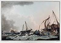
180813510London: Published by I. & W. Macgavin No. 107 New Bond Street 1808. Coloured aquatint. Printed on wove Whatman paper. In excellent condition. Image size: 13 5/8 x 20 1/4 inches. A dramatic view of fishermen at Worthing from Philippe Loutherbourg's great work "Picturesque Scenery of Great Britain".<br/> <br/> This impressive aquatint is plate six of Phillip Jacques Loutherbourg's seminal work "Picturesque Scenery of Great Britain." This accomplished text is comprised of six large aquatint views engraved after Loutherbourg's acclaimed paintings. The work which was first engraved in 1801 by J. C. Stadler was later re-engraved in 1808 by J. Hill. Reminiscent of Rowlandson's superb paintings this image depicts fisherman rowing out from the seashore on a stormy day. The son of a court painter in Darmstadt the versatile artist Philippe Jacques Loutherbourg was born in Fulda Germany and was a pupil of J. H. Tischbein and Carle Vanloo and Francis Casanova the elder in Paris. His romantic landscapes battle scenes portraits and biblical subjects were highly esteemed and lauded by influential colleagues such as Diderot. He frequently exhibited at the Salon and became a venerated member of the Académie Royale in 1767. In 1771 he moved to England where he was employed as the principal scenery designer at London's Drury Lane Theatre. His creative and minutely detailed sets revolutionized the genre of scene painting and he soon began dabbling in costume design. Loutherbourg once again astounded contemporaries in 1782 with his pioneering invention of the "Eidophusikon" a novel variety of moving panorama that was accompanied by music. His substantial and varied oeuvre also included book illustrations and a series of aquatints of British scenery that was published in 1801 and 1805. Aside from a brief trip to Switzerland in 1782 he remained in London for the duration of his life and became heavily engrossed in mysticism.<br/> <br/> Abbey Scenery of Great Britain and Ireland in Aquatint and Lithography 1770-1860 no.6 plate 6. Published by I. & W. Macgavin, No. 107 New Bond Street unknown
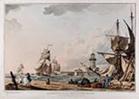
180813508London: Published by I. & W. Macgavin No. 107 New Bond Street 1808. Coloured aquatint. Printed on wove paper. In excellent condition. Image size: 13 1/2 x 20 inches. A beautiful view of Ramsgate Pier from Philippe Loutherbourg's great work "Picturesque Scenery of Great Britain."<br/> <br/> This impressive aquatint is plate two of Phillip Jacques Loutherbourg's seminal work "Picturesque Scenery of Great Britain." This accomplished text is comprised of six large aquatint views engraved after Loutherbourg's acclaimed paintings. The work which was first engraved in 1801 by J. C. Stadler was later re-engraved in 1808 by J. Hill. Reminiscent of Rowlandson's superb paintings this image depicts the stormy docks of Ramsgate pier. While a group of hardy sailors converse at ease a party of three figures are battered by the fierce winds that beat the shoreline. The son of a court painter in Darmstadt the versatile artist Philippe Jacques Loutherbourg was born in Fulda Germany and was a pupil of J. H. Tischbein and Carle Vanloo and Francis Casanova the elder in Paris. His romantic landscapes battle scenes portraits and biblical subjects were highly esteemed and lauded by influential colleagues such as Diderot. He frequently exhibited at the Salon and became a venerated member of the Académie Royale in 1767. In 1771 he moved to England where he was employed as the principal scenery designer at London's Drury Lane Theatre. His creative and minutely detailed sets revolutionized the genre of scene painting and he soon began dabbling in costume design. Loutherbourg once again astounded contemporaries in 1782 with his pioneering invention of the "Eidophusikon" a novel variety of moving panorama that was accompanied by music. His substantial and varied oeuvre also included book illustrations and a series of aquatints of British scenery that was published in 1801 and 1805. Aside from a brief trip to Switzerland in 1782 he remained in London for the duration of his life and became heavily engrossed in mysticism.<br/> <br/> Abbey Scenery of Great Britain and Ireland in Aquatint and Lithography 1770-1860 no.6 plate 2. Published by I. & W. Macgavin, No. 107 New Bond Street unknown
1827220303Brussels: Phillippe Marie Vandermaelen 1827. unbound. very good. Map set of 4. Large format lithograph with original hand outline color. Each image measures 18.75" x 20 5/8" 18 5/8" x 20 5/8" 18.5" x 20 3/8"<br/> <br/> Beautifully detailed set of four regional maps of northern China and southern Mongolia. Mountains are delicately treated with hachure marks and major rivers waterways and cities are also shown. Notable inclusions from the west to the east: Plate 44 shows the very northwestern tip of China Xinjiang province and part of south central Mongolia with Lac Nor and Hami. Plate 45 shows the eastern portion of Xinjiang province and western Mongolia with Karakorum called here Karakum the medieval capital of Ghengis Khan and the Mongol Empire. Plate 46 demarcates the tribal regions of Khalkha and Tzakhares Mongolians. Plate 47 shows the western portion of the Wall of China delineating the border between Tartary and China. Some minor offsetting several tears and chips to edges. From Vandermaelen's 6 volume "Atlas universel de geographie physique politique statistique et mineralogique sur l'echelle de 1/16411836". Can be combined as gores to form an immense globe. The atlas was the first to map the world on a uniform scale.<br/> <br/> Phillippe Marie Vandermaelen unknown
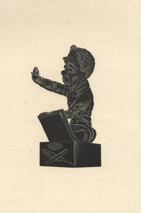
183929818Paris 1839. 117 x 73 wide margins sheet size 260 x 168 mm. Printed on wove paper. A fine impression. <br/><br/>Based on a bust by Dantan executed in 1838 depicting Musard conducting a quadrille at a "Bal de l'Opéra." Sorel 199. Dantan 124.<br/><br/>"After the July Revolution Musard returned to France and conducted at masked balls at the Théâtre des Variétés. He then became artistic director of a series of popular open-air concerts and dances on the Champs-Elysées which marked the beginning of the Concerts-Musard; these were an immediate and enormous success. He also conducted for masked balls at the Salle Ventadour and the Opéra-Comique and eventually in 1835 and 1836 for the balls at the Opéra itself. He continued to be a popular conductor until 1845. In France he was considered the doyen of dance composers and popular conductors until 1852." Gérard Streletski Gustave Chouquet and David Charltonin Grove Music Online.<br/><br/>Dantan's caricatures of writers artists and particularly musicians are highly regarded. He is said to be the inventor of the "sculptural caricature." Wikipedia. unknown books
182736239Brussels Belgium: Lithographed By H. Ode. Very Good. 1827. Map. Map # 38 A Very Good primitive and early map of western and southern Oregon territory including southern Washington state. It especially emphasizes the coast. Latitude of the map is 42 degrees to 48 degrees and longitude is 120 degrees to 130 degrees. Of course almost all localities shown are French or Indian names. The atlas from which this is extracted is extremely rare and originally composed 6 volumes this map being from the North America volume. Lithographer Ode and Cartographer Vandermaelen produced the first lithographed atlas ever done. Condition is overall Very Good. Browning to the centerfold crease caused by glue used in attaching the tab to the original volume the two page spread measures 21" x 26 1/2" when opened out. Topigraphical features are accentuated see image. Shipping will require extra care and cost due to insurance. Photo available upon request. ; 21" x 26 1/2"; 1 pages . Lithographed By H. Ode unknown
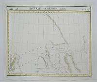
1825M4496Brussels 1825. Very Good minor woming on upper portion of map not affecting the map proficiently repaired. Notes: The first atlas of the world on a uniform scale. If assembled as a globe gores forms a very large globe. Size : 475x575 mm 18.75x22.625 Inches Coloring: Original Outline Coloring Category: Maps Canada West British Columbia; Maps Canada West Alberta unknown
1825M4519Brussels 1825. Very Good minor worming on upper and lower portion of the map along the central fold proficiently repaired. Notes: The first atlas of the world on a uniform scale. If assembled as a globe gores forms a very large globe. Size : 465x520 mm 18.25x20.5 Inches Coloring: Original Outline Coloring Category: Maps Central America Mexico unknown
1825M4521Brussels 1825. Very Good minor worming on upper and lower portion of the map along the central fold proficiently repaired. Notes: The first atlas of the world on a uniform scale. If assembled as a globe gores forms a very large globe. Size : 465x551 mm 18.25x21.625 Inches Coloring: Original Outline Coloring Category: Maps Central America Mexico unknown
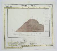
1825M4499Brussels 1825. Very Goodminor worming appear at the upper and lower portion of the map along the central fold proficiently repaired. Notes: The first atlas of the world on a uniform scale. If assembled as a globe gores forms a very large globe. Size : 480x535 mm 18.875x21 Inches Coloring: Original Outline Coloring Category: Maps West Indies Dominican Republic / Haiti & Puerto Rico; unknown
183929818Paris 1839. 117 x 73 wide margins sheet size 260 x 168 mm. Printed on wove paper. A fine impression. <br /> <br /> Based on a bust by Dantan executed in 1838 depicting Musard conducting a quadrille at a "Bal de l'Opéra." Sorel 199. Dantan 124.<br /> <br /> "After the July Revolution Musard returned to France and conducted at masked balls at the Théâtre des Variétés. He then became artistic director of a series of popular open-air concerts and dances on the Champs-Elysées which marked the beginning of the Concerts-Musard; these were an immediate and enormous success. He also conducted for masked balls at the Salle Ventadour and the Opéra-Comique and eventually in 1835 and 1836 for the balls at the Opéra itself. He continued to be a popular conductor until 1845. In France he was considered the doyen of dance composers and popular conductors until 1852." Gérard Streletski Gustave Chouquet and David Charltonin Grove Music Online.<br /> <br /> Dantan's caricatures of writers artists and particularly musicians are highly regarded. He is said to be the inventor of the "sculptural caricature." Wikipedia. unknown
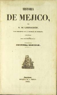
185131809Barcelona: A. Frexas 1851. 8vo 2 parts in 1 as issued; pp. 4 252 8; 127 1; text in double column 3 engraved folding maps 86 plates; full Mexican tree calf smooth gilt-decorated spine lettered in gilt marbled edges; minor scuffing; very good. First published in 1843. The text includes Historia de Méjico & Tejas 252 p.; Historia de Guatemala p. 1-42; and Historia de la República del Perú & Bolivia p. 45-124. The plates include a number of the pre-Columbian ruins. Palau 131639; this edition not in Sabin but see 39027-30. A. Frexas unknown
185131809Barcelona: A. Frexas 1851. 8vo 2 parts in 1 as issued; pp. 4 252 8; 127 1; text in double column 3 engraved folding maps 86 plates; full Mexican tree calf smooth gilt-decorated spine lettered in gilt marbled edges; minor scuffing; very good. First published in 1843. The text includes Historia de Méjico & Tejas 252 p.; Historia de Guatemala p. 1-42; and Historia de la República del Perú & Bolivia p. 45-124. The plates include a number of the pre-Columbian ruins. Palau 131639; this edition not in Sabin but see 39027-30. <br/><br/> A. Frexas unknown books
182028811paris 1820-1831 1- Copie d'une lettre adressée à Mr le Maire de Saint CLOUD, par le Chevalier DUFOUR , Médecin et Commissaire du Bureau de Bienfaisance du deuxième arrondissement de Paris, faisant l'Eloge des préparations anti-dartreuses de KÜNCKEL, avec cachet de la Mairie de St Cloud en noir in-fine : avec couronne et 3 fleurs de lys, lettre de 4 pages manuscrite à l'encre brune sur papier vergé crème, ligné et filigrané "P. MOREL", format : 30 x 19 cm, Paris, le 11 juin 1821, 2- Lettre Originale de Mr Guillaume CAPELLE, Conseiller d'Etat chargé de l'Administration Générale des Hospices et Etablissements de Bienfaisance adressée à Mr KÜNCKEL, Avenue du Chateau à St Cloud, N°11, à propos des Remèdes Secrets dont Mr KÜNCKEL est propriétaire, signature manuscrite à l'encre brune du Conseiller D'Etat Guillaume CAPELLE, Paris, le 4 Juillet 1820, lettre Originale de 2 pages manuscrite à l'encre brune sur papier vergé crème, ligné , format : 31 x 20 cm, 3- Lettre Originale de Mr Guillaume CAPELLE, Conseiller d'Etat chargé de l'Administration Générale des Hospices et Etablissements de Bienfaisance adressée à Mr KÜNCKEL, Avenue du Chateau à St Cloud, N°11, en réponse à sa demande d'examiner ses remedes Secrets par l'academie royale de Medecine, signature manuscrite à l'encre brune du Conseiller D'Etat Guillaume CAPELLE, Paris, le 27 Octobre 1821, ettre Originale de 2 pages manuscrite à l'encre brune sur papier vergé crème, ligné , format : 31 x 20 cm , 4- Lettre Originale du comte Antoine Maurice Apollinaire d'Argout : Ministre du Commerce et des Travaux publics adressée à Mr KÜNCKEL, rue Bellefond Nos 14 et 16, Paris, en reponse à sa réclamation, il a invité le Prefet de Police à faire lever les scellés mis sur les poudres, anti-Dartreuses en attendant le rapport de l'acdemie Royale de Medecine; signature manuscrite du Comte d'ARGOUT, lettre Originale de 2 pages manuscrites à l'encre brune sur papier vergé crème, ligné et filigrané : "LP ne", format : 30 x 20 cm, Paris, le 2 Novembre 1831, 5- Lettre Originale du Ministere des travaux Publics, de l'Agriculture et du Commerce, Bureau Sanitaire, section remedes secrets adressée à Mr KÜNCKEL, rue de la victoire N°11, Paris, signature manuscrite illisible pour le conseiller d'etat Directeur, Paris, le 27 Avril 1831, lettre Originale de 4 pages manuscrites à l'encre brune sur papier crème, format : 31 x 20,5 cm, Lettre : "accusant réception des recettes cachetées et leurs échantillons de préparations anti-dartreuses dont vous avez fait le depot au Bureau Sanitaire, que nous venons de transmettre à l'Academie Royale de Médecine....",
1827M2726Bruxelles 1827. Good; some worming on the upper and lower parts of the fold. Notes: From Vandermaelen's "Atlas Universel de Geographie Physique Politique Statistique et Mineralogique" Brusseles 1827.<br><br>"The map trade in the 1820s had taekn notice of the enormous interest in Texas and had begun to supply maps catering to it. In 1827 Phillipe van der Maelen's 'Atlas Universel' the most lavish and detailed cartographic production of the decade and the first major lithographed atlas included five maps depicting parts of Texas. These maps were based primarily on the outmoded models of Humboldt and Pike and contributed no new knowledge." Martin & Martin 32 Size : 470x515 mm 18.5x20.25 Inches Coloring: Original Outline Coloring Reference: Martin & Martin 32 Category: ; Maps United States South Texas unknown
182736276Brussels Belgium: Lithographed By H. Ode. Very Good. 1827. Map. Map # 52 A Very Good primitive and early map showing the central California coast with Santa Barbara and others. Map has wonderful color and many small text descriptions of the coast lines. Latitude of the map is 30 degrees to 36 degrees and longitude is 120 degrees to 128 degrees. Of course almost all localities shown are French or Indian names. The atlas from which this is extracted is extremely rare and originally composed 6 volumes this map being from the North America volume. Lithographer Ode and Cartographer Vandermaelen produced the first lithographed atlas ever done. Condition is overall Very Good. Browning to the centerfold crease caused by glue used in attaching the tab to the original volume the two page spread measures 21" x 26 1/2" when opened out. Topigraphical features are accentuated see image. Shipping will require extra care and cost due to insurance. Photo available upon request. ; 21" x 26 1/2"; 1 pages . Lithographed By H. Ode unknown
1820EINSSAIN31Paris: Le Normant 1820. 1820. 8vo. pp. 2 p.l. 640 2table inserted between pp. 416 & 417. with half-title. contemporary mottled calf gilt stamps of the Society of Writers to the Signet on covers spine worn & chipped joints cracked some moderate foxing mainly to outer leaves. First Edition. In Palgrave's opinion Saint-Chamans "was the most distinguished of the upholders of the theory of the balance of trade." Most of his works seem to be on popular economic topics of the day i.e. Examen des fautes du dernier gouvernement 1815 Sur le Budget de 1818 1817 Des Causes et des résultats de la révolution de 1830 1832 and Traité d'économie publique suivi d'un aperçu sur les finances de la France 1852. Coquelin & Guillaumin II p. 564. Einaudi 4934. Goldsmiths' 22857. Palgrave III p. 345. F. Hardcover. Paris: Le Normant, 1820. Hardcover
1846B121426Bruxelles, Etablissement Géographique 1846 Page de titre + 1p. + 1 carte en double-page d'assemblage à l'échelle 1:10.000 + 9 plans de détails en double-page (plans parcellaires) à l'échelle 1:2500 ou 1:1250, Grand in-folio (59x38cm.), reliure d'époque en cuir brun (titre doré au premier plat, dos et bords frottés, plats usés, qqs. manque au dos), texte et intérieur sont frais, [Atlas cadastral historique d'une grande rareté, documentant le village de Bogaarden situé dans le Pajottenland. Dans les années 1840 il y avait le besoin de données géographiques précises à des fins fiscales et d'aménagement du territoire. Sur les plans de détail chaque parcelle de Bogaarden est numérotée et précisée (maisons, terres agricoles, vergers, chemins, cours d'eau). Chaque feuille comprend une échelle graphique en mètres, l'indication de la section spécifique et les numéros de parcelles individuelles et les noms des propriétaires], poids: 1.9kg., B121426
187650002Librairie de l’Art - Charles Delagrave 1876 in-folio, en ff. sous portfolio demi-percaline à coins et recouvrements, 8- XVIII- 19 pp. Vignette de titre, 11 bois dont 3 hors-texte & 20 planches à l’eaux-forte. Une gravure sur Chine, représentant Jules et Edmond de Goncourt, par Alphonse Descaves, a été rajoutée à l'ensemble. Porfolio réparé, plats empoussiérés, absences des rubans, coins émoussés et frottés. Bel état intérieur.