948 résultats
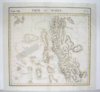
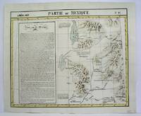
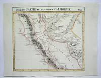
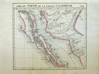
182740378Bruxelles: Ph. Vandermaelen 1827. First edition. Very good bright copies a few minor spots or marginal finger soiling. 2 sheets. Hand-colored lithographic maps. 46 x 51 cm and 46 x 54 cm. Large scale map of Baja. Map 58 includes parts of Baja California Sonora Sinaloa and Chihuahua. Map 65 includes the tip of Baja California and the "Iles Revillagigedo" and a text box: Note sur le Mexique . de Humboldt. Sheets from Phillipe Vandermaelen Atlas universel de geographie physique politique statistique et mineralogique. a magnificent and ground breaking six volume atlas of the entire world which was the first Atlas to use lithography to show the entire world using such a large uniform scale approcimately 26 miles to the inch and which was designed to be joined together into a three-dimensional globe with a diameter of approximately 25 feet. Phillips 749. Sabin 43762. [Ph. Vandermaelen] unknown
182736275Brussels Belgium: Lithographed By H. Ode. Very Good. 1827. Map. Map # 53 A Very Good primitive and early map showing the southern California coast with San Diego and others. Map has wonderful color and many small text descriptions of the coast lines. Latitude of the map is 30 degrees to 36 degrees and longitude is 112 degrees to 120 degrees. Of course almost all localities shown are French or Indian names. The atlas from which this is extracted is extremely rare and originally composed 6 volumes this map being from the North America volume. Lithographer Ode and Cartographer Vandermaelen produced the first lithographed atlas ever done. Condition is overall Very Good. Browning to the centerfold crease caused by glue used in attaching the tab to the original volume the two page spread measures 21" x 26 1/2" when opened out. Topigraphical features are accentuated see image. Shipping will require extra care and cost due to insurance. Photo available upon request. ; 21" x 26 1/2"; 1 pages . Lithographed By H. Ode unknown
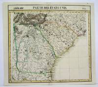
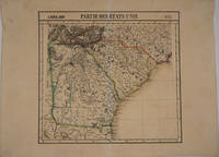
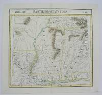
1825M4504Brussels 1825. Very Good minor worming on upper and lower portion of the map along the central fold proficiently repaired. Notes: The first atlas of the world on a uniform scale. If assembled as a globe gores forms a very large globe. Size : 460x495 mm 18.125x19.5 Inches Coloring: Original Outline Coloring Category: Maps United States East Carolinas; Maps United States South States; unknown
182740378Bruxelles: Ph. Vandermaelen 1827. First edition. Very good bright copies a few minor spots or marginal finger soiling. 2 sheets. Hand-colored lithographic maps. 46 x 51 cm and 46 x 54 cm. Large scale map of Baja. Map 58 includes parts of Baja California Sonora Sinaloa and Chihuahua. Map 65 includes the tip of Baja California and the "Iles Revillagigedo" and a text box: Note sur le Mexique . de Humboldt. Sheets from Phillipe Vandermaelen Atlas universel de geographie physique politique statistique et mineralogique. a magnificent and ground breaking six volume atlas of the entire world which was the first Atlas to use lithography to show the entire world using such a large uniform scale approcimately 26 miles to the inch and which was designed to be joined together into a three-dimensional globe with a diameter of approximately 25 feet. Phillips 749. Sabin 43762. [Ph. Vandermaelen] unknown books
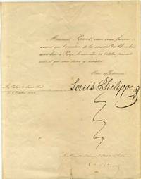
1840015856France: No publisher 1840. Autograph. Very good condition. Unbound. Signed by Authors. First Edition. Quarto 4to. One page letter signed by Louis Philippe. Countersigned by Charles Remusat 1797-1875 Le Ministre Secretaire d'Etat de l'Interieur Ministry of the Interior. The letter was folded into fourths. The letter reads "Monsieur Perrier nous vous faisons savoir que l'ouverture de la session des Chambres aura lieu a Paris le mercredi 28 Octobre present mois et que vous dever y assister. Votre affectionne signed Louis Philippe." It was sent from "Au Palais de Saint-Cloud le 8 Octobre 1840". No publisher Paperback
1840015856France: No publisher 1840. Book. Very good condition. Unbound. Signed by Authors. First Edition. Quarto 4to. One page letter signed by Louis Philippe. Countersigned by Charles Remusat 1797-1875 Le Ministre Secretaire d'Etat de l'Interieur Ministry of the Interior. The letter was folded into fourths. The letter reads "Monsieur Perrier nous vous faisons savoir que l'ouverture de la session des Chambres aura lieu a Paris le mercredi 28 Octobre present mois et que vous dever y assister. Votre affectionne signed Louis Philippe." It was sent from "Au Palais de Saint-Cloud le 8 Octobre 1840". No publisher Paperback books
1827M2724Bruxelles 1827. Good; some worming on the upper and lower parts of the fold wormholes professionally filled. Notes: From Vandermaelen's "Atlas Universel de Geographie Physique Politique Statistique et Mineralogique" Brusseles 1827. Size : 468x490 mm 18.375x19.25 Inches Coloring: Original Outline Coloring Category: Maps United States West States; unknown
1827M2720Bruxelles 1827. Very Good; several wormholes on the upper and lower parts of the fold. Notes: From Vandermaelen's "Atlas Universel de Geographie Physique Politique Statistique et Mineralogique" Brusseles 1827. Size : 460x554 mm 18.125x21.75 Inches Coloring: Original Outline Coloring Category: Maps United States West States; unknown
182716375Brussels 1827. Scarce original hand colored lithographed map of Georgia South Carolina North Carolina & Northern Florida. From the six volume atlas by Vandermaelen 'Atlas Universel de Geographie.'. This atlas was the first lithographed world atlas and the first of the entire world with all the maps on the same scale. Image size: 21 5/8 x 18 3/4". Paper size: 29 1/2 x 22". Very good condition. unknown
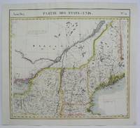
1825M4528Brussels 1825. Very Good. Notes: The first atlas of the world on a uniform scale. If assembled as a globe gores forms a very large globe. Size : 460x505 mm 18.125x19.875 Inches Coloring: Original Outline Coloring Category: Maps Canada East Quebec;; Maps United States New England unknown
1825M4500Brussels 1825. Very Good minor worming on the upper and lower portion of the map along the central fold proficiently repaired. Notes: The first atlas of the world on a uniform scale. If assembled as a globe gores forms a very large globe. Size : 460x495 mm 18.125x19.5 Inches Coloring: Original Outline Coloring Category: Maps United States South Louisiana; Maps United States South States; unknown
1825M4470Brussels 1825. Very Good minor worming holes along the lower portion of the central fold proficiently repaired. Notes: The first atlas of the world on a uniform scale. If assembled as a globe gores forms a very large globe. Size : 465x566 mm 18.25x22.25 Inches Coloring: Original Outline Coloring Category: Maps United States West States; unknown
1886KC8047Paris: Alcan-Levy 20 May 1886. Limited Edition. Paperback. Very Good. 28pp 2. 245 x 152mm. Limited edition number 29 of 100 printed on papier Hollande. Original printed wrappers edges uncut preserved and bound possibly for Paul Verlaine in 19th-century marbled boards spine stamped with author title and Ex. De Paul Verlaine. Pierre Quillard dedicates this copy to friend Philippe Martinon 1859-1917 a French linguist philologist and translator À mon ami ce petit livre ancien en souvenir dancienne et présente amitié To my friend this little old book old memories of past and present friendship and autograph of Quillard. Martinon is best remembered for his classic text translations of Greek and Latin and other studies on French metric. It is possible Martinon gave this presentation copy to Verlaine who in turn had it bound with his ex-libris on the spine. Both men were of great literary reputation and frequented the same poetic circles of the burgeoning symbolist movement. <br/><br/>It was a new symbolist mystery play to be presented in two simple tableaux as opposed to acts and scenes with minimal direction and the barest of staging directions. In effect the speaker became a central character and the intention thus emphasized the lyricism of the verse. Therefore the verse has a continuous prose accompaniment which explains the changes in time and space indicating different entities and slowly revealing the facts. Quillards verse is freed to reveal the expression of the characters souls -- it becomes a book of masks and symbolic portraits. This Quillards manifesto performance aimed to establish a new aesthetic for stageable drama. The schematic story line of this work arguably made one of the boldest attempts to put such ideas into action. In it Quillard represents the medieval story of St. Uliva a young virgin who agrees to amputate her hands to save her from the incestuous caresses of her brutal father. The story is imbued with vague mysticism supernatural journeys and resurrections. This copy was well admired in the circle of symbolist artists and writers with a definite association with Martinon and perhaps the great Verlaine. Alcan-Levy paperback
182830319Mulhouse et Paris Engelmann & Cie 1828 2 Volumes In-folio volume du Haut-Rhin : 1 portrait de Benjamin constant XI -126 - 40 planches lithographiées (24 pp - 1 ff - - puis pour les monumens Romains et huit planches, vues plan et carte ) Volume du Bas -Rhin : 180 pp ( 1 ff ) et 40 planches Lithographiées par Engelmann , très nombreuses rousseurs mais principalement en marges des lithographies - les dos et les bords des plats sont très usagés avec manques en coiffes et mors partiellement fendus . L'ouvrage non dérelié est complet mais vendu tel que décrit e
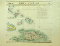
182740377Bruxelles: Ph. Vandermaelen 1827. First edition. Very good bright copies a few minor spots or marginal finger soiling. 2 sheets. Hand-colored lithographic maps. 46 x 53 cm and 50 x 56 cm. Large scale map of Haiti; map 68 also includes parts of Cuba and the Bahamas and has a text box entitled: Iles Bahamas ou Lucayes; map 74 includes the southern and remaining portion of Haiti plus Aruba Bonaire and small parts of Puerto Rico and Venezuela. Text box entitled: Republique d'Haiti. Redigee par A. Delavault. Sheets from Phillipe Vandermaelen Atlas universel de geographie physique politique statistique et mineralogique. a magnificent and ground breaking six volume atlas of the entire world which was the first Atlas to use lithography to show the entire world using such a large uniform scale approximately 26 miles to the inch and which was designed to be joined together into a three-dimensional globe with a diameter of approximately 25 feet. [Ph. Vandermaelen] unknown books
181989218Bachelier | Paris 1819 | 13.5 x 21.5 cm | Relié
1824122875Napoli R. Marotta e Vanspandoch / C. Bompard 1824/1836. Opera completa in 21 grossi volumi in 8° massimo mezza pergamenta molto semplice fine '800 con titoli calligrafici ai dorsi. Buoni esemplari con gialliture dovute al tipo di carta e minima usura. Politico e giurista francese. Avvocato al Parlamento di Fiandra legato agli Orléans fu deputato del terzo stato agli Stati generali del 1789 e uno dei più esperti legislatori dellAssemblea Costituente. fu uno degli artefici della caduta di Robespierre." Treccani Napoli, R. Marotta e Vanspandoch / C. Bompard unknown
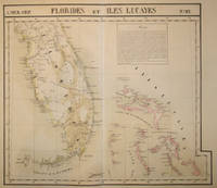
182715843Brussels 1827. Scarce hand colored early lithographed map of Florida and the Bahamas with a notable degree of detail for the time period including under the inset titled 'Florides' information on the variety of trees and plants fruit and iron mining. From the six volume atlas by Vandermaelen 'Atlas Universel de Geographie.'. This atlas was the first lithographed world atlas and the first of the entire world with all the maps on the same scale. Early roads are indicated here as well as a Native American Trail the Everglades several early colonies & Saint Augustine Cape Canaveral Tampa and Cape Sable. Image size: 21 5/8 x 18 3/4". Paper size: 29 1/2 x 22". Very good condition. unknown
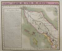
1815M9661Brussels c.1815. Very Good. Notes: Map of the northern half of Sumatra from the early 19th century. The map shows topographical features and has a short history of the island . <br>Philippe Vandermaelen 1795-1869 was an eminent Belgian geographer and cartographer famous for having founded the geographical establishment of Brussels. Size : 480x570 mm 18.90x22.44 Inches Coloring: Hand Colored Category: Maps Asia South East Indonesia & Papua New Guinea; unknown
182736277Brussels Belgium: Lithographed By H. Ode. Very Good. 1827. Map. Map # 46 A Very Good primitive and early map showing the northern California coast with San Francisco and Monterey. Map has wonderful color and many small text descriptions of the coast lines. Latitude of the map is 36 degrees to 42 degrees and longitude is 120 degrees to 150 degrees. Of course almost all localities shown are French or Indian names. The atlas from which this is extracted is extremely rare and originally composed 6 volumes this map being from the North America volume. Lithographer Ode and Cartographer Vandermaelen produced the first lithographed atlas ever done. Condition is overall Very Good. Browning to the centerfold crease caused by glue used in attaching the tab to the original volume the two page spread measures 21" x 26 1/2" when opened out. Topigraphical features are accentuated see image. Shipping will require extra care and cost due to insurance. Photo available upon request. ; 21" x 26 1/2"; 1 pages . Lithographed By H. Ode unknown
1825M4513Brussels 1825. Very Good minor worming on upper and lower portion of the map along the central fold proficiently repaired. Notes: The first atlas of the world on a uniform scale. If assembled as a globe gores forms a very large globe. Size : 464x515 mm 18.25x20.25 Inches Coloring: Original Outline Coloring Category: ; Maps United States West California unknown
1833LA - HAY178501833 - 1ère édition. Paris Paulin Libraire-Editeur. relié demi-cuir marron éditeur. Un feuillet avec quelques plissures et une faible tache sinon reliure et intérieur en très bon état. pt in-8. avec dos orné d'un grand motif floral et du titre dorés ; toutes tranches moirées. unknown
187651511Paris Librairie de l'art - Charles Delagrave 1876 1 vol. in-folio, en feuilles, sous portefeuille éditeur à rabats, XVIII + 19 pp.Premier tirage de cet album comprenant une eau-forte en page de titre, 12 bois in-texte et 20 eaux-fortes à grandes marges hors-texte. Tirage limité à 300 exemplaires, celui-ci numéroté sur papier teinté avec les planches tirées sur Hollande. Cartonnage usé comme souvent, sinon très bel état intérieur.
187651511Paris Librairie de l'art - Charles Delagrave 1876 1 vol. in-folio, en feuilles, sous portefeuille éditeur à rabats, XVIII + 19 pp.Premier tirage de cet album comprenant une eau-forte en page de titre, 12 bois in-texte et 20 eaux-fortes à grandes marges hors-texte. Tirage limité à 300 exemplaires, celui-ci numéroté sur papier teinté avec les planches tirées sur Hollande. Cartonnage usé comme souvent, sinon très bel état intérieur.
1878842Paris, Dupont, 1878 ; in-12 de [1] f., 152 pp., [2] ff., maroquin bleu nuit, large fleuron doré au centre des plats, dos à nerfs orné, coupes filetées, dentelle intérieure, tranches dorées sur marbrure, premier plat de couverture (David).