FERRIER, Joseph PhilippeBiblio.com
948 résultats
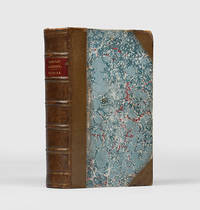
1856168702London: John Murray 1856. His descriptions are colourful and graphic First edition of this rich contribution to the literature of the Great Game noted by Wilber as one of the most valuable works on Afghanistan especially for its "description of remote regions such as the Hazara and Ghur areas and the Helmand Valley". The work demonstrates the author's "masterly knowledge of the history geography and languages" of the area Yakushi. After returning wounded from the French expedition to Algeria in 1837 Joseph Philippe Ferrier 1811-1886 accepted employment as an instructor with the Persian army. He travelled to Persia as part of a rather ramshackle delegation which soon collapsed. Ferrier was appointed adjutant-general and "chef d'état major" on an eight-year contract and was sent to Zanjan to train cavalry battalions receiving the Order of the Lion and Sun. He later undertook an overland journey through Persia and Afghanistan to join the group of French officers at Lahore in the service of Ranjit Singh's burgeoning Sikh empire. In 1847 he was attached to the office of the governor-general of Fars finally securing a safe passage to Turkey in 1851. His other works include a History of the Afghans published in 1858. Octavo 217 x 135 mm. Engraved frontispiece 2 similar plates folding map at end. Later 19th-century half calf spine with red morocco labels raised bands gilt and stylized blind rules in compartments marbled sides edges sprinkled red green endpapers. Bookplate of R. C. A. Prior physician 1809-1902 on front pastedown. Light rubbing along joints and extremities shine to the spine suggesting sometime varnished tips slightly bumped pale spotting to prelims the very occasional small spot or mark to text map slightly offset with closed tear to the stub sometime repaired with paper on verso. A very good copy. Burrell 252; Ghani p. 129; Wilber 150; Wilson p. 69; Yakushi F31a. William L. Hanaway Jr "J. P. Ferrier" Review of Middle East Studies vol. 12 1978. hardcover
183719200Bruxelles: Delfosse 1837. SECOND EDITION. Folding lithographed plate. Contemporary gilt sheep-backed marbled boards edges sprinkled red. A nice complete copy. Second edition an anatomical guide to human and animal teeth. The first chapters cover tooth formation parts of the tooth tooth loss functions of individual teeth and differences in teeth between men and women and among different races of people. The second part of the book focuses on animal teeth across four orders: mammals birds reptiles and fish. The plate features 8 figures and is accompanied by explanatory text. <br /> <br /> Blandin 1798-1849 was a French surgeon and anatomist. He was a pioneer in the field of plastic surgery and is credited with coining the term autoplasty. Delfosse unknown
185886634Paris : Imprimerie Imperiale 1858. First Edition. Hardback. Very good copy bound in full contemporary gilt-blocked buckram. Slightest suggestion only of dust-dulling to the spine bands and panel edges. Remains particularly well-preserved overall; tight bright clean and strong. ; 231 pages; Description: xxxii 231 p. ; 21 cm. Subjects: Tibetan language --Grammar. Scattered minor marginal foxing. Paris : Imprimerie Imperiale hardcover
186413458Paris: Dusacq & Cie. Editeurs 1864. Hand-coloured lithograph after a painting by Linder. Very good condition apart from some mild rippling a small loss in the top margin and a few skillfully repaired tears in the bottom margin. A beautifully coloured humorous plate that was most likely part of a series published by Dusacq of images by various artists depicting railway related scenes.<br/> <br/>During the mid-nineteenth century the technological advancement and financial prosperity of France under Napoleon III hastened the development of the railway and other modern modes of transportation such as the omnibus. These improvements brought about a culture of mass tourism as members of various classes flocked to the railroad to take day trips. An archetypal symbol of modern life the railway station became a popular subject during the period and was represented and parodied by artists such as Honoré Daumier and William Powell Frith. It was an ideal place to observe a varied cross-section of society and the idiosyncrasies of human behavior. In the tradition of Daumier's satiric railway scenes from the 1840s and 1850s Linder exploits the comic possibilities of this bustling modern subject in this charming print. The title 'Pleasure Train' was most likely intended as an ironic play on words since pleasure is the last thing enjoyed by the swelling crowd of people on the platform many of whom scream in frustration as they are pushed and prodded in an effort to exit and enter the train. A pupil of the celebrated artist Charles Gleyre Philippe Jacques Linder was a genre and portrait painter who regularly exhibited works at the Salon between 1857-1880.<br/> <br/>Cf. Benezit Dictionaire des Peintres Sculptteurs Dessinateurs et Graveurs vol. 8 p. 679. Dusacq & Cie. Editeurs unknown books
1825M3339Bruxelles 1825. Excellent;. Notes: The first atlas of the world on a uniform scale. If assembled as a globe gores forms a very large globe.<br><br>The map shows British Columbia and extends as far north and the Straits of Queen Charlotte. The map also notes the location of different Native tribes of the area. Finally this map shows the route that MacKenzie took to the Pacific from the Frasier River. Size : 472x561 mm 18.625x22.125 Inches Coloring: Original Hand Coloring Category: Maps Canada West British Columbia; unknown
1801009173Paris France: Richard Caille et Ravier 1801. Book. Very Good. Hardcover. First Edition. Small Octavo. lvi 318 pp Introduction Plan générale de l'ouvrsage. Sept Sections avec plusieur chapitres. Tables des Matières. 2 copperplate engravings 2 charts one folding rebound in 3/4 polished calf marbled boards. Text en français. In the spirit of the French refolution unchained the confineed at the Bicetre in October 1793 and initiated the humane treatment of the insane. A landmark in the history of psychiatric literature. Richard, Caille et Ravier Hardcover
187621881Paris.: Librairie de l'art. 1876. Bound in contemporary red calf-backed boards. Folio. 20 original etchings by Goncourt. From the edition limited to 300 copies with this one of 200 examples with the plates printed on Hollande. Librairie de l'art. hardcover
180741017Reliure plein maroquin rouge. Dos à nerfs finement orné de saisons dorés. Triple filets dorés en encadrement sur les plats. Toutes tranches dorées. Reliure signée CAPE.Ouvrage illustré de superbes gravures dessinées parMoreau.
188391775Librairie Hachette | Paris 1883 - 1886 | 20 x 27.70 cm | 4 volumes reliés
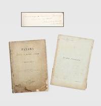
1892185348Paris: G. Masson 1892. An infrastructural and political revolution First and sole edition presentation copy signed on the dedication page "Hommage à Monsieur Gournay curé de Vertou. P. Bunau-Varilla 12 Septembre 1893". This comprehensive study was written by one of the driving forces behind the Panama Canal alongside de Lesseps. Most institutions list the text volume alone lacking the elaborate prospectus volume. Bunau-Varilla 1859-1940 was first sent to Panama in 1884 by the Compagnie Universelle du Canal Interocéanique where he rose to the position of chief engineer of the new canal. The attempt failed in 1889 and the company was dissolved after which he wrote a number of books to document and build support for the project's resumption. In this volume he both describes the work completed so far and his plan to complete the canal with locks. He "distributed copies of his book to the French Parliamentaries. However it did not meet any audience. as the Champer of Deputies' members did no want to be involved again in the burning subject of the Panama Canal" Loizillon p. 333 Bunau-Varilla tried again in 1894 and soon became a prominent figure in US-Panama relations. In particular when Colombia refused to ratify a treaty granting the United States rights to build the canal he encouraged the Panamanians to declare independence and his wife designed their new flag. He later signed the Hay-Bunau-Varilla Treaty giving the US control over the canal despite local protests. The canal would continue to occupy a central position in both the infrastructural and political development of Central America. This work contains a large number of photographic illustrations showing the construction as well as colour diagrams describing the geology of the area. The identity of Monsieur Gournay is unclear and there are no records linking Bunau-Varilla to the commune of Vertou. 2 vols quarto. With 45 half-tone photographic plates 5 folding colour folding map 5 colour diagrams 4 folding tables in text; text in French. Original buff paper wrappers spines and front wrappers lettered in black rear wrapper of text vol. decorated with publisher's device. Worn and soiled spines split sometime repaired with tape in gutters map loose in annex volume contents bright with a little toning at edges: a good copy. Gabriel J. Loizillon The Bunau-Varilla Brothers and the Panama Canal 2012. unknown
187625551Paris.: Librairie de l'Art / Charles Delagrave. 1876. Loose as issued later cloth-backed portfolio with flaps and cloth ties titles to front cover in red and black. Folio. 470 x 325 mm. Half-title in red and black printed title in red and black with large engraved vignette by de Goncourt nine leaves with Burty's text illustrated with 11 monochrome vignettes and plates three full-page ten leaves with 'Catalogue de l'Oeuvre de Jules de Goncourt' with monochrome vignette tail-piece leaf with 'Index des Eaux-Fortes' recto and 'Liste des Bois' verso leaf with printer's monochrome vignette final leaf with justification recto and 20 original monochrome etchings by de Goncourt each printed recto only on uncut sheets of Hollande; sheet size: c.440 x 310 mm or the reverse. Philippe Burty's catalogue raisonné of Jules de Goncourt's etchings.From the edition limited to 300 numbered copies with this one of 200 examples with the text on papier teinté and the plates on Hollande.The catalogue raisonné of Jules de Goncourt's engraved work with a biography by Philippe Burty. The catalogue lists 86 examples listing their states dimensions and sources where applicable. The catalogue gives printed examples of 20 of them ranging from the vignette title engraving 'Le Pantin de Mademoiselle Marcille' to etchings after Fragonard de Saint-Aubin Chardin Monnier and Gavarni among others as well as those original compositions described as 'd'après nature'. The plates were printed in an edition of 302 copies by François Lienard including 2 on peau de vélin. Librairie de l'Art / Charles Delagrave. hardcover
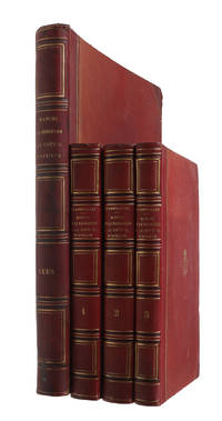
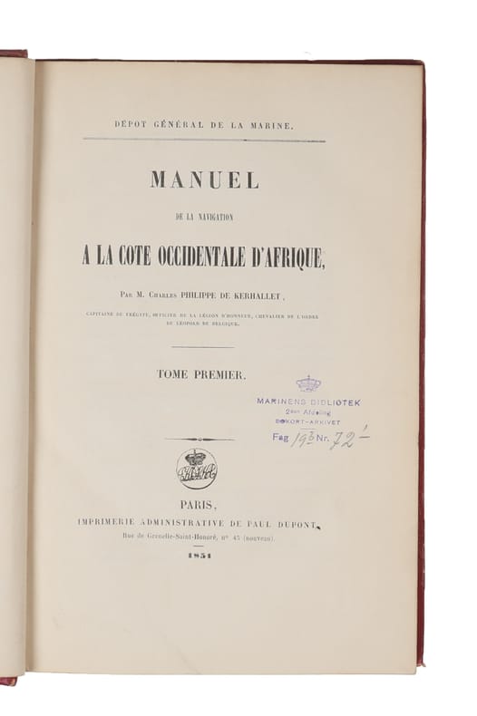
185153791Paris Paul Dupont 1851-52. Royal8vo a. Large 4to. Bound in 4 uniform contemp. hcalf. Gilt spines and with gilt lettering. Stamp on title-pages. Light wear to edges of atlas-volume. XIV2532;4604;2VII3922 pp. Atlasvolume: Engraved title-page. 6 pp. and 57 engraved plates depicting numerous landfalls. Internally clean and fine. <br/><br/><em>First edition. </em> unknown
185153791Paris, Paul Dupont, 1851-52. Royal8vo a. Large 4to. Bound in 4 uniform contemp. hcalf. Gilt spines and with gilt lettering. Stamp on title-pages. Light wear to edges of atlas-volume. XIV,(2),532(4),604(2),VII,392,(2) pp. Atlasvolume: Engraved title-page. (6) pp. and 57 engraved plates depicting numerous landfalls. Internally clean and fine.
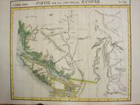
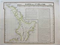
1827M9228Brussels: Philippe Vandermaelen c. 1827. Very Good. Notes: A scarce set of maps one showing the north island and the other the south island of New Zealand from the early 19th century. This is considered to be one of the first maps to show New Zealand as the core focus. They do an excellent job of showing detail by having the names of various places showing geographical features and by keeping that same detail in their portrayal of the numerous smaller islands around New Zealand. To further add to the detailed nature of the map there are extensive notes. <br><br>Measurement for No. 60 is 495x545mm<br><br> Size : 483x595 mm 19.02x23.43 Inches Coloring: Original Hand Coloring Reference: Phillips 749; Koeman Vdm 1; National Maritime Museum 179; Wellens-De Donder L. Philippe Vandermaelen 1795-1869 4-5. Category: Maps Pacific; Philippe Vandermaelen unknown
186121098Nantes Charpentier 1861 -in-folio demi-chagrin 3 volumes, reliure d'époque demi-chagrin marron foncé in-folio Editeur (binding half shagreen in-folio Editor)(49 x 33,5 cm), dos à nerfs (spine with raised bands) décoré or (gilt decoration), titre et tomaison frappés "or", filet et roulette chainette "or" de part et d'autre des nerfs, roulette chainette "or" en tête et en pied, entre-nerfs décorés de fers à froid, plats de percale noire muets, toutes tranches lisses, illustré de 100 lithographies sur fond teinté, certaines rehaussées de détails en couleurs, d'après BENOIST, CHAPUY, ISABEY, etc. et 38 bois gravés in-texte, légères mouillures au coin supérieur gauche de la page de titre du 3ème Volume , [(4)-XII-88-(2)-122] + [(6)-76-(2)-44-(2)-24-(2)-22-(2)-36-(2)-26] + [(8)-76-(2)-80-(2)-34] pages, 1861 Nantes: Imprimerie de Charpentier père, Fils et Cie Editeur,
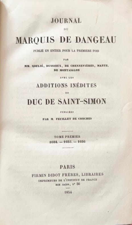
18546028Paris, Firmin-Didot, 1854-1860. 19 vol. in-8, demi-basane brune, dos à nerfs (reliure de l'époque).
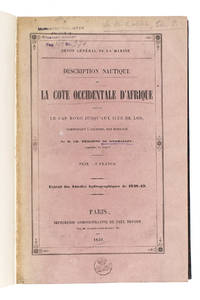
1849L8Q93SJK6UXUParis 1849. 8vo. Paul Dupont Later half black cloth with the title and year of publication lettered in gold on the front the logo of the Royal Danish Navy library gold-tooled on the front black and pink marbled paper sides. 102 pp. Rare first edition of a navigational pilot to the West African coast from Kabrousse on the border of Senegal and Guinea-Bissau to the Îles de Los off Conakry in Guinea. It was written by the French captain and navigator Charles-Marie Philippe de Kerhallet 1809-1863 for the first issue of the Annales Hydrographiques 1848-1849 a yearly publication on hydrography and navigation but has here been separately published. It was intended to supply navigators with the most up-to-date information on the West African coast to help them safely navigate this area. A second edition was published in 1858. Kerhallet published a small number of other works on the same subject including his important Manuel de la Navigation a la Cote occidentale dAfrique 1853 and various works on navigating the coasts of Mexico and Panama. He is also known for his contributions to the understanding of oceanic gyres.Bound with the original pink printed wrappers with the stamps of the Royal Danish Navy Library to the front wrapper and title-page a shelf mark label mounted on the front pastedown. The edges and corners of the boards are slightly scuffed. The work is printed on heavy paper. Overall a clean copy in very good condition.l WorldCat 457878835 2 copies; cf. Bessero et all "150 years of French "Annales Hydrographiques" " in: International hydrographic review LXVII 1 March 1990 pp. 148-170. hardcover
1831116171831 1831 Paris. Richard, Caille et Ravier. A IX. 1 volume in-8, plein veau, dos lisse orné, pièce de titre en maroquin rouge. Discrètes épidermures sur les plats. LVI pp. ; 318 pp.
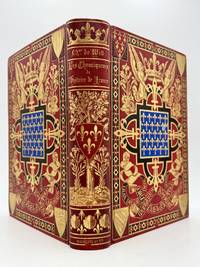
188391775Paris: Librairie Hachette 1883. Fine. Librairie Hachette Paris 1883 - 1886 20 x 27.70 cm 4 volumes reliés First edition of the four volumes issued successively between 1883 and 1886. Rich and remarkable iconography featuring 36 chromolithographic plates 187 plates and 1256 illustrations in the text. Translation and arrangement by Madame de Witt who compiled the texts in order to present them as a chronological history. Complete sets in the correct edition are relatively scarce. Striking publishers binding with elaborate gilt decoration signed A. Souze. Red half morocco with red percaline boards. Large gilt panel on the spine depicting an oak tree with two fleurs-de-lys and a shield charged with fleurs-de-lys as well as shell ornaments at the foot. Large and intricate gilt panel on the covers with a central blue panel scattered with fleurs-de-lys and various royal emblems and ornaments forming a decorative scheme evocative of the Middle Ages; four corner shields representing the four great French provinces. All edges gilt. Minor rubbing to the spine ends notably and to the blue panels on the boards. A perfectly fresh copy free of foxing seldom found in such condition. A very fine copy. First series: the chroniclers from Gregory of Tours to William of Tyre. Second series: the chroniclers from Suger to Froissart. Third series: the chroniclers from Froissart to Monstrelet. Fourth series: the chroniclers from Monstrelet to Commynes. An interesting publication bringing together the major historical texts written before the Renaissance enhanced with abundant illustration. Librairie Hachette hardcover
183439379Exeter: George Rowe at his Lithographic Establishment 1834. George Rowe. AN EXTRAORDINARY ASSOCIATION COPY OF AN EXTRAORDINARILY RARE SUITE OF LITHOGRAPHS. Two parts in one volume complete with twelve wonderful lithographed views. This is the deluxe proof issue on India paper. Bound in is a letter dated October 5 1911 from Henry Campbell Booth to French botanist Philippe de Vilmorin 1872-1917 in which Booth explains that this book belonged to his wife's grandfather Captain Frederick Marryat 1792-1848 the Royal Navy officer who pioneered nautical fiction. Large folio 38 cm. Attractively bound in quarter calf c. 1900 spine decorated with gilt fleurons. Froont wrappers of both parts bound in. Light wear to extremities of binding. Some foxing to margins of plates but images generally very clean. A very good set. Not in WorldCat BL BN or anywhere else I looked. <br/><br/> George Rowe, at his Lithographic Establishment unknown
189235864Paris France: Ecole Nationale Des Beaux-Arts. As New. 1892. Paperback. FREE UPGRADE to Courier/Priority Shipping Upon Request IN STOCK AND IMMEDIATELY AVAILABLE FOR SHIPMENT - Near mint condition. Text in French; 255 works catalogued none illustrated. Includes photo of Pelouse as frontispiece. Rare. -- with a bonus offer-- . Ecole Nationale Des Beaux-Arts paperback
189351122Paris France: L. Allison & Cie. /Librairie De L'Art. As New. 1893. Paperback. FREE UPGRADE to Courier/Priority Shipping Upon Request IN STOCK AND IMMEDIATELY AVAILABLE FOR SHIPMENT - Text block clean pages tight to spine - Text in French. 116 page monograph illustrated with 55 gravures. -- with a bonus offer-- . L. Allison & Cie. /Librairie De L'Art paperback
190093428Librairie Spéciale Des Catalogues De Ventes. As New. 1900. Paperback. - IN STOCK AND IMMEDIATELY AVAILABLE FOR SHIPMENT - ORIGINAL SCARCE EDITION NOT A REPRINT. RARE DOCUMENTATION ON THIS ARTIST. Text block pristine pages tight to spine - Text in French. 220 pages. Record of prices fetched at auction for works by Constant Troyon with descriptions of those works. -- with a bonus offer-- . Librairie Spéciale Des Catalogues De Ventes paperback
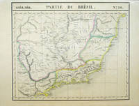
182740380Bruxelles: Ph. Vandermaelen 1827. First edition. A very good sharp set housed in a clamshell box. 17 sheets. Hand-colored lithographic maps. 47 x 57 cm. The Empire of Brazil on a grand scale printed shortly after Pedro declared the independence of Brazil but before the conclusion of the Cisplatine War against the United Provinces of the RÃo de la Plata Argentina which cost her Uruguay. Sheets from Phillipe Vandermaelen Atlas universel de geographie physique politique statistique et mineralogique. a magnificent and ground breaking six volume atlas of the entire world which was the first Atlas to use lithography to show the entire world using such a large uniform scale approximately 26 miles to the inch and which was designed to be joined together into a three-dimensional globe with a diameter of aboout 25 feet. Includes all of Brazil with some surrounding areas: 1. Amer. Merid. no. 9. Partie de la Colombie et du Bresil. Parts of Peru Colombia and Brazil. 2. Amer. Merid. 10. Partie du Bresil. Amazonas region Brazil. 3. Amer. Merid. 11. Partie du Bresil. Parts of Amazonas Para and Amapa. 4. Amer. Merid. 12. Partie du Bresil. Covers parts of Para and Maranhao. 5. Amer. Merid. 13. Partie du Bresil. Parts of Piaui Ceara and Rio Grande do Norte. Text: Note sur le Bresil . Pour la suite voyez la carte no. 32. 6. Amer. Merid. 15. Partie du Perou et du Bresil. Parts of Peru Brazil and northern Bolivia. 7. Amer. Merid. 16. Partie du Bresil. Parts of Brazil and northern Bolivia. 8. Amer. Merid. 17. Partie du Bresil. Parts of Mato Grosso Tocantins Amazonas and Para. 9. Amer. Merid. 18. Partie du Bresil. Parts Tocantins Bahia Maranhao and Piaui. 10. Amer. Merid. 19. Partie du Bresil. Parts of northeastern Brazil. 11. Amer. Merid. 22. Partie du Bresil. Part of Santa Cruz Bolivia and Mato Grosso and Mato Grosso do Sul Brazil. 12. Amer. Merid. 23. Partie du Bresil. Parts of Goias Federal District Minas Gerais and Tocantins. 13. Amer. Merid. 24. Partie du Bresil. Parts of Bahia and Minas Gerais with coast soundings. 14. Amer. Merid. 27. Partie du Bresil. Part of southern Brazil. 15. Amer. Merid. 28. Partie du Bresil. Parts of Sao Paulo Minas Gerais Espirito Santo and Rio de Janeiro states. 16. Amer. Merid. 32. Partie du Bresil. Part of southern Brazil. Text box: Note sur le Bresil. Pour le commencement voyez la carte no. 13. 17. Amer. Merid. 35. Partie du Bresil. Parts of Uruguay Rio Grande do Sul Brazil and Buenos Aires province Argentina an eighteenth sheet No.36 was labeled 'Partie du Bresil but in fact only included parts of Argentina and Chile. If joined together the map would measure approximately 9 x 7 feet. Phillips 749. Amer. Geol. Soc. Catalogue of Maps of Hispanic America: III p. 172. Sabin 43762. [Ph. Vandermaelen] unknown books
186120316Nantes Charpentier 1861 -in-folio demi-chagrin 3 volumes, reliure d'époque demi-chagrin havane in-folio Editeur (binding half shagreen in-folio Editor)(49 x 33,5 cm), RELIURE EDITEUR D'EPOQUE (pour l'Edition de Luxe), dos à nerfs (spine with raised bands) décoré or (gilt decoration), plat orné d'un décor romantique en encadrement avec, au centre du premier plat, le blason de Paris, le Louvre médiéval et la devise de la capitale soutenus par deux personnages, toutes tranches dorées, illustré de 100 lithographies sur fond teinté, certaines rehaussées de détails en couleurs, d'après BENOIST, CHAPUY, ISABEY, etc. et 38 bois gravés in-texte, légères mouillures claires (sur moins de 3 cm2) au coin inférieur droit des 17 premiers feuillets du 1er volume et des 2 premiers feuillets du 3ème volume, [(4)-XII-88-(2)-122] + [(6)-76-(2)-44-(2)-24-(2)-22-(2)-36-(2)-26] + [(8)-76-(2)-80-(2)-34] pages, 1861 Nantes Paris : Imprimerie de Charpentier père, Fils et Cie Editeurs,