314 résultats
1756102718P., Jean-Thomas Hérissant, 1756, in-12, (6)-535 pp, bandeaux, culs-de-lampe, approbation et privilège du Roi, reliure plein veau granité, dos lisse très orné, triples filets dorés sur les plats, coupes filetées, tranches marbrées (rel. de l'époque), bon état
175661684Jean-Thomas Herissant 1756 In-16 11,5 x 17 cm. Reliure de l’époque pleine basane brune marbrée, dos à 5 nerfs, roulettes dorés, caissons ornés de fers dorés, 558 pp. Coiffes et coins émoussées, intérieur en bon état.
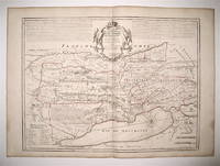
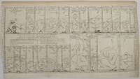
175217483Very Good. 1752. Map. Rare. Title: Essai Dun Parallele Des Fleuves De L'Europe qui ont leurs Embouchures Immediatement dans 1 ' Ocean ou dont les Eaux s'y jettent par les Mers Baltique et Meditrranee pour servir d'exemple du Parallele des Fleuves disposes en hauteur sur une meme ligne et selon la distance la plus courte des Sources aux Embouchures qui en sont comme les Bases avec le Developem. Du Cours de chaque Fleuve. Essay on a Parallel of the Rivers of Europe which have their Mouths Immediately in the Ocean or whose Waters flow there through the Baltic and Mediterranean Seas to serve as an example of the Parallel of the Rivers arranged in height on the same line and according to the shortest distance from the Sources to the Mouths which are like the Bases with the Developem. Of the Course of each River. Date printed: 1752.Condition: This original 18th century copper plate engraved map is toned with close trimming on lower left side and folds as issued but overall in very good condition. Dimensions: 19.5 x 11. Details: RIVERS OF RUSSIA POLAND GERMANY FRANCE SPAIN TURKEY and ITALY. . . unknown
17801394642Argentorati Strasbourg: Bauer et Treuttel 1780. Quarto xiv 243 pages. In Good minus condition. Bound in full leather with gilt tooling to banded spine spine label worn away. Boards show moderate plus wear to edges moderate plus bumping and wear to corners significant wear to head and tail of spine and significant cracking along joint of front board front board loose but attached. Text block has moderate plus age toning to speckled edges and some light smudging to front free end paper. Ex libris of former owner on front paste down. Marbled end papers. 1394642. Special Collections - Downstairs. Bauer et Treuttel unknown
1777121877P., Deslauriers, s.d. (1777), in-folio (323 x 250 mm), (1) f. de titre, 279 pp, reliure plein veau raciné, dos à 5 larges faux-nerfs soulignés de doubles filets dorés, titre doré dans un encadrement floral au 1er plat, tranches mouchetées (rel.de l'époque), coiffes arasées, pt accrocs au 2e plat, pt mque à un coin, plats lég. frottés, coins émoussés, trace de mouillure ancienne en coin, infime travail de vers en marge sup. des 10 derniers feuillets, marges des 4 premiers feuillets restaurées, 4 pages manquantes (p. 217-220) remplacées par une copie manuscrite très bien exécutée à l'époque, bon exemplaire, entièrement gravé sur cuivre, imprimé sur papier fort
17879001Paris 1787. Copper engraving 29 x 41 cm engraved by Moithy after Herault black and white blank verso. Map of Asia as understood in the Greco-Roman world in classical antiquity; subsequent European discoveries are shown in outline. Map unknown
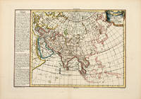
178757628Paris. 1787. Attractive map of Asia with text in French on the left on the geography divisions and borders of the continent. Decorated title cartouche at right. Copper engraving. Excellent condition. Hand coloured. Size: 42 x 28 cm. unknown
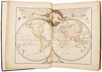
178951612Paris: chez Dezauche 1789. Updating the work of "one of the key figures in the development of French cartography" First edition thus and uncommon with just four listings on WorldCat three of these for the BnF and no complete copy at auction for 30 years; an excellent complete and inclusive French atlas of the 18th century. Jean-Claude Dezauche 1745-1824 was one of the geographer-publishers most influential in the establishment of the French theoretical approach to cartography. This movement which downplayed the decorative elements valued by the Dutch school in favour of scientific rigour and accuracy can be traced back to the work of Guillaume Delisle - "one of the key figures in the development of French cartography" Tooley - who had studied under Jean-Dominique Cassini director of the Paris observatory. Delisle's business was inherited by his son-in-law Philippe Buache who had studied with him and who entered the Depôt des Cartes et Plans de Marine in 1721 in 1729 being appointed "premier géographe du roi" a position previously held by his father-in-law. On Buache's death his widow sold his work to Jean Nicholas Buache de la Neuville Philippe's nephew and in 1780 Dezauche bought it from him together with work by Delisle Jaillot and others. He in turn made his own alterations and improvements to the maps and then re-issued them in a revised form. For example the twin- and four-hemispheric world maps in volume I the former dated 1792 have been revised to include the latest discoveries from Cook's voyages. 2 vols folio 453 x 375 mm. Engraved allegorical title page and contents leaves to each and 151 double-page or folding maps all coloured in outline. Contemporary calf rebacked red morocco labels. Somewhat rubbed and with some restoration at the corners light dampstain in the lower margin of vol. I slightly heavier at the title page which has been reinforced with archival tissue map of Paris shaved to the ruled border at the upper margin a few minor splits and chips in the margins but overall very good. unknown
1776017046Sans lieu Aux Deux-Ponts, à l'imprimerie Ducale 1776 Deux parties en un volume in-8, XVI 248 (4) 186pp. Reliure en veau fauve marbré époque, dos à nerfs orné d'une pièce de titre et de caissons fleuronnés dorés, tranches marbrées. (dos légèrement épidermé et comportant des fentes, coiffe supérieure arasée, coins émoussés, nombreux feuillets uniformément et parfois fortement brunis). Édition originale. Cet ouvrage, imprimé à l'étranger, fut interdit par la police lors de son introduction. Abrégé des événements du règne de Louis XV, et particulièrement dans les arts et les sciences, l'art militaire, l'agriculture, le commerce, les Arts mécaniques .etc. Un feuillet volant d'annotations manuscrites anciennes relatives à l'ouvrage. Étiquette ancienne de bibliothèque au contre plat supérieur : " Ex libris RAPARLIER " .
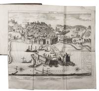
1725J319ML17AD8LAmsterdam: Marten Schagen 1725. Contemporary calf richly gold-tooled spine with a red morocco title-label gold-tooled boards gold-tooled board edges marbled edges. 4to. With engraved title page letterpress title page printed in red and black with engraved vignette folding engraved map of Algeria folding engraved view and a folding engraved birds eye view of Algiers. 3 parts in 1 volume. Rare first and only edition of the Dutch translation of an influential description of Algeria published in the same year as the original French and expanded here with a detailed list of 73 Dutch ships captured by Algerian pirates. Algeria was at this time nominally ruled by the Ottoman Empire but retained a great deal of independence in practice. After more than a century as a French colony 1830-1954/62 it regained its independence and is now a member of the Arab League the United Nations and a founding member of the Maghreb Union. The work begins with a description of the various in habitants including separate chapters on the Arabic and Turkish populations followed by chapters on its architecture military navy politics slavery trade etc.It was written by the Jacques Philippe Laugier de Tassy a former diplomat in Algeria and at this date commissioner of the French navy and consul in the Netherlands. It was translated into English as A complete history of the piratical states of Barabry a title that emphasized the notorious Algerian pirates.With owner's inscription. A good copy; some minor thumbing a couple smudges and the bird's eye view has some restorations. Binding slightly rubbed along the extremities and some restorations to the spine but otherwise good.l Cat. NHSM p. 201; STCN 8 copies; Tiele Bibl. 644; WorldCat 6 copies; cf. Cox I p. 382; Gay Bibl. de l'Afrique et l'Arabe 917 French eds.; Playfair 220; not in Blackmer. Marten Schagen, hardcover
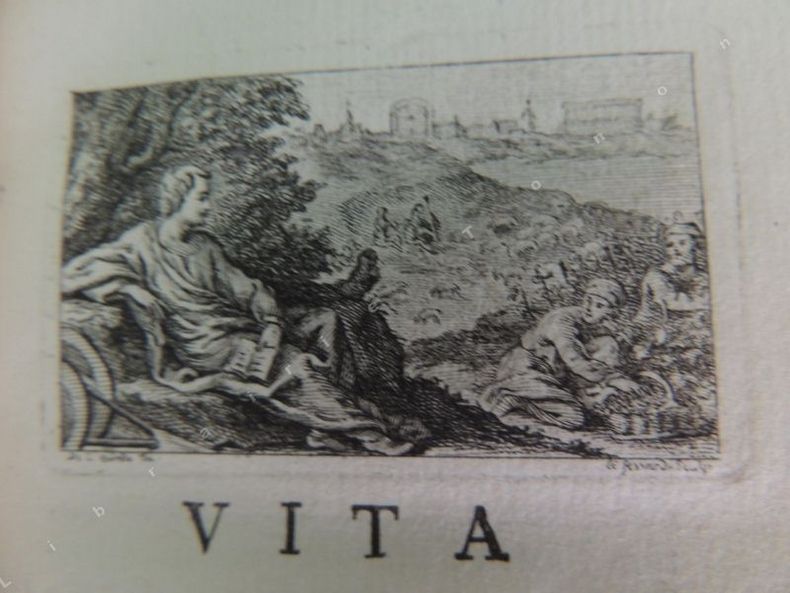
175473Lutetiae Parisiorum Josephi Barbou 1754 2 livres en1 vol. in-12 (15,5 x 9,5 cm)XXIV, 238 pp. ( en latin ) Frontispice d'après de Sève gravé par Fessard. 3 vignettes-bandeaux (une au début des pièces liminaires, une au début de chacun des deux livres), dont au moins 2 gravées par Fessard et 1 d'après de Sève. Lettrines, culs-de-lampe. Nombreuses pièces liminaires: Vita Caii Velleii Paterculi; De Vellei Paterculi Vita et Sciptis ex Gerardi Joannis Vossii Opere de Historicis Latinis; Variorum de Caio Velleio Paterculo judicia; Excerpta ex Annalibus Velleianis Henrici Dodwelli per Christophorum Cellarium. Et, in fine, Index rerum geographicarum; Catalogus editionum Caii Velleii Paterculi ( de 1520 à 1746 ); Approbatio. Plein veau moucheté d'époque. Dos lisse orné de fleurons dorés, p. de titre maroquin rouge. Triple filet encadrant les plats. Roulettes sur les coupes et les chasses. Toutes tranches dorées. Gardes marbrées. Mors frottés; petit manque à un coin.
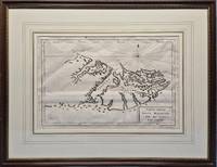
1775026742Venice: Vincenzo Formaleoni. 1st thus n.d. 1775; originally published in 1771. 360 x 240mm 540 x 420mm framed. Copperplate engraving; mounted with gilt border and framed in gilt decorated wood with glass. Printed by Vincenzo Formaleoni. Unrecorded in Fordham's "Falkland Islands: A bibliography of 50 examples of printed maps bearing specific reference to the Falkland Islands." Framed by The Parker Gallery London BADA. VG condition with very slight folds as issued . Very Good. No Binding. 1775. Vincenzo Formaleoni unknown
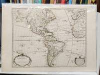
1763159241Paris: Chez l'Auteur Sur le Quay de l'Horloge 1763. Seventh state. Very good. 55 x 78 cm handcoloured map. Centrefold. A few spots. <br/><br/>Originally issued by Guillaume Delisle in 1722 this was one of the most popular maps of the Western Hemisphere in the 18th century and was printed in numerous editions. This is the important seventh state of the map notable because it depicts the mythical "Sea of the West" north of California. An inset in the top left features Buache's elaborate Northwest Passage theories including a conjectural Lac de Valasco. In Labrador is another hypothetical inland sea Mer Nouvellement Decouverte. In South America Brazil is separated from the Pays des Amazones. The map is decorated with a garland-draped title cartouche "Avertissement" cartouche and compass rose. Buache's imprint is in both the title cartouche dated 1722 and at bottom right with the nearly-illegible date of 1745. <br /> <br />Tooley America #7 p. 14. McGuirk #111. Wagner NW #523. Chez l'Auteur Sur le Quay de l'Horloge unknown
17792092902138100218Not Available 1779. Soft Cover. Fine. Size: 55.5cmx73.5cm Number of books: 1 Not Available paperback
17452430061745. Map. Engraving with hand coloring. Image measures 19 x 25.5".<br/> <br/> This beautiful map depicts the Neuchatel region of Switzerland showing the town of Neuchatel as well as Lake Neuchatel. It is based on a 1710 original by David Francois de Merveilleux redone by Guillaume de L'Isle and published by Philippe Buache. The map is is finely detailed with abbeys and priories castles battlefields mineral springs and forests. An elegant compass rose is shown in Lake Neuchatel and a decorative title cartouche at the top of the map is flanked on either side by historical and geographical text in French. The map dates to the reign of Frederick I of Prussia who presided over Neuchatel's golden age and ushered in a period of expansion in commerce banking and industry such as watchmaking and lace. The map is in excellent condition with wide margins as issued and no chips or tears. Minor stains in margins not affecting the image. Philippe Buache 1700--1773 was a French geographer who trained under the geographer Guillaume De L'Isle 1675--1726 a French cartographer known for his popular and accurate maps of Europe and the newly explored Americas and Africa. He is important as the first "scientific" cartographer who incorporated the most current information on exploration and topography into his maps.<br/> <br/> unknown
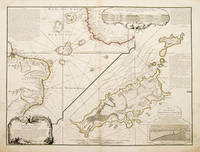
173755258Atlas de Geographie. Sept 1737. An interesting geo-hydrographic map of the Atlantic Ocean and its islands. It is divided into two with one side showing the Atlantic Ocean and the coasts of Africa and Brazil and the other side a detailed examination of the archipelago of Fernando de Noronha. A note top left explains the purpose of the map which in brief is to give an idea of the variety of islands in the Atlantic Ocean. Another note top right explains a little about the cartographers and expedition members. Another explains about an embankment between islands on the archipelago. A cartouche top right contains a cross-section diagram of what is below sea level. Another below sea-level cross-section shows the particulars of Fernando de Noronha lower right corner. Copper engraving. Very good condition - slight dark patches to lower corners and repair to lower left margin. Some offsetting. Original colour. Size: 65 x 49.5 cm. 25½ x 19½ inches unknown
178038197Paris: Dezauche 1780. A stunning map of Arabia and northeastern Africa from Libya and Egypt in the north to Somalia and the Gulf of Guinea in the south. 50 x 62 cm plate 55 x 76 cm sheet. Arabia Egypt Sudan and Abyssinia Ethiopia are wonderfully detailed; the interior much less so with some marvelously cryptic comments "Desert de Berdoa d'une grande sécheresse où il n'y a pas de sûreté pour les marchands à cause de voleurs"; "Royaume de Témian dont les habitans sont à ce qu'on dit Antropophages." Printed on fine thick watermarked laid paper. Original outline color. Reverse blank. A fine impression. Three small faint stains in the upper margin that could easily be removed and that in any case would be invisible were the map matted and framed else A PRISTINE EXAMPLE with the paper FINE AND BRIGHT. Very scarce in such fine condition. <br/><br/> Dezauche unknown
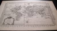
1787159181787. Ca. 1787. Very detailed map of the world on a flattened Mercator projection. With the hypothetical east coast of Australia showing New Guinea attached to Carpentaria. Despite the fact that the map was published after Captain James Cook's explorations only Tasman's west coast of New Zealand is shown. With great detail in the oceans and with recent discoveries noted in the south and north Pacific Canada and Greenland. The prime meridian runs through Paris; with an elaborate title cartouche and compass rose. Uncolored on laid paper. Image size: 16 1/2 x 11 1/2". Paper size: 20 x 13 1/4". Pin hole at center fold otherwise very good. unknown
17452430061745. Map. Engraving with hand coloring. Image measures 19 x 25.5".<br/><br/> This beautiful map depicts the Neuchatel region of Switzerland showing the town of Neuchatel as well as Lake Neuchatel. It is based on a 1710 original by David François de Merveilleux redone by Guillaume de L'Isle and published by Philippe Buache. The map is is finely detailed with abbeys and priories castles battlefields mineral springs and forests. An elegant compass rose is shown in Lake Neuchatel and a decorative title cartouche at the top of the map is flanked on either side by historical and geographical text in French. The map dates to the reign of Frederick I of Prussia who presided over Neuchatel's golden age and ushered in a period of expansion in commerce banking and industry such as watchmaking and lace. The map is in excellent condition with wide margins as issued and no chips or tears. Minor stains in margins not affecting the image. Philippe Buache 1700--1773 was a French geographer who trained under the geographer Guillaume De L'Isle 1675--1726 a French cartographer known for his popular and accurate maps of Europe and the newly explored Americas and Africa. He is important as the first "scientific" cartographer who incorporated the most current information on exploration and topography into his maps.<br/><br/> unknown books
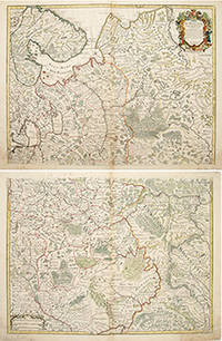
170655266Atlas de Geographie. Guillaume Delisle Quai de Horloge. 1706. The map is in two parts north and south they are both of equal size. The northern map has a decorated cartouche and shows the north of white Russia and part of the arctic coast reaches as far south as the Principality of Galicz. The southern map stretches to the northern tip of the Black Sea the Volga in the East and a tiny bit of the Baltic Coast in the North West. There are some text on the map about the inhabitants rivers etc A very handsome pair of maps. The plates were originally made by Delisle around 1700. Covens and Mortimer reissued them in the Atlas Novissimo 1730-40. Phillipe Buache de l'Isle's successor and son in law continued to reissue Delisle's maps in the later eighteenth century. The price is for the pair. Copper engraving. Very good condition slightly browned margins some sporadic spotting. Some nicks lower margins. Original colour. Size: 66 x 50 cm. 26 x 19½ inches unknown
178778676Paris. c.1787. Sheet size: 332 x 472 mm Plate size: 264 x 393 mm. Copper engraving. Hand colouring. In fine condition. unknown
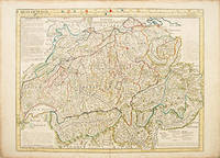
175052843Paris. c.1750. A large clear and detailed map of Switzerland outlining the cantons with their coats of arms at upper border alongside title. 'Avertissement' at at top left with description of the area. Atlas Geographique des Quatre Parties du Monde. Copper engraving. Very good condition a few waterstains at the slightly darkened edges not affecting map 2cm closed tear at lower centrefold Original colour. Size: 64 x 49 cm. unknown
1772331985Paris: Academie des Sciences 1772. Map. Engraving. Image measures 12.25" x 15.5".<br/> <br/> This fascinating sheet contains two maps-- a French map of Western discoveries in Russia and the Northwest Passage area and a Japanese map of the same area taken from Japan by German explorer Englebert Kaempfer. Both maps contain notes on discoveries and speculations islands land masses and bodies of water. This map offers an interesting comparison between Eastern and Western perspectives and achievement in cartography and on the first mapping of Russia and the Northwest Passage. This was published as a supplement to Diderot's Encyclopedie. In very good condition wiith some scattered light foxing. <br> <br> Robert de Vaugondy 1688-1766 was an important French mapmaker during the 18th century. His "Atlas Universel" was one of the most significant atlases of the period integrating older sources with more modern surveyed maps in order to convey correct geographical and political information. <br> <br> Philippe Buache 1700--1773 was a French geographer who trained under the geographer Guillaume Delisle. This map of Lake Geneva is a fine example of his work.<br/> <br/> Academie des Sciences unknown
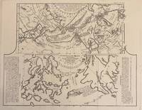
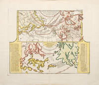
1752523481752. A fascinating map showing two early maps of the American north-west. the upper map shows the new discoveries in the northern Pacific. The coastline of Asia is more or less correctly drawn but America is wildly inaccurate. The lower part is an extract from a Japanese map brought back to Europe by Kaempfer for the collection of Hans Sloane. This shows the same area even more fancifully. The lower map is flanked by texts - an 'Avertissement'. and an extract from Kaempfer's travels. Worm hole in bottom margin not affecting the image Copper engraving. Fine condition good margins. Later colouring. Size: 40 x 32 cm. 15½ x 12½ inches. unknown
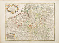
178052801Paris. 1780. Ornamental cartouche seven different national scales a good clear map showing the regions of Holland Belgium and Luxembourg. The plates were originally made by De l'Isle around 1700. Covens and Mortimer reissued them in the Atlas Novissimo 1730-40. Phillipe Buache de l'Isle's successor and son in law continued to reissue de l'Isle's maps in the later eighteenth century Copper engraving. The map itself is in fine condition there are a couple of faint watermarks at top and left hand margins there is a small tear at top right margin with a little loss not affecting map Original colour. Size: 62 x 47.5 cm. unknown