DELISLE, Guillaume, & Philippe BuacheBiblio.com
314 résultats
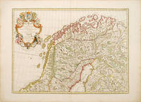
178852804Dezauche Paris. 1788 French. Fine elaborate cartouche although the title suggests a map of Denmark this handsome map shows the northern halves of Sweden Norway and Finland. The plates were originally made by De l'Isle around 1700. Covens and Mortimer reissued them in the Atlas Novissimo 1730-40. Phillipe Buache de l'Isle's successor and son in law continued to reissue de l'Isle's maps in the later eighteenth century Copper engraving. Fine condition good margins a little browned Original colour. Size: 62 x 45 cm. 24½ x 17½ inches unknown
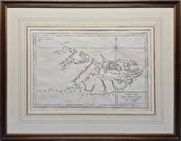
1787026741Paris: Privately Printed. 1st thus n.d. 1787; originally published in 1771. 360 x 240mm 540 x 420mm framed. Copperplate engraving; mounted with gilt border and framed in gilt decorated wood with glass. This map shows no west coast on the western island and other than Is. Sebaldes gives only two place-names. Point A indicates "Lieu ou étoit l'établissement François occupe aujourd'hui par les Espagnols." and Point B "Ou l'on soupçone que les Anglois sont établis." Appears in Bougainville's "Voyage autour du Monde" 1771 and 1772 in "Receuil des Cartes pour l'Histoire Moderne" par l'Abbé de Marsy et M. Richer extrait de "l'Atlas Universel" par Philippe de Pretot 1787 &c. Fordham 18. Framed by The Parker Gallery London BADA. VG condition with very slight fold as issued . Very Good. No Binding. 1787. Privately Printed unknown
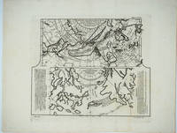
177925866Livourne 1779. Maps. A map of Asia Canada Japan and the Arctic regions with two maps on one sheet. The upper map shows the European view of the northern Pacific showing western North America from New Orleans west with a clearly depicted Mer de l'Ouest to Kamchatka and northern Japan. The lower map shows the Japanese perception of the same region with very sketchy and inaccurate features in North America and a larger showing of the Japanese islands. The Japanese map has no depiction of Alaska.<br /> <br /> Copper engraving with two maps on one sheet. Includes text. Upper margin: "Suppl. 6e carte." Lower margin: "189 190"; "R. Spadaccini Sculp." This conforms with the edition at the Univ. of British Columbia mccormick_174. According to UBC "This atlas map removed from source: Robert de Vaugondy Didier. Recueil de 10 cartes.traitant particulierement de l'Amerique du Nord et des regions arctiques d'apres les relations les plus authentiques depuis le commencement du 17 siecle reproduites. 1 p.l. 10 fold. maps. 8. Livourne 1779."<br /> <br /> The title translates - Map of new discoveries prepared by Phil. Buache the King's Geographer presented to the Academy of Science August 9 1752 and approved in its meeting on the 6th of September following. and Excerpt from a Japanese map of the universe brought to Europe by Kaempfer and deposited in the cabinet of the late Mr. Han-Sloane president of the Royal Society of London. <br /> <br /> The map also appeared in a supplement to Diderot and d'Alembert's "Encyclopédie" without the lower margin text.<br /> <br /> Printed area measures 12 1/2 x 14" on paper 15 3/4 x 20 1/4". Very good overall with some unevenness in paper production causing the lower margin to look somewhat mottled. unknown
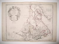
1783242998Dezauche 1783. Map. Engraving with hand coloring. Image measures 19.75 x 25.5". Sheet measures 21.5 x 30".<br/> <br/> This map of Canada and the northern United States extends north from around the latitude of Baltimore all the way up to Baffin Bay along the shore of Greenland. Published by Jean-Claude Dezuache in 1783 it is the eighth revision of a map originally published by De L'Isle in 1703. The map is notable as the first to include "Etats-Unis" in the title coming as it did on the heels of the American Revolution. In fact this appearance is one of the earliest appearances of the name United States Etats-Unis on a printed map. The map is compelling in its accuracy particularly with regard to the Great Lakes depicting them as fully enclosed and properly placed in longitude and latitude. There is also excellent detail around the Hudson and Mississippi Rivers. The elaborate cartouche is decorated with a beaver natives one of whom is bearing a scalp and Jesuit explorers. Furthermore the fleurs-de-lis that previously adorned the shield at the top of the cartouche has been erased and the crown converted into a halo suspended above an orb a response to the execution of the king following the French Revolution Below a table of colors delineates the boundaries of the United States and European possessions. Indian nations are also labeled. The map is in excellent condition with wide margins as issued. Guillaume De L'Isle 1675--1726 was a French cartographer known for his popular and accurate maps of Europe and the newly explored Americas and Africa. He is important as the first "scientific" cartographer who incorporated the most current information on exploration and topography into his maps. Philippe Buache 1700--1773 was a student of De L'Isle and became one of the most active proponents of the so-called school of theoretical cartography active in mid-18th century France. This map is fascinating record from a remarkable moment in North American history.<br/> <br/> Dezauche unknown
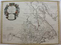
1718M9192Paris c. 1718. Very Good. Notes: Fifth State. Scarce. "De l'Isle's map of Canada is one of the most outstanding maps of Canada of the 17th and early 18th centuries. Typical of all of his work the information that went into his map of Canada was the result of careful and painstaking research. It thus seems somewhat surprising that the dubious discoveries of Lahontan should have been so readily accepted and included on his map of Canada. De l'Isle's careful research resulted in the first map of Canada to present the whole of the Great Lakes correctly. In addition the position of the lakes relative to Hudson Bay is also correct and the Avalon Peninsula is shown much more realistically than in previous maps of Canada. Of considerable significance the geography of the coastal regions of James and Hudson Bays together with their major river systems is presented b De l'Isle with a surprising degree of accuracy."-Kershaw I page 275. Size : 497x645 mm 19.57x25.39 Inches Coloring: Hand Colored Reference: Karpinski p.40 and XXXI Tooley p.20 Kershaw 310 Schwartz pl. 80. Category: Maps Canada; Maps North America Great Lakes; unknown
1783242998Dezauche 1783. Map. Engraving with hand coloring. Image measures 19.75 x 25.5". Sheet measures 21.5 x 30".<br/><br/> This map of Canada and the northern United States extends north from around the latitude of Baltimore all the way up to Baffin Bay along the shore of Greenland. Published by Jean-Claude Dezuache in 1783 it is the eighth revision of a map originally published by De L'Isle in 1703. The map is notable as the first to include "Etats-Unis" in the title coming as it did on the heels of the American Revolution. In fact this appearance is one of the earliest appearances of the name United States Etats-Unis on a printed map. The map is compelling in its accuracy particularly with regard to the Great Lakes depicting them as fully enclosed and properly placed in longitude and latitude. There is also excellent detail around the Hudson and Mississippi Rivers. The elaborate cartouche is decorated with a beaver natives one of whom is bearing a scalp and Jesuit explorers. Furthermore the fleurs-de-lis that previously adorned the shield at the top of the cartouche has been erased and the crown converted into a halo suspended above an orb a response to the execution of the king following the French Revolution Below a table of colors delineates the boundaries of the United States and European possessions. Indian nations are also labeled. The map is in excellent condition with wide margins as issued. Guillaume De L'Isle 1675--1726 was a French cartographer known for his popular and accurate maps of Europe and the newly explored Americas and Africa. He is important as the first "scientific" cartographer who incorporated the most current information on exploration and topography into his maps. Philippe Buache 1700--1773 was a student of De L'Isle and became one of the most active proponents of the so-called school of theoretical cartography active in mid-18th century France. This map is fascinating record from a remarkable moment in North American history.<br/><br/> Dezauche unknown books
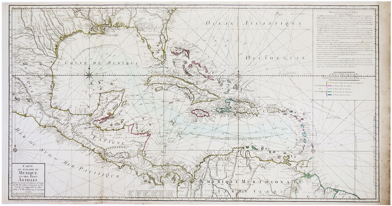
1780LBW-3496Paris, Dezauche, 1780. 494 x 925 mm.
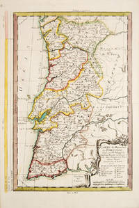
177353884Cosmographie Universal. 1773. Attractive map of Portugal. Title and scales at lower right. Copper engraving. Fine condition. Original outline colour. Size: 270 x 375 mm. 10½ x 15 inches. unknown
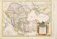
178765677Paris. c.1787. An interesting map of those countries that comprised the Turkish Empire in Europe. Each separate country is coloured in outline. A handsome and very decorative title cartouche is viewed in lower left corner. Size: 290 x 430 mm. Copperplate engraving with later additional hand colour. Good condition. Some minor foxing. unknown
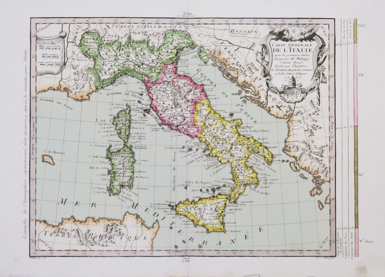
1767LBW-46651767. 275 x 375 mm.
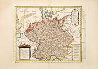
178753093Paris. 1787. Map of the whole of Germany which at the time included the Netherlands cartouche at lower right scales at lower left. Published in the Atlas Universal. Copper engraving. Fine condition Later colour. Size: 37 x 28.5 cm. unknown
1766LBW-46541766. 385 x 264 mm.
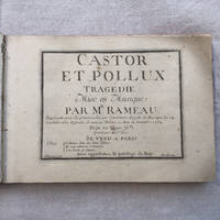
175417<p>Jean-Philippe RAMEAU CASTOR ET POLLUX</p><p>First edition of the definitive version very different from the first attempt of 1737 of the most important and successful opera of Jean-Philippe Rameau. A very good clean copy.</p><p>TrageÌdie mise en Musique par Mr. Rameau repreÌsenteÌe pour la premieÌ€re fois par l'AcadeÌmie Royale de Musique Le 24 Octobre 1737. Refondu Et remis au TheÌaÌ‚tre au Mois de DeÌcembre 1754. GraveÌe par Le Sr. Hue. A Paris Chez l'Auteur Rue des bons Enfans Et aux adresses ordinaires AÌ€ la Porte de l'OpeÌra.</p><p>In-4 aÌ€ l'italienne 1â„2 veÌlin ivoire aÌ€ coins pieÌ€ce de titre papier en forme de cÅ“ur colleÌe au 1er plat tranches rouges Reliure ancienne très légèrement postérieure. 1 f. de titre 163 pages.</p><p>Bel exemplaire de l'édition originale du plus important opéra de J.Ph Rameau et son plus grand succès qui connut plus de 250 représentations à Paris avant la Révolution française. Après une première version créée en 1737 l'opéra fut entièrement refondu pour atteindre à un équilibre exceptionnel dans sa version définitive très différente de la première : le livret est devenu parfaitement limpide et l'ensemble d'une concision et d'une variété admirables. Le coup de génie des fameuses trois notes faisant la transition entre la plainte du chÅ“ur des Spartiates Que tout gémisse et le célébrissime tristes Apprêts apparaît ici pour la première fois. Le déchirant Prélude du cinquième Acte est aussi une nouvelle version caractéristique de la plus grande maîtrise de Rameau au sommet de son art parmi bien d'autres exemples possibles.</p><p>Exemplaire de toute fraicheur imprimé sur vergé fort en excellent état de conservation. Menus défauts à la reliure coiffe inférieure frottements. Tache brune au dernier feuillet. Page de titre un peu salie.</p><p>On trouve relieÌs aÌ€ la suite : <br />Chant de guerre pour l'ArmeÌe du Rhin deÌdieÌe au MareÌchal Lukner. A Paris chez Bignon sans date. 3 pp. <br />Cinq airs d'Estelle et un deÌtacheÌ avec Accompagnement de ForteÌ-Piano. par Daniel Steibelt Paris chez Naderman sans date. 1 f. de titre 15 pp. Signature autographe de J.H. Nadermann 1734-1799 luthier et eÌditeur en marge du f. de titre. Rousseurs sur la pièce de Steibelt.</p><p>Photos supplémentaires sur demande.</p><p>Envoi avec suivi et assurance</p> hardcover
176910715Paris: P. Vente 1769. Contemporary gilt-ruled polished tan calf rubbed flat spine gilt à la grotesque with a gilt-lettered morocco label red edges blue silk marker. <p>A talented sculptor and frame-maker Cayeux 1688-1769 collected for six decades: “his cabinet was renowned for its examples of ‘our talented modern artists’†like Boucher van Loo and Cochin Bailey. Many lots have eighty or more drawings or prints. One copy in the U.S. In good condition contemporary title inscription On behalf of your most humble servant Cayeux tr. — penned by the deceased collector’s son Louis-Philippe d. 1776.<br /> ¶Bailey Patriotic Taste: Collecting Modern Art in Pre-Revolutionary Paris 21-22; Advielle Notice sur Philippe Cayeux passim; Lugt Répertoire des catalogues des ventes 1793.</p> P. Vente unknown
1719175851719 Collection Black Out n° 17 / Editions de la Flamme d'Or (1953) - In-12 broché de 192 pages - Belle couverture en couleurs illustrée par Jef DE WULF - Exemplaire en bon état
177921946PARIS 1779 un document, manuscrit à l'encre brune d'une page sur velin parcheminé, format 47,5 centimètres de large par 32,5 centimètres de haut, signature de Louis Philippe d'Orléans en bas au centre avec grand sceau et contre-sceau de cire rouge quasiment complet du Prince [lEmpreinte du Grand Sceau représente le Prince à cheval armé de pied en cap avec la date 1762 et le Contre-Sceau aux Armes du Prince (fleurs de lys)], FAIT A PARIS AU PALAIS ROYAL , LE 1 JUILLET 1779,
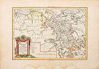
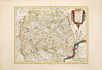
178778528Paris: 1787. An interesting map of the Lower Rhin with the Electorates of Cologne Treves Mayence and the Palatinate of the Rhin. Copper engraving. Hand coloured. Size: 294 x 430 mm Very good condition. unknown
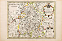
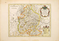
178778564Paris. 1787. An interesting map of Baviera with a very decorative cartouche. Size: 292 x 440 mm. Copperplate engraving with later hand colour. In fine condition. unknown
178778589Paris. c.1787. An interesting map of Paris with a highly decorative cartouche. Copperplate engraving with later hand colour. Sheet size: 338 x 476 mm Plate size: 280 x 405 mm In fine condition. unknown
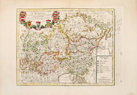
178752367Paris. 1787. Attractive Map of Bavaria with decorated cartouche at top right and 'Explication of Signes' at lower right. Published in the Atlas Universal. Copper engraving. Fine condition good margins. Later colouring. Size: 35 x 27 cm. unknown
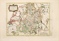
178753094Paris. 1787. Atractive map of present day Netherlands and North West part of Germany with decorative cartouche at top left scales at lower right. Published in the Atlas Universal. Copper engraving. Fine condition Later colour. Size: 38 x 28 cm. unknown
178752368Atlas Universal 1787. Attractive map of Austria which at the time included most of Southern Germany part of northeast Italy the Czech Republic and Slovenia. Title cartouche at top right with five coats of arms. Key at lower right. Copper engraving. Fine condition. Later colouring. Size: 36 x 27 cm. 14 x 10½ inches. unknown
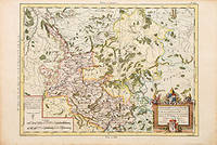
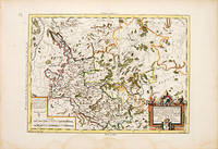
179053072Paris. c.1790. An attractive and detailed map of a part of the Rhine in central Germany. Interesting and decorative title cartouche. Copper engraving. Very good condition good margins waterstains along lower margin not affecting map Later colour. Size: 35 x 26 cm. unknown
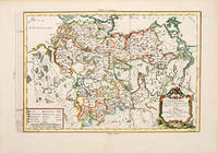
1787530901787. Map of south west Germany. Decorated cartouche at top right. 'Explication des Signes' and scales at lower left. Copper engraving. Fine condition. Later colour. 335 x 480 mm unknown
178753092Paris. 1787. An attractive map of Lower Saxony with a pleasant title cartouche at lower right scales at lower left. From the Atlas Universal. Copper engraving. Fine condition Later colour. Size: 41 x 26 cm. unknown