1 361 résultats
1865101001Philadelphia 1865. Unbound colored engraved map decorative border 14"x 11". Slight toning and aging a couple a minor chips to left edge; overall bright and clear and in very good shape. Maps are wrapped with acid free board or in rigid sleeves. The Mitchell family started to produce atlases in 1846 and continued into the early 1890s. Around 1860 S. Augustus Mitchell Jr. took over and the atlas would be called Mitchell's New General Atlas. This is an attractive colored map of Africa from the 1861 installment of that atlas. The map shows a sizeable unknown territory and not surprisingly the map presents some very different political boundaries from more modern times. A small map of the Island of St. Helena is featured in an inset. Ristow 311-313 unknown
1869101002<p>Philadelphia 1869. Unbound colored engraved map decorative border 14"x 11". Slight toning and aging; overall bright and clear and in very good shape. Maps are wrapped with acid free board or in rigid sleeves. The Mitchell family started to produce atlases in 1846 and continued into the early 1890s. Around 1860 S. Augustus Mitchell Jr. took over and the atlas would be called Mitchell's New General Atlas. This is an attractive colored map of Africa from the 1869 installment of that atlas. The map shows a sizeable unknown territory and not surprisingly the map presents some very different political boundaries from more modern times. A small map of the Island of St. Helena is featured in an inset. Ristow 311-313</p>
1861101000Philadelphia 1861. Unbound colored engraved map decorative border 14"x 11". Slight toning and aging a couple a minor chips to edges; overall bright and clear and in very good shape. Maps are wrapped with acid free board or in rigid sleeves. The Mitchell family started to produce atlases in 1846 and continued into the early 1890s. Around 1860 S. Augustus Mitchell Jr. took over and the atlas would be called Mitchell's New General Atlas. This is an attractive colored map of Africa from the 1861 installment of that atlas. The map shows a sizeable unknown territory and not surprisingly the map presents some very different political boundaries from more modern times. A small map of the Island of St. Helena is featured in an inset. Ristow 311-313
1870101015Unbound colored engraved map decorative border 14"x 11". Slight toning and aging; overall bright and clean. Maps are wrapped with acid free board or in rigid sleeves. The Mitchell family started to produce atlases in 1846 and continued into the early 1890s. Around 1860 S. Augustus Mitchell Jr. took over and the atlas would be called Mitchell's New General Atlas. This is a nice colorful map of Chicago from the 1870 installment of this atlas. Ristow 311-313.
1865106793<p>Unbound colored engraved map decorative border 11" x 14". Slight browning and aging; a couple of small nicks along edge otherwise bright and clean and very good. Maps are wrapped with acid free board or in rigid sleeves. The Mitchell family started to produce atlases in 1846 and continued into the early 1890s. Around 1860 S. Augustus Mitchell Jr. took over and the atlas would be called Mitchell's New General Atlas. This is a detailed single page map of Illinois from the 1865 installment of this atlas. There is an insert of Chicago on the map. The map shows a lot of detail with nice coloring. Extra postage may be required.</p>
1869106726Unbound colored engraved map decorative border 15" x 12". Slight browning and aging; a couple of small nicks along edge otherwise bright and clean and very good. Maps are wrapped with acid free board or in rigid sleeves. The Mitchell family started to produce atlases in 1846 and continued into the early 1890s. Around 1860 S. Augustus Mitchell Jr. took over and the atlas would be called Mitchell's New General Atlas. This is a detailed single page map of Illinois from the 1869 installment of this atlas. There is an insert of Chicago on the map. The map shows a lot of detail with nice coloring. Extra postage may be required.$85 S. Augustus Mitchell,
1870101212<p>Philadelphia 1870. Unbound colored engraved map decorative boarder 14"x 11". Slight toning and aging minor staining in margins; overall very bright and clear and in very good shape. Maps are wrapped with acid free board or in rigid sleeves. The Mitchell family started to produce atlases in 1846 and continued into the early 1890s. Around 1860 S. Augustus Mitchell Jr. took over and the atlas would be called Mitchell's New General Atlas. This is a colorful map of North America from the 1870 installment of that atlas. The map is bright and crisp and includes Russian America Alaska Greenland and Central America. May require extra postage.Ristow 311-313</p>
1861101205<p>Philadelphia 1861. Unbound colored engraved map decorative boarder 14"x 11". Slight toning and aging; overall very bright and clear and in very good shape. Maps are wrapped with acid free board or in rigid sleeves. The Mitchell family started to produce atlases in 1846 and continued into the early 1890s. Around 1860 S. Augustus Mitchell Jr. took over and the atlas would be called Mitchell's New General Atlas. This is a colorful map of North America from the 1861 installment of that atlas. The map is bright and crisp and includes Russian America Alaska Greenland and Central America. May require extra postage.Ristow 311-313</p>
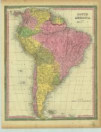
18631428Philadelphia: : S. Augustus Mitchell 1863. 13-1/2" x 11-1/2" - 34.2 x 29.2 cm. Lithograph with original hand colouring. Minor chips and browning to margins else very good. A detailed and decorative map of all of South America with scrolling foliate border. Shows towns cities ports and railroad lines. An inset map of the Proposed "Atrato-Inter-Oceanic" Canal Routes for Connecting the Atlantic and Pacific Oceans. S. Augustus Mitchell, unknown
1861101177Philadelphia 1861. Unbound colored engraved map decorative boarder 22 1/2"x 14 1/2". Some toning and aging; otherwise very good. Maps are wrapped with acid free board or in rigid sleeves. The Mitchell family started to produce atlases in 1846 and continued into the early 1890s. Around 1860 S. Augustus Mitchell Jr. took over and the atlas would be called Mitchell's New General Atlas. This is an attractive double page map of the world from the 1861 installment that atlas. Ristow 311-313 Phillips 907 unknown
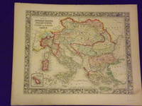
1861101210<p>Philadelphia 1861. Unbound colored engraved map decorative border 14"x 11". Slight toning and aging a little minor staining or soling in rightt margin; overall bright clear and crisp and in very good shape. Maps are wrapped with acid free board or in rigid sleeves. The Mitchell family started to produce atlases in 1846 and continued into the early 1890s. Around 1860 S. Augustus Mitchell Jr. took over and the atlas would be called Mitchell's New General Atlas. This is a very attractive single page colored map of mostly modern day Germany Italy and Turkey from the 1861 installment of that atlas. American maps with a complete picture of Italy are often hard to find. Ristow 311-313</p>
1861101045Philadelphia 1861. Unbound colored engraved map decorative boarder 14"x 11". Some toning and aging a small margin stain; otherwise bright and clean. Maps are wrapped with acid free board or in rigid sleeves. The Mitchell family started to produce atlases in 1846 and continued into the early 1890s. Around 1860 S. Augustus Mitchell Jr. took over and the atlas would be called Mitchell's New General Atlas. This is a colorful map of Minnesota and Dakota from the 1861 installment of that atlas. Lands of the Cree and Dakota Indians are included on the map. Ristow 311-313 unknown
1898241108-MB11George W. Jacobs & Co. 1898. Very Good Hardcover pictorial cover with illustrations previous owner's inscription. Hardcover. Very Good/No Dust Cover. George W. Jacobs & Co. Hardcover
1895517269Philadelphia: Charles H. Banes 1895. Hardcover. Near Fine. First edition. Octavo. 75pp. Illustrated. Pale green decorative cloth. A bit of very faint soiling to cloth else a near fine good bright copy. Not in Wright Fiction III which does locate another novel by this author Colonel published in 1896. Portions of text are written in a stereotypical Southern Black dialect. Charles H. Banes hardcover
1860103229<p>Mitchell Samuel Augustus Jr. Plan of Baltimore. Philadelphia: 1860. Unbound colored engraved map decorative border 14" x 11". Slight browning and aging; otherwise bright and clean and very good. Maps are wrapped with acid free board or in rigid sleeves. The Mitchell family started to produce atlases in 1846 and continued into the early 1890s. Around 1860 S. Augustus Mitchell Jr. took over and the atlas would be called Mitchell's New General Atlas. This is a detailed single page map of Baltimore from the 1860 installment of this atlas. The map shows a lot of street detail with nice coloring. Extra postage may be required. Ristow 311-313. # 103229</p>
1861101070Philadelphia 1861. Unbound colored engraved map decorative boarder 14"x 11". Slight toning and aging a few small chips at the top edge; overall bright and clear and in very good shape. Maps are wrapped with acid free board or in rigid sleeves. The Mitchell family started to produce atlases in 1846 and continued into the early 1890s. Around 1860 S. Augustus Mitchell Jr. took over and the atlas would be called Mitchell's New General Atlas. This is a colorful map of the city of Philadelphia from the 1861 installment of that atlas. Ristow 311-313 unknown
1864101071Philadelphia 1864. Unbound colored engraved map decorative boarder 14"x 11". Slight toning and aging; overall bright and clear and in very good shape. Maps are wrapped with acid free board or in rigid sleeves. The Mitchell family started to produce atlases in 1846 and continued into the early 1890s. Around 1860 S. Augustus Mitchell Jr. took over and the atlas would be called Mitchell's New General Atlas. This is a colorful map of the city of Philadelphia from the 1864 installment of that atlas. Ristow 311-313 unknown
1882101073Philadelphia: Bradley 1882. Unbound colored engraved map decorative boarder 22 1/2"x 14 1/2". Slight toning and aging; overall bright and clear and in very good shape. Maps are wrapped with acid free board or in rigid sleeves. The Mitchell family started to produce atlases in 1846 and continued into the early 1890s. Around 1860 S. Augustus Mitchell Jr. took over and the atlas would be called Mitchell's New General Atlas. This is a fairly colorful double page map of the city of Philadelphia from the 1882 installment. The Camden portion of the map is to the side and almost set up as an inset. Ristow 311-313 Phillips 907 Bradley unknown
184630766Philadelphia 1846. Other. Original hand color in outline and wash when published. . 394 by 319mm 15½ by 12½ inches. Lithograph period hand color in wash and outline when published. unknown
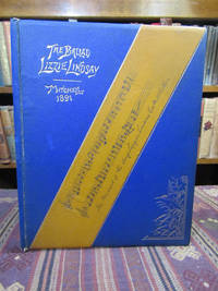
1895045223Brighton: Privately Printed / J. Bral and Son 1895. Second Edition. . Hardcover. Very Good. 4to - over 9¾ - 12" tall. Quarto. Unpaginated. Slim hardback bound in blue and tan cloth with cover designs embossed in gilt and in black. Light to moderate wear to the binding. Bevelled edges and all edges of the text block are gilt. Blue marbled endpapers. The frontispiece is an actual photographic image or albumen print of George Mitchell with his facsimile signature beneath A sound copy with clean text. A very slim book. There are 3 pages of the Preface a page showing a couple of lines of the music in facsimile replicated on the front cover 3 pages of the lyrics and then three pages of "Notes of the Mitchell Famaily and George Mitchell's Recollection of the Song "Lizie Lindsay." Scarce. <br/> <br/> Privately Printed / J. Bral and Son hardcover
190044211The Century Company 1900. MITCHELL S. Weir. THE WAGER AND OTHER POEMS. NY: The Century Company 1900. 16mo. tan quarter-calf leather & marbled boards. First Edition. Signed. Initialed by Mitchell on the half-title page: "by S. W. M." Very Good some rubbing quarter-inch loss at head of spine front cover reattached. $85.00. The Century Company unknown
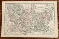
1865249Philadelphia: E. H. Butler & Co 1865. 17 1/4 x 10 3/4 inches. Very good with separation at lower centerfold expertly repaired with archival mending tape. This is a broad regional midwestern map from "Mitchell's New Reference Atlas for the Use of Colleges Libraries Families and Counting Houses." The states are delineated by color with firm linear county designations. Important to the overall presentation are the railroads that dominate the connections between urban places. The interstices draw their identity from a format that is light on places maps. Overall this is a Civil War look at part of the polarity of the north. This map should be in any serious Civil War or transportation collection. E. H. Butler & Co unknown
1884102638P.F. Collier. 1884. Hardcover. UsedGood. Hardcover; scuffing soiling and edge wear to exterior; corners bumped; cl oth wearing at ends of spine; former owner's stamping on front endpaper; bi nding reinforced; fading to pages; in good condition with clean text. No du st jacket. . P.F. Collier hardcover
1883225111.XLondon: Kegan Paul Trench & Co. Ltd. 1883. First Edition . Hardcover. Good. 295 b/w illustrations. 4 b/w plates. 766 pages in excellent condition. Small holes on title page. Dark green endpapers. Both boards loose. Green cloth with gilt titles and decoration. Corners bumped light wear along the edges stains. G. <br/> <br/> Kegan Paul, Trench & Co. Ltd. hardcover
1899mon0000431472Longmans Green 1899-01-01. Hardcover. Acceptable. in x in x in. Ex-library book usual markings. Well read with some wear but still very useable. Longmans, Green hardcover