MITCHELL, Samuel Augustus JrBiblio.com
1 372 résultats
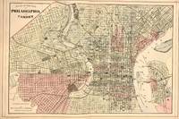
1884321800Philadelphia: Mitchell Samuel Augustus Jr. 1884. unbound. Map. Engraving with original hand coloring. Image measures 14.5" x 22".<br/> <br/> This fantastic double page city plan or town plan of Philadelphia Pennsylvania includes downtown Philadelphia and Camden and is one of the most beautiful maps of Philadelphia to be included in a 19th century atlas. Shows streets notable buildings parks railroads etc. Unlike most maps of Philadelphia from the period this map depicts the regions west of the Schuylkill River as far west as Millbourne and Cobbs Creek. The map is in very good condition with minor toning along edges and along centerfold. Dated and copyrighted. Samuel Augustus Mitchell Sr. 1792-1868 was one of the leaders in American cartography of the 19th century and pioneered the conversion of engraved map plates to more affordable lithographic plates. His son Samuel Augustus Mitchell Jr. continued his father's successful mapmaking and publishing business and was one of the most prolific and renowned 19th century American publishers.<br/> <br/> Mitchell, Samuel Augustus Jr. unknown
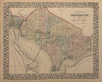
1882334639Philadelphia: Mitchell Samuel Augustus Jr. 1882. unbound. Gamble W.H. Map. Engraving with original hand coloring. Image measures 11" x 13 3/4"<br/> <br/> Beautiful city plan of Washington D.C. with streets and major buildings labeled. Hand colored by ward. Includes Georgetown. Drawn and engraved by W.H. Gamble. In excellent condition. <br> <Br> Samuel Augustus Mitchell Sr. 1792-1868 was one of the leaders in American cartography of the 19th century and pioneered the conversion of engraved map plates to more affordable lithographic plates. His son Samuel Augustus Mitchell Jr. continued his father's successful mapmaking and publishing business and was one of the most prolific and renowned 19th century American publishers.<br/> <br/> Mitchell, Samuel Augustus Jr. unknown
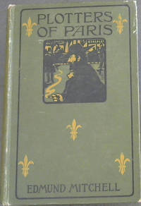
1900osgxHutchinson & Co 1900. First Edition. Hardcover. Good/No Jacket. the original green pictorial boards are worn marked and a little frayed but not excessively so given the book's age. there are no inscriptions but there is foxing and the front end page has darkened. the binding is strong. the condition is given in terms of the book's age. Our orders are shipped using tracked courier delivery services. Hutchinson & Co hardcover
1895476681Oxford : Clarendon Press 1895. First Edition. Hardcover. Good library copy in the original title-blocked white cloth over bevelled boards now dust-dulled. Joints and endbands somewhat rubbed with minor tearing. Text edges preliminary and final leaves foxed with some remaining library marks. Very strong text block remaining bright and clean with unread and unopened pages. A well-preserved example overall. Physical description; xxii 352 pages : illustrations maps ; 26 cm. Notes; Errata slip inserted. Some Greek text. Subjects; Phrygia – History. Phrygia – Historical geography. Inscriptions Greek – Turkey – Phrygia. Bishops – Turkey – Phrygia. Cities and towns Ancient – Turkey – Phrygia. Turkey – Historical geography. Oxford : Clarendon Press hardcover
18756335Providence Rhode Island: Self-published 1875. 1st. Cloth. Collectible; Very Good. The uncommon 1875 1st edition. Tight and VG in its original brown cloth with bright gilt-lettering at the spine. Very light rubbing to the panels neat former owner name at the front pastedown scattered light pencil to the text. Octavo 99 pgs. <br/><br/> Self-published hardcover books
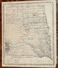
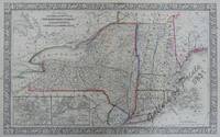
1882379Philadelphia: S. Augustus Mitchell 1882. 14 1/4 x 11 3/4 inches. Very good Condition. Beautiful map printed in color near the end of the Dakota Territory era. Both future states are included in the map as one territory. The division came in 1889. S. Augustus Mitchell unknown
18958707New York: The Century Co 1895. 1st. Hardcover. Collectible; Very Good. The 1895 1st edition in its decorative light-brown suede. Clean and VG with patterned blindstamping to the panels. 64mo miniature 165 pgs. all edges gilt. An elegant celebration of the Portuguese wine Madeira. <br/><br/> The Century Co hardcover books
184441322Prato: Tip. Giachetti 1844. Tip. Giachetti unknown
1851879M20New York: Charles Scribner 1851. Leather. Very Good. 7.5" by 5.5". Not Stated. A charming anecdotal account of Donald Grant Mitchell's travels through Europe. An early edition of this work in a half vellum binding with gilt detailing to the spine. Donald Grant Mitchell 1822-1908 was an American essayist and novelist who wrote under the pen name Ik Marvel. He was particularly interested in agriculture and landscape gardening. This is an account of his travels through Europe starting in Torquay and journeying through France the Netherlands and Belgium. In a half vellum binding. Externally smart with light shelf wear to the boards and extremities. Internally firmly bound. A touch of age toning to pages with the odd spot. Ink inscription to page 336. Very Good Charles Scribner hardcover
1845GEN9-E-35Philadelphia: S. Augustus Mitchell 1845. Cloth. Near Fine. 9" by 6". None. A companion volume to Mitchell's 'Map of The World'. This volume has a wealth of information on varying countries from individual states of the United States to continents. Written by Samuel Augustus Mitchell an American geographer. He published many geography textbooks and maps. This work is the companion textbook to his previously published map of the world. Lacking the map. In a quarter cloth binding with paper covered boards. Externally excellent with minor shelfwear to the head and tail of spine. Internally firmly bound. Pages are bright with spots to the first and last few pages. Near Fine S. Augustus Mitchell hardcover
1885289945Philadelphia.: Lea Brothers & Co. 1885. 2nd Edition. Publisher’s green cloth blind ruled borders gilt spine title. Very good some darkening and a spot to spine contents tight and unmarked. 20.2x13 cm. Mitchell was a noted neurologist and also an author of popular fiction. Virginia Woolf was one of his famous patients Lea Brothers & Co. hardcover
18669831<p>lithograph map from 'Mitchell's New General Atlas' pl. 16 insets pls. 17 & 18 hand-coloured county boundaries. Reference: Phillips Atlases 848. Condition: professionally repaired tears at left and right margin into plate with slight smudges and water stains with paper creases.</p> S. Augustus Mitchell, Jr., Philadelphia.
1866788F36Montrose: George Walker 1866. First edition. Cloth. Very Good. 8" by 5.5". None. The scarce first edition of this small work of Scottish local history. The scarce first edition history of this small Scottish coastal town located between Aberdeen and Dundee.In author and resident of the town David Mitchell's preface he notes that 'two years at least would be required to investigate the antiquities of the town - indeed something worthy of record occurs almost every day'. This history is arranged chronologically beginning with the town's early history prior to 1600 and concluding with a discussion of the population and industry of the region as it was at time of writing in the 1860s.With the former owner's label of Dorothy Morrison of Montrose to the front free endpaper. In the publisher's original cloth binding. Bumping to extremities with fading to back strip. Former owner's label to front free endpaper. Internally firmly bound. Pages clean and bright. Very Good George Walker hardcover
1886024132Washington: The Smithsonian Institution 1886. Book. Fine. Hardback. First Edition. Folio. From Smithsonian Contributions to knowledge vol. XXVI dated 1890; pp ix 1 186; 5 chromolithographic plates. Modern blue cloth binding fine. Contents clean and tight pages crisp discreet contemporary Geological Society of London stamps to the reverse of the plates and general title otherwise unmarked. A fine tight copy. The Smithsonian Institution Hardcover
1863biblio37610<p>New York: Charles Scribner's Sons; 2d Edition with New Preface 1863. 263 pages. DarkGreen cloth Gilt spine title no dj. NearFine Hardcover No Wear. Clean Unmarked throughout Excellent original binding and hinges. 7.5"x5.0"x0.9". be26803.</p> Charles Scribner's Sons hardcover
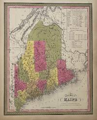
1847310373Philadelphia: S. A. Mitchell 1847. unbound. Map. Lithograph with original hand coloring. Image measures 14 7/8" x 12".<br/> <br/> Excellent map of Maine showing all counties railroads major routes and waterways. Two tables at the top of the page list population over time. Small chips to lower margin not affecting the image. From the 1847 edition of Mitchell's seminal New Universal Atlas. This is State XII of this map Thompson 84.<br> <br> Samuel Augustus Mitchell Sr. 1792-1868 was one of the leaders in American cartography of the 19th century and pioneered the conversion of engraved map plates to more affordable lithographic plates. His son Samuel Augustus Mitchell Jr. continued his father's successful mapmaking and publishing business and was one of the most prolific and renowned 19th century American publishers.<br/> <br/> S. A. Mitchell unknown
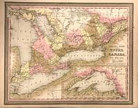
1850321865Philadelphia: Samuel Augustus Mitchell Jr. 1850. unbound. Map. Lithograph with original hand coloring. Image measures 14" x 17".<br/> <br/> This is a lovely circa 1850 Mitchell map of Ontario Canada depicts the province in its entirety. Centered on Toronto the map shows "Canada West" which was previously known as "Upper Canada" in great detail. An inset of the northwest portion of the province is included in the lower right quadrant and is centered on Lake Superior. Color coded by district mountains lakes rivers and other topographical features are noted throughout. Wilberforce tract is noted along with 'Indian Land' and fur companies. In good condition with minor foxing. <br> <br> Samuel Augustus Mitchell Sr. 1792-1868 was one of the leaders in American cartography of the 19th century and pioneered the conversion of engraved map plates to more affordable lithographic plates. His son Samuel Augustus Mitchell Jr. continued his father's successful mapmaking and publishing business and was one of the most prolific and renowned 19th century American publishers.<br> <br> Mitchell acquired the plates of Tanners Universal Atlas from it's publisher Carey and Hart in 1846 and went on to remove the 'Carey and Hart' vine border with the traditional strap work border distinctive to Mitchell. Mitchell's name appears in this addition. This is a fine example of his work.<br/> <br/> Samuel Augustus Mitchell Jr. unknown
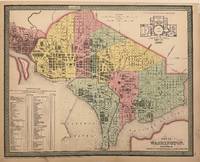
1854334638Philadelphia: Thomas Cowperthwait & Co 1854. Map. Engraving with original hand color. Image measures 12 5/8" x 15 1/2"<br/> <br/> This detailed map of Washington D.C. was published in Thomas Cowperthwait's 1854 edition of Mitchell's "New Universal Atlas." The map depicts the city from Georgetown to the Anacostia River. Colored to depict wards the map includes references to individual streets parks churches hotels railroads bridges creeks and important buildings. In the upper right corner is a Plan of the Principal Floor of the Capitol. The map is in very good condition with some wear to left margin from the binding - not affecting the image.<br> <br> Samuel Augustus Mitchell Sr. 1792-1868 was one of the leaders in American cartography of the 19th century and pioneered the conversion of engraved map plates to more affordable lithographic plates. His son Samuel Augustus Mitchell Jr. continued his father's successful mapmaking and publishing business and was one of the most prolific and renowned 19th century American publishers.<br> <br> Thomas Cowperthwait & Co. took over publication of S. A. Mitchell's important "Universal Atlas" in 1850 and continued to produce updated maps that were considered some of the best commercial cartography of the 19th century.<br/> <br/> Thomas Cowperthwait & Co unknown
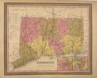
1846333853Philadelphia: S. Augustus Mitchell 1846. unbound. Map. Engraving with original hand coloring. Philadelphia: H.N. Burroughs 1846. Image measures 12 1/4" x 14 3/4".<br/> <br/> First edition map of Connecticut divided into counties showing railroads major routes and notable buildings. A statistical table lists population in various towns counties and eras. Insets of Hartford and New Haven. Canals are delineated by hand in blue and railroads in orange. Toning and minor chips to margins not affecting the image. <Br> <br> Samuel Augustus Mitchell Sr. 1792-1868 published this map as part of the first edition of his seminal New Universal Atlas. Mitchell is one of the pioneers in American cartography of the 19th century and led the conversion of engraved map plates to more affordable lithographic plates.<br/> <br/> S. Augustus Mitchell unknown
1835059621London: John Murray Albermarle Street 1835. First Edition . Hardcover. Very Good Plus. 8vo. LONDON : 1835. Greek text with notes in English. Hardback. Brown cloth gilt lettered spine. Untrimmed edges as issued. Bright tight and clean. Minor wear only. Ex University Library; with gilt Glasgow University name to spine foot and bookplate; no other internal markings. VERY GOOD. xiii ii 260 pages. SCARCE. 8vo. THE WASPS is the fourth in chronological order of the eleven surviving plays by Aristophanes the master of an ancient genre of drama called 'Old Comedy'. It was produced at the Lenaia festival in 422 BC a time when Athens was enjoying a brief respite from the Peloponnesian War following a one-year truce with Sparta. As in his other early plays Aristophanes satirizes the demagogue Cleon but in The Wasps he also ridicules one of the Athenian institutions that provided Cleon with his power base: the law courts. The play has been thought to exemplify the conventions of Old Comedy better than any other play and it has been considered to be one of the world's greatest comedies. 8vo. Will be well-packed for posting/shipping. London: John Murray Albermarle Street <br/> <br/> John Murray, Albermarle Street hardcover
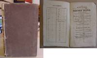
181519706Printed by W Glindon Rupert Street Haymarket For The Author & sold by G Robinson 25 Paternoster Row; H Colburn Conduit Street Hanover Square; Bell And Bradfute Edinburgh & John Cumming Dublin 1815. 1st edition. Hardback. Original boards G. viii72pp engraved frontis & 3 engraved plates spine deffective & partly missing contents spotted and a little loose a good copy of an uncommon book. Slim treatise which was reprinted several times in the 19th century on Short Hand. The author learnt Short Hand himself from the system detailed in the Encyclopaedia Britannica & his own system is a refinement of that same system. Printed by W Glindon, Rupert Street, Haymarket For The Author & sold by G Robinson 25 Paternoster Row; H Colburn, Conduit St hardcover
1850964F34Philadelphia: Thomas Cowperthwait & Co for James A. Bill 1850 . Leather. Very Good. 9.5" by 6.5". Not Stated. Charmingly illustrated throughout this is S. Augustus Mitchell's informative guide to global geography aimed at educating young Americans. A scarce work in all editions Mitchell first published this work in 1842.Illustrated with 'upwards of nine hundred' vignette engravings.This geographical textbook was intended for educational use providing a descriptive overview of the physical and political features of various nations and regions.Mitchell a noted American geographer and atlas publisher organised the book into regional sections covering topics such as climate population natural resources and principal cities.This publication was part of a broader effort to standardise geographic teaching in mid-19th-century American classrooms. In a full calf binding with blind tooling. Significant fading and rubbing to back strip with further rubbing to joints. Tail of front joint starting with board firmly held. Internally firmly bound. Title page age toned with handling marks. Tide marks to fore edge of first 60 pages with pages otherwise clean and bright. Very Good Thomas, Cowperthwait & Co for James A. Bill hardcover
18980582741898. Original Manuscript . No Binding. Very Good. Two Page Autograph Manuscript Poem Written In A Fine Cursive Hand Dated Christmas 1898 At End And Appears To Be Written At That Time. May Have Been Written By Writer/Editor Edmund Mitchell As It Was With His Journal Etc. <br/> <br/> unknown
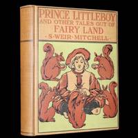
18991577212024093<p>Author: Silas Weir Mitchell. <br />Title: Prince Little Boy and Other Tales Out of Fairy Land.<br />Publisher: New York The Century Co. 1899.<br />Language: Text in English.<br />Size: 8.5" X 6.5".<br />Pages: ix-157 pages.<br />Binding: Attractive and very good original decorated cloth binding featuring a colorful depiction of "Prince Little Boy" surrounded by squirrels hinges fine overall slightly scuffed - as shown spine gilt faded - as shown under a protective removable mylar cover. <br />Content: Very good content bright tight and clean rare light foxing - as shown. <br />Illustrations: Complete with nine full-page illustrations and some other in-text illustrations.</p><p>Estimate: Scarce with no or few other copies in this binding variant available for sale worldwide.</p><p>The book: Scarce edition of "Prince Little Boy and Other Tales Out of Fairy Land" a delightful collection of fairy tales crafted by S. Weir Mitchell. This 1899 edition transports readers to a magical world with stories such as "The Wolf That Wanted a Doctor" and "The Tale of the Great Giant Smokey Pokey" appealing to both young readers and collectors of fairy tales.</p> New York, The Century Co., 1899. hardcover
1824264204Newcastle ON Tyne United Kingdom: Printed for the Waltonian Club At the Mercury Press. Very Good with no dust jacket. 1824. Hardcover. Half leather over paper covered boards marbled endpapers; gilt lettering to spine. Light wear to edges inscription penned to second blank leaf. A nice clean copy. ; 8vo ; 32 pages . Printed for the Waltonian Club, At the Mercury Press hardcover