Master of the Dinteville AllegoryBiblio.com
187 résultats
326763Contentum Ltd. Loose sheet. New. High-quality art print based on an original work from the Met. Created in the 16th century 1537. Professionally printed on premium fine-art paper Photo Rag 308 in size A2. The artwork is printed with a white border museum-style presentation. Contentum Ltd. unknown
8vo., some mild offsetting from fold-ins to free endpapers; navy cloth, gilt back, a very good, bright, clean copy in price-clipped, lightly age-soiled dustwrapper, the latter with small loss (not affecting lettering) at head of backstrip. Unusually bright copy of Lewis's classic study, first published in 1936. Hooper 4 (recording the first edition).
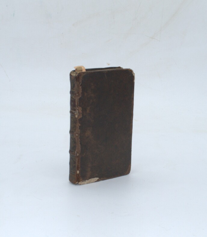
326764Contentum Ltd. Loose sheet. New. High-quality art print based on an original work from the Met. Created in the 16th century 1537. Professionally printed on premium fine-art paper Photo Rag Bright White premium quality in size A2. The artwork is printed with a white border museum-style presentation. Contentum Ltd. unknown
190433489ABDresden, Stengel (Verlagsangabe auf Vorderdeckel und Titelseite überklebt mit 'Max Spielmeyer, Buchhandlung für Architektur und Kunstgewerbe, Berlin), o.J. [1904]. 2°, ein Blatt Titelseite, ein Blatt faksimilierte Titelseite sowie 3 beidseitig bedruckte Blatt mit dem franz. Text sowie 72 Blatt mit wunderbaren s/w-Illustr. (= alles), in der original Mappe mit den 3 Schließbändern, Neue Facsimile-Ausgabe in Photolithographie zwei der Textseiten seitlich mit winzigem Einrißchen, sonst ein erstaunlich schönes, sauberes und so gut wie nicht altersfleckiges Exemplar..
Legatura editoriale illustrata, ottima copia. Prima edizione con 91 tavole fuori testo a fine volume. Sc. U.
sc.: Gusman S., Dujardin - del. Cabasson, Hadamard 1 36x27 cm., estratto di 24 pagine, in francese con la biografie illustrata da ritratto dell'A. in testa (disegnato da DuJardin) e da 9 magnifiche incisioni eseguite dall'Artista stesso, mancano le pagine 19-20-21-22, ma ? allegata una bellissima incisione del ritratto di Prud'hon disegnato da Sabeta nell'aprile del 1837.
Inc. su rame, mm. 325x230 alla battuta, margini in barbe (con ombreggiature e aloni di muffa). Tenue coloritura coeva.
326765Contentum Ltd. Loose sheet. New. High-quality art print based on an original work from the Met. Created in the 16th century 1537. Professionally printed on premium fine-art paper Museum Etching museum quality in size A2. The artwork is printed with a white border museum-style presentation. Contentum Ltd. unknown
8vo., on laid paper, with 2 woodcut frontispieces and 16 woodcut illustrations (a number full-page) in the text, endpapers very lightly browned; original brown cloth, boards with elaborate floral roll in blind, back with four flat bands, second compartment with label lettered in gilt, red edges, backstrip lightly pulled at head else a very good, crisp, clean copy. With the contemporary binder's ticket of Smith Brothers of Paternoster Row on rear paste-down. Bunyan's allegory was first published in 1678, less than a handful of copies are known to exist. This much-needed facsimile includes the frontispieces and titles to both parts, the 14 woodcut illustrations of the first part and the 2 woodcut illustrations of the second part. All marginalia (comprising arguments and biblical references) are faithfully retained. The work was not divided into chapters until Burder's edition of 1786. A notable and very scarce facsimile edition.
199642102Köln, Weimar, Wien, Böhlau, 1996. XII, 374, [76] Seiten, mit zahlreichen Abbildungen. 23 x 16 cm, Broschur.
1600196861600 Une Gravure originale de la déesse grecque de la JUSTICE, technique eau-forte pointe sèche en noir, format : 14 x 20 cm, sur papier vergé crème contrecollée sur carton, sans date (XVIIème),
est227t3Dimension extérieur 40 x 31 cm. Image : 30,5 x 21 cm. Petite gravure sympathique, à caractère allégorique, mettant en scène le printemps au travers d'une femme. On y trouve un petit texte qui loue les avantages et bienfaits de cette saison. Gravure dans son jus, contrecollée sur carton. Présence d'une déchirure (voir photos) mais restaurée.
0451-Bo.J. Kupferstich, nach Johann Elias Ridinger (1698-1767), auf Bütten. 25,4:17,6 cm. Literatur: Schuster 145. Blatt 2 einer 2-Blatt-Folge. - Sehr guter und vollrandiger Abdruck. Einige kleinere Braunflecken.
1967851451967. Blattfüllende Darstellung in grau-violett Tönen mit aquarellierter Rahmenbordüre. 24,6 x 16 cm.
Frontespizio allegorico di Italia, Sclavoniae et Graeciae tabula geographicae (Duisburg, 1589) che comprende 22 carte geografiche della penisola, dei Balcani e della Grecia. Successivamente le carte sono ristampate nell’Atlantis Pars Altera (1595) pubblicato postumo alla morte del Mercatore, dallo stampatore di Duisburg Albert Buys, sotto la supervisione del figlio Rumold Mercator. Composto da sei parti – pubblicate separatamente tra il 1589 e il 1594 – comprende 107 mappe, tutte tranne la carta del mondo di Rumold, firmate da Gerard Mercator. Le lastre vennero poi acquistate da Jodocus Hondius, che tra il 1606 e il 1630 le utilizzò per il suo Atlas Sive Cosmographicae Meditationes de Fabrica Mundi, integrandole ed aggiornandole con proprie “nuove” carte. Delle mappe di Mercator sono note anche ristampe curate da Johannes Janssonius. Le edizioni Hondius e Janssonius ebbero un grande successo commerciale e furono stampate in più lingue, con il testo al verso della carta in latino, francese, tedesco e olandese. Incisione in rame, coloritura coeva, in buono stato di conservazione. Bibliografia cfr. Koeman II Me 11 e Koeman II Me 13A, 1595); Van der Krogt 1:002; J. Keuning, The History of an Atlas, in “Imago Mundi” IV (1947) pp. 37-43; World Encompassed p. 134. Title page of Italia, Sclavoniae et Graeciae tabula geographicae (Duisburg, 1589), which includes an allegorical frontispiece and 22 maps of Italy, the Balkans and Greece. Later, the maps are reprinted in the Atlantis Pars Altera (1595) published posthumously after the death of Mercator, by the Duisburg printer Albert Buys, under the supervision of his son Rumold Mercator. Composed of six parts - published separately between 1589 and 1594 - it includes 107 maps, all except Rumold's map of the world, made by Gerard Mercator. The plates were then purchased by Jodocus Hondius, who between 1606 and 1630 used them for his Atlas Sive Cosmographicae Meditationes de Fabrica Mundi, integrating and updating them with his own "new" maps. Of Mercator's maps are also known reprints edited by Johannes Janssonius. The Hondius and Janssonius editions had a great commercial success and were printed in several languages, with the text on the back of the map in Latin, French, German and Dutch. The map is engraved with the typical connotations of Mercatorian work. The mountains are aligned in a mountainous area concept, not to indicate true chains or valleys, and have a structure with some differences in size, but similar in shape, with vertical slopes and flat tops. The cities are shown through more or less large castles characterized by slender and pointed roofs, similar to wizard hats. Copper engraving, in good condition. Bibliografia cfr. Koeman II Me 11 e Koeman II Me 13A, 1595); Van der Krogt 1:002; J. Keuning, The History of an Atlas, in “Imago Mundi” IV (1947) pp. 37-43; World Encompassed p. 134
Frontespizio del "Itinerarium Italiae" di Martin Zeiler. Incisione in rame, in eccellente stato di conservazione. Frontespizio del "Itinerarium Italiae" di Martin Zeiler. Incisione in rame, in eccellente stato di conservazione. D. Cremonini, L’Italia nelle vedute e carte geografiche dal 1493 al 1894 libri di viaggi e atlanti, 1996, pp.37 e 64.
Frontespizio della serie Palazzi di Roma de' più celebri architetti designati da Pietro Ferrerio pittore et architetto. L'opera fu progettata e iniziata da Pietro Ferrerio nel 1638 circa; il secondo libro, Nuovi disegni delle architetture e piante dei palazzi di Roma de' più celebri architetti..., fu realizzato da G. B. Falda, che ne fu anche l'intagliatore, e venne pubblicato nel 1655 da G. G. De Rossi. Riguardo al primo libro non si conosce il nome dell'incisore: il Ferrerio firma le tavole solo in qualità di disegnatore. Le più importanti tipologie edilizie romane sono illustrate dal Ferrerio sia in alzato sia in pianta, a partire dall'età d'oro di Bramante, Raffaello, Peruzzi e Michelangelo per poi passare a Vignola, Ammannati, Ligorio, Della Porta, dedicando infine un modesto spazio agli architetti del nuovo secolo, quali Bernini, Borromini o Domenico Fontana: segnale evidente, questo, di quanto l'orientamento della cultura e del gusto del Seicento maturo tendesse verso un recupero ed una preferenza nei riguardi del classicismo cinquecentesco o del tardo manierismo controriformato. Ogni tavola è corredata da un'iscrizione di carattere storica che riporta sempre, tra le altre notizie, il nome dell'architetto che progettò l'opera, e l'anno di inizio della costruzione. Le incisioni si caratterizzano per la precisione del disegno, l'attenzione verso il particolare e la nitidezza dell'immagine. L'opera costituisce una sorta di guida all'architettura romana tra cinquecento e seicento, di grande valore storico-documentario. Acquaforte, stampata su carta vergata coeva, in buono stato di conservazione. Plate from the series Palazzi di Roma de' più celebri architetti designate da Pietro Ferrerio pittore et architetto. The work was projected and begun by Pietro Ferrerio in about 1638; the second book, Nuovi disegni delle architetture e piante dei palazzi di Roma de' più celebri architetti..., was done by G. B. Falda, who was also the engraver, and was published in 1655 by G. G. De Rossi. Regarding the first book we do not know the name of the engraver: Ferrerio signs the plates only as a draftsman. The most important Roman building typologies are illustrated by Ferrerio both in elevation and in plan, starting from the golden age of Bramante, Raphael, Peruzzi and Michelangelo and then moving on to Vignola, Ammannati, Ligorio, Della Porta, finally dedicating a modest space to the architects of the new century, such as Bernini, Borromini or Domenico Fontana: This is an evident sign of how much the orientation of the culture and taste of the mature seventeenth century tended towards a recovery and a preference for sixteenth-century classicism or late counter-reformed Mannerism. Each panel is accompanied by a historical inscription that always reports, among other information, the name of the architect who designed the work, and the year in which construction began. The engravings are characterized by the precision of the drawing, the attention to detail and the sharpness of the image. The work constitutes a sort of guide to Roman architecture between the sixteenth and seventeenth centuries, of great historical-documentary value. Etching, printed on contemporary laid paper, in good condition.
1772900627AGNürnberg:, Andreas Endter, 1772. Kupferstich, kreisförmige Darstellung, Plattengröße 27,5 x 25,5 cm, Blattgröße 40,5 x 34,5 cm. [3 Warenabbildungen]
163087241630 Lugdunum Batavorum, Ex Officina Elzeviriana, 1630; in-12, plein veau fauve, double filet doré encadrant les plats, dos à nerfs , caissons de double filet doré ornés d'une rosace dorée, titre doré, tranches mouchetées de rouge; 690,(6)pp.; titre orné.
17681601111768. Klarer Druck mit der vollen Darstellung auf Bütten. 15,2 x 23,6 cm. Papier: 17,5 x 25,2 cm.
Frontespizio del terzo volume dell'Atlas Major di Blaeu. Willem Janszoon Blaeu, avviò nel 1599 la sua attività di costruttore di globi e strumenti astronomici ad Amsterdam. Nel 1630, dopo aver comprato alcune lastre dell’atlante del Mercator da Jodocus Hondius II, fu in grado di pubblicare un volume di 60 mappe con il titolo di Atlantis Appendix. Cinque anni dopo, pubblicò i primi due volumi del suo atlante Atlas Novus o Theatrum Orbis Terrarum, in sei libri. Dopo la sua morte, Joan (Johannes) continuò l’opera paterna, completando l’intera serie di sei volume dell’Atlas Novus intorno al 1655. Fu inoltre autore di un Atlas Maior sive Cosmographia Blaviana, in 12 volumi pubblicati nel 1662 -72. Incisione in rame, bella coloritura coeva, in ottimo stato di conservazione. Title page from Blaeu's Atlas Major. Willem Janszoon Blaeu, started in 1599 his business as a builder of globes and astronomical instruments in Amsterdam. In 1630, after buying some plates of the Mercator atlas from Jodocus Hondius II, he was able to publish a volume of 60 maps under the title Atlantis Appendix. Five years later, he published the first two volumes of his atlas Atlas Novus or Theatrum Orbis Terrarum, in six books. After his death, Joan (Johannes) continued his father's work, completing the entire six-volume Atlas Novus series around 1655. He was also the author of an Atlas Maior sive Cosmographia Blaviana, in 12 volumes published in 1662 -72. Copperplate with fine original hand colour, in very good conditions.
Opera tratta dall’Isolario dell’Atlante Veneto del P. Coronelli, In Venetia MDCXCVI. Coronelli visse un periodo di straordinaria fecondità editoriale a partire dal 1689, quando ebbe la cattedra di geografia presso l'Università alle Procuratie, con la pubblicazione, nel 1690, del primo volume dell'Atlante Veneto. In effetti sotto il nome di Atlante Veneto va tutta la raccolta di tredici opere composte nell'arco del decennio successivo, dall'Isolario allo Specchio del mare. L'Isolario mira, con una barocca e minuziosa ricerca del dettaglio, alla celebrazione dei possedimenti della Serenissima. Monumentale raccolta di carte e vedute di isole, rappresenta l'ultimo degli “isolari” concepiti, che, tra la fine del XVII e l'inizio del XVIII secolo, vennero progressivamente soppiantati dagli atlanti di moderna concezione, opere a stampa caratterizzate da crescente precisione scientifica e da sempre minore pregio artistico. Sulla scia delle nuove conquiste coloniali le rappresentazioni cartografiche vennero ad assumere un carattere sempre più tecnico, fino ad allora piuttosto arbitrario. Incisione in rame, in perfette condizioni. A finely engraved allegorical frontispiece by the eminant cartogapher Vincenzo Maria Coronelli.This highly attractive composition features the Royal Arms of England, including a garter featuring the motto: 'Honi Soit Mal Qui Pense' (Evil to him who thinks Evil). Below is the allegorical figure of Hercules bearing a tablet with another English royal motto: 'Dieu et Mon Droit' (God and my Right). To the right is the personification of the Enlgish Empire, 'Britannia', bearing the sceptre and orb of royal authority. To the right is St. George, the patron saint of England, slaying a Dragon. Likwise, Britannia and Hecules are shown to be vanquishing Britain's enemies below. The rhetoric is one of unadulterated Anglo power during a period when England was engaged in a long series of wars with Louis XIV's France. The map is taken from Isolario dell’Atlante Veneto del P. Coronelli, In Venetia MDCXCVI. Coronelli lived a period of extraordinary editorial fecundity starting from 1689, when he had the chair of geography at the University at the Procuratie, with the publication, in 1690, of the first volume of the Atlante Veneto. Under the name of Atlante Veneto goes the entire collection of thirteen works composed over the next decade, from the Isolario to the Specchio del mare. The Isolario aims, with a baroque and meticulous search for detail, to celebrate the possessions of the Serenissima. Monumental collection of maps and views of islands, represents the last of the "isolarios" conceived, which, between the end of the seventeenth and the beginning of the eighteenth century, were gradually supplanted by modern atlases, printed works characterized by increasing scientific precision and less and less artistic value. In the wake of the new colonial conquests, cartographic representations came to assume an increasingly technical character, until then rather arbitrary. Copperplate in very good condition.
Frontespizio del Nova et accurata Italiae hodiernae descriptio in qua omnium eius regionum, vrbium, pagorum, dominiorum, castellorum, montium, fluviorum, fontium, lacuum, et portuum, historia exhibetur. Geographicis tabulis et vrbium praecipuarum iconibus illustrata a Iudoco Hondio addita est Siciliae, Sardiniae, Corsicae, et itinerariorum per Italiam brevis delineatio, stampato a Leida dalla tipografia Elzevir nel 1627. Si tratta di un atlante geografico unito ad una raccolta di cartografia urbana, esclusivamente dedicato alla penisola. L’opera consta di 31 carte geografiche e 67 vedute o piante di città. Le carte derivano dall’Atlas Minor del Mercator, mentre la cartografia urbana è basata sui modelli introdotti a Venezia da Francesco Valegio e da quelli del Civitates Orbis Terrarum di G.Braun e F. Hogenberg. L’opera è relativa al periodo in cui Jodocus Hondius II si era appena diviso dal fratello Hendrick. Secondo la letteratura esisterebbe una prima edizione della raccolta, stampata ad Amsterdam nel 1626. Incisione in rame, finemente colorata a mano, in ottimo stato di conservazione. Bibliografia Cremonini, pp. 23/25, n. 18; Fossati Bellani; n. 320; Willems; n. 279. Title page taken from Nova et accurata Italiae hodiernae descriptio in qua omnium eius regionum, vrbium, pagorum, dominiorum, castellorum, montium, fluviorum, fontium, lacuum, et portuum, historia exhibetur. Geographicis tabulis et vrbium praecipuarum iconibus illustrata a Iudoco Hondio addita est Siciliae, Sardiniae, Corsicae, et itinerariorum per Italiam brevis delineatio, printed in Leiden by the printing house Elzevir in 1627. This is a geographical atlas combined with a town book, exclusively dedicated to Italy. The work consists of 31 maps and 67 views or plans of cities. The maps derive from Mercator's Atlas Minor, while the plans are based on the models introduced in Venice by Francesco Valegio and those of Civitates Orbis Terrarum by G. Braun and F. Hogenberg. The work is related to the period in which Jodocus Hondius II had just separated from his brother Hendrick. According to the literature there is a first edition of the collection, printed in Amsterdam in 1626. Copper engraving, finely hand-colored, in excellent condition. Literature Cremonini, pp. 23/25, n. 18; Fossati Bellani; n. 320. Willems; n. 279.
Frontespizio dell'atlante di Janssonius. Incisione in rame in ottimo stato di conservazione. Joannes Janssonius, figlio dell'editore di Arnhem Jan Janssen, sposò Elisabeth Hondius, figlia di Jodocus Hondius, ad Amsterdam nel 1612. Dopo il suo matrimonio, si stabilì in questa città come libraio ed editore di materiale cartografico. Nel 1618 si stabilì ad Amsterdam accanto alla libreria di Willem Jansz. Blaeu, entrando in una seria competizione. Le sue attività non riguardavano solo la pubblicazione di atlanti e libri, ma anche di mappe singole e un vasto commercio di libri con filiali a Francoforte, Danzica, Stoccolma, Copenaghen, Berlino, Koningsbergen, Ginevra e Lione. Nel 1631 iniziò a pubblicare atlanti insieme a Henricus Hondius. Nei primi anni 1640 Henricus Hondius lasciò l'attività di pubblicazione di atlanti completamente a Janssonius. La concorrenza con Joan Blaeu, figlio e successore di Willem, nella produzione di atlanti spinse Janssonius ad ampliare il suo Atlas Novus finalmente in un'opera di sei volumi, in cui furono inseriti un atlante marino e un atlante del Vecchio Mondo. Dopo la morte di Joannes Janssonius, il negozio e la casa editrice furono continuati dagli eredi sotto la direzione di Johannes van Waesbergen (c. 1616-1681), genero di Joannes Janssonius. Le matrici degli atlanti di Janssonius furono in seguito vendute a Schenk e Valck. Title page of Atlas Novus. Copperplate, in good conditions. Joannes Janssonius (Arnhem, 1588-1664), son of the Arnhem publisher Jan Janssen, married Elisabeth Hondius, daughter of Jodocus Hondius, in Amsterdam in 1612. After his marriage, he settled down in this town as a bookseller and publisher of cartographic material. In 1618 he established himself in Amsterdam next door to Blaeu’s book shop. He entered into serious competition with Willem Jansz. Blaeu.. His activities not only concerned the publication of atlases and books, but also of single maps and an extensive book trade with branches in Frankfurt, Danzig, Stockholm, Copenhagen, Berlin, Koningsbergen, Geneva, and Lyon. In 1631 he began publishing atlases together with Henricus Hondius. In the early 1640s Henricus Hondius left the atlas publishing business completely to Janssonius. Competition with Joan Blaeu, Willem’s son and successor, in atlas production prompted Janssonius to enlarge his Atlas Novus finally into a work of six volumes, into which a sea atlas and an atlas of the Old World were inserted. After the death of Joannes Janssonius, the shop and publishing firm were continued by the heirs under the direction of Johannes van Waesbergen (c. 1616-1681), son-in-law of Joannes Janssonius. The copperplates from Janssonius’s atlases were afterwards sold to Schenk and Valck.
1689PHO-2384Londres, Rome, se, Francophile Alethophile, 1689, in-12 (15x8,5cm), 32pp.-48pp.54pp.-44pp.-54pp., veau époque, dos à nerfs orné avec pièce de titre, frottements, coins émoussés, coiffes usées, mouillure, manque la page de titre du premier dialogue, manque les pages 35-36 au second dialogue.