Nilson, Johann Esaias - 1721 - Augsburg - 1788Antiquariat.de

187 résultats
0447-Bo.J. Altkolor. Kupferstich, auf Bütten. 22,5:16,6 cm. Literatur: Schuster 130 a und b. - Sehr guter Abdruck mit vollem Rand. - Mit altem Kolorit selten!
Decorativa allegoria pubblicata nell'opera di Heinrich Scherer Atlas Novus exhibens orbem terraguem per naturae opera, historiae navae acveterus monumenta, artistique geographicae leges et praecepta edita in 8 parti, stampate tra il 1702 e il 1710 a Monaco di Baviera. Heinrich Scherer, professore di matematica a Monaco di Baviera, era un gesuita devoto la cui opera sottolineava la gerarchia cattolica e la diffusione delle missioni gesuite in tutto il mondo. Il suo Atlas Novus contiene mappe di tutte le altre parti che mostravano la diffusione del cattolicesimo e delle missioni gesuite. Le 180 mappe incluse in questo lavoro sono state preparate tra il 1699 e il 1700 e sono state incise da Leonard Hecknaeur, Joseph Montelegre e Matthus Wolfgang; ogni volume è introdotto da splendidi frontespizi allegorici dagli stessi incisori. Incisione su rame, in ottimo stato di conservazione. Decorative allegoric title page by Heinrich Scherer for his Atlas Novus exhibens orbem terraguem per naturae opera, historiae navae acveterus monumenta, artistique geographicae leges et praecepta...published in eight volumes from 1702-1710 in Munich. Scherer, a devout Jesuit, produced this geographical compendium to depict the Catholic hierarchy and the spread of Jesuit missions throughout the world. The 180 maps included in this work were prepared between 1699 and 1700 and were engraved by Leonard Hecknaeur, Joseph Montelegre or Matthus Wolfgang with each volume introduced by fine allegorical frontispieces by the same engravers. Copper engraving, in very good condition. Interesting and original engraving; devoted allegorical attention to sea-going nations at a time when much of the world had been discovered and Europeans were swarming out like bees to learn details of hitherto unknown continents, taking possessions and bringing back whatever was new to them as well as not only taking blessings to the people they met on their adventures.
Decorativa allegoria pubblicata nell'opera di Heinrich Scherer Atlas Novus exhibens orbem terraguem per naturae opera, historiae navae acveterus monumenta, artistique geographicae leges et praecepta edita in 8 parti, stampate tra il 1702 e il 1710 a Monaco di Baviera. Heinrich Scherer, professore di matematica a Monaco di Baviera, era un gesuita devoto la cui opera sottolineava la gerarchia cattolica e la diffusione delle missioni gesuite in tutto il mondo. Il suo Atlas Novus contiene mappe di tutte le altre parti che mostravano la diffusione del cattolicesimo e delle missioni gesuite. Le 180 mappe incluse in questo lavoro sono state preparate tra il 1699 e il 1700 e sono state incise da Leonard Hecknaeur, Joseph Montelegre e Matthus Wolfgang; ogni volume è introdotto da splendidi frontespizi allegorici dagli stessi incisori. Incisione su rame, in ottimo stato di conservazione. Decorative allegoric title page by Heinrich Scherer for his Atlas Novus exhibens orbem terraguem per naturae opera, historiae navae acveterus monumenta, artistique geographicae leges et praecepta...published in eight volumes from 1702-1710 in Munich. Scherer, a devout Jesuit, produced this geographical compendium to depict the Catholic hierarchy and the spread of Jesuit missions throughout the world. The 180 maps included in this work were prepared between 1699 and 1700 and were engraved by Leonard Hecknaeur, Joseph Montelegre or Matthus Wolfgang with each volume introduced by fine allegorical frontispieces by the same engravers. Copper engraving, in very good condition.
Frontespizio della serie Les stations de Rome. “Les stations de Rome, suite de 10 pièces numérotées, non compris le titre. Les inscriptions de cette suite sont en français (caractères italiques) et en latin (caractères romains). Le titre de chaque pièce qui sépare l'inscription latine de l'inscription française est en italien et en gros caractères. On n'a mis ici que le titre italien et l'inscription française. Ces pièces sont de la plus belle manière de Silvestre” (cfr. Faucheux, Catalogue raisonné de toutes les estampes qui forment l'oeuvre d'Israel Silvestre). Il Silvestre, incisore e disegnatore, nasce a Nancy nel 1621. Come era consuetudine all'epoca, fece diversi viaggi in Italia per copiare i vecchi maestri e per migliorare le sue abilità con i più grandi maestri. Faucheux fissa le date di questi viaggi, il primo prima del 1640 (Israel non aveva ancora 20 anni), il secondo dal 1643 al 1644 e l'ultimo intorno al 1653. Israel portò con sé molte vedute dell'Italia, quasi tutte incise. Fino al 1659, fece altri viaggi in Francia e in Lorena, da cui trasse molti disegni e incisioni. Il suo stile fu, all'inizio, piuttosto sciolto, ma dal 1643 in poi divenne più raffinato e delicato, acquisendo accuratezza e precisione senza essere asciutto, risultando a volte simile a quello di Jacques Callot o di Stefano della Bella, con i quali ebbe rapporti di amicizia attraverso il suo zio materno e mentore, l’editore Israël Henriet. Accanto alle testimonianze per la Roma antica mostrò ben presto un grandissimo interesse per la città "moderna", divenendo uno dei precursori del vedutismo - non solo nel campo incisorio - anticipando artisti come Lievin Cruyl e Gaspar van Wittel. È praticamente impossibile fare un inventario completo delle opere di Israël Silvestre, tanto era prolifico l'artista. Ha lasciato numerosi disegni e più di mille incisioni. Tra le sue opere più belle, possiamo tuttavia menzionare le numerose e complesse “piccole” suite (composte da poche tavole) sulle piazze, le chiese e le antichità di Roma. Acquaforte, in ottimo stato di conservazione. Bibliografia L. E. Faucheux, Catalogue raisonné de toutes les estampes qui forment l'oeuvre d'Israel Silvestre: précédé d'une notice sur sa vie (1857), n. 2.0; F. Baré, Israël Silvestre et sa famille, suivi du catalogue de son oeuvre (1885), n. 806. Title page from the series Les stations de Rome. Les stations de Rome, suite of 10 numbered pieces, not including the title. The inscriptions of this suite are in French (italic characters) and in Latin (Roman characters). The title of each piece which separates the Latin inscription from the French inscription is in Italian and in large characters. Silvestre, engraver and draftsman, was born in Nancy in 1621. As was customary at the time, he made several trips to Italy to copy the old masters and to improve his skills with the greatest masters. Faucheux fixes the dates of these trips, the first before 1640 (Israel was not yet 20 years old), the second from 1643 to 1644 and the last around 1653. Israel brought with him many views of Italy, almost all of them engraved. Until 1659, he made other trips to France and Lorraine, from which he took many drawings and engravings. His style was, at the beginning, rather loose, but from 1643 onwards became more refined and delicate, acquiring accuracy and precision without being dry, resulting sometimes similar to that of Jacques Callot or Stefano della Bella, with whom he had friendly relations through his maternal uncle and mentor, the publisher Israël Henriet. Alongside the testimonies to ancient Rome, he soon showed great interest in the "modern" city, becoming one of the precursors of vedutism - not only in the field of engraving - anticipating artists such as Lievin Cruyl and Gaspar van Wittel. It is quite impossible here to make a complete inventory of Israël Silvestre's works, so prolific was the artist. He left numerous drawings and more than a thousand engravings. However, among his most beautiful works, we can mention the many complex "small" suites (composed of a few plates) on the squares, churches and antiquities of Rome. Etching, in excellent condition. Bibliografia L. E. Faucheux, Catalogue raisonné de toutes les estampes qui forment l'oeuvre d'Israel Silvestre: précédé d'une notice sur sa vie (1857), n. 2.0; F. Baré, Israël Silvestre et sa famille, suivi du catalogue de son oeuvre (1885), n. 806.
pp. xvi, 42 (2) lxviii + Plates (some in color). 4to. 27 cm. Attractive original full blue cloth binding, lettered in gold. Edited and translated by Nathaniel Hill, Katherine Isabella Cust, John Lydgate (Ca. 1370-1451), and others. The wonderful woodcuts are from the Paris edition of 1511. First Edition thus. Scarce. **PRICE JUST REDUCED! W144
192227320Paris La Connaissance 1922 In-4 illustré de nombreuses vignettes en noir et de 8 lithographies demi-ton hors-texte, 390p. Couverture illustrée.
1637910978CGNürnberg:, Paul Fürst, 1637 - 1638. Altkol. Kupferstich, Blattmaß: 18,5 x 15 cm (quer), Plattenmaß: 15 x 20 cm.
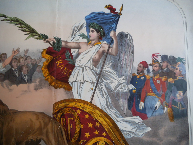
8433Elle Est acclamée par tous le Peuples.Lithographie originale en couleurs,rehaussée à la gomme arabique.Format 610x785mm et 470x610mm hors marges.Paris Vve Gosselin imp. Editeur.Vve Gadola éditeur Lyon. Une trace de pliure, petites rousseurs avec de petites déchirures réparées, en marge. Coloris frais. Peu courant.
8574presentato e PARTENOPE accennato dal SEBETO, dalle SIRENE, e dalle Régia Villa di PORTICI-La Fede l’accoglie in Seno, l’éduca ASTREA,l’ornano Le Grazie, Pallade l’istruisce per la pace,e Marte per la guerre, onde La Fama la consacra all’immortalita.Gravure allégorique par Carlo GREGORI 370x500mm à la cuvette, marges courtes, Une restauration ancienne et maladroite au bas à droite
1920200082Um 1920. Signiert "Walter-Cl. Schmidt". Im Stock monogrammiert "W.C / SCH". Druck auf breitrandigem faserigem Japan. 14,5 x 7,2 cm. Papier: 20,8 x 15,7 cm.
Frontespizio del Theatrvm statvvm regiæ celsitvdinis Sabavdiæ dvcis, Pedemontii principis, Cypri regis pubblicato per la prima volta ad Amsterdam Amstelodami, apud. hæredes Ioannis Blaev, 1682. L’opera venne successivamente ristampata da Pierre Mortier. Acquaforte, in ottimo stato di conservazione. Title page of Theatrvm statvvm regiæ celsitvdinis Sabavdiæ dvcis, Pedemontii principis, Cypri regis first published in Amstelodami, apud. hæredes Ioannis Blaev, 1682. The work was later reprinted by Pierre Mortier. Etching, in excellent condition.
Frontespizio dell'edizione olandese dell’Atlas Novus di Blaeu. Willem Janszoon Blaeu, avviò nel 1599 la sua attività di costruttore di globi e strumenti astronomici ad Amsterdam. Nel 1630, dopo aver comprato alcune lastre dell’atlante del Mercator da Jodocus Hondius II, fu in grado di pubblicare un volume di 60 mappe con il titolo di Atlantis Appendix. Cinque anni dopo, pubblicò i primi due volumi del suo atlante Atlas Novus o Theatrum Orbis Terrarum, in sei libri. Dopo la sua morte, Joan (Johannes) continuò l’opera paterna, completando l’intera serie di sei volume dell’Atlas Novus intorno al 1655. Fu inoltre autore di un Atlas Maior sive Cosmographia Blaviana, in 12 volumi pubblicati nel 1662 -72. Incisione in rame, bella coloritura coeva, in ottimo stato di conservazione. Title page of the Dutch edition of Blaeu's Atlas Novus. Willem Janszoon Blaeu, started in 1599 his business as a builder of globes and astronomical instruments in Amsterdam. In 1630, after buying some plates of the Mercator atlas from Jodocus Hondius II, he was able to publish a volume of 60 maps under the title Atlantis Appendix. Five years later, he published the first two volumes of his atlas Atlas Novus or Theatrum Orbis Terrarum, in six books. After his death, Joan (Johannes) continued his father's work, completing the entire six-volume Atlas Novus series around 1655. He was also the author of an Atlas Maior sive Cosmographia Blaviana, in 12 volumes published in 1662 -72. Copperplate with fine original hand colour, very good condition.
Frontespizio del celebre Itinerario, voyage ofte schipvaert van J.H. van Linschoten naar Oost ofte Portugaels Indien. L’opera fu pubblicata nel 1596 al ritorno in Olanda dopo anni spesi nelle Indie, in particolare nella colonia portoghese di Goa, dove tra il 1583 ed il 1589 fu al servizio dell’Arcivescovo del Portogallo. Le carte del Linschoten sono basate su accurati portolani portoghesi del XVI secolo, e oltre a fornire le rotte più semplici e vantaggiose per il raggiungimento delle Indie. Incisione in rame, in ottimo stato di conservazione. Title page of the famous Itinerario, voyage ofte schipvaert van J.H. van Linschoten naar Oost ofte Portugaels Indien. St Helena was an important early re-supply point for the Portuguese from the late 1400s, particularly on their return voyages from Asia. This plate appeared in Linschoten's book in 1596, once he came back from the Indies. The engraver for this plate was Baptista van Doetechum. Schilder, Gunter, Monumenta Cartographica Neerlandica, vol VII.
17292158Regensburg, Lang, 1729. Siehe Lentner 10020; Pfister 572. - Das Blatt bildet das doppelblattgroße schöne allegorische Frontispiz, mit barockem Dekor, im Hintergrund die Ansicht von Regensburg.
Frontespizio inserito nel famoso itinerario del Lonschoten, edizione del 1638 curata da Evert Cloppenburgh. Incisione in rame, rifilata al margin destro, per il resto ottime condizioni. Title page of the famous Itinerario, voyage ofte schipvaert van J.H. van Linschoten naar Oost ofte Portugaels Indien. This plate appeared in Linschoten's book in 1596, once he came back from the Indies. The engraver for this map was Baptista van Doetechum. Published by Cloppenburgh in 1638. Trimmed al the right edge, otherwise good conditions. Schilder, Gunter, Monumenta Cartographica Neerlandica, vol VII.
180519625Leipzig, Leo, (1805). 232 (recte 132) SS., 33 Kupfertafeln von P. J. Laminit, T. J. Richter und Schnorr-Gründer. Kl.-8°, zeitgen. rote Pappe, etw. Rückenvergoldung, doppelte Deckelfilten, Goldschnitt, grüne Vorsätze, im grünen Pappschuber, dieser stärker berieben und bestoßen. Der Einband an den Ecken und Kapitalen berieben.
Frontespizio dell'edizione francese dell'Atlas Novus di Blaeu. Willem Janszoon Blaeu, avviò nel 1599 la sua attività di costruttore di globi e strumenti astronomici ad Amsterdam. Nel 1630, dopo aver comprato alcune lastre dell’atlante del Mercator da Jodocus Hondius II, fu in grado di pubblicare un volume di 60 mappe con il titolo di Atlantis Appendix. Cinque anni dopo, pubblicò i primi due volumi del suo atlante Atlas Novus o Theatrum Orbis Terrarum, in sei libri. Dopo la sua morte, Joan (Johannes) continuò l’opera paterna, completando l’intera serie di sei volume dell’Atlas Novus intorno al 1655. Fu inoltre autore di un Atlas Maior sive Cosmographia Blaviana, in 12 volumi pubblicati nel 1662 -72. Incisione in rame, bella coloritura coeva, in ottimo stato di conservazione. Title page of the French edition of Blaeu's Atlas Novus. Willem Janszoon Blaeu, started in 1599 his business as a builder of globes and astronomical instruments in Amsterdam. In 1630, after buying some plates of the Mercator atlas from Jodocus Hondius II, he was able to publish a volume of 60 maps under the title Atlantis Appendix. Five years later, he published the first two volumes of his atlas Atlas Novus or Theatrum Orbis Terrarum, in six books. After his death, Joan (Johannes) continued his father's work, completing the entire six-volume Atlas Novus series around 1655. He was also the author of an Atlas Maior sive Cosmographia Blaviana, in 12 volumes published in 1662 -72. Copperplate with fine original hand colour, very good condition.
Frontespizio del secondo volume dell'edizione francese del "Civitates Orbis Terrarum", il primo atlante devoto esclusivamente alle piante e vedute delle principali città del mondo. Stampato in sei volumi tra il 1572 ed il 1617 ebbe grande fortuna e diffusione, tanto che ne furono stampate diverse edizioni tradotte in latino, tedesco e francese. Il primo volume delle Civitates Orbis Terrarum fu pubblicato a Colonia nel 1572. Il sesto e ultimo volume apparve nel 1617. Questo grande atlante di città – cartografia urbana - curato da Georg Braun e inciso in gran parte da Franz Hogenberg, conteneva 546 prospettive, vedute a volo d'uccello e vedute cartografiche di città di tutto il mondo. Franz Hogenberg realizzò le tavole dei primi quattro volumi e Simon van den Neuwel (Novellanus, attivo dal 1580) quelle dei volumi V e VI. Georg Braun (1541-1622), un ecclesiastico di Colonia, fu il principale redattore dell'opera e fu molto aiutato nel suo progetto dalla vicinanza e dal continuo interesse di Abraham Ortelius, il cui Theatrum Orbis Terrarum del 1570 fu, come raccolta sistematica e completa di mappe di stile uniforme, il primo vero atlante. Le Civitates, in effetti, erano destinate ad accompagnare il Theatrum, come indicato dalla somiglianza dei titoli e dai riferimenti contemporanei sulla natura complementare delle due opere. Tuttavia, le Civitates erano progettate per avere un approccio più popolare, senza dubbio perché la novità di una raccolta di piante e vedute di città rappresentava un'impresa commerciale più rischiosa di un atlante mondiale, per il quale c'erano stati diversi precedenti di successo. Franz Hogenberg (1535-1590) era figlio di un incisore di Monaco che si era stabilito a Malines. Incise la maggior parte delle tavole del Theatrum di Ortelius e la maggior parte di quelle delle Civitates, e potrebbe essere anche indicato come il responsabile dell'origine del progetto. Oltre un centinaio di artisti e cartografi diversi, il più importante dei quali fu l'artista di Anversa Georg Hoefnagel (1542-1600), fornirono i disegni per le tavole delle Civitates. Hoefnagel non solo contribuì alla maggior parte del materiale originale per le città spagnole e italiane, ma rielaborò e modificò anche quello di altri collaboratori. Dopo la morte di Hoefnagel, il figlio Jakob continuò il lavoro per le Civitates. Gli autori della raccolta si proponevano di raffigurare "non icones et typi urbium", cioè non immagini generiche e tipizzate, "sed urbes ipsae admirabili caelaturae artificio, spectantium oculis subiectae appareant": non intendeva alludere o idealizzare, ma rappresentare fedelmente sulla carta, riprodurre esattamente, e in tempo reale, ciò che l'occhio vede, come annunciato nella prefazione al primo volume delle Civitates Orbis Terrarum. Incisione in rame, magnifica coloritura a mano, in ottimo stato di conservazione. Title page of the second volume of the French edition of Civitates Orbis Terrarum, the first atlas devoted exclusively to plans and views of the world's major cities. Printed in six volumes between 1572 and 1617 it was so successful and widespread that several editions translated into Latin, German and French were printed. The first volume of the Civitates Orbis Terrarum was published in Cologne in 1572. The sixth and the final volume appeared in 1617. This great city atlas, edited by Georg Braun and largely engraved by Franz Hogenberg, eventually contained 546 prospects, bird-eye views and map views of cities from all over the world. Fransz Hogenberg produced the plates for the first four books, and Simon van den Neuwel (Novellanus, active since 1580) those for volumes V and VI. Georg Braun (1541-1622), a cleric of Cologne, was the principal editor of the work, and was greatly assisted in his project by the close, and continued interest of Abraham Ortelius, whose Theatrum Orbis Terrarum of 1570 was, as a systematic and comprehensive collection of maps of uniform style, the first true atlas. The Civitates, indeed, was intended as a companion for the Theatrum, as indicated by the similarity in the titles and by contemporary references regarding the complementary nature of two works. Nevertheless, the Civitates was designs to be more popular in approach, no doubt because the novelty of a collection of city plans and views represented a more hazardous commercial undertaking than a world atlas, for which there had been a number of successful precedents. Franz Hogenberg (1535-1590) was the son of a Munich engraves who settled in Malines. He engraved most of the plates for Ortelius's Theatrum and the majority of those in the Civitates, and may have been responsible for originating the project. Over a hundred of different artists and cartographers, the most significant of whom was Antwerp artist Georg Hoefnagel (1542-1600), engraved the cooper-plates of the Civitates from drawings. He not only contributed most of the original material for the Spanish and Italian towns but also reworked and modified those of other contributors. After Hoefnagel's death his son Jakob continued the work for the Civitates. The author set out to depict "non icones et typi urbium," that is, not generic and typified images, "sed urbes ipsae admirabili caelaturae artificio, spectantium oculis subiectae appareant": not intended to allude or idealize but to represent faithfully on paper, to reproduce exactly, and in real time, what the eye sees, as announced in the preface to the first volume of Civitates Orbis Terrarum. Copperplate with fine clouring, very good conditions.
Frontespizio del "Atlas Novus" di Janssonius. Joannes Janssonius, figlio dell'editore di Arnhem Jan Janssen, sposò Elisabeth Hondius, figlia di Jodocus Hondius, ad Amsterdam nel 1612. Dopo il suo matrimonio, si stabilì in questa città come libraio ed editore di materiale cartografico. Nel 1618 si stabilì ad Amsterdam accanto alla libreria di Willem Jansz. Blaeu, entrando in una seria competizione. Le sue attività non riguardavano solo la pubblicazione di atlanti e libri, ma anche di mappe singole e un vasto commercio di libri con filiali a Francoforte, Danzica, Stoccolma, Copenaghen, Berlino, Koningsbergen, Ginevra e Lione. Nel 1631 iniziò a pubblicare atlanti insieme a Henricus Hondius. Nei primi anni 1640 Henricus Hondius lasciò l'attività di pubblicazione di atlanti completamente a Janssonius. La concorrenza con Joan Blaeu, figlio e successore di Willem, nella produzione di atlanti spinse Janssonius ad ampliare il suo Atlas Novus finalmente in un'opera di sei volumi, in cui furono inseriti un atlante marino e un atlante del Vecchio Mondo. Dopo la morte di Joannes Janssonius, il negozio e la casa editrice furono continuati dagli eredi sotto la direzione di Johannes van Waesbergen (c. 1616-1681), genero di Joannes Janssonius. Le matrici degli atlanti di Janssonius furono in seguito vendute a Schenk e Valck. Incisione in rame, coloritura coeva, in buono stato di conservazione. Title page of Janssonius' "Atlas Novus". Joannes Janssonius (Arnhem, 1588-1664), son of the Arnhem publisher Jan Janssen, married Elisabeth Hondius, daughter of Jodocus Hondius, in Amsterdam in 1612. After his marriage, he settled down in this town as a bookseller and publisher of cartographic material. In 1618 he established himself in Amsterdam next door to Blaeu’s book shop. He entered into serious competition with Willem Jansz. Blaeu.. His activities not only concerned the publication of atlases and books, but also of single maps and an extensive book trade with branches in Frankfurt, Danzig, Stockholm, Copenhagen, Berlin, Koningsbergen, Geneva, and Lyon. In 1631 he began publishing atlases together with Henricus Hondius. In the early 1640s Henricus Hondius left the atlas publishing business completely to Janssonius. Competition with Joan Blaeu, Willem’s son and successor, in atlas production prompted Janssonius to enlarge his Atlas Novus finally into a work of six volumes, into which a sea atlas and an atlas of the Old World were inserted. After the death of Joannes Janssonius, the shop and publishing firm were continued by the heirs under the direction of Johannes van Waesbergen (c. 1616-1681), son-in-law of Joannes Janssonius. The copperplates from Janssonius’s atlases were afterwards sold to Schenk and Valck. Copperplate with fine original colouring, very good condition.
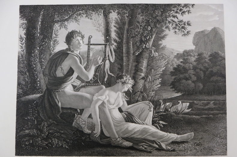
est164t3Dimension extérieur 44,5 x 55,5 cm, cuvette 43 x 53,5 cm. Très belle gravure, d'après Jean-Louis Ducis (1775-1847) et gravée par Jean Marie Gudin (1782-18..), représentant Orphée et Eurydice. En excellent état, épreuve réalisée peu de temps après le tableau de Ducis (1826).
est165t3Dimension extérieur 44,5 x 55 cm, cuvette 42,5 x 53 cm. Très belle gravure, d'après Jean-Louis Ducis (1775-1847) et gravée par Jean Marie Gudin, représentant le mythe de Boutadès, raconté par Pline qui dit que Callirrhoé avait imaginé de tracer l'ombre de son amant au charbon sur une pierre. En excellent état, épreuve réalisée peu de temps après le tableau de Ducis (1826).
Frontespizio allegorico del L’Italia a cura di Fabio Magini, edito a Bologna nel 1620, tre anni dopo la prematura morte del padre. Inciso da Oliviero Gatti. Composto da un breve testo descrittivo di sole 24 carte, l’opera è corredata di 61 carte geografiche della penisola, e costituisce il primo esempio di atlante italiano. L’opera è per intero di mano del Magini, che iniziò la realizzazione delle carte nel 1594 circa, dando alla luce per prima nel 1595 la carta del territorio di Bologna. Tutte le carte vennero alle stampe quindi prima del 1620, nelle loro stesure provvisorie, successivamente corrette ed aggiornate per l’edizione definitiva. Per la realizzazione delle lastre il Magini si servì di due dei più famosi intagliatori dell’epoca: il belga Arnoldo Arnoldi e l’inglese Benjamin Wright. Decorative titlepage of L'Italia edited by Fabio Magini, published in Bologna in 1620, three years after the untimely death of his father. Composed of a short descriptive text of only 24 pages, the work is accompanied by 61 maps of the peninsula, and is the first example of an Italian atlas. The work is entirely by the hand of Giovanni Antonio Magini, who began the realization of the maps in 1594 or so; the first dated map (1595) the map of the territory of Bologna. All the maps were printed before 1620, in their provisional drafts, later corrected and updated for the final edition. For the realization of the plates Magini used two of the most famous engravers of the time: the Belgian Arnoldo Arnoldi and the English Benjamin Wright. Copperplate, in good condition.
Frontespizio decorativo con titolo e dedica da L’Italia a cura di Fabio Magini, edito a Bologna nel 1620, tre anni dopo la prematura morte del padre. Composto da un breve testo descrittivo di sole 24 carte, l’opera è corredata di 61 carte geografiche della penisola, e costituisce il primo esempio di atlante italiano. L’opera è per intero di mano del Magini, che iniziò la realizzazione delle carte nel 1594 circa, dando alla luce per prima nel 1595 la carta del territorio di Bologna. Tutte le carte vennero alle stampe quindi prima del 1620, nelle loro stesure provvisorie, successivamente corrette ed aggiornate per l’edizione definitiva. Per la realizzazione delle lastre il Magini si servì di due dei più famosi intagliatori dell’epoca: il belga Arnoldo Arnoldi e l’inglese Benjamin Wright. Incisione in rame, bella coloritura coeva, in ottimo stato di conservazione. Decorative allegoric titlepage of from L'Italia edited by Fabio Magini, published in Bologna in 1620, three years after the untimely death of his father. Composed of a short descriptive text of only 24 pages, the work is accompanied by 61 maps of the peninsula, and is the first example of an Italian atlas. The work is entirely by the hand of Giovanni Antonio Magini, who began the realization of the maps in 1594 or so; the first dated map (1595) the map of the territory of Bologna. All the maps were printed before 1620, in their provisional drafts, later corrected and updated for the final edition. For the realization of the plates Magini used two of the most famous engravers of the time: the Belgian Arnoldo Arnoldi and the English Benjamin Wright. Copperplate with fine original hand colour, very good condition.
Ritratto di Giovanni Antonio Magini.La didascalia in basso recita: All'Ill.mo Sig.re Padrone mio Collendiss.mo il Signor Ferdinando Riario Senatore di Bologna, Nobile Venetiano, Marchese di Castiglione di Valle d'Orcia, e Cameriero della Chiave d'Oro della Maestà Cesarea Ferdinando Secondo Imperatore. Giovanni Antonio Magini's portrait.In the caption on the bottom: All'Ill.mo Sig.re Padrone mio Collendiss.mo il Signor Ferdinando Riario Senatore di Bologna, Nobile Venetiano, Marchese di Castiglione di Valle d'Orcia, e Cameriero della Chiave d'Oro della Maestà Cesarea Ferdinando Secondo Imperatore.
186652348London: Longmans Green Reader and Dyer Paternoster Row 1866. Thick 4to. xii 2 239 1 pp. Woodcut-engraved & illustrated title in red & black illust. half-title in red & black red & black frontisp. many leaves printed in blue red yellow or green woodcut-engraved plates historiated initials head- and tail-pieces woodcut borders. Contemporary full red morocco with gilt ornamented designs on front & back cover gilt decorated spine raised bands marbled endpapers t.e.g. very minor rubbing at hinges minor rubbing to corners very slight tidemark to fore-edge of first couple leaves still a NF copy bound by Riviere w/ their stamp on lower fore-edge of inner ruled dentelle on front pastedown. First edition of this lavish Victorian work celebrating the life span of man in the 12 months of a calendar year beginning with the infant in January the schoolboy in February the apprentice in March as well as the soldier in June the philosopher and statesmen in September and more. Pigot has drawn upon the verse of Bacon Cicero Carlyle Caxton Chaucer Dickens Dryden Emerson Goethe Martial Shakespeare Sallust and Virgil. Longmans, Green, Reader, and Dyer, Paternoster Row, hardcover