BROWN, Henry CollinsBiblio.com
34 338 résultats
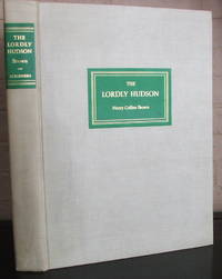
1937006950NY: Scribner. SIGNED first edition. Limited to 920 copies. Not numbered. Signed by author on limitation page. Brown was founder of the Museum of the City of New York. Published NY: Scribners 1937. Large folio 12 1/2" x 16 1/2" xiv319pp. profusely illustrated with b/w and tipped-in color plates - most full page the 15 color plates are all present. Cream cloth with gilt titles in green block deckle edges and top edge gilting. Mild soil to the cloth bookplate on pastedown else very good plus clean crisp attractive copy. . Very Good Plus. Hard. 1st. 1937. Scribner unknown
Fine English Paperback. Pbo. Roy. 8vo. (24 x 17 cm). Articles in Turkish, English, German, French, Italian, Spanish. Printed issues, set; this periodical is going on to be published. OTAM: Journal of the Center for Ottoman Studies, Ankara University.= Ankara Üniversitesi Osmanli Arastirma ve Uygulama Merkezi Dergisi. 1-35/36 issues. 1990-2014. Set. A very heavy and oversize set. A very precious set of journal on Ottoman researches. / Ottomanica.
1947007362Glendale CA: The Arthur H. Clark Co. 1947. First Edition . Hardcover. Very Good. The first two volumes of a three-volume set. Red cloth with gilt lettering to spine. Top edges gilt others uncut. 412 pages. Frontispiece in each volume. Index. Clean books with little wear. <br/> <br/> The Arthur H. Clark Co. hardcover
1996SONG9054105941CRC Press 1996-01-01. 1. hardcover. Used: Good. 11.02x8.27x1.44. Buy with confidence. Excellent Customer Service & Return policy. CRC Press hardcover
20022081502111904570China Hubei Education Publishing House 2002. Soft Cover. Fine. Volume: 1 China Hubei Education Publishing House paperback
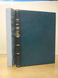
195325871EDICION FACSIMIL LIMITADA Y NUMERADA.- S.l. pero imp. en Valencia: Ed. .la fonte que mana y corre. 1953 Tip. Moderna Valencia en colofón.- 5 h. tres de ellas en blanco 46 h. del facsimil impresas por ambas caras a excepción de la última 13 h. con el colofón catálogo editorial y lista des suscriptores cuatro de ellas en blanco; 4º 237 x 17.3 cm.; Cuidada impresión sobre excelente papel de hilo verjurado; Finamente encuadernado en Plena Piel chagrén de color verde lomo dorado conservando la cubierta anterior original.- Incunables Poéticos Castellanos. II.- Consta esta edición facsimil de 225 ejemplares numerados del 1 al 225 SIENDO ESTE EL Nº 61. Se editaron además 30 ejemplares marcados de A a Z. Ha sido dirigida por Antonio Pérez y Gómez y realizada al cuidado de MarÃa Amparo y Vicente Soler. PRECIOSA EDICIÓN DE BIBLIOFILO. LITERATURA Y FILOSOFÃA MEDIEVALES ESPAÑOLAS Libro en español Tipografía Moderna hardcover
1978WA-33Harrison Idaho: Lacon Publishers 1978. Classic scarce text contains an array of personally collected stories by the author handed down through generations depicting the culture people life and times in northern Idaho in the early 1900's. Includes the lives of packers firefighters trappers and women in the wilderness of Idaho's St. Joe River. 296 pgs. Illustrated. Second printing. Inscribed numbered 217 of 500 H.B. dated and signed by the author on front endpaper. Tiny bump to top front corner. Dustjacket has some minor rubbing to the upper spine and tips of corners. In mylar. Signed by Author. Limited/Numbered. Hard Cover. Fine/Very Good. 8vo - over 7¾" - 9¾" tall. Lacon Publishers Hardcover
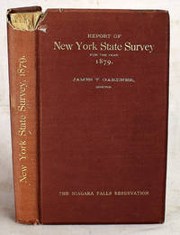
18802308090001Charles Van Benthuysen and Sons Albany NY 1880. First Edition. Hardcover. Good. Early Proposal for a park at Niagara Includes an inlaid label "with the compliments of James T. Gardner Director." 25 cm. Bound in publisher's maroon cloth. Title in gilt on cover. Wear to cover with loss at top spine corner. 4 preliminary leaves 7-96 pages. 11 plates: Folding frontispiece 10 plates 9 heliotype 6 folding maps including 1 in rear pocket; 1 map detached. Some marginal spotting. New York no. 86 no. 37. Text by Frederick Law Olmstead. Includes a facsimile of Hennepin's A New Discovery of a Vast Country in America. Dow page II: 1113. Charles Van Benthuysen and Sons, Albany, NY hardcover
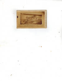
006778Pleasant Hill MO: Little & Sprague Photographic Image. Very Good. No Binding. 2 1/2" x 4". No Date circa 1869 what is now called the Hannibal Bridge saw construction begin in 1867 and finish in 1869. Titled "Kansas City Railroad and Carriage Bridge" under photo "Little & Sprague Pleasant Hill MO" right margin in fine print under left side of photo "Total Length 1395 Feet" and :"PACAN & WINANS illegible" under right side of photo. Verso appears to have a map in faint pencil of the area of the bridge. Very Good dark spot to margin left edge. Little & Sprague unknown
20192-0808047833Cch Inc 2019. Paperback. New. 13.00x9.75x8.75 inches. Cch Inc paperback
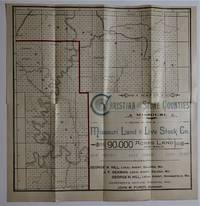
009782Neosho. Missouri/ St. Louis: Missouri Land and Live Stock Company/ Woodward & Tiernan Printing Co Book. Very Good. Single Sheet Folded. 16 1/2" x 16 3/4". No date after 1881 circa mid-1880s to mid-1890s. Single Sheet Folded 16 1/2" x 16 3/4" folded 4 times to make a 4 1/4" x 8 1/2" brochure. Verso a single map - "Map of Christian & Stone Counties Missouri" measuring 16 1/2" x 16 3/4" Recto includes front and rear covers 4 fold description of the two counties with terms of sale and an 8 1/2" x 8 1/2" map - "Map showing the Railroads of Southwest Missouri already in operation in the vicinity of Christian and Stone Counties". Very Good small tears at edges of folds a 1" internal tear at fold. The Missouri Land & Live Stock Company Limited of Scotland was in operation from 1882-1908. The Company bought 350000 acres of land in SW Missouri in 1882 to use primarily for cattle grazing playing a big role in the development of the cattle industry in the region. The purpose of this map and brochure was to sell 80000 acres of land in Stone County and 10000 acres in Christian County for farming and agricultural uses. A RARE brochure not found at OCLC which only records two other county maps published by this company. Missouri Land and Live Stock Company/ Woodward & Tiernan Printing Co unknown
a92105New York 1792 first edition. Francis Childs and John Swaine. Sm folio. Stringbound wraps. 247p. complete. First 16 pages and titlepage lack top margin and outer corner with very little loss of text. Binding secure. Fair. . paperback
189355608Seattle WA & Silverton WA: Stillaguamish & Sultan Mining Co. 606 Bailey Bldg. ca. 1893. Four albumen cabinet photographs sized 3.9 x 4.9 in. mounted on thick studio board stock sized 4.25 x 5.25 in. w/ all four containing manuscript annotations in ink on versos minor dustsoiling edgewear minor over-exposure to a couple images still a nice grouping with consistent contrast and definition. These scarce original albumen photos show the canyon water fall power and miners along the Hoodoo Quartz Claim Mineral Survey No. 403A and B which was filed originally in 1892 and are neatly numbered 3 6 15 & 11. The first image shows a heavily forested canyon with creek running through and annotations on verso detailing that the “Anaconda and Roman Senator lodes at the head of gulch.†The second photo shows fast running water fall and creek -- “water power that will be utilized in the development of the Stilliguamish sic and Sultan Mining Co’s property. Copper Lake Canyon.†Third photo depicts gold miners carrying and working with pick axes in “Hoodoo Canyon 500 feet higher up. . . the vein is found in the bed of the gulch at this point.†The series of mines developed by the Stillaguamish & Sultan Mining Co. had a well-defined fissure vein carrying iron and copper pyrites and pyrrhotite with bell metal all contained in a lime quartz gangue. The main tunnel was driven 420 feet on the Hoodoo ledge with about another 200 feet of tunneling ore concentrate worth about $83 a ton including gold silver and copper ores. The description on back of four describes “passageway where work was shot away for approach to Hoodoo tunnel. The snow banks in the distance and at the right are at the foot of Big Four Mountain. . . seen plainly from Monte Cristo 8 miles East.†By 1905 the company was largely dormant and later the mines would be owned by the Sykes Estate of which the Continental Illinois National Bank & Trust Co. of Chicago was the trustee. See: L.K. Hodges Mining in the Pacific Northwest: A Complete Reivew of the Mineral Resources of Washington and British Columbia 1897; The Copper Handbook: A Manual of the Copper Industry of the World 1905 Vol. V p. 655; Carithers & Guard Geology and Ore Deposits of the Sultan Basin Snohomish County Washington Bulletin No. 36 1949 pp. 49-50. Stillaguamish & Sultan Mining Co., 606 Bailey Bldg., unknown
77773Small album containing 12 photographs captured during an ascent of "Old Baldy" which looms majestically above Spokane Washington at 5883 feet. The southernmost mountain in the Selkirk Range it was known as Mount Carlton until August 1912 when it was renamed Mount Spokane.<br /> <br /> The images show a party of eight men at the start of their journey and at various points along the way including Sky Line Spring Brickell Creek and the summit. All the photographs are accompanied by holographic captions and two are identified as the work of Joe Shields. Notably there is an image of Cook's Camp and a portrait of Francis H. Cook.<br /> <br /> A pioneering figure in Spokane's history Cook 1851-1920 published the city's first newspaper The Spokan Times before setting his sights on developing an area on Spokane's South Hill. He purchased 680 acres and platted it out for development and in 1888 started the first steam-powered street railroad to move residents up and down the hill. Later Cook purchased the top of Old Baldy and set about securing the rights of way in order to build a road to the summit. Though he did not live to see it his vision was realized with the establishment of the Mt. Spokane State Park in 1927.<br /> <br /> The photographs are pasted to leaves of an oblong album which is bound with string in brown paper wrappers 8 1/2" x 5 1/4". The front panel features black titles and an original white ink and watercolor rendering of Old Baldy framed by tall trees. Some mild edgewear; else very good. unknown
195920047073New York: Antiquarian Press 1959. 1st Edition . Hardcover. Fine. Folio - over 12 - 15" tall. Limited edition of 550 copies. This is numbered 339. 757 pp. This is the facsimile edition bound in half leather cowhide with top edge gilt and housed in slipcase. No markings of any kind. A beautiful copy. Ships within 24 hours. <br/> <br/> Antiquarian Press hardcover
1930106202Houghton Mifflin Company. 1930. First Edition; First Printing. Hardcover. Hardcover. 1930. First Printing. Houghton Mifflin Company. 272 pages. Book has light shelfwear else Very Good condition. Scarce Dust Jacket has some wear and chipping else Very Good Minus. Price clipped. Owners name and date from Christmas 1931 on endpaper. One of a large collection of James Willard Schultz we have acquired. ; 8vo - over 7¾" - 9¾" tall; 272 pages . Houghton Mifflin Company hardcover
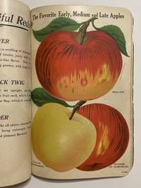
19104203Rochester NY: United Litho. and Printing Co. and Vredenberg Co. 1910. Good. Album of 66 leaves plus one duplicate of chromolithograph or half-tone illustrations some printed in two or more colors depicting plants flowers and trees in some instances alongside homes also of fruit specimens all with full-page descriptive text on verso. Contemporary wrappers printed in black on front cover with the name of the nursery William C. Moore & Co. recent black cloth spine wrappers worn signs of heavy use throughout inscription inside front cover. With faults and priced accordingly. AMERICAN ART AND BOOK PRODUCTION IN THE SERVICE OF COMMERCE: A MODEST NURSERYMAN'S FRUIT FLOWER AND TREE SALES CATALOGUE PRINTED IN VIBRANT COLORS. SEED CATALOGUES SUCH AS THIS ONE WERE HEAVILY USED AS VEHICLES OF SALE BY TRAVELING SEED PEDDLERS THROUGHOUT SMALL TOWN AMERICA. <br /> <br /> "Nurserymen's plates were an American innovation. . In design and coloring these plates were more akin to folk painting than to the commercial art of their time" Charles von Ravenswaay "Drawn and Colored from Nature" in Antiques Magazine March 1983 pp. 594-599. <br /> <br /> Vintage Nurseryman's Guides provide a "floracopia" of American chromolithography at its apogee. All the plates have descriptive text on the versos giving name of the plant / tree / fruit useful information about color fragrance production preferred growing season and other particulars such as taste in the case of fruit. Our catalogue was issued by the William C. Moore & Co. of Newark New York State which evidently offered a wide selection indeed. Unusually the text on our wrappers bears a curious attestation by the Arcadia National Bank proclaiming that "in our opinion the Nursery is a reliable and responsible concern with ample capital to carry on its large operations." The President and General Manager of the firm was at that time Wilson M. Gould whose name appears as such in the Dec. 5 1912 issue of Florists' Review vol. 31 p. 82. <br /> <br /> Most fruit seed catalogues are undated because they were literally assembled according to which seeds were or would be in stock as here. The most "recent" plate in the present nurseryman's guide is dated 1904. United Litho. and Printing Co. [and Vredenberg Co.] unknown
Very Good Turkish, Ottoman (1500-1928) Original cloth bdg. with 'Tercüman Gazetesi Kitapligi' [i.e. Tercüman Newspaper Library] label on spine. Roy. 8vo. (24 x 16 cm). In Ottoman script. [8], 391 p., 5 numerous folded plates and plans. Some underlined sentences and notes by pencil. Goltz's reference book on "battles of fortresses" printed for the Ottoman military schools. Muharebât-i kila'. Translated by Farukî Sâmi [Pasha], (1861-1911). Wilhelm Leopold Colmar Freiherr von der Goltz, also known as Goltz Pasha, was a Prussian Field Marshal and military writer. After defeat in the Russo-Turkish War (1877-1878), Sultan Hamid, Sultan of the Ottoman Empire, asked for German aid in reorganizing the Ottoman Army, so that they would be able to resist the advance of the Russian Empire. Baron von der Goltz was sent. He spent twelve years on this work which provided the material for several of his books. During his time in the Ottoman Empire, Goltz had very negative view of Abdul Hamid II, writing: "The Stambul Efendi, whose father held a well-paid sinecure, reward by Sultan Hamid for his faithfulness, and who enjoyed to the fullest the good life, now knowing the struggle for existence, could not be a great leader on the battlefield. As long as Sultan Abdulhamid and the present ruling classes remain at the rudder, one may not speak of the rescue of Turkey.". Goltz achieved some reforms such as lengthening the period of study at military schools and adding new curricula for staff courses at the War College. From 1883 to 1895, Goltz trained the so-called "Goltz generation" of Ottoman officers, many of whom would go to play prominent roles in Ottoman military and political life. Goltz, who learned to speak fluent Turkish, was a much admired teacher, regarded as a "father figure" by the cadets, who saw him as "an inspiration.". Attending his lectures, in which he sought to indoctrinate his students with his "nation in arms" philosophy, was seen as "a matter of pride and joy" by his pupils. As a result, it was the Ottoman army rather the German army which first embraced Goltz's "nation in arms" theory as the basis of its understanding of war. After some years he was given the title Pasha (a signal honor for a non-Muslim) and in 1895, just before he returned to Germany, he was named Mushir (field-marshal). His improvements to the Ottoman army were significant. It is noteworthy that in the Greco-Turkish War (1897), the Turkish army stopped just before Thermopylae, only when the Czar Nicholas II of Russia threatened the Ottoman Sultan that he would be attacking the Ottoman Empire from eastern Anatolia unless the Ottoman Army stopped their campaign at that point. On his return to Germany in 1895 Goltz became a lieutenant-general and commander of the 5th Division, and in 1898, head of the Engineer and Pioneer Corps and Inspector-General of Fortifications. In 1900 he was made General of Infantry and in 1902 commander of the I. Army Corps. After returning to Germany in 1895, Goltz was in close contact with his students, and offered them his advice. [.] Soon afterward Goltz gave up that position and became a military aide to the essentially powerless Sultan Mehmed V. Baron von der Goltz did not get along with the head of the German mission to Turkey, [.] Sami Pasha al-Faruqi, (1861-1911), was an Ottoman / Turkish soldier, bureaucrat and governor. The Ottoman governor who played an important role in suppressing the Karak Uprising, which was an uprising against Ottoman authority in the Transjordanian town of Al-Karak, which erupted on 4 December 1910. The revolt came after Sami Pasha, the governor of Damascus, wanted to apply the same measures of conscription, taxation, and disarmament to the inhabitants of Al-Karak that previously provoked the Hauran Druze Rebellion. This Edition not in Özege. Second Edition. Other Editions see. Only 2 copies in OCLC: 909026729 (Orient Institut & Library of Congress).; Özege 14077.; TBTK 11566.; Library of Congress. Karl Su?ssheim Collection, no. 297.
Very Good Turkish, Ottoman (1500-1928) Original pictorial wrappers. Chromo-lithographed photo-montage collage cover with seven b/w photos of African buildings and natives, and a red map of Africa. Complete in wrappers and folded huge Africa map (size: 57 x 82 cm). Cover size: 28.5 x 20.5 cm. In Turkish. Scale: 1/20,000,000. A very rare chromo-lithographed Africa map, prepared for the geography lessons about foreign countries in Turkey in 1930. The map shows the territories of the African continent, which was still politically under European colonialism as of the 1930s. It includes Rio de Oro (Spanish territory), Fas [i.e. Morocco], Algeria, Sahara, Cameroon (French territories), Trabulus [i.e. Libya] as Italian territory; and Liberia, Egypt, East Sudan, Eritre [i.e. Eritrea], Habesistan [i.e. Ethiopia], Somali, Kenya, Belgian Kongo, Angola, Mozambique and South African land including Rhodesia (equivalent in the territory to modern Zimbabwe), Transvaal, The Orange Free State [Oranje-Vrystaat], Natal and Kap [Cape] with Madagascar. An extra panel for the same scale map showing the Suez Canal, Nile Delta, and North Egypt in the lower-left corner. Duran studied in Istanbul and Paris. He worked as a geography teacher in various high schools and afterward he undertook the positions of lecturer and administrator in Ankara Gazi Education Institute for a time. He was known for his writings on various topics and particularly for his works on geography. Born in the imperial period, Duran conducted the first cartographic studies of the Republic of Turkey after the transition to the Republican administration. Sealed. Slight foxing. Otherwise a fine copy. Not in OCLC.
Good Armenian Full modern leather binding. An ex-library stamp on the colophon. Small 4to. (27 x 18 cm). In Armenian. 512, [8] p., engraved plates. Richly illustrated. Stains on pages and edges. Otherwise a good copy. Extremely rare first Armenian edition of Fenelon's "Telemaque". According to Abdolonyme Ubicini's account in his La Turquie actuelle (Paris 1855), Les Aventures de Télémaque was the most popular classic among Levantines in Istanbul in the first half of the 19th century, and it was translated into many languages besides Turkish and Arabic in the Ottoman Empire. The first printed version of a Greek translation dates from the 18th century, while an Armenian version by Ambroise Calfa was published in Paris in 1860. (The Ottoman Reception of Fénelon's Télémaque.; Meral, Arzu). The translator, Ambroise Calfa Nar Bey, Guy de Lusignan, (1831-1906), was a Franco-Armenian historian and linguist from the second half of the 19th century and the beginning of the 20th century. Ambroise Calfa is one of the three sons of Kévork (Georges) -Youssouf Calfa, an Armenian trader living in Constantinople, and Sophie Cantar (or Kantaroglou), daughter of an Armenian merchant or banker from the Ottoman capital. Member of several learned societies, including the Asian Society, Ambroise Calfa published several historical or linguistic works, including an Armenian Calligraphy (Paris, 1853), a work awarded at the Universal Exhibition of 1855, and, above all, an Armenian-French Dictionary ( Paris, Hachette, 1861) dedicated to Emperor Alexander II. (Wikipedia). Les Aventures de Télémaque, fils d'Ulysse (The adventures of Telemachus, son of Ulisses) with the original title is a didactic French novel by Fénelon, Archbishop of Cambrai, who in 1689 became tutor to the seven-year-old Duc de Bourgogne (grandson of Louis XIV and second in line to the throne). It was published anonymously in 1699 and reissued in 1717 by his family. The slender plot fills out a gap in Homer's Odyssey, recounting the educational travels of Telemachus, son of Ulysses, accompanied by his tutor, Mentor, who is revealed at the end of the story to be Minerva, goddess of wisdom, in disguise. OCLC 953068302 (One institutional copy in BnF). (Utopias from the Middle East 3).
Very Good French Original decorated map. Hand-coloured. Oblong elephant folio. (54 x 76 cm). In French. Shows Greece, Archipelago, Isle de Candie, Asia Minor (Western side), and East Mediterranean. Delisle od de l'Isle was a French cartographer known for his popular and accurate maps of Europe and the newly explored Americas. At 27, Delisle was admitted into the French Académie Royale des Sciences, an institution financed by the French state. After that date, he signed his maps with the title of "Géographe de l'Académie". Five years later, he moved to the Quai de l'Horloge in Paris, a true publishing hub where his business prospered. Delisle's progress culminated in 1718 when he received the title of Premier Géographe du Roi. He was appointed to teach geography to the Dauphin, King Louis XIV's son, a task for which he received a salary. Again, his father's reputation as a man of science probably helped the younger Delisle. Historian Mary Sponberg Pedley says, 'once authority was established, a geographer's name might retain enough value to support two or three generations of mapmakers'. Delisle's case, it could be said that his accomplishments surpassed his father's. Up to that point, he had drawn maps not only of European countries, such as Italy, Spain, Germany, Great Britain, Poland, and regions such as the Duchy of Burgundy, but he had also contributed to the empire's claims to recently explored continents of Africa and the Americas. Like many cartographers of his day, Delisle did not travel with the explorers. He drew maps mostly in his office, relying on a variety of data. The quality of his maps depended on a solid network to provide him first-hand information. Given his family's and his own reputation, Delisle had access to fairly recent accounts of travellers who were returning from the New World, which gave him an advantage over his competitors. Being a member of the Académie, he also kept current with recent discoveries, especially in astronomy and measurement. When he could not confirm the accuracy of a source, he would indicate it clearly on his maps. For instance, his Carte de la Louisiane shows a river that the baron of Lahontan claimed he discovered. As no one else could validate it, Delisle noted a warning to the viewer that it might not exist. (Source: Wikipedia). Tooley, p.43.
New English Original bdg. HC. 4to. Text is in Turkish, preface and introduction is in Turkish, Arabic and English. Ottoman Waqfs in the Balkans waqf deeds. Greece 1.= Balkanlar'da Osmanli Vakiflari vakfiyeler. Yunanistan 1.
Very Good Turkish, Ottoman (1500-1928) Original color map on cloth. A little foxing on cloth. Very good. Folded. Oblong atlas folio. (66 x 72 cm). In Ottoman script. Scale: 1/210.000. Ottoman sanjaks in Albania and Greece. A rare Ottoman map of Balkans with Turkish place names for the period of pre-Balkan Wars, (1912-1913). Very important for onomastics and historical geography. Written 'Paris -French meridian- was accepted as the 0 meridian'. The Paris meridian is a meridian line running through the Paris Observatory in Paris, France-now longitude 2°20'14.03" east. It was a long-standing rival to the Greenwich meridian as the prime meridian of the world. Personal stamp of Muhiddin Pasha on cloth, under the printed descriptive texts. It's from the collection of him. Hasan Muhiddin Pasha [Çanga], (1866-1944), who was a lieutenant in Hedjaz Army of the Ottoman Empire in 1887. After he suppressed the rebellion in Yemen, 1891, his rank was promoted to the 'major'. After the Imam Yahya rebellion in Yemen, 1904, he prepared a report for the Ottoman government. He also took part in Ethiopia, Sudan, Yemen, Arabian Peninsula for various military duties. After promotion to division command, he was provincial president of CHP (Republican People's Party). He was a very important politic and diplomatic figure for the last period of Ottoman and early Republican Turkey. Not in Tooley. Extremely rare.
Very Good Turkish, Ottoman (1500-1928) Original color map on cloth. A little foxing on cloth. Very good. Folded. Oblong atlas folio. (66 x 72 cm). In Ottoman script. Scale: 1/210.000. Ottoman cities in Bulgaria. A rare Ottoman map of Balkans with Turkish place names for the period of pre-Balkan Wars, (1912-1913). Very important for onomastics and historical geography. Written 'Paris -French meridian- was accepted as the 0 meridian'. The Paris meridian is a meridian line running through the Paris Observatory in Paris, France-now longitude 2°20'14.03" east. It was a long-standing rival to the Greenwich meridian as the prime meridian of the world. Personal stamp of Muhiddin Pasha on cloth, under the printed descriptive texts. It's from the collection of him. Hasan Muhiddin Pasha [Çanga], (1866-1944), who was a lieutenant in Hedjaz Army of the Ottoman Empire in 1887. After he suppressed the rebellion in Yemen, 1891, his rank was promoted to the 'major'. After the Imam Yahya rebellion in Yemen, 1904, he prepared a report for the Ottoman government. He also took part in Ethiopia, Sudan, Yemen, Arabian Peninsula for various military duties. After promotion to division command, he was provincial president of CHP (Republican People's Party). He was a very important politic and diplomatic figure for the last period of Ottoman and early Republican Turkey. Not in Tooley. Extremely rare.
Very Good Turkish, Ottoman (1500-1928) Original color map on cloth. A little foxing on cloth. Very good. Folded. Oblong atlas folio. (66 x 72 cm). In Ottoman script. Scale: 1/210.000. Ottoman sanjaks in Greece, mostly in Greek Macedonia. A rare Ottoman map of Balkans with Turkish place names for the period of pre-Balkan Wars, (1912-1913). Very important for onomastics and historical geography. Written 'Paris -French meridian- was accepted as the 0 meridian'. The Paris meridian is a meridian line running through the Paris Observatory in Paris, France-now longitude 2°20'14.03" east. It was a long-standing rival to the Greenwich meridian as the prime meridian of the world. Personal stamp of Muhiddin Pasha on cloth, under the printed descriptive texts. It's from the collection of him. Hasan Muhiddin Pasha [Çanga], (1866-1944), who was a lieutenant in Hedjaz Army of the Ottoman Empire in 1887. After he suppressed the rebellion in Yemen, 1891, his rank was promoted to the 'major'. After the Imam Yahya rebellion in Yemen, 1904, he prepared a report for the Ottoman government. He also took part in Ethiopia, Sudan, Yemen, Arabian Peninsula for various military duties. After promotion to division command, he was provincial president of CHP (Republican People's Party). He was a very important politic and diplomatic figure for the last period of Ottoman and early Republican Turkey. Not in Tooley. Extremely rare.