335 résultats
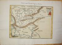
152556635Strasbourg. 1525. Originalt tresnitt. Arkets størrelse : 535 cm X 395 cm. Latin. <br/><br/><em>Latinsk tekst. Bretten noe gulnet et par brunpletter.Med Kypros.Map of Palestine Mesopotamia and Babylonia in present day Middle East.Relief shown pictorially.Includes names of places and natural features.Descriptive text within ornamental borders on verso.Appears in the author's Geographia translated by Willibald Pirckheimer with annotations by Joannes Regiomontanus. Argentoragi i.e. Strasbourg : Iohannes Grieningerus communibus Iohannis Koberger impensis excudebat anno a Christi Natiuitate 1525 tertio Kalendas Apriles. Boston Public Library. </em> unknown
200181701Planeta–De Agostini 2001. Planeta–De Agostini unknown
1541M7225Lyon: Michael Servetus c. 1541. Very good minor wormholing on upper margin. Notes: StolenThe only text on verso is the number "33". The publisher Michael Villanovus or Servetus was tried by Calvin for heresy and burned at the stake with several of his books. Size : 307x363 mm 12.09x14.29 Inches Coloring: Hand Colored Category: Maps Europe Poland Lithuania; Maps Europe Hungary; Maps Europe Romania; Maps Europe Ukraine; Maps Europe Czech Republic Slovakia; Michael Servetus unknown
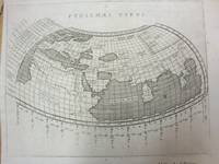
1597M7073Venice 1597. Very Good; a tear in the lower margin not effecting the map. Notes: Ptolemaic map following the classical format. The Indian Ocean is landlocked with a continuous coastline joining Africa to South East Asia. Toprobana present day Sri Lanka is a very large island in the Indian Ocean and the Indian sub-continent is completely missing although the Ganges river is shown. The Mediterranean is well depicted but greatly exaggerated in length. In Africa the Nile is shown originating in mountains below the Equator. Finely engraved in the Italian style with a stippled sea by Girolamo Porro. The map is on a full sheet of Italian text. Italian text on verso. Size : 138x178 mm 5.43x7.01 Inches Coloring: Black & White Reference: Shirley #193. Category: Maps World; unknown
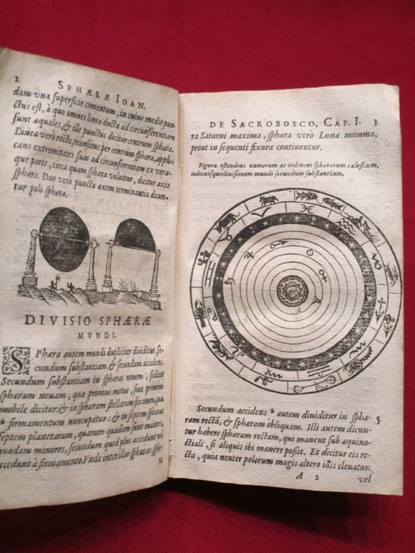
1617118060lyon Antoine Pillehotte 1617 in-8 parchemin de réemploi Lugduni (Lyon), Antonii (Antoine) Pillehotte, 1617, 1 volume in-8 de 100x165 mm environ, 192 pages, complet des deux tableaux et, fait rare, contient la planche in-fine intacte pour constituer les volvelles. Reliure, par laçage, en parchemin de réemploi, dos muet, gardes blanches. Quelques taches sur le parchemin et traces sur les tranches, une des lanières de laçage est rompue (mors interne fendu), ex libris manusrit partiellement raturé sur garde volante en fin de volume, intérieur frais, bon état général, bel exemplaire.
16753455Fredericum Leonard, Typographum Regis, 1675. In-folio (37,5 x 25,5 cm), 632 pp., 23 ff. d'index et errata (texte en Latin), reliure d'époque veau brun, dos à nerfs orné (quelques défauts d'usage mais très bon état intérieur, sans rousseurs). Edition originale. Cet ouvrage rare est l'une des meilleures sources pour l'histoire de l'ancienne Gaule, rédigé sous forme de dictionnaire, il n'a pas même été remplacé par le célèbre d'Anville.
200690171Museum. New. 2006. Paperback. 0954904141 . FREE UPGRADE to Courier/Priority Shipping Upon Request - IN STOCK AND IMMEDIATELY AVAILABLE FOR SHIPMENT - Flawless copy brand new pristine never opened -- 72 pp. ; 70 illus. -- with a bonus offer-- . Museum paperback
16845Paris Le Club du Livre - Philippe Lebaud 1972 grand in 4 Un volume reliure plein maroquin havane ornée de l'éditeur, dos à nerfs, tête dorée, sous chemise doublée, étui toilé, 220 pages. Ouvrage illustré de 20 lithographies hors-texte en couleurs par Jean Picart Le Doux (tirage par Fernand Mourlot). Traduction de Nicolas Bourdin de Vilennes revue et accompagnée de deux études par André Barbault, les quatres livres des jugements des astres de Ptolémée ou le Tetrabiblos. Collection gravure contemporaine. Tirage limité à 300 exemplaires numérotés, celui-ci un des 225 exemplaires numérotés sur Rives, et signé par l'illustrateur. (poids du Colis: 4 kilogrammes). Exemplaire à l'état de neuf ( Photographies sur demande / We can send pictures of this book on simple request )
1584Map1002Cologne: Goldefridi Kempensis 1584. 2nd Edition . No Binding. Fine. Folio. AN ORIGINAL MAP. Original hand colouring. 47x40cms Folding double page.PLEASE EMAIL FOR PHOTOS. <br/> <br/> Goldefridi Kempensis unknown
1533204261533 Basle, Joannes Herwagen, mars 1533, petit in folio de (16)-244-145-85 pp. reliure d'origine de plein velin ivoire dont les bords ont été rogné, rognés, angles des premiers feuillets habilement restaurés par un professionnel, dans l'ensemble assez bon exemplaire.
154115881Vienna 1541. Very good condition. The second map to show just southern Africa; it is based on the Waldseemuller modern map of southern Africa and derived from Ptolemy. Decoratively illustrated with African kings serpents an elephant and a Christian soldier riding a sea monster towards Madagascar. Three large rivers arise from a mountain range labeled 'Fontes Nili' source of the Nile other mountain ranges and coastal towns named in Latin or Portuguese. With the figure of the King of Portugal riding a sea monster towards Madagascar. <br /> <br /> Based on the slightly larger map from 1513 published in "Ptolemy's Geographia". The atlas was reprinted in 1520 1522 1525 1535 and 1541. This wood block was cut in 1525 for the publisher J.Grünninger. This being the variant of 1541 now without the banner title but title in letter type and blank verso.<br /> <br /> From the last edition of Ptolemy's "Geography" with maps by Laurens Fries and the text edited by Michael Servetus. Servetus was accused of heresy and burnt at the stake. Calvin ordered that copies of the book should be burnt with him although this copy seems to have eluded the flames. <br /> <br /> Wood block map with early hand color. Blank on the verso with the number 39 at the lower right corner. Image size: 16 7/8 x 13". Paper size: 21 1/4 x 15". Strengthened on the verso very faint browning at middle of center fold otherwise very good. Betz p. 55-56. Tooley "Map Collectors' Circle No. 30 Printed Maps of the Continent of Africa Part II" p. 61-62. Karrow "Mapmakers of the Sixteenth Century" unknown
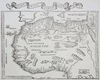
1535M6976Lyons: Melchior & Gaspar Trechsel c. 1535. Very Good;. Notes: No text on verso.<br><br>This is based on Waldseemuller's map Norwich 286 with borders and ornaments by Holbein and Graf. The reissued map includes six kings seated on their thrones a rhinoceros a cyclops and two oxen. <br><br>"As northern Africa was better known than southern Africa at that period it has more geographical information in the interior. Various kingdoms are described with a multitude of coastal names and as with the southern part . these are placed within the coastline. The Mediterranean and Red Seas are prominently featured as well as a number of islands on the northwest coast -- Madeira the Canaries etc. -- which at that time were already well known to the Portuguese in their initial efforts to discover a route to the Indies." Norwich Size : 320x400 mm 12.60x15.75 Inches Coloring: Black & White Reference: Norwich 286 Category: Maps Africa North; Melchior & Gaspar Trechsel unknown
151354087Strasbourg. 1513. Originalt tresnitt. Arkets størrelse : 60 cm X 425 cm. Norsk. <br/><br/><em>“Martin Waldseemüller a highly accomplished scholar of geography merged the science of mapmaking and the art of printing in his 1513 atlas one of the most groundbraking documents in the history of cartography. He intended this atlas as a new edition of Ptolemy’s Geographia but included the addition of 20 modern maps which were not based upon the tradition of Ptolemy. Waldseemüller’s use of a quadratic plane projection was also a noteworthy advance.â€Martin Waldseemüller 1470-1520.Liten rift ved nedre marg. Et lite ormehull i venstre marg. Et par slitasjer i øvre marg. </em> unknown
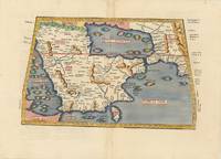
62979Vienna 1525-1541. Original woodcut Ptolemaic map of the Arabian Peninsula 40 x 55.5 cm with later hand-colouring; Latin title text and additional woodcut decorations to verso. Some minimal discrete paper repairs to upper portion of centrefold generally a very good copy. Early Ptolemaic woodblock map of the Arabian Peninsula here called Arabia Felix. The map is presented on a trapezoidal projection with parallels and meridians forerunners of lines of longitude and latitude enumerated in the borders. The map shows the Arabian Peninsula wider in the southeast and shows a somewhat distorted shape for the Arabian Gulf. Details include topography the major towns while the rivers and many islands are imaginary. This map is based on the slightly larger map from 1513 published in "Ptolemy's Geographia". The atlas was reprinted in 1520 1522 1525 1535 and 1541. This wood block was cut in 1525 for the publisher J.Grünninger. This being the variant of 1541 now without the banner title and wood cut ornaments on the verso. [Vienna, 1525-1541]. unknown
1519045673Venice: Aldus & Andreas Torresano 1519. First Edition. Hardcover Full Leather. Very Good Condition. Contemporary calf worn paneled with a central Venetian device. Corners worn through rubbing to hinges old paper spine labels lacking ties but sound overall. Very light dampstain in top margin in latter sections scattered very minor foxing heavier to endpapers but generally bright and clean. 301 19 leaves. Ahmanson-Murphy 183 Adams P1860 The first Aldine edition of Pontano's commentary on the Ptolemaic Centiloquium and Pontano's De rebus coelestibus two of the central astrological texts of the Renaissance. This volume was meant to complement the two volume edition of Pontano's works published by Aldine the year previous. Size: Quarto 4to. Previous owner's signature in ink. Quantity Available: 1. Shipped Weight: Under 1 kilo. Category: Science & Technology; Astronomy; Philosophy. Inventory No: 045673. <br/><br/> Aldus & Andreas Torresano hardcover books
1519045673Venice: Aldus & Andreas Torresano 1519. First Edition. Hardcover Full Leather. Very Good Condition. Contemporary calf worn paneled with a central Venetian device. Corners worn through rubbing to hinges old paper spine labels lacking ties but sound overall. Very light dampstain in top margin in latter sections scattered very minor foxing heavier to endpapers but generally bright and clean. 301 19 leaves. Ahmanson-Murphy 183 Adams P1860 The first Aldine edition of Pontano's commentary on the Ptolemaic Centiloquium and Pontano's De rebus coelestibus two of the central astrological texts of the Renaissance. This volume was meant to complement the two volume edition of Pontano's works published by Aldine the year previous. Size: Quarto 4to. Previous owner's signature in ink. Quantity Available: 1. Shipped Weight: Under 1 kilo. Category: Science & Technology; Astronomy; Philosophy. Inventory No: 045673. <br/><br/> Aldus & Andreas Torresano hardcover
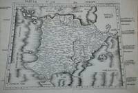
8053615. PTOLEMY. GEOGRAPHIA UNIVERSALIS VETUS ET NOVA complectens<br /> Claudii Ptolemaei Alexandrini enarrationis libros VIII. Quorum<br /> primus noua translatione Pirckheimheri et accessione commentarioli<br /> illustrior quàm hactenus fuerit redditus est . Succedunt tabulae<br /> Ptolemaicae opera Sebastiani Munsteri nouo paratae modo. His<br /> adiectae sunt plurimae nouae tabulae. Basileae: apud Henricum<br /> Petrum 1540.<br /> <br /> 20 of 48 maps present: 5. Gallia 6. Germaniam Magnam 11. Iazyges<br /> Metanastas Daciam 17. Ionid Trapesus 18 Sarmatia Asiaticam 19.<br /> Colchidem Iberiam 22. Arabia Felix 23. Margianam Bactriana 25.<br /> Ariam Paropanisadas 26. Indiam Gangem Flu 29. Europa Prima 31.<br /> Hispanium 33. Helvetiae 34. Germania 35. Alsatia 36. Teria<br /> Rheni 37. Quartia Rheni 38. Brabantia et Geldria 39. Svevia et<br /> Bavaria 40. Franconia.<br /> <br /> All maps have descriptive letterpress printed within a decorative<br /> frame on reverse.<br /> Most maps have some worming at the center.<br /> Map 5 Gallia cannot be opened fully; at some point it was glued<br /> together along the center fold when a new backingstrip was laid<br /> down.<br /> <br /> Small folio: 2a4a-c6A-N6 - maps - 62A-2B32C8 30.3.cm. unknown
8053615. unknown books
105903Lutetiæ Apud Gulielmum Cauellat 1556. 8 76 leaves. Illustrated with geometrical figures in the text. Contemporary vellum. Rebacked. Name erased from title-page. Occasional light foxing. . hardcover
173076110Amsterdam:: Apud. R. & J. Wetstenios & Guil. Smith 1730. original pale blue boards; leather spine perished; sewn over tapes which are still largely intact. This copy lacks the last two leaf of the Index and the final blank leaf. . Folio. Added engraved illustrated title leaf; 28 fine maps on 56 leaves. Apud. R. & J. Wetstenios & Guil. Smith, hardcover
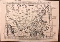
1513M8825Strasburg: Martin Waldseemuller c. 1513. Excellent. Notes: StolenA fine and strong impression of this rare map of Eastern Europe from the 1513 edition of Waldseemüller's modern atlas Geographia.<br><br>The verso is blank. The watermark is similar to fleur de lis sitting on a multi headed star.<br><br>Large Ptolemaic map depicting Europe and Balkan from the Adriatic Sea to the Black Sea.<br><br>The Atlas ' GEOGRAPHIE OPUS NOVISSIMA TRADUCTIONE E GRECORUM ARCHETYPIS ' one of the most important edition of Ptolemy Atlases.was published by Johannes Schott in Strasburg 1513.<br> Size : 434x618 mm 17.09x24.33 Inches Coloring: Black & White Category: Maps Europe Greece Macedonia; Maps Europe Balkans; Maps Europe Romania; Maps Europe Hungary; Martin Waldseemuller unknown
1621B6798Padova: Paolo & Francesco Galignani. 1621. . Some toning interior otherwise clean and crisp. Edition: Second Italian edition. Binding: Recent full calf boards. Matching upper and lower with double blind panels gilt floral devices at corners of inner panel. Spine with 4 raised bands abbreviated title in gilt on maroon label in 2 remaining compartments with gilt devices and blind rules. Notes: Translated from Latin into Italian by Leonardo Cernoti Vinitiano.<br>Text in Italian. <br>A fine example of this monumental atlas and treatise on cartography considered to be the most influential cartographic and geographical account of the ancient world originally written by Ptolemy in Greek around 150 AD. <br><br>Claudius Ptolemy c.100 – c.170 AD was a mathematician astronomer astrologer and geographer living in the city of Alexandria then the Roman province of Egypt under Roman rule who wrote a number of scientific treatises that greatly influenced Byzantine Islamic and Western European science. His Geografia written around 150 AD is a thorough discussion on maps and the geographic knowledge of the Greco-Roman world and also serves as a handbook on how to draw maps using geographic coordinates for parts of the Roman world known at the time. Geografia draws from an earlier work by Marinus of Tyre now lost to us as well as various Roman and Persian gazetteers.<br>Geografia is divided into 8 books: book I is a treatise on cartography describing the methods used to assemble and arrange Ptolemy's data; from Book II through the beginning of Book VII a gazetteer provides longitude and latitude values for the world known to the ancient Romans; the rest of book VII provides details on three projections to be used for the construction of a map of the world varying in complexity and fidelity; book VIII constitutes an atlas of regional maps. The maps include a recapitulation of some of the values given earlier in the work which were intended to be used as captions to clarify the map's contents and maintain their accuracy during copying.<br>Geografia was translated into Arabic in the 9th century and Latin around 1406 and was a highly influential resource on the cartographic traditions of the medieval Caliphate and Renaissance Europe.<br><br> Size: Small Folio 301x 206 mm Illustration: Complete with 64 engraved maps 27 Ptolemaic 37 modern including the rare double-page world map “Orbis Terrae Compendiosa Descriptio†engraved by Girolamo Porro in addition to 14 in-text illustrations plus title vignette and chapter headpieces. Folio pagination. La Seconda Parte Della Geografia di Cl. Tolomeo…: title dated 1620; period marginalia in margins of 126v; 154 mispag. 174. Pg. 13 of Commentarii et Annotationi… unnumbered. Volume: 2 parts in 1 volume. References: Sabin 66506; Phillips Atlases 405; Adams M-118; Shirley 193-96 Pages: Blank 2. Title. 1597 dedication to Marco Cornaro from Gio. Battista & Giorgio Galignani. 1621 dedication to Marco Cornaro from Paolo & Francesco Galignani. Blank. Della Geografia di Claudio Tolomeo: p. 1-62. Commentarii et Annotationi dell’Eccell. Sig. Gio. Antonio Magini Padouano…: p. 1-21. Blank 2. Table of contents. Index 27. La Seconda Parte Della Geografia di Cl. Tolomeo…: p. 2-212. Blank. Index 59. Blank 3. Category: Book Atlas & Cartography; Paolo, & Francesco Galignani. hardcover
1562220508Venice: Vincenzo Valgrisi 1562. hardcover. very good-. Venice: Vincenzo Valgrisi 1562. 2 parts with separate pagination. Short thick 4to bound in 19th century vellum with red edges. Features 64 double page maps: 27 Ptolemaic maps showing the ancient world as Ptolemy knew it including one world map 37 "modern" maps with two world maps and several woodcut diagrams illustrations and decorative initials. Text in Latin. Staining throughout affecting some of the maps. Title page cropped .5" at right margin. Bookplate of Otto Orren Fisher and ink inscription of Charles Singer.<br/><br/> Giuseppe Moleto Josephus Moletius 1531-1588 was an Italian mathematician who based the text of this edition on the 1525 translation by Wilibald Pirckheimer. Moleto's draws upon Ruscelli's enlarged maps of his 1561 edition which in turn were based upon those by Jacopo Gastaldi. Moleto has also included some of Girolamo Ruscelli's innovations from his own edition: the double hemisphere world map and "Carta Marina Nuova Tavola" a rare sea chart of the world. Also from Ruscelli is a revised version of the Zeno map of the Arctic first published in 1558. The Zeno map describes the purported journey of the author's ancestors in the 1390s to Greenland Iceland the mythical islands of Frisland and Icaria and what is now thought to be Newfoundland and Labrador. While Zeno shows Greenland connected to Norway Ruscelli updated the map by eliminating this land bridge. Despite its inaccuracies and inclusion of mythical lands the Zeno map persisted as the prevailing map of the Arctic and Greenland for many years. Six other New World maps include the South American continent Brazil Central America and the Baja Peninsula the eastern coast of North America Cuba and Hispaniola. Moleto juxtaposes the Ptolemaic maps with the contemporary offering easy comparison between ancient and new. Claudius Ptolemy 90-168 CE was a Roman geographer and mathematician living in Egypt who compiled his knowledge and theories about the world's geography into one seminal work. Although his maps did not survive his mathematical projections and location coordinates did. During the Renaissance revival of Greek and Roman works "Geographia" was rediscovered by monks and based upon Ptolemy's detailed instructions the maps were recreated. The first printed edition of "Geographia" with maps was published in Bologna in 1477. A rare and exciting edition for any collector.<br/><br/> Vincenzo Valgrisi unknown books
1562220508Venice: Vincenzo Valgrisi 1562. hardcover. very good-. Venice: Vincenzo Valgrisi 1562. 2 parts with separate pagination. Short thick 4to bound in 19th century vellum with red edges. Features 64 double page maps: 27 Ptolemaic maps showing the ancient world as Ptolemy knew it including one world map 37 "modern" maps with two world maps and several woodcut diagrams illustrations and decorative initials. Text in Latin. Staining throughout affecting some of the maps. Title page cropped .5" at right margin. Bookplate of Otto Orren Fisher and ink inscription of Charles Singer.<br/> <br/> Giuseppe Moleto Josephus Moletius 1531-1588 was an Italian mathematician who based the text of this edition on the 1525 translation by Wilibald Pirckheimer. Moleto's draws upon Ruscelli's enlarged maps of his 1561 edition which in turn were based upon those by Jacopo Gastaldi. Moleto has also included some of Girolamo Ruscelli's innovations from his own edition: the double hemisphere world map and "Carta Marina Nuova Tavola" a rare sea chart of the world. Also from Ruscelli is a revised version of the Zeno map of the Arctic first published in 1558. The Zeno map describes the purported journey of the author's ancestors in the 1390s to Greenland Iceland the mythical islands of Frisland and Icaria and what is now thought to be Newfoundland and Labrador. While Zeno shows Greenland connected to Norway Ruscelli updated the map by eliminating this land bridge. Despite its inaccuracies and inclusion of mythical lands the Zeno map persisted as the prevailing map of the Arctic and Greenland for many years. Six other New World maps include the South American continent Brazil Central America and the Baja Peninsula the eastern coast of North America Cuba and Hispaniola. Moleto juxtaposes the Ptolemaic maps with the contemporary offering easy comparison between ancient and new. Claudius Ptolemy 90-168 CE was a Roman geographer and mathematician living in Egypt who compiled his knowledge and theories about the world's geography into one seminal work. Although his maps did not survive his mathematical projections and location coordinates did. During the Renaissance revival of Greek and Roman works "Geographia" was rediscovered by monks and based upon Ptolemy's detailed instructions the maps were recreated. The first printed edition of "Geographia" with maps was published in Bologna in 1477. A rare and exciting edition for any collector.<br/> <br/> Vincenzo Valgrisi unknown
In 4° (234 x 163 mm), 3 parti in 1 volume.; [8], 358, [2] pagine; [28] carte; 47, [49] pagine, 64 carte geografiche a doppia pagina delle quali 27 raffiguranti il mondo antico e 37 raffiguranti il mondo moderno con la descrizione al retro, 12 xilografie e diagrammi nel testo, marche tipografiche (alcuni difetti.). Solida legatura coeva in pergamena con unghie (sguardie nuove).