BELON (Pierre).Livre Rare Book
2 100 résultats
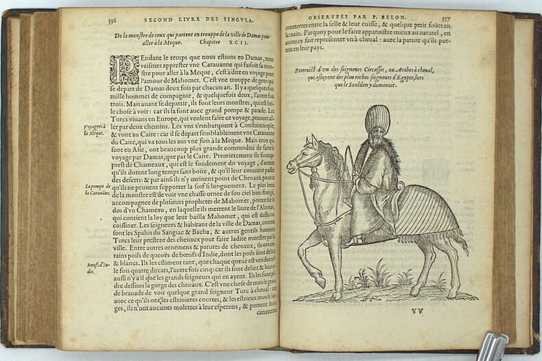
1588PHO-2120Paris, Hierosme de Marnes & la Veuve Guillaume Cavellat, 1588. Petit in-4 (21,6 × 15,5 cm), [12] ff., 468 pp., [1] f. (achevé d’imprimer, marque de l’imprimeur au verso). Basane fauve mouchetée du XVIIe siècle, dos à cinq nerfs orné, titre doré, tranches mouchetées, reliure un peu usée, frottements et épidermures, petit manque au dos, charnière fendillée, très légères rousseurs, infimes trous de vers marginaux.
16061395728Augustae Vindelicorum Augsburg: Exeudebat Christophor Mangus Christoph Mang 1606. Hardcover. Quarto 28 555 35 pages. In Good minus condition. Bound in full vellum. Spine has handwritten ink titling. Tearing and partially detached vellum from spine and loose end band at tail end of spine. Boards have moderate yellowing and soiling. Textblock has tears to pastedowns minor worming scattered on some pages throughout not impacting the text; light age toning moderate foxing and stains scattered throughout. Title page has 2 blue stamps and 1 brown stamp. Red ink along the edges. Text in Latin. Shelved in Room A. VD17 no: 23:230865S; USTC no: 2014301; OCLC no: 80468668. 1395728. Special Collections. Exeudebat Christophor Mangus [Christoph Mang] hardcover
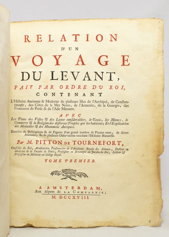
171817654Amsterdam, Aux dépens de la Compagnie, 1718. Deux tomes en un volume in-4° de [28]-188; [2]-208-[16] pages, demi-basane blonde, dos lisse orné de filet doré, pièce de titre en papier cartonné, non rogné.
Very Good Turkish, Ottoman (1500-1928) Fine brown quarter leather bdg., brown boards with decorative embossing. Roy. 8vo. (24 x 17 cm). In Ottoman script (Old Turkish with Arabic script). 176 p., 33 unnumbered b/w plates of views of the Middle Eastern cities, Kaiser and queen's portraits, ills. of their maritime voyages, a general view of Beirut, a panorama of Jerusalem (in two pages), The Government House and Lake Tiberia in Beirut, a general view of Jaffa, churches and castles and Masjid-i Aksa of Jerusalem, Idlib, the interior of the Umayyad Mosque in Jerusalem, The Government House of Jaffa, Beirut - Damascus railways, street views and architectural buildings from Damascus, the market place of Jaffa, Bethlehem and the church, views of Trablus-Sam [i.e. Tripolis], ruins of Baalbek, and other numerous b/w photos, published for only this book. Slight stains on pages, a modern repair on a leaf with tape, otherwise a very good copy. Bound together with "Eski Sevda" which is a compilation of Turkish tales. First and only edition of this richly illustrated scarce and uncommon book was printed for the German Emperor Wilhelm II and his wife Augusta Victoria, the commemoration of the construction of Alman Çesmesi [i.e. German Fountain] in Constantinople, and the first anniversary of the Wilhelm II's travel to the Ottoman Empire in 1898. The fountain's design was drawn by the architect Spitta and constructed by the architect Schoele with the German architect Carlitzik and Italian architect Joseph Anthony, working on the project. The fountain was built in Germany and then transported piece by piece to Istanbul, reassembled in its current site, and officially opened on January 27, 1901, on the birthday of German Emperor Wilhelm II. Wilhelm II's voyage to the Levant in 1898 was a state visit that the German Emperor undertook in the Ottoman Empire between 25 October and 12 November 1898. The Kaiser started his journey to the Ottoman Eyalets with Istanbul on 16 October 1898; then he went by yacht to Haifa on 25 October. After visiting Jerusalem and Bethlehem, the Kaiser went back to Jaffa to embark on Beirut, where he took the train passing Aley and Zahlé to reach Damascus on 7 November. This book is richly illustrated including many views of the cities of this voyage's destinations like Jerusalem, Damascus, Beirut (Beirut), Jafa, Baalbek, etc. On 10 November, Wilhelm went to visit Baalbek before heading to Beirut to board his ship back home on 12 November. His visit spurred interest in the German Templer colonies in Palestine. One of the Kaiser's traveling companions, Colonel Joseph von Ellrichshausen, initiated the formation of a society for the advancement of the German settlements in Palestine, named the Gesellschaft Zur Förderung der Deutschen Ansiedlungen in Palästina, in Stuttgart. It enabled the settlers to acquire land for new settlements by offering them low-interest loans. A subsequent second wave of German settlers founded Wilhelma (named after the Kaiser, now called Bnei Atarot) in 1902 near Lod, Walhalla (1903) near the original Jaffa colony, followed by Bethlehem of Galilee (1906). The German Settlement Society successfully encouraged some of the Templars to return to the official, national Protestant Church. The non-Templar colony of Waldheim (now Alonei Abba) was subsequently founded next to Bethlehem of Galilee in 1907 by proselytized Templers now affiliated with the Old-Prussian State Church. The visit resulted in the highest-profile political event in the life of Theodor Herzl, considered the founder of Zionism. Through the efforts of William Hechler, via Frederick I, Grand Duke of Baden, Herzl publicly met Wilhelm II three times during the voyage, once in Istanbul (on 15 October 1898) and twice in Palestine (29 October and 2 November). The meetings significantly advanced Herzl's and Zionism's legitimacy in Jewish and world opinion. (Wikipedia). Only one copy in OCLC (Library of Congress. Karl Süssheim Collection, no. 1300) 900684728. Özege 7023
Very Good Turkish, Ottoman (1500-1928) Extremely rare huge chromo-lithograph map in 24 sheets mounted on canvas, showing a large zone including Midyat (Mardin), Mosul, Mt. Cilo (Resko-Buzul) on the southeast; Kahta (Adiyaman), Munzur Mt., Divrigi (Sivas) on the west; the Black Sea on north and Turkish borders to Armenia, Azerbaijan on the east, and to Russia on the northeast. In addition shows in separate little portions, roads, mountains and hills, lakes, and telegraph and post ways and borders in that zone. Not in any libraries and any collection. An attractive map with its huge size and decorative surface. Several toponyms are underlined in red ink. Otherwise a very good example. Original folded map mounted on canvas. 118x112 cm. In Ottoman script (Turkish with Arabic letters). Scale: 1/630.000.
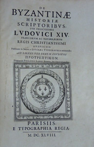
1648HI246Parisiis, e typographia regia -curante Sebastiano Cramoisy- 1648. Folio, 1f, 59, 12, 220,, 161, 191, 1f. En-tetes, initiales decorees, pages de titre, culs-de-lampe, grandes vignettes graves sur cuivre. Textes grec et latin. Rel. plein veau contemp., ecusson de cardinal au milieu des plats, roulette doree, ex-libris grave, dos a nerfs decore, exemplaire propre, non-lave.
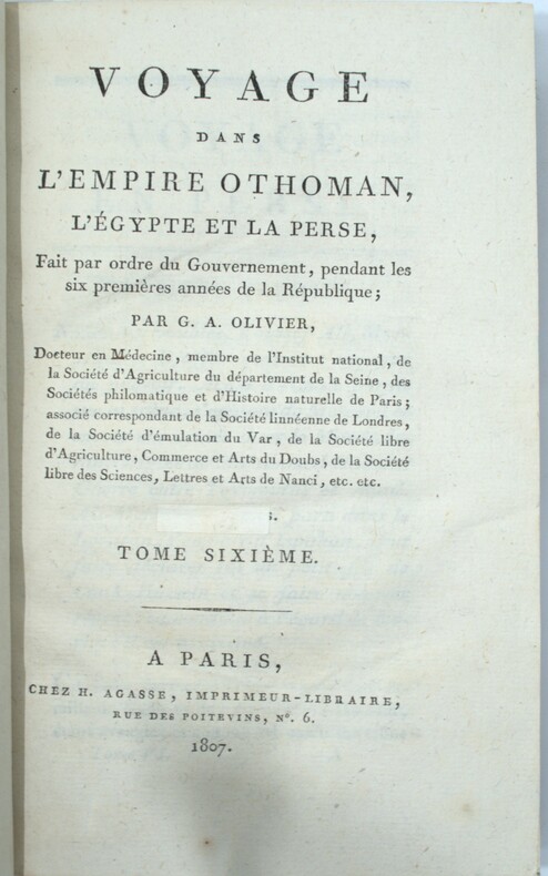
1801PHO-1355Paris, H. Agasse, an 9 [1801]-1807. 6 vol. in-8 (207 x 134 mm) sans l’Atlas ,xx-392pp.-1f. , 2ff.-377pp.1f. , 2ff.-iv-369pp.-1f.,2ff.-456pp.-1f.,2ff.-xv-485pp.,2ff.-522pp.-1f., relié demi veau, dos lisse richement orné,tranches marbrées (Reliure de l'époque), quelques frottements .
1735PHO-674Paris, Charles J.-B. Delespine fils, 1735.T1(4), xvi, (2), 470 pp., ( 22) .T2(3), 521 pp., (14) .T3(6), 558 pp., (17).T4(6), 572 pp., (16).T5 (5), 613 pp., (15). T6 (4) 615 pp., (17) 6 volumes in-12, veau moucheté, dos à nerfs orné avec pièce de titre et tomaison, tranches marbrées (Reliure de l'époque), défauts d’usage, manque au dos , charnières fendues , coiffes arasées .
Very Good Turkish, Ottoman (1500-1928) An extremely rare litho propaganda map published as an extra supplement to the Tercümân-i Hakîkat [i.e. The Translator of Truth] newspaper just before the proclamation of Republic in Turkey in 1923 by Mustafa Kemal Atatürk (1881-1938), showing the front in West Anatolia during the War of Independence (or National Struggle) between 1919-1922 against Greek forces. The upside of the map between the note as title 'Gift to the readers of 'Tercümân-i Hakîkat', Mustafa Kemal Atatürk's portrait among decorated heroic lithographed drawings. In the lower right corner, can be seen legends of the map, scale, and mapmaker's signature. Tercümân-i Hakîkat was a daily newspaper published in Istanbul between 1878-1921 during the Ottoman Empire. Tercüman-i Hakîkat, the most important newspaper published during the reign of Sultan Abdülhamid II, was founded by novelist Ahmed Midhat Efendi, (1844-1912). In the beginning, most of the articles were written by Ahmed Midhat Efendi. It was an encyclopedic newspaper with the aim of inculcating and educating reading habits among the Turks and it played an important role in the training of many famous Ottoman journalists. Its first issue was published on June 26, 1878. After Ahmed Midhat's death in 1913, the newspaper changed owners, and the last issue was published on February 11, 1921. Ibrahim Alaettin Gövsa, (1889-1949), was an Ottoman / Turkish journalist, educator, and intellectual who supported the War of Independence the most. This propaganda map published in Tercümân-i Hakîkat, during the war in 1920 or 1921, is a propaganda tool that calls on the literate people belonging to a certain class, especially those living in Istanbul, to support the war, and aims to spread the word that Turkey is winning the war. Original lithograph map. 50x35,5 cm. In Ottoman script (Turkish with Arabic letters). Scale: 1: 250.000. Occasionally foxing and slight stains on paper, folded traces. Otherwise a very good copy.
New English Paperback. Pbo. 4to. (31 x 22 cm). In Turkish. B/w and color ills. and original b/w Ottoman documents. 1000 copies were printed. Vol. 1: Hatt-i Hümâyûn, 1577-1804. 372 p.; Vol. 2: Ilmühaber 1, 1667-1871. [xxx], 494 p.; Vol. 3: Mâi Lezîz defterleri 1, 1791-1794. 402 p.; Vol. 4: Mâi Lezîz defterleri 2, 1791-1794.; Vol. 5: Ilmühaber 2, 1710-1841. 398 p.; Vol. 6: Ilmühaber 3, 16016-1898. 404 p.; Vol. 7: Ilmühaber 4, 1856-1928. [xvii], 342 p.; Vol. 8: Mâi Lezîz defterleri 3, 1794-1797. [xix], 407 p.; Vol. 9: Mâi Lezîz defterleri 4, 1798-1802. [xvii], 398 p.; Vol. 10: Mâi Lezîz defterleri 5, 1801-1806. [xviii], 394 p.; Vol. 11: Kirkçesme sulari 1. [xxxvi], 436 p.; Vol. 12: Kirkçesme sulari 2, 1811-1921. [xxxviii], 402 p.; Vol. 13: 19. ve 20. yüzyillarda Istanbul sulari. 301 p.; Vol. 14: Su hukuku ve teskilâti, Gülfettin Çelik. 223 p.; Vol. 15: Mâi Lezîz defterleri 6, 1806-1813. [xxvii], 399 p.; Vol. 16: Mâi Lezîz defterleri 7, 1813-1817. [xxv], 379 p.; Vol. 17: Mâi Lezîz defterleri 8, 1817-1823. [xxiv], 385 p.; Vol. 18: Mâi Lezîz defterleri 9, 123-1826. [xxiv], 342 p.; Vol. 19: Mâi Lezîz defterleri 10, 1817-1829. [xxiv], 319 p.; Vol. 20: Mâi Lezîz defterleri 11, 1829-1838. [xxv], 364 p.; Vol. 21: Halkali sulari 1, 1837-1905. [xxvii], [1], ]301 p.; Vol. 22: Halkali sulari 2, 1843-1913. [xxx], 297 p.; Vol. 23: Avrupa Yakasi sulari 1, 1603-1826. [xxxviii], 326 p.; Vol. 24: Avrupa Yakasi sulari 2, 1577-1842. [xxxvi], 323 p.; Vol. 25: Avrupa Yakasi sulari 3, 1574-1831. [xLv], 3998 p.; Vol. 26: Suyolcu 1, 1717-1925. [xxiv], 309 p.; Vol. 27: Su kesif defteri 1, 1842-1862. [xxvi], 333 p.; Vol. 28: Su kesif defteri 2, 1847-1872. [xxvi], 334 p.; Vol. 29: Su kesif defteri 3, 1862-1876. [xxxii], 374 p.; Vol. 30: Bogaziçi ve Taksim sulari 1, 1836-1908. [xxviii], 339 p.; Vol. 31: Bogaziçi ve Taksim sulari 2, 1813-1928. [xLi], 338 p.; Vol. 32: Su tahrirleri, 1655-1807. [xLix], 278 p.; Vol. 33: Suyolcu 2, 1871-1921. [xxxv], 309 p.; Vol. 34: Suyolcu 3, 1684-1876. 335 p. Everything on water systems, water management, water supplying in Istanbul City based on original Ottoman archival documents and their transcriptions order in modern Turkish as in chronological order after the Conquest of Istanbul (Constantinople), in 1453. Also including The Roman, The Byzantine Era on it. [Istanbul Constantinople Constantinopolis Constantinopla Constantinopolin Konstantinopel Water supplying system Fountain Fountains History of art Turkish and Islamic art Ottoman arts Fine arts Khumayoun Humayoun Ottoman Empire The Ottoman State Constantinus Hadrianus Canalisation Canalization Engineering Arc Wtaer supply Canal Channel Drainage Dam Barrage Dike Aqueduct Pool Pond Receiver Sewer Cesspool Scales Grate Ways Water way Waterway Waterways Masjid Fountain for ablutions Charitable fountain Bath Hammam Hamam Assignment Allocating Distrubition Well Pit Sink Letting flow Conducting line Municipality Mayoralty Townhall Parish Ward Quarter District Harbour Narbor Port Haven Seaport Estuary Arm of the Sea The Golden Horn Lodging Settling Cistern Tank Registering Recording Enrolment Development Prosperity].
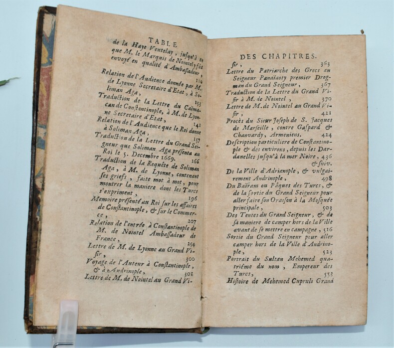
1720PHO-9761720, à Paris chez Jean Baptiste Coignard , In-12,7ffnch - 398pp- relié plein veau brun, dos à nerfs orné, pièce de titre (petit manque) , tranches mouchetées , coiffes arasées , coins usés(Reliure de l'époque).
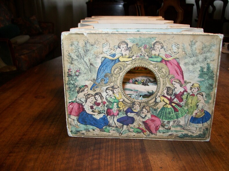
1860GITk506Pont-à-Mousson Haguenthal Editeur sans date vers 1860. Vue en perspective en accordéon, hauteur 14cm, largeur 19cm, longueur déplié environ 43cm, composée de 2 façades en carton et 4 sections de papier, le tout en lithographie rehaussée de couleurs à la main. La 1re façade, ornée d'une réunion d'enfants dans un décor champêtre, est percée d'un trou rond central à travers lequel on pourra avoir une vue en relief de la ville de Constantinople. La 2e façade, placée au fond de la perspective, offre une belle vue des monuments typiques de la ville (le verso étant occupé par de la publicité pour les créations Haguenthal et la liste des 12 modèles de la collection panoramique). Chaque section propose des éléments de décors et des personnages, créant l'effet d'optique. Bordure des carton légèrement usée, discret manque de décor en tête de la 1re section (parmi le feuillage du faîte des arbres). Intérieur en bon état, complet, ayant conservé toute la fraîcheur de ses couleurs. TRES RARE VUE PANORAMIQUE DE CONSTANTINOPLE, évoquant bien le charme exotique et la beauté architecturale de cette ville.
Very Good Turkish, Ottoman (1500-1928) Contemporary red cloth. Roy. 8vo. (24 x 16 cm). In Ottoman script (Old Turkish with Arabic letters). [1], 229, [1] p., many b/w and color ills., 30 chromo-lithographed maps. Wear and fading on spine, some ex-library stamps on the colophon and several blank pages, ownership ink inscription and signature on the first page-overall a good copy. First edition of this rare Ottoman atlas for the primary schools in the late Ottoman Empire, including beautiful 30 chromo-lithographed maps of the Ottoman land according to administrative regions (provinces) and richly illustrated with b/w plates of the cities and provinces in the Middle East. Map list: 1. World map 2. Complete Imperial Ottoman 3. Arabian Peninsula 4. Anatolia 5. Asia Minor 6. Marmara and Black Sea 7. Aegean (The Archipelago) 8. Demography of Anatolia and Syria, Libya, etc 9. Administrative map of Anatolia 10. Map of mines of Anatolia 11. Agricultural map of the Imperial Ottoman 12. Arabian Peninsula 13. Map of the Edirne Vilayat [Adrianople Province of the Ottoman Empire] 14. Map of the Bosphorus 15. Map of the Hüdavendigâr Vilayat [Brusa Province] 16. Maps of Izmit and Biga Sanjaks 17. Map of Aydin Vilayat and Mentese Sanjak 18. Map of the Konya Vilayat 19. Maps of the Adana Vilayat and the Mediterranean Sea 20. Maps of the Erzurum and Ankara Vilayats 21. MAps of Kastamonu Vilayat and Bolu Sanjak 22. Map of the Trebizond Vilayat 23. Maps of the Van and Bitlis Vilayats 24. Maps of the Sivas and Harput Vilayats 25. Maps of the Bagdad and Basrah Vilayats 26. Map of the Mosul Vilayat and Day al-Zor Sanjak 27. Map of the Aleppo Vilayat and Urfa Sanjak 28. Map of the Syria and Beirut Vilayats 29. Map of the Arabia 30. Maps of the Yemen vilayat and Asir Sanjak. This atlas was printed four times for the different classes of the early Turkish / Ottoman schools, during World War 1 (two times in 1916) and the National Struggle (two times in 1921). Geylangil was born in Istanbul in 1887 and studied in Aleppo and Baghdad. Geylangil, who also studied economic geography, taught geography at many schools, including Galatasaray High School. Until his death, he wrote 14 books on geography, most of which were geographical atlases. In 1941, he was among the founding members of the Turkish Geographical Society. Özege 23216.; TBTK 11481.; We couldn't find any copy of this edition worldwide.
Very Good Turkish, Ottoman (1500-1928) Contemporary quarter leather bdg. Rebacked boards. Foolscap 8vo. (18 x 12 cm). In Ottoman script (Old Turkish with Arabic letters). 220 p. Very rare early book of the concise biographies of 137 people who served as admirals in the Ottoman Empire between 1352 and 1853, written by Mehmed Izzet Pasha (d. 1853), son of Turkish admiral Abdullah Râmiz Pasha (d. 1813). Ceridehâne Printing House was founded for publishing Ceride-i Havâdîs [i.e. The Journal of News], which was the first semi-official newspaper in the Ottoman Empire. This journal was published from 1840 to 1877 and was founded by William Nosworthy Churchill (1796-1846), a British-born journalist who moved to Turkey aged 19. He was the cause of a diplomatic incident that resulted in the temporary severance of diplomatic relations between Britain and the Ottoman Empire. Babinger p. 323/2.; Özege 6951.; Library of Congress. Karl Süssheim Collection, no. 1336., OCLC: 11810438, 880485954.
Very Good Turkish, Ottoman (1500-1928) Original newspaper taken from a volume. Folio. (42,5 x 28 cm). In Ottoman script (Old Turkish with Arabic letters). [5] p. Extremely rare early issue of this first official newspaper of the Ottoman Empire after the proclamation of Reform (Tanzîmât) in 1839, informed Daguerre's new and weird invention ("photography" as it would be called in the 1850s) to the Ottoman peoples and readers. The article reads: "It is the talk of the town, steam engines have been able to run on rails in factories in recent years. Meanwhile, a man carefully focused on his thoughts so much and the craft turned into a strange art, and finally, a coquettish mirror (surface) appeared. This skillful Frenchman named Daguerre drew the lines of objects by reflecting the sunlight with the methods of the different science of art he learned, drew the contours of the objects, and gave 20 years secretly and openly to the formation of this strange art. Finally, he reached the goal and this event won the appreciation and admiration of everyone. This is to say, the image of the object, in the form of a large or small box free from light, is pictured inside by passing through the glass in front of it. In order for the reflected picture to be captured on a surface, some chemicals must be prepared. Daguerre has achieved this mix based on his experience. This substance applied on the plate is called iodine. After the plate is kept in the vapor of the iodine for a few minutes, it is immediately placed in the dark box, and the image passing through the window of the box is pictured for five minutes. Considering that some of the things that should be hidden are captured like this, it will be understood what a valuable invention this is...". In the continuation of the article, it is written that an Englishman named Talbot (Henry Fox Talbot) found the same thing with almost the same processes (!), but Daguerre had taken pictures before. Takvim-i Vekâyi was the first fully Turkish-language newspaper. It was launched in 1831 by Sultan Mahmud II, taking over from the Moniteur ottoman as the Official Gazette of the Ottoman Empire. With the beginning of the Tanzimat reform period, Takvim-i Vekayi produced versions in multiple language editions. It ceased publication in 1878, resuming in 1891-2, before being closed again. It resumed in 1908 until around 1922. In the 1831-1878 period it published a total of 2119 issues - an average of slightly less than one a week.
182851526Constantinople Matbaa-i Amire 1828 1243 h. Small 4to. 22 x 16 cm. Contemp. full calf. with flap. A tear in the flap. Rebacked. Blindtooling to covers and a medaillon on front and back. Covers a bit rubbed. 34259 pp. A small burnmark in inner margins of the last 8 leaves otherwise internally clean and fine. Printed arabic types in Turkish/ Ottoman Turkish. <br/><br/><em>First edition. Esad Effendi Turkish historian born 1790 dead 1848. The work deals with the armed forces hydrology etc. </em> unknown
182851526Constantinople, Matbaa-i Amire, 1828 (1243 h.). Small 4to. (22 x 16 cm.). Contemp. full calf. with flap. A tear in the flap. Rebacked. Blindtooling to covers and a medaillon on front and back. Covers a bit rubbed. 3,4,259 pp. A small burnmark in inner margins of the last 8 leaves, otherwise internally clean and fine. Printed arabic types in Turkish/ Ottoman Turkish.
96464A Paris, chez Gervais Clovzier, 1670, 1664, 1653, série reconstituée de 4 volumes in-8 de 240x185 mm environ, Tome I : (1) f., (4) ff. (titre, au lecteurs)-348-102 pages (4) ff. (table), (1)f., - Tome II : (1) f.,1 frontispice, (5) ff. (titre, épistre, sonnet), 622 pages, (26) ff. (table des matières, privilège), (1) f., - Tome III : (1) f., (8) ff. (titre, 2 frontispices, epistre), 649 pages, (10) ff. (table des matières), (1) ff., - Tome IV : (1) f., (6) ff. titre, épistre, éloge), 597 pages, (6) ff. (table), (1) ff., plein veau granité brun, dos à nerfs, titres et tomaisons dorés sur pièces de titre en maroquin bordeaux pour les derniers tomes (sans pièces de titre pour les 2 premiers tomes), coupes dorées. Epidermures, coins et coiffes émoussés, coiffes endommagées pour le tome I avec manque de cuir, quelques mouillures (tome III et IV) et trous de ver, 4 volumes (série reconstituée), avec 1 portrait dans le tome II, 1 portrait et une planche dans le tome III, 5 plans in-texte (sans la carte hors-texte).
1662PHO-1467Paris :Augustin Courbé et Sébastien Cramoisy, 1662. 2 volumes in-folio, Tome1:Histoire des Turcs, 11ff.-907pp.-14ff. , tome 2 :Histoire des Turcs ;6ff.-204pp.-6ff.,Histoire générale du Serrail...2ff.-89pp.-273 colonnes-1f., Plusieurs descriptions des accoutremens...63 feuillets numérotés, Tableaux prophétiques...1f.-68-116-2ff.,Les annales du Sultan...85pp.-4ff., illustré d’un titre gravé, 2 planches doubles ( Constantinople et Portrait de l’armée…),3 portraits de Sultan , 2 portraits en pieds , 62 gravures de personnages et costumes et 16(17)tableaux prophétiques , relié plein veau époque , dos à nerfs ornés avec titre et tomaison , tome 1, relié à l’envers ,charnières fendues , coins et coiffes abîmés,manque le titre gravé,les portraits et le texte afférents, Tome 2, frottements ,traces de réparations, plan de Constantinople détaché avec manque au coin, réparation au Portrait de l’armée du sultan,manque le premier tableau prophétique et le dernier feuillet de la table des matières , travail de ver sur quelques feuillets sans atteinte, brunissures , qlqs taches.
44661Brissot-Thivars.1819.2 vols.in-8 en cartonnage d'époque,reliures imitation cuir romantique.271 et 318 p. BE.Ex-libris.Légères mouillures.Reliures frottées.
1747PHO-1539Paris, Mortier et Merigot & Piget, 1747. 2 volumes in-4, relié plein veau époque, dos à nerf orné avec pièce de titre et tomaison, tranches rouges, illustré de 16 planches dont 3 vues dépliantes, tome 1 ; manque la pièce de tomaison, coiffes et coins usés, début de fente, ressaut de feuillets, adhésif sur la page de garde, Tome 2 ; manque aux coins, coiffes usées, début de fente, traces de réparation aux cartes, déchirure sans manque, ressaut de feuillets.
New New English Original bdg. Dust wrapper. In publisher's special box. 4to. (1934, [4] p.), color and b/w ills. A journey through maps from the Ottoman world to the Republic of Turkey. From Constantinople to Istanbul between the 15th and the 20th centuries. The cartographic collection of Erhan Öner. 4 volumes set. A project of passion and patience: For four decades Erhan Öner has been painstakingly collecting maps of Turkey, assembling a cartographic collection that is now one of the largest and most comprehensive of the area. His maps range in date from the 15th century, the early days of the Ottoman Empire, through to the 20th century and the early days of the Republic, and encompass historical, military, marine and archaeological maps, and even postcards with maps on them. Examples by the renowned cartographers Abraham Ortelius, Gerardus Mercator, Jodocus Hondius, Homann Heirs, Freres Lotter, Visscher Family, Sanson Family, John Speed and Frederick de Wit are among the highlights. A project of passion and patience, Öner's collection is finally being published in a four-volume catalogue. Displaying as many as 1,500 maps on 2,000 pages, it will be an important reference work for academics, researchers and fellow collectors. At the same time it is a visual feast, with beautiful illustrations, engravings and vignettes. Contents: Vol. 1: HISTORICAL MAPS OF TURKEY. 15th - 16th Centuries, 17th Century, 18th Century, 19th Century, 20th Century. TURKEY IN EUROPE. Vol. 2: REGIONAL MAPS. Black Sea, Thrace, Sea of Marmara Dardanelles, Aegean Archipelago. Mediterranean Sea, Central, Eastern and South East of Turkey,Middle East, Serial. OTTOMAN VILAYETS AND SANCAKS Postcard Maps, Yumni Maps. Other Vilayet Maps PORT PLANS. RAILWAYS. RELIGION RELATED MAPS, THE RETREAT OF THE TEN THOUSAND MAPS. GEOLOGICAL MAPS. POSTCARD MAPS. CLIPPINGS. Vol. 3: MILITARY MAPS. War and Peace Maps and Plans Maps of Erkan-¿ Harbiye. Harita Umum Müdürlügü, Milli Müdâfaa Vekâleti. Harita Genel Müdürlügü, Harita Genel Direktörlügü Maps of War Office & Ordnance Survey Office, Henri & Richard Kiepert Maps. ATLASES. Vol. 4: ISTANBUL NECIP BEY MAPS OF ISTANBUL: Societe Anonyme, Ottomane d'etudes et d'entreprises Urbanies. KESFlYÂT VE ¿NSAAT TÜRK ANON¿M S¿RKETl, TURKISH SURVEY AND CONSTRUCTION COMPANY UNFINISHED MAP OF ¿STANBUL, INSURANCE PLANS OF ISTANBUL. ARCHEOLOGICAL MAPS. OTHER CITIES. INFORMATION ABOUT CARTOGRAPHERS. ENGRAVERS AND BOOK PUBLISHERS.
New German Original bdg. HC. Elephant folio. (67 x 51 cm). -Text book: 30 x 24 cm- In German. 2 volumes set: ([xii], [vii], [Lii], 140 p., 2 plates.; 39 color and b/w plts. (Tafeln)). Limited reprint edition (all copies are numbered) of 1854-1855 Berlin edition of Salzenberg's book exemplifying a growing 19th-century appreciation of Romanesque and 'Byzantine' architecture. For the original edition see Blackmer 1483; Brunet V, 103. "Salzenberg's important work remains the major source of information about the mosaics of St. Sophia". (Blackmer). 1000 copies were printed for individual persons. This copy belonged to 'Ender S. Özer Bagciman. All copies were numbered. (651/1000). The churches Salzenberg describes illustrating the development of a Christian architecture away from the secular long nave basilica or of the classical temple (never intended for congregational use), to a Greek-cross plan with a central dome, allowing greater accessibility to the altar table. Most of the text is devoted to the cathedral of the Holy Wisdom [i.e. Hagia Sophia], built-in Constantinople for Justinian I by Anthemius of Tralles and Isidore of Miletus, who dared to set a large dome over a square with the support of pendentives, achieving, with eastern and western half-domes, an uninterrupted span of over 200 feet. This building provided a model or inspiration to architects of the Middle East and Europe seeking to experiment with central, domed structures. Contents: Titelblatt.; Frontispiz.; Titelblatt.; Inhalt des Textes.; Vorwort.; Einleitung.; Verschiedene Baureste der aelteren Zeit.; Agios Johannes, Klosterkirche des Studios.; Agios Sergios, Kirche des Klosters Hormisdas.; Agia Sophia.; Agia Irene.; Agia Theotokos, Klosterkirche des Lips.; Agios Pantokrator.; Saalbau des Hebdomon.; Cisterne des Philoxenos (Bin-Bir-Direk).; Wasserpfeiler oder Suterasi.; Kirchen aus Klein-Asien.; Anmerkungen.; Anhang: Des Silentiarius Paulus: Beschreibung der Heiligen Sophia und des Ambon.; Vorwort.; I-VI i: Die H. Sophia des Silentarius Paulus.; VII-XIV Der Ambon.; Verzeichniss der Abbildungen.; Blatt I - XXXIX.; Maßstab/Farbkeil.
1833PHO-614Paris, Firmin Didot frères, 1833. In-8, VII-365pp. Relié plein veau marron époque,liseré fleuri sur les plats, dos orné avec pièce de titre et auteur en maroquin dos orné , plat détaché, cachet de bibliothèque.
17890033301789 Paris, Durand, Père & Fils, 1789. In-8 (129 X 205 mm) demi-veau fauve marbré à petits coins de vélin ivoire, dos lisse orné d'un double filet doré en place des nerfs, caissons dorés, titre doré, tranches mouchetées en rouge (reliure de l'époque) ; faux-titre, titre, carte dépliante, 306 pages, (1) f. de privilège, 6 planches dépliantes.