Abraham OrteliusBiblio.com
Ortelius, AbrahamBiblio.com
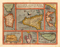
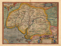
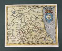
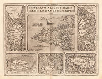
Insularum Aliquot Maris Mediterranei Descriptio. Ortelius Abraham – Mediterranean Islands · Copper Engraving · Theatrum Orbis Terrarum Antwerp · 1573
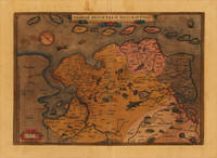
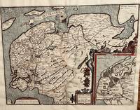
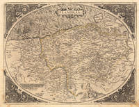
157324542Antwerp: Platin 1573. Other. A very good example printed on excellent German paper. In excellent condition. 365 by 478mm 14 by 18 inches. Original antique copper engraving from the 'Theatrum Orbis Terrarum' by Abraham Ortelius the world's first modern atlas published in Antwerp 1573. Depicting Mediterranean Islands this map is a fine example of 1570s European cartography. Image: 365 by 478mm 14 by 18 inches. An attractive and historically significant 16th-century map for the discerning collector. Abraham Ortelius 15271598 was a Flemish cartographer and geographer born in Antwerp. He is widely regarded as the creator of the first modern atlas the 'Theatrum Orbis Terrarum' Theatre of the World first published in 1570 by Gilles Coppens de Diest in Antwerp. Considered the world's first true atlas it established the modern format of uniform standardized maps bound together in a single volume. Appointed Geographer to King Philip II of Spain in 1575 Ortelius was one of the most influential figures in the history of cartography. His maps are held in the collections of the British Library the Library of Congress and major European institutions. The 'Theatrum' went through more than 30 editions and was translated into multiple languages making Ortelius's maps among the most sought-after in the world of antique cartography.Decorative double page map showing six islands in the Mediterranean Islands Sicily Sardinia Corfu Malta Djerba Elba. Sicily is prominently displayed in the center of the map above the title cartouche.A fine example from Theatrum Orbis Terrarum Antwerp sought after by collectors of antique maps of Italy antique maps of Mediterranean Islands and antique copper engravings for sale. In good condition consistent with age. Light age-toning to the sheet as expected for a 16th-century engraving. Centerfold as published. Broe. 141 Platin unknown
Antiquariat Reinhold Berg ek · Allemagne950,00 $US≈ 803,80 €